
Severe thunderstorms are expected mainly from Kansas into northern Missouri and into Iowa Tuesday. Damaging winds will be the most likely threat, with large hail possible. An Enhanced Risk (level 3 of 5) of severe thunderstorms is in effect. Hot conditions will continue across the Southern Plains Tuesday, spreading into the southeast and Mid-Atlantic by Independence Day. Read More >
Last Map Update: Tue, Jul 2, 2024 at 3:07:03 am MDT
|
Text Product Selector (Selected product opens in current window)
|
|


 Great Falls Radar
 Satellite
 Current Observations
 Forecast Discussion
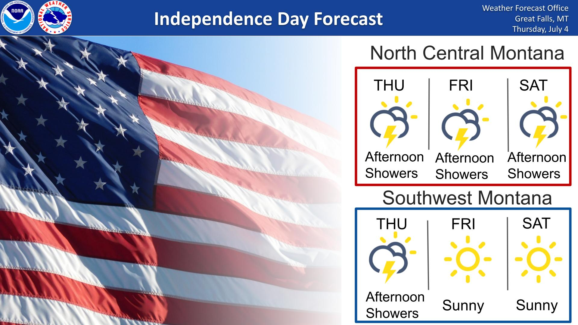
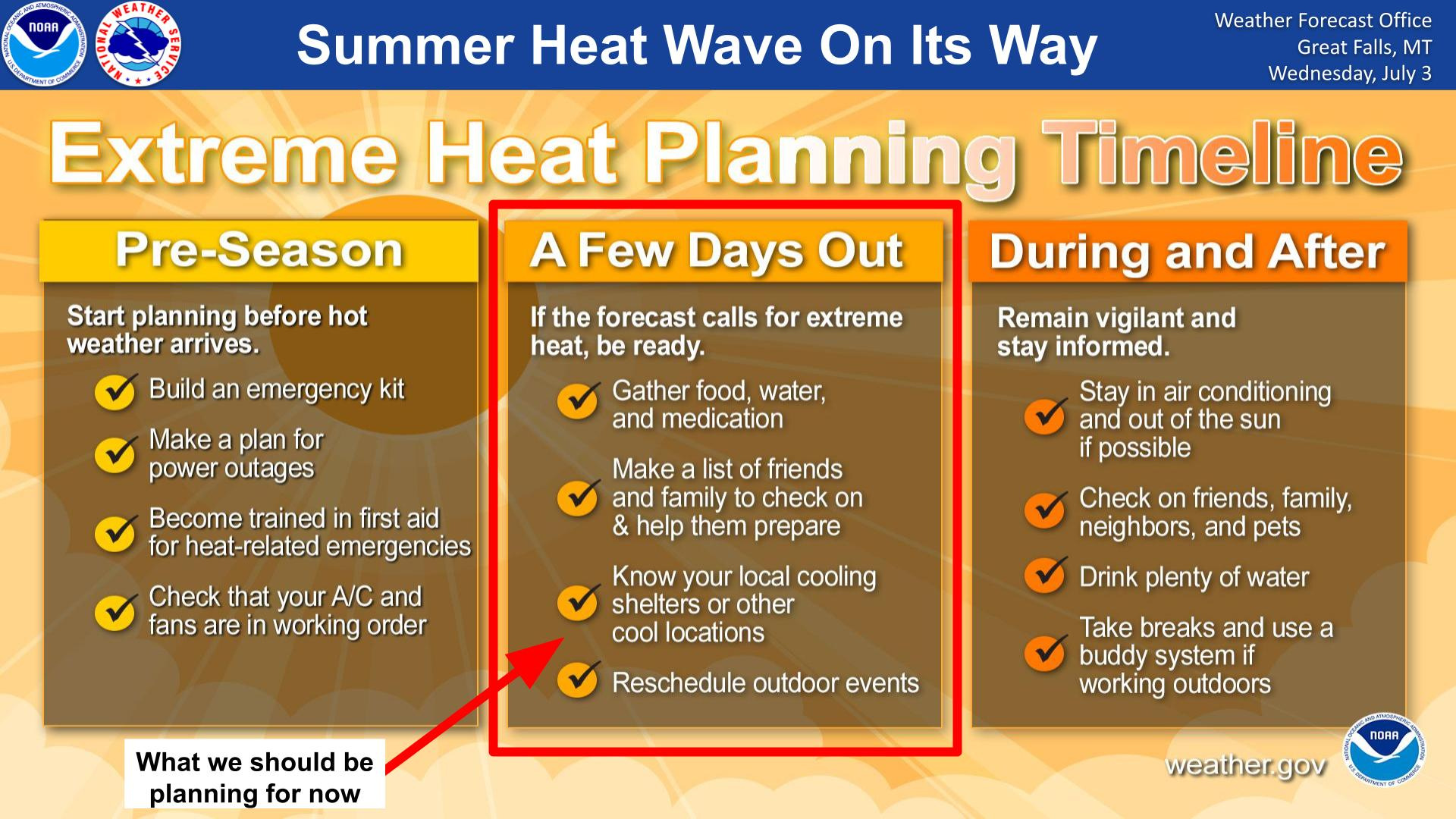
 Montana Weather
 Fire Weather
 Winter Weather Forecasts
 Transportation Forecasts
 Weather Prediction Center
 Storm Prediction Center
 Aviation Weather