
Severe thunderstorms are expected mainly from Kansas into northern Missouri and into Iowa Tuesday. Damaging winds will be the most likely threat, with large hail possible. An Enhanced Risk (level 3 of 5) of severe thunderstorms is in effect. Hot conditions will continue across the Southern Plains Tuesday, spreading into the southeast and Mid-Atlantic by Independence Day. Read More >
West Gulf RFC
River Forecast Center
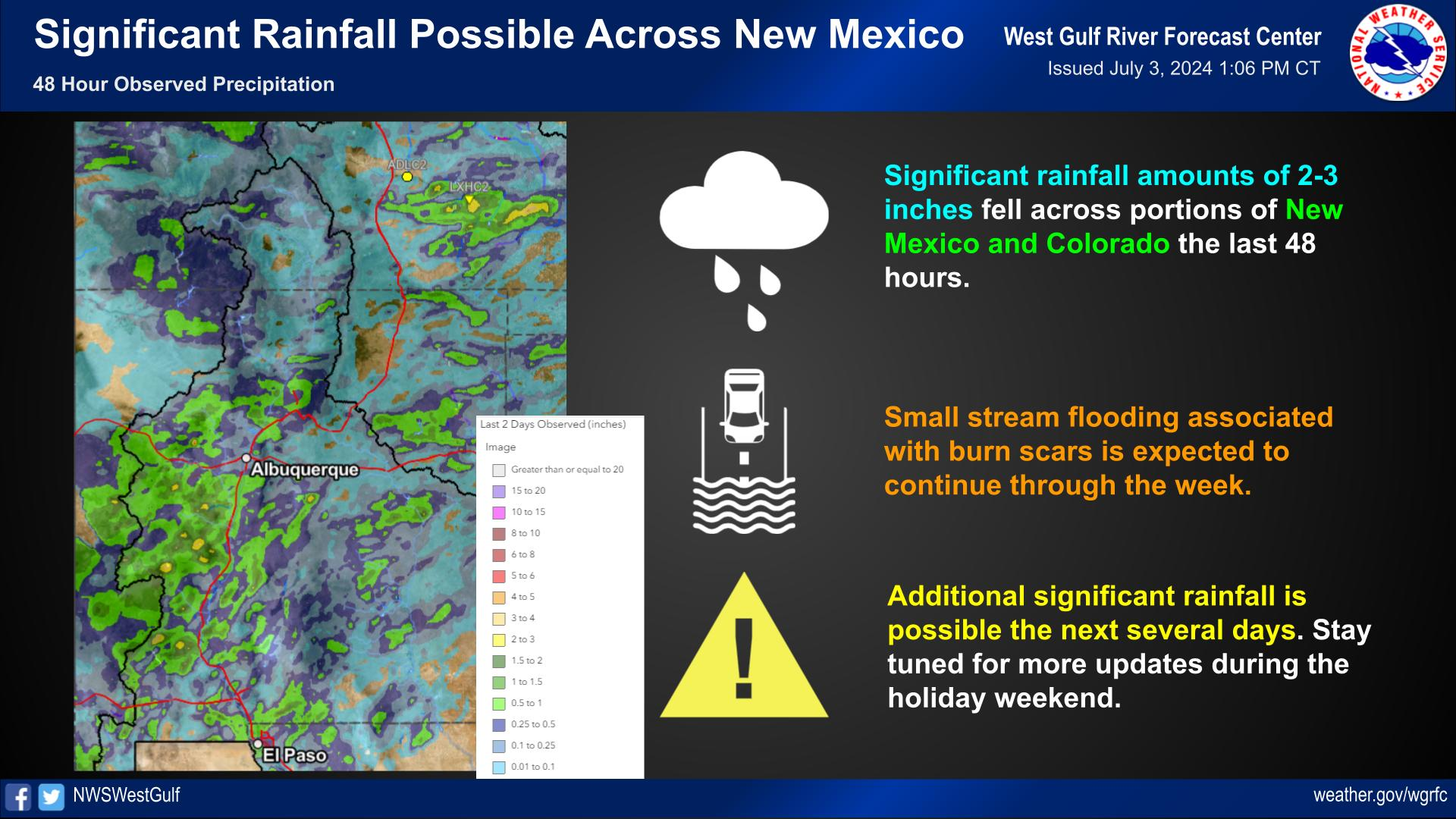
WGRFC River Flood Summary: Minor: 1 (0%)
Moderate: 0 (0%)
Major: 0 (0%)
Use the map below to view forecast locations experiencing flooding and link to detailed forecast information.
US Dept of Commerce
National Oceanic and Atmospheric Administration
National Weather Service
West Gulf RFC
3401 Northern Cross Blvd.
Fort Worth, TX 76137
Comments? Questions? Please Contact Us.


 Weather Story
 Year in Review
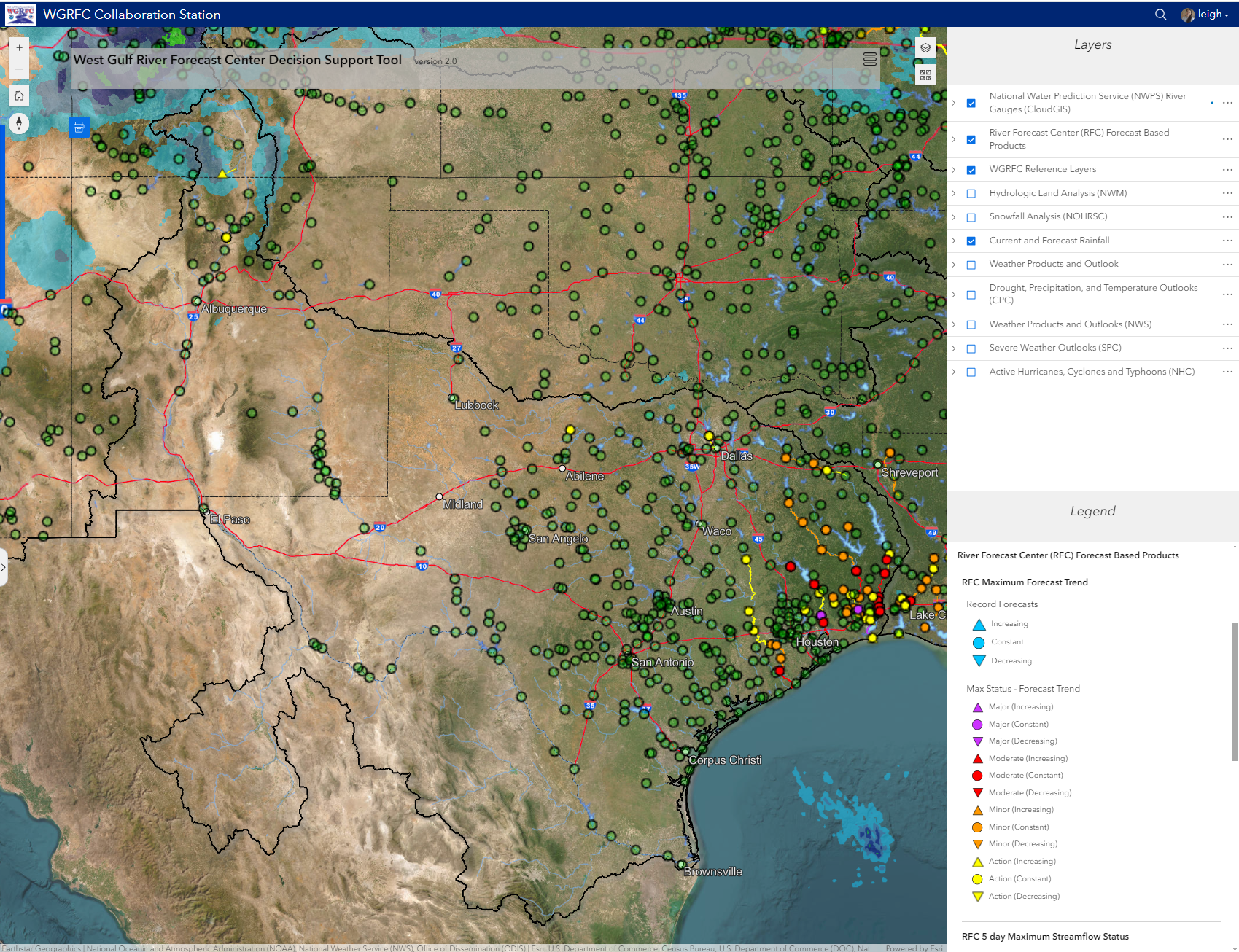 RFC Decision Support Tool
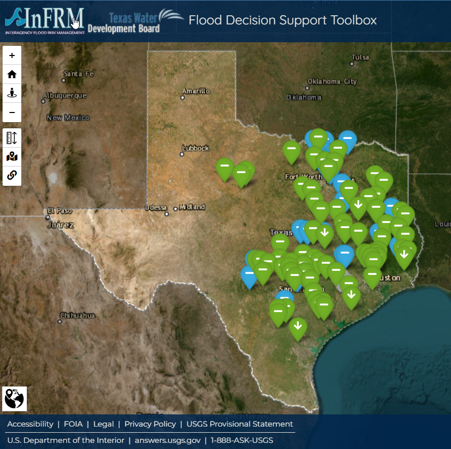 InFRM Flood Decision Support Toolbox
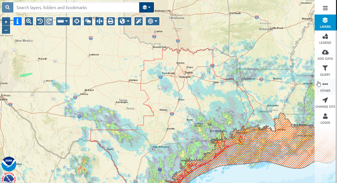 National Weather Service GIS Viewer (Water)