Flood Outlook
Current Conditions
|
|
|
|
|
Current Vis/IR Loop (click for loop)
|
Total Precipitable Water Loop
|
|
Alaska Mosaic Radar Loop
|
|
Kenai Radar Loop
|
Middleton Radar Loop
|
Sitka Radar Radar Loop
|
|
Fairbanks Radar Loop
|
King Salmon Radar Loop
|
Bethel Radar Loop
|
|
Nome Radar Loop
|
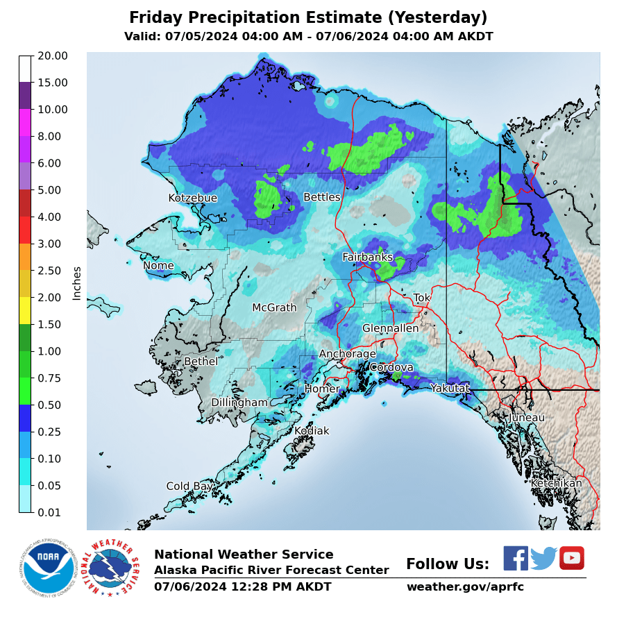
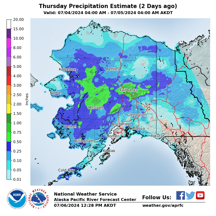
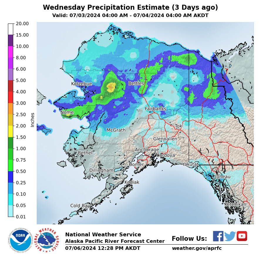
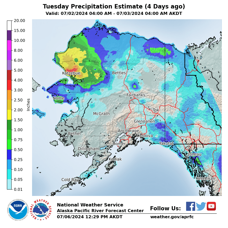
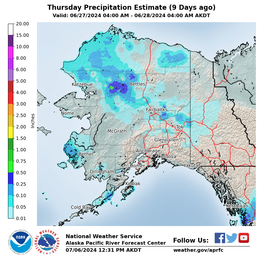
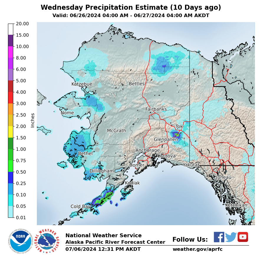
Observed Precipitation
|
Yesterday
|
2 Days Ago
|
3 Days Ago
|
|
4 Days Ago
|
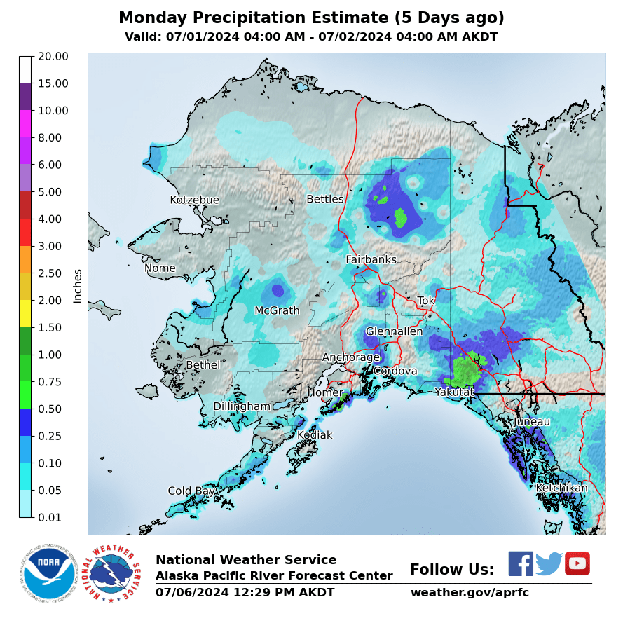
5 Days Ago
|
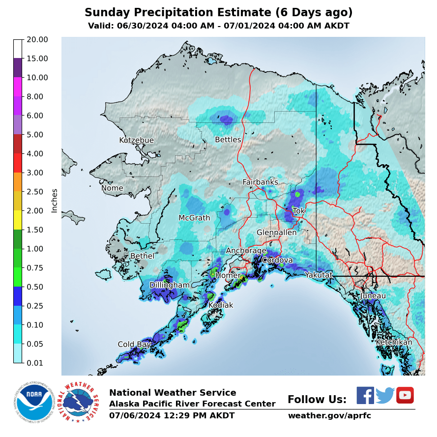
6 Days Ago
|
|
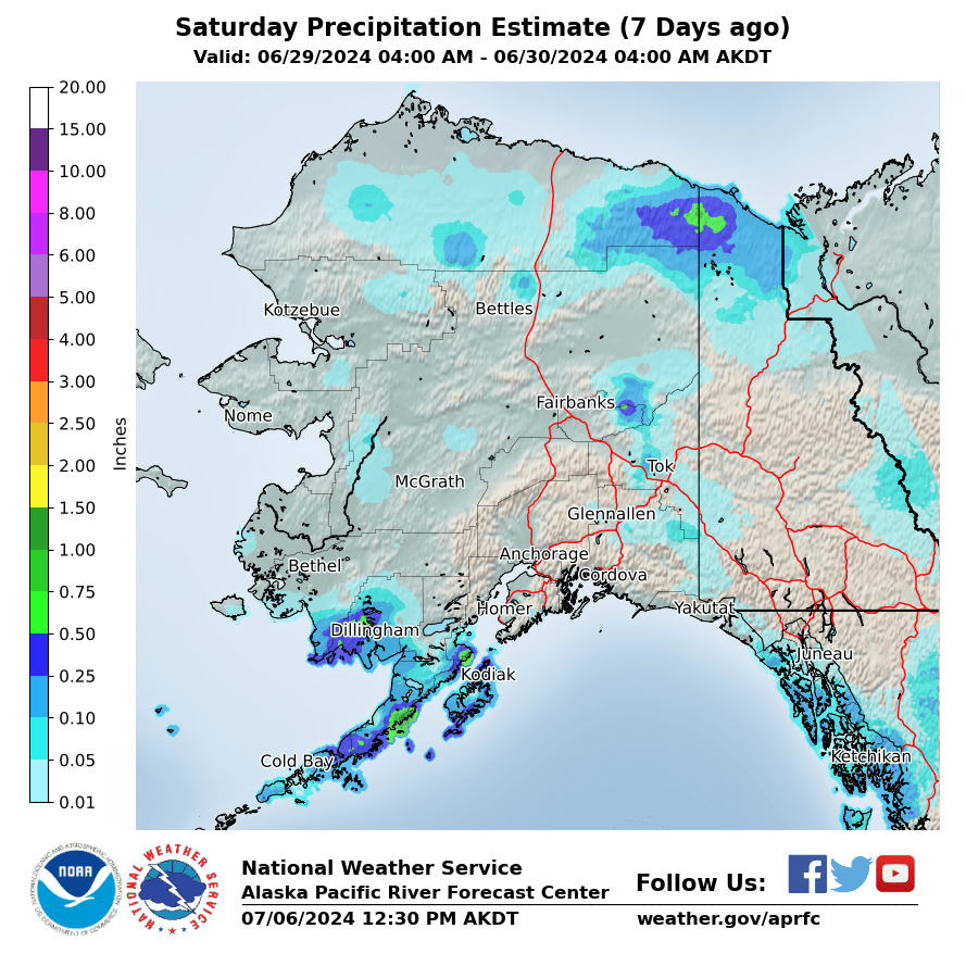
7 Days Ago
|
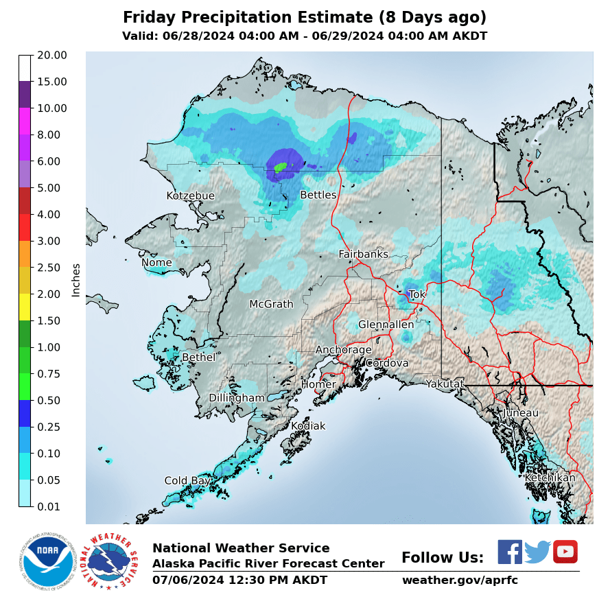
8 Days Ago
|
9 Days Ago
|
|
10 Days Ago
|
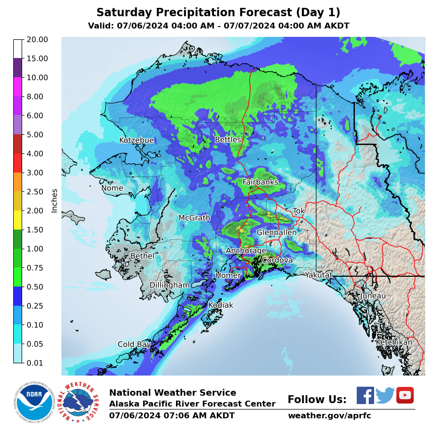
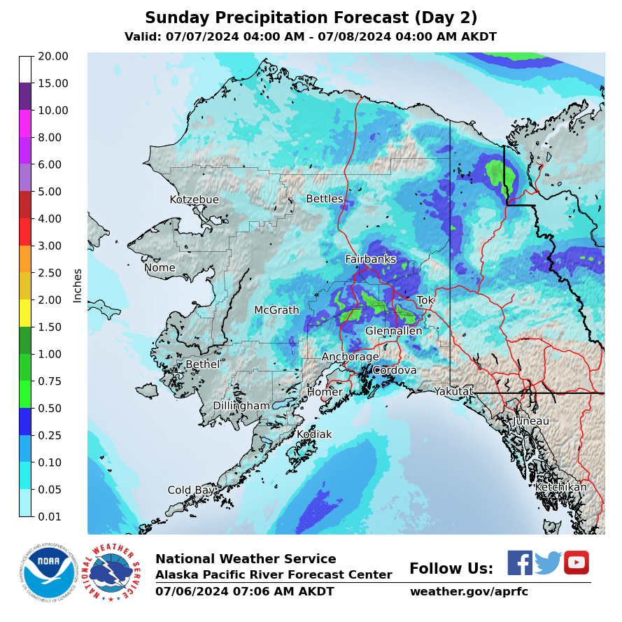
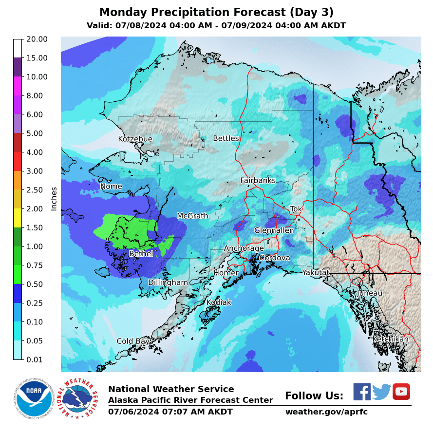
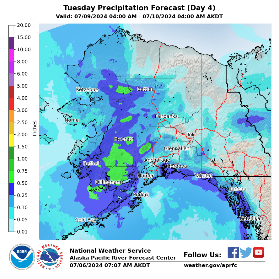
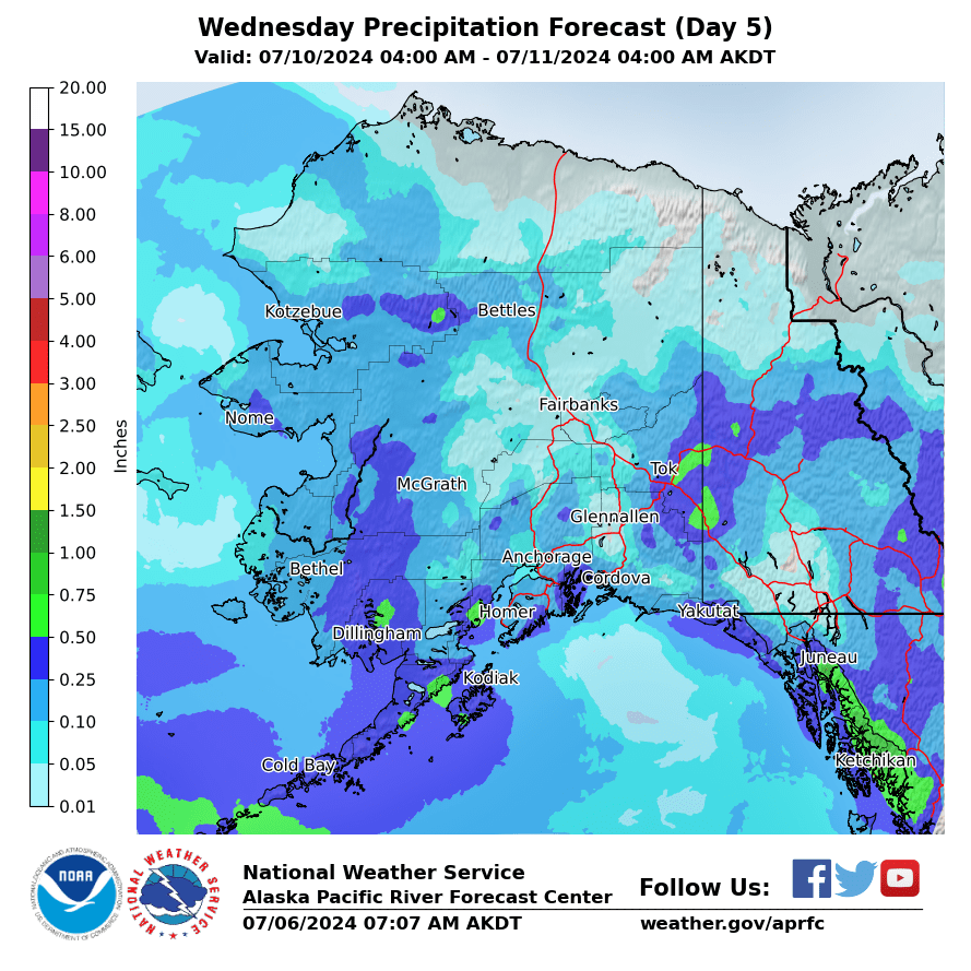
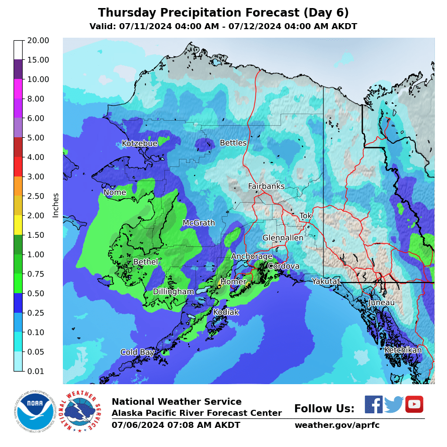
Forecasted Precipitation
|
Day 1
|
Day 2
|
Day 3
|
|
Day 4
|
Day 5
|
Day 6
|
|
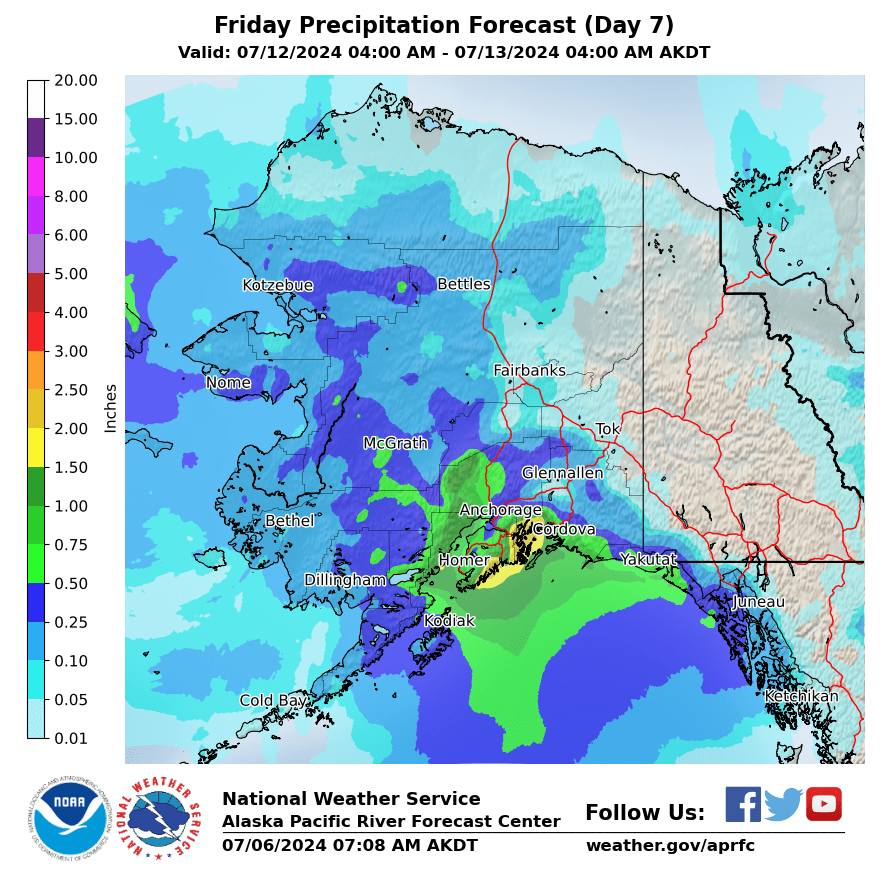
Day 7
|
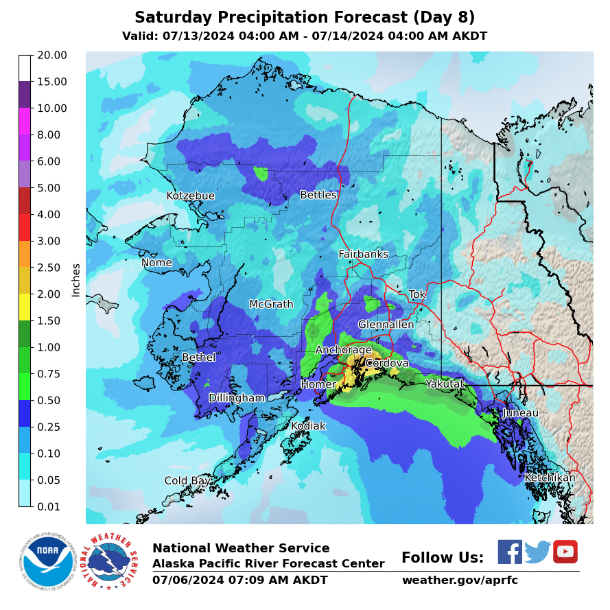
Day 8
|
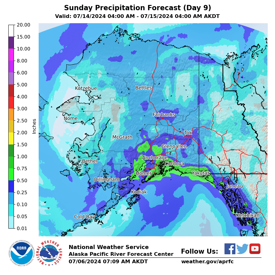
Day 9
|
|
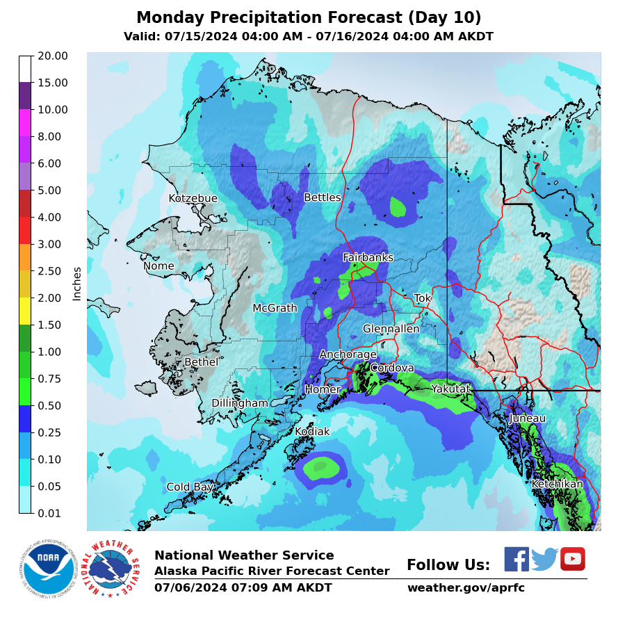
Day 10
|
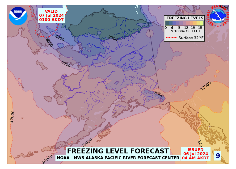
Forecasted Freezing Levels (click for Loop)
|
|
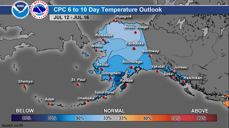
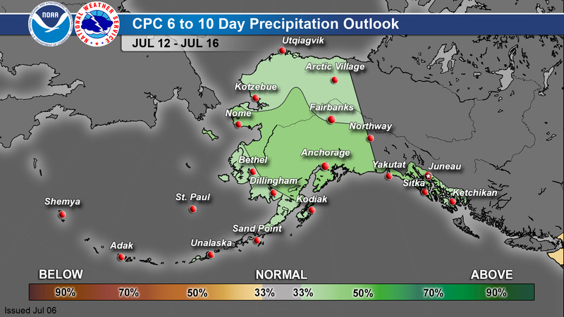
CPC 6-10 Day Outlook
|
Temperature
|
Precipitation
|
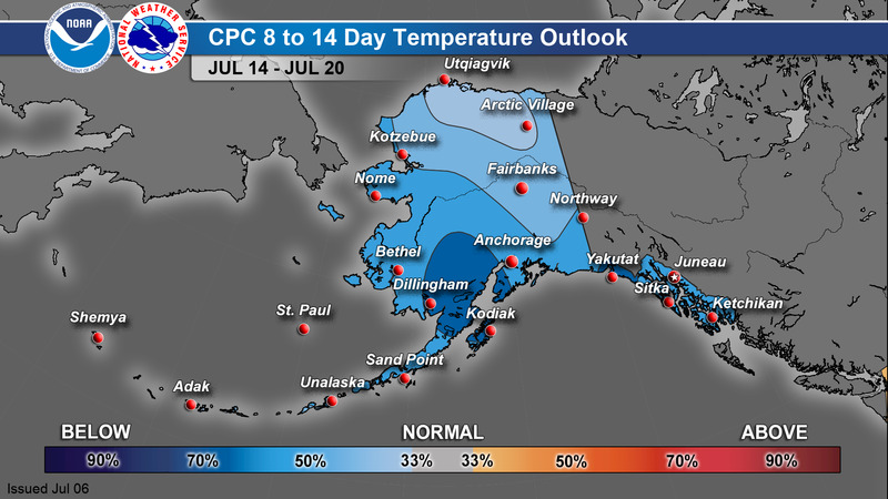
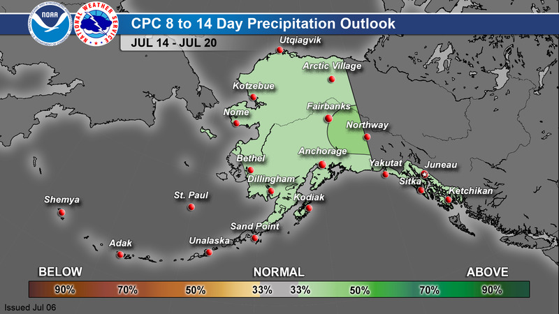
CPC 8-14 Day Outlook
|
Temperature
|
Precipitation
|
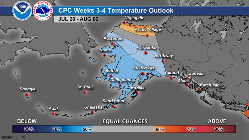
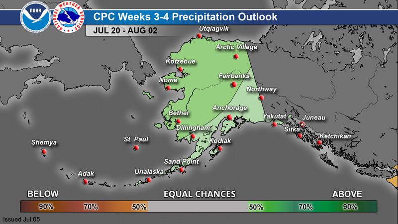
CPC Week 3-4 Outlook
|
Temperature
|
Precipitation
|
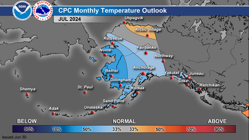
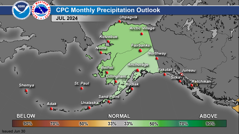
CPC 1 Month Outlook
|
Temperature
|
Precipitation
|
>
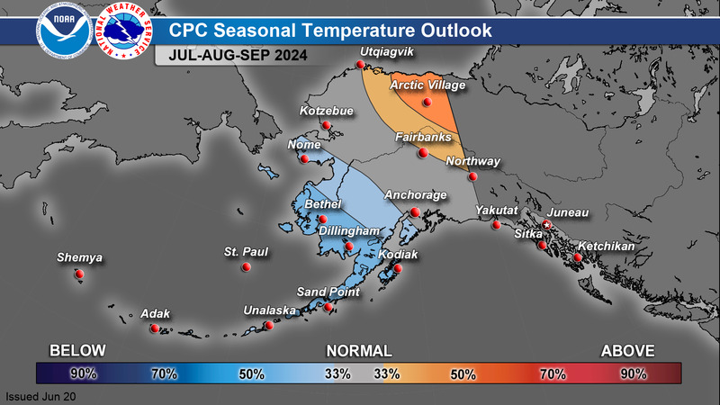
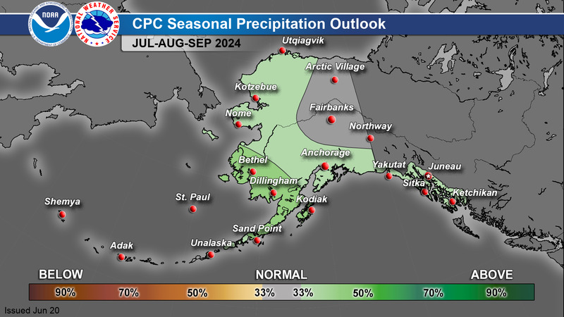
CPC 3 Month Outlook
|
Temperature
|
Precipitation
|
For additional climate outlook data, see: https://www.cpc.ncep.noaa.gov/
A Guide to Interpreting CPC Products: https://www.weather.gov/afc/GuideToInterpretCPCProducts
Alaska Drought Monitor
|
|
033
FXAK68 PAFC 040031
AFDAFC
Southcentral and Southwest Alaska Forecast Discussion
National Weather Service Anchorage AK
431 PM AKDT Wed Jul 3 2024
.SHORT TERM FORECAST SOUTHCENTRAL ALASKA (Days 1 through 3:
Tonight through Saturday)...
An upper level ridge will continue to provide calmer weather for
most of Southcentral through most of the day tomorrow. However,
the nicer conditions over the 4th of July will quickly become
unsettled as a frontal boundary sweeps over the region. Widespread
rainfall is expected for most locations, however the rainfall is
expected to be light due to the influence of dry westerly flow
aloft. The front will pass over the Alaska Range by mid-afternoon
tomorrow before exiting the region Friday afternoon. Models
continue to slow down the main band of rainfall over Southcentral,
with Anchorage and the Mat-Su likely not seeing any drops until
the evening hours. In addition, a building pressure gradient over
the Copper River Basin will likely result in gustier conditions
for that portion of the forecast area starting tomorrow evening
and continuing into Saturday.
As the front exits off to the east on Friday, most lower elevation
locations will see a break from the rain as weak ridging tries to
build back over southern Alaska. Unfortunately, this break in rain
won`t last long as a deep upper level trough in northwest Alaska
begins to dig towards Southcentral. The placement of this trough,
as well as the trough currently located in the Gulf, will result
in a convergence boundary of southwesterly flow forming along the
southern portion of the forecast area. This will produce a
widespread and heavier rainfall event in comparison to the one
expected to occur tomorrow and looks to persist through at least
Saturday night. While the exact placement of this convergence band
is still begin contested in current model guidance, all models
are depicting a strong rainfall event to occur over the area. This
pattern setup will also result in widespread cloud cover for most
locations, as well as a brief cool down for the first half of the
weekend.
-BS
&&
.SHORT TERM FORECAST SOUTHWEST ALASKA/BERING SEA/ALEUTIANS (Days
1 through 3)...
High pressure ridging extends over Southwest Alaska, promoting
dry conditions for the rest of today. A front extending off a
Kamchatka low stretches across the central Aleutians and Bering
sea that will eventually feed into a shortwave dropping south into
Southwest Alaska early Thursday morning. There is a decent
moisture feed that will pull into Southwest, bringing widespread
wetting rain showers on Thursday and Saturday.
&&
.LONG TERM FORECAST (Days 4 through 7)...
The long range models are in more agreement today with the
pattern change mentioned in previous discussions. The areas of
high pressure that have been persistent over the Bering Sea and
the Gulf of Alaska in the early part of the period will start to
break down allowing a North Pacific low to track northward into
the Gulf. This combined with troughs of low pressure transiting
across the Bering Sea and Kuskokwim Delta will track eastward
across the region through the end of the period. As a result,
expect scattered precipitation and cooler temperatures across the
much of the forecast area. Additionally, gusty winds and possible
small craft conditions are expected in Cook Inlet and coastal
regions of the Kenai Peninsula Saturday afternoon and into Sunday.
-DD
.AVIATION...
PANC...VFR conditions and light winds persist through tomorrow
morning. Westerly winds begin shifting southerly this evening as
Turnagain Arm winds strengthen ahead of an approaching front.
Southerly to southeasterly winds then increase by late Thursday
morning, with the potential for gusts 20-25 kt persisting through
the afternoon.
Light rain is expected late Thursday afternoon through Friday
morning, with minor uncertainty in timing. Ceilings will drop with
this rainfall, likely below 5000 ft, with some guidance even
dropping ceilings to IFR.
&&
$$
644
FXAK69 PAFG 041007
AFDAFG
Northern Alaska Forecast Discussion
National Weather Service Fairbanks AK
207 AM AKDT Thu Jul 4 2024
.SYNOPSIS...
Today will be similar to yesterday but the rain will be a bit
heavier in the Interior and the wind will be a bit lighter. The
exception will be around the Yukon Flats and SW Interior where
wind gusts to 40 mph are possible with the rain once again.
Otherwise, expect temperatures 5-10+ degrees below normal as it
will stay cool, wet and windy. The West Coast and North Slope
remain breezy with chances for rain as well.
&&
.DISCUSSION...
Upper Levels and Analysis...
At 500 mb, the models initialized quite well compared to the 00z
radiosonde data in Northern AK. At 00z we had a 536 decameter low
north of Utqiagvik a 592 decameter high in the Central NPAC with
an appendage into SW AK and South Central east to Northway.
Otherwise, in between this, over mainland AK, is westerly to
northwesterly flow with shortwaves moving through the flow from
west to east. There is also a 555 decameter low in the Gulf about
700 miles south of Kodiak. Currently at 09z, the low in the
Arctic is shifting to the east with 2 more waves of energy behind
it, the ridge in the NPAC hasn`t budged and the low remains in
nearly the same spot as well.
Surface Analysis...
Similar to aloft, we have a 993 mb low in the Arctic moving east
into the Canadian Archipelago, a 1036 mb high in the Central NPAC
and a 1024 mb low to the east in the Gulf. Otherwise, west-
southwest flow at the surface is dominant.
Central and Eastern Interior...
Another round of rain and wind will be arriving today and this
could come with more moderate to heavy rain. Expect widespread
rainfall amounts around 0.25-0.50" with localized areas,
especially in the higher terrain pushing 1.00". The driest areas
come in the N. Yukon Flats and SE Interior from Delta Junction to
Northway where 0.10" or less is expected. The wind doesn`t look to
be as strong in the southern Interior, but a few gusts to 35 mph
are possible. The strongest winds will be in the YK Flats with
gusts as high as 40 mph possible. Rain and breezy conditions
continue through the day on Friday before both the rain and wind
comes to a brief halt Friday night. Breezy conditions look to
prevail but gradually weaken this weekend, but rain moves back
into the Interior Saturday afternoon with another round possible
on Sunday. Rainfall totals through Sunday are quite high with the
terrain potentially receiving upwards of 3" while locations
outside of the N. YK Flats and SE Interior accumulating
0.50-1.50".
West Coast and Western Interior...
Another round of rain is currently moving through the West Coast
and will make it into the Western Interior later this morning.
The West Coast will gradually dry out with only lingering showers
this afternoon while the bulk of the rain moves into the Interior.
Expect another 0.25-0.50" of Rain from the Southern Seward Pen.
through the Norton Sound to the YK Delta this morning. In the
Interior, expect 0.25-0.75" this afternoon with the highest
amounts in the higher terrain. This rain also comes with some
wind, potentially gusting as high as 35-40 mph from Galena South.
Any trees have the chance to lose some branches or limbs and there
may be localized power outages as a result. The wind will subside
a bit tonight and remain lighter tomorrow with rain continuing at
times for most of the Western Interior. Friday night looks to
gradually dry out, then Saturday comes with another front, though
this one looks to be much weaker with less wind and total
rainfall. Sunday will have another chance for heavier rain.
North Slope and Brooks Range...
Rain showers will be on and off through the day today with the
steadiest rain expected in the West/Central Brooks Range. Winds
will also be gusty from the west/northwest today with peak gusts
around 25-35 mph this morning, then gradually weakening through
the afternoon. More widespread rain arrives tonight after midnight
and continues through Friday and into Saturday. Expect 0.10-0.25"
of rain along the coast today with the highest amounts up to 0.40"
east of Deadhorse as well as in the Brooks Range. Tonight through
tomorrow, expect widespread rainfall amounts around 0.25-0.50".
Heading into Saturday, especially the afternoon and evening,
temperatures will be dropping off pretty significantly with high
temperatures in the 30s to near 40 along the coast. There is a
chance for a rain/snow mix, or a complete changeover to snow west
of Deadhorse. Given the rain beforehand, accumulations are not
likely at this point.
Extended Forecast Days 4-7...
Rainy and cooler conditions will continue in the extended with
several rounds of rain anticipated across the state. A strong 594
decameter high in the central NPAC will persist through the
weekend, weaken and then gradually shift south next week. Upper
level troughing over the state will persist and then a low in the
Gulf will get caught up in the main flow making for broad
troughing over much of the state by the middle of next week.
Looking towards the end of the week, ensembles do diverge a bit,
as expected, and we could be looking towards a more typical
pattern with troughing over the west and southerly flow over the
east.
Coastal Hazard Potential Days 3 and 4...
As strong SW winds persist, expect sea level heights to remain
about 0.5-2 feet above the normal high tide line this weekend from
Nome South. The highest water levels that we are seeing occur
near Koyuk with 4-5 feet of rise expected through this weekend.
Those with items on the beach should continue to take precautions
as water levels remain high until the beginning of next week.
&&
.FIRE WEATHER...
Today, widespread, heavier rain than yesterday arrives for most
locations and this continues into Friday. Several locations in
the Interior will be around 0.50-0.75" of rain with the exception
of SE AK and the N. Yukon Flats where around 0.10" of rain is
expected. Winds will be gusty once again, but slightly weaker in
the Southern/Central Interior. There may be a few gusts as high as
35 mph, though most should be below that. The only exception with
wind will be in SW AK and the N. YK Flats, where winds may gust
as high as 40 mph briefly this afternoon. Temperatures remain cool
through this weekend with high minimum RHs and a winds gradually
weakening. Several more rounds of rain move through N. AK through
the weekend and into next week.
&&
.HYDROLOGY...
Heavy rain in the Western Brooks Range on Tuesday resulted in a
quick rise in river levels but these have crested and are coming
back down. However, persistent rain events in the Brooks Range
through this weekend and next week may keep some rivers and creeks
elevated.
In the Interior, rain is going to be moving through each day
through the weekend as well with rainfall amounts upwards of
1.00-3.00". The highest amounts should be expected in the higher
terrain. This may also lead to rises in some rivers and streams.
&&
.AFG WATCHES/WARNINGS/ADVISORIES...
AK...None.
PK...Small Craft Advisory for PKZ801.
Small Craft Advisory for PKZ802.
Small Craft Advisory for PKZ803-804-807-852-853-856.
Small Craft Advisory for PKZ805-850.
Small Craft Advisory for PKZ811-857.
Small Craft Advisory for PKZ812.
Brisk Wind Advisory for PKZ815-861.
Small Craft Advisory for PKZ816.
Small Craft Advisory for PKZ817.
Small Craft Advisory for PKZ851.
Small Craft Advisory for PKZ854.
Small Craft Advisory for PKZ858.
&&
$$
Bianco
177
FXAK67 PAJK 032252
AFDAJK
Southeast Alaska Forecast Discussion
National Weather Service Juneau AK
252 PM AKDT Wed Jul 3 2024
.SHORT TERM.../ Through Thursday night / Vertically stacked low
drifting southward from S of Kodiak Island towards the northern
central Pacific. Generally area of higher pressure over the
eastern and northern Gulf of Alaska persisting and holding in
place. Weak flow pattern aloft will not lead to any systems coming
in and breaking the pattern so the marine deck will continue. A
slight reposition of the high pressure ridge will begin some
clearing for the southern panhandle as the more pronounced NW
winds which is a drying and clearing trend for the southern
panhandle. Significant changes not anticipated the nest 24 to 36
hours.
.LONG TERM.../Friday through Wednesday/...
Overview: High pressure ridge over the AK Gulf remains in place into
the weekend keeping overall quiet weather. Increasing probability of
rain next week.
Low pressure system over the Western Gulf will have tracked to the
south while high pressure ridge over the Eastern Gulf expands.
souther areas will get the most out of this pattern will dry weather
and decreased cloud cover. The surface ridge keeps onshore flow for
northern half of the panhandle keeping slight chances of light
showers and mostly cloudy skies in place. The NE Gulf Coast will
remain under cloudy skies with high pops into the weekend.
Ensembles probability of mostly cloudy skies drops into the weekend
while operational models have more of a spread as NAM showing wide
spread low cloud deck while GFS has skies lifting and more breaks.
Moderated temps where clouds remain but the southern areas warming
into the low 70s due to solar heating. Warmer 850 mb air mass moves
in by next week. Inner channel winds will be generally 10 kt or less
initially except for the northern channels where the pressure
gradient between the panhandle ridge and Yukon low will have
southerly winds closer to 15 to 20 kt. Eastern gulf winds on lee
side of the ridge in the 15 to 20 kt range with tip jets near
coastal ocean entrances possible into the weekend. Next gulf
front/low has been delayed into late Monday/Tuesday before the
blocking pattern breaks down.
&&
.AVIATION...Mostly static conditions for this TAF issuance with
MVFR and occasional IFR for the northern half of the panhandle and
VFR conditions for the south. Lighter winds and plenty of
moisture on the northern half will keep CIGs to around 1500 to
2500 ft through today before dropping later this evening.
Naturally, the exception is around Taiya Inlet and Skagway, where
ceiling will remain elevated as long as the southerly breeze is
strong. For the south, there is the possibility of patchy fog
developing with light winds and clear skies, particularly around
southern PoW Island.
&&
.MARINE...No significant systems in the area. Clouds will help
diminish sea breeze impacts. Anticipate wind speeds of up to 20 kt
for parts of the outer coastal waters, northern Lynn Canal, and
ocean entrances.
&&
.AJK WATCHES/WARNINGS/ADVISORIES...
PUBLIC...None.
MARINE...None.
&&
$$
SHORT TERM...Bezenek
LONG TERM....PRB
AVIATION...NC
MARINE...Bezenek
Visit us at https://www.weather.gov/Juneau