Older TAFs
TAF Impact Board
5-min ASOS Data
Winds Aloft
Hourly Forecast
General Public Forecast
Older TAFs
TAF Impact Board
5-min ASOS Data
Winds Aloft
Hourly Forecast
General Public Forecast
Older TAFs
TAF Impact Board
5-min ASOS Data
Winds Aloft
Hourly Forecast
General Public Forecast
Older TAFs
TAF Impact Board
5-min ASOS Data
Winds Aloft
Hourly Forecast
General Public Forecast
Older TAFs
TAF Impact Board
5-min ASOS Data
Winds Aloft
Hourly Forecast
General Public Forecast
Older TAFs
TAF Impact Board
5-min ASOS Data
Winds Aloft
Hourly Forecast
General Public Forecast
Older TAFs
TAF Impact Board
5-min ASOS Data
Winds Aloft
Hourly Forecast
General Public Forecast
.AVIATION /08Z THURSDAY THROUGH MONDAY/...
Through 06Z Friday...Mainly VFR conditions are expected through
the period with local MVFR at KMSS and KSLK through 09-12Z.
Otherwise, scattered showers through 12Z may briefly reduce vsby
to MVFR/IFR but too difficult to forecast explicitly so just
mentioned VCSH. After 12Z, BKN ceilings lift to SCT for the
remainder of the period, continuing as VFR. Winds will also
lower significantly through the period, only gusting above 20kts
at KBTV through about 08Z, then lowering to 6kts or less after
12Z from the SSW. Areas of LLWS additionally shift east of the
region by sunrise.

Outlook...

Friday: VFR. Slight chance SHRA, Slight chance TSRA.
Friday Night: Mainly VFR, with areas MVFR possible. Chance SHRA,
Slight chance TSRA.
Saturday: Mainly VFR, with local IFR possible. Likely SHRA,
Slight chance TSRA.
Saturday Night: VFR. Chance SHRA, Slight chance TSRA.
Sunday: Mainly VFR, with areas MVFR possible. Slight chance SHRA.
Sunday Night: Mainly VFR, with local MVFR possible. NO SIG WX.
Monday: VFR. NO SIG WX.
Click on Radar and Satellite images below for a loop.
|
Radar Loop
|
Current Weather Map
|
|
Visible Satellite Loop
|
Infrared Satellite Loop
|
|
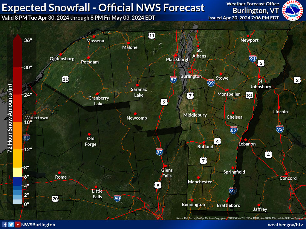
Expected Snowfall
|
Expected Ice Accumulation
|
Click on images below to enlarge.
|
Radar Loop
|
Convective SIGMETs
|
TFM Convective Forecast (TCF)
|
|
SPC Day 1 Convective Outlook
|
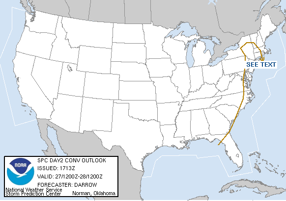
SPC Day 2 Convective Outlook
|
SPC Day 3 Convective Outlook
|
|
Current Icing SIGMETs
|
CIP/FIP Icing Guidance
|
|
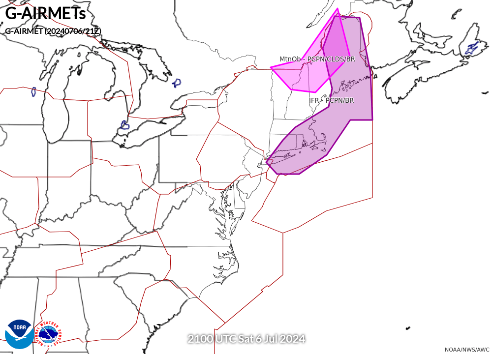
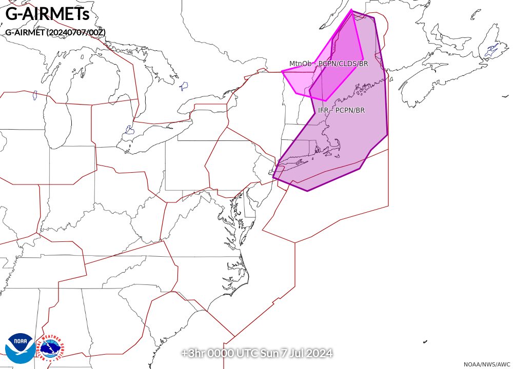
00-03 hr Icing AIRMETs
|
03-06 hr Icing AIRMETs
|
|
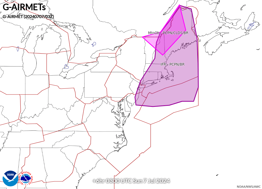
06-09 hr Icing AIRMETs
|
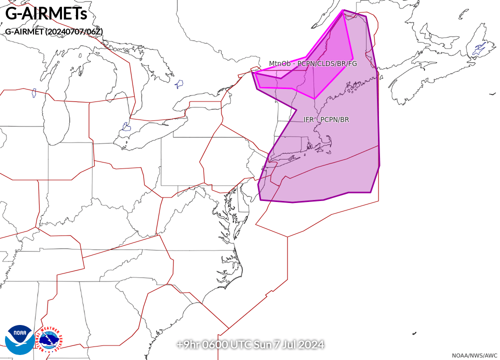
09-12 hr Icing AIRMETs
|
|
Current Turb SIGMETs
|
Turbulence Guidance (GTG)
|
|
00-03 hr Turb/LLWS AIRMETs
|
03-06 hr Turb/LLWS AIRMETs
|
|
06-09 hr Turb/LLWS AIRMETs
|
09-12 hr Turb/LLWS AIRMETs
|
|
00-03 hr Visibility AIRMETs
|
03-06 hr Visibility AIRMETs
|
|
06-09 hr Visibility AIRMETs
|
09-12 hr Visibility AIRMETs
|