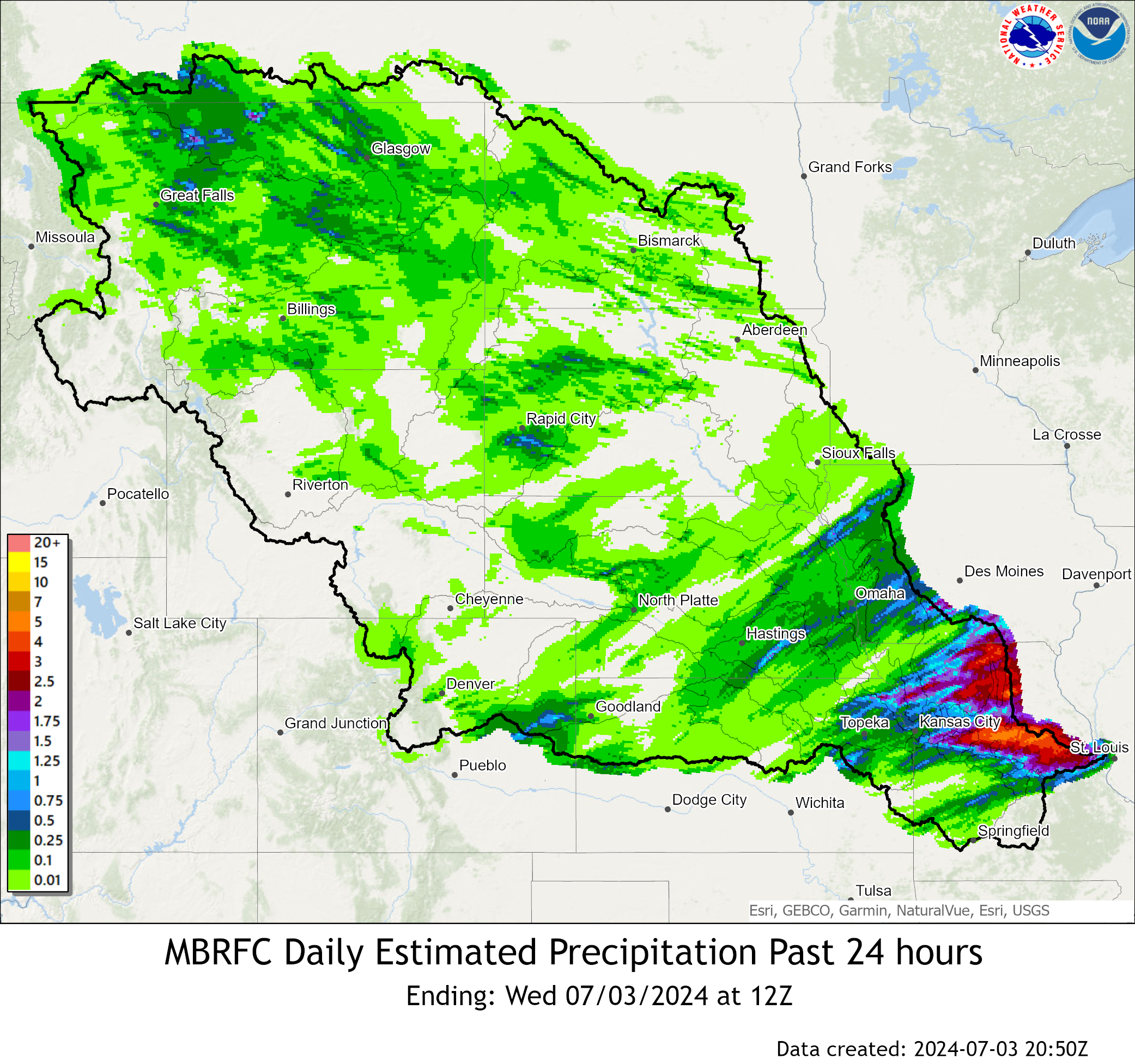
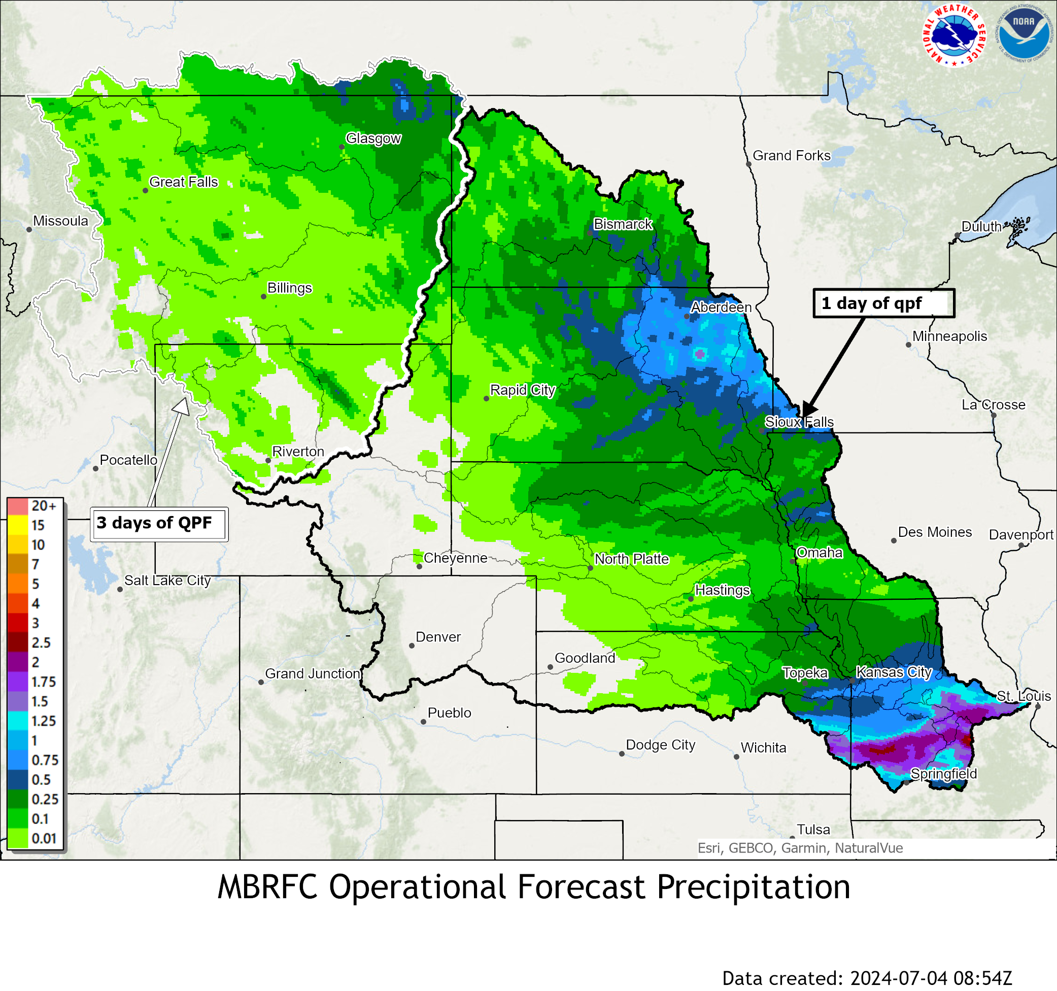
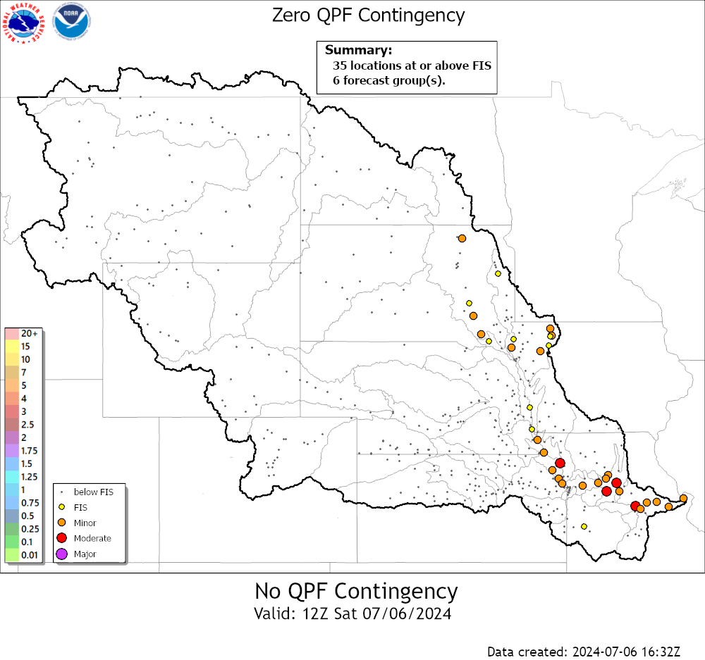
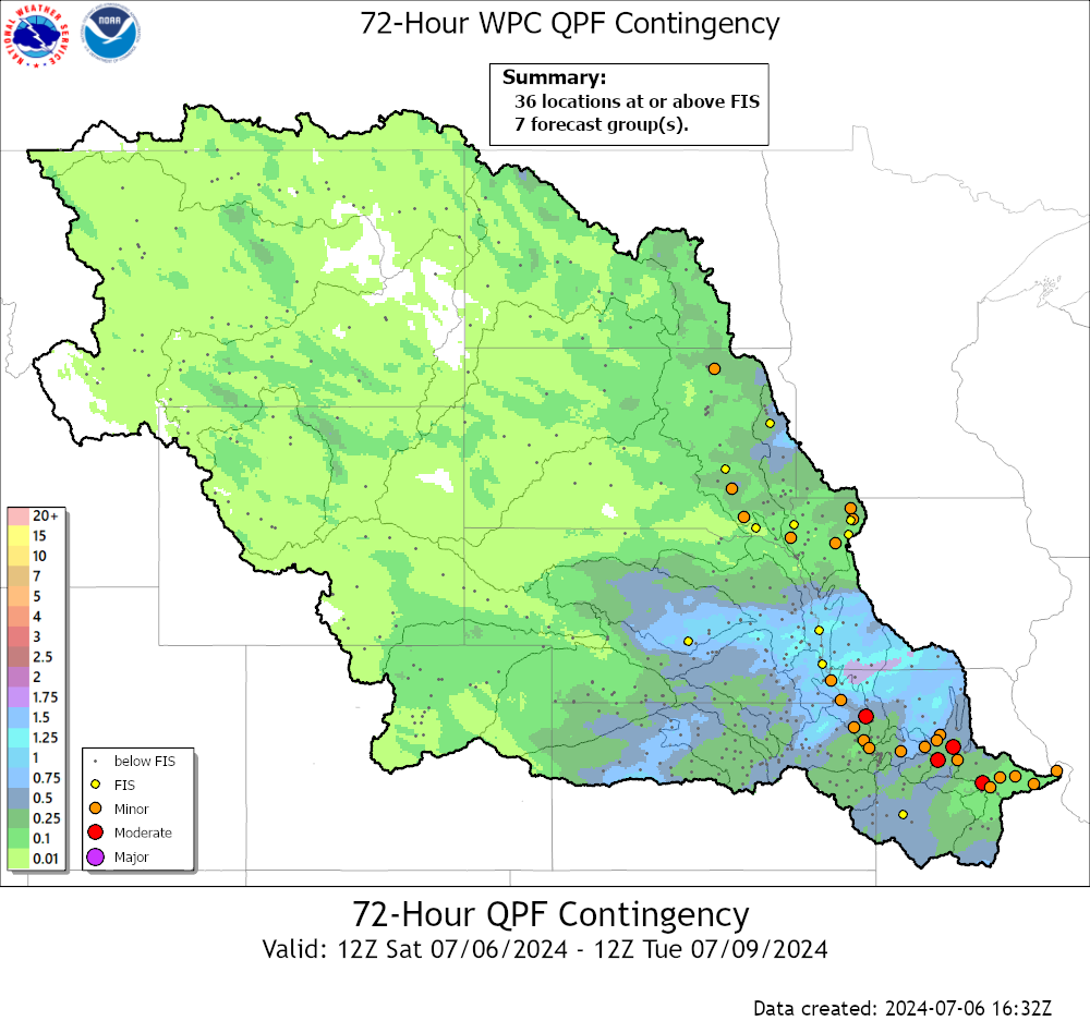
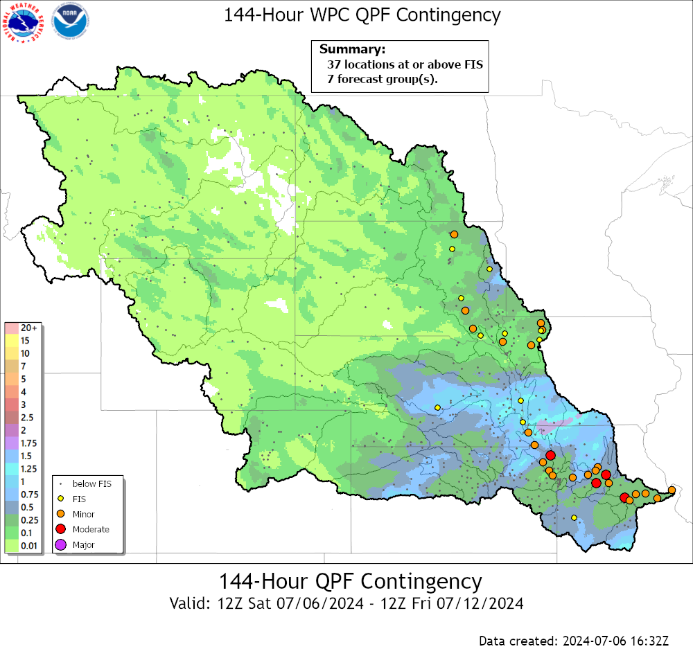
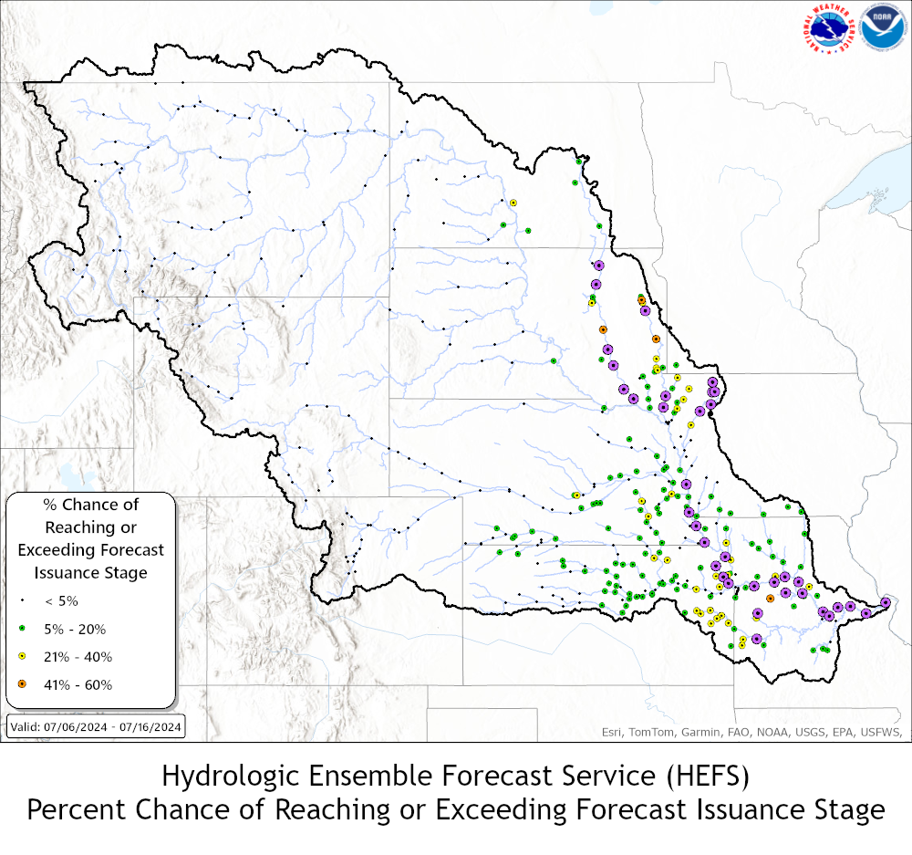
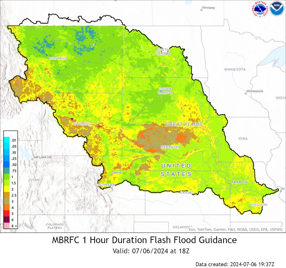
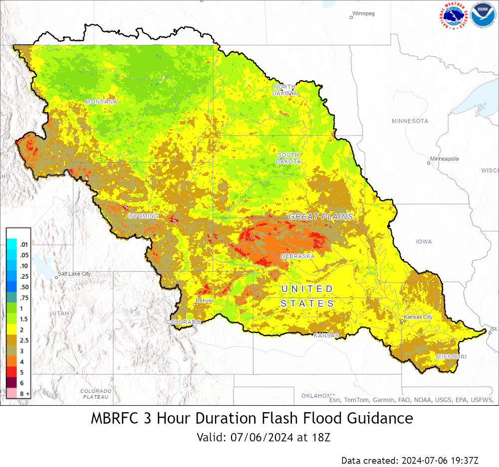
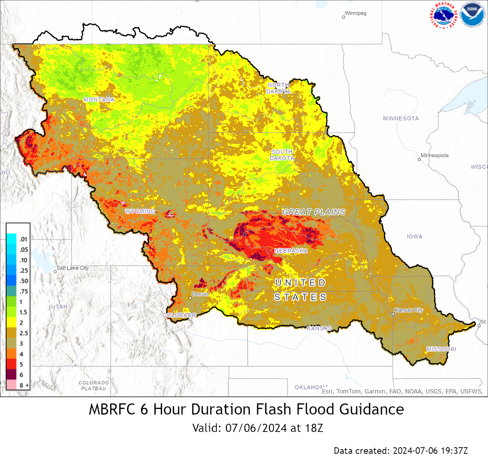
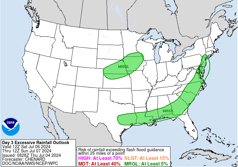
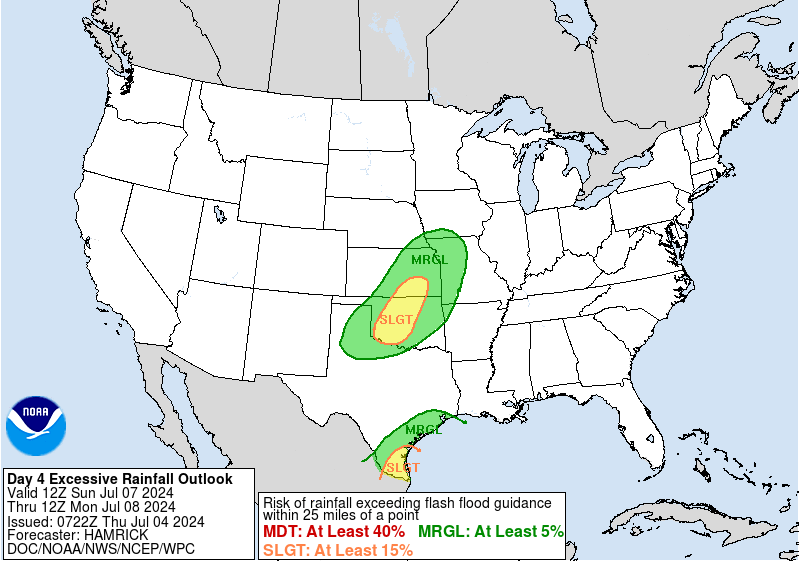
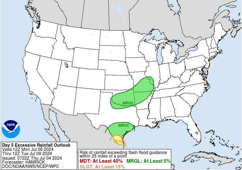
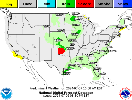
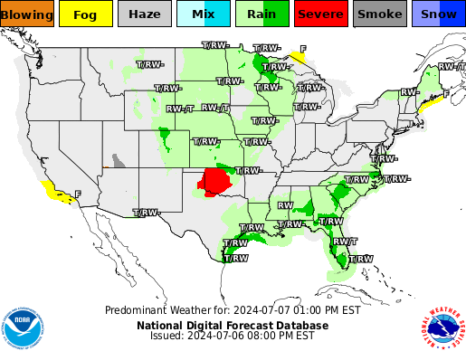
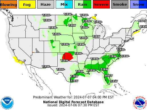
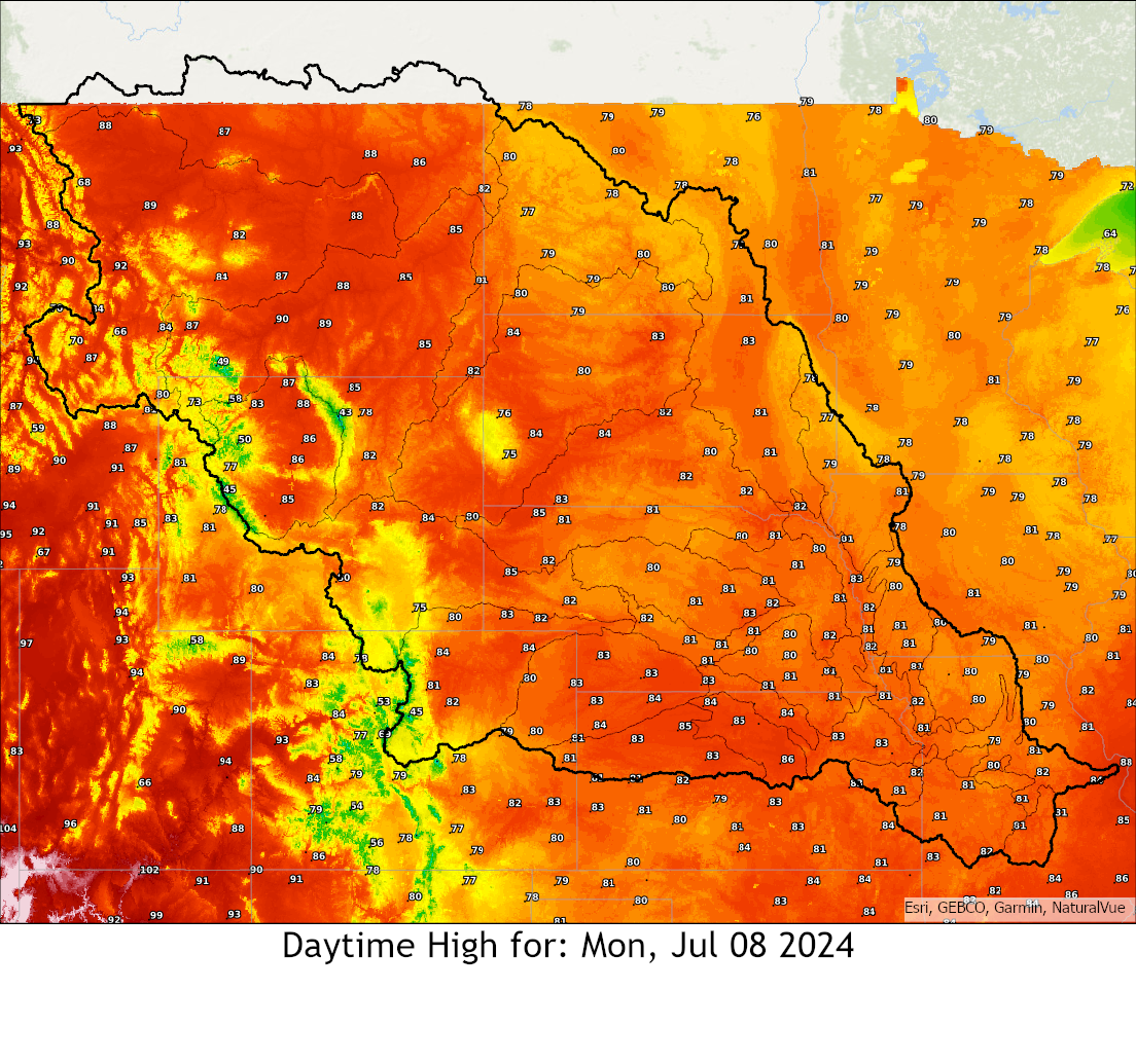
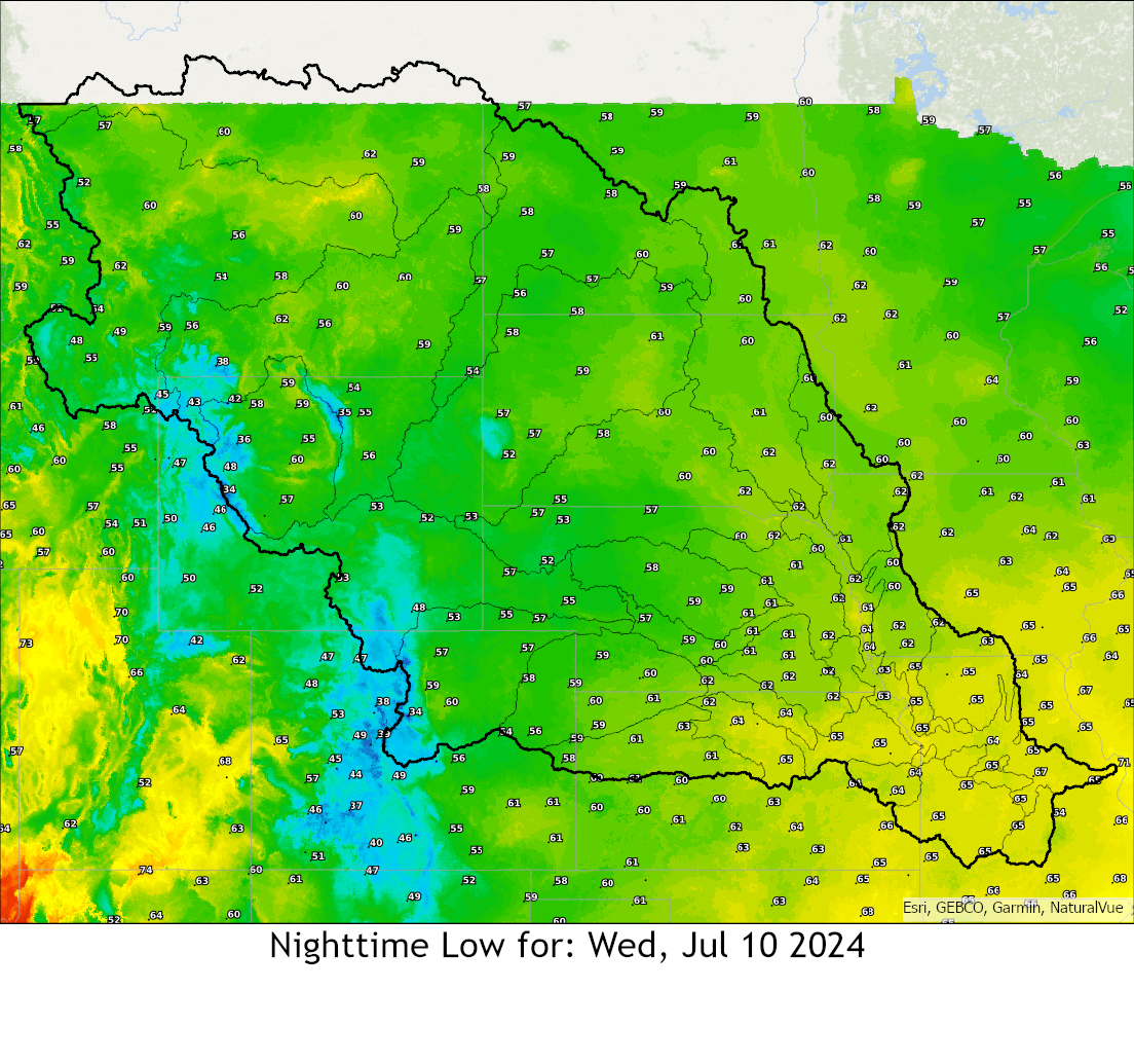
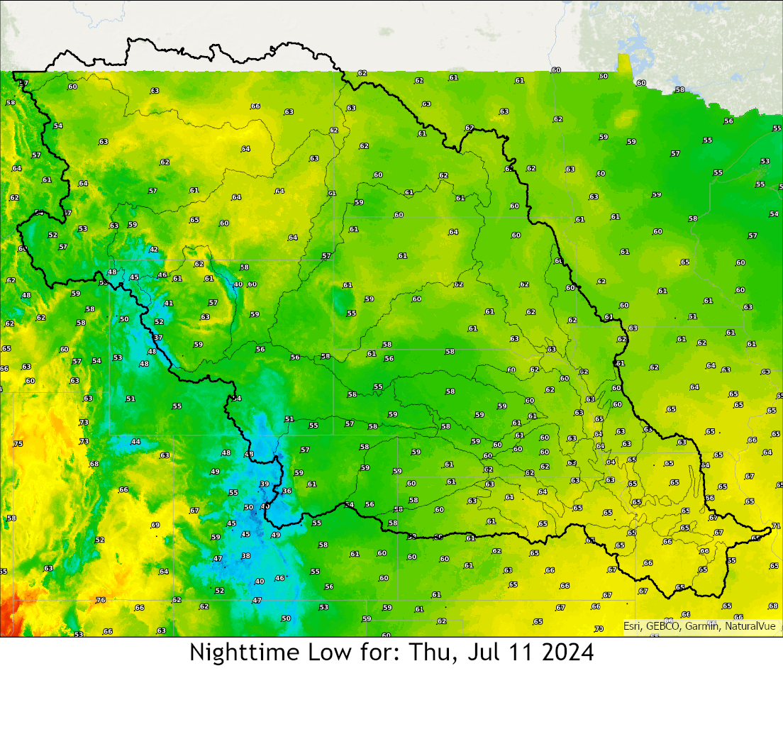
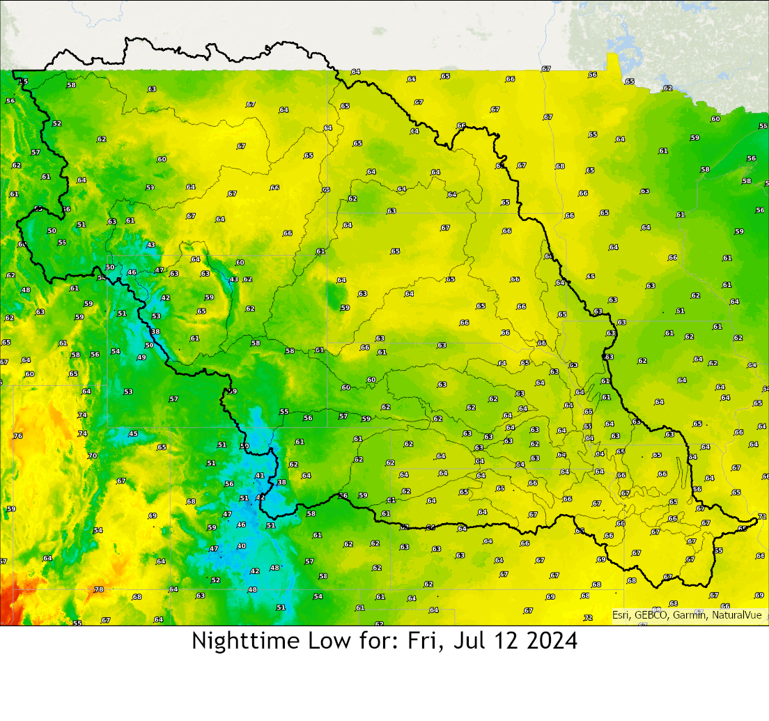
National Weather Service United States Department of Commerce
 

MBRFC Decision Support Page

24 Hour Observed Precipitation

(ending at 12Z)

Precipitation Since 12Z


Forecast Precipitation in Model


For additional images of
observed precipitation click here

For additional images of
forecast precipitation click here


River At A Glance

Missouri River (Below Gavins Point) - RVFMOM

Kansas River and Tributaries - RVFKSR

Big Blue River and Tributaries - RVFBBL

Bighorn and Wind River - RVFBGH

Elkhorn and Platte River and Tributaries - RVFELK

Grand River and Tributaries - RVFGRA

James River and Tributaries - RVFJAM

Loup River and Tributaries - RVFLUP

Lower Dakota Tributaries - RVFLDT

Lower Missouri Tributaries - RVFMTB

Lower Republican River and Tributaries - RVFLRP

Lower Smoky Hill River and Tributaries - RVFLSH

Marais Des Cygnes River and Tributaries - RVFMDC

Middle Dakota Tributaries - RVFMDT

Milk River and Tributaries - RVFMIL

North Platte River and Tributaries - RVFNPL

Osage River and Tributaries - RVFOSG

Siouxs, Floyd and Rock River - RVFSIO

South Platte River and Tributaries - RVFSPL

Upper Dakota Tributaries - RVFUDT

Upper Missouri River and Tributaries - RVFUMO

Upper Missouri Tributaries - RVFMTA

Upper Republican River and Tributaries - RVFURP

Upper Smoky Hill River and Tributaries - RVFUSH

Yellowstone River and Tributaries - RVFYEL


Current River Conditions
Current Observed Above Flood
Current Forecast Above Flood


River Conditions With Uncertainty Bands


Hydro Viewer


Local Storm Reports


Latest Radar

For radar webpage click here.


Gridded Flash Flood Guidance
1 HR 3 HR 6 HR


WPC Briefing

Overview
Day 1 Day 2 Day 3


Latest Surface Analysis


QPF
Day 1 Day 2 Day 3 Day 4
Day 5 Day 6 Day 7  
 
Accumulated QPF
Day 1-2 Day 1-3 Day 1-5 Day 1-7


Excessive Rainfall Outlook 

Day 1

Day 2

Day 3

Experimental Day 4 Experimental Day 5

Excessive Rainfall Discussion

Mesoscale Precipitation Discussion

Main Excessive Rainfall website


NDFD Weather Graphics

Current

+3 hours

+6 hours

+9 hours

+12 hours

+15 hours

+18 hours

+21 hours

+24 hours


NDFD Temperature Graphics


USACE

Graphic above, courtesy of USACE, updated every Tuesday.

Graphics below courtesy of USACE; data source NRCS, are NOT updated July through December.


Meteorology Websites

College of DuPage - MET Wall

Penn State - MET Wall

Pivotal Weather

Tropical Tidbits

The Weather Forecast Animator

Earl's Regional Snowfall

Weather Model Assortment

Satellite Loops

HRRR Model Data

Iowa State Text Products

WPC Storm Reports

Wind

Polar Weather Mesoanalysis