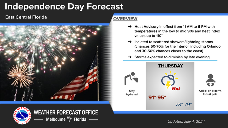
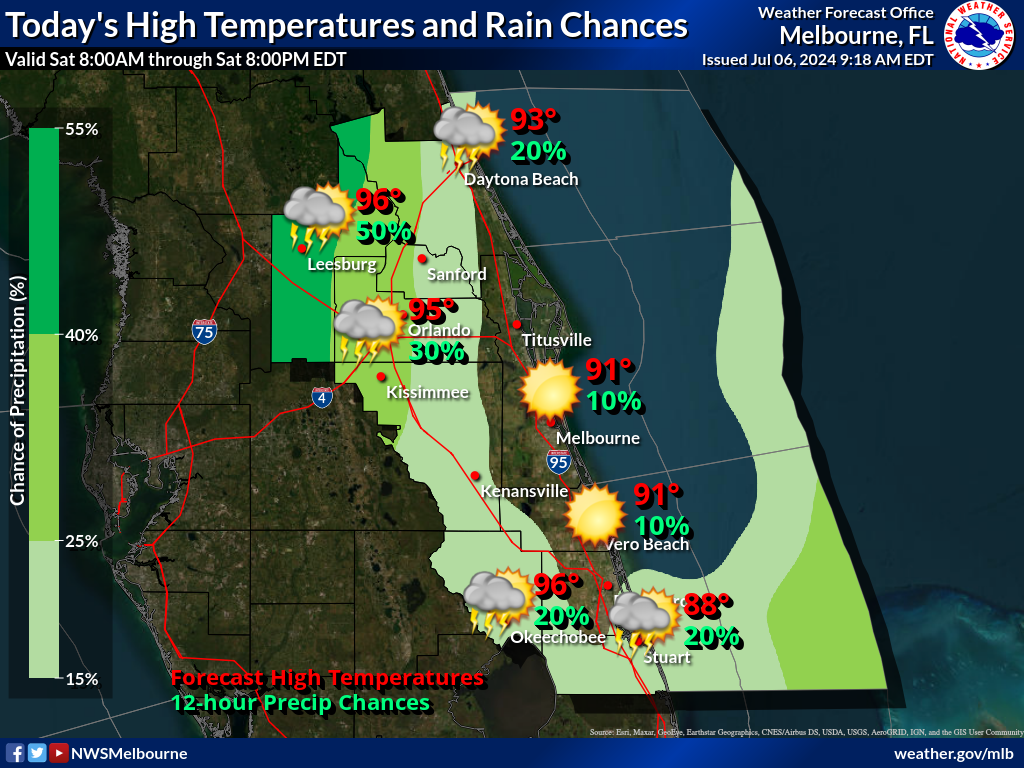
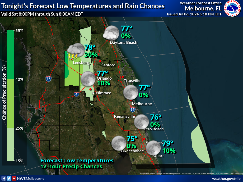
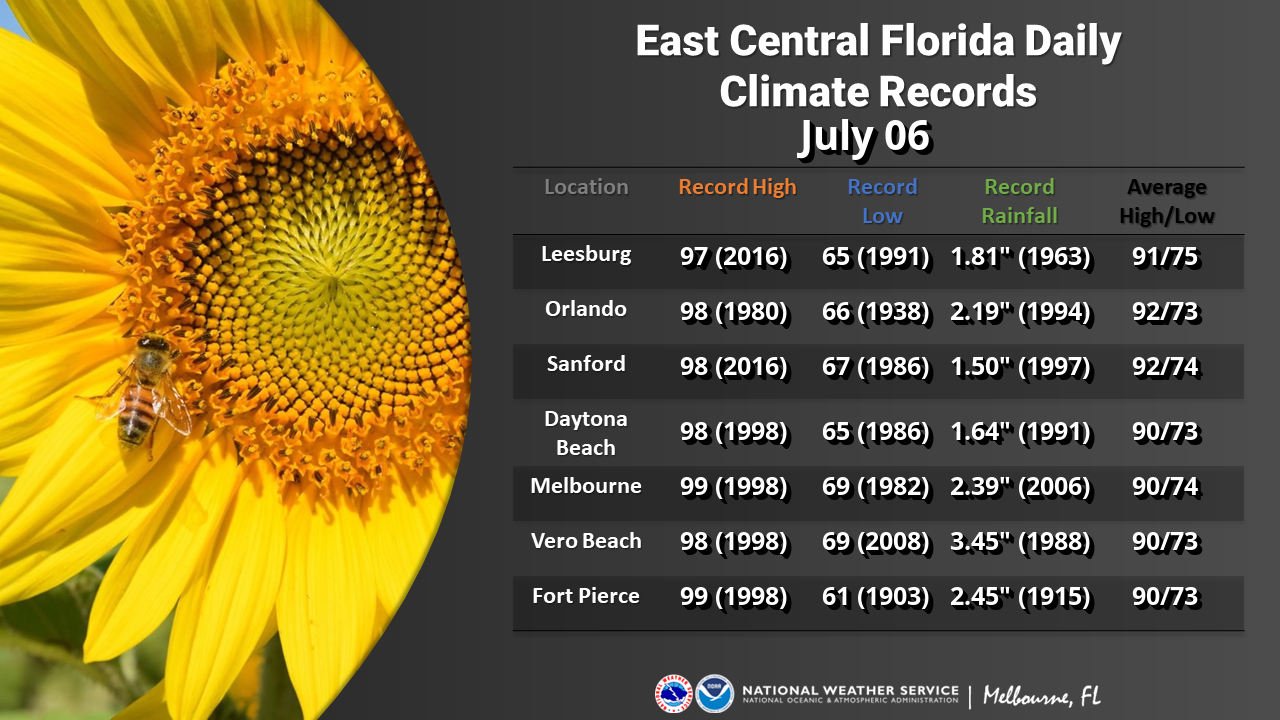
A hot and humid 4th of July is expected today with heat index values up to 110. A Heat Advisory is in effect for all counties in east central Florida from 11 AM to 6 PM. This level of heat can affect anyone without adequate precautions. It is recommended to take frequent breaks from the heat and to drink plenty of fluids. Mostly to partly sunny skies are forecast before scattered showers and lightning storms are expected to develop into the afternoon and evening. The main storm hazards will be wind gusts up to 30-45mph, occasional to frequent lightning strikes, and heavy rainfall that has the potential to result in minor flooding of roadways and low lying areas. Afternoon highs in the low to mid 90s are forecast.
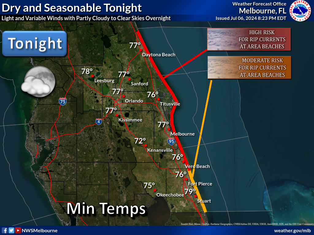
A High Risk for life-threatening rip currents exists at the Volusia and northern Brevard county beaches. Entering the surf is strongly discouraged. A Moderate risk for rip currents exists at the central Florida beaches to the south. Remember to swim near a lifeguard and never swim alone.
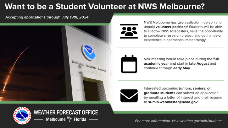
Are you a junior, senior, or graduate student with an interest in operational meteorology? NWS Melbourne has two volunteer positions available for the full academic year. Additional details are available at the link under "News Headlines" at the top of the webpage!


 Interactive Radar
 Regional Satellite
 Tropical Weather