 |
 |
|
Latest Emergency Manager's Briefing (pdf) NO! This briefing is updated when hazardous weather is expected or occurring. |
Weather Hazards Outlook
|
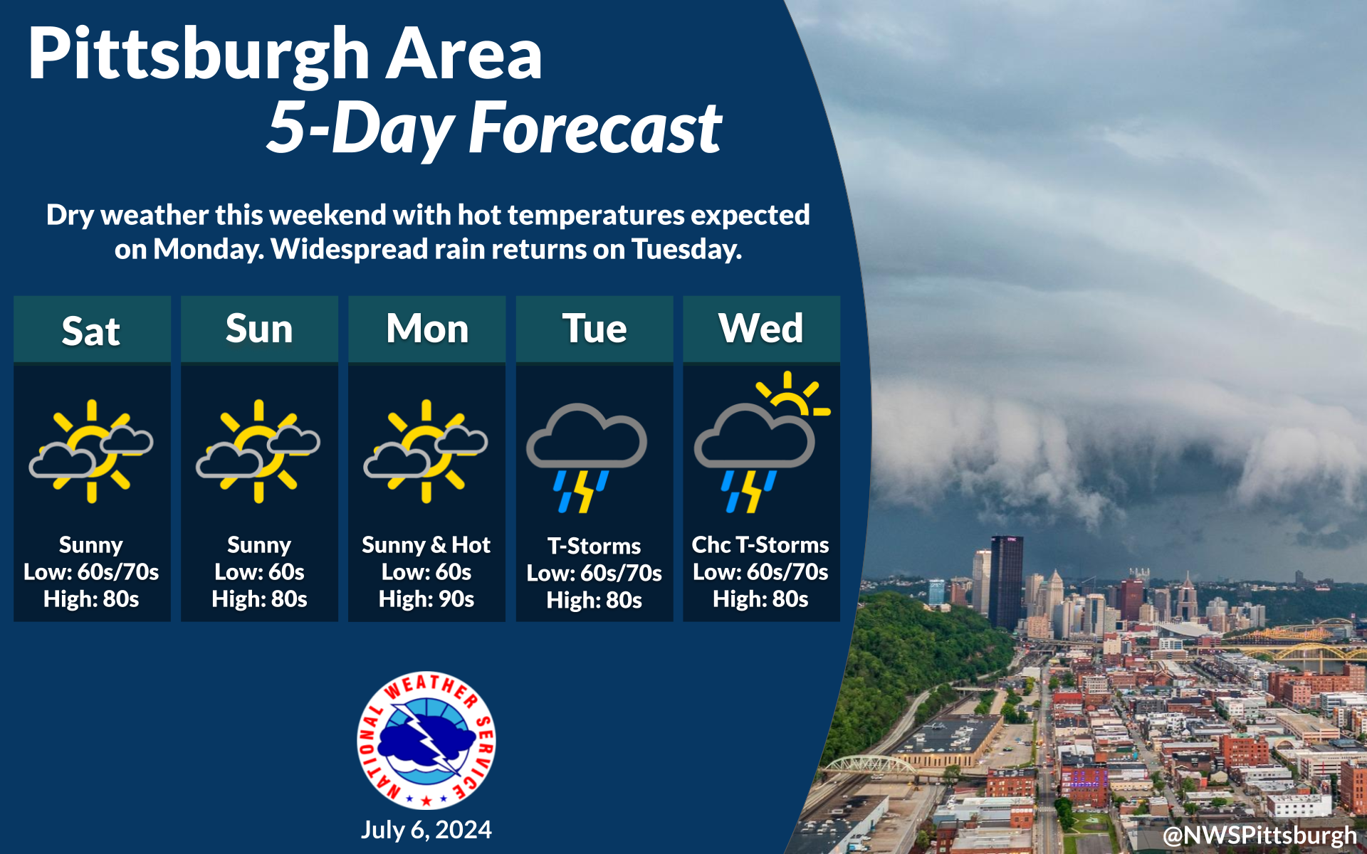
881 FLUS41 KPBZ 040626 HWOPBZ Hazardous Weather Outlook National Weather Service Pittsburgh PA 226 AM EDT Thu Jul 4 2024 OHZ039>041-048>050-057>059-PAZ007>009-013>016-020>022-029-073-074- 077-078-WVZ001>003-050630- Tuscarawas-Carroll-Columbiana-Coshocton-Harrison-Jefferson OH- Muskingum-Guernsey-Belmont-Mercer-Venango-Forest-Lawrence-Butler- Clarion-Jefferson PA-Beaver-Allegheny-Armstrong-Washington- Westmoreland-Higher Elevations of Westmoreland-Indiana- Higher Elevations of Indiana-Hancock-Brooke-Ohio- 226 AM EDT Thu Jul 4 2024 This Hazardous Weather Outlook is for east central Ohio, western Pennsylvania, and northern West Virginia. .DAY ONE...Today and tonight. No hazardous weather is expected at this time. .DAYS TWO THROUGH SEVEN...Friday through Wednesday. There is a Marginal Risk (level 1 out of 5) for severe thunderstorms Friday afternoon and evening. The main hazard is expected to be damaging wind. .SPOTTER INFORMATION STATEMENT... Spotter activation is not expected at this time. $$ OHZ068-069-PAZ031-075-076-WVZ004-012-021-509>514-050630- Noble-Monroe-Greene-Fayette-Higher Elevations of Fayette-Marshall- Wetzel-Marion-Monongalia- Ridges of Eastern Monongalia and Northwestern Preston-Preston- Eastern Preston-Western Tucker-Eastern Tucker- 226 AM EDT Thu Jul 4 2024 This Hazardous Weather Outlook is for east central Ohio, southwest Pennsylvania, and northern West Virginia. .DAY ONE...Today and tonight. There is a Marginal Risk (or level 1 out of 5) for severe thunderstorms this afternoon and evening. The main hazard is expected to be damaging wind, though locally heavy rainfall is also possible. .DAYS TWO THROUGH SEVEN...Friday through Wednesday. There is a Marginal Risk (level 1 out of 5) for severe thunderstorms Friday afternoon and evening. The main hazard is expected to be damaging wind. .SPOTTER INFORMATION STATEMENT... Weather spotters are encouraged to report significant weather conditions according to Standard Operating Procedures. $$ Rackley |
Graphical Hazardous Weather Outlook |
|
|
| Days 1-8 Severe Weather Outlooks | |
 |
|
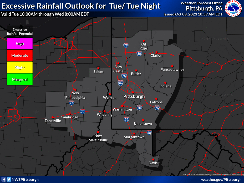
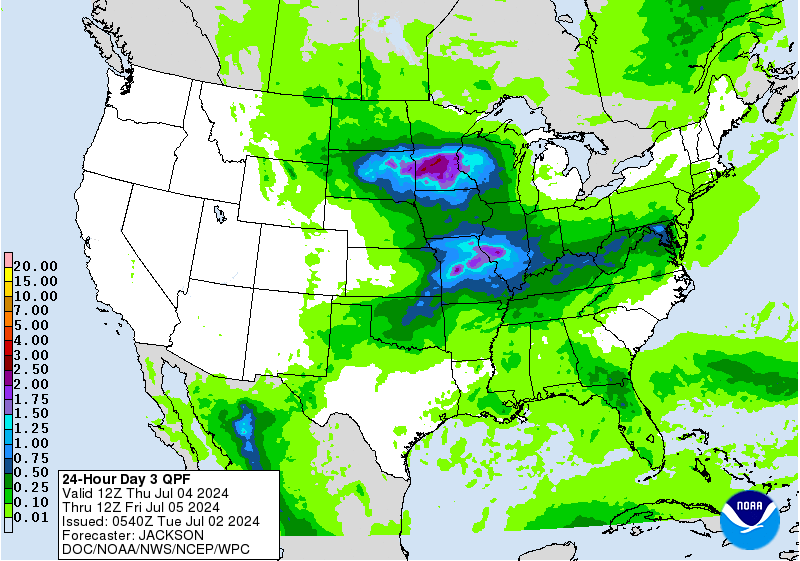
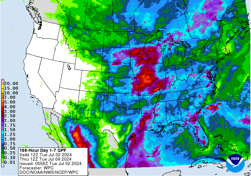
| Days 1-3 Excessive Rainfall Outlooks | |
 |
Observed Weather Briefing
 |
 Regional Radar Loop |
 NWS Pittsburgh, PA Radar Loop |
 Cleveland, OH |
 Wilmington, OH |
 State College, PA |
 Sterling, VA |
 Charleston, WV |
 Buffalo, NY |
||
| Click Here for Interactive Radar Display | ||||
 GeoColor Satellite Image |
 Infrared Satellite Image Infrared Satellite Image |
 Water Vapor Image |
| Additional Satellite Imagery |
 US Surface Analysis |
 US Surface Analysis with Radar |
 US Surface Temps | N America | World |
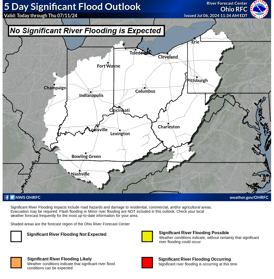
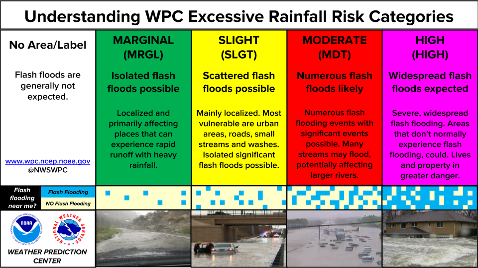
Rainfall and Flood Threat Briefing
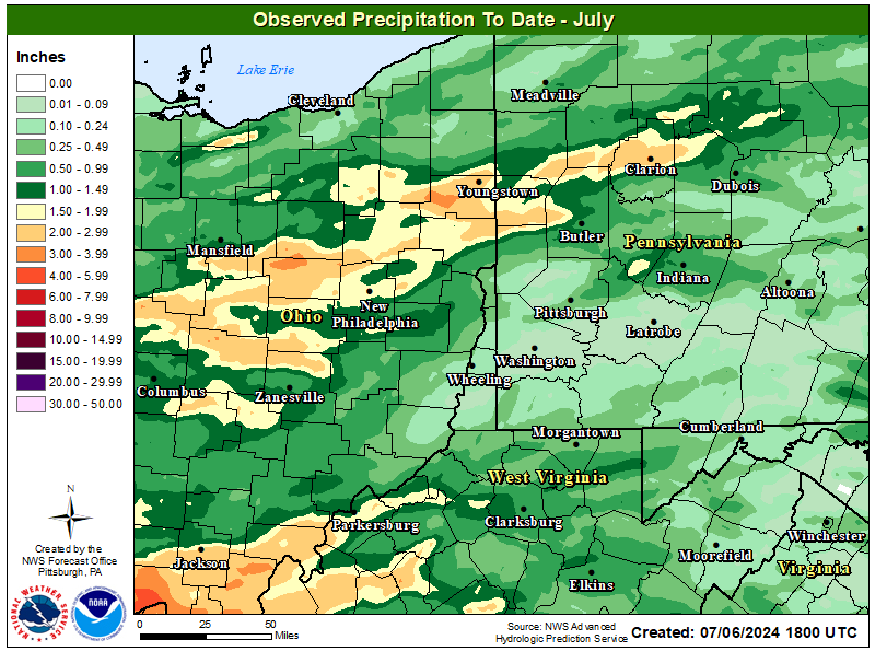
| How Much Rain Has Fallen? (Interactive) | |
 |
 |
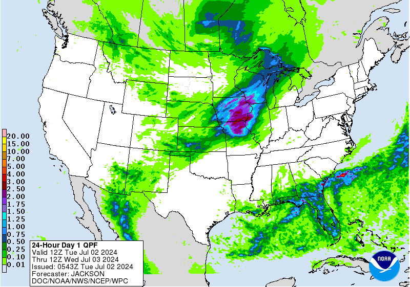
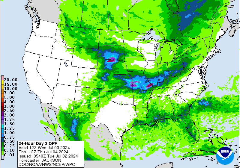
| Precipitation Forecasts | |||
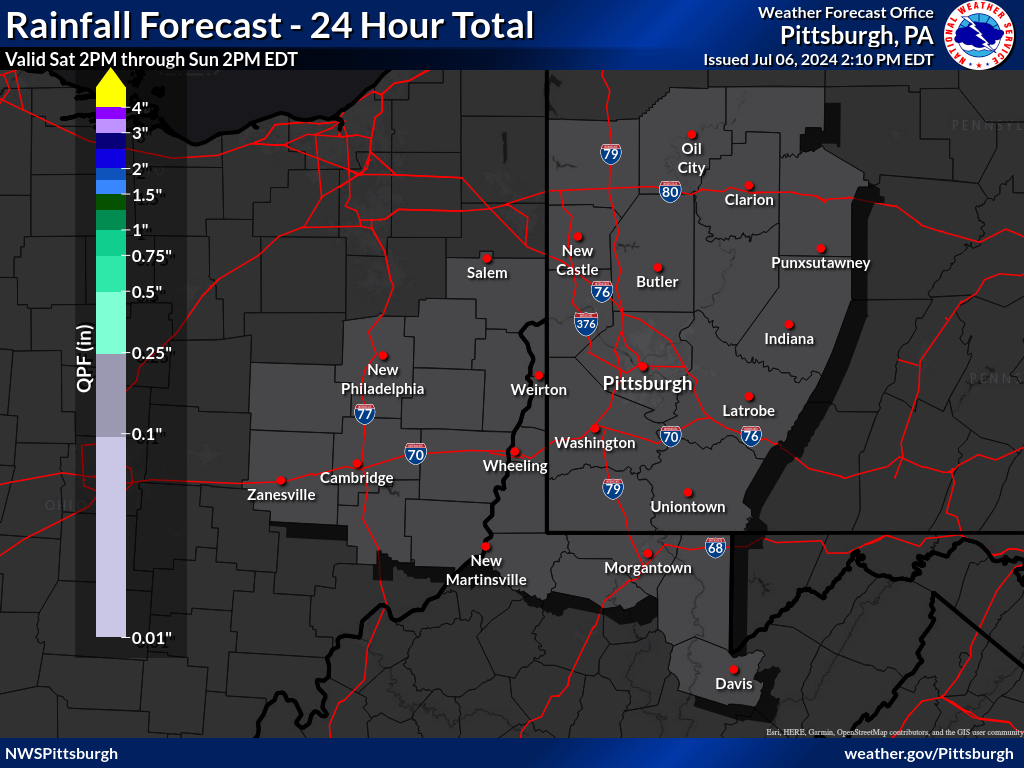
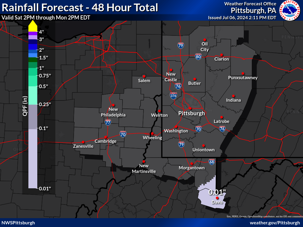
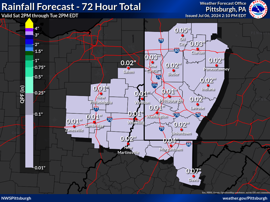
| Today's Precip Forecast | Day 1 - 2 Precip Forecast | Day 1 - 3 Total Precip Forecast | |
 |
 |
 |
|
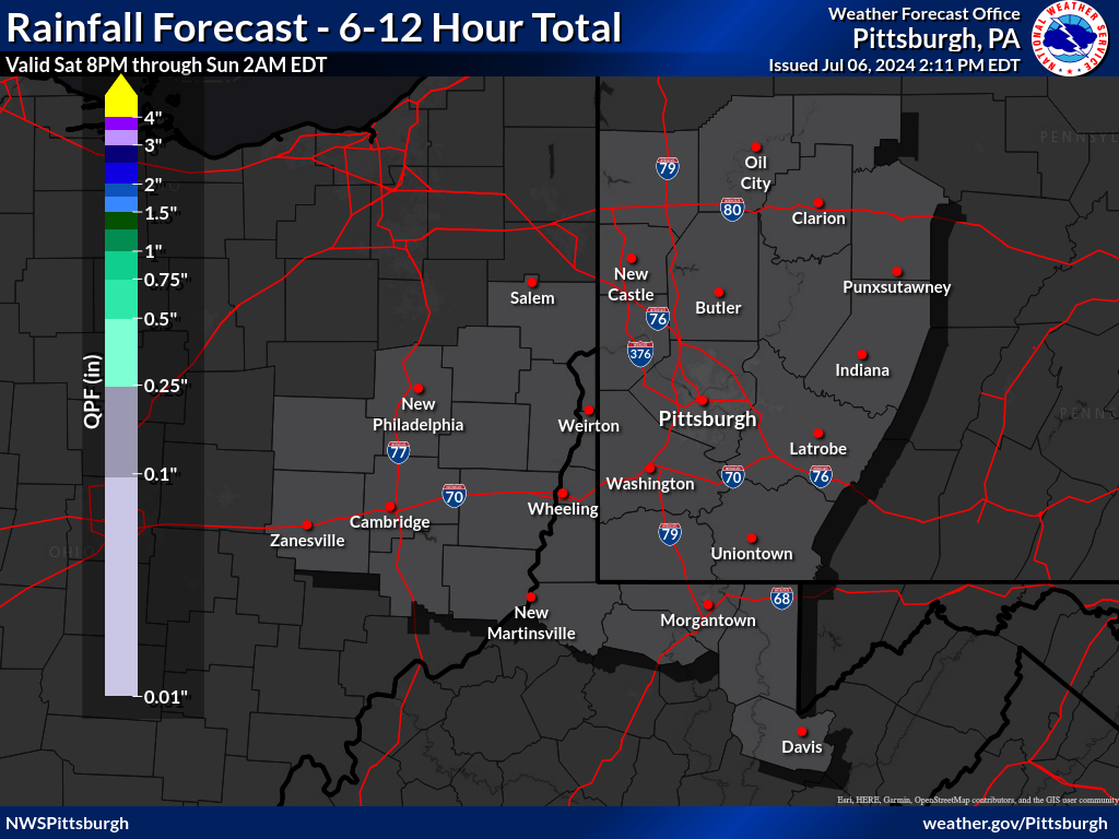
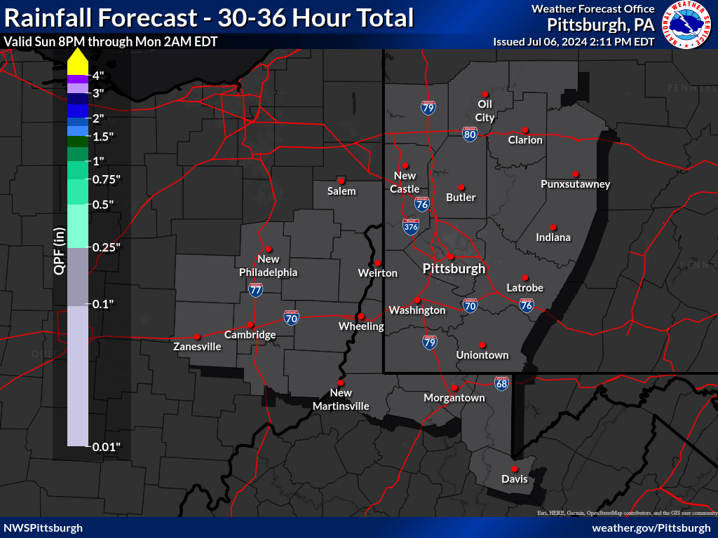
| 0 to 6 hours | 6 to 12 hours | 12 to 18 hours | 18 to 24 hours | 24 to 30 hours | 30 to 36 hours | |
 |
 |
 |
 |
 |
 |
 |
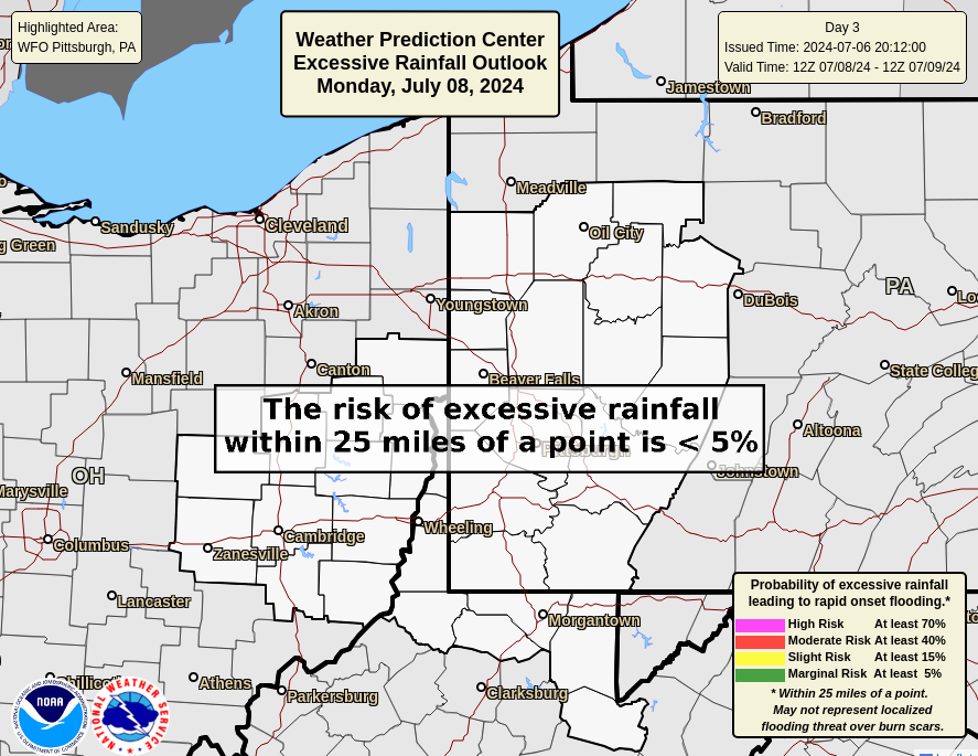
| Day 1 Excessive Rainfall Outlook | Day 2 Excessive Rainfall Outlook | Day 3 Excessive Rainfall Outlook | Ohio River Basin Flood Outlook |
 |
 |
 |
 |
| Day 1 Precipitation | Day 2 Precipitation | Day 3 Precipitation |
 |
 |
 |
| Day 4-5 Precipitation | Day 6-7 Precipitation | 7-Day Total Precipitation |
 |
 |
 |
Thunderstorm Threat Briefing
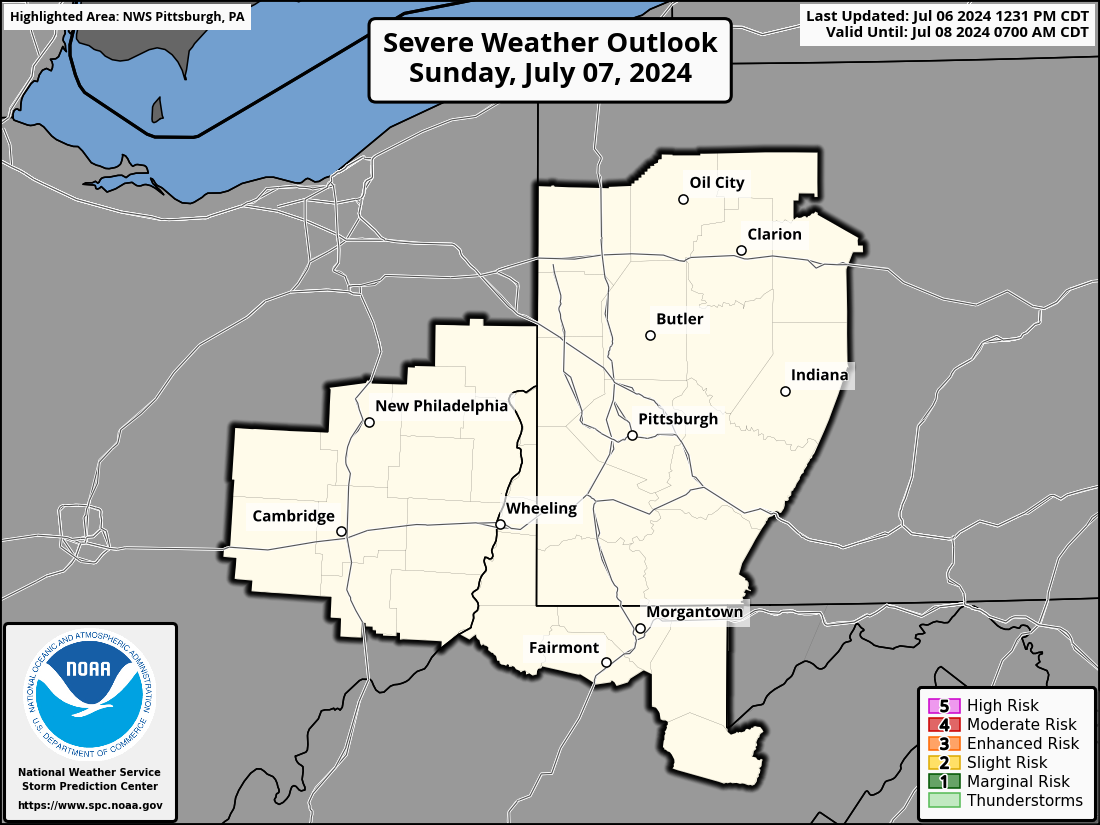
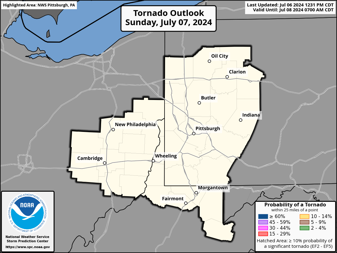
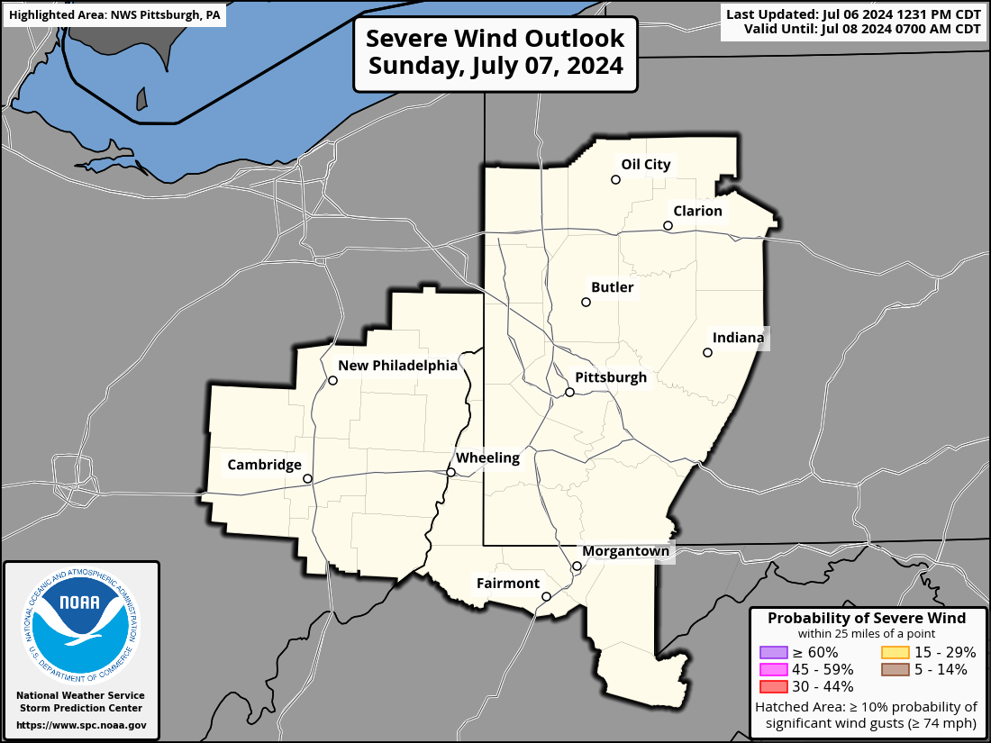
| Day 1 Local Severe Weather Outlooks | |||
 |
 |
 |
 |
| Additional SPC Day 1 Outlook Details | |||
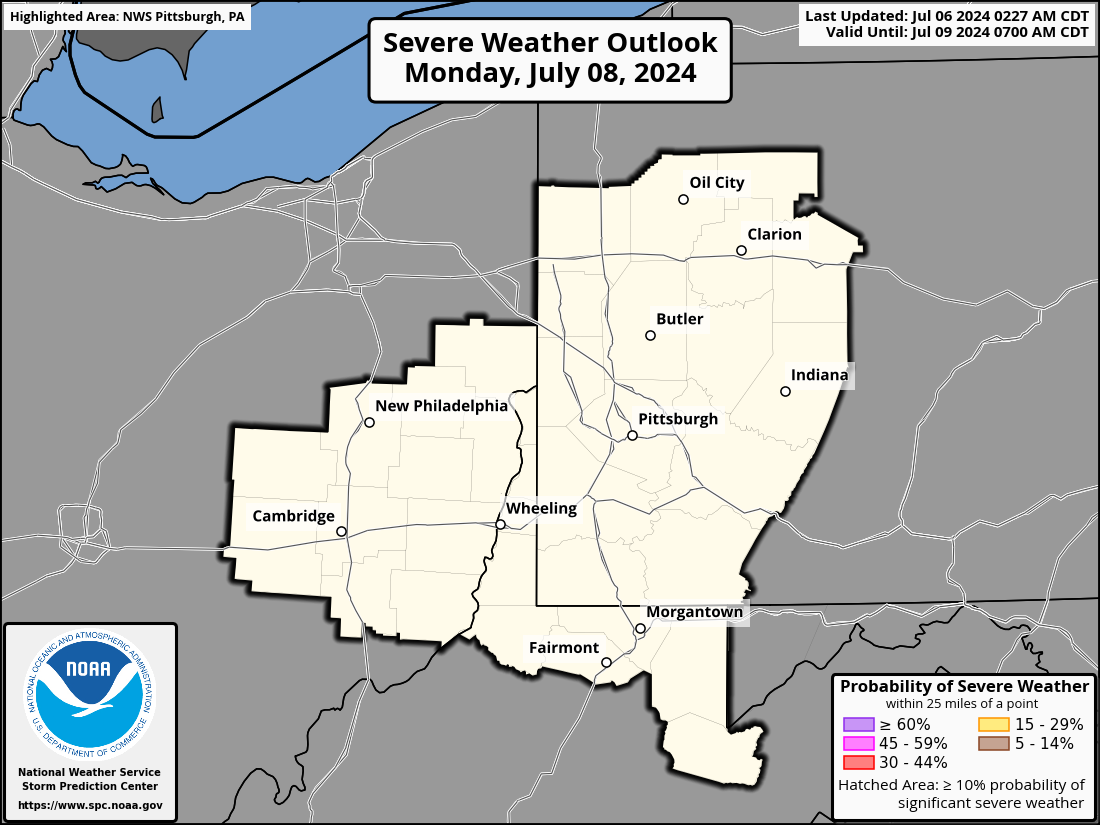
| Day 2 Local Severe Weather Outlooks | |||
 |
 |
 |
 |
| Additional SPC Day 2 Outlook Information | |||
| Day 3 Local Severe Weather Outlooks | |
 |
 |
| Additional SPC Day 3 Outlook Information | |

 |
Current Watches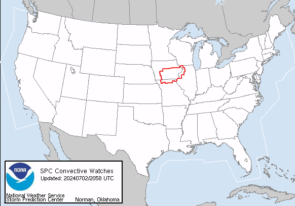 |
Storm Trend Discussions |
Today's Storm Reports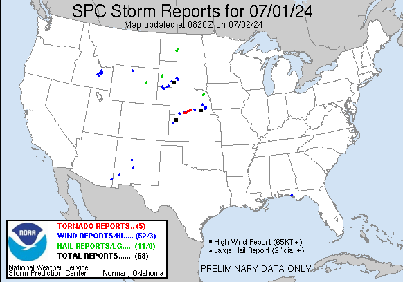 |
Yesterday's Storm Reports |
| SPC Day 1 Thunderstorm Outlook | SPC Day 1 Tornado Outlook | SPC Day 1 Severe Wind Outlook | SPC Day 1 Severe Hail Outlook |
 |
 |
 |
 |
| SPC Day 1 Thunderstorm Outlook Discussion | |||
| SPC Day 2 Thunderstorm Outlook | SPC Day 2 Tornado Outlook | SPC Day 2 Severe Wind Outlook | SPC Day 2 Severe Hail Outlook |
 |
 |
 |
 |
| SPC Day 2 Thunderstorm Outlook Discussion | |||
| SPC Day 3 Thunderstorm Outlook | SPC Day 4-8 Thunderstorm Outlook |
 |
 |
| SPC Day 3 Outlook Narrative | SPC Day 4-8 Outlook Narrative |
Winter Weather Threat Briefing
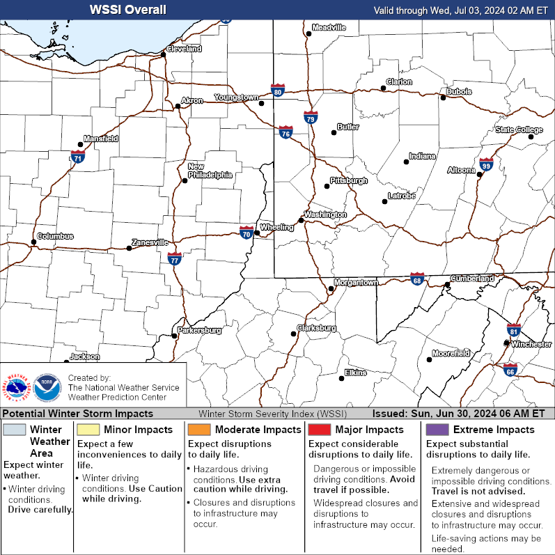
| Expected Snowfall Forecast | Expected Ice Accumulation Forecast | Winter Storm Severity Index | |
 |
 |
 |
|
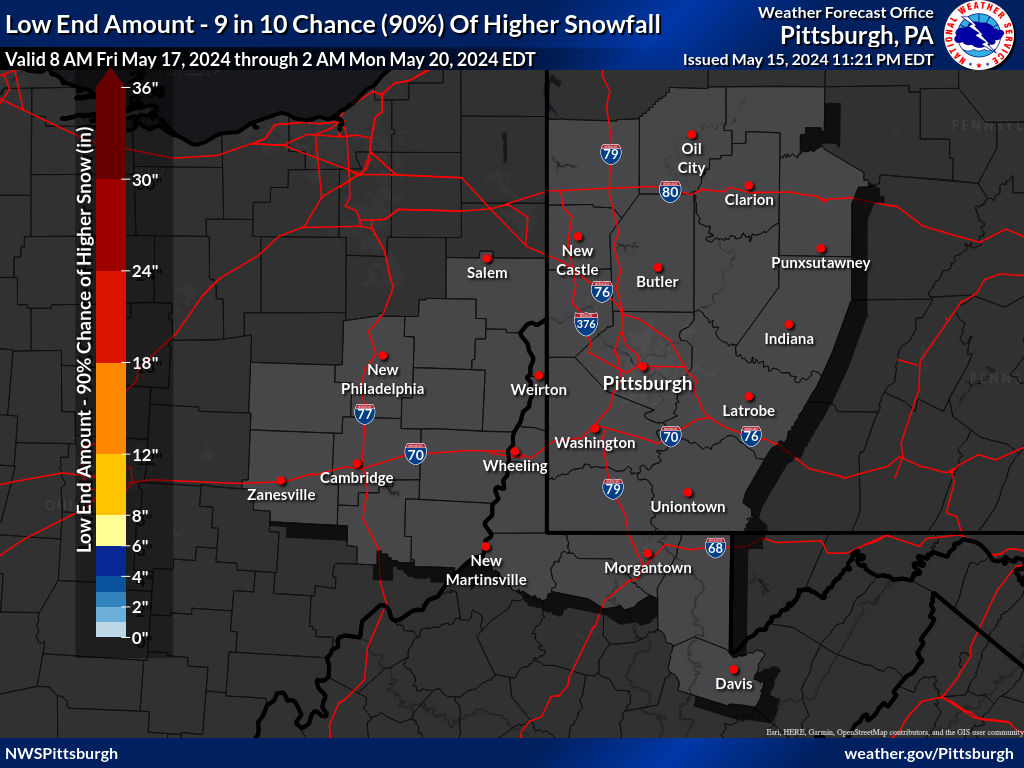
| 10th Percentile (Low-End) Snowfall Forecast | 90th Percentile (High-End) Snowfall Forecast |
 |
 |
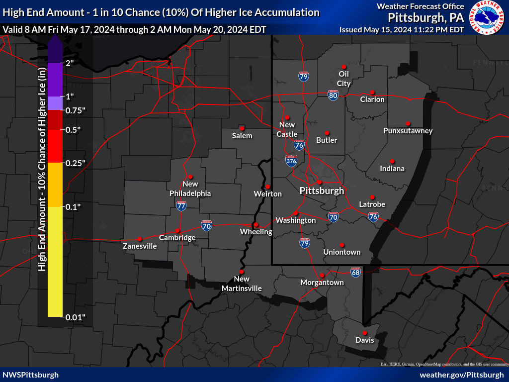
| 10th Percentile (Low-End) Ice Accumulation Forecast | 90th Percentile (High-End) Ice Accumulation Forecast |
 |
 |
| 30 Hour Forecast Snow Amounts (6 Hour Periods) | ||||||
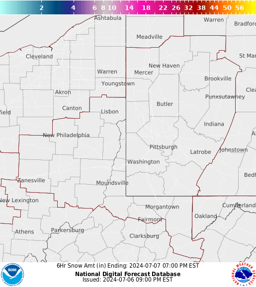
| 0 to 6 Hours | 6 to 12 Hours | 12 to 18 Hours | 18 to 24 Hours | 24 to 30 Hours | 30 to 36 Hours | |
 |
 |
 |
 |
 |
 |
|
| Day 1 Snowfall Greater Than 4" | Day 2 Snowfall Greater Than 4" | Day 3 Snowfall Greater Than 4" |
 |
 |
 |
| Day 1 Freezing Rain Greater than 1/4" | Day 2 Freezing Rain Greater than 1/4" | Day 3 Freezing Rain Greater than 1/4" |
 |
 |
 |
| Day 4 Experimental Winter Weather Outlook | Day 5 Experimental Winter Weather Outlook | Day 6 Experimental Winter Weather Outlook | Day 7 Experimental Winter Weather Outlook |
 |
 |
 |
 |
Temperature and Wind Threat Briefing
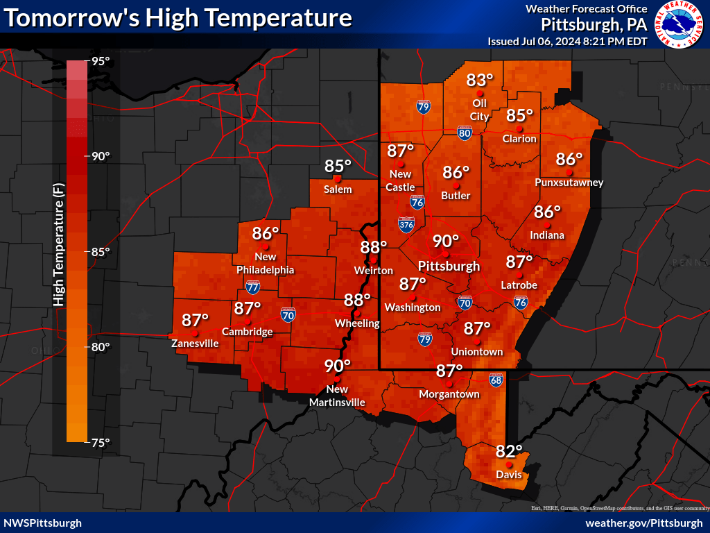
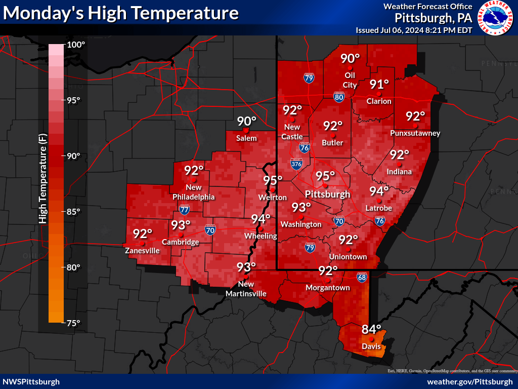
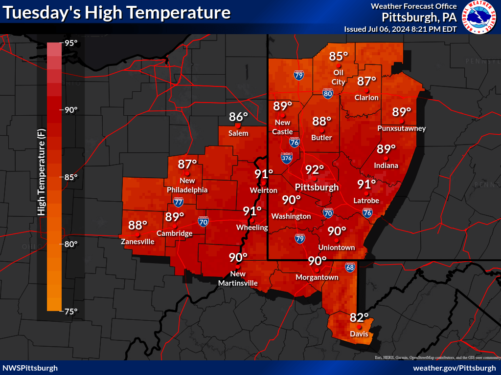
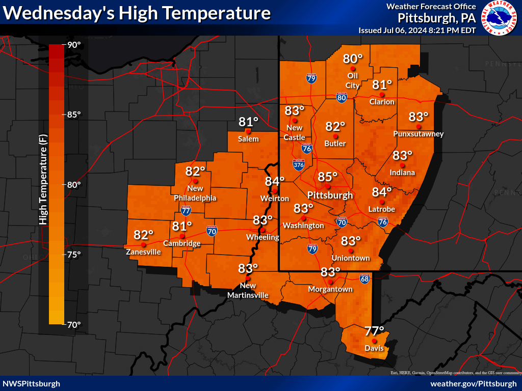
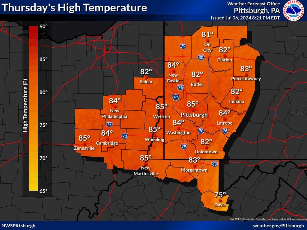
| Today's High Temperatures | Tomorrow's High Temperatures | Day 3 High Temperatures | Day 4 High Temperatures | Day 5 High Temperatures |
 |
 |
 |
 |
 |
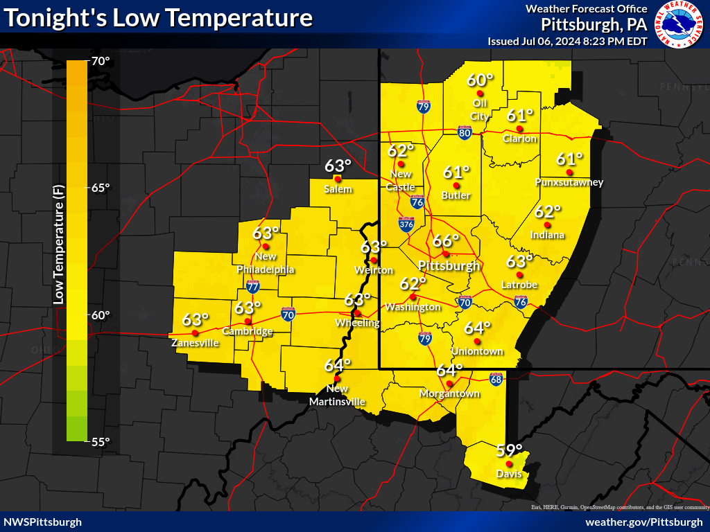
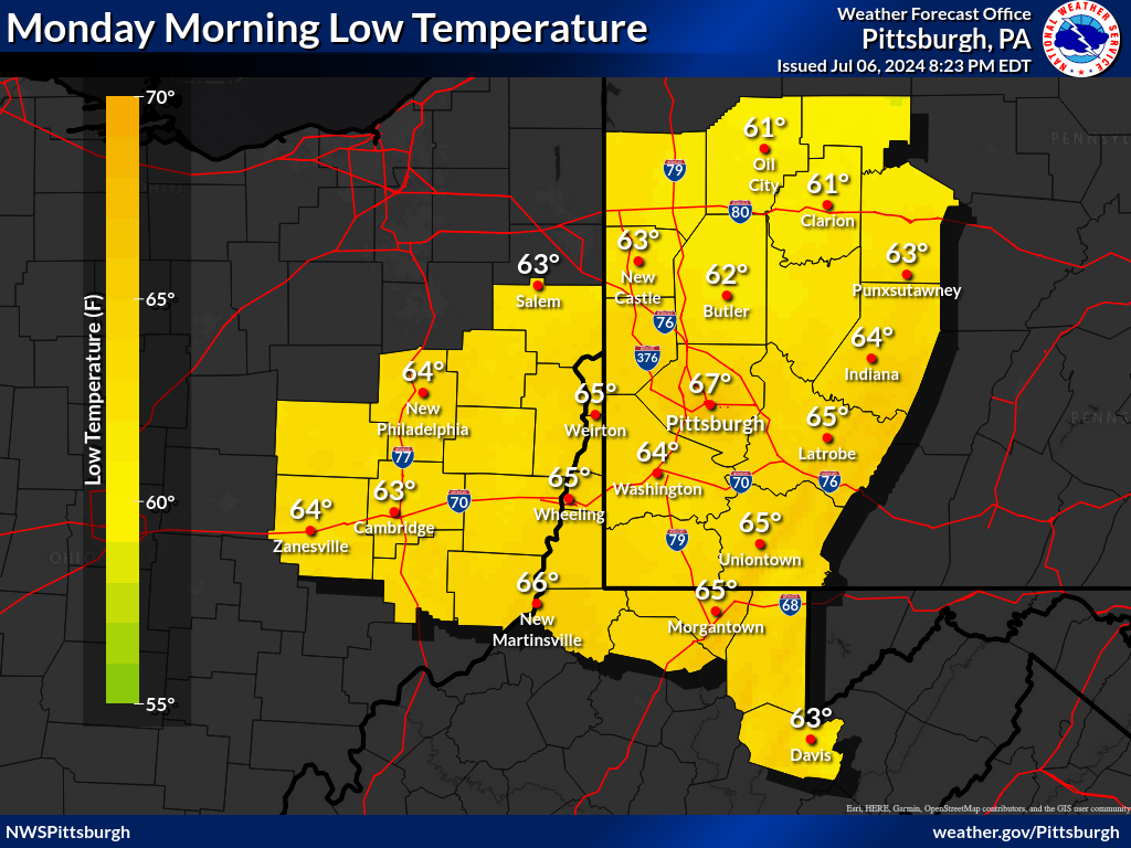
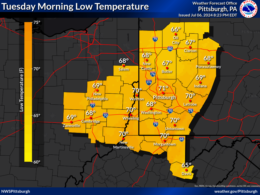
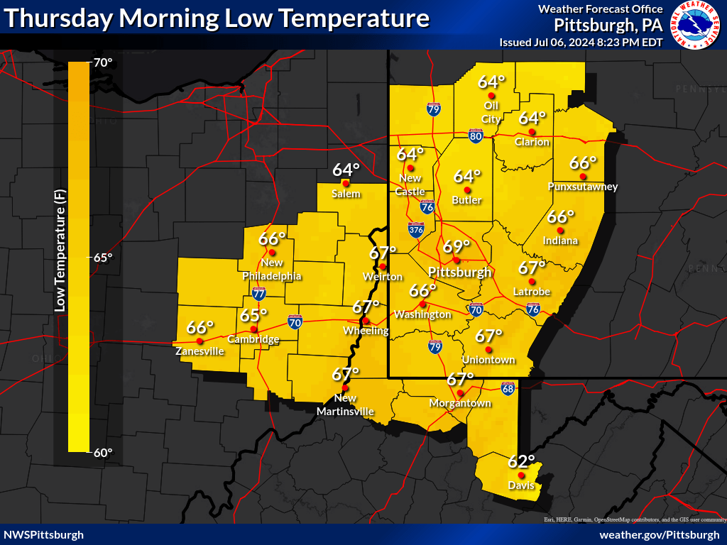
| Today's Low Temperatures | Tonight's Low Temperatures | Day 3 Low Temperatures | Day 4 Low Temperatures | Day 5 Low Temperatures |
 |
 |
 |
 |
 |
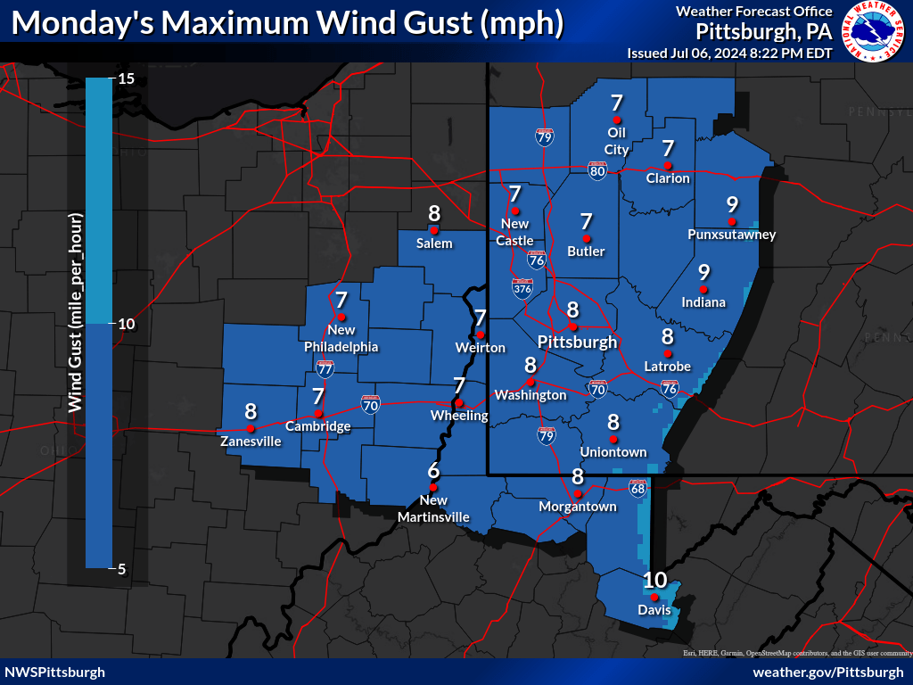
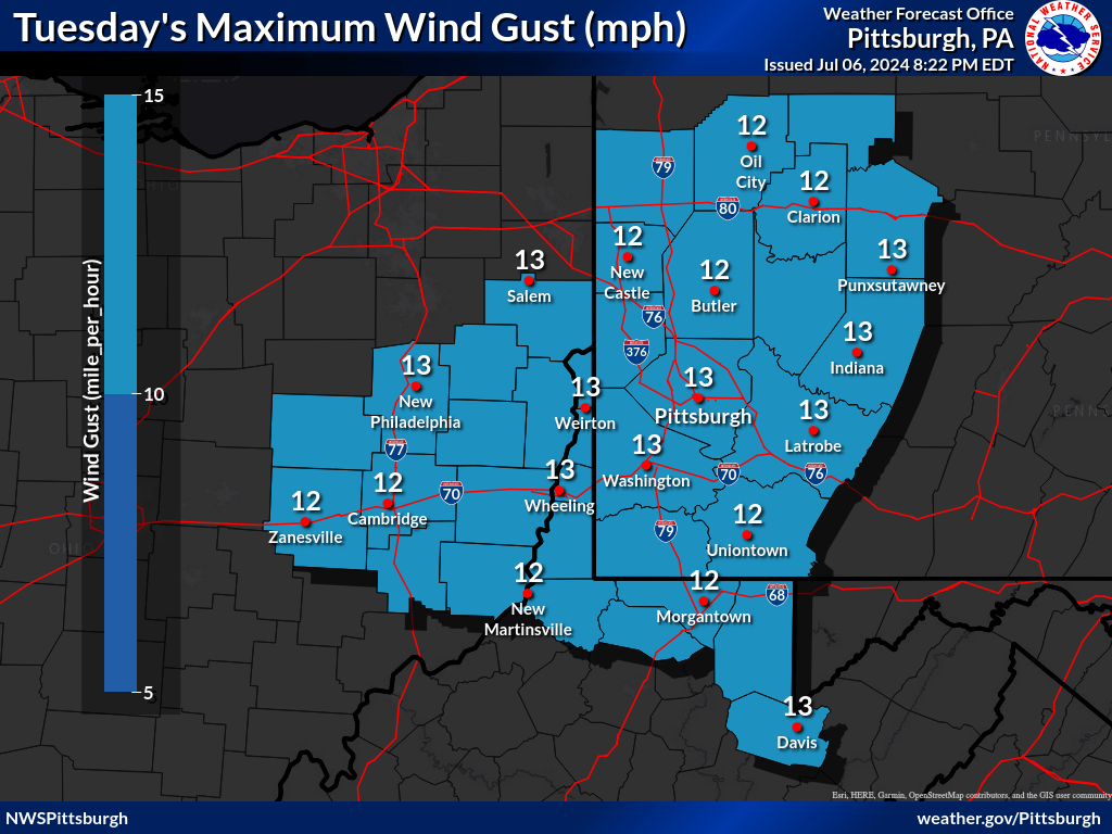
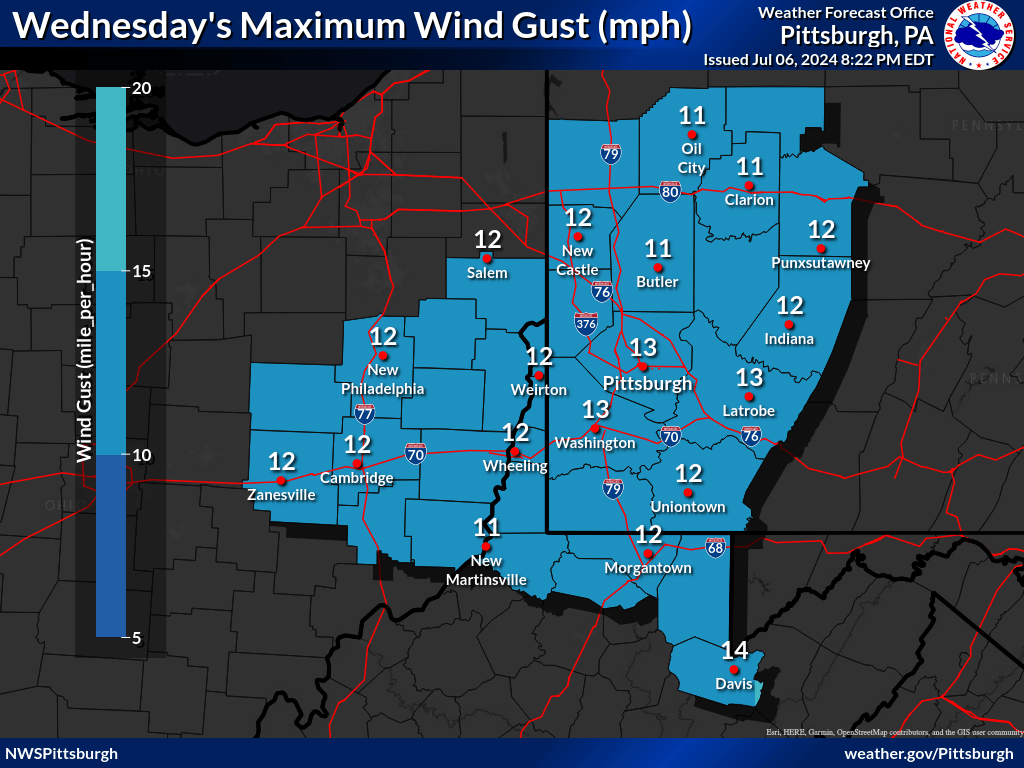
| Today's Max Wind Gusts | Tomorrow's Max Wind Gusts | Day 3's Max Wind Gusts | Day 4's Max Wind Gusts |
 |
 |
 |
 |
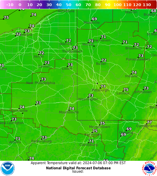
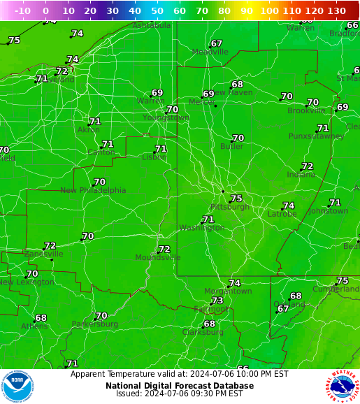
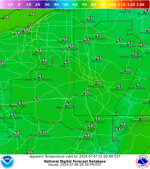
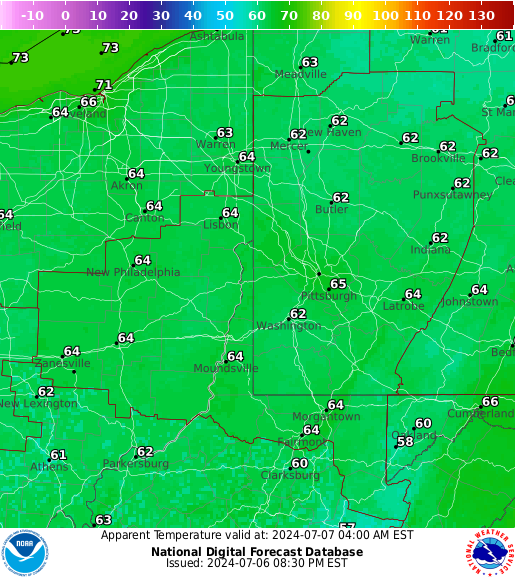
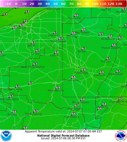
| 3 Hourly Apparent Temperature |
 |
 |
 |
 |
 |
 |
|
Drought and Fire Weather Threat Briefing
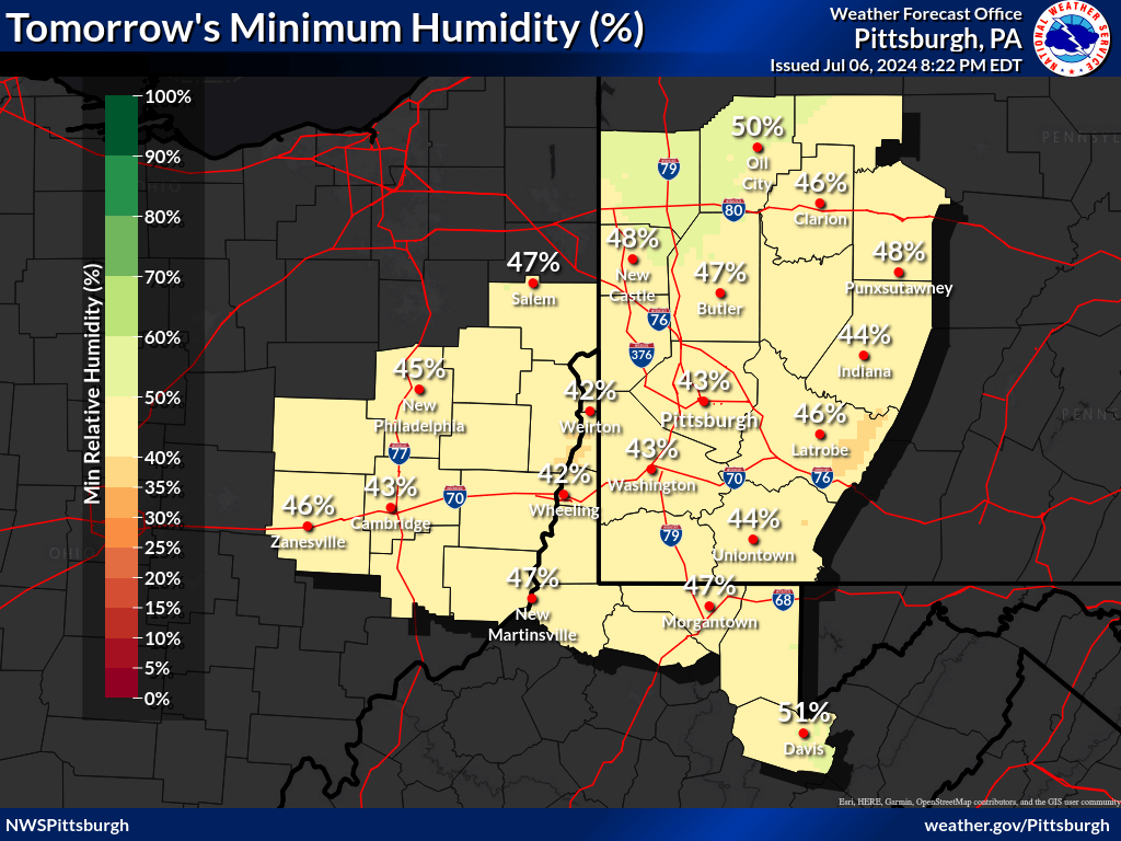
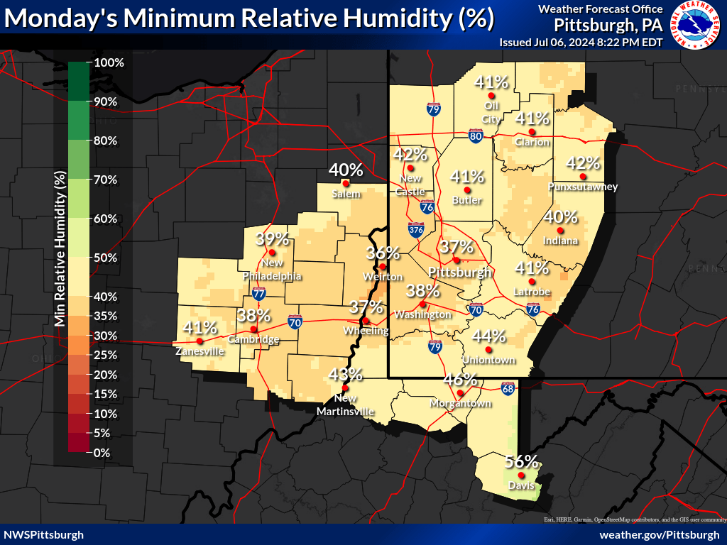
| Today's Minimum Humidity | Tomorrow's Minimum Humidity |
 |
 |
| Today/Tonight Max Wind Gusts | Tomorrow/Tomorrow Night Max Wind Gusts |
|
|
WFAS Observed Fire Danger Rating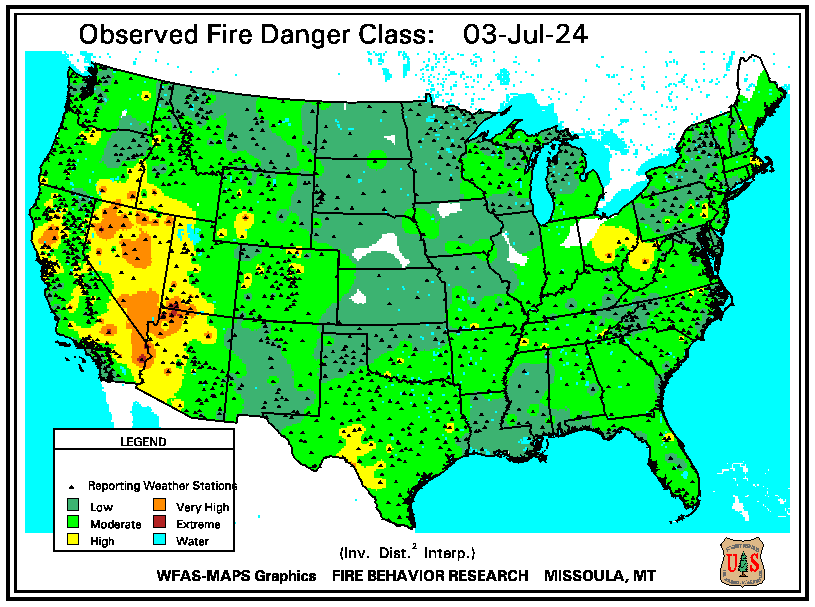 |
WFAS Forecast Fire Danger Rating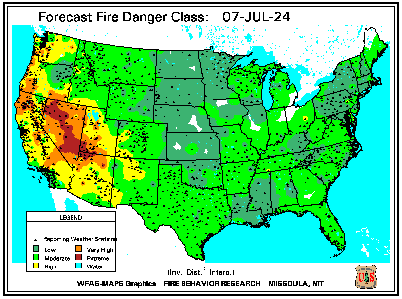 |
| SPC Fire Weather Day 1 Outlook | SPC Fire Weather Day 2 Outlook | SPC Fire Weather Day 3-8 Outlook |
 |
 |
 |
 |
 |
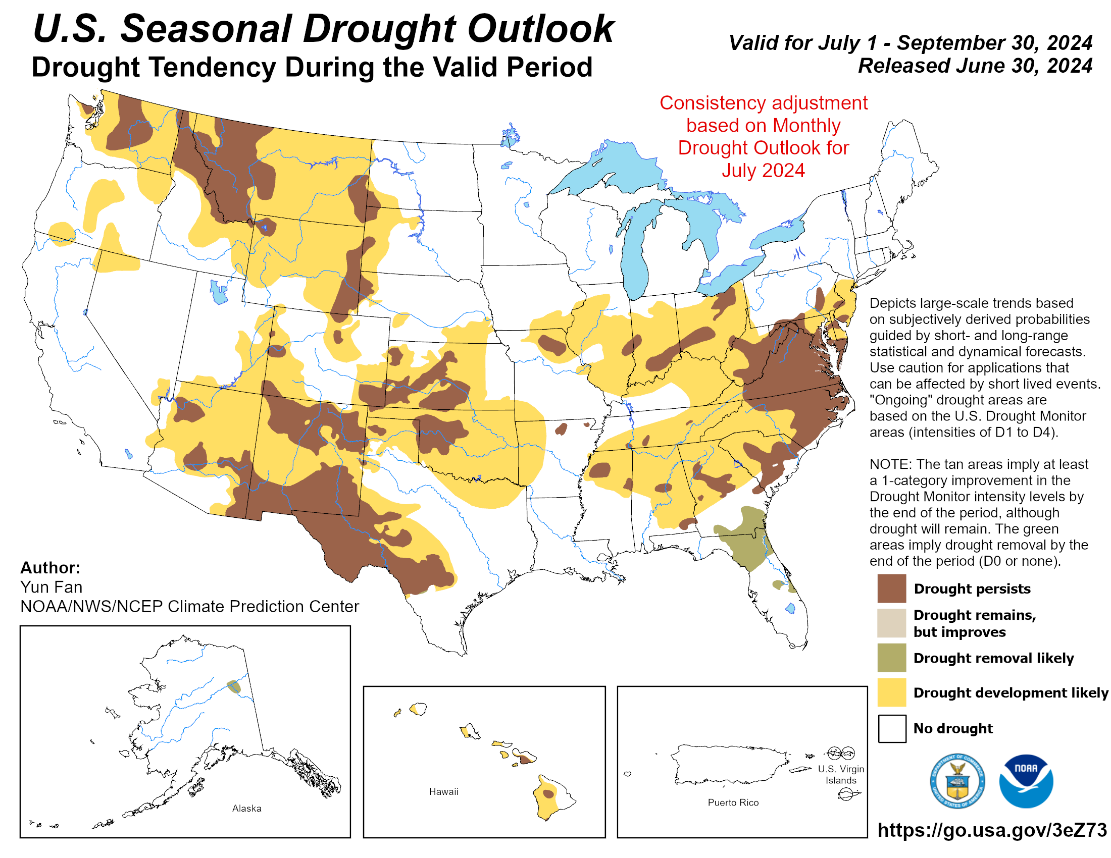
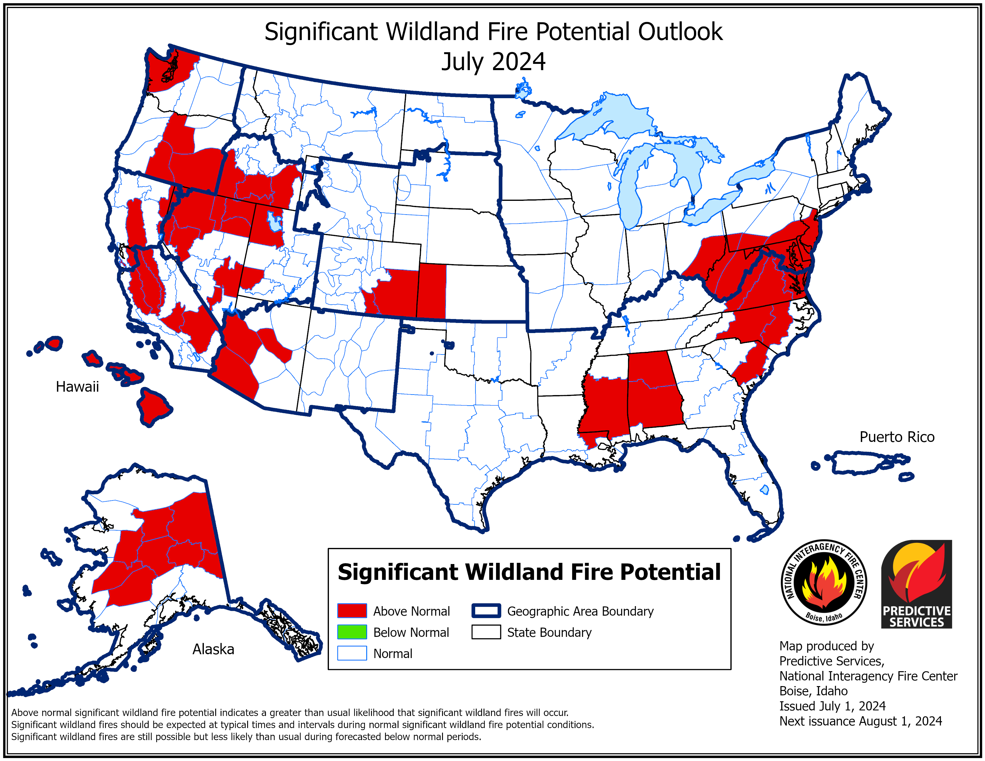
| Seasonal Drought Outlook | NICC Significant Fire Potential Outlook |
 |
 |
Long Range Outlook Briefing
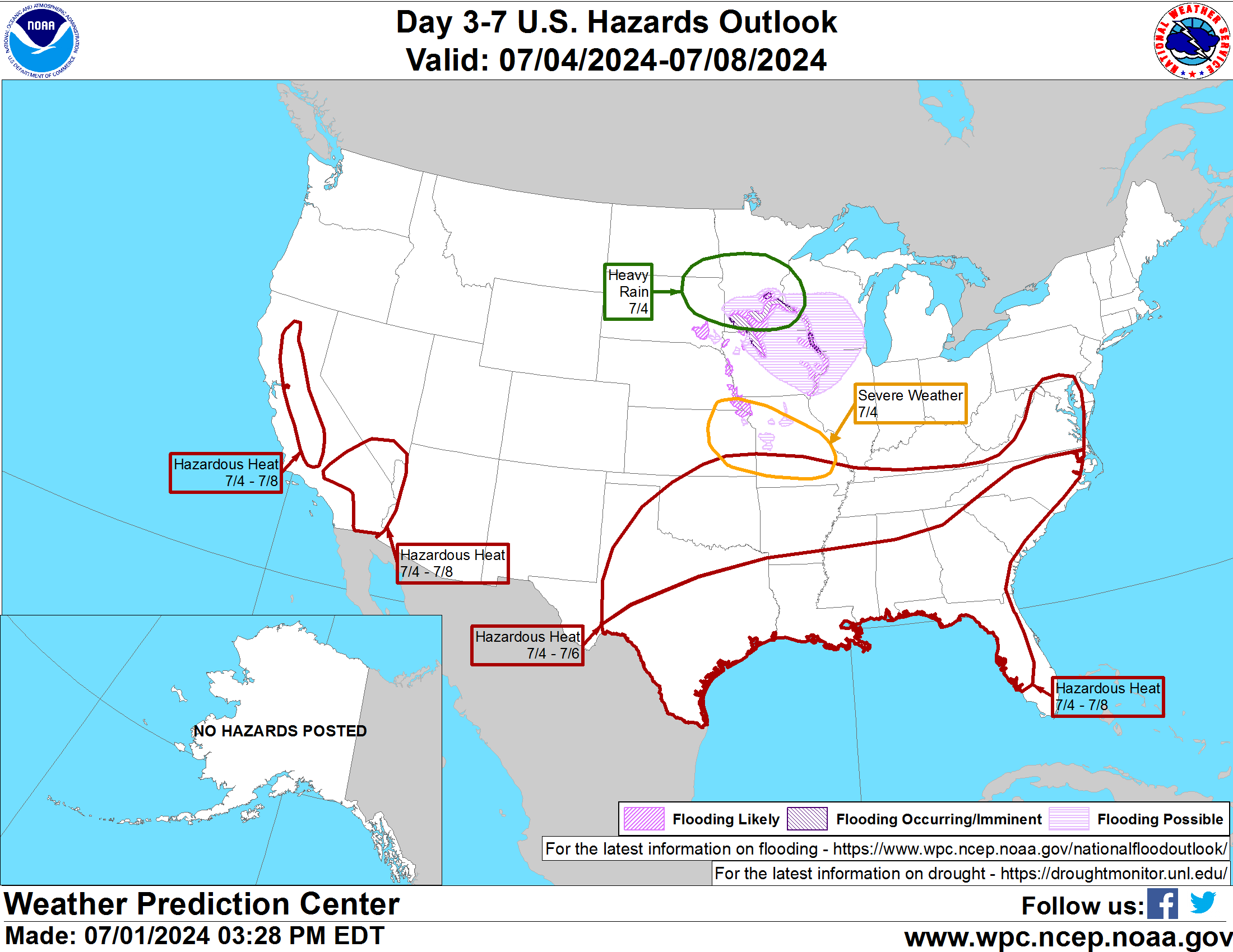
| Days 3-7 Hazards Outlook (WPC) |
 |
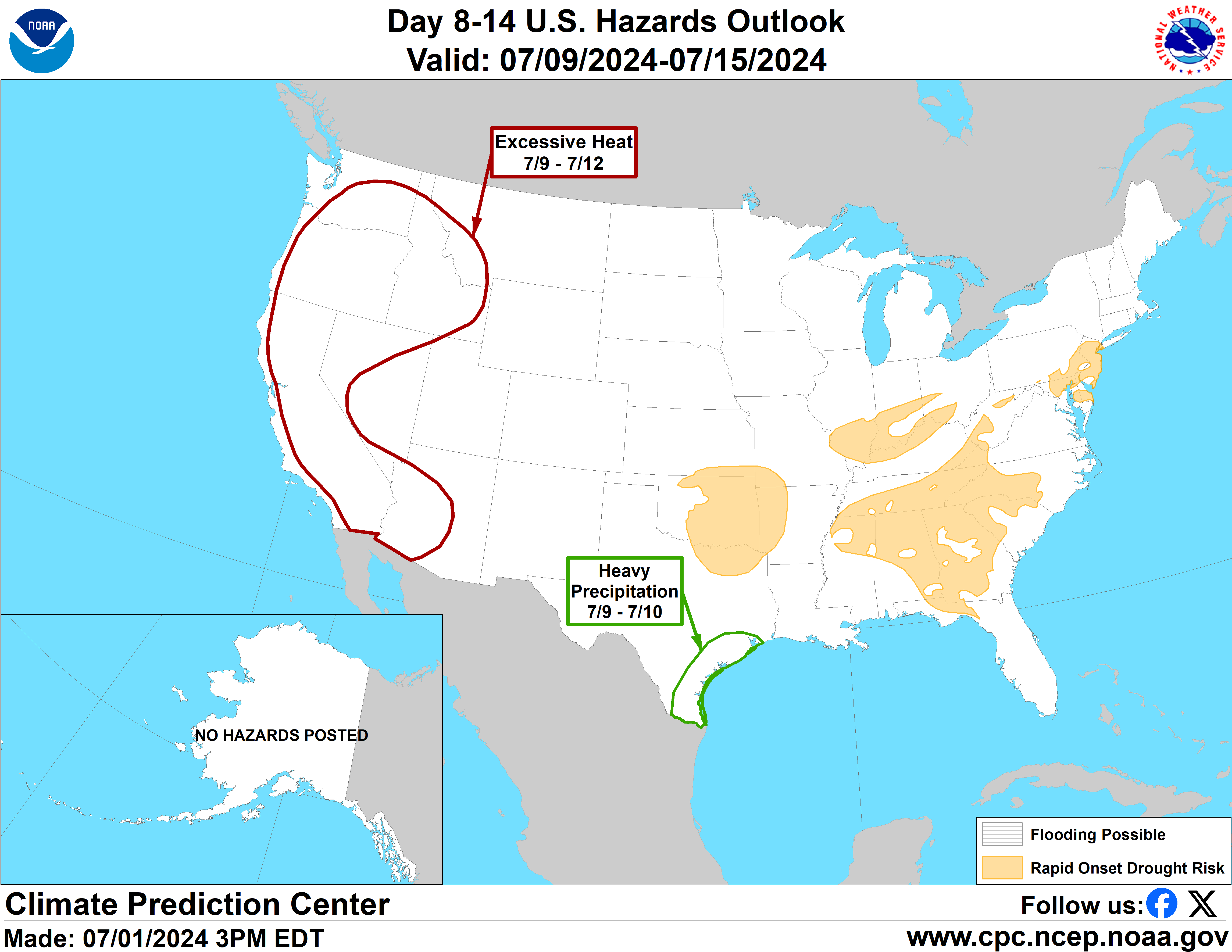
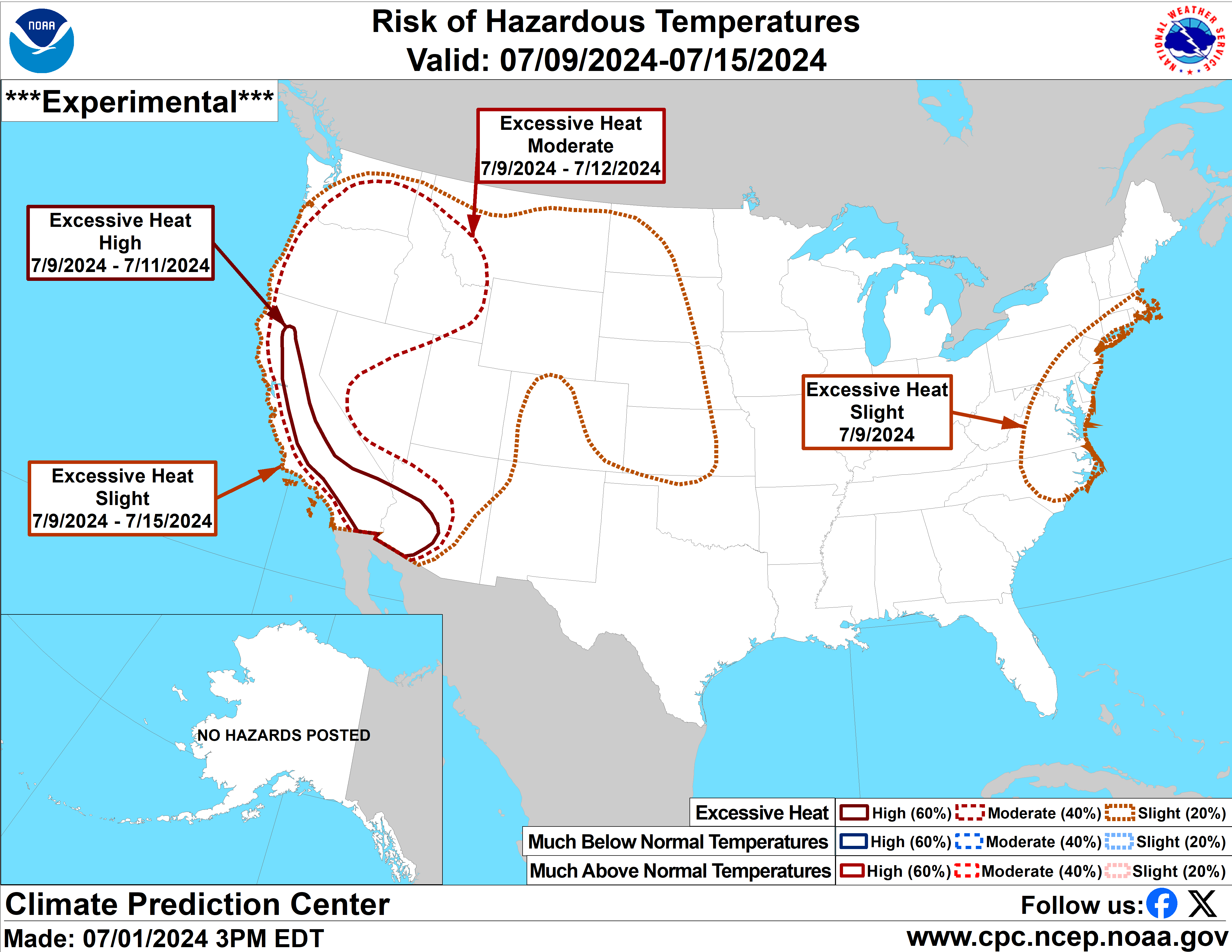
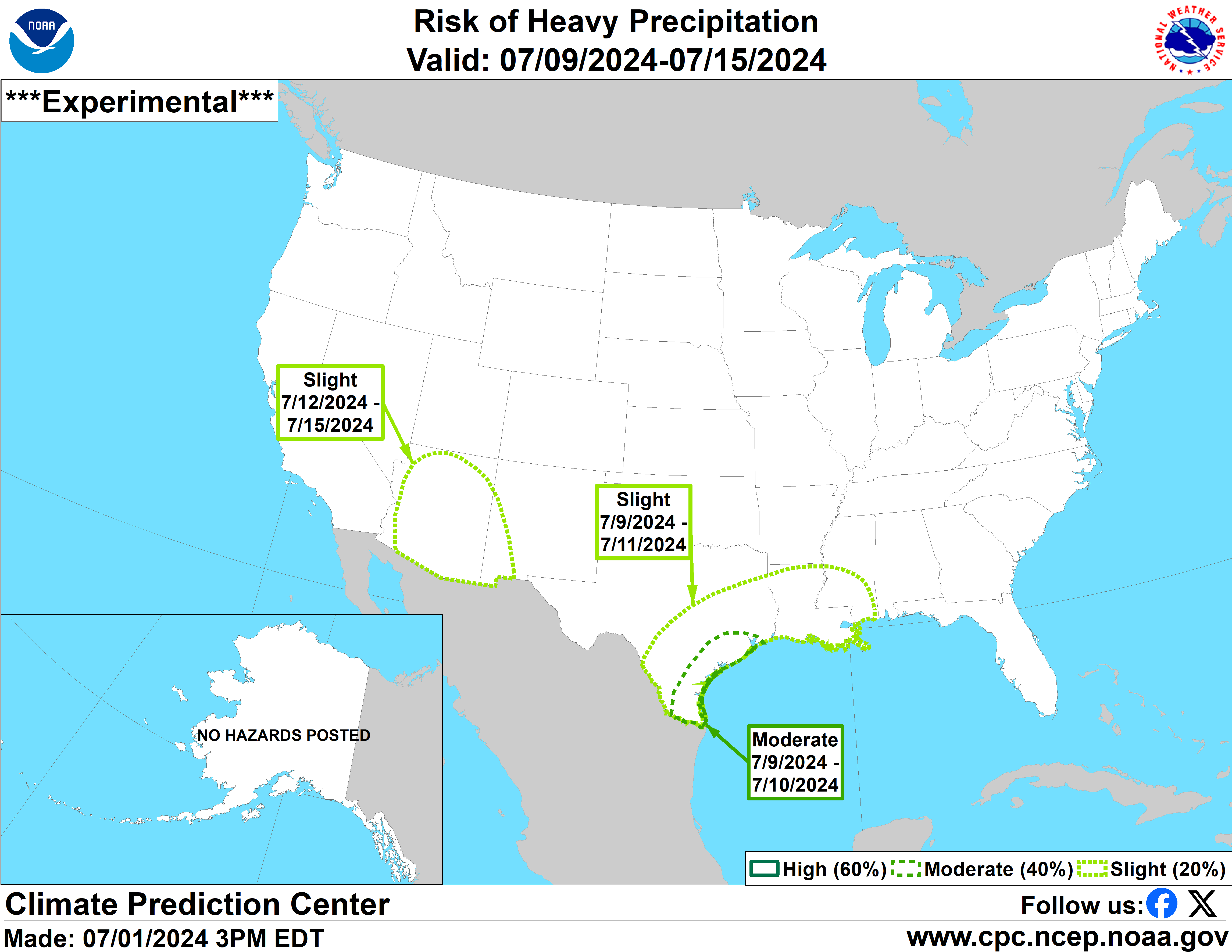
| Days 8-14 Hazards Outlook (CPC) | Days 8-14 Risk of Hazardous Temperatures (CPC) | Days 8-14 Risk of Heavy Precipitation (CPC) |
 |
 |
 |
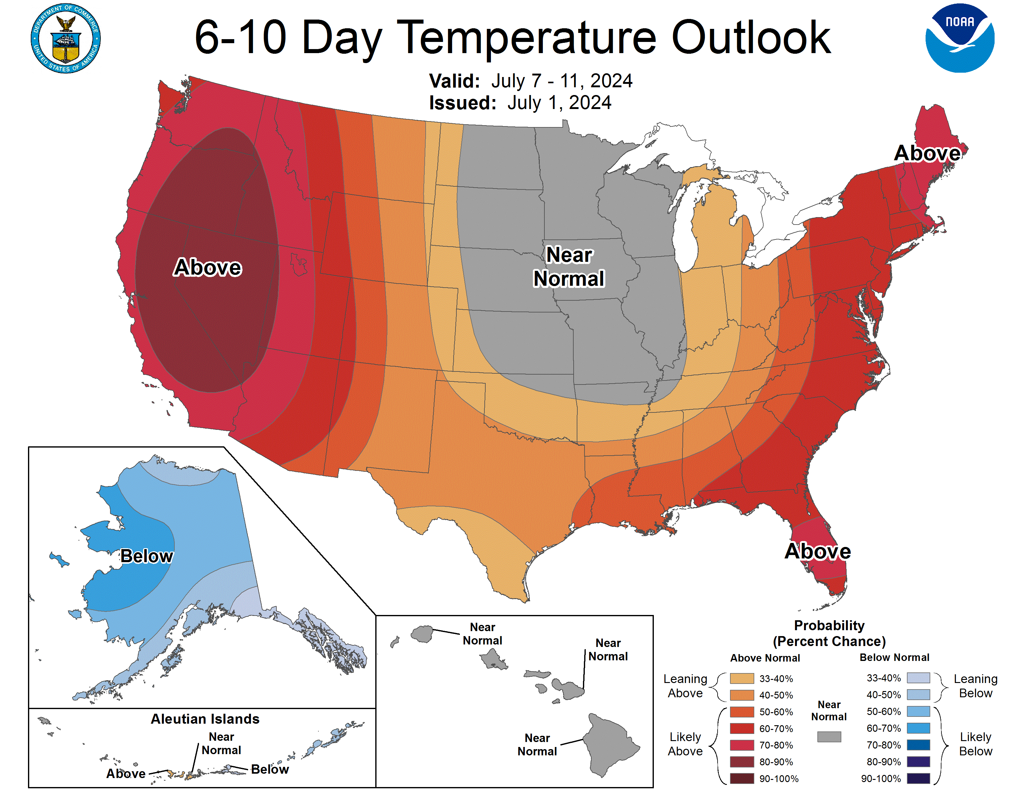
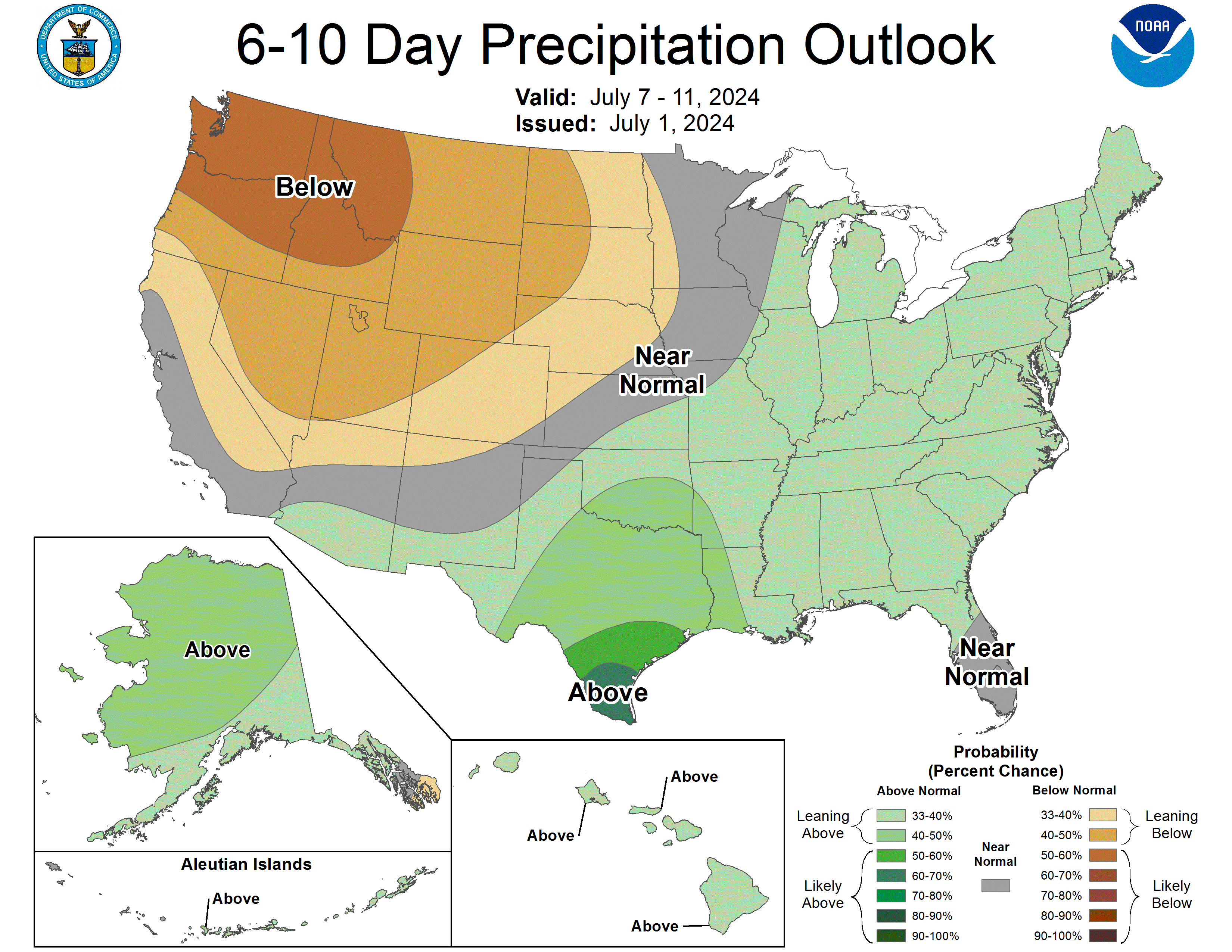
| 6-10 Day Temperature Outlook (CPC) | 6-10 Day Precipitation Outlook (CPC) |
 |
 |
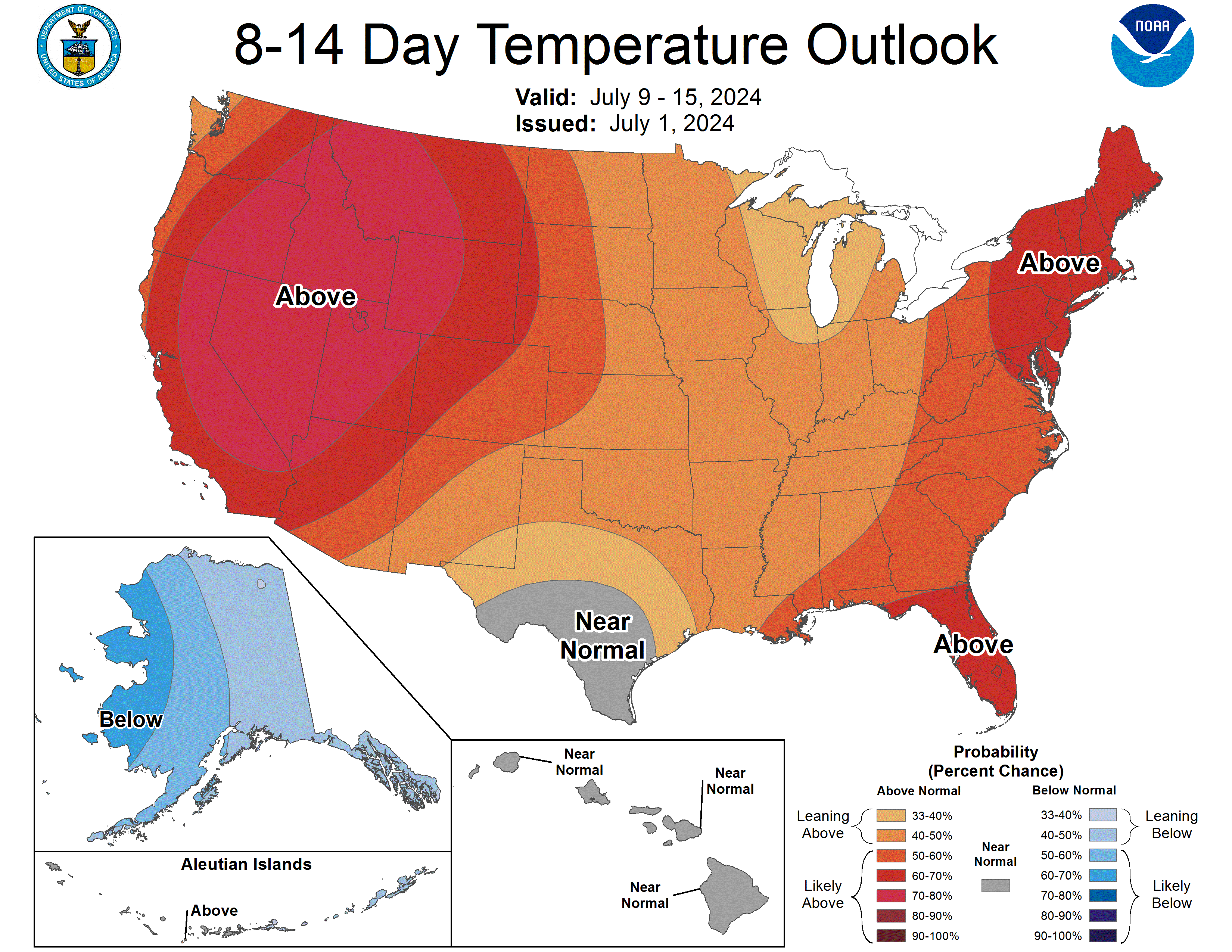
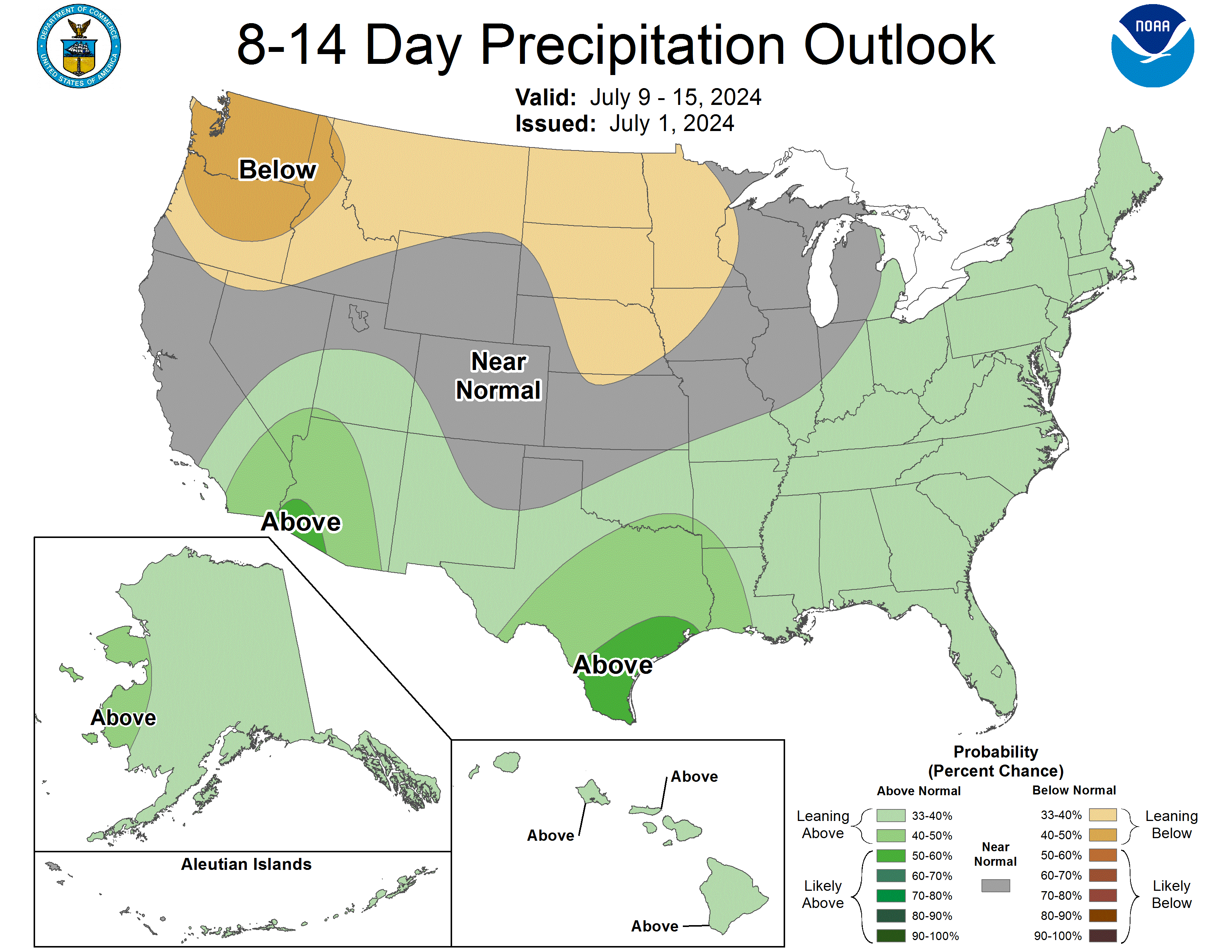
| 8-14 Day Temperature Outlook (CPC) | 8-14 Day Precipitation Outlook (CPC) |
 |
 |
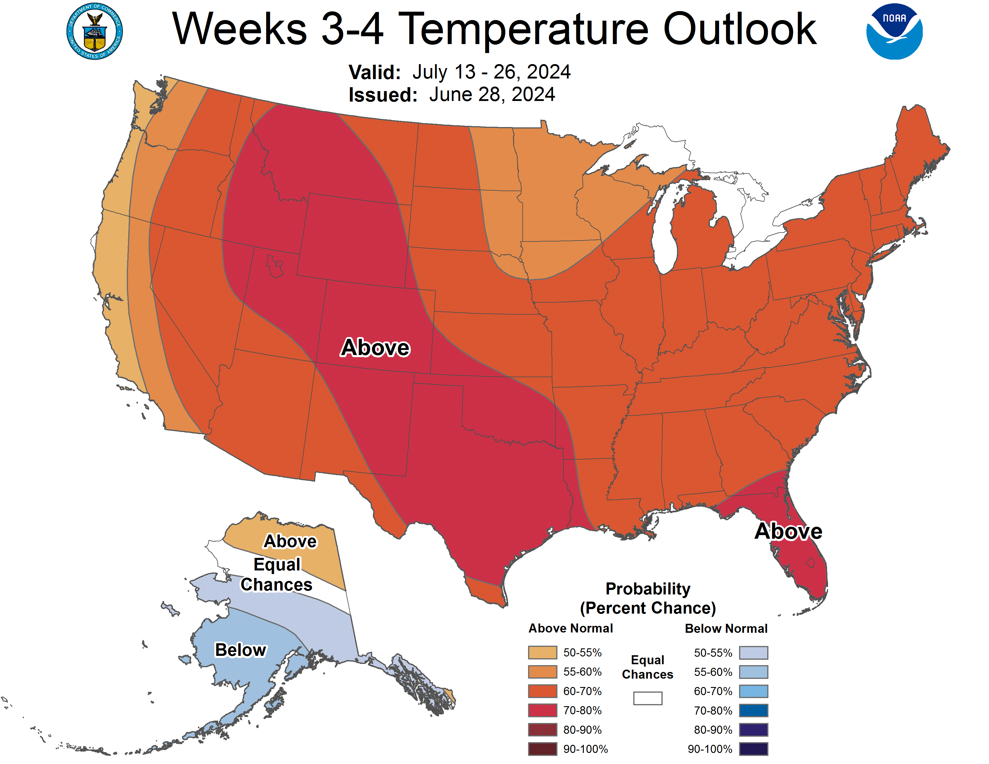
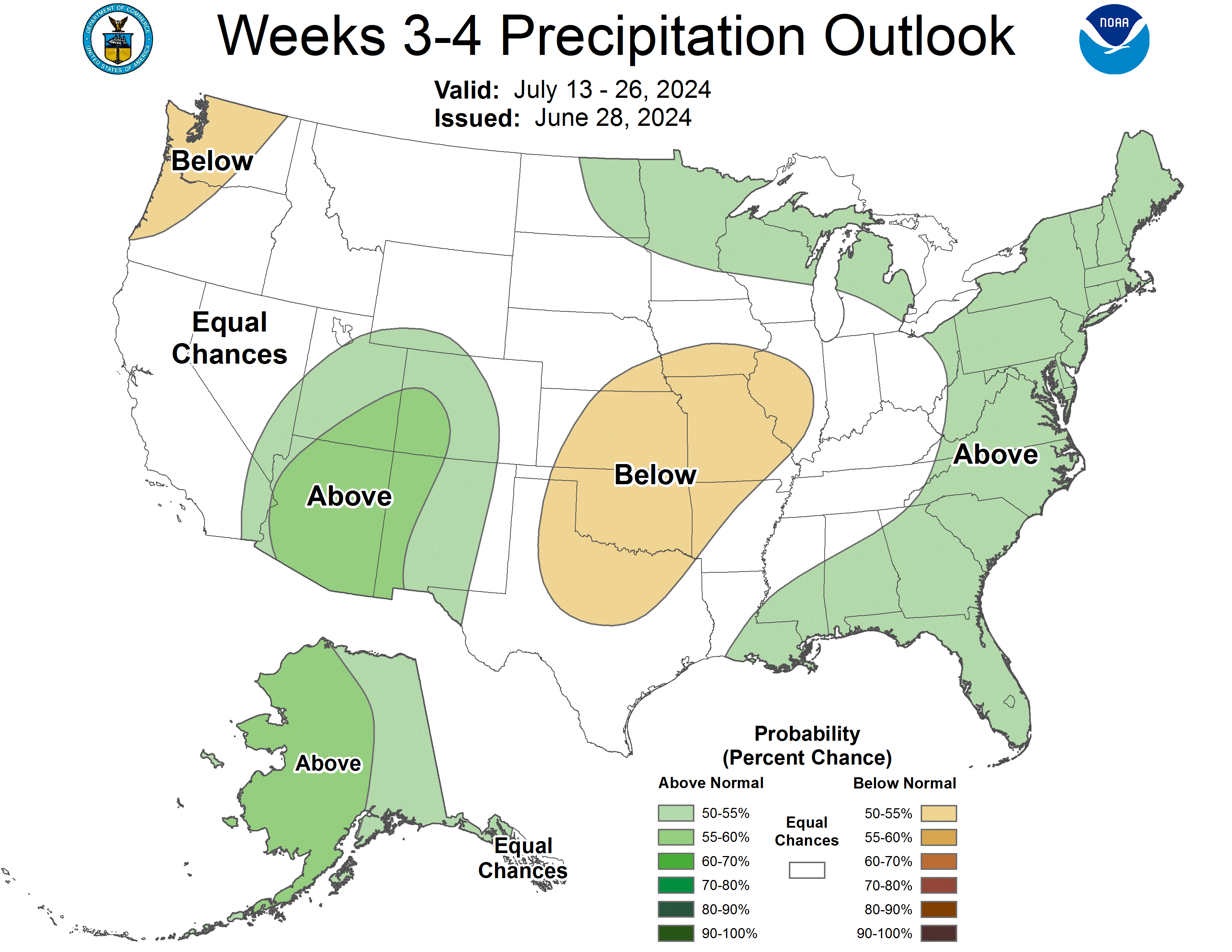
| **Experimental** Week 3-4 Temperature Outlook (CPC) | **Experimental** Week 3-4 Precipitation Outlook (CPC) |
 |
 |
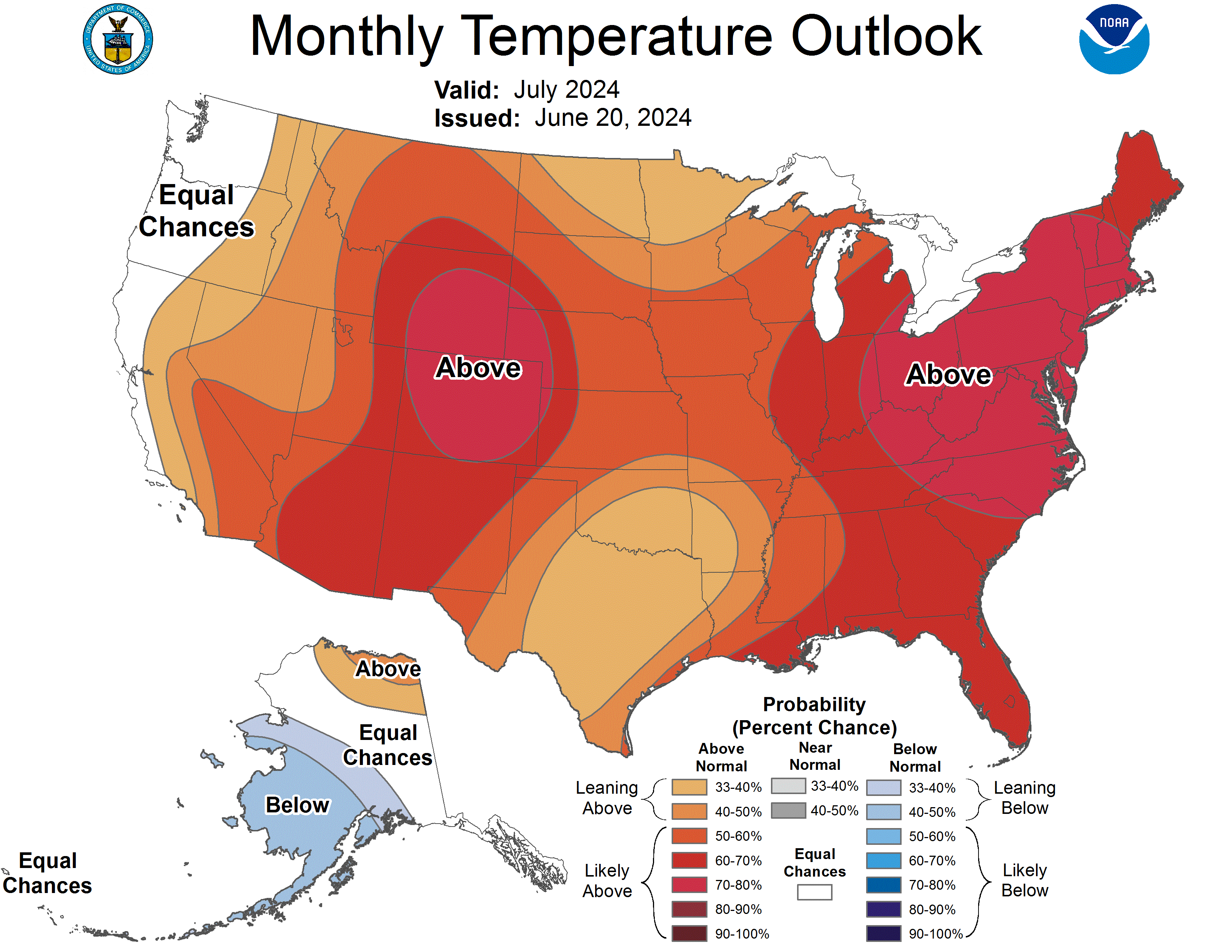
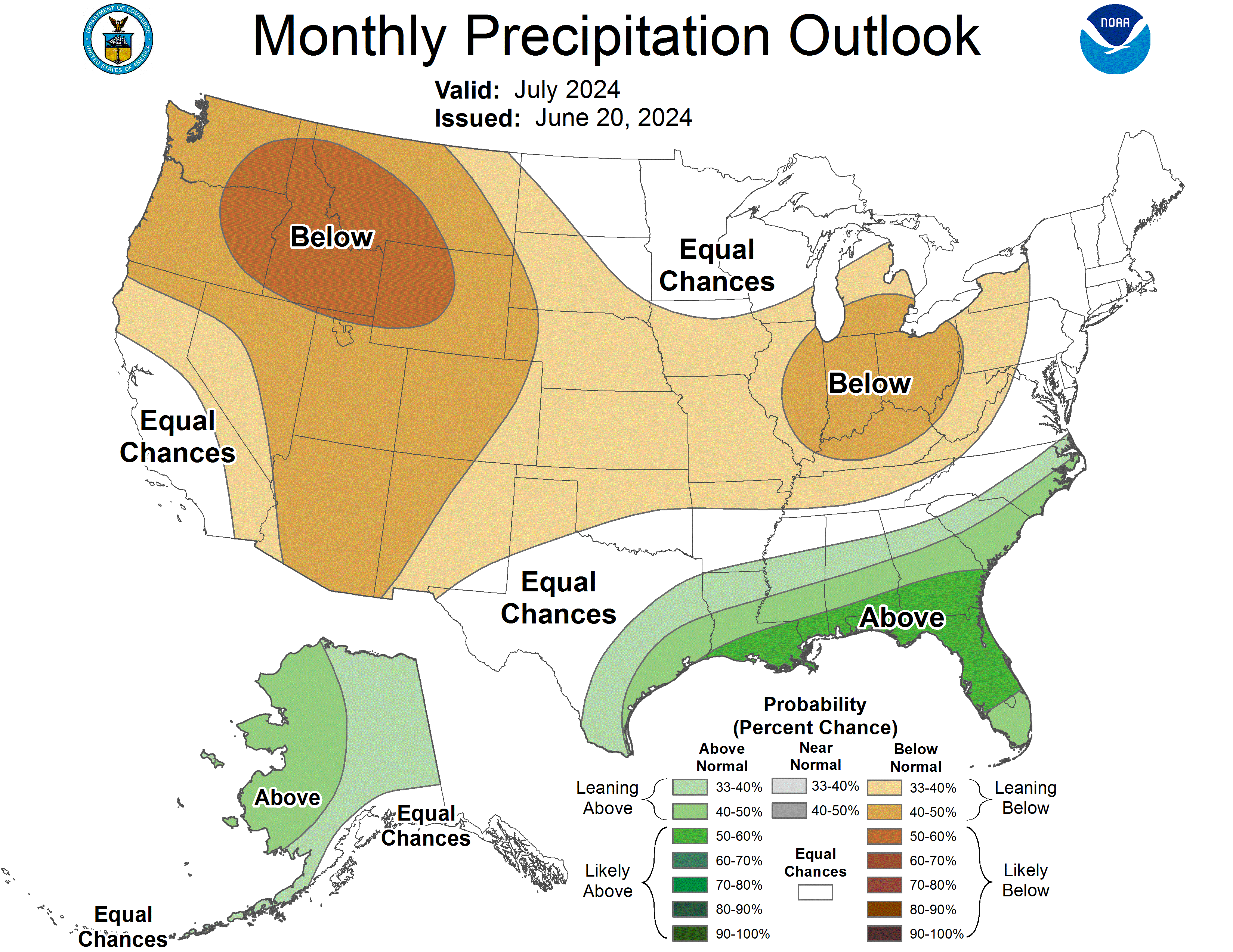
| One Month Temperature Outlook (CPC) | One Month Precipitation Outlook (CPC) |
 |
 |
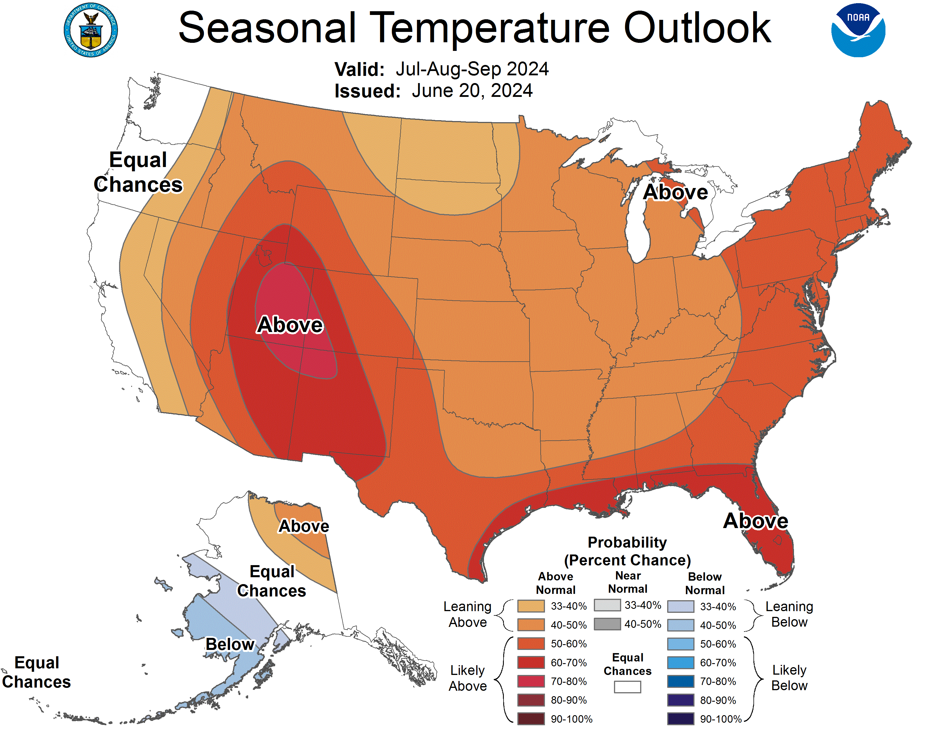
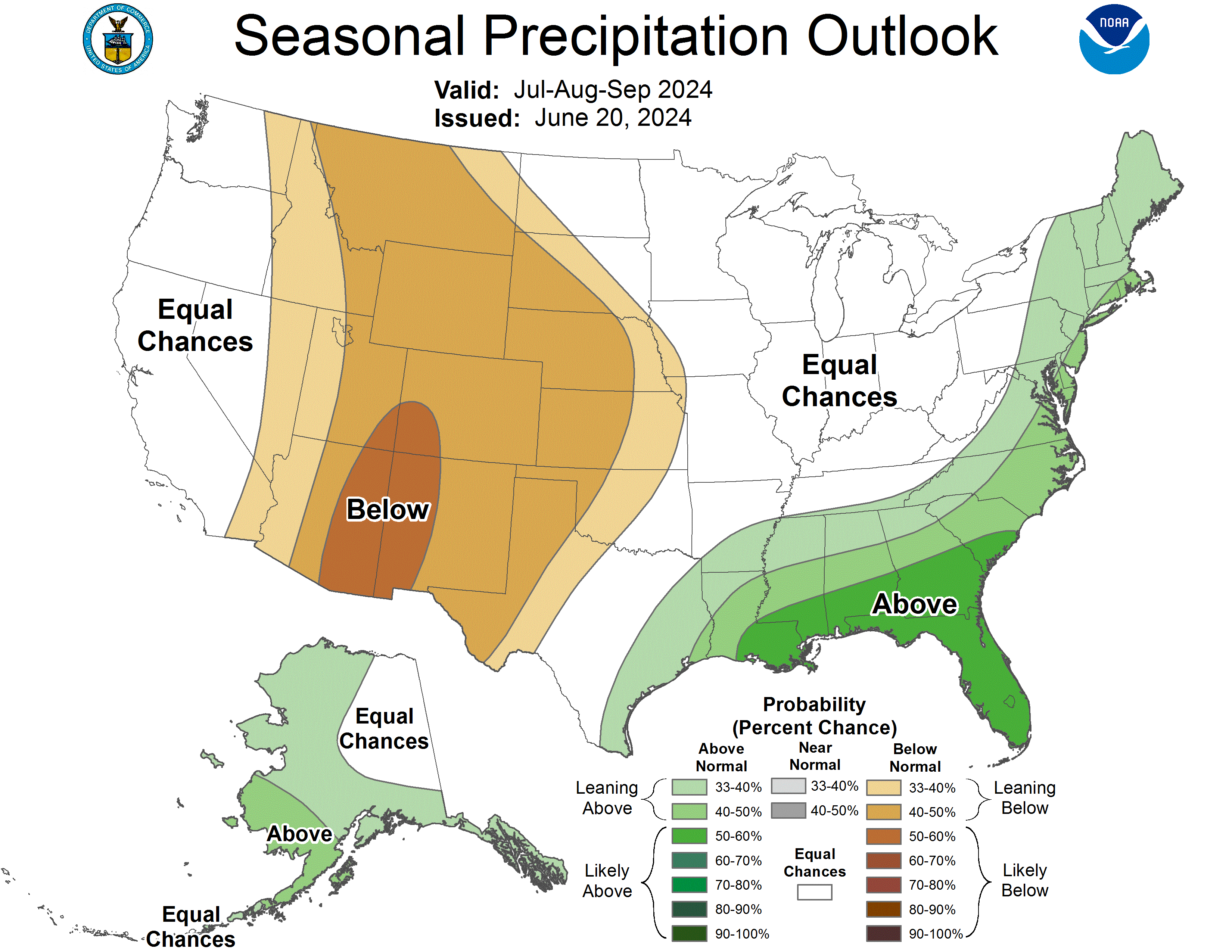
| Three Month Temperature Outlook (CPC) | Three Month Precipitation Outlook (CPC) |
 |
 |


