National Weather Service United States Department of Commerce

Severe Thunderstorms and Excessive Rainfall in the Central U.S.; Excessive Heat Across the Western and Southern U.S.

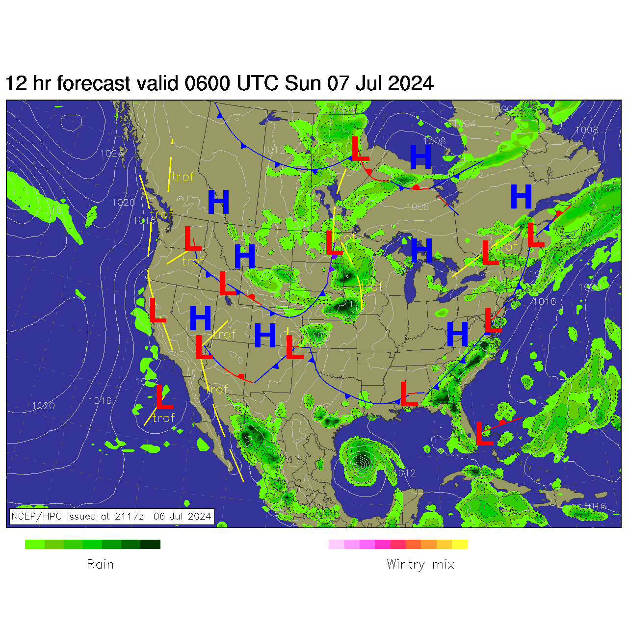
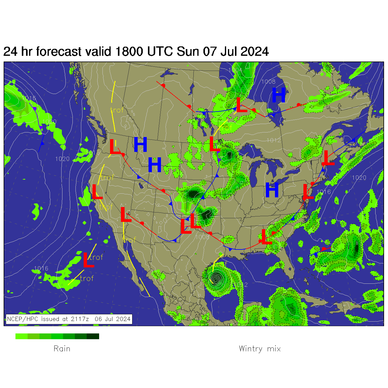
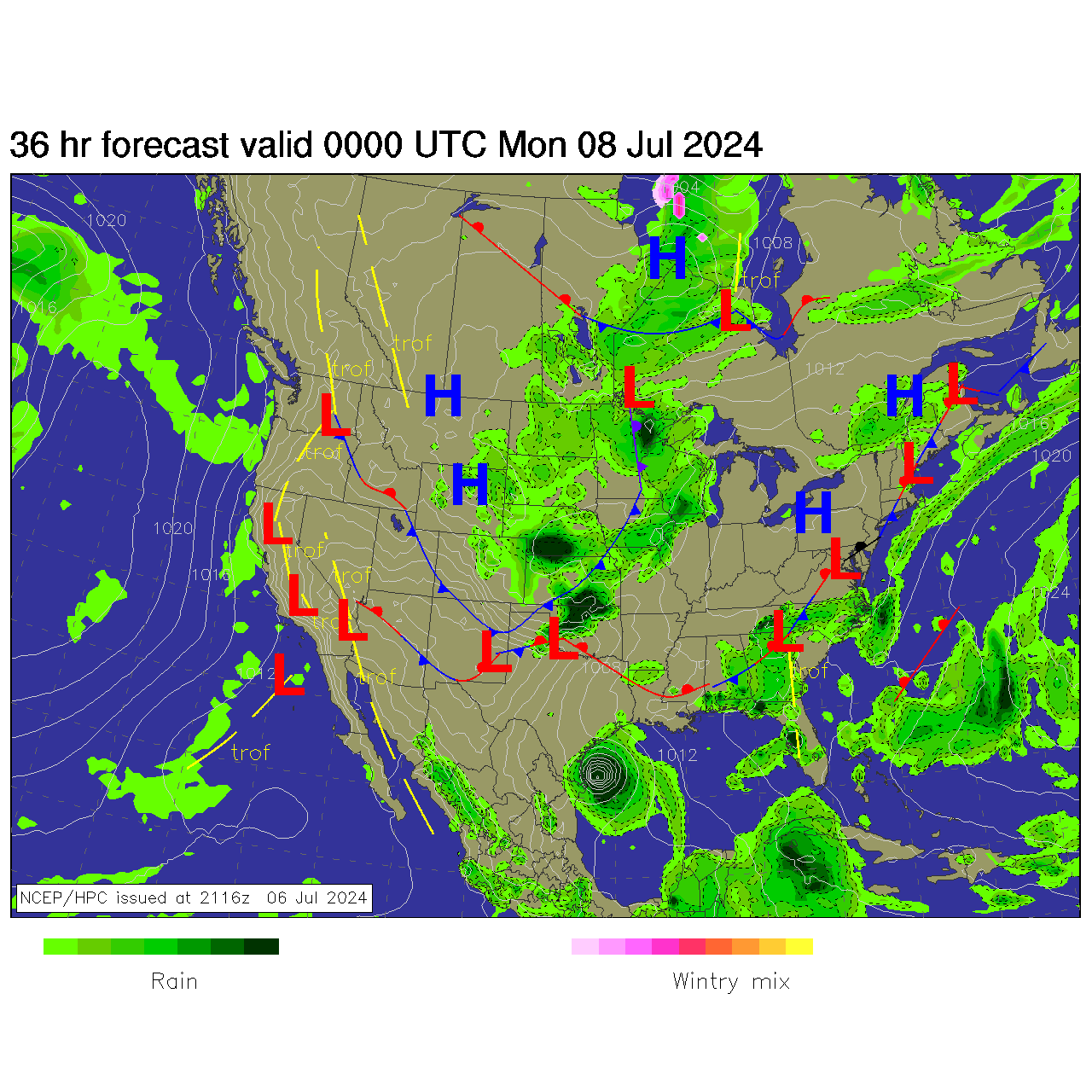
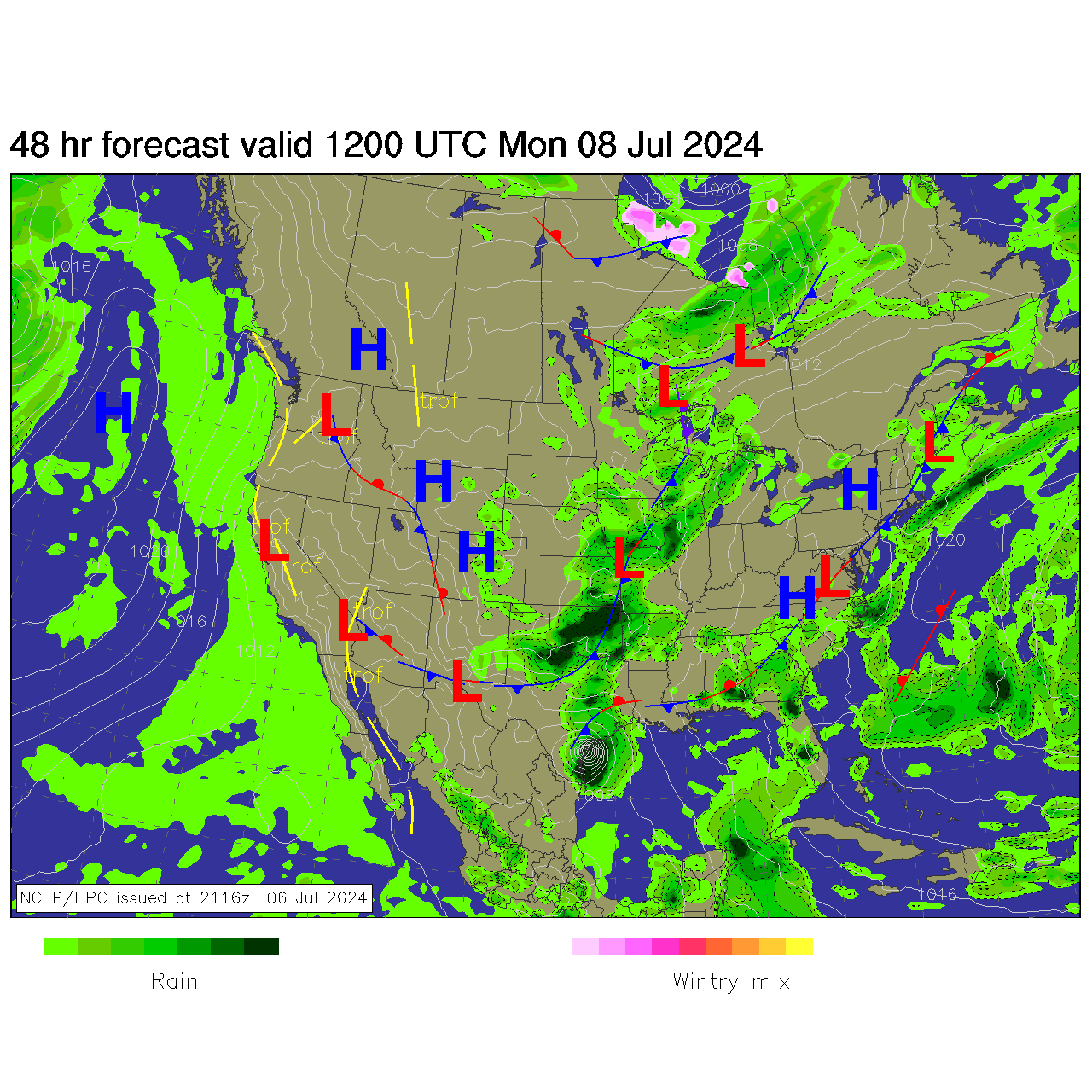
Severe thunderstorms will be possible on Independence Day, mainly across parts of the Upper Mississippi Valley, Ozarks, and southern/central Plains. Excessive heat with possible record highs and warm overnight lows will continue to impact much of the West into next week. Dangerous heat is expected across the Southern U.S. and Mid-Atlantic into the weekend. Read More >


ZBW Aviation Weather SA--Quick Brief
Navigation Menu
Current Conditions

Advance Planning


Current Conditions
Northeast Observations
Northeast Radar


Northeast Fronts
Fog Channel
IR Satellite
Current Icing
Current Turbulence


Turbulence PIREPS
Icing PIREPS
WX PIREPS


Core TAFs
KBOS
KPVD
KMHT
KBDL


All Hazards
CCFP 2 Hour Forecast
CCFP 4 Hour Forecast
CCFP 6 Hour Forecast
CCFP 8 Hour Forecast


SPC Day 1
SPC Day 1 Tornado
SPC Day 1 Hail
SPC Day 1 Wind


Watches/Warnings/Advisories
Mid SIG WX
High SIG WX
SIGMETS


SFC Progs
12 Hour Forecast
24 Hour Forecast
36 Hour Forecast
48 Hour Forecast


Winds Aloft Forecast
18,000 ft MSL/500 mb Winds
0 Hour
6 Hour
12 Hour
24 Hour


30,000 ft MSL/300 mb Winds
0 Hour
6 Hour
12 Hour
24 Hour


OSZAR »