
Severe thunderstorms will be possible on Independence Day, mainly across parts of the Upper Mississippi Valley, Ozarks, and southern/central Plains. Excessive heat with possible record highs and warm overnight lows will continue to impact much of the West into next week. Dangerous heat is expected across the Southern U.S. and Mid-Atlantic into the weekend. Read More >
CWSU ZLA - National Weather Service
About the Area: Palmdale is one of two incorporated cities (along with Lancaster) in the desert and northern portion of Los Angeles County, behind the San Gabriel Mountains which separate the Antelope Valley (the western tip of Mojave Desert) from the Los Angeles Basin. The Los Angeles County portion of the Antelope Valley has a population of about 500,000 out of the county’s 10-million total. Palmdale and Lancaster are slightly less than an hour drive from the San Fernando Valley and slightly over an hour drive from Downtown Los Angeles. Palmdale’s Air Force Plant 42 as well as nearby Edwards AFB and Mojave Space Port (30 minutes to the north) and their associated defense contractors and commercial enterprises provide a valuable aerospace industry to the area. Outside the city limits and unincorporated communities, the rest of the desert comprises of federal lands, agricultural lands and quite a bit of undeveloped areas, some even within Palmdale and Lancaster city limits. Housing costs are significantly lower than the L.A. metropolitan area but Palmdale and Edwards AFB are within the Los Angeles-Long Beach federal locality pay area.
Recreation Opportunities: Most everything associated with Los Angeles (urban areas, sporting venues, theme parks and beaches) is just about an extra hour away. The San Francisco Bay area and Las Vegas are about the same distance and time compared to originating from Los Angeles, except you may be able to avoid much of traffic congestion of the L.A. metropolitan area. Mountain skiing hiking, and fishing areas are fairly close and easier to reach from the Antelope Valley, especially up the Owens Valley toward Mammoth Lakes and Lake Tahoe. Nearby commercial airports include Los Angeles (LAX, 70 miles and 1-3 hours drive depending on time-of-day), Burbank (BUR, 45-60 minutes drive), and Ontario (ONT, 1-1.5 hours drive).
The CWSU: The NWS Center Weather Service Unit is located within the FAA Los Angeles Air Route Traffic Control Center (ZLA ARTCC) which controls upper en-route airspace over the southern half of California, southern Nevada, southwestern Utah and western Arizona. ZLA ARTCC coordinates traffic flow into major airports in this area including Los Angeles (LAX), Las Vegas (LAS) and San Diego (SAN). The CWSU conducts daily briefings to ZLA traffic management and ATC supervisors as well as other ATC facilities in the area. The CWSU also coordinates with WFOs and the AWC for various NWS aviation forecast and warning products. Coastal stratus and summer thunderstorms are ZLA’s major weather concerns, with turbulence, upper-level winds and Santa Ana winds being secondary issues. The CWSU operates two eight-hour shifts per day from 05:00 to 20:30 local time with four meteorologists.
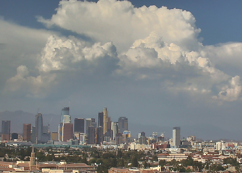
Climate: The Antelope Valley and the rest of the Mojave Desert which stretches eastward to Las Vegas are also known as the “High Desert” which lies mostly between 2,000 feet and 3,000 feet above sea level. Without the marine layer and its stratus/low clouds and fog common in the Los Angeles Basin, the High Desert is drier year round. Annual precipitation ranges between 6 and 9 inches in the Antelope Valley, mostly falling between December and March just like the rest of Southern California. The Southwest U.S. monsoon weather sometimes reaches the Antelope Valley with a few days of afternoon thunder- storms and higher humidity. Summer daily temperatures are normally minimum to maximum, 68-98°F, hotter than the L.A. Basin’s inland areas. However, a heat wave can push temperatures >110°F but that’s still more bearable than the >115°F in the San Fernando Valley and San Bernardino area because of higher humidity there. Winters are generally colder than the L.A. Basin, with normal minimum to maximum, 28-58°F. Clear nights are colder nights (in the teens if calm) and heavy rain (atmospheric river) events can bring warmer temperatures (e.g. 45-60°F) to the High Desert. Snow can occur every year but accumulation is on average less than once a year. If the wind is just right (e.g. NE, upslope) during a storm system’s passage, heavy snow can occur with >6 inches accumulation. Santa Ana winds in the L.A. Basin are non-eventful on the desert side (before winds get funneled), but the almost-daily sea breeze at the coast turns into strong SW winds for the Antelope Valley most afternoons and evenings. The Santa Clarita Valley (1,000-1,500 ft elevation) is 30-40 miles from both Palmdale and Downtown Los Angeles, and features in-between climate: less marine stratus, and temperatures slightly more extreme than Los Angeles but milder than the Antelope Valley. State Highway 14 between Santa Clarita and Palmdale peaks at 3,258 feet so snow can affect the freeway more often than Palmdale.

