|
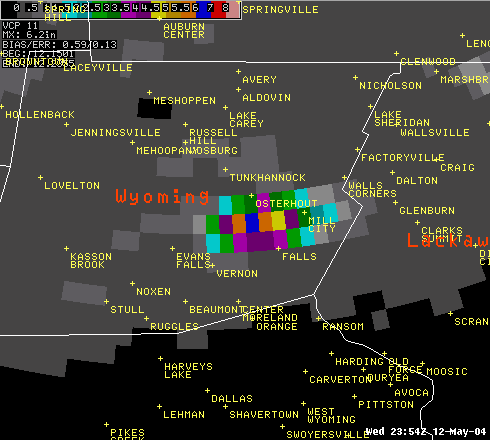
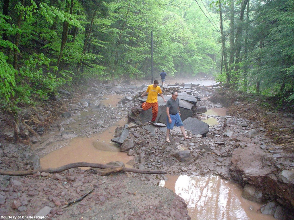
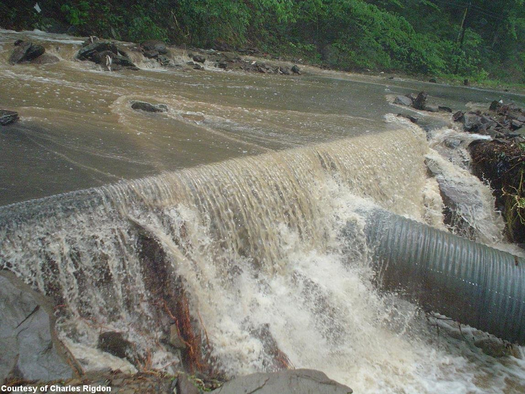
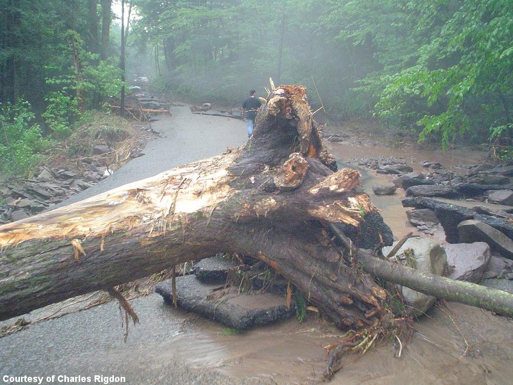
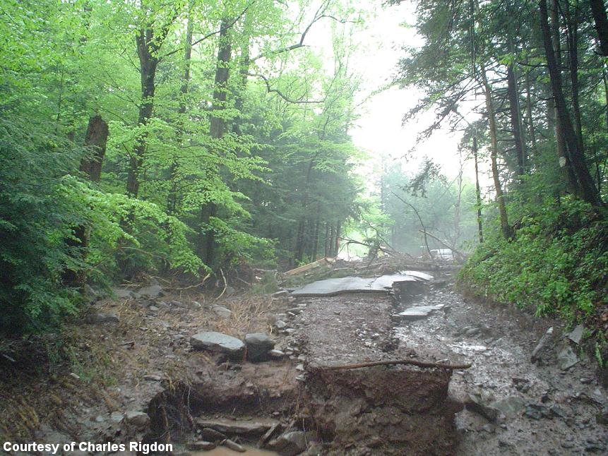
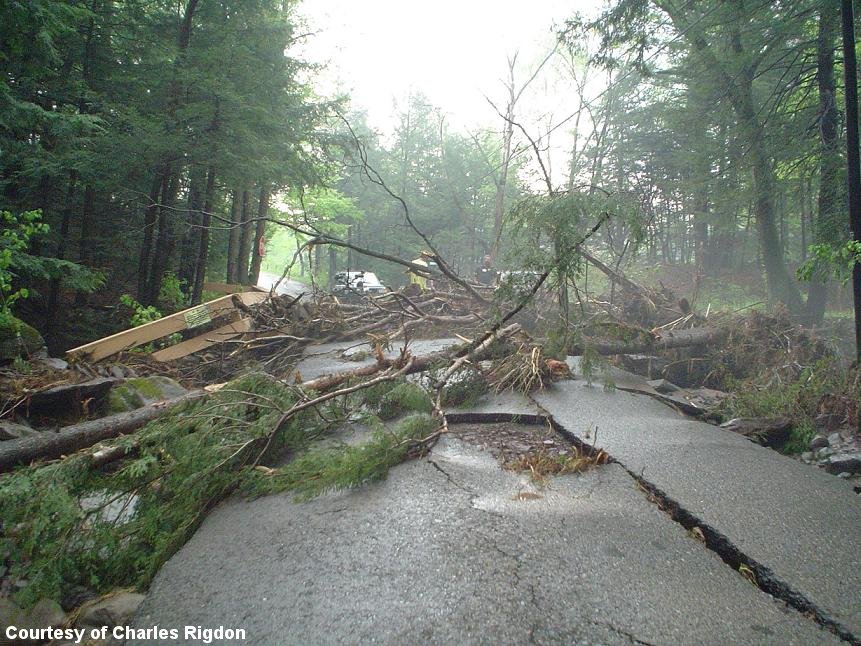
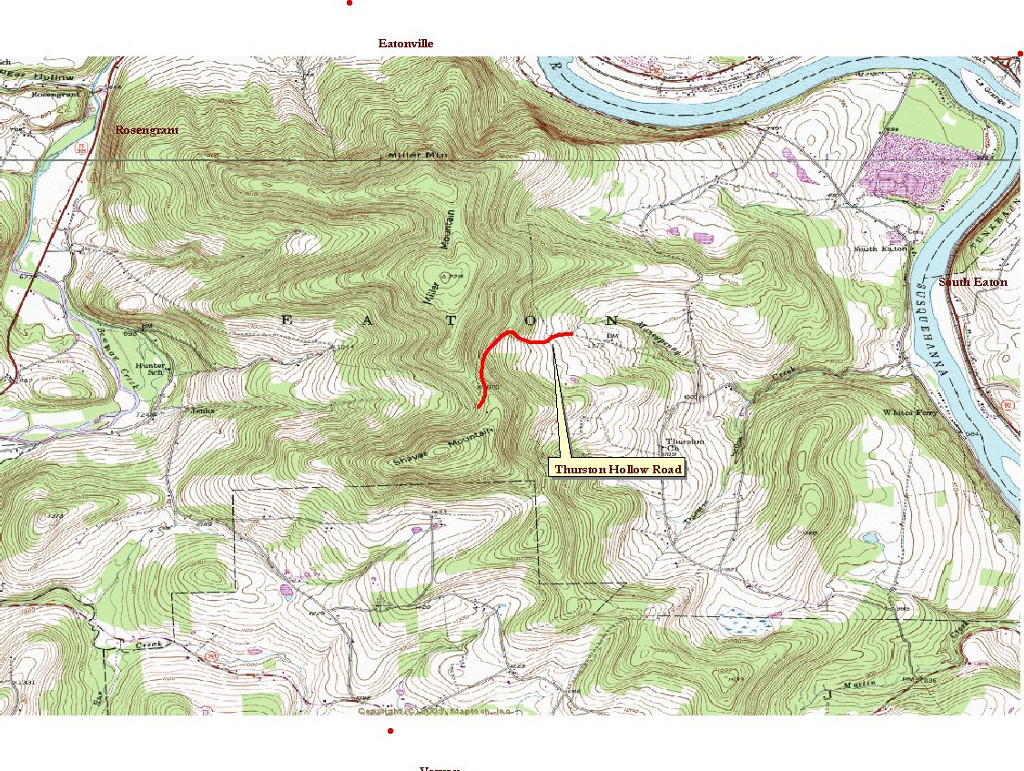
Early in the afternoon of Wednesday, May 12th, a thunderstorm developed over Miller and Shaver Mountains south of Tunkhannock Pennsylvania in Wyoming County. The thunderstorm was nearly stationary and at times had rainfall rates over 4 inches per hour. Rainfall totals exceeded 6 inches, see below, in just a few hours times and caused massive flash flooding of the Moneypenny Creek which is along Thurston Hollow Road in Eaton township. The power of water is evident in the photographs (Courtesy of Charles Rigdon) shown on the right, as the water carved a swath of damage and scattered debris along Thurston Hollow Road which was totally devastated. Total damages estimates have exceeded 500,000 dollars to this area. The major flash flooding occurred about 230 pm in the afternoon and continue for a few more hours. There were no injuries or deaths related to this flash flood. This is a credit to the strong partnership between the National Weather Service in Binghamton and the Wyoming County Emergency Management Agency. NWS Binghamton issued this flash flood warning for southeastern Wyoming County about 1 hour before the flood hit that specifically mentioned Moneypenny Creek. The specificity of the warning message and lead time allowed Gene Dziak, Director of Wyoming County Emergency Management Agency and his staff to take protective action by barricading roads, and diverting school buses out of the affected area. The NWS in Binghamton used new technology known as FFMP (short for Flash Flood and Monitoring Program) to produce a very specific flash flood warning. There is no doubt that the warning message and the coordinated response from the Wyoming County Emergency Management Agency saved lives and prevented injuries and further property damage in this area. Storm Total Precipitation or STP is a map of estimated storm total precipitation accumulation continuously updated since the last one-hour break over the entire scope. This product is used to locate flood potential over urban or rural areas, estimate total basin runoff and provide rainfall data 24 hours a day.
|
Click for a larger view
Flash Flood damage to Thurston Hollow Road.
Water running across Thurston Hollow Road.
Trees across Thurston Hollow Road.
Another picture of damage across Thurston Hollow Road.
Another picture of trees and parts of a fence across Thurston Hollow Road. |
Schematic of how thunderstorms can produce flash flooding.
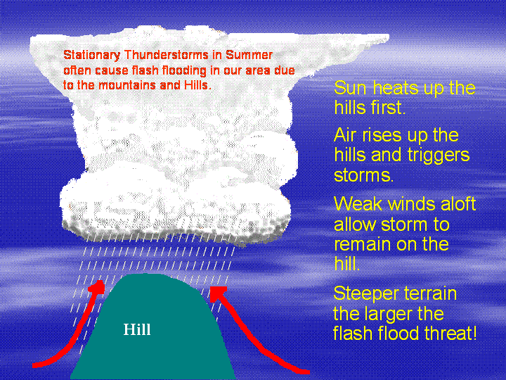 The most common cause of flash flooding in spring and summer is a slow-moving or stationary thunderstorm that dumps heavy rain relentlessly on a small, localized region. This is especially true when the jet stream is often very weak or north of our area. The jet stream is a current of air high up in our atmosphere, which "steers" weather systems along, including thunderstorms. When the jet stream is weak or well north of the region, thunderstorms that form often have very weak steering currents and move slowly, producing flash floods. The hills and mountains of our region often are the breeding grounds for these slow-moving thunderstorms. As winds rise up the mountains, the air cools and condenses forming clouds, and, when the conditions are right, the clouds can develop into thunderstorms. With weak steering currents aloft, these thunderstorms often remain stationary on a hill or mountainside. This often has disastrous consequences since many small streams and creeks flow down our mountains and hills.
Flash Flood's kill more people than any other storm-related hazard-find out more from the NWS's flood awareness campaign Turn Around Don't Drown!

