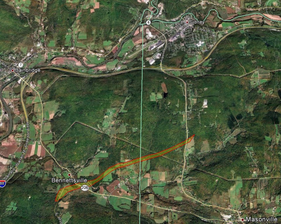
Tornado confirmed from 4 miles South Southeast of Bainbridge in Chenango county to 3 miles south of Sidney in Delaware county New York
Summary:
The National Weather Service in Binghamton, NY has confirmed that a tornado touched down about 4 miles South Southeast of Bainbridge in Chenango, tracked northeast about 3.2 miles, and then ended about 3 miles South of Sidney in Delaware county New York from 7:53 PM to 7:58 PM EDT on April 19, 2013.
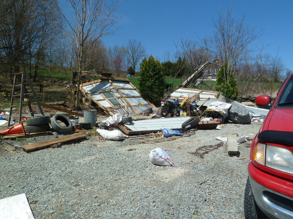
The tornado touched down between interstate 88 and highway 206, on East Afton Road, where 2 power poles were snapped and a car was destroyed by a large tree branch. Another vehicle was also damaged. Several trees were snapped or uprooted. A barn had minor roof damage. The tornado continued northeast and crossed highway 206, where a farm equipment building and a mobile home were heavily damaged, and a storage trailer was destroyed. Other nearby homes had minor damage, and a carport was lifted and moved 75 feet. Farther down it's path, the tornado intensified to a high end EF 1 strength while traveling in the vicinity of Houck Drive. In this area it uprooted or snapped many 1 to 2 foot diameter trees along its path, both hardwoods, maples, and softwoods, pines, with the largest more than 3 feet wide. It also caused structural damage to a single family residence and garage, while transporting a significant amount of debris a hundred yards or more. The tornado then crossed into Delaware county, downing several more trees on some properties along highway 8 before dissipating.
Below are two images. Images were taken of damage on East Afton Road. Click on images for a larger view.
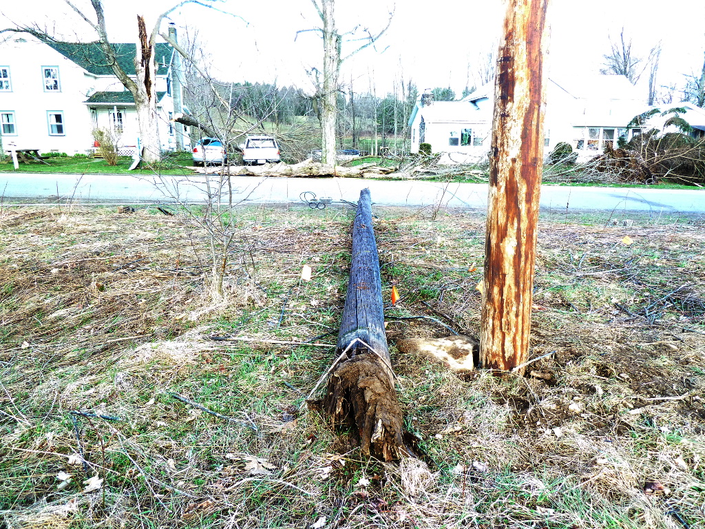 |
Power pole snapped at the base with trees downed in the background on house and vehicles. |
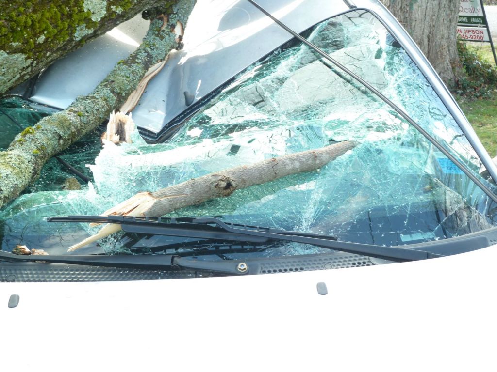 |
A tree on a car, tree in background, with a branch from another tree sent through the windsheild near the windsheild wiper. |
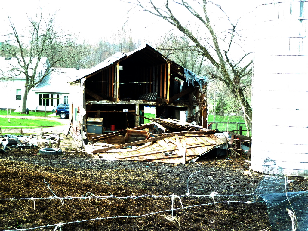 |
Back wall on barn taken off. |
For reference, the Enhanced Fujita Scale classification can be found here.
Summary:
The National Weather Service in Binghamton, NY has confirmed a Microburst/Straight line wind damage near Hancock in Delaware county New York on April 19, 2013.
Straight line wind damage was observed on Stockport Road just south of the village of Hancock in Delaware county. Strong straight line winds associated with a thunderstorm rapidly descended the western aspect of a hill leading down to the south branch Delaware River. At this location, multiple uprooted or snapped trees were found lying in a west to north fanning orientation. As a result of all trees laying in a similar path, and no evidence of a cyclonic circulation extending to the ground, the damage is consistent with straight line wind damage of roughly 80-85 mph.
Summary:
The National Weather Service in Binghamton, NY has confirmed a Microburst/Straight Line wind damage in Auburn Township along Rowe Road in Susquehanna county Pennsylvania on April 19, 2013.
At this location, strong straight line winds on the order of 100 to 110 mph caused extensive damage to two outbuilding type structures composed of wood framing and tin siding. Strong winds hit the first structure causing nearly complete destruction, with wood framing and tin siding blown directly towards the north-northeast down Rowe Road. Winds then hit the second structure with remnant tin siding and attached roof framing blown directly east across Route 267 into an adjoining field and wooded area. As with the first outbuilding, strong winds caused nearly complete destruction of the second metal-framed building. With the damage pattern extending in a fanned out pattern from location of initial structural damage, the above evidence supports strong straight line wind damage at this location.
Click on the images for a larger view.
 |
Structure damage in the Auburn Township area. |
 |
Structure damage in the Auburn Township area. |
Reference:
A microburst is a convective downdraft with an affected outflow area of less than 2 1/2 miles wide and peak winds lasting less than 5 minutes. Microbursts may induce dangerous horizontal/vertical wind shears, which can adversely affect aircraft performance and cause property damage. Straight-line winds are generally any wind that is not associated with rotation, used mainly to differentiate them from tornadic winds.

