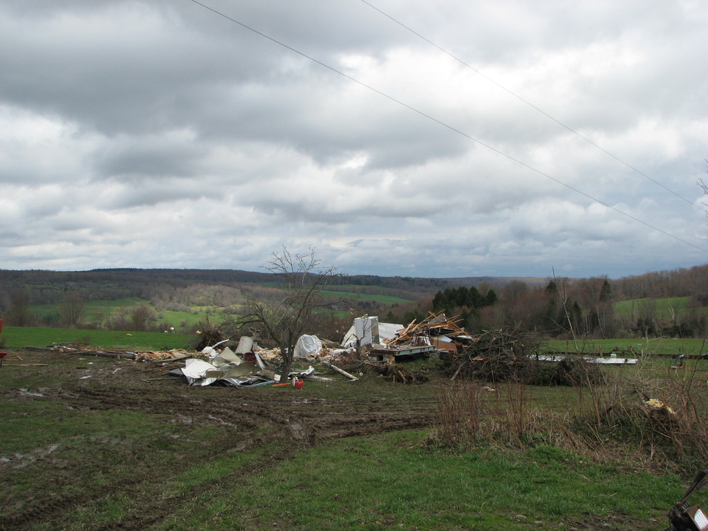
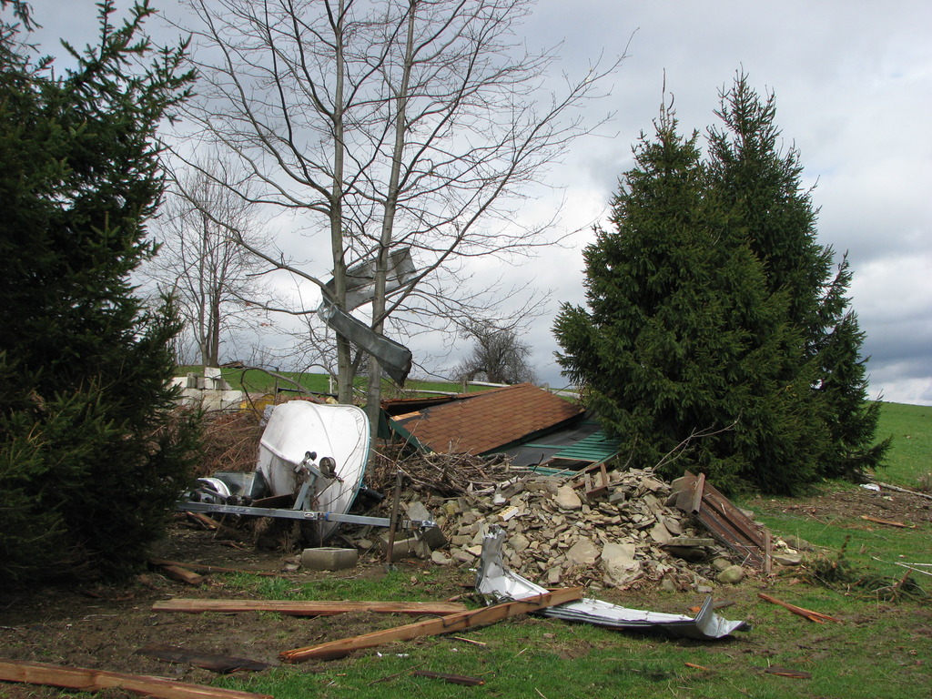
Use the tabs below to view data or storm surveys.
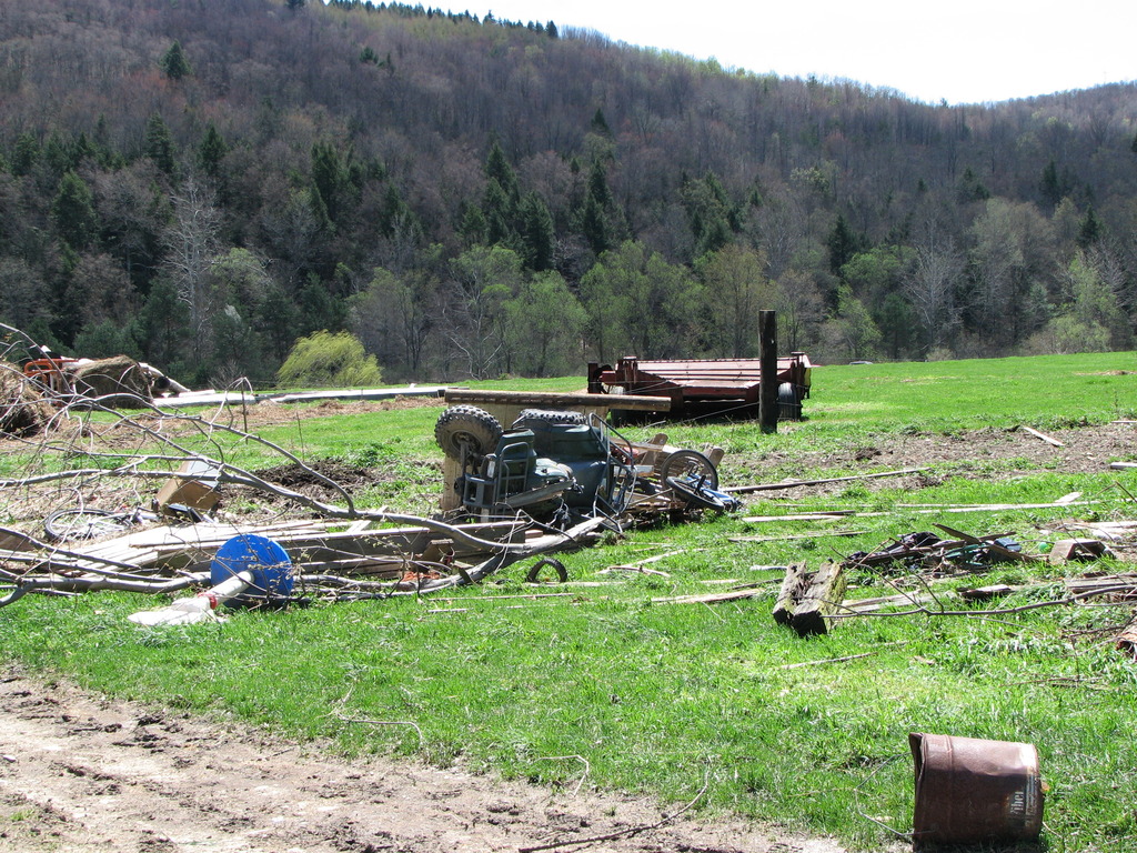
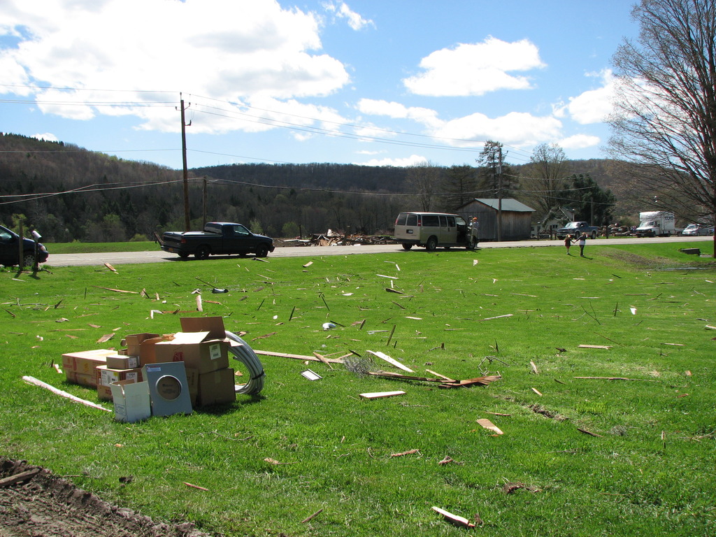
A series of storm systems moved over parts of central New York and Pennsylvania July 26 through 28, 2011. A significant severe weather outbreak developed across central New York as a storm system moved east from the Great Lakes. First, showers and thunderstorms developed early in the evening on the 27th, as an upper level disturbance approached the region. Two of the more significant storms included one supercell that produced a tornado in Steuben county, and a bowing line segment that caused tree and structural damage across Steuben, Chemung and Schuyler counties. Elsewhere across central New York, storms caused scattered wind damage and heavy rain. After a brief break in the late evening, mini super cells developed overnight ahead of a cold front. Several tornadoes and severe thunderstorms developed in the early morning hours, with many reports of damage. Most of the tornadoes were EF1 and EF2. Significant flash flooding also transpired during the overnight hours.
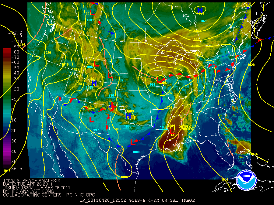
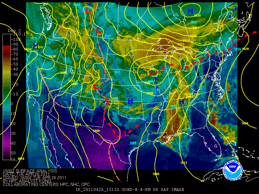
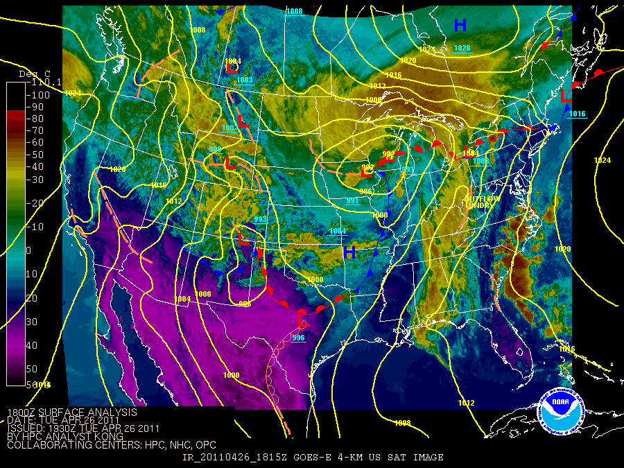
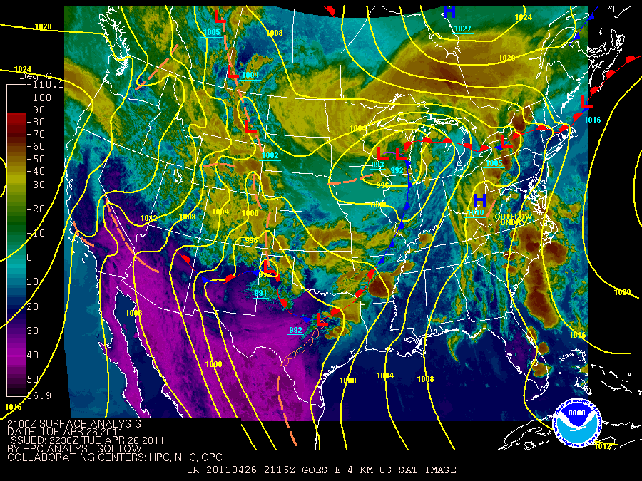
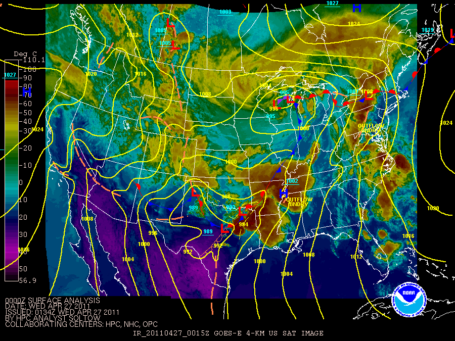
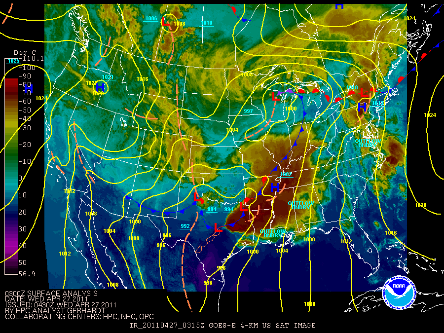
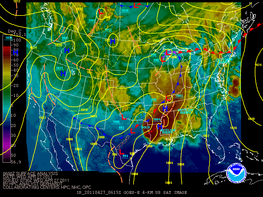
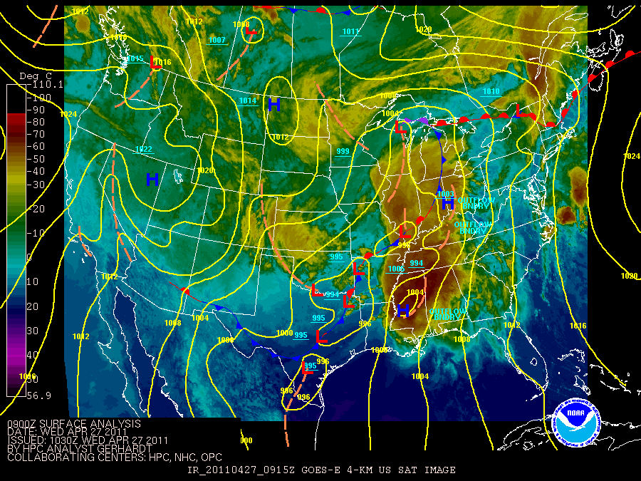
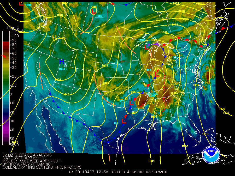
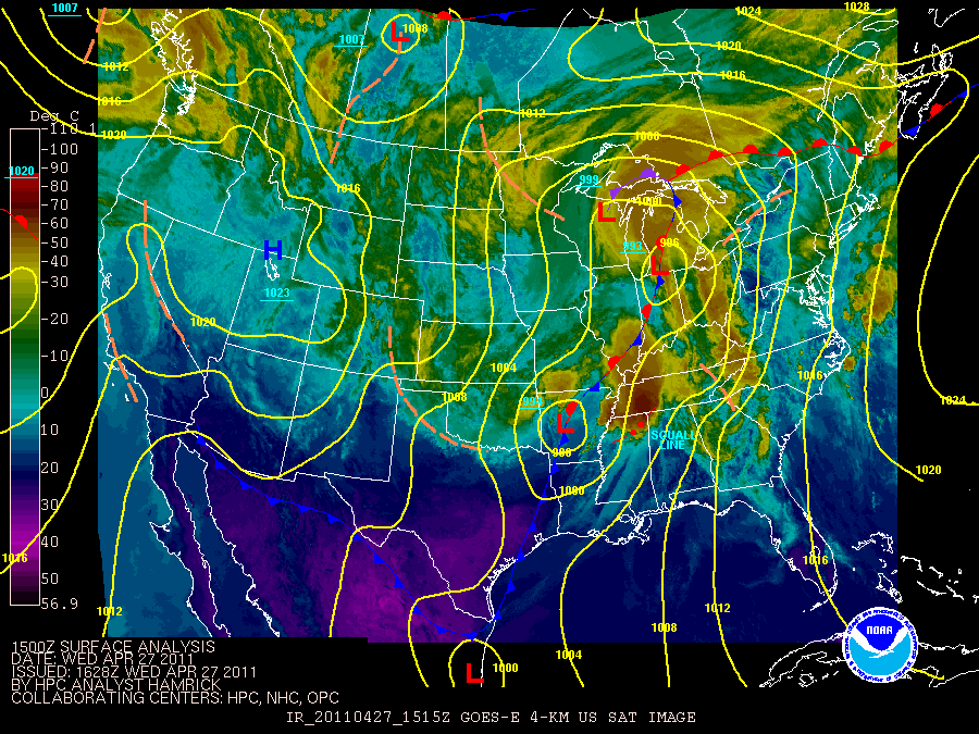
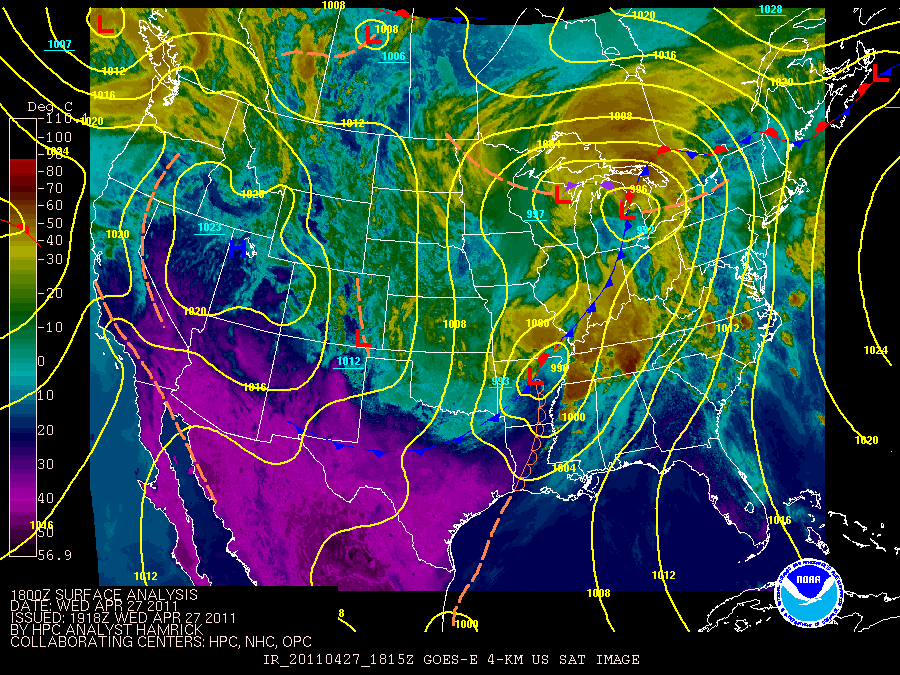
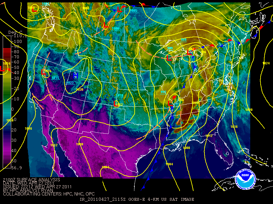
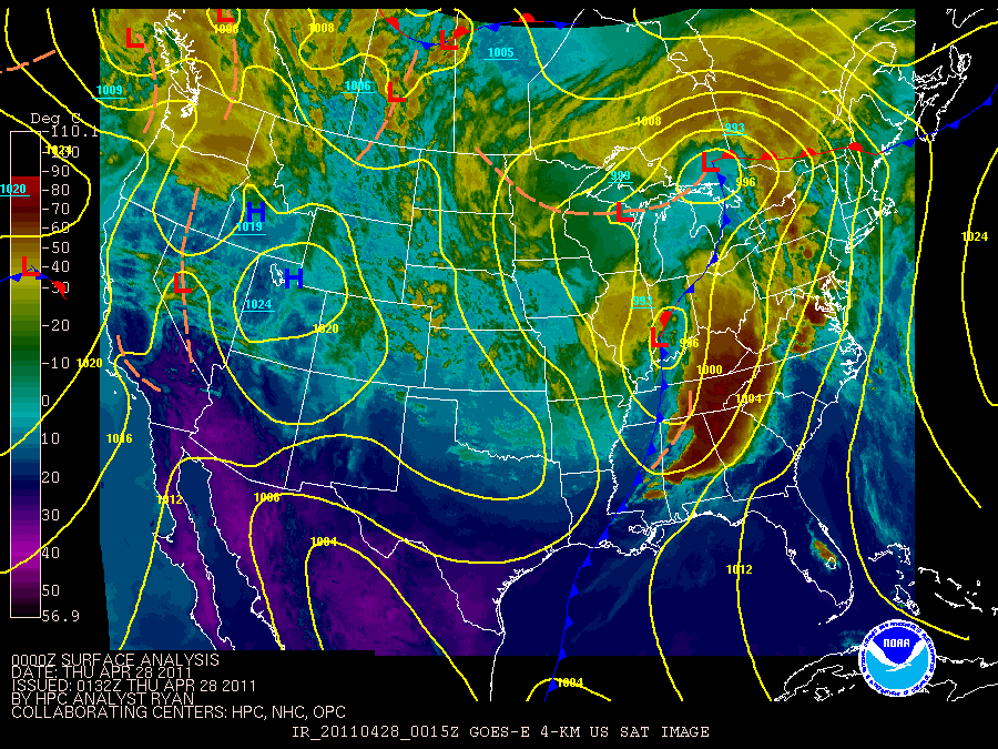
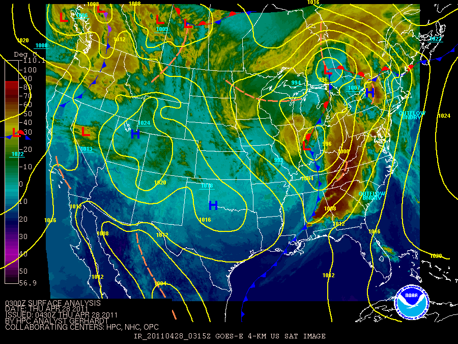
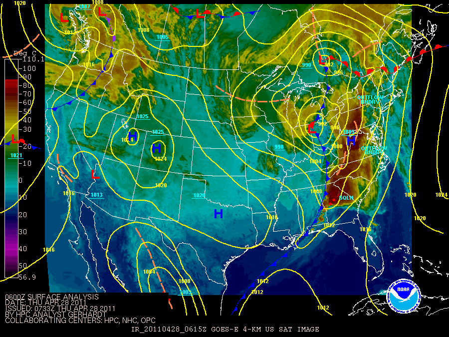
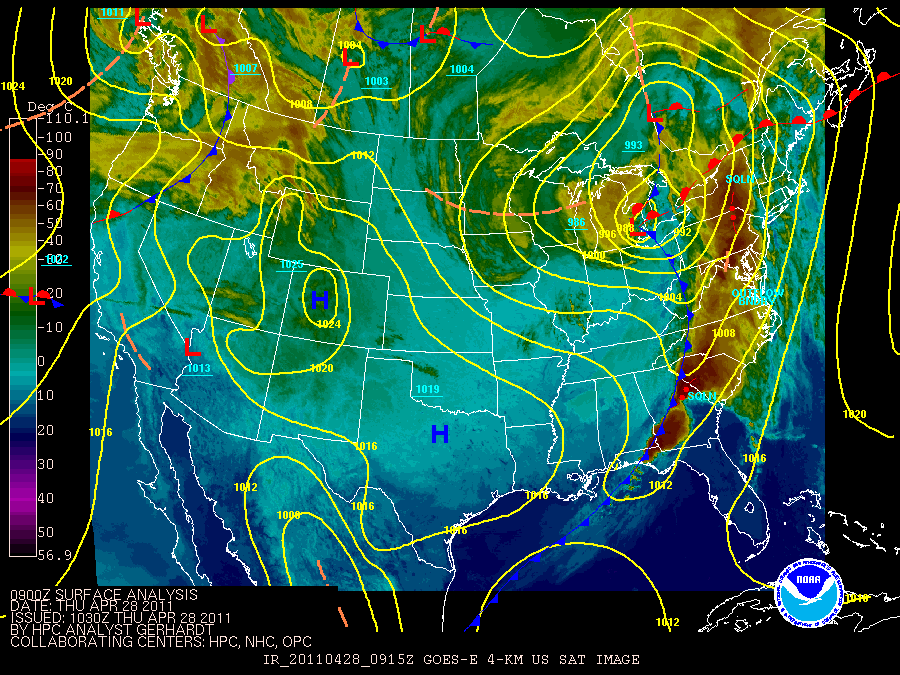
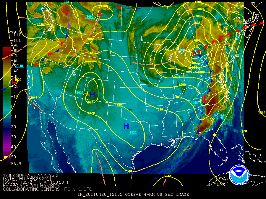
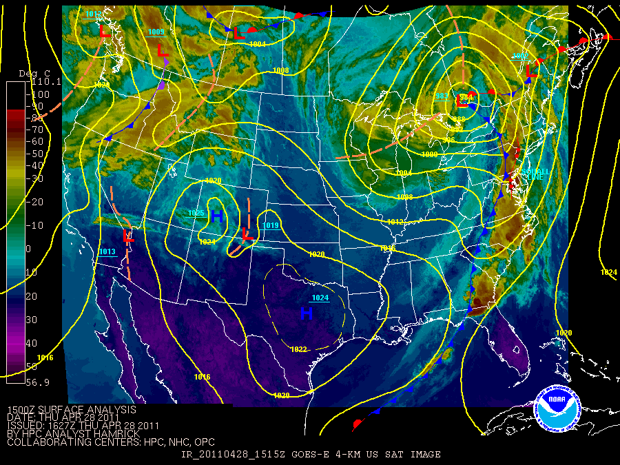
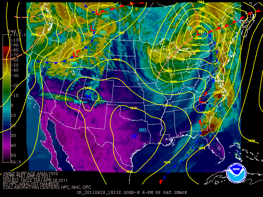
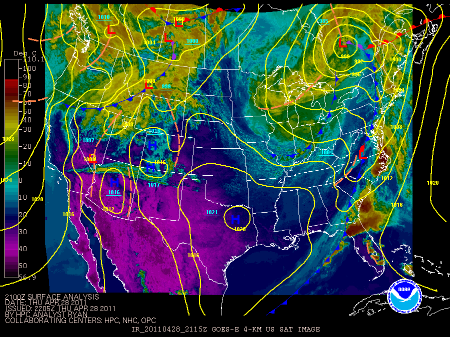
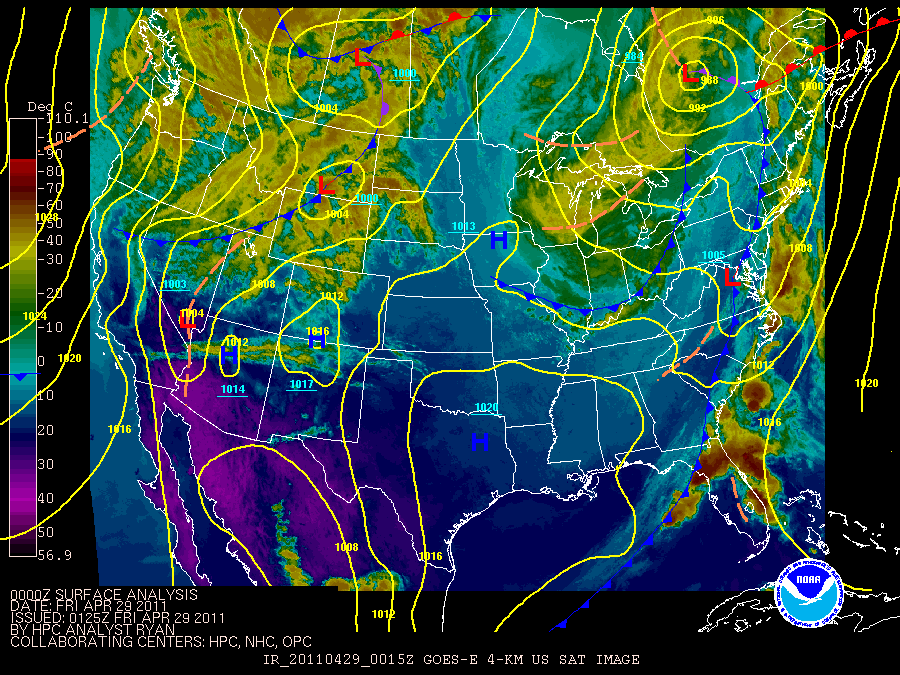
This surface chart loop was from April 26, 2011 to April 29, 2011.
Case Studies
These are meteorological overview of the events.
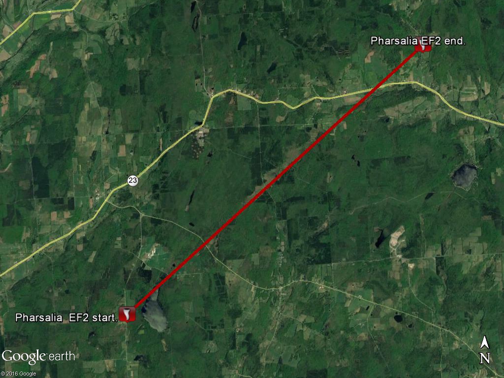
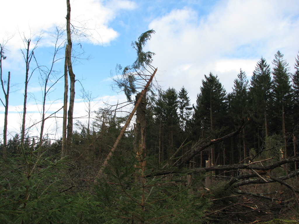
EF2 Tornado near Pharsalia in Chenango County NY
Summary
The National Weather Service in Binghamton, NY has confirmed a tornado near Pharsalia in Chenango County New York on April 28 2011.
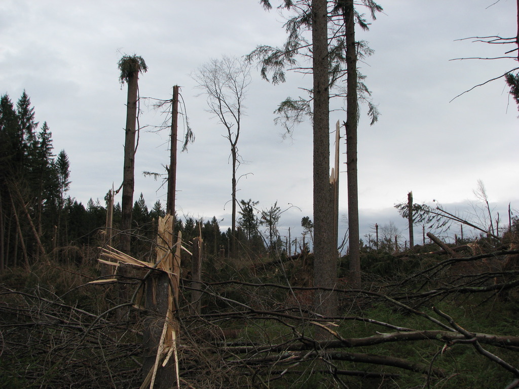
The tornado touched down on county Route 7 in Pharsalia and produced EF1 damage to a few barns and some trees. The tornado traveled northeast approximately 8 miles before dissipating on Pigeon Hill Road in Pharsalia. Intensity for most of the path was estimated at EF1, however EF2 intensity was estimated along North Road and Center Road in Pharsalia. In those areas hundreds of large trees were snapped and uprooted leveling a dense forest. Over the hill a house trailer was lifted and demolished, a 2 story barn was demolished, a small pond had its water sucked out, and a jeep was moved several feet and hit with debris. Out buildings were destroyed.
The National Weather Service would like to extend our appreciation to local officials, local media and especially eyewitness accounts for help during this survey.
MSE/BMW
This map show the approximate path of the tornado. Click for a larger view.
Photos:
Click on an image below to see a larger view.
 |
 |
 |
 |
 |
 |
 |
 |
 |
 |
 |
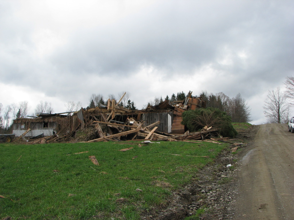 |
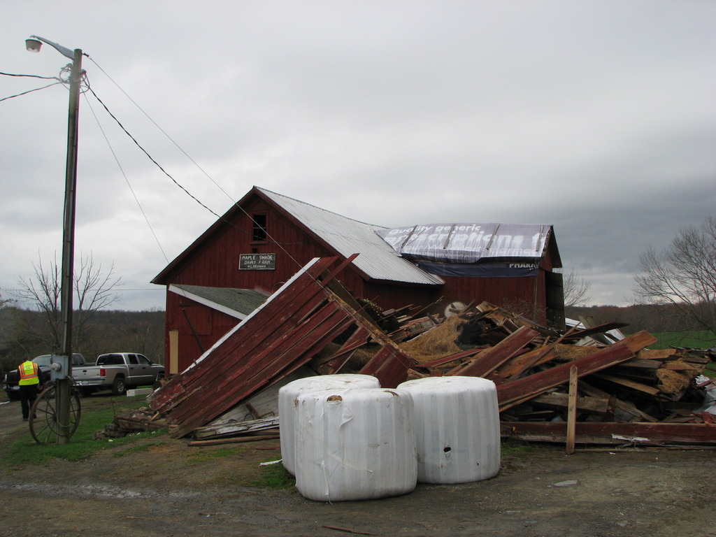
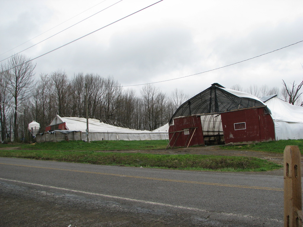
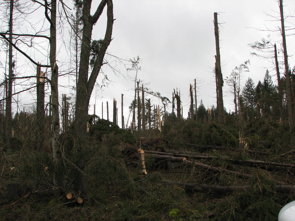
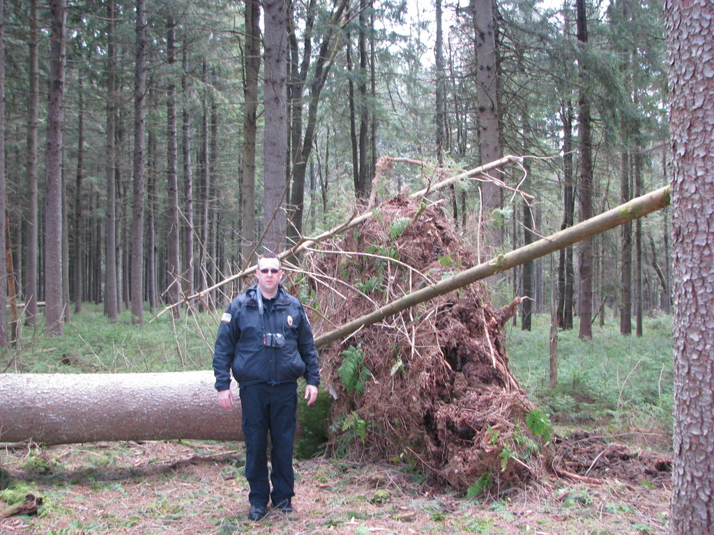
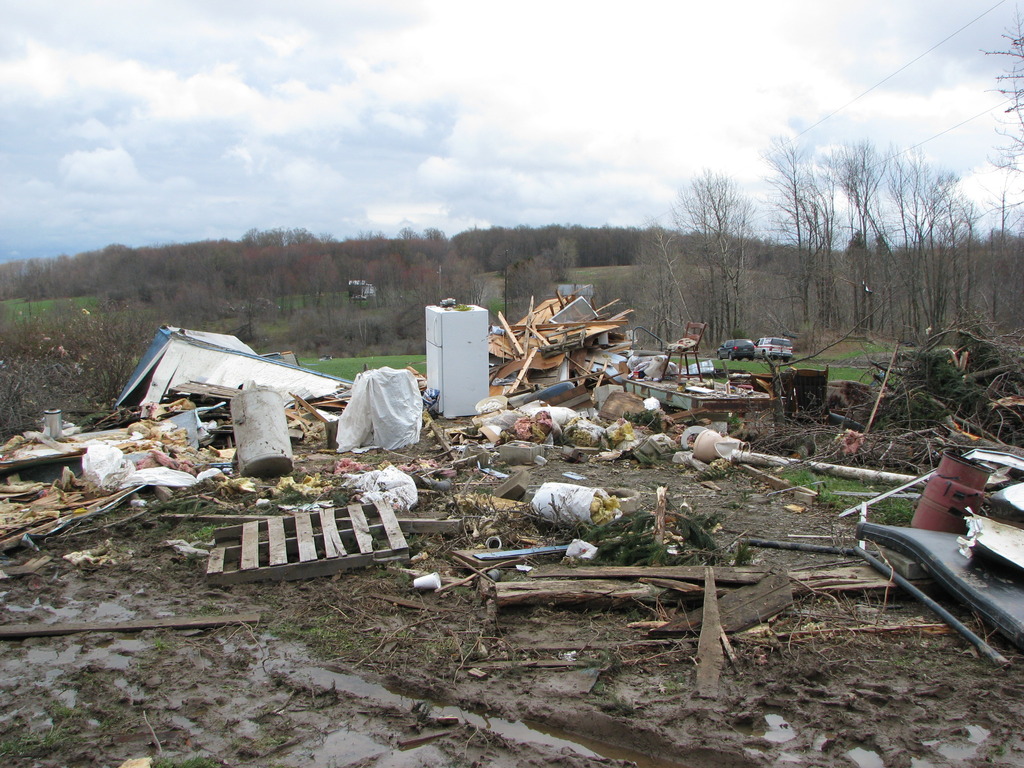
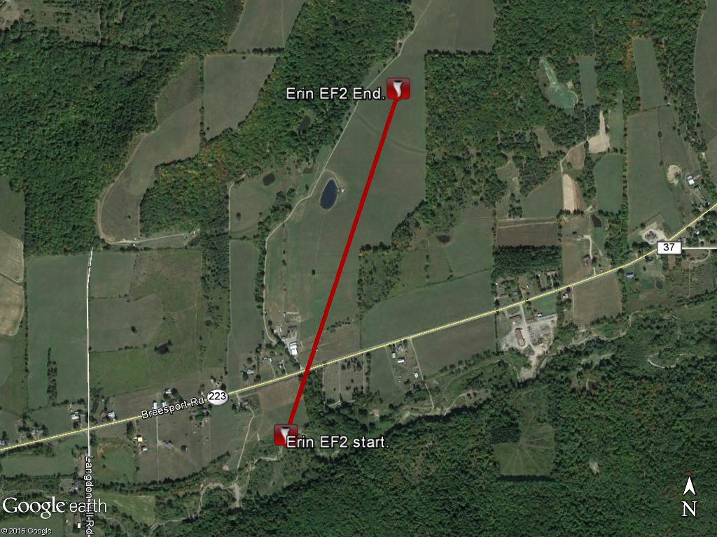
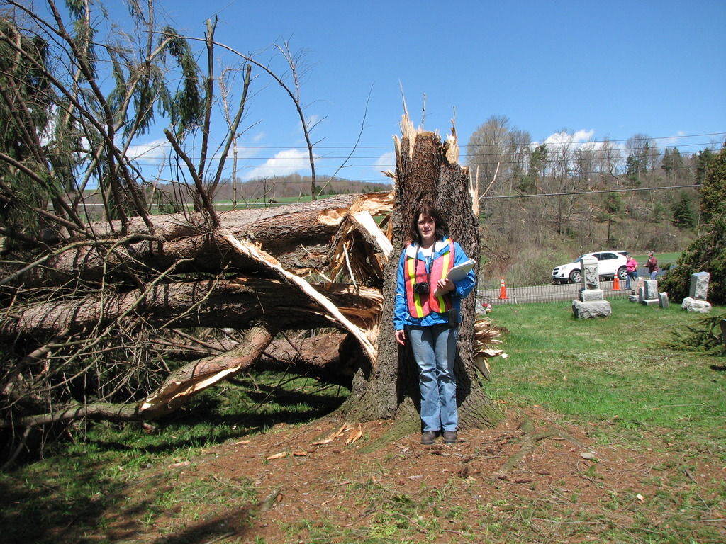
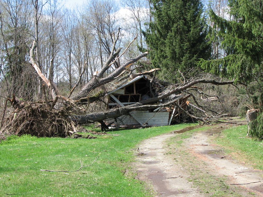
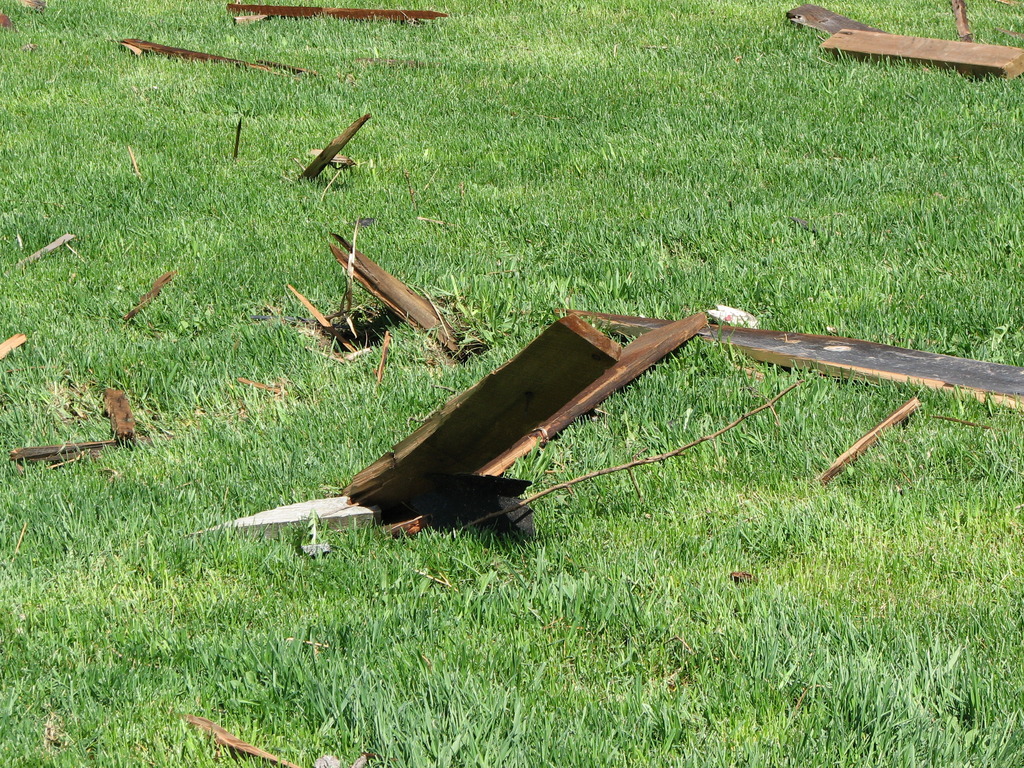
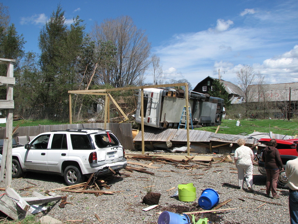
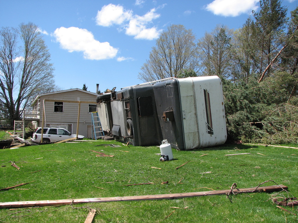
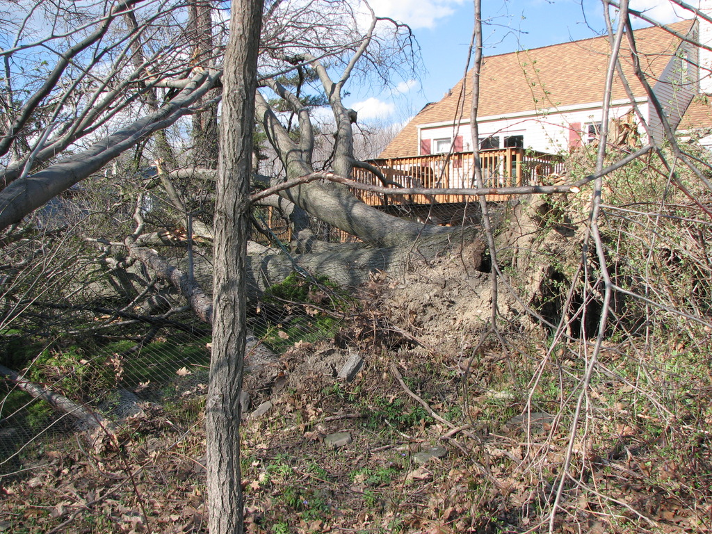
EF2 Tornado near Erin in Chemung County NY
Summary
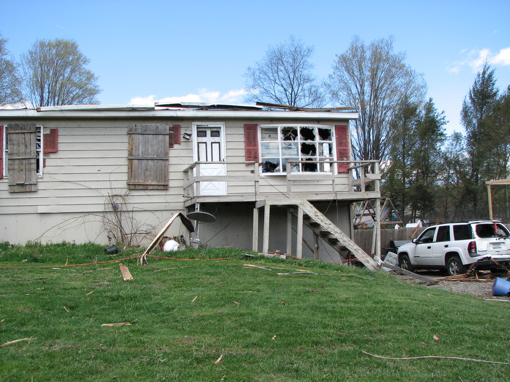
The National Weather Service in Binghamton, NY has confirmed an EF2 tornado near Erin in Chemung County New York on April 28 2011.
The tornado started just west of the Erin Town Hall south of Route 223. It began just southwest of the local cemetery and tracked toward the northeast. Numerous pine trees were snapped off and uprooted in the cemetery.
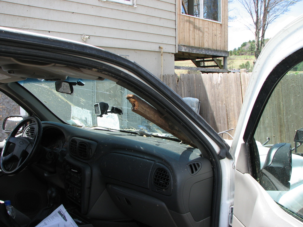
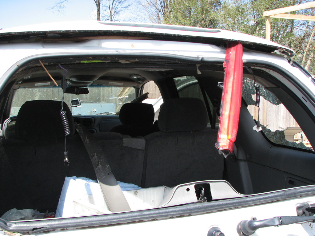
Immediately to the west of the cemetery a well-constructed barn was destroyed with all four walls completely collapsed. The tornado tracked northeast and across Route 223. The tornado lofted debris into the yard across the street with debris from the destroyed barn impaled into the front lawn. Debris also blew all windows out of the front of the home with some debris penetrating the siding and thrown into the home. At this site, all three vehicles were damaged with a beam from the destroyed barn impaled through the dashboard of one vehicle. An 11,000 pound camper was flipped up over a five foot fence and toppled onto its side before coming to rest.
The tornado continued tracking to the northeast with damage to a barn roof and debris wrapped in trees. A garage and mobile home at the site was completely demolished. Heavy debris from the mobile home was strewn approximately 100 yards downstream from the site, with lighter material found several miles away.
The tornado tracked an additional one-half mile up the hill with numerous trees uprooted or snapped and two horses killed on the farm. At this point the tornado lifted and no additional damage was found.
The National Weather Service would like to extend our appreciation to local officials, local media and especially eyewitness accounts for help during this survey.
PN/RAM
This map show the approximate path of the tornado. Click for a larger view.
Photos:
Click on an image below to see a larger view.
 |
 |
 |
|
 |
 |
 |
|
 |
 |
 |
|
 |
 |
 |
Move your mouse over the image. This will show the approximate direction that the tornado traveled. The facing direction is Northeast. The image shows a large barn that was destroyed by the tornado. The parts of the barn were thrown across the road and into the yards and structures. The trees that fell in the cemetery where all pointing towards the northwest. |
This image shows the 11,000 lbs trailer that was moved over a 5 foot wall to its final resting position. |
Move your mouse over the image. This will show the approximate direction that destroyed trailer took as the tornado passed through. The image is facing West and the direction of travel is Northeast. The trailer debris was thrown up and over the hill. |
EF1 Tornado near McDonough in Chenango County NY
Summary
The National Weather Service in Binghamton, NY has confirmed a tornado near McDonough in Chenango County New York on April 28, 2011.
A tornado touched down in the early morning hours of April 28 about 4.5 miles south-southeast of McDonough and moved northeast cutting a path through heavy woods. The tornado passed just south of Lake Ludlow where a couple homes where damaged by the storm. The tornado path appeared to be its strongest and widest just south of the lake through the wooded area. It continued to the northeast where the path narrowed again and weakened. The tornado lifted a little less than 2 miles south of east McDonough.
A significant swath of trees were also blown down southwest of the tornado track on Waldron Road. These trees were all pointing to the southeast in a slightly divergent pattern and were associated with a significant downburst of wind.
The National Weather Service would like to extend our appreciation to local officials, local media and especially eyewitness accounts for help during this survey.
This map show the approximate path of the tornado. Click for a larger view.

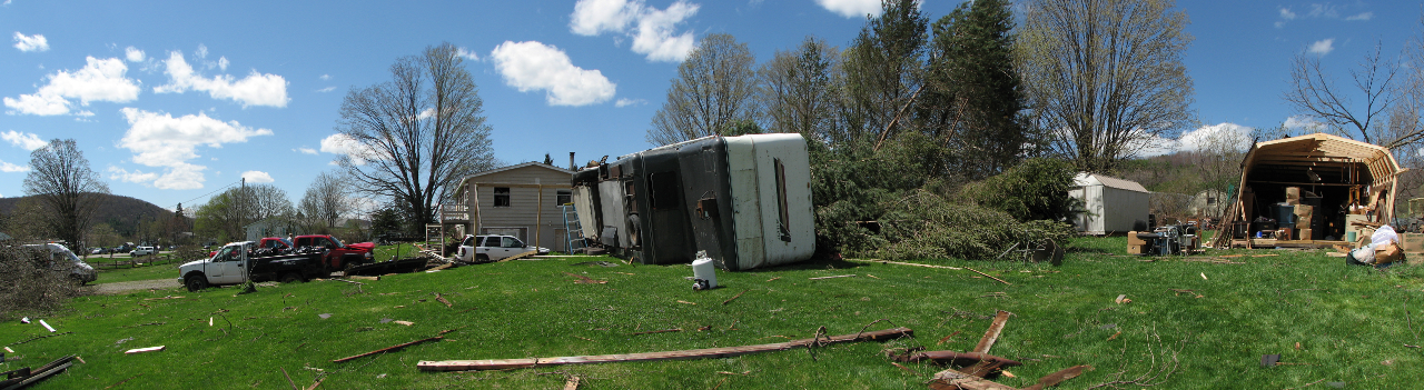
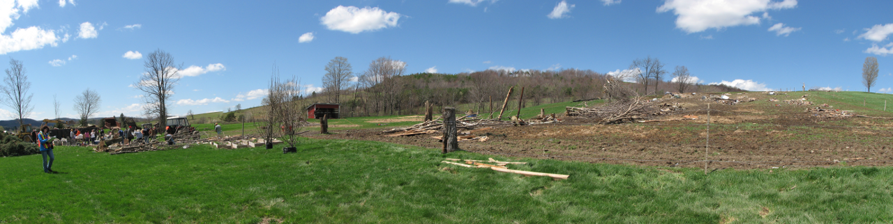
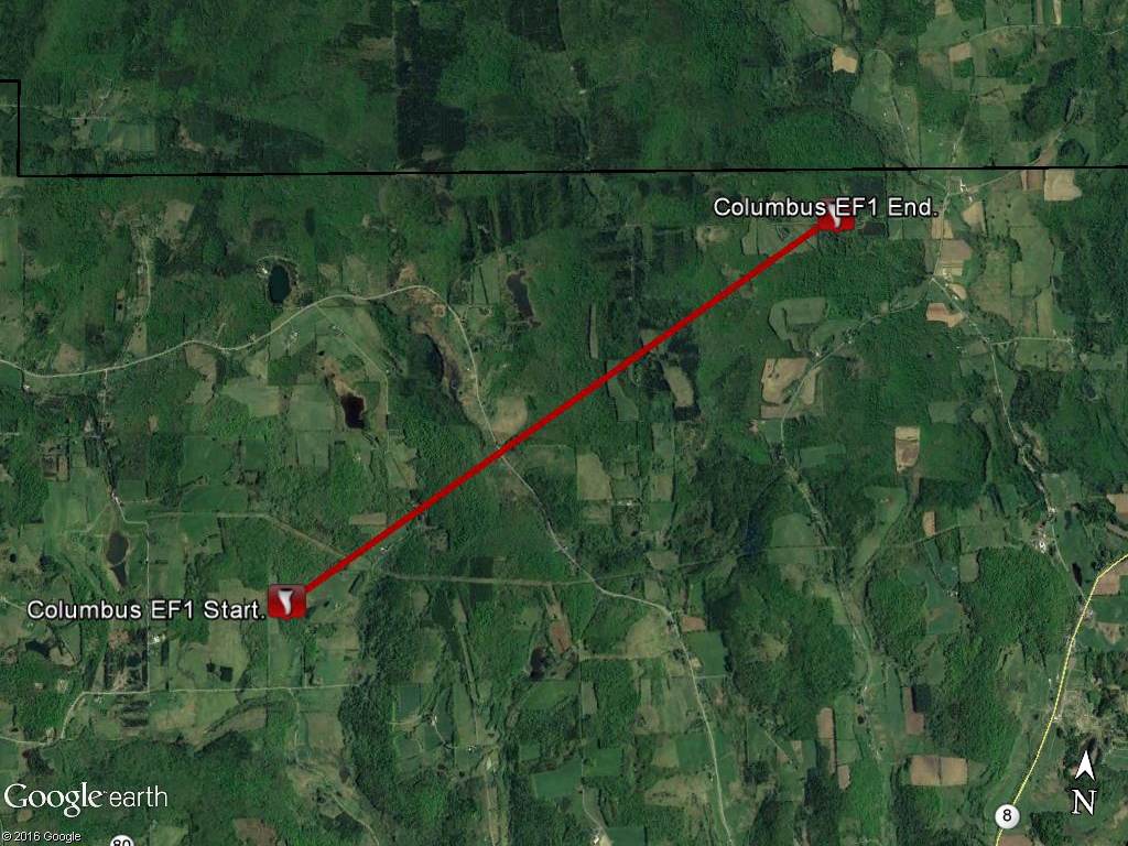
EF1 Tornado near Columbus in Chenango County NY
Summary
The National Weather Service in Binghamton, NY has confirmed a tornado near Columbus in Chenango County New York on April 28, 2011.
Tornado path began about 3 miles to the northwest of Columbus, NY off Barnard Road. Damage was primarily to trees which were uprooted and snapped. Tornado was moving to the northeast. The upper story of a two story horse barn was torn off. This was the only structure identified that was damaged by the tornado. Debris and trees were blown to the left of the path. The remaining damage was to trees along the 3.5 mile path. The tornado weakened to EF0 after the first mile then strengthened back briefly to EF1 after crossing kelly road. The tornado then weakened again to EF0 and lifted after crossing pope hill road before reaching the Madison County line.
The National Weather Service would like to extend our appreciation to local officials, local media and especially eyewitness accounts for help during this survey.
This map show the approximate path of the tornado. Click for a larger view.
Photos:
Click on an image below to see a larger view.
 |
 |
 |
BMW/RAM
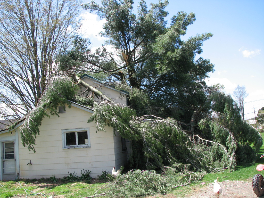
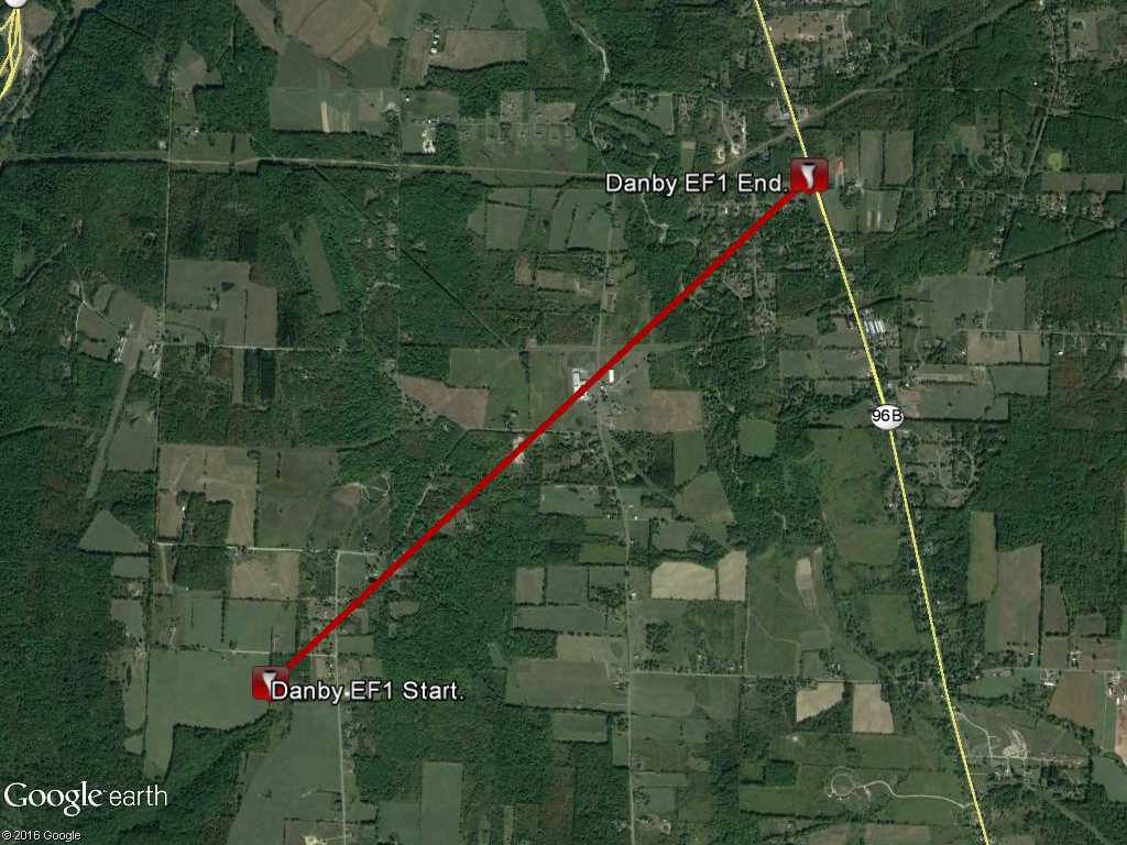
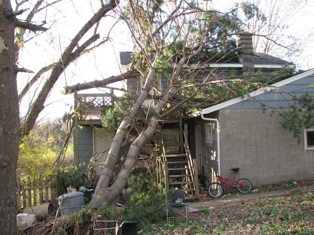
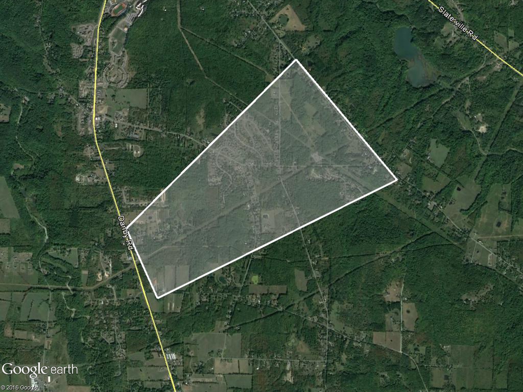
EF1 Tornado near Danby in Tompkins County NY
Summary
The National Weather Service in Binghamton, NY has confirmed an EF1 tornado near Danby in Tompkins County New York on April 28 2011.
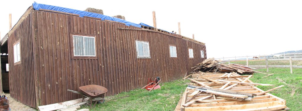
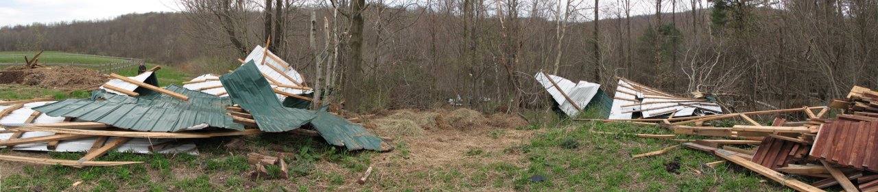
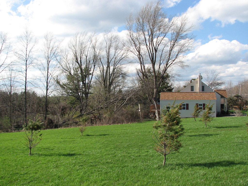
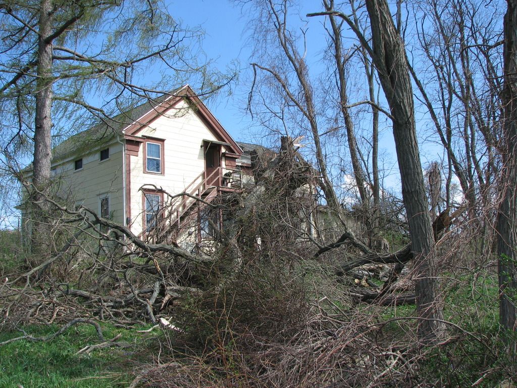
The tornado touched down near a home just off of hilltop road northwest of danby. The house`s roof was peeled off and some walls were colapsed. The tornado crossed jeresy hill road and into a forested area. Numerous pine trees were uprooted and snapped in this forest. The tornado tracked from southwest to northeast, snapping numerous pines as it crossed comfort road. A metal outbuilding was completely collapsed and a barn across the street received roof damage with debris lofted into the trees.
The tornado continued off to the northeast toward the intersection of beardsley lane and danby road. One home sustained damage when a tree collapsed onto the roof and a window was blown out. Surrounding homes saw numerous trees snapped or uprooted. A small branch was propelled and impaled into a car windshield.
A homeowner at the intersection of beardsley lane and danby road had a working anemometer at the time of the tornado. At 1:44 AM EDT, a wind gust to 90.3 mph was recorded. No additional tornado damage was noted as the storm headed off to the northeast.
The National Weather Service would like to extend our appreciation to local officials, local media and especially eyewitness accounts for help during this survey.
This map show the approximate path of the tornado. Click for a larger view.
Photos:
Click on an image below to see a larger view.
 |
 |
 |
 |
 |
 |
EF0 Tornado near Herrick in Susquehanna County PA
Summary
The National Weather Service in Binghamton, NY has confirmed a tornado near Herrick in Susquehanna County Pennsylvania on April 28 2011.
The tornado touched down on Lewis Lake Road and uprooted many trees in one woodlot. The tornado then apparently lifted for a time before touching down again, damaging a mobile home. Part of The roof was torn off the mobile home and thrown about 100 yards. There were no injuries or fatalities. It is estimated that the tornado was on the ground for just a few minutes.
This map show the approximate path of the tornado. Click for a larger view.
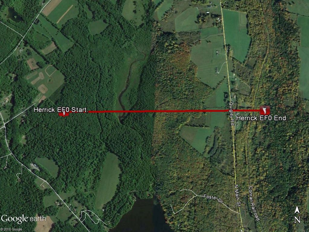
DJN
Wind Damage near Afton in Chenango County NY
Summary
The National Weather Service in Binghamton, NY has confirmed a Macroburst /Straight Line Wind Damage near Afton in Chenango County New York on April 28, 2011.
Significant downburst wind event hit the Afton area around 5 AM EDT on April 28. Much damage was done to trees along the core path of the downburst with scattered tree damage north and south of the core. The majority of trees fell to the east-northeast with a slightly divergent pattern detected. Damage occurred to several homes from trees falling on the structures. The heaviest damage occurred near power lines north of the intersection of Algerine Street and Route 7.The path of tree damage is seen crossing Interstate 88 with uprooted and snapped trees.
Watson
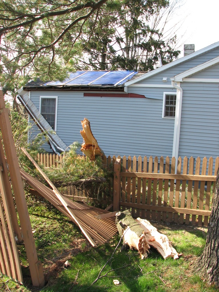
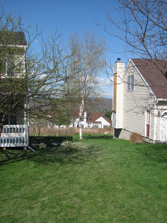
Wind Damage near Danby in Tompkins County NY
Summary
The National Weather Service in Binghamton, NY has confirmed straight line wind damage near Danby in Tompkins County New York on April 28 2011.
A storm that originally produced tornadic damage northwest of Danby continued heading off toward the northeast and produced straight line winds to near 100 MPH. Numerous hardwood trees were snapped and uprooted on the east side of Danby road. Trees fell on the roof of a house at the corner of Nelson and Danby Road with shingles blown off and flung nearly 20 yard.
The straight line winds continued with an average path width of 0.45 miles, causing excessive tree damage. A home in the Deer Run subdivision sustained significant damage as the roof was peeled up and strewn downstream approximately 30 yards. Insulation and siding was also blown off this house with minor siding damage to other houses nearby.
The storm continued to produce tree damage toward the northeast before finally ending near Coddington Road.
Photos:
Click on an image below to see a larger view.
 |
 |
 |
 |
PN/RAM
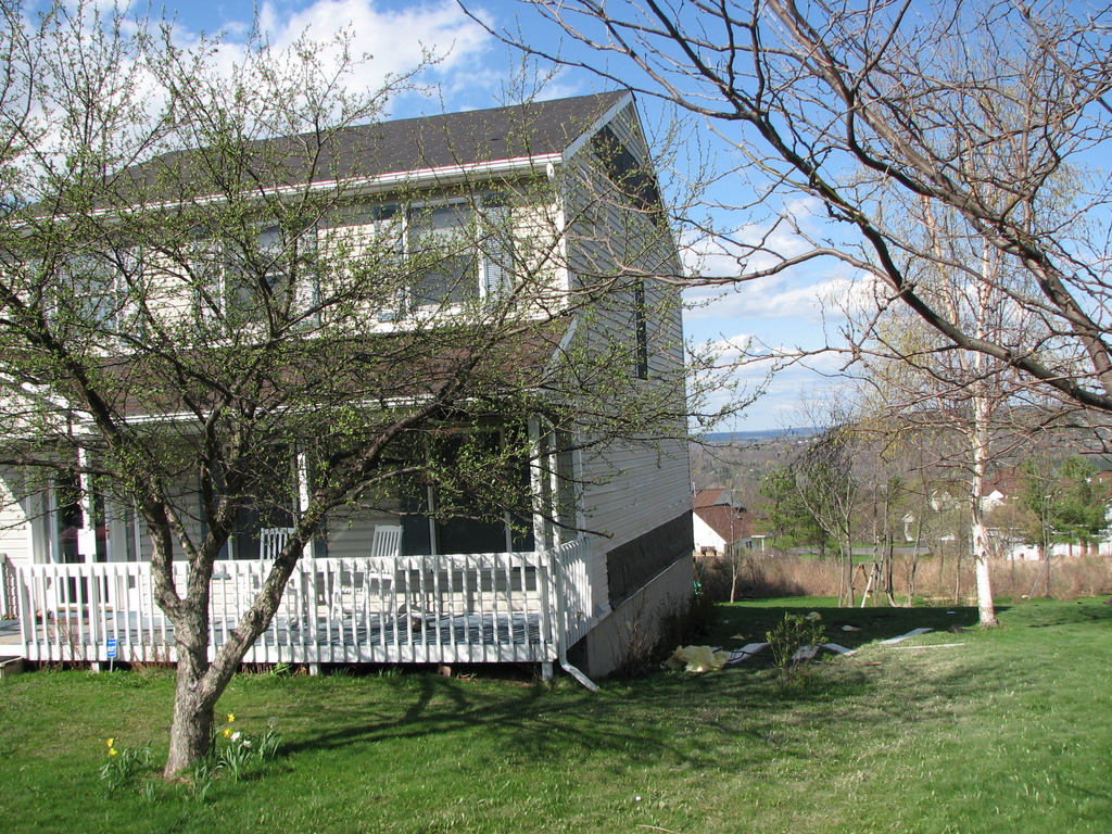
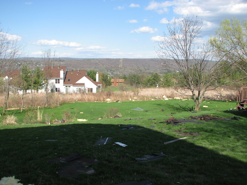
Wind Damage near Falls and Newton Townships in PA
Summary
The National Weather Service in Binghamton, NY has confirmed a microburst/straight line wind damage near falls in Wyoming County Pennsylvania on April 28, 2011.
A microburst hit along the Wyoming-Lackawanna County line in Falls and Newton Townships. Most of the damage was to trees which were uprooted. A garage was partially collapsed by the wind with 1 garage door completely blown in. A home sustained some damage to the roof as many shingles were blown off.
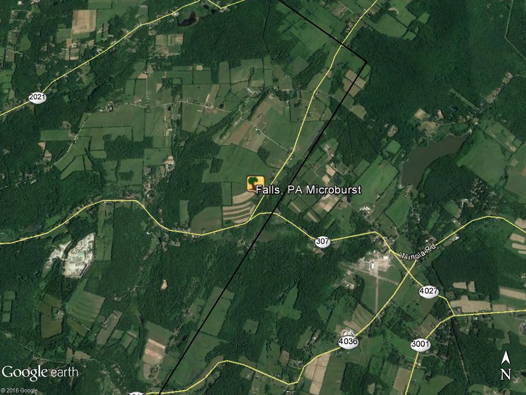
DJN
Wind Damage near Lehman in Luzerne County PA
Summary
The National Weather Service in Binghamton, NY has confirmed a microburst/straight line wind damage near Lehman in Luzerne county Pennsylvania on April 28 2011.
The damage was concentrated near market street to the west of the Huntsville Reservior. Numerous White Pine and Eastern Hemlock trees were snapped with a few uprooted. The width of the damage swath was about 500 yards with the damage path length about 1 mile.
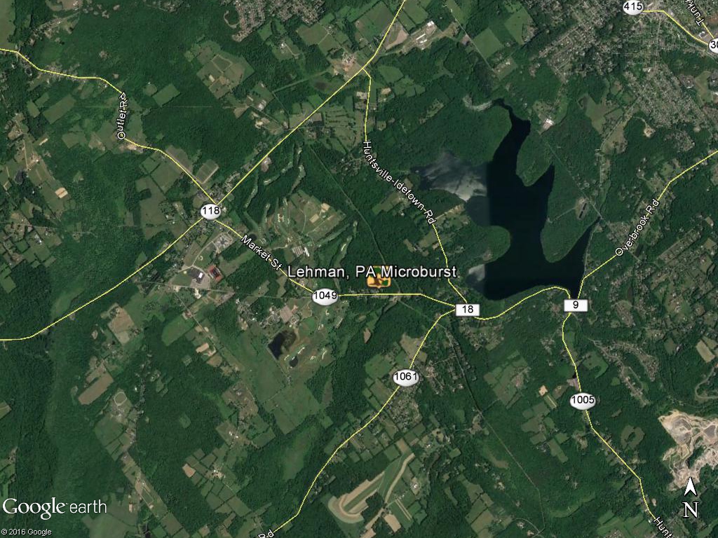
DJN
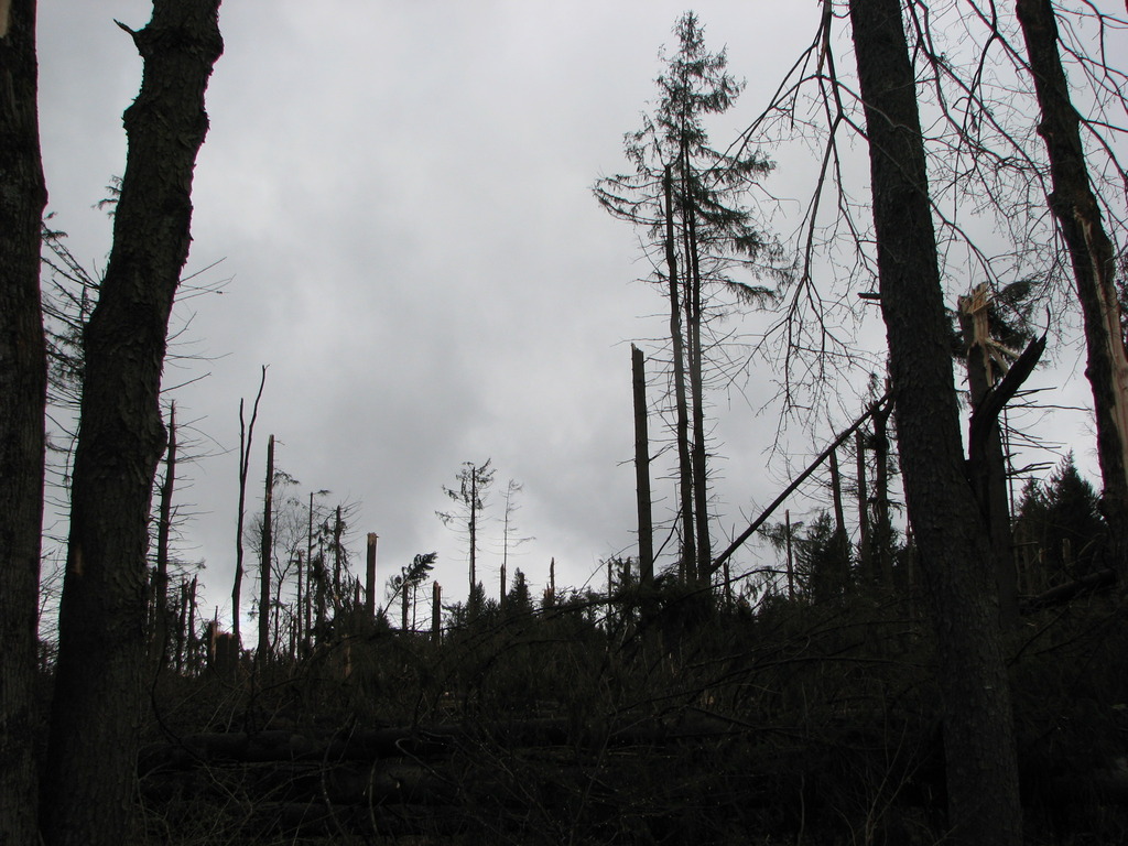
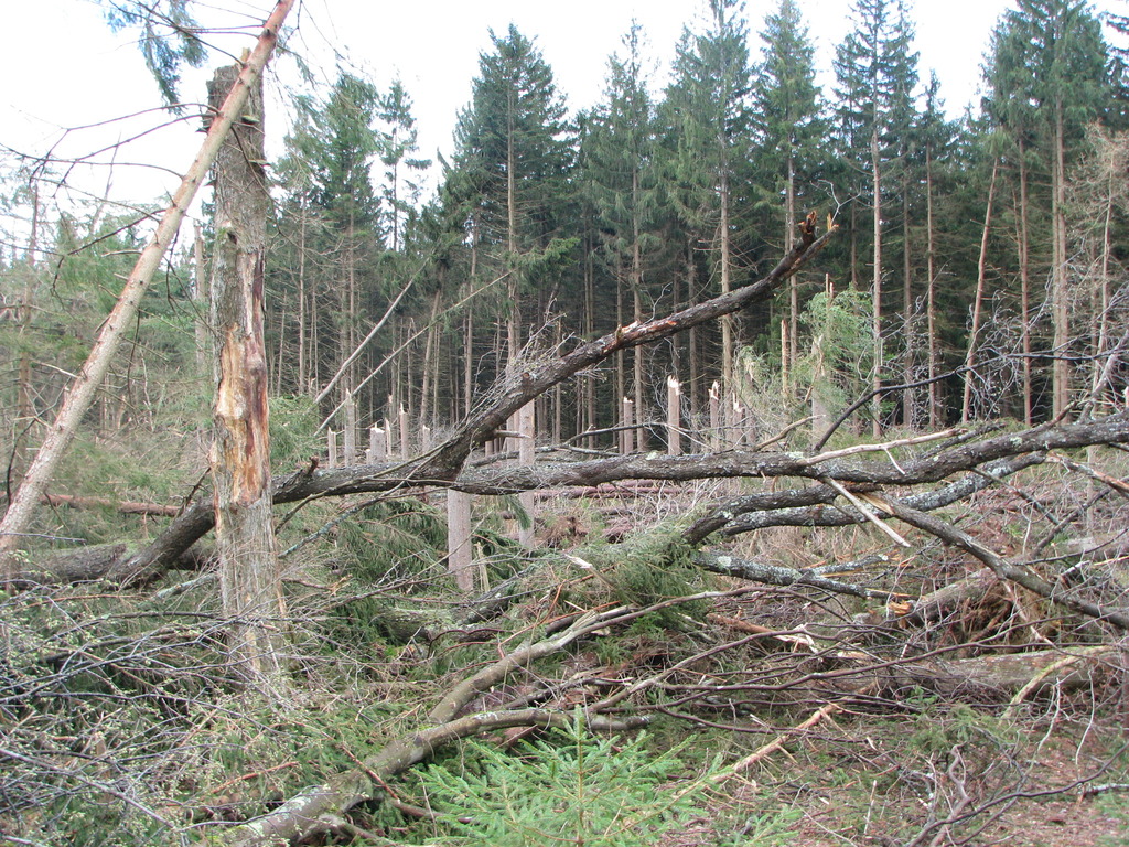
EF1 Tornado confirmed near Campbell in Steuben County NY
Summary
The National Weather Service in Binghamton, NY has confirmed a tornado near Campbell in Steuben county new york on April 27 2011.
The tornado first touched down at around 804 PM EDT, on a hillside just west of Hough Road, in the town of Campbell. As the tornado topped the crest of the hill and descended towards Hough Road, dozens of trees were either snapped off or uprooted, in a swath about 150 yards wide. Included in this grove of trees were numerous large healthy hardwoods. As the tornado crossed Hough Road it damaged two homes and a storage barn. The houses sustained mostly roof and siding damage, while the barn (actually bolted to a foundation) was moved off of its cement padding, with heavy damage to the roof and two of the walls, with its shingles blown westward back across Hough Road and into a field. A large camper was also blown cross-wise about 6 inches. Several large pine trees were uprooted on these properties, and facing northeastward. The tornado was estimated to be EF1 strength at this location.
Farther northeast, sporadic tree snaps and uproots were noted, until an area of heavier damage was once again seen near Tannery Road, just west of the Cohocton River. Once again, a swath of trees were either snapper or uprooted, just behind a residence southwest of Tannery Road. Again, many large healthy trees were included in this group, including some hardwoods, with a chaotic damage pattern noted. An EF1 rating was estimated at this location. The tornado appeared to have lifted for a brief time, with little damage noted to the residence itself.
A short distance further to the northeast, the storm crossed Interstate 86, just east of Exit 41. Several tree uproots and snaps occurred on either side of the highway, with two large trees uprooted in the highway median.
Just northeast of Interstate 86, along County Route 415, more large trees were either uprooted or snapped. One tree temporarily blocked Route 415, and another nearly hit several trailer homes in the Seager Court Trailer Park, and blocked entry to the complex.
The storm then continued northeastward and up a large ridge. Near the ridge top, at the corner of Rumsey Road and Dug Road, a large section of trees were heavily damaged (snapped or uprooted). The center line of the damage appeared to be along Dug Road, with the trees pointed mainly in a westerly direction along the north side of Dug Road, and in an easterly direction along the south side. This damage pattern implied convergent rotation, with an EF1 rating again given at this location.
Little or no damage was found farther to the northeast.
The National Weather Service would like to extend our appreciation to local officials, local media and especially eyewitness accounts for help during this survey.
EF1 Tornado near Gilbertsville in Otsego County NY
Summary
The National Weather Service in Binghamton, NY has confirmed a tornado near Gilbertsville in Otsego County New York on April 26, 2011.
The tornado set down in woods near Route 51 between Mount Upton and Gilbertsville producing EF0 damage until reaching Copes Corners Road where it strengthened to EF1 snapping and uprooting trees through a heavily wooded area. It moved up the hill and across the athletic fields of the Gilbertsville-Mount Upton Central School. Here it threw metal bleachers several hundred yards to the north. Tore a press box off steel beams. Hurled a railroad tie used in a parking lot over a hundred feet into a fence. Broke off metal poles used for hanging netting. Bent a soccer goal back in the southward direction. The field was littered with small tree missiles pointing in both directions with a southward direction on the left side of the path. A portable toilet was lifted and dropped about a half mile away and some other light material was found almost a mile away. The tornado was estimated to be its strongest and widest here. It continued to the northeast passing south of Gilbertsville with damage primarily to trees. The path continued to narrow and weaken ending a couple miles east of Gilbertsville.
The National Weather Service would like to extend our appreciation to local officials, local media and especially eyewitness accounts for help during this survey.
Watson
EF1 Tornado 7 Miles West Northwest of Rome in Oneida County NY
Summary
The national weather service in binghamton, ny has confirmed a tornado near 7 miles wnw of rome in oneida county new york on 04 26 2011.
A brief touchdown of an ef-1 tornado occurred in a wooded area near the intersection of state road 49 and lauther rd near verona mills. Damage included mulitple trees down and a snapped power pole.
SLI/MJ
This is a base reflectivity radar loop from the National Weather Service radar Binghamton, NY. This loop shows several waves of thunderstorms moving across parts of central NY and northeast PA from 08:01 PM EDT (00:01 UTC) April 26, 2011 to 7:53 PM EDT (23:53 UTC) April 28, 2011.
For reference:

