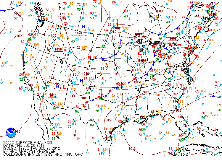
Fig. 1: 2:00 PM HPC surface analysis. |
Aloft, multiple approaching upper-level shortwave troughs approached the region from the central Great Lakes during the early afternoon hours which provided the initial forcing for thunderstorm development (Fig 2). Also at mid-levels, water vapor imagery showed a punch of mid-level dry air (reddish appearance in Fig. 2) which helped create mid-level convective instability along with a favorable setup for strong damaging winds. The presence of dry air aloft is a key indicator meteorologists look for when determining severe weather potential. Dry mid-level air can rapidly descend in a storm creating strong damaging winds along the surface.
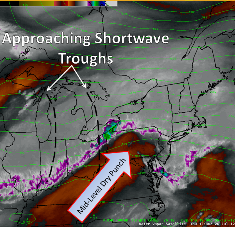
Fig. 2: 1:40 PM water vapor image. |
Thunderstorms developed over southwestern New York and northwestern Pennsylvania by early afternoon. As these storms continued east, they matured into a multicell line as they approached western Stueben County. Before moving into the Binghamton forecast area, multiple severe weather reports were recorded upstream across western New York. Knowing the history of the storms off to the west, the first of multiple severe weather warnings as issued at 2:25 PM for Steuben County. As the storms raced east at 50-55 mph through southern Steuben County, the system matured into a well-defined bow echo (Fig. 3, or reflectivity radar loop) by the time it was entering western Chemung County. As the storm was entering western Chemung County, a well-defined "inflow notch" was detected by radar with broad rotation noted around this feature. Within the core of the bow, the Binghamton, NY WSR-88D Doppler radar estimating winds to be anywhere from 50-70 mph (Fig. 4 or velocity radar loop). Embedded within the leading edge of the bow, Doppler radar detected a low-level rotational couplet (Fig. 5 or storm relative motion radar loop) heading towards the Elmira area. As this rotational couplet moved towards Elmira, an EF-1 tornado touched down in West Elmira. The tornado then continued east into Elmira where it affected the downtown district before finally lifting just east of the city.
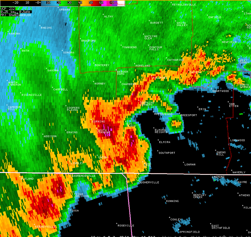
Fig. 3: Base reflectivity at 3:51 PM just prior to the storm reaching the Elmira area. Reflectivity radar loop |
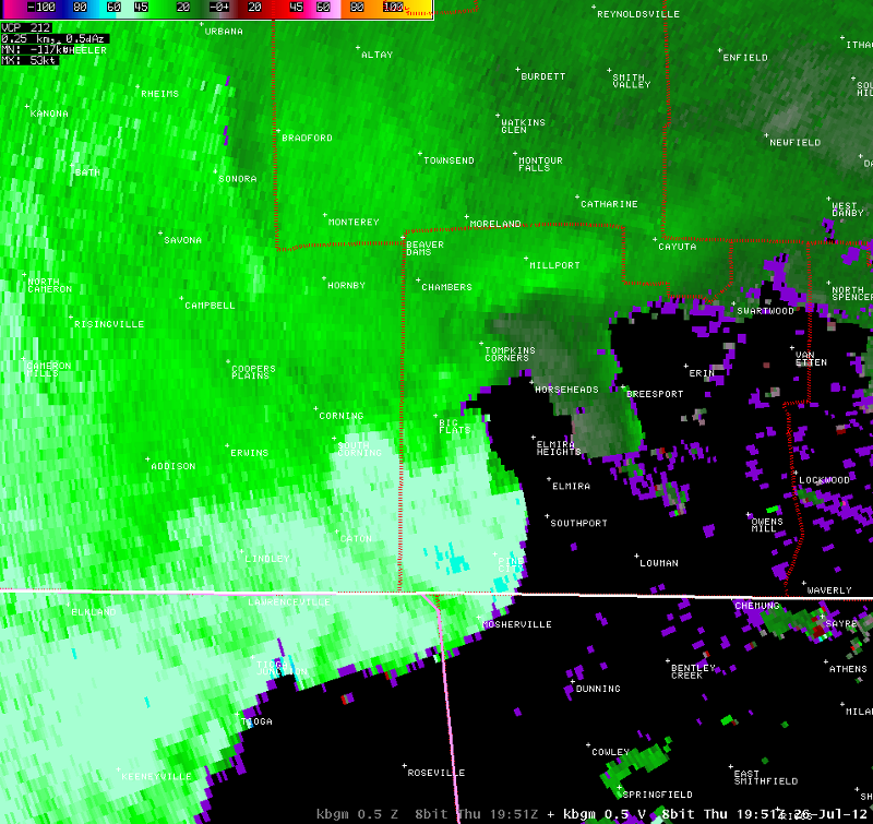
Fig. 4: Base velocity at 3:51 PM just prior to the storm reaching the Elmira area. Velocity radar loop |
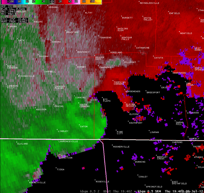
Fig. 5: Storm relative motion valid at 3:46 PM. Storm relative motion radar loop |
After moving through Elmira, the storm system quickly moved east through the Twin Tiers, where numerous damage reports such as trees and wires down were received. As the system moved into the Binghamton area a tornado warning was issued for eastern Tioga and much of Broome Counties at 4:24 PM. The strongest winds plowed into southwest Broome County where numerous damage reports were received from Owego east through Apalachin, Vestal, the Town of Binghamton, and Conklin (Fig 6).
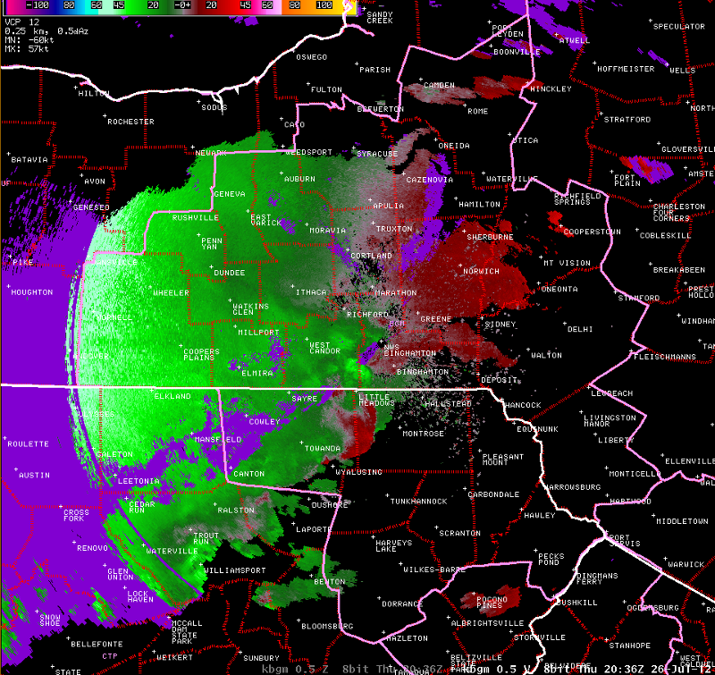
Fig. 6: Base velocity imagery valid at 4:36 PM. As the system moved through central Susquehanna County, a brief EF-1 tornado occurred just south of Montrose along the Bridgewater/Dimock Township line (Fig. 7) at approximately 4:45 PM. |
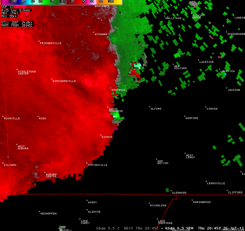
Fig. 7: Storm relative motion valid at 4:45 PM. Out ahead of the main line, a supercell thunderstorm developed over Columbia County, PA and moved into western Luzerne County around 5:05 PM (Fig. 8). |
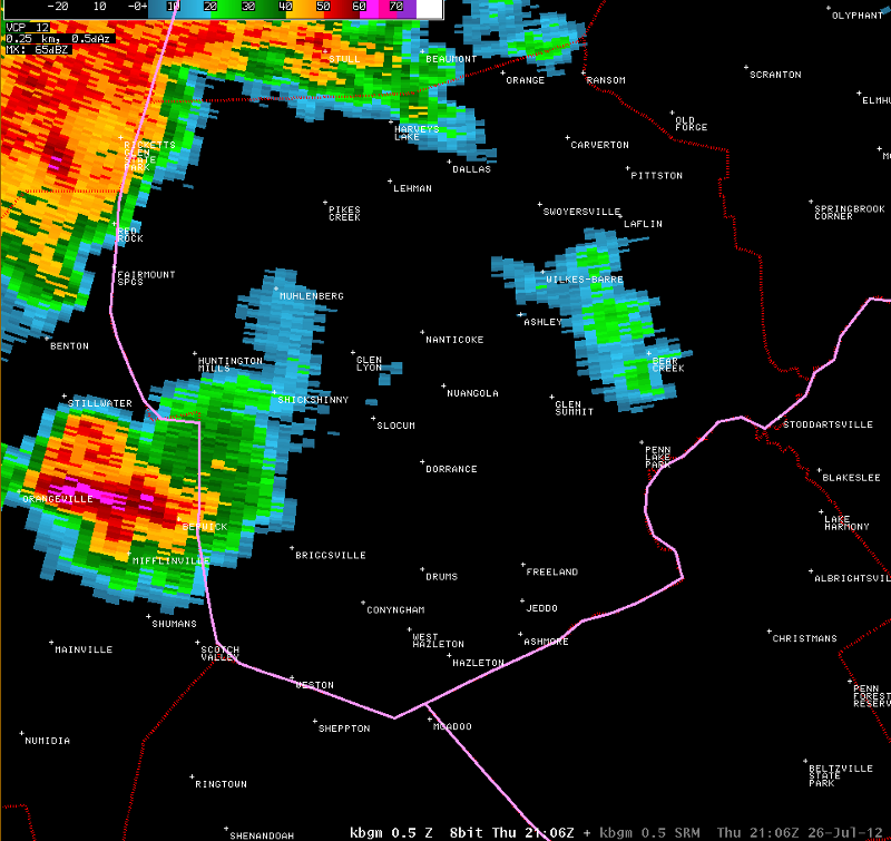
Fig. 8: Supercell thunderstorm moving into southwestern Luzerne County at 5:06 PM. |
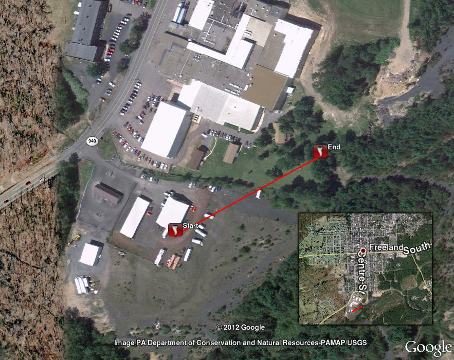
As this storm entered the county, Doppler radar indicated strong mid-level rotation. Downburst winds associated with this storm produced straight line wind damage in the Township of Sugarloaf. The storm continued to move east where it produced additional straight line wind damage along East Foothills Drive in the Town of Hazel. As the storm entered western Foster Township, a brief tornado occurred just southwest of Freeland at 5:44 PM (Fig. 9).
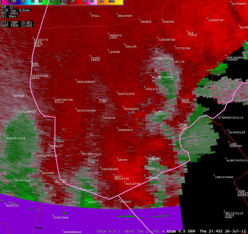
Fig. 9: Storm relative motion valid at 5:45 PM. |
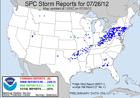
Beyond this, the bow echo and associated strong winds raced east through the remainder of the Binghamton forecast area with additional damage was reported. In total, 5 tornadoes occurred within the Binghamton forecast region. Below is an image of the storm reports for the duration of the event. Notice the high number of wind damage reports which is a direct result of the strong winds associated with the eastward moving bow echo structure.
 |
Please click on the buttons below to expand the suvery summaries
Tornado Confirmed Approximately 7 Miles South Southwest of Corning in Steuben County NY
Summary
The National Weather Service in Binghamton, NY has confirmed a tornado approximately 7 miles south southwest of Corning in Steuben county New York on July 26, 2012.
Touchdown occured near the intersection of Ryers Creek Road and River Road. Mainly tree damage. Tree also fell on house.
The image below is the approximate path of the tornado.
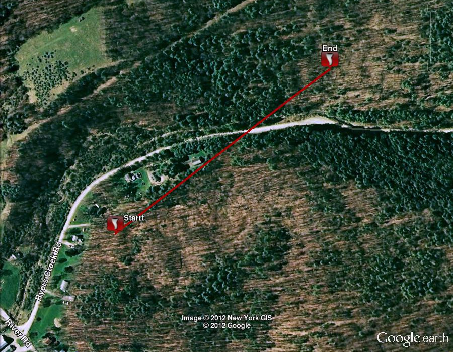
Watson/Nadolski
Tornado Confirmed near South Corning in Steuben County NY
Summary
The National Weather Service in Binghamton, NY has confirmed a tornado near South Corning in Steuben County New York on July 26, 2012.
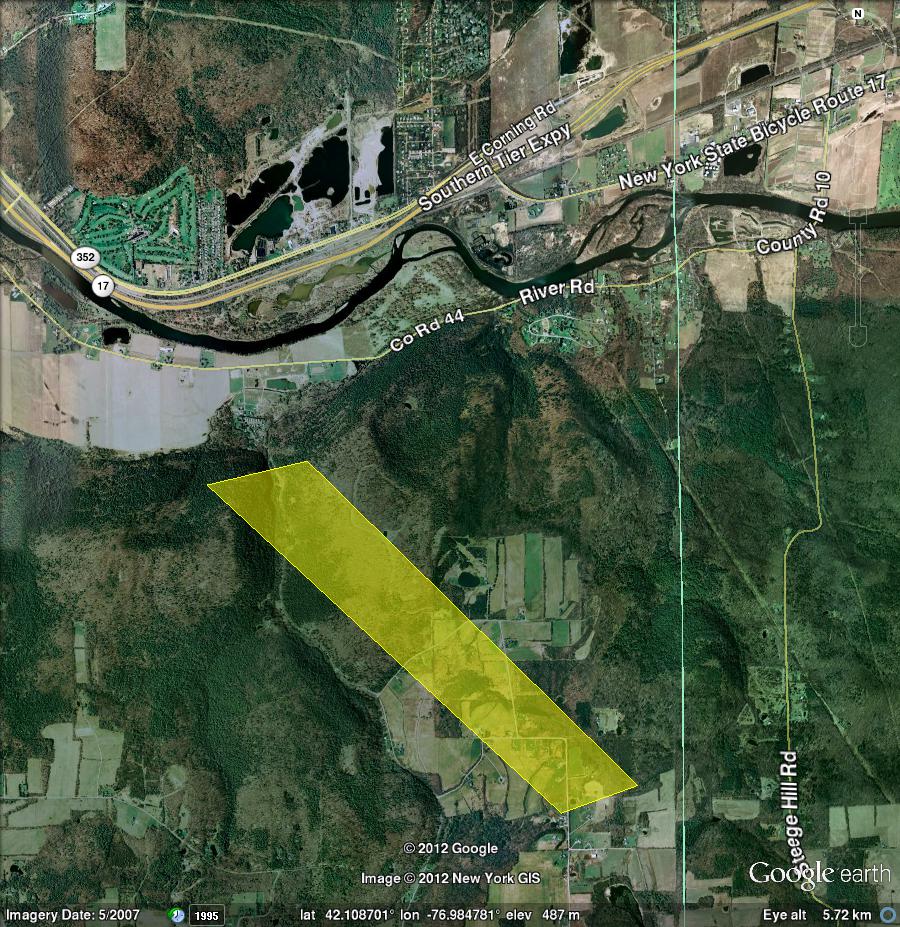
The tornado first touched down just south of county Route 44 in South Corning. Eyewitness reports indicated leaves and other debris being lifted in the air and twisted at this time. Minor tree and structural damage also occurred along county Route 44, including damage to the metal top of a barn silo.
The most significant damage occurred to the south of county Route 44, along Brown Hollow Road. A swath of damage, including approximately 200-300 trees, was observed. Trees were mangled, snapped off, and twisted in different directions. Winds appeared to maximize in this area, reaching speeds of 100-110 mph.
The damage path continued eastward, with more sporadic tree damage. The tornado damage path appeared to end just west of Murphy Road, still in South Corning.
Southeast of the tornado track, a separate damage path occurred, due to straight line winds. The most significant damage here was to the metal roof of a new barn, where portions of the roof were lifted off and lofted into several trees across the adjacent roadway (Stickler Road). Winds maximized around 75 mph at this location. No additional damage was observed farther to the east or southeast of this point.
The image below is the approximate path of the tornado.
The image below is the approximate area of the straight line wind damage.
Watson/Nadolski
Tornado Confirmed in Elmira in Chemung County NY
Summary
The National Weather Service in Binghamton, NY has confirmed a tornado in Elmira in Chemung County New York on July 26, 2012.
A tornado touched down west of Elmira near Miracle Lane off of Route 352. It traveled through west Elmira and into downtown Elmira along Church Street. The damage path widened while in downtown Elmira between Route 14 and Route 17. Then the tornado turned towards the southeast and traveled in a path near Jerusalem Hill Road. It lifted near the intersection of Jerusalem Hill Road and Monkey Run Road.
Damage included damage to power poles, snapped and uprooted trees, and damage to multiple structures.
The image below is the approximate path of the tornado.
Watson/Nadolski
Another Long Track Tornado Confirmed in the Southern Tier of NY From July 26, 2012
Summary
The National Weather Service in Binghamton, NY has confirmed a tornado path from near north Chemung in Chemung County through Lockwood to north of Barton in Tioga County, New York on July 26, 2012.
This tornado is a new touch down from the same storm that produced the tornadoes in south Corning and Elmira. This was another long track tornado with EF1 damage that moved up and down over ridges and across valleys for almost 14 miles. The first touch down was across Route 1 in north Chemung. The tornado moved east eventually moving through the town of Lockwood. East of Lockwood and similar to the Elmira tornado, the tornado takes a turn to the southeast doing heavy damage along Crandall Hill Road and down across Oak Hill Road ending just east of there and north of the town of Barton.
The majority of damage was to softwood and hardwood trees which were uprooted or snapped. Unlike the extensive straight-line wind damage found to the south of this track, this damage clearly had signs of circular motion in a very concentrated and narrow path. The damage path averaged about 200 yards wide. Some homes, garages and sheds were damaged by wind with trim or siding torn or shingles off roofs. Some homes had more significant damage from trees falling on them. One barn was completely destroyed.
BMW
Tornado Confirmed in the Town of Kirkwood in Broome County NY
Summary
The National Weather Service in Binghamton, NY has confirmed a tornado in the town of Kirkwood in Broome County New York on July, 26 2012.
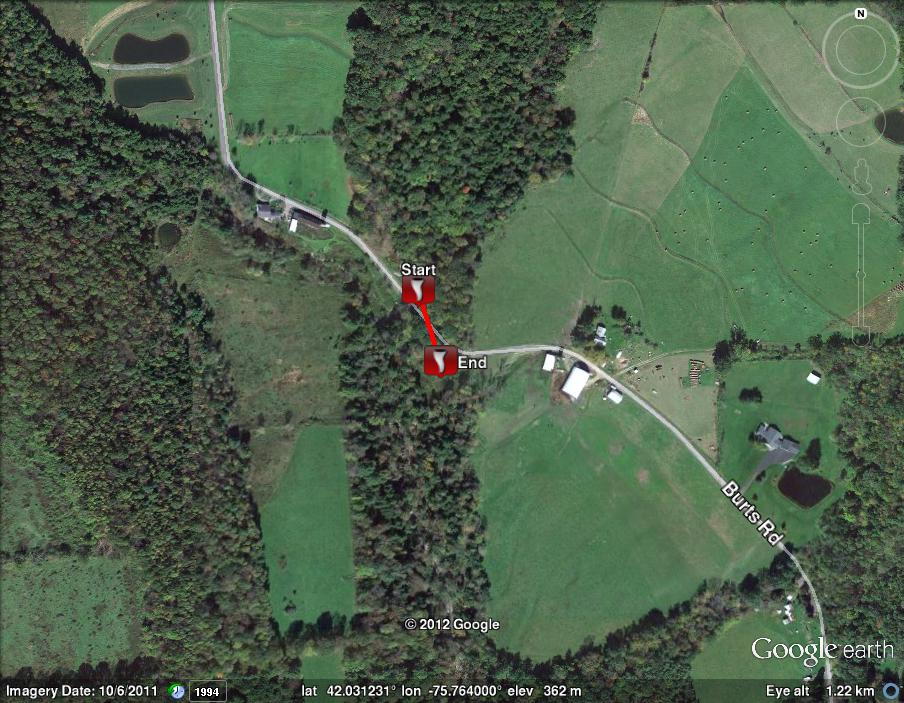
After a nearly continuous path of straight-line wind damage across southwestern and south-central Broome County, a National Weather Service storm survey team has confirmed a tornado touchdown just east of Interstate 81 in the town of Kirkwood. The tornado path began on Burts Road approximately 0.62 miles north-northwest of the Burts/Gorman Road intersection. At this location, multiple hard and softwood trees were snapped or uprooted. Many fallen trees were oriented in a convergent pattern which is consistent with tornadic damage. The tornado path continued in a south-southeast manner before lifting approximately 0.10 miles southeast of the initial touchdown location along Burts Road.
CMG/MN
The image below is the approximate path of the tornado.
The image below is the approximate path and width of the straight line winds.
Tornado Confirmed near Bridgewater Township in Susquehanna County PA
Summary
The National Weather Service in Binghamton, NY has confirmed a tornado near Bridgewater Township in Susquehanna county PA on July 26 2012.
This is an update to the preliminary report issued earlier of a tornado confirmed near Montrose Pennsylvania. This tornado actually occurred south of the village out in rural sections of Bridgewater Township. This is not a separate tornado event.
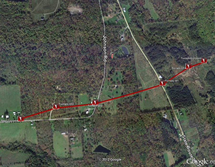
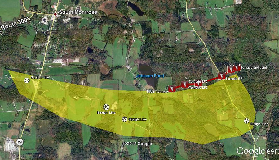
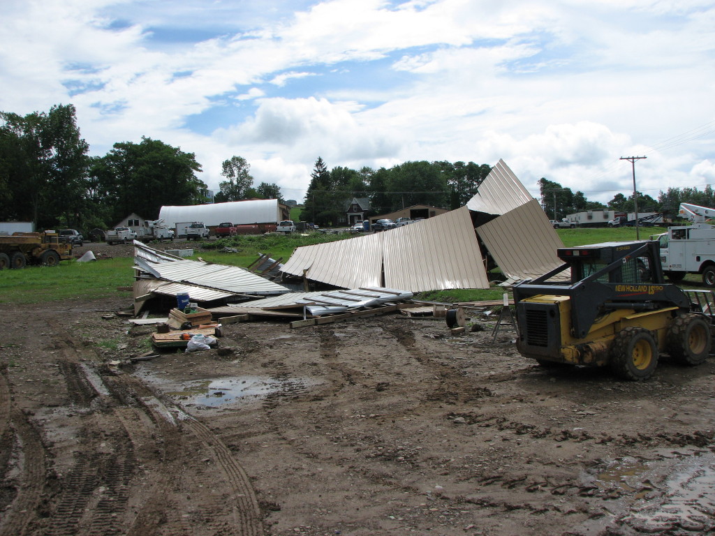
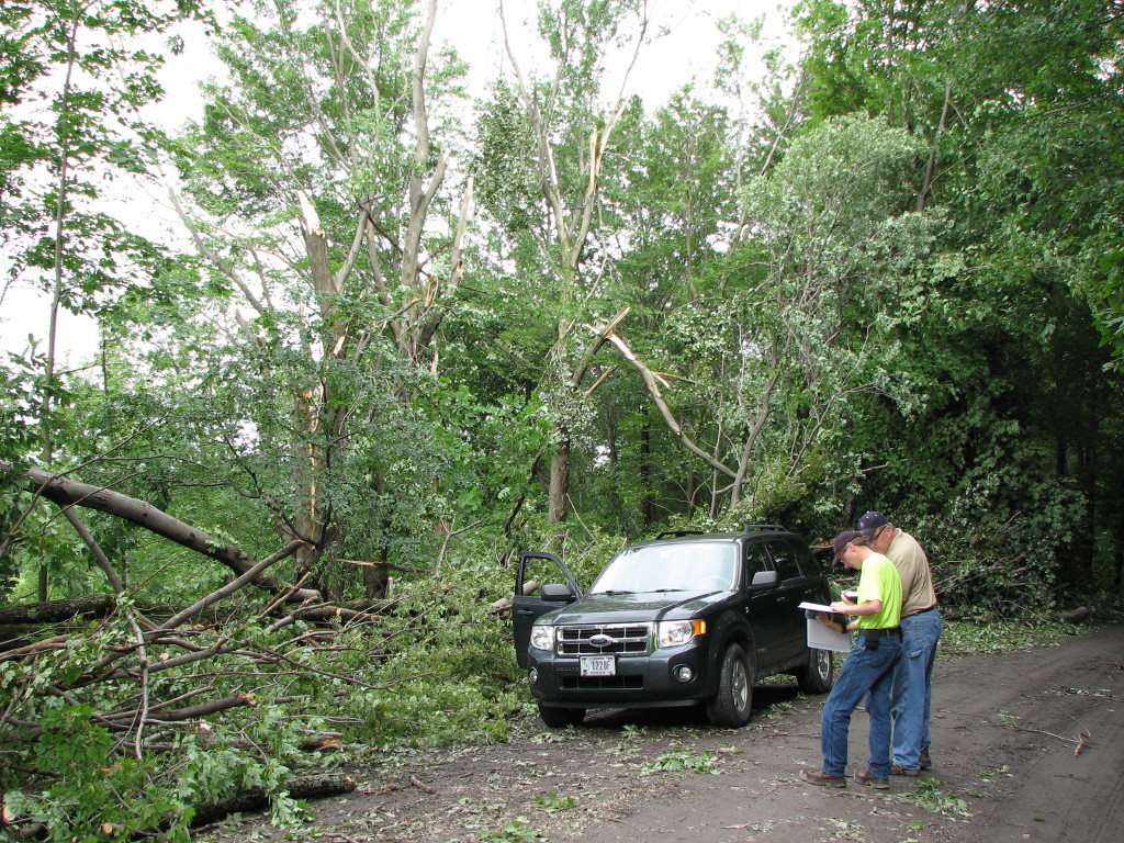
On the afternoon of july 26, 2012, a severe thunderstorm produced several areas of tree and minor structural damage to buildings along Davis Road in the township. As the storm tracked east, a tornado was formed and initially touched down around 5:00 PM EDT along Johnson Pond Road. Significant damage to softwoods and hardwoods was observed at two residences on this road with approximately 75 to 100 trees destroyed. The roof of a small, concrete block building was lifted off and tossed approximately 50-75 yards across the road and into a nearby field. The concrete block walls were pushed over. Minor shingle and siding damage was done to each of the residences. The tornado continued tracking east, and decended a hill toward Meshoppen Creek Road. A residence at the base of the hill experienced considerable structural damage from large trees falling into the building. Two sheds were destroyed by tornadic winds. The tornado then entered a field and grove of trees, causing a considerable amount of damage to several dozen trees. The tree damage was in a chopped up and chaotic appearance which is indicative of a tornado signature. The tornado lifted before climbing another ridge line to the east of Meshoppen Creek Road. The tornado traveled for approximately 0.8 miles and was between 75 and 150 yards wide. Maximum estimated winds were around 90 MPH which is classified as an ef1 on the Enhanced Fujita Scale.
The image below is the approximate path of the tornado.
The image below is the approximate path and width of the straight line winds.
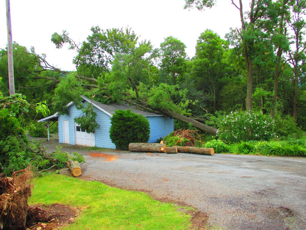
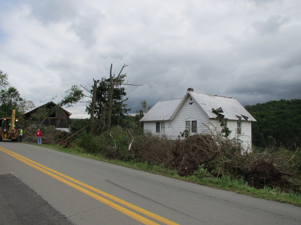
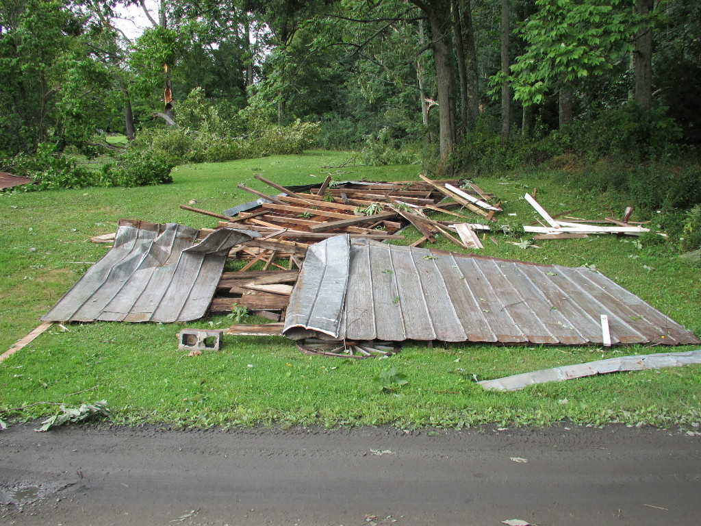
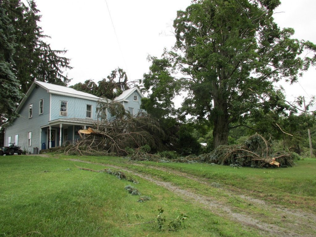
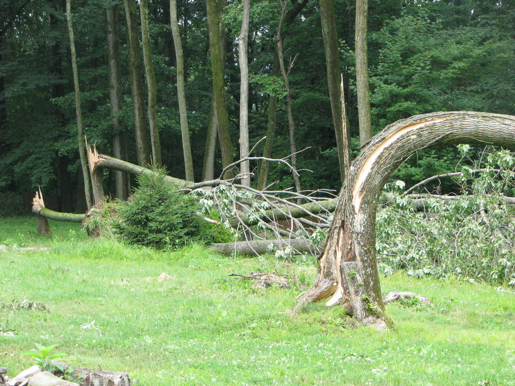
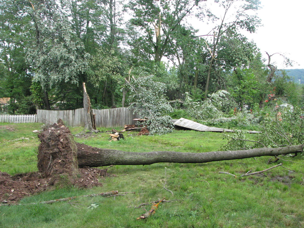
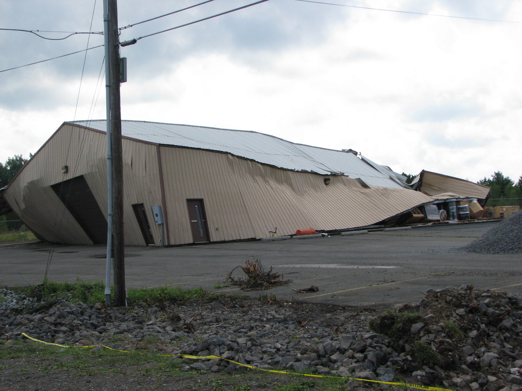
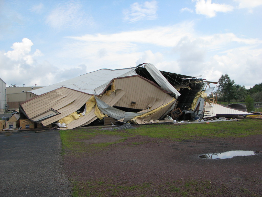
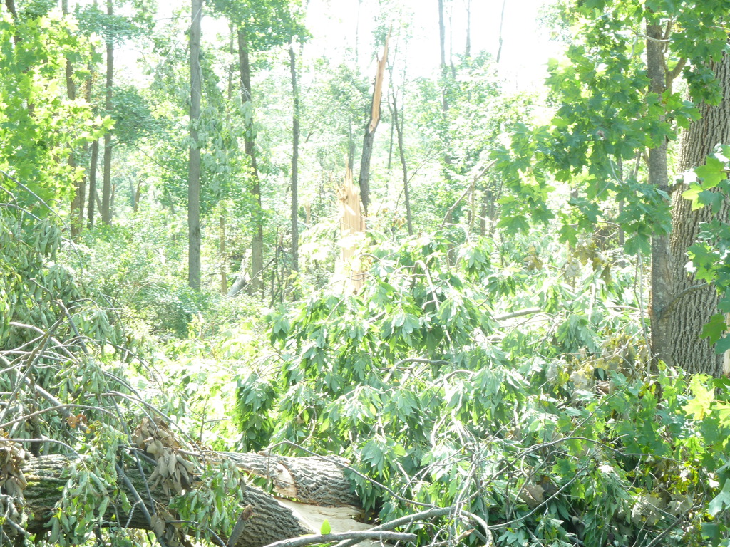
Damage Photos
Click on an image to see a large version
 |
 |
 |
 |
 |
 |
 |
||
Brewster
Tornado Confirmed in Foster Township in Luzerne County PA
Summary
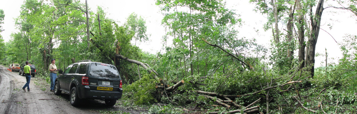
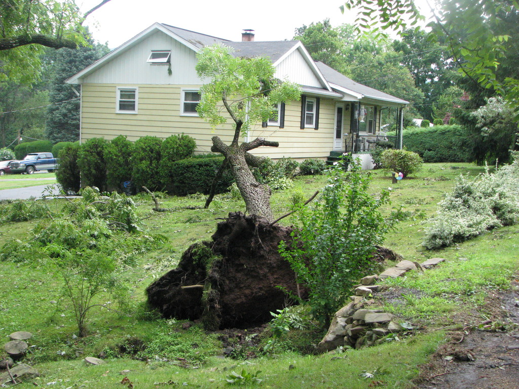
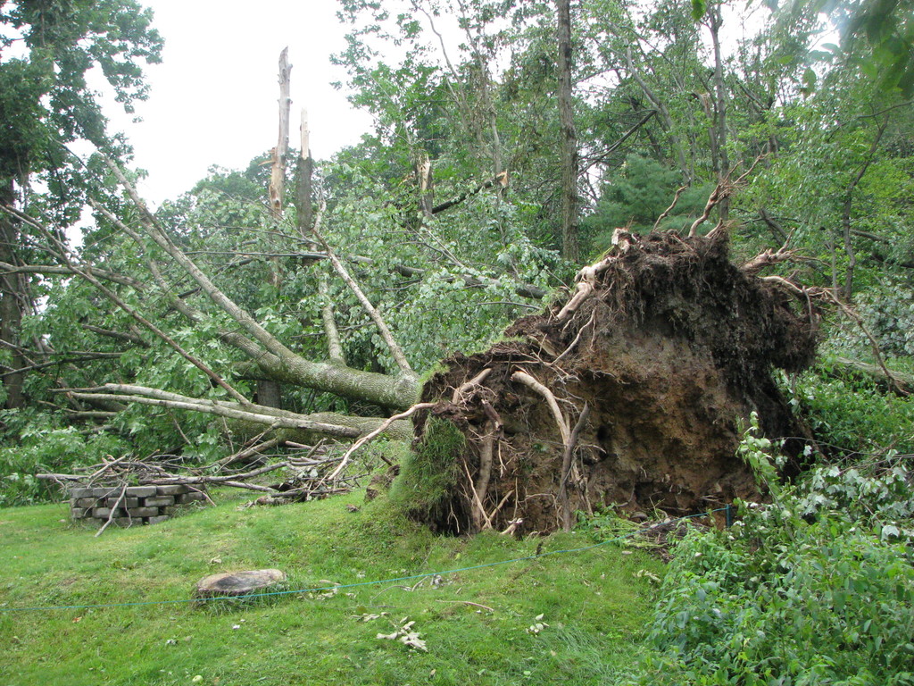
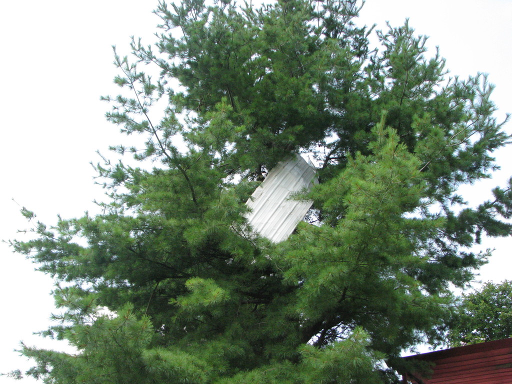
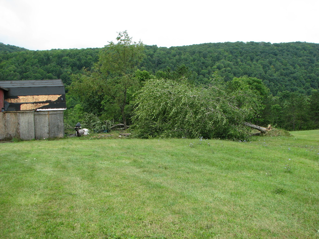
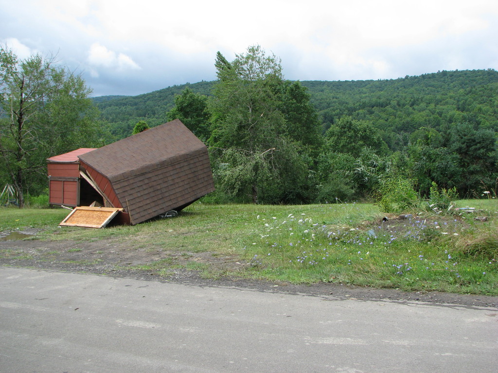
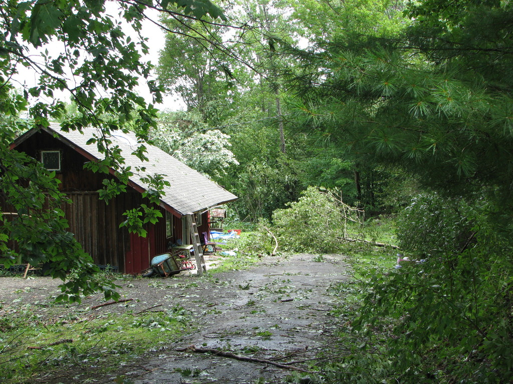
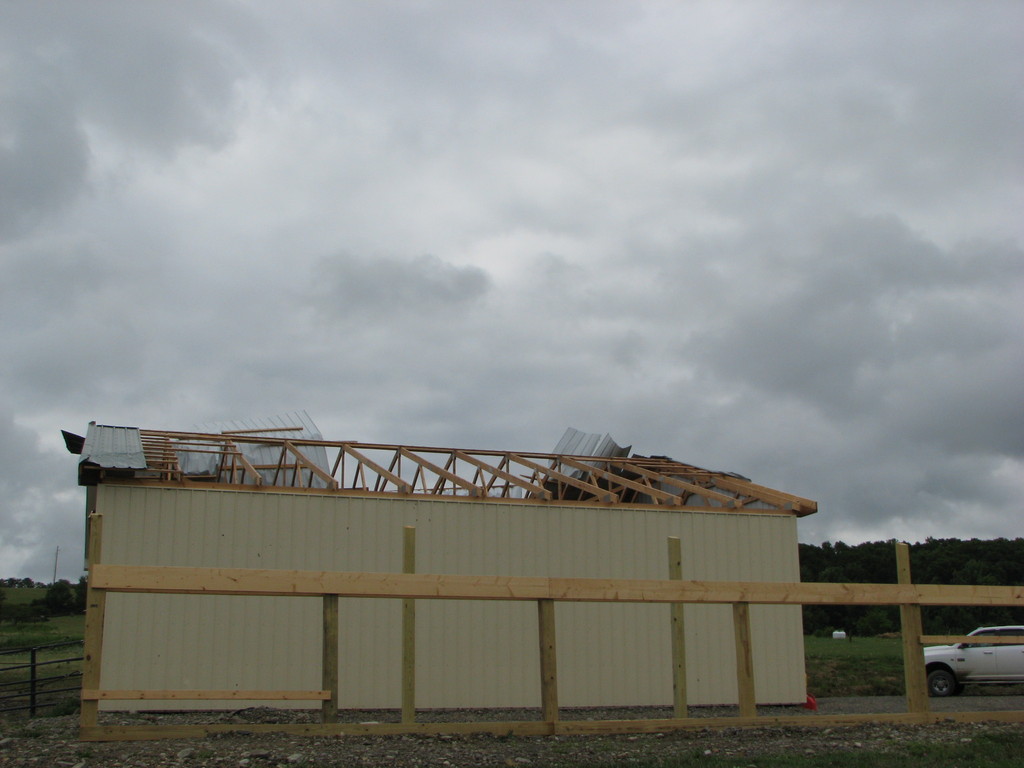
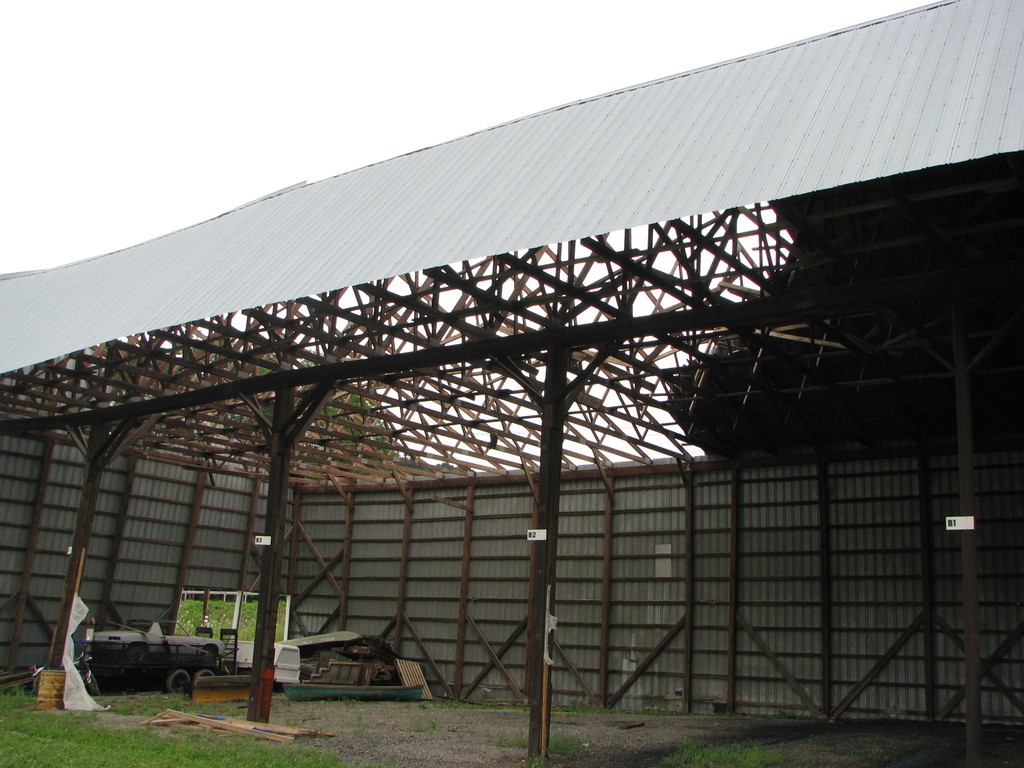
The National Weather Service in Binghamton, NY has confirmed a tornado near Foster Township in Luzerne County Pennsylvania on July 26, 2012. A supercell thunderstorm moved into southern Luzerne county at approximately 5:05 PM EDT from east-central Columbia county. As the storm entered the county, dopper radar indicated a tight cyclonic circulation contained within the storm's mid-levels. As the storm traveled east, numerous trees were downed or uprooted just south of Sybertsville in the township of Sugerloaf. Reports from local Emergency Management Officials indicate that all tree damage in this location was oriented in the same direction, consistent with straight line wind damage. As the storm traveled east, extensive tree damage occurred in Butler Township along east Foothills Drive, immediately east of Route 309. Again, downed trees were oriented all in the same direction, consistent with straight line wind damage with winds estimated between 90-100 mph. The storm then continued east where extensive damage occurred along main street just south of Freeland in western Foster Township. At this location, an outside storage building was destroyed. Debris from the building then traveled through the air and penetrated in several locations the roof of a 58 foot tall building. After hitting and destroying the building, additional damage occurred directly to the northeast where several trees were downed or uprooted. Downed trees were convergent in nature, consistent with a tornadic circulation moving over the area. Maximum estimated winds were between 95-100 mph which is classified as and EF-1 on the Enhanced Fujita Scale.
The image below is the approximate path of the tornado.
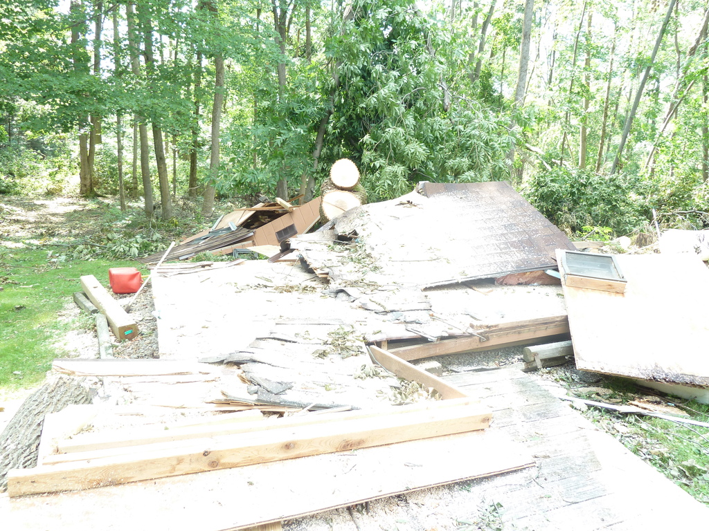
Damage Photos
Click on an image to see a large version
 |
 |
 |
 |
 |
 |
 |
 |
Gitro
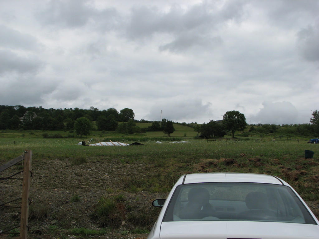
Microburst/straight Line Wind Damage near Barton in Tioga County NY
The National Weather Service in Binghamton, NY has confirmed a microburst/straight line wind damage near Barton in Rioga county New York on July 26, 2012.
Intense straight line or microburst winds from a thunderstorm struck just west of Route 34 about 4 miles north of the village of Waverly around 414 PM EDT. The high winds took part of the roof off an open pole barn near Route 34 and knocked down and snapped many trees and tree branches along its path to the east northeast toward north Barton. The winds were mainly between 60 and 80 mph, except on Madigan Road where maximum estimated winds were around 100 mph. Numerous large pine trees and a few hardwoods were snapped and a well constructed relatively new horse barn had its roof lifted off and thrown up to 150 yards downwind. The owner of the barn was inside the structure when the roof was lifted off and had both doors barred shut. The winds hit the barn on the side with no windows. It should be noted that the barn was made of metal siding as was the roof. The winds were strong enough to blow the doors out on the sides of the barn and tear the roof off, making it likely that winds were around 100 mph. The winds then continued up the hill to the east and weakened.
The total path length of the microburst wind damage was about 2.5 miles and the width of the damage was around 2 miles wide.
Damage Photos
Click on an image to see a large version
 |
 |
 |
 |
 |
 |
DJN
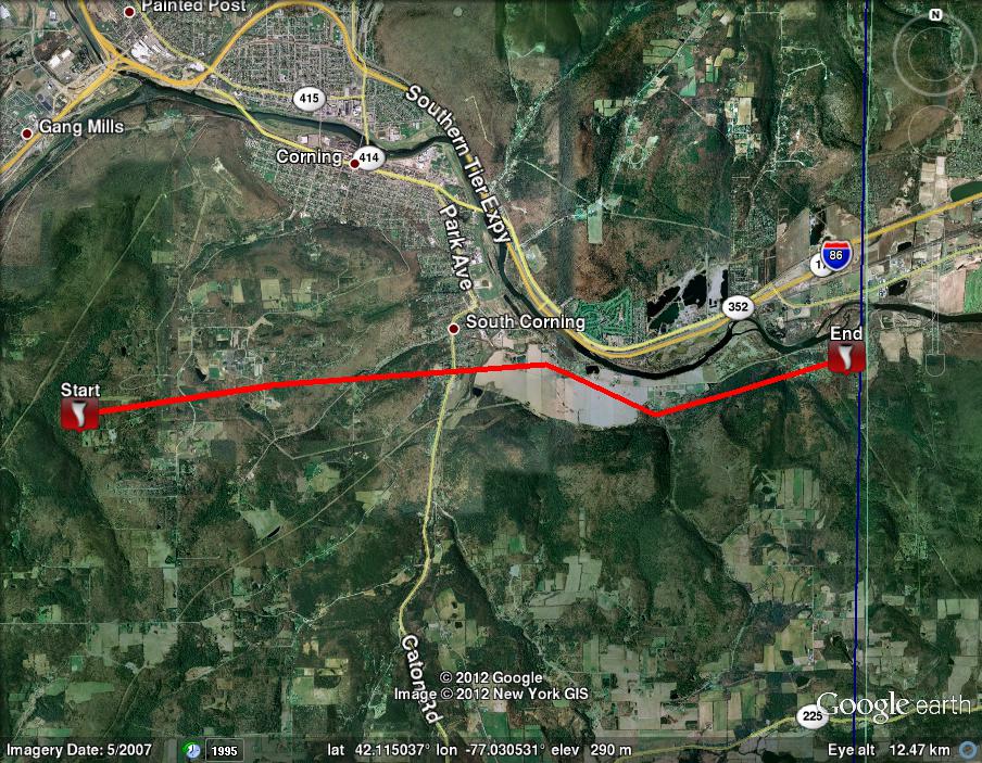
Macroburst/Straight Line Wind Damage confirmed in a Swath from Southern Steuben to Southern Chemung Counties in New York
Summary
The national weather service in Binghamton, NY has confirmed a Macroburst/Straight line wind damage/near south of Corning to south of Elmira in Steuben and Chemung county New York on July 26, 2012.
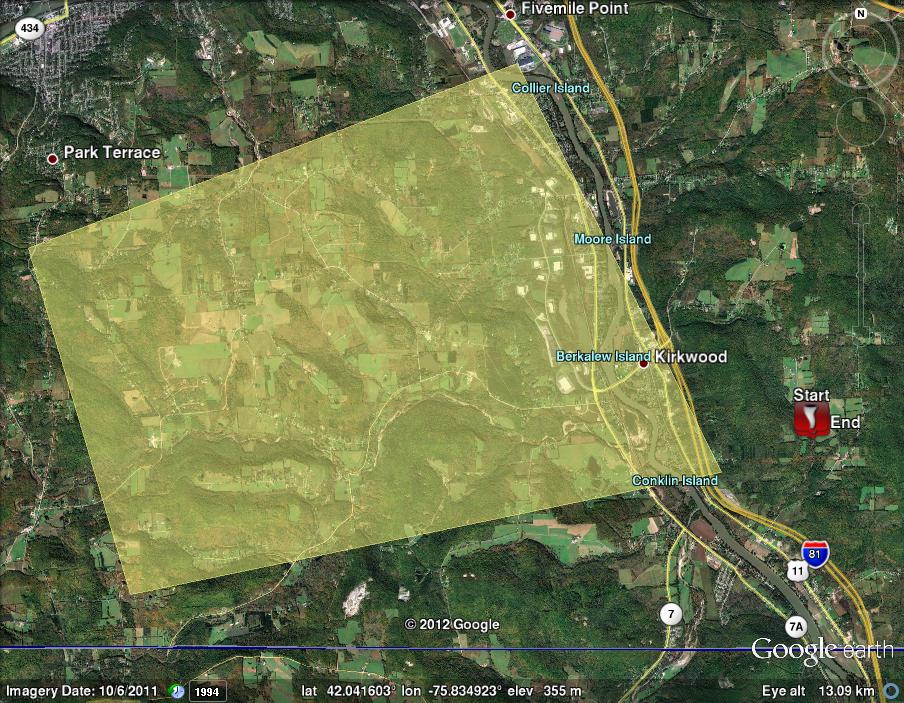
A National Weather Service team surveyed a wide swath of straight-line wind damage that occurred with a Macroburst associated with a line of thunderstorms that moved across southern Steuben and southern Chemung counties from 335 to 405 PM EDT on Thursday, July 26th, 2012.
Watson
Microburst/Straight Line Wind Damage/Confirmed near Harford in Susquehanna County PA
Summary
The National Weather Service in Binghamton, NY has confirmed a Microburst/Straight Line wind damage near Harford in Susquehanna County Pennsylvania on July 26 2012.
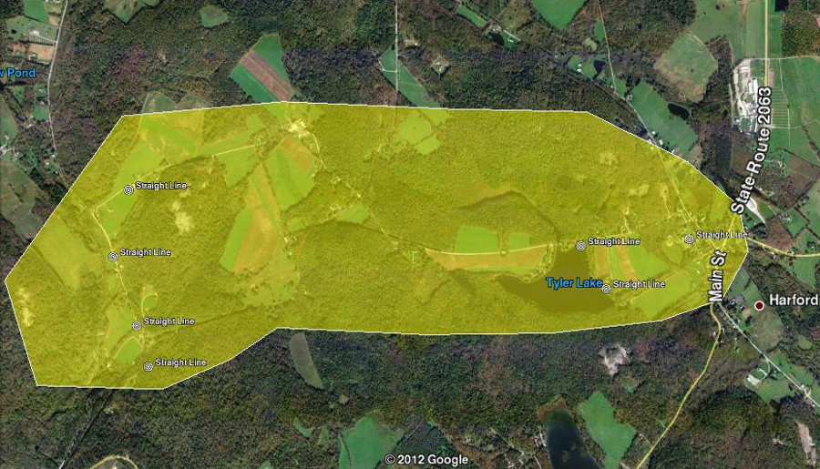
A severe thunderstorm tracked across south central Susquehanna County on the afternoon of Thursday July 26, 2012. Strong winds produced damage near Harford, PA beginning with several areas of uprooted and snapped trees along Grinnell and Miller roads. A piece of metal roofing from a silo was torn off and sent through the window of a nearby residence. Damage then continued along Tyler Lake where dozens of trees were uprooted and toppled onto cottages on the eastern shore of the lake. A porch roof was torn off one of the buildings. From the damage observed, the winds accelerated to the maximum estimated speed of 80 mph while crossing the lake. Additional damage to trees and buildings was noted in the village of Harford. A chimney was toppled off one of the structures, otherwise damage was mostly caused by trees falling onto homes.
In general,the damage pattern was oriented in a west to east fashion which is consistent with straight line winds from a Microburst. Estimated wind speeds associated with this storm were 60 to 80 mph.
The image below is the approximate path and width of the straight line winds.
Brewster
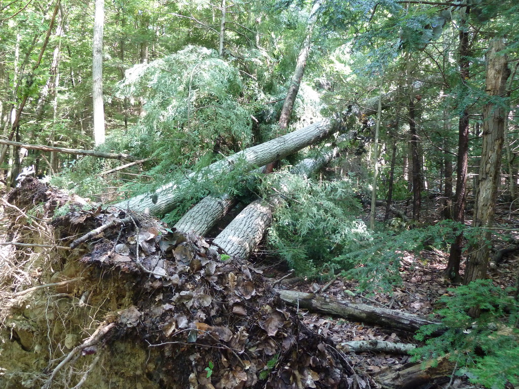
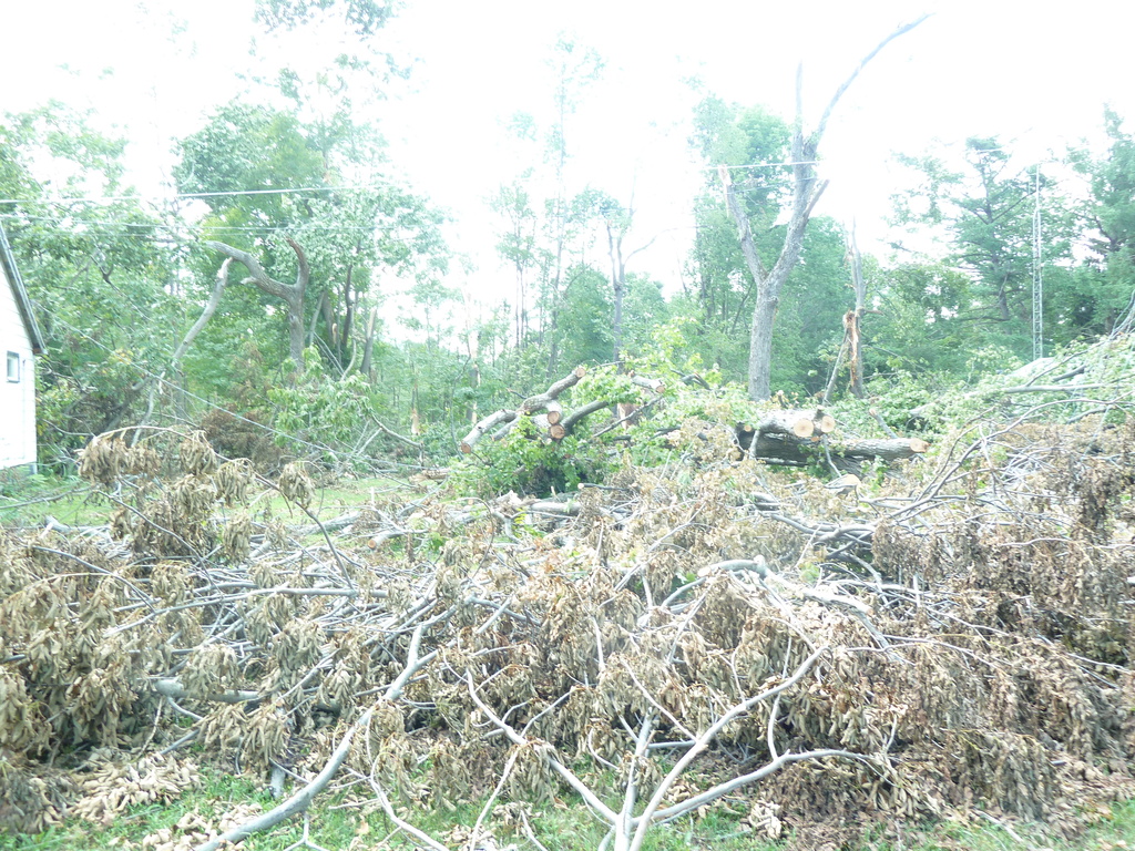
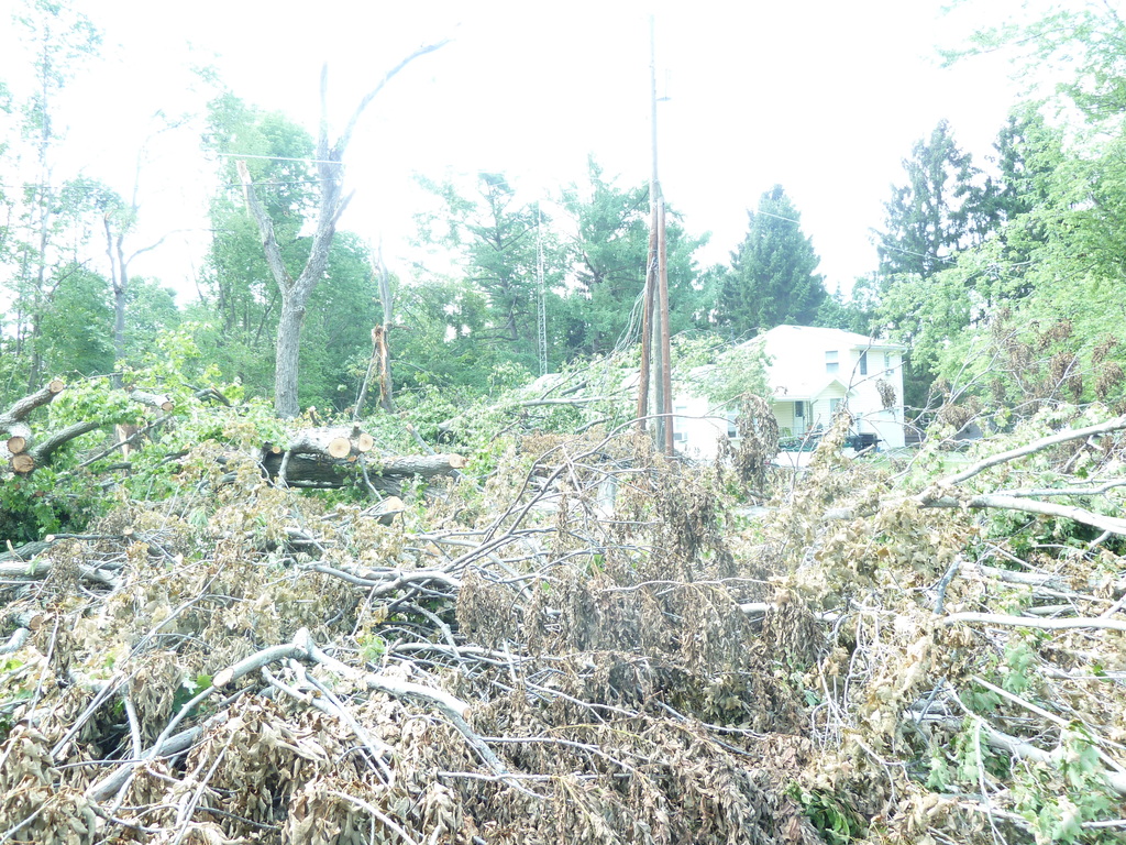
Microburst/Straight Line Wind Damage Confirmed near Orwell in Bradford County PA
Summary
The National Weather Service in Binghamton, NY has confirmed a microburst/straight line wind damage near Orwell in Bradford county Pennsylvania on July 26, 2012.
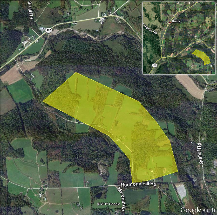
A path of straight line wind damage began, going up a hillside in Orwell Township, along and just north of Raglan Road. The most significant damage occurred near the northern edge of the damage path, within a logging area. Approximately 600 trees were impacted, many of them healthy hardwoods that were either snapped off or uprooted. Winds appeared to maximize in this area, reaching speeds of 100 to 110 mph.
As the microburst continued east southeastward, damage became more sporadic in nature, consisting primarily of occasional tree snaps and uproots, as well as downed limbs. The damage path appeared to end just northeast of where Raglan Road intersects with Harmony Hill Road, still in Orwell Township.
The image below is the approximate path and width of the straight line winds.
Damage Photos
Click on an image to see a large version
 |
 |
 |
 |
 |
 |
MJ/MJN
For reference:

