 Two waves of strong to severe thunderstorms moved across parts of New York on June 17-18, 2014. Isolated strong to severe storms occurred during the afternoon hours. As these storms dissipated, numerous storms formed and moved from lower Ontario Canada and swept across most of central New York/northeast Pennsylvania during the evening Tuesday and into the earlier morning hours Wedensday.
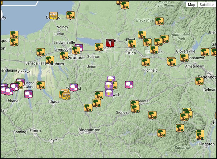
The storms generated numerous severe weather reports across New York . Click on the image to the right for a larger view.
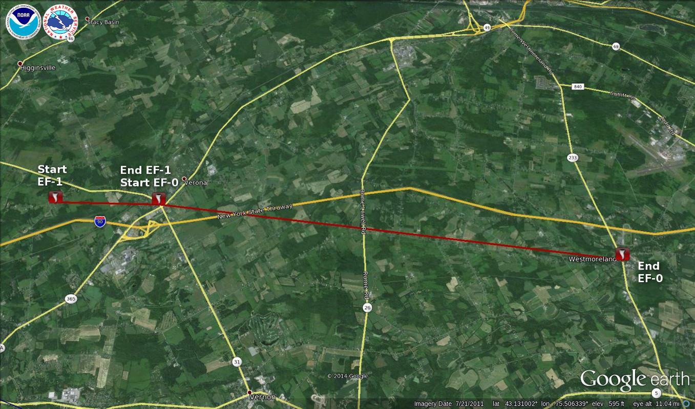
Survey of the EF-1 Tornado Verona, NY
A storm survey team examined a concentrated path of damage beginning on sand hill road near Route 31 west of Verona moving east across west main street and through the intersection of Route 31 and 365. Winds through this area were estimated at 80 to 100 mph consistent with an EF-1 tornado. Considerable damage occurred to trees in the area. Several homes and buildings were damaged with shingles and trim pulled off and some siding. Several sheds and a barn were destroyed. Signs and fencing were taken out.
A convergent debris pattern was determined with clear signs of inflow into the tornado center at a few locations. Heavy objects were thrown to the left of the main path with light objects carried and scattered in all directions. With a couple sheds destroyed. Path was long and narrow with a chaotic chopped up pattern.
 East of Verona the tornado weakened to EF-0 moving across the I-90 thruway and continuing in an easterly direction all the way to Westmoreland. Damage along this portion of the path was snapped and uprooted trees but in a more inconsistent and spotty pattern as the winds fluctuated. Still, damage Was along a distinctive narrow path and trees were slightly angled to the left of the track.
Scattered straight-line wind damage to trees was found west of sand hill road in Verona leading up to where the tornado began.
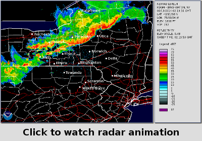
Click on the radar image to view a radar animation of the storms via our YouTube channel.
Map showing the approximate path of the Verona, NY tornado. Click for a larger view.
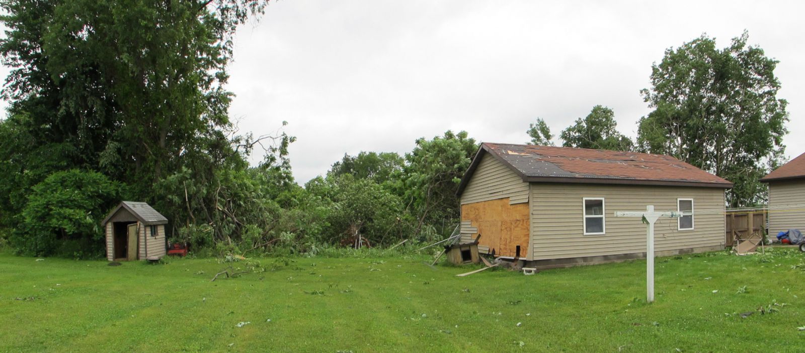
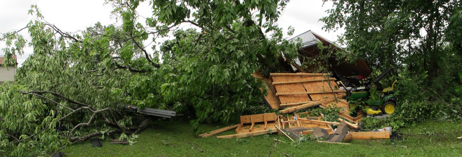
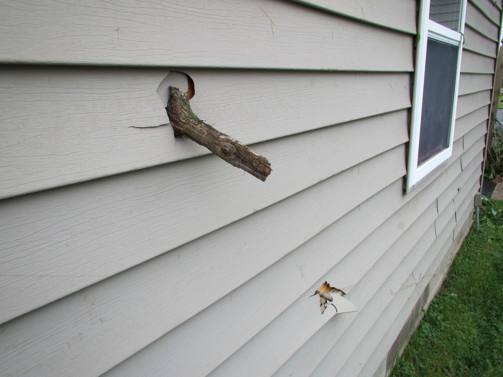
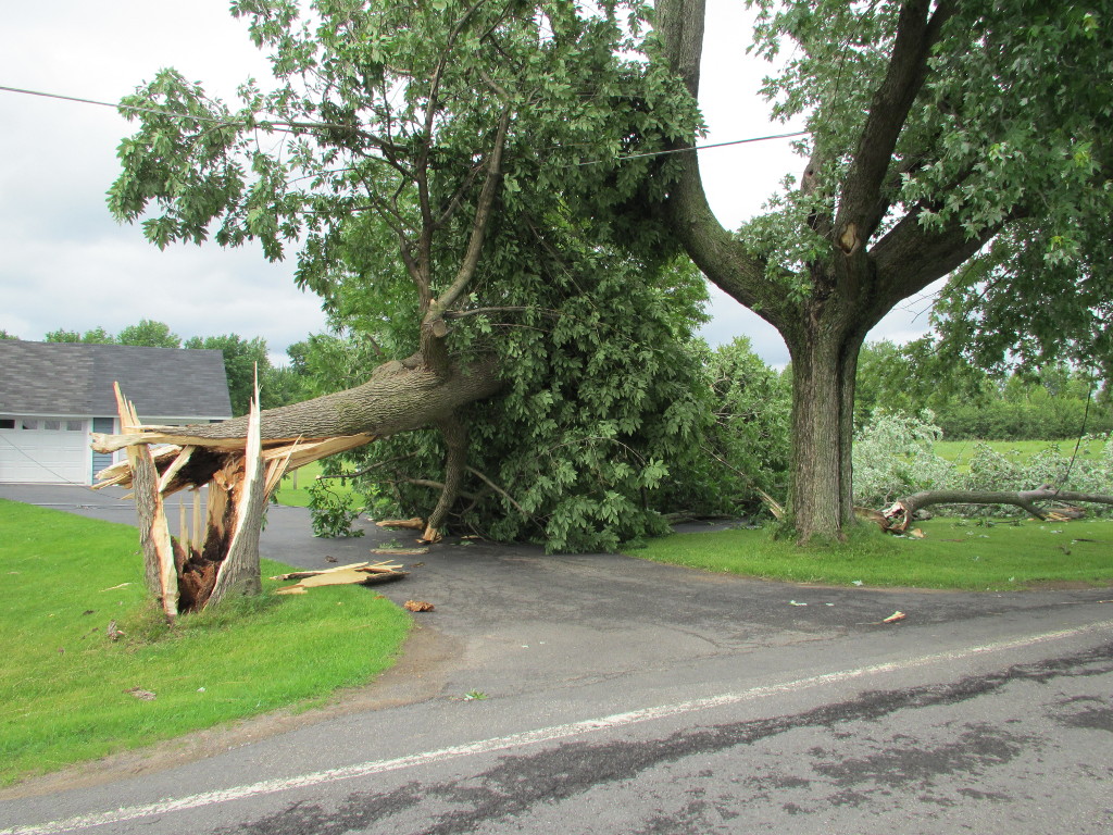
Damage Photos
Below show some of the damage in the Verona, NY area. Click on image for a larger view.
|
Garage and tree damage. |
Shed and tree damage. |
Garage wall impaled by branches. |
|
Leaning garage. |
Tree over driveway. |
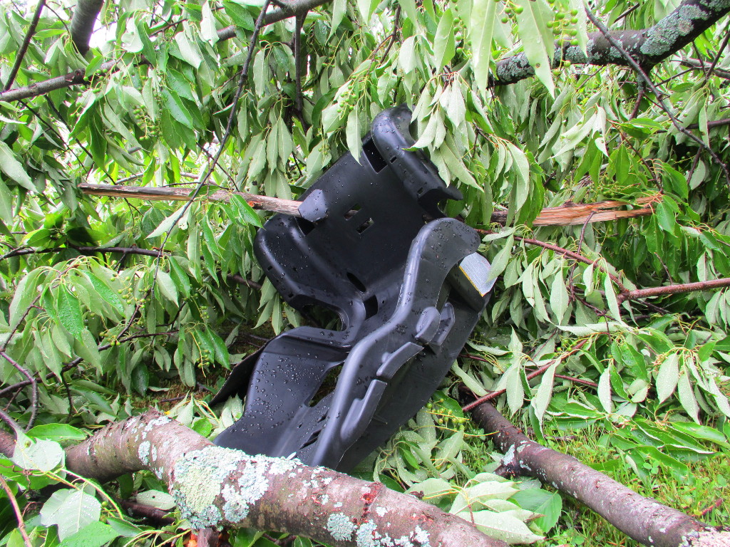
Car seat impaled by branch. |
More images can be found on our Facebook page.
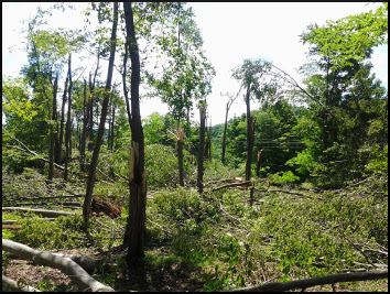
The National Weather Service in Binghamton, NY has confirmed a microburst/straight line wind damage near Hamden in Delaware County New York on June 18, 2014.
A line of thunderstorms produced a microburst that extended from the town of Hamden, NY east to a few miles southeast of Delhi. The damage first appeared on Munn Road in the town of Hamden and continued east for about 9 miles close to Route 28 south of Delhi where it ended on Glen Burnie Road. The damage was confined to trees where in a few locations there were numerous trees uprooted and/or snapped. Most of the tree damage was to softwoods like pines, spruce, cherry and red maple. The hardest hit areas were along Gray Road, Munn Road and Ridge Road in the town of Hamden. In this general area maximum winds were estimated up to 90 mph. The rest of this area had winds between 60 and 70 mph. For reference: A microburst is a convective downdraft with an affected outflow area of less than 2 1/2 miles wide and peak winds lasting less than 5 minutes. Microbursts may induce dangerous horizontal/vertical wind shears, which can adversely affect aircraft performance and cause property damage. Straight-line winds are generally any wind that is not associated with rotation, used mainly to differentiate them from tornadic winds. |
 |
Additional Information: