More information will be posted tomorrow.
Microburst/Straight Line Wind Damage confirmed near Norwich in Chenango County New York
The information in this statement is preliminary and subject to change pending final review of the event(s) and publication in NWS Storm Data.
Summary
A large squall line of severe thunderstorms moved across the whole area Monday evening, including Chenango County between 800 PM and 830 PM. The storms caused sporadic damage through much of the area, from Chenango County into Otsego County, but a powerful microburst was contained within the line. It struck around 818 PM near the City of Norwich Reservoir along Route 23. 90 to 100 mph winds accelerated up the valley, and then snapped or uprooted approximately 100 healthy trees on the east side of the reservoir.
For reference:
This map shows the general swath of concentrated damage and where the storm surveys were conducted in Chenango county. Note that there were numerous reports of trees and powerlines down, structure damage and some flooding due to heavy rainfall.
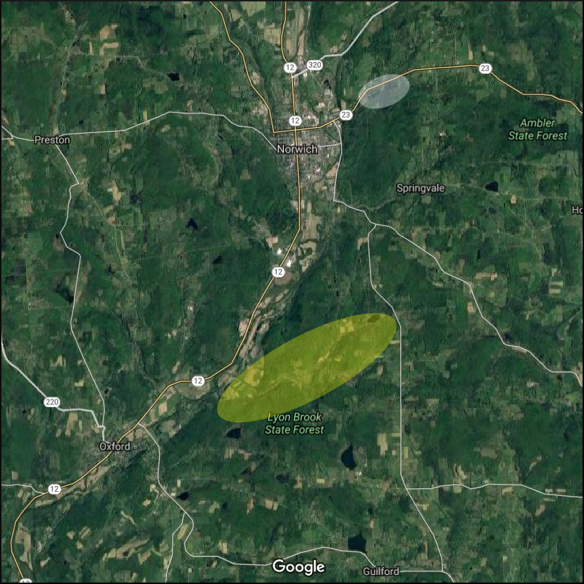
Microburst/Straight Line Wind Damage confirmed near Oxford in Chenango County New York
The information in this statement is preliminary and subject to change pending final review of the event(s) and publication in NWS Storm Data.
Summary
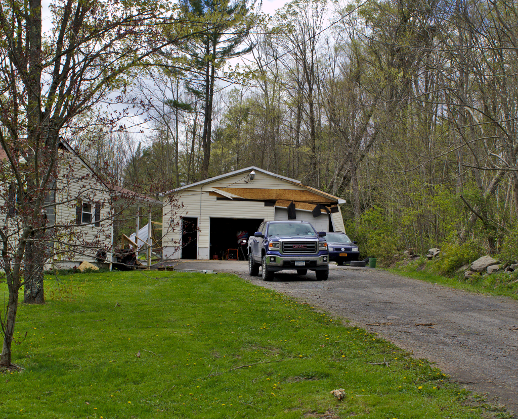
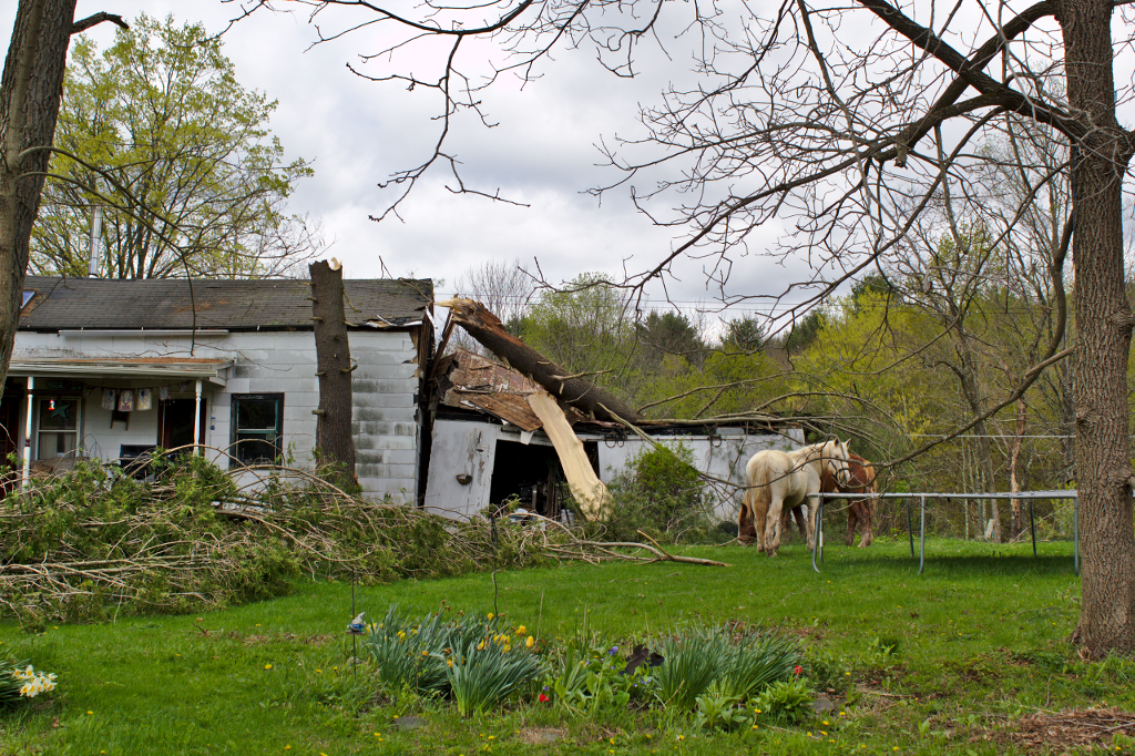
The National Weather Service surveyed an area of storm damage over Chenango county on Wednesday, May 3rd. Sporadic damage to trees was found near Oxford, NY. The damage became more concentrated along Lyon Brook Road northeast of Oxford. Numerous trees were uprooted and snapped along Lyon Brook Road and Pratt Road. The tree damage pattern within the concentrated damage area indicated either straigh-line winds, or winds that were fanning slightly outward down the path of the storm, indicating a microburst or a series of microbursts as opposed to a tornado. Structural damage included a large tree destroying a garage on Lyon Brook Road, and a peeled roof and a large tree on a house along Pratt road.
For reference:
This map shows the general swath of concentrated damage in Chenango county. Note that there were numerous reports of trees and powerlines down, structure damage and some flooding due to heavy rainfall.
National radar loop from 04/27/2017 09:18 PM EDT to 05/02/2017 07:58 PM EDT. This shows an upper storm system moving from the central parts of the country across the great lakes region and into Canada.
This is a base reflectivity and velocity radar loop from the National Weather Service radar Binghamton, NY. Base reflectivity is shown during the first half and then velocity. This shows a line of thunderstorms moving across parts of central NY and northeast PA from 05/01/2017 04:29 PM EDT to 05/02/2017 12:18 AM EDT. There were numerous reports of trees and powerlines down, structure damage and some flooding due to heavy rainfall.
Here are some pictures taken during the storm surveys. Click on the pictures for a larger view.
|
Tree on road. |
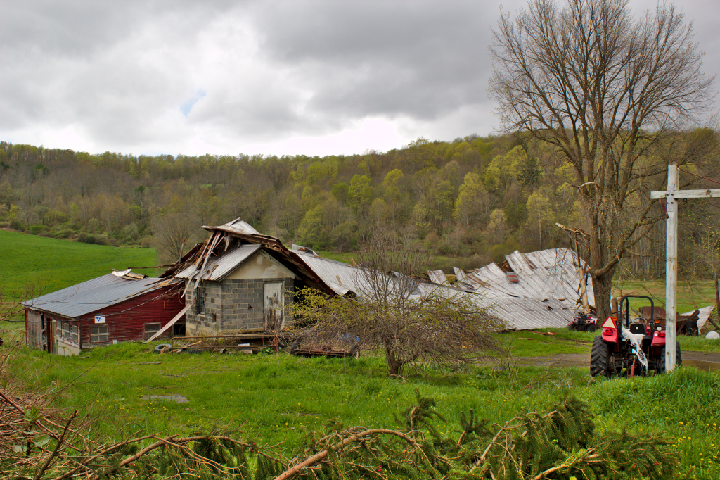
Roof peeled on barn. |
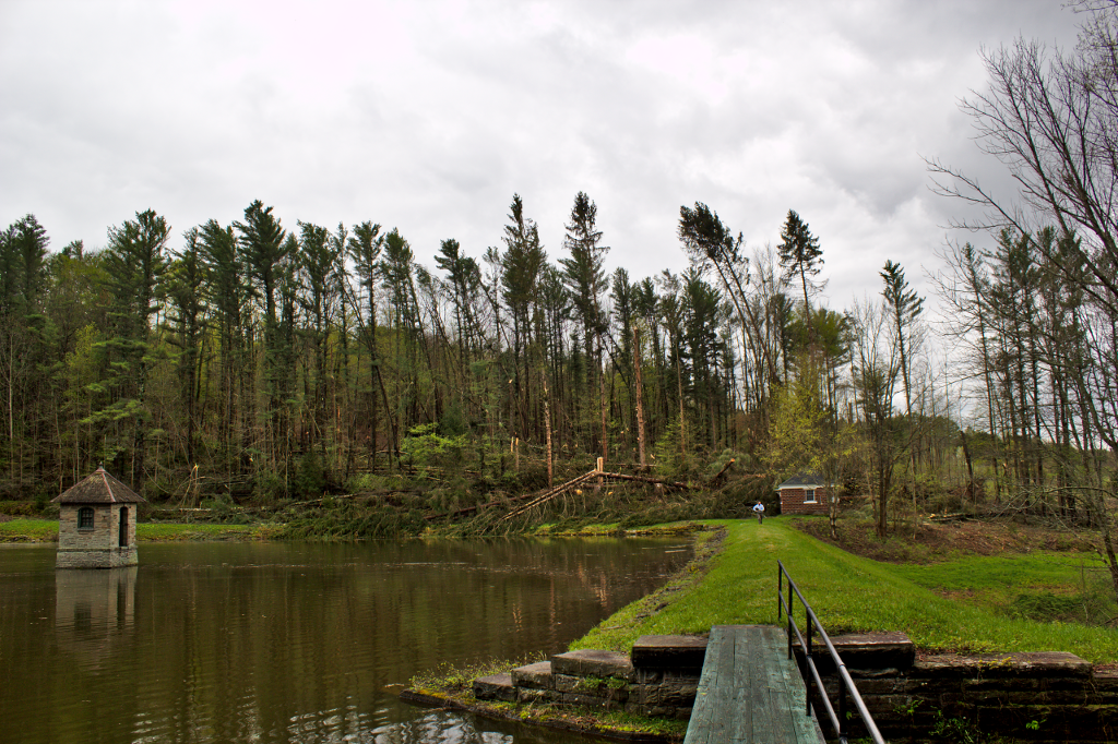
Trees down Norwich reservoir. |
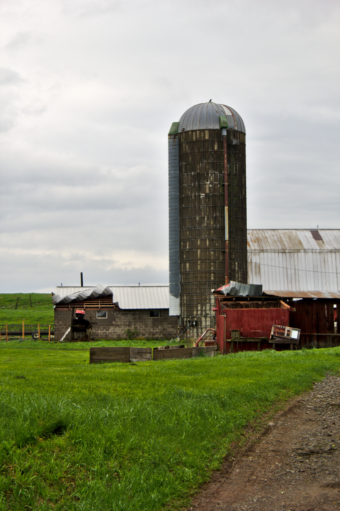
Barn damaged South New Berlin area. |
|
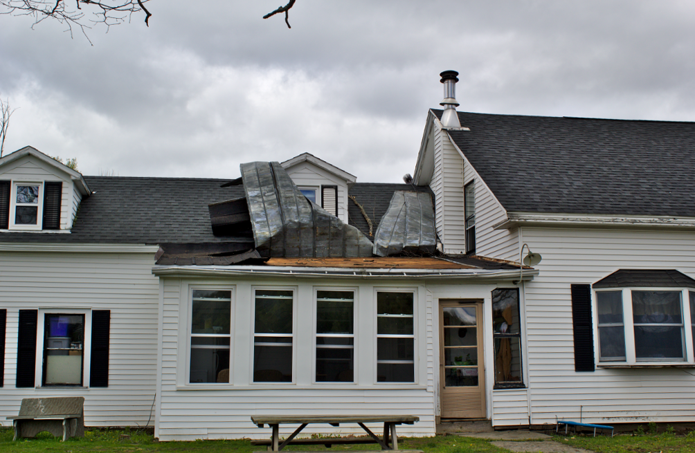
Peeled roof on house northeast of Oxford, NY |
Damage to a garage near Oxford, NY |
Large pine tree on house near Oxford, NY |
Forecaster Mark Pellerito conducting an interview in South New Berlin. He did a total of 4 interviews during the storm survey. |