This information is preliminary and subject to change pending final review of the events and publication in NWS Storm Data.
Caanan Township, PA Tornado

Summary
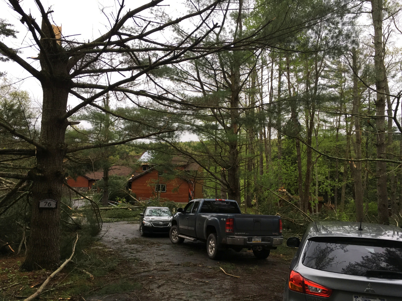
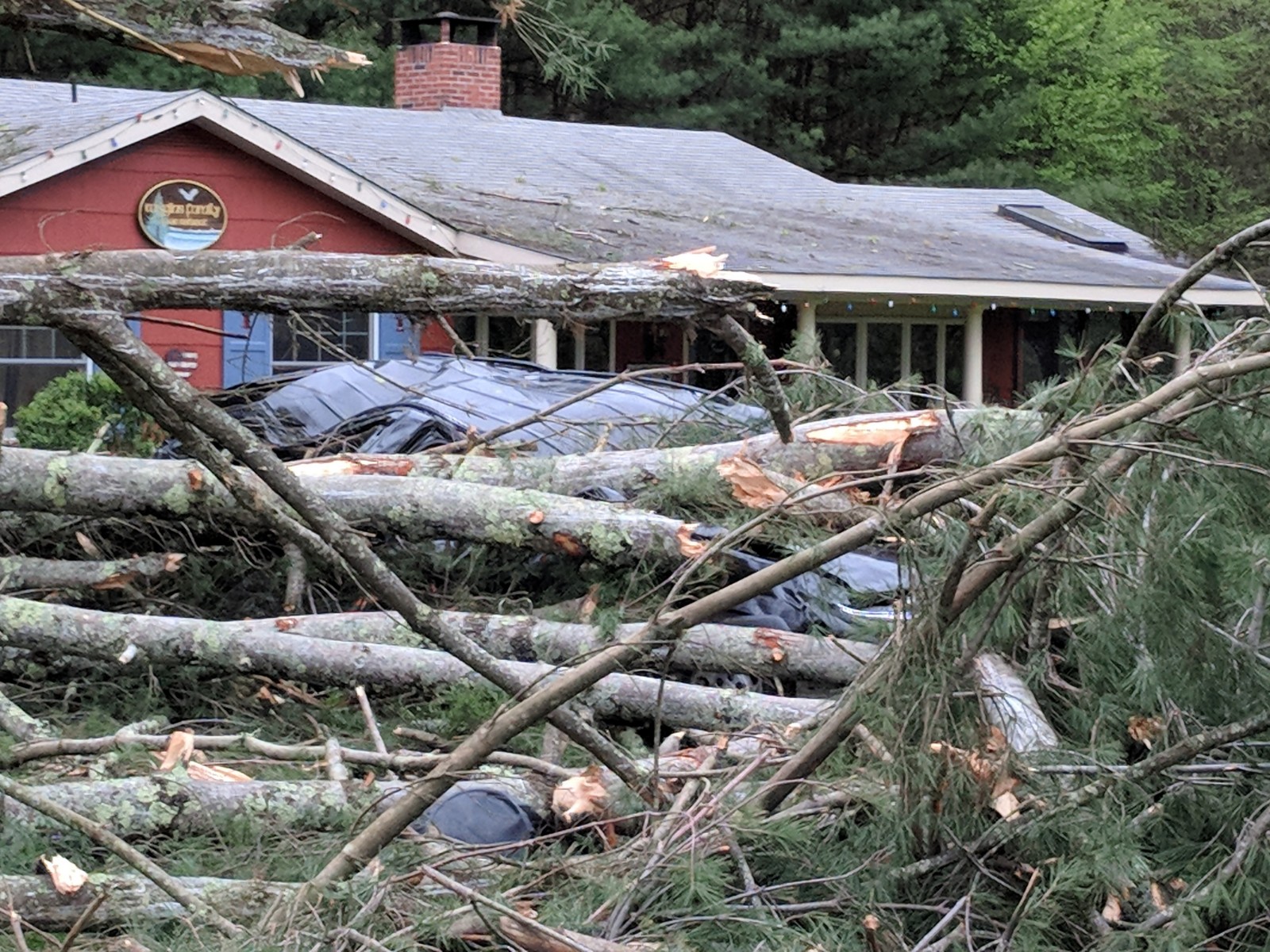
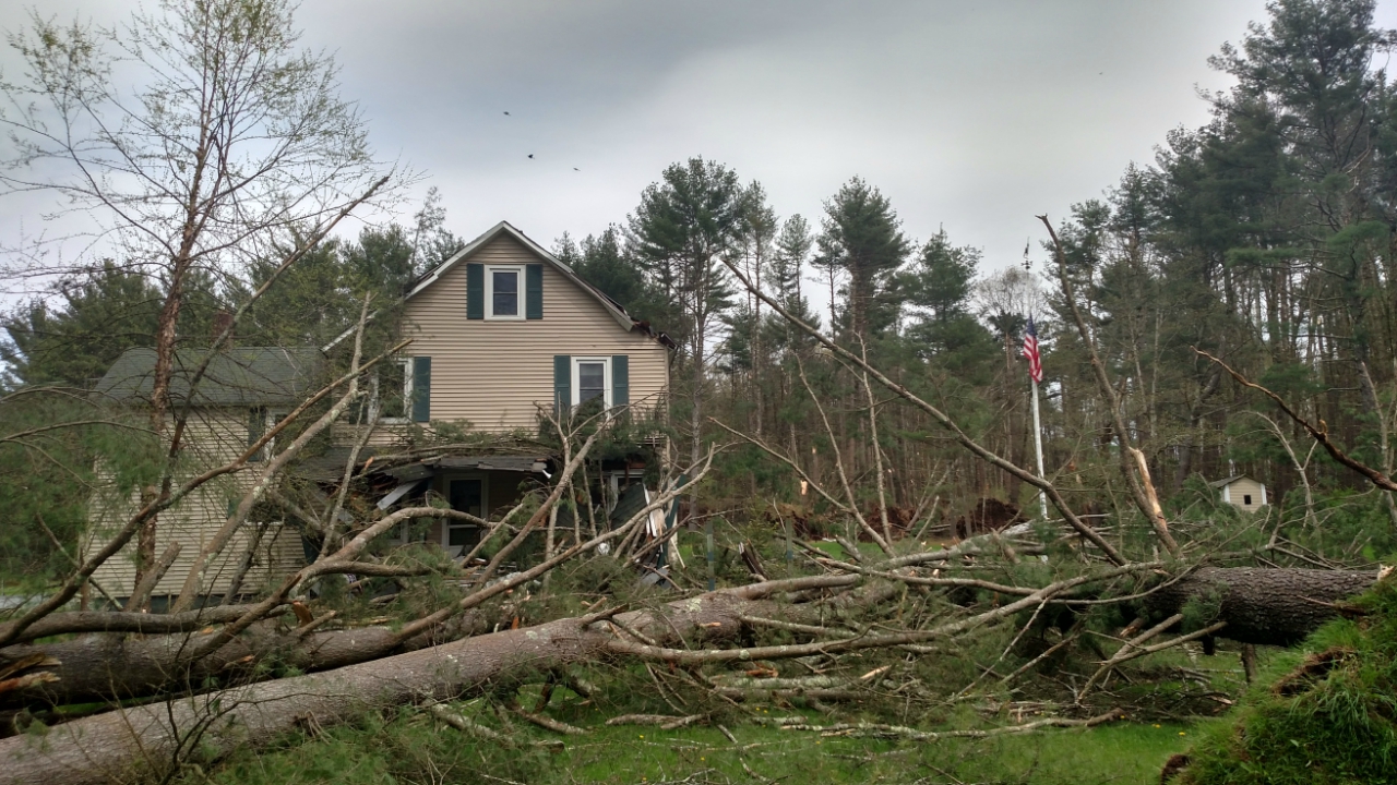
A weak tornado touched down on the eastern shore of Keen Lake, approximately 120 yards from the coastline. Most of the damage observed with the tornado was noted near the touchdown point, where several (mostly) pine trees were snapped and uprooted. Damage to homes in the area was also noted, as well as the loss of gutters and mesh screening for porches. Minor roof damage was also seen, as trees were snapped along the path. A weakly convergent path, and sporadic tree damage, continued along the tornado`s path before lifting in an open field just under one-quarter of a mile east-southeast of its touchdown point.
Wayne County Microburst #1
Summary
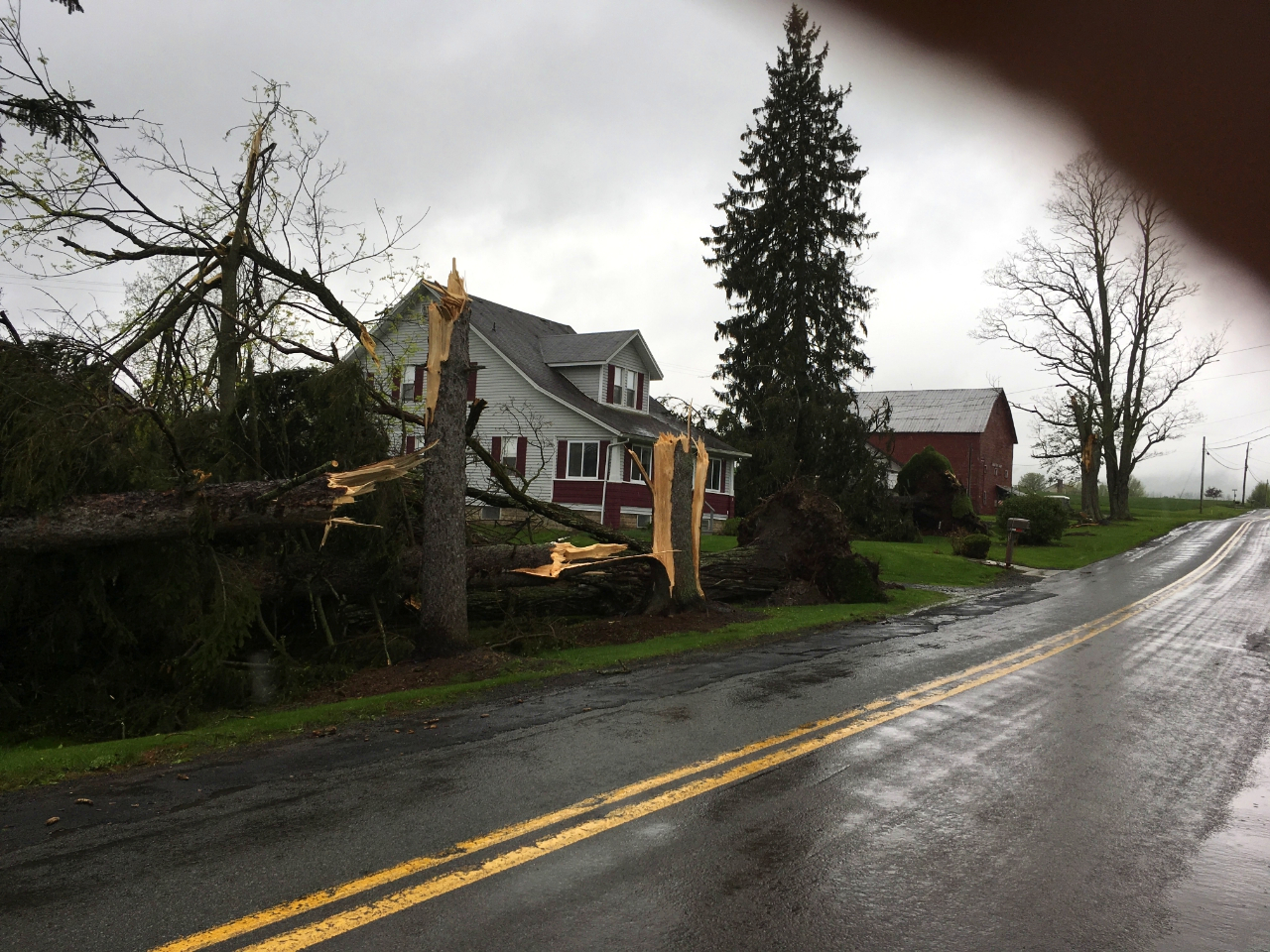
A line of severe thunderstorms produced a damaging wind event across much of Central Wayne County, Pennsylvania. Damage was first noted just northwest of Waymart, where several large branches were observed to have snapped in a thicket of mixed hardwood/softwood trees. Trees continued to be either uprooted or snapped as the line continued moving eastward, with at least sporadic tree damage noted in a one mile wide swath along the damage path. Damage to barns was noted, with at least one poorly attached structure shifted in its entirety on its foundation. Power poles were snapped, with additional damage done to the roof and/or facade of several buildings. After producing damage at Prompton State Park, the Honesdale Golf Club lost 30 trees during the storm. However, the most significant damage was noted at a cemetery in Honesdale, where nearly 75 trees were estimated to have been lost near the end of the microburst.
Wayne County Microburst #2
Summary
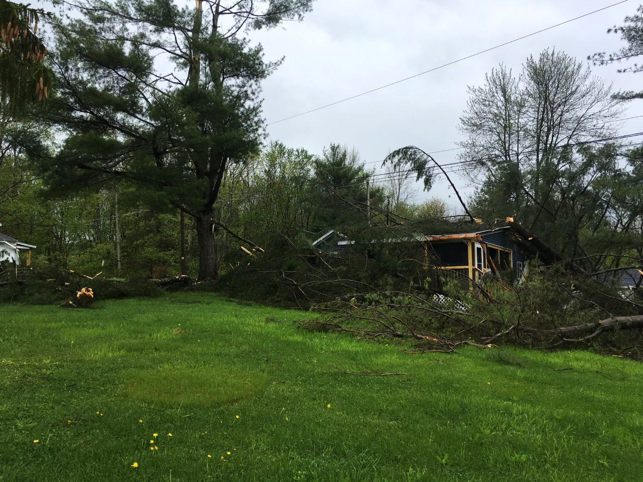
The line of severe thunderstorms produced a second, possibly more significant microburst event across eastern Wayne County, Pennsylvania. Sporadic tree and structural damage from this microburst was first noted near the intersection of Eighmy and Nobles Roads, where a poorly anchored storage building was overturned by thunderstorm winds. Additional trees were snapped and uprooted as the line of thunderstorms continued moving eastward, with several power poles and powerlines also blown down. Minor roof damage was noted to several homes, with a few storage buildings receiving heavy damage. Wind speeds appeared to intensify near the Delaware River, where wind swaths of trees were almost completely blown down along River Road. Several trees fell on an SUV parked near a home, but fortunately, no one was in the vehicle. A report of damage to a school transport van was also received. However, the extent of injuries (if any) from anyone in the van is unknown at this time. National Weather Service Meteorologists observed snapped trees across the Delaware River in Sullivan County, New York from their vantage point on River Road, but were unable to conduct the survey yesterday due to time constraints.
Summary
A powerful line of thunderstorms blasted through Sullivan County and surrounding areas between 320 PM and 340 PM on Tuesday May 15 2018, blowing down numerous trees. There were several locations with widespread blowdowns of mainly pine and spruce trees. There were also many other locations with several trees blown down and/or snapped. Most of the structural damage was to trees falling on homes. There was an estimated 20 homes at least that sustained damage from falling trees. Power was out through a widespread area with numerous wires down and power poles snapped.
Summary
A downburst blasted through the town of Yulan on Tuesday May 15th with estimated winds up to 80 mph. The winds knocked down numerous trees and power poles. There was some structrual damage from trees falling on homes.
A cold front moved across parts of central New York and northeast Pennsylvania Tuesday. Showers and thunderstorms developed along and ahead of the cold. Some of these thunderstorms produced severe weather across parts of northeast Pennsylvania and southeast New York.
Local Radar
National Radar
National radar loop showing severe storms that impacted parts of the east and east central United States. Loop is from 09:18 PM EDT 05/13/2018 (0118 UTC 05/14/2018) to 03:08 AM EDT 05/16/2018 (0708 UTC 05/16/2018).
Satellite
Severe weather occurred across parts of New York and Pennsylvania on May 15, 2018. This is a loop of one minute GOES East satellite images from 1000 AM EDT (1400 UTC) to 08:37 PM EDT (0037 UTC) May 15, 2018.
Data used 0.64 micrometer Red Visible Band, channel 02.
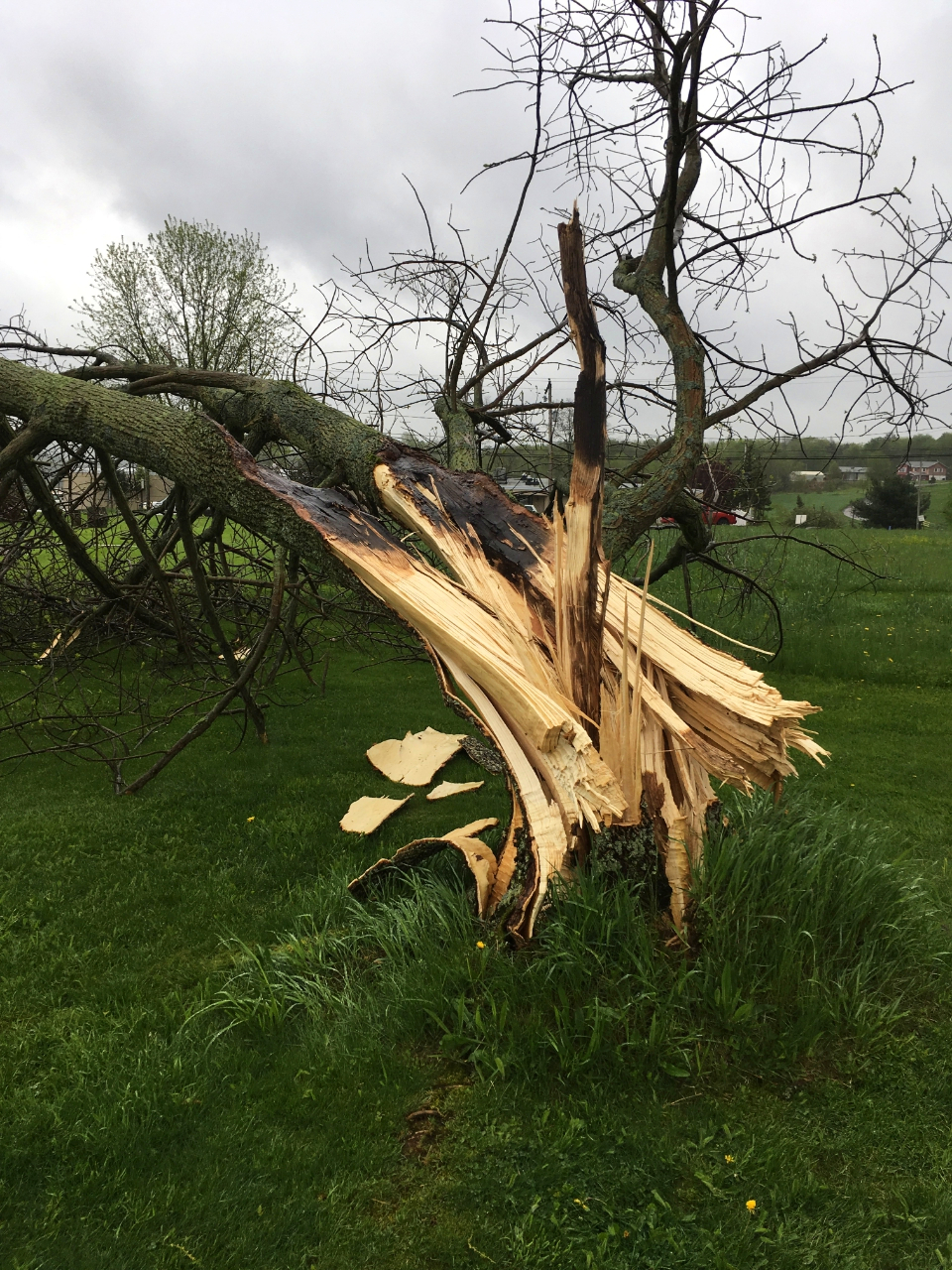
Pictures from the survey. Click for a larger view.
|
Tree damage in Narrowsburg, PA area. |
Tree on home in the Keen Lake PA area. |
Trees downed northeast of Waymart, PA |
Trees on SUV. |
|
Roof off house Elk Lake PA area. |
Barn downed in Waymart PA |
Tree downed in Waymart, PA |
Trees downed. |
|
For reference: Enhanced Fujita Scale classifies tornadoes into the following categories:
A microburst is a convective downdraft with an affected outflow area of less than 2 1/2 miles wide and peak winds lasting less than 5 minutes. Microbursts may induce dangerous horizontal and vertical wind shears, which can adversely affect aircraft performance and cause property damage. Straight-line winds are generally any wind that is not associated with rotation, used mainly to differentiate them from tornadic winds. |