F1 Tornado near Sanford, NY
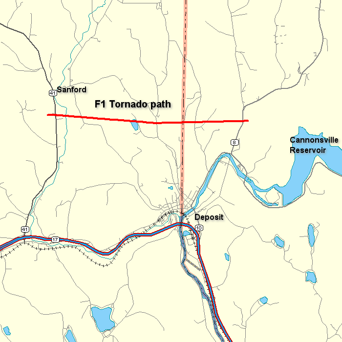 An F1 tornado with maximum winds between 73 and 112 mph touched down near Sanford New York in eastern Broome County at 5:30 PM EDT. The tornado tracked east and lifted about 3 miles northeast of Deposit in Delaware County by 5:40 PM EDT. The tornado had a 6 mile long path length and was about 100 yards wide. It uprooted and snapped many trees along its path, demolished a trailer, damaged siding on a house and destroyed a barn. In addition to the damage associated with the tornado, there was a 5 mile wide swath of hail damage associated with this storm in and around Sanford and to the north and northeast of Sanford. Click on the map to the right for a larger view.
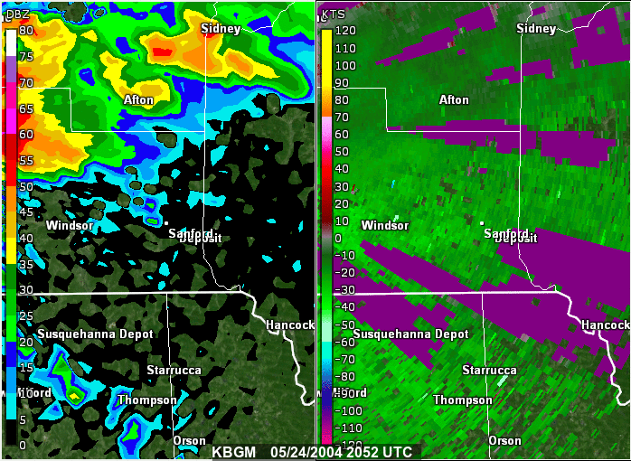
The two panel animation shows 0.5 Base Reflectivity on the left, and 0.5 Storm Relative Motion on the right. Both are from the National Weather Service radar in Binghamton, NY. The loop is from 04:52 PM to 05:56 PM EDT ( or 2052 to 2156 UTC) May 24, 2004. The yellow circle on the Storm Relative Motion (right panel) shows the rotation associated with the severe storm.
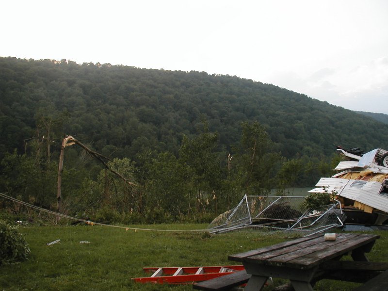
Below are some pictures showing the damage caused by the tornado. Click on the image to get a large view.
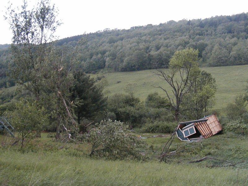
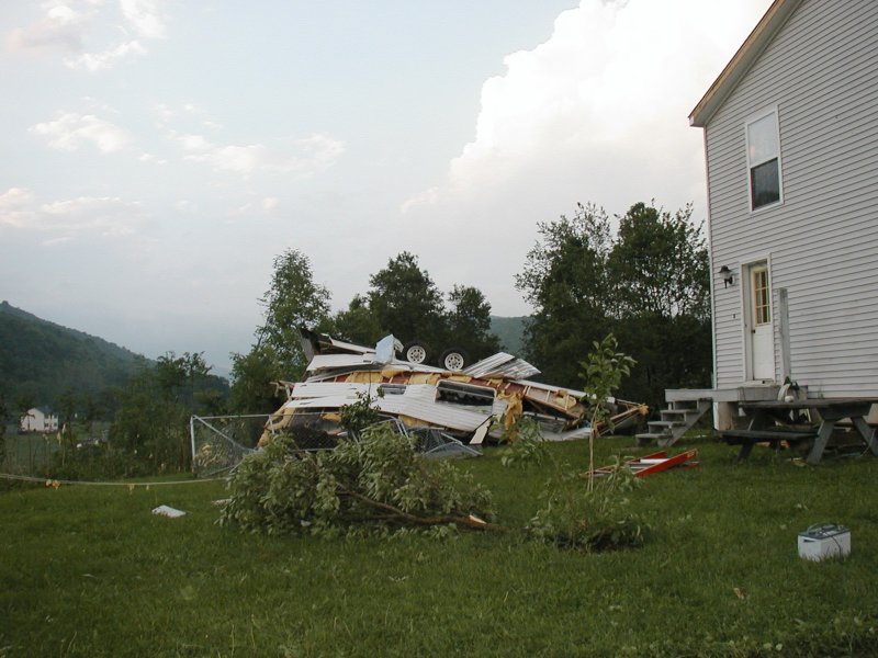 Camper trailer destroyed by F1 tornado along Route 8 one mile north of Stilesville in Delaware County, NY. |
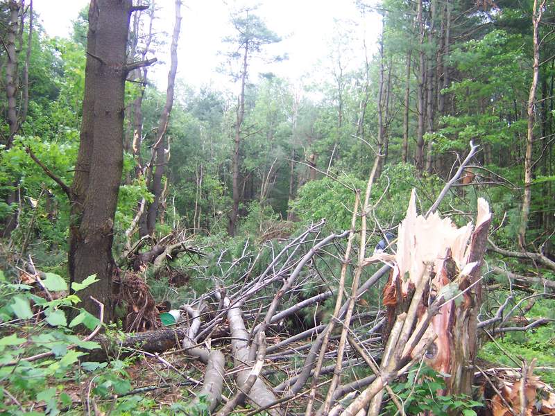
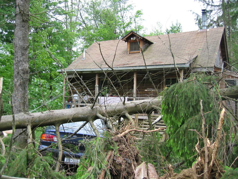
 Trees snapped at house in Delaware County. |
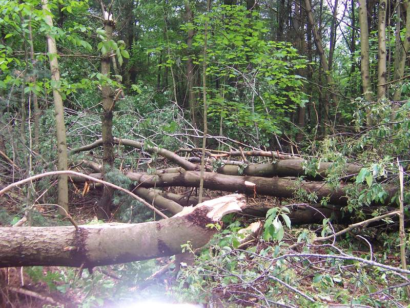
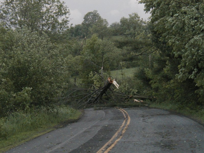 Tree snapped in the middle of Big Hollow Road near the eastern edge of Broome County, NY. |
 Shed demolished and trees snapped. off Big Hollow Road in eastern Broome County, NY. |
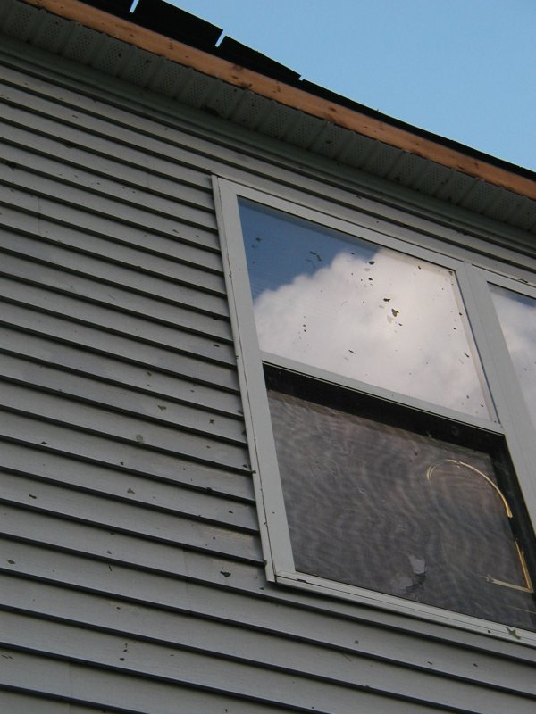 Screens on house broken by 1.5" hailstones hitting the house. Leaf debris plastered on siding and damage to roof from nearby tornado. House one mile north of Stilesville along Route 8 in Delaware County, NY. |
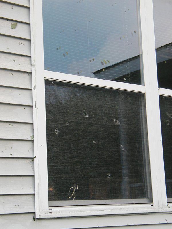 Same as picture to the left - screen damage and leaf debris. |
 A pile of pea size hail at the National Weather Service Office in Binghamton, NY. Hail ranged from peas to golfball in size. This same storm produced the F1 tornado in eastern Broome County. |
 Hail the size of quarters at the National Weather Service Office in Binghamton, NY. |
Damaging Winds Oneida County
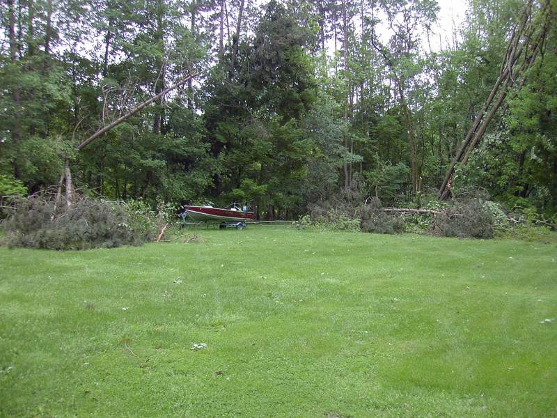
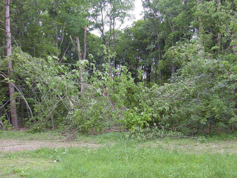
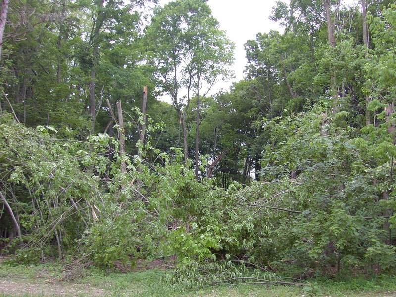
The National Weather Service surveyed localized areas of wind damage that occurred with severe thunderstorms in Oneida County on Monday May 24, 2004. Scattered tree damage was found along a path from the eastern shore of Oneida Lake to the town of Remsen. The greatest amount of damage was found in the village of Westernville, and in a rural area about 5 miles northwest of Rome. In those two locations, it was determined that downburst winds, possibly reaching speeds of 100 mph, caused extensive damage to dozens of large trees.
In both cases, the damage swaths were approximately 30 yards wide and 80 yards long. The trees were snapped and knocked down in a straight-line to slightly divergent pattern in both locations, indicating that the damage was most likely done by downbursts of strong winds, but not by a tornado.
Several reports of funnel clouds were received in the area between 4:30 and 4:50 PM EDT. It is likely that the storms that produced these funnel clouds also produced the damaging straight line winds.
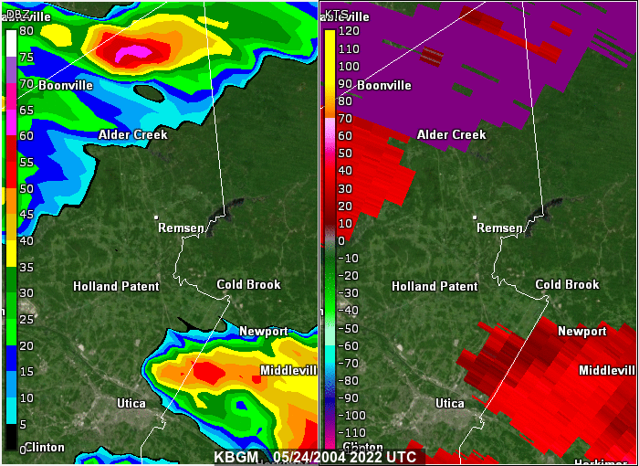
The two panel animation shows 0.5 Base Reflectivity on the left, and 0.5 Storm Relative Motion on the right. Both are from the National Weather Service radar in Binghamton, NY. The loop is from 04:22 PM to 05:31 PM EDT ( or 2022 to 2131 UTC) May 24, 2004. The loop shows a line of storms moving across the eastern part of the county producing wind damage.
Below are some pictures showing the damage caused by the tornado. Click on the image to get a large view.
 Trees downed. Courtesy of Dave Eichorn. |
 Trees snapped. Courtesy of Dave Eichorn. |
 Another angle of the photo above. Courtesy of Dave Eichorn. |
 Trees blown down or snapped by straight line winds. |
 More trees downed by straight line winds. |
 Metal awning pushed back over the roof of the house by straight line winds. |
Damaging Wind Otsego County/
Severe storms moved across parts of Otsego County producing damage. Tree damage and other evidence indicated wind from one direction, generally in the 50 to 70 mph range. There was extensive hail damage in some areas. Trees were stripped of leaves and ground cover flattened. 24 hours later, there was still hail in places on the ground.
Below are some pictures showing the damage caused by the tornado. Click on the image to get a large view.
 Trees downed on house in the Arnold Lake area. |
 Trees downed on driveway, just missed the car. This was in the Arnold Lake area. |
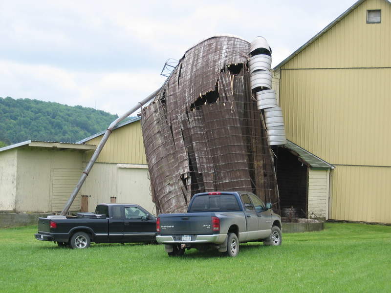 Silo damaged. On County Route 29, town of Worcester. |
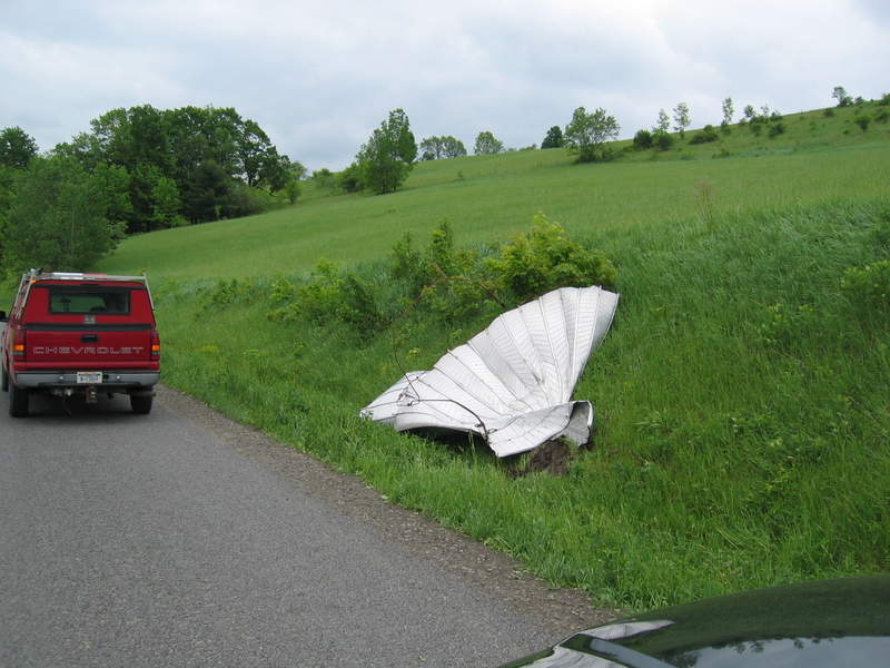 Top of silo on side of road. On County Route 29, town of Worcester. |
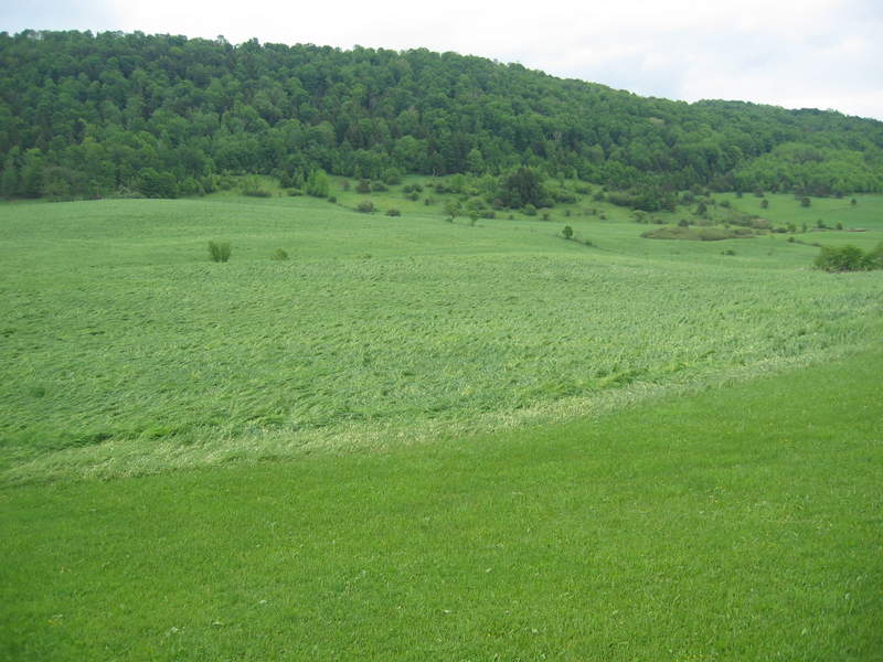 Field of grass flattened by winds produced by the severe thunderstorm. On County Route 29, town of Worcester. |
 Same as picture to the left, but close up. On County Route 29, town of Worcester. |
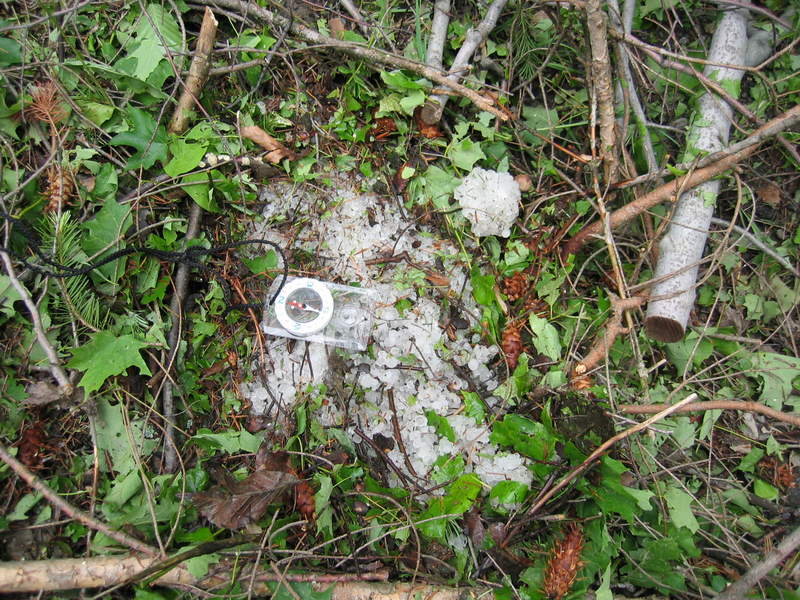 Clump of hail 24 hours after the storm event. This was on Percy Holmes Road. |
 More hail 24 hours after the storm event. This was on Percy Holmes Road. |

