Binghamton, NY
Weather Forecast Office
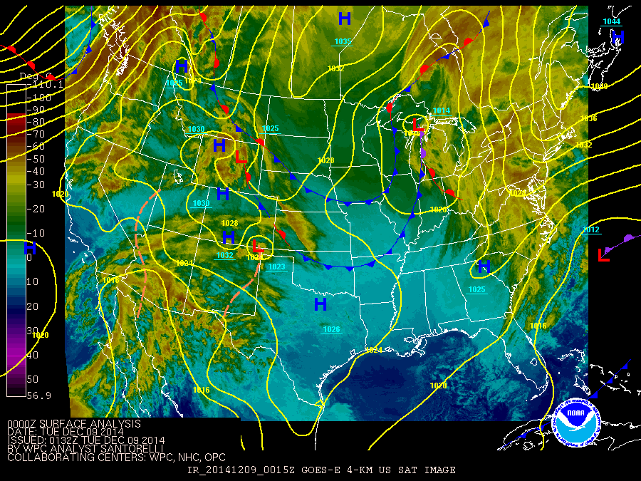
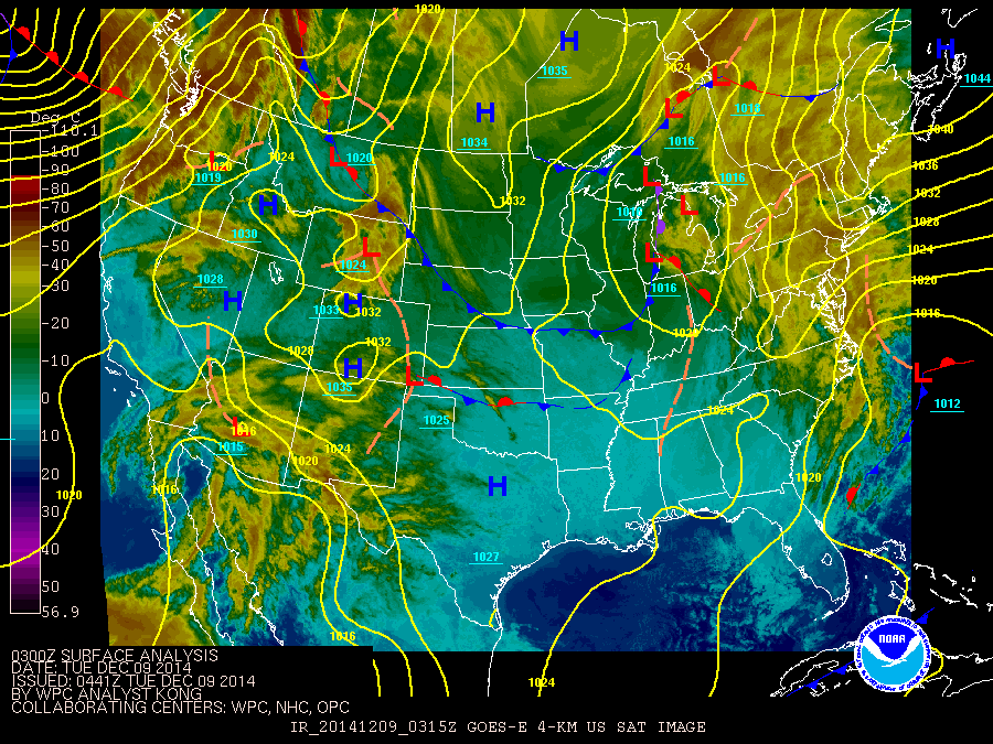
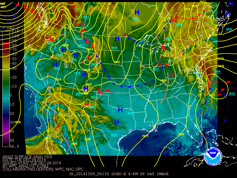
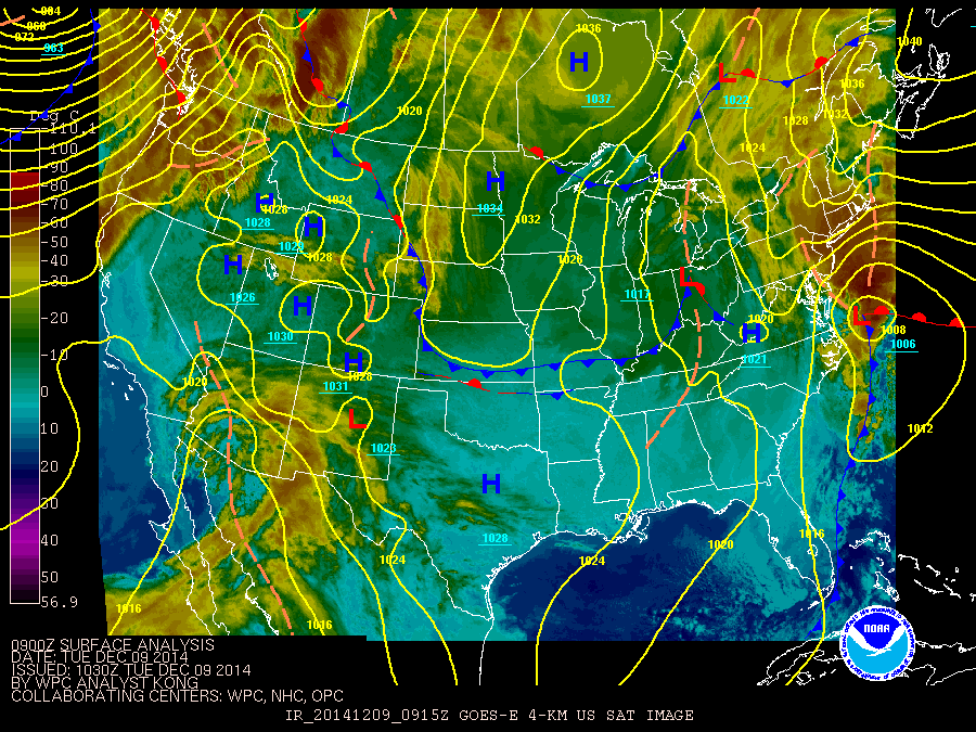
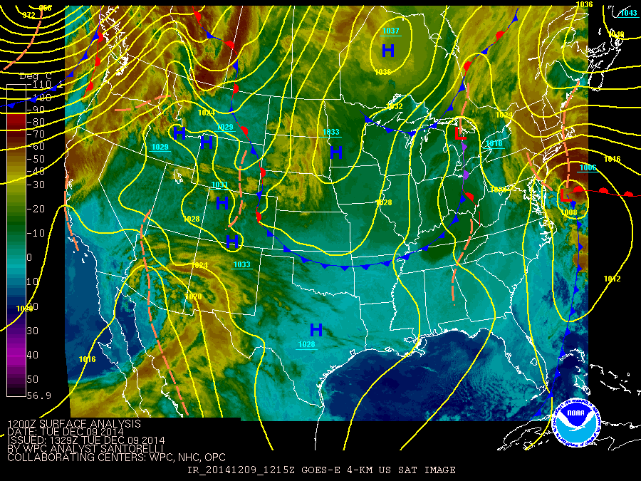
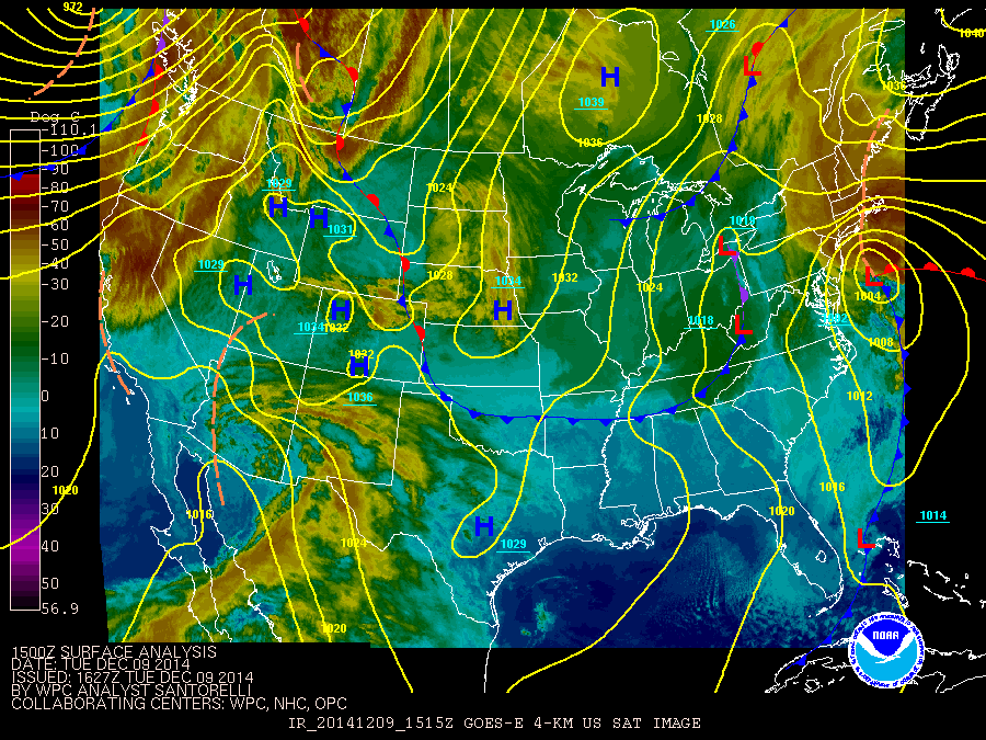
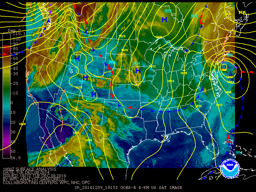
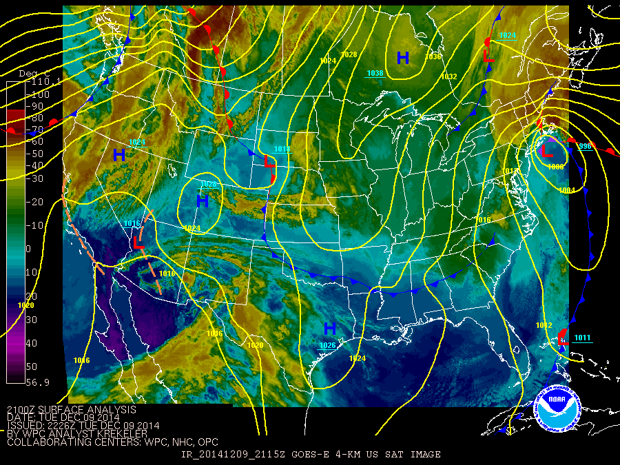
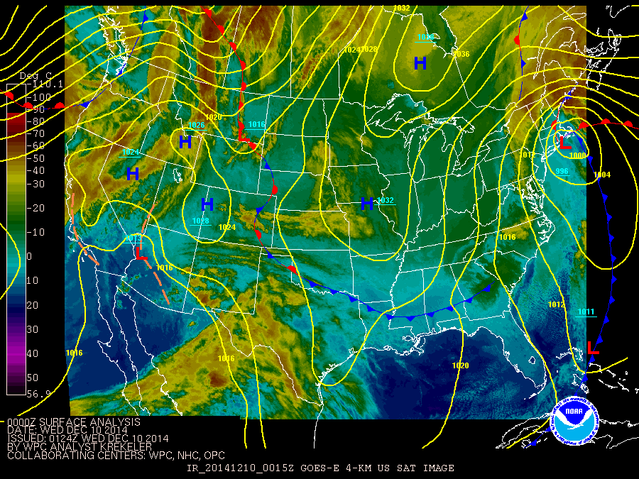
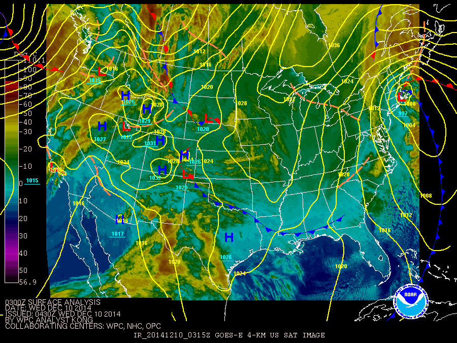
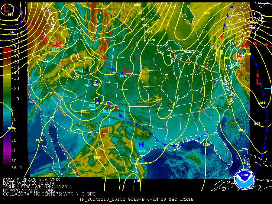
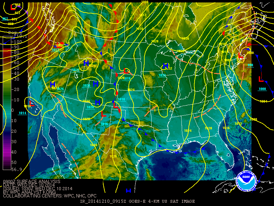
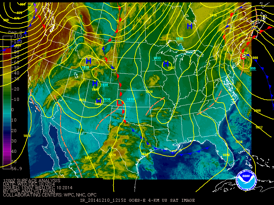
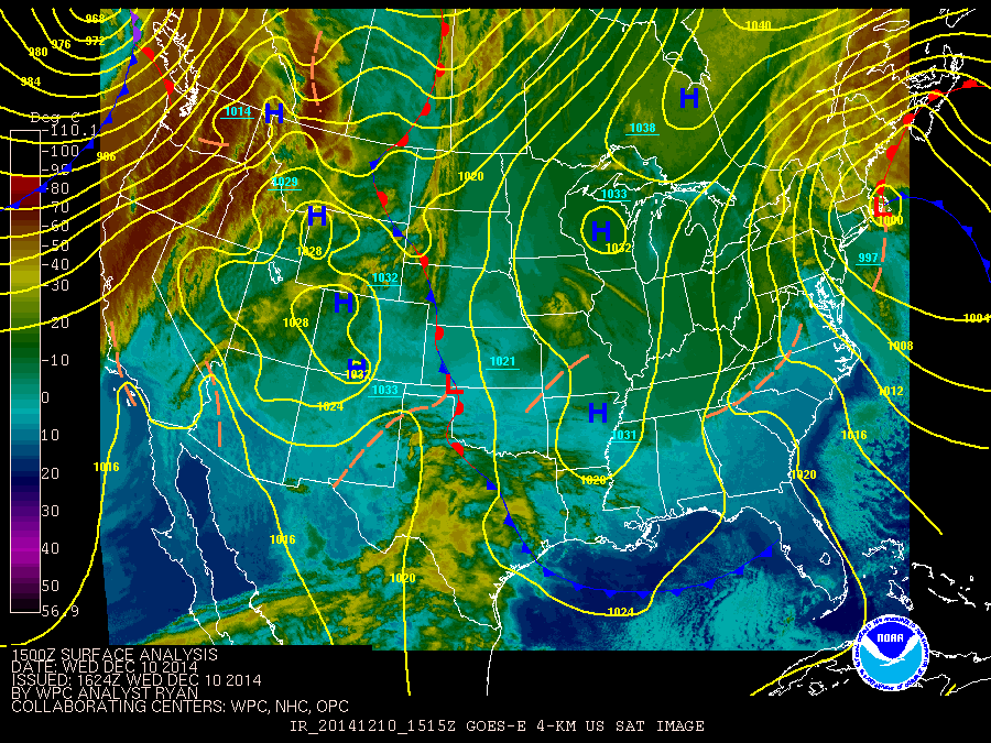
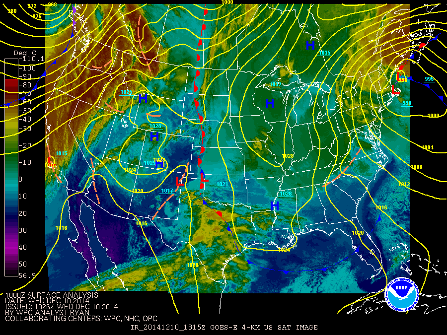
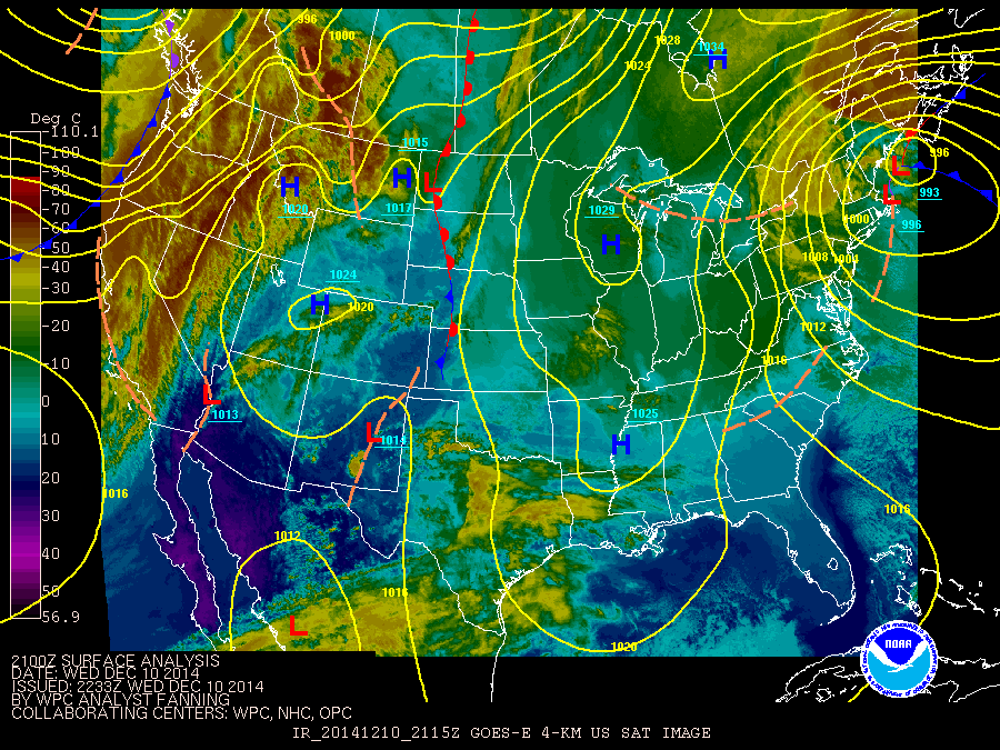
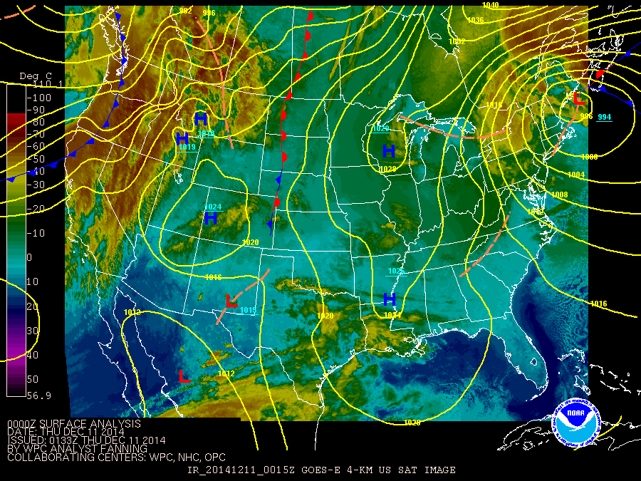
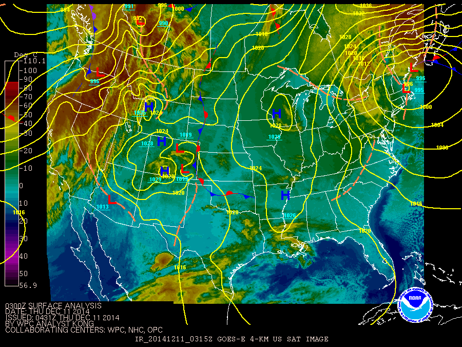
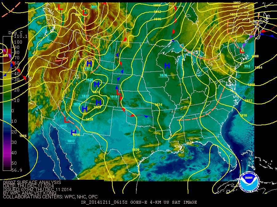
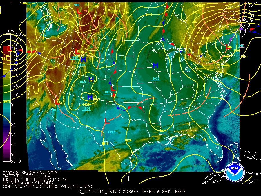
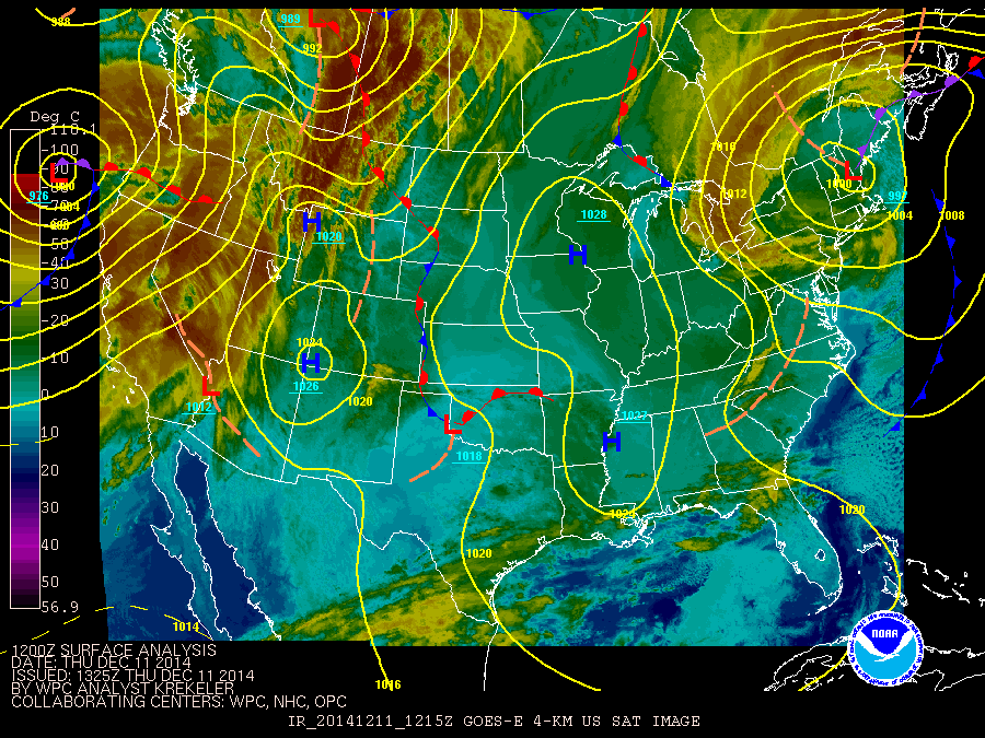
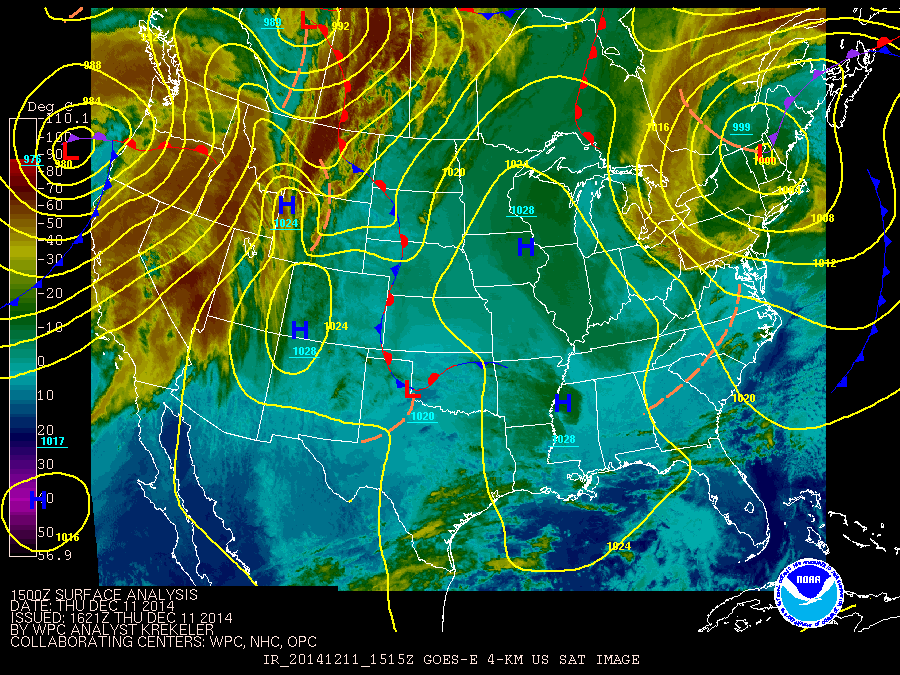
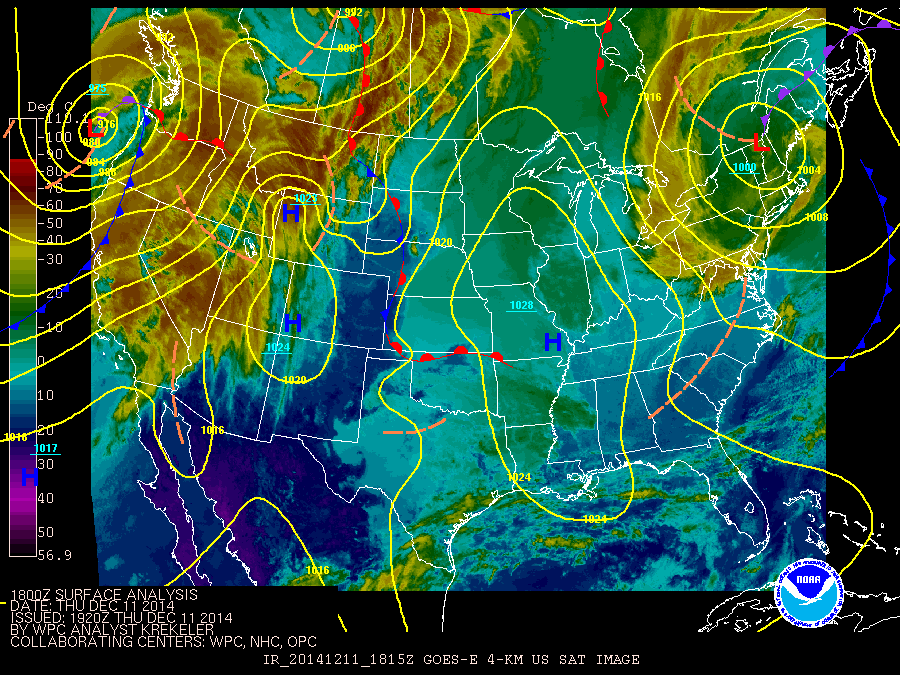
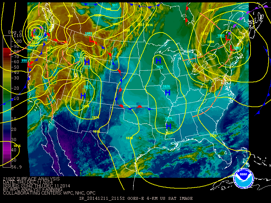
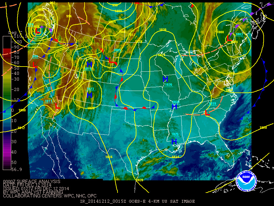
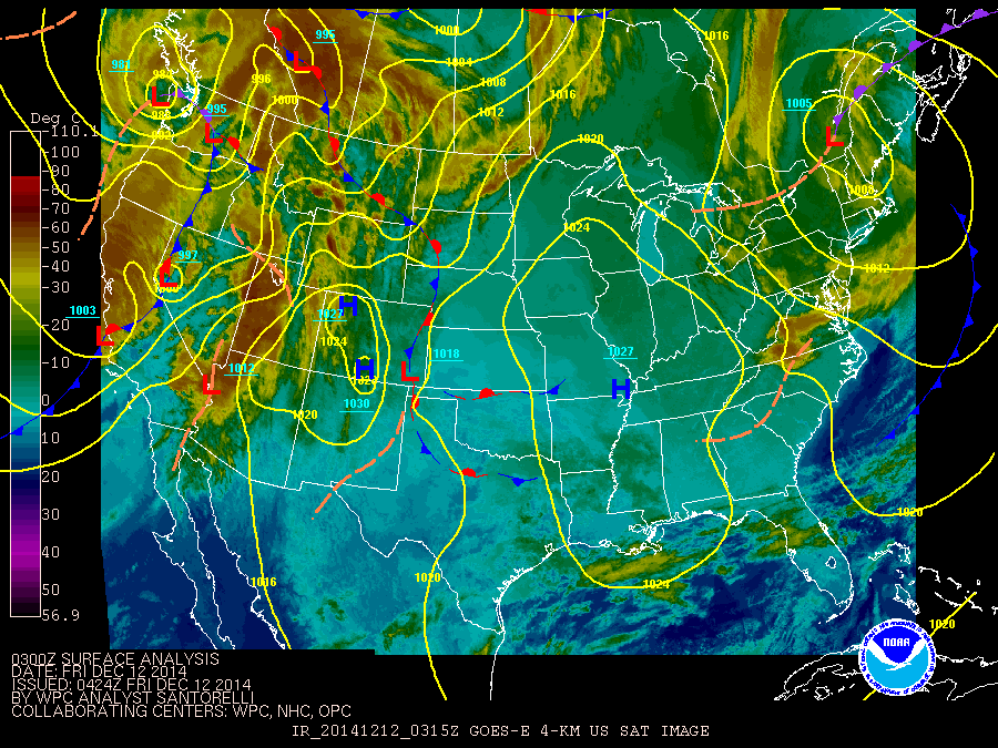
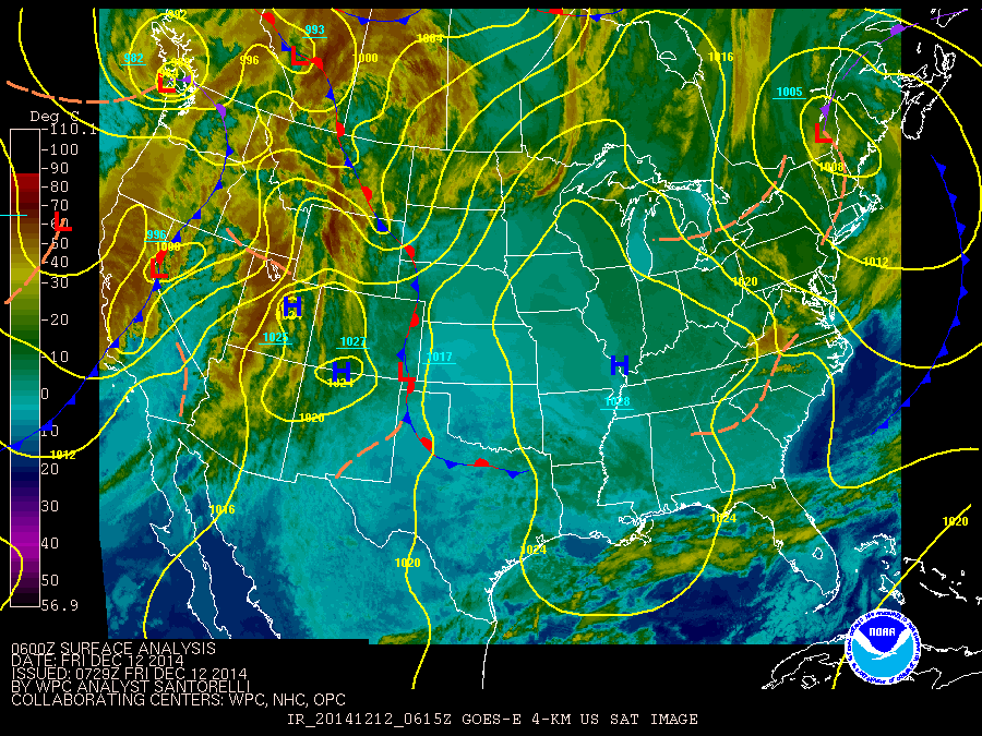
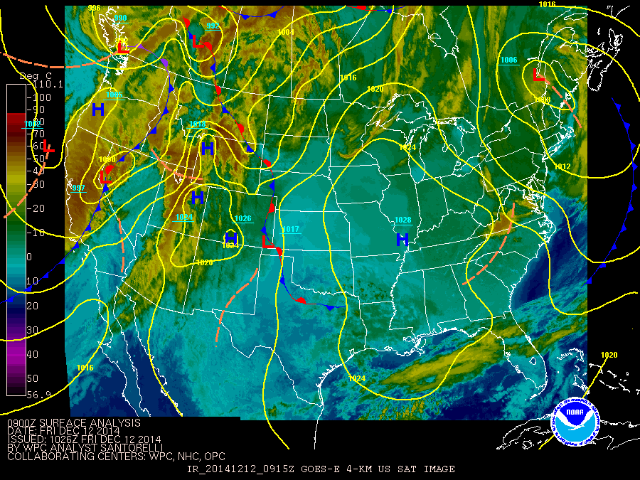
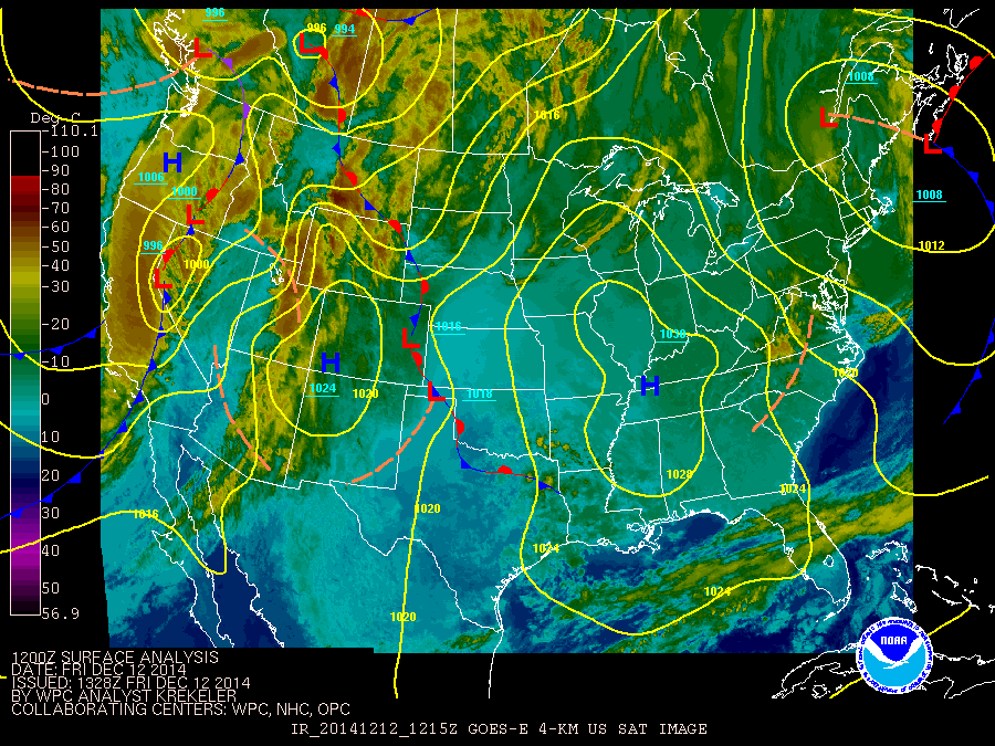
The loop below is map combination of satellite images and surface analysis. The storm system or Nor'easter moves northward along the east coast of the Unitied States.
Times on the images are in Zulu or UTC times. The loop starts at 0132Z December 9 or 08:32 PM EST December 8, to 1338Z December 12 or 08:28 AM EST December 12, 2014.
These images are from Weather Prediction Center's (https://www.hpc.ncep.noaa.gov/) archive web site.
Use the slider bar to control the speed of the loop.
Current Hazards
Briefing
Drought
Fire Weather
Graphical Hazardous Weather Outlook
Hurricanes
Local Outlook
River Flooding
Space Weather
Thunderstorms
Winter
Current Conditions
Air Quality
Local Storm Reports
Observation (list)
Observations (Map)
More Surface Observations
Rainfall
Satellite
More Satellite
Upper Air
Radar
Local Enhanced Radar
Local Standard Radar (low bandwidth)
Regional/National Standard Radar (low bandwidth)
More Radar
Forecasts
Activity Planner
Aviation
Detailed View
Fire Weather
Forecaster's Discussion
Hourly View
Map View
Model Data
Space Weather
Text Products
User Defined Area Forecast
Rivers and Lakes
River Forecasts (Map)
River Observations (Map)
River Forecast Centers
River Forecasts (Text)
Ensemble River Guidance
Current Streamflow
Flood Inundation Maps
River Monitor
US Dept of Commerce
National Oceanic and Atmospheric Administration
National Weather Service
Binghamton, NY
32 Dawes Drive
Johnson City, NY 13790
(607) 729-1597
Comments? Questions? Please Contact Us.

