Binghamton, NY
Weather Forecast Office
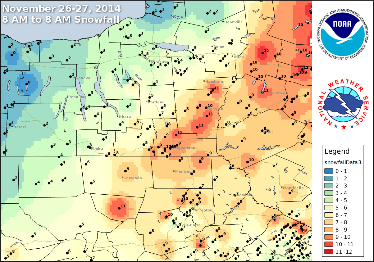
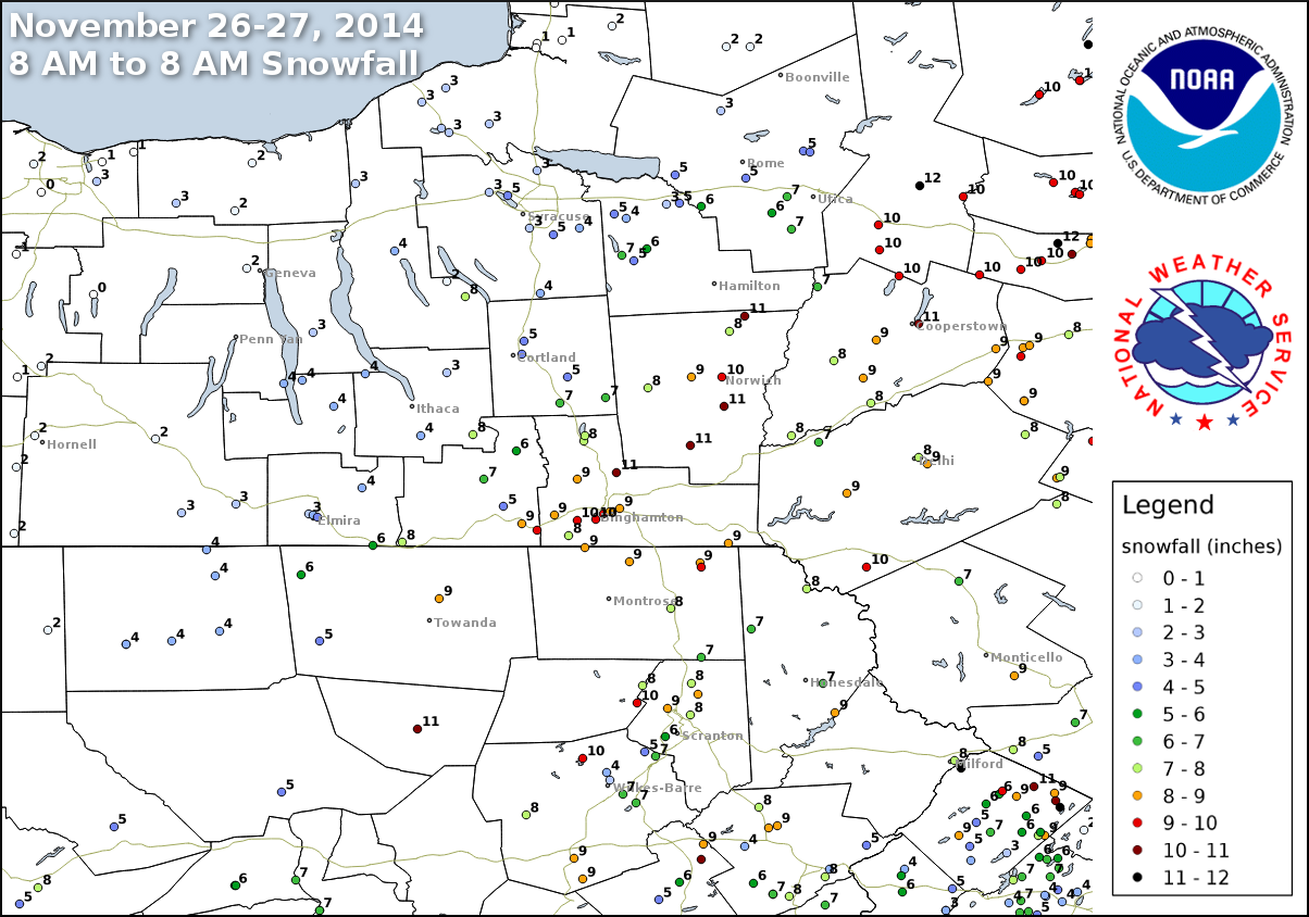
A storm system moved up the Unitied States east coast from Tuesday November 25 through Thursday November 27, 2014. The storm system, also known as a Nor'easter, produced varying snowfall amounts with a highest amounts across parts of central and eastern New York and northeast Pennsylvania.
|
Nor'easter: A strong low pressure system that affects the Mid Atlantic and New England States. It can form over land or over the coastal waters. These winter weather events are notorious for producing heavy snow, rain, and tremendous waves that crash onto Atlantic beaches, often causing beach erosion and structural damage. Wind gusts associated with these storms can exceed hurricane force in intensity. A nor'easter gets its name from the continuously strong northeasterly winds blowing in from the ocean ahead of the storm and over the coastal areas.
|
The following maps shows selected snowfall amounts across parts of New York and Pennsylvania. These are preliminary amounts and appreciation is extended to cooperative observers, SKYWARN spotters, those following us on Facebook and Twitter, highway departments, public and the media for these reports. Some of the reports used to create the maps can be found in this table. Click on a map for a larger view.
 |
 |
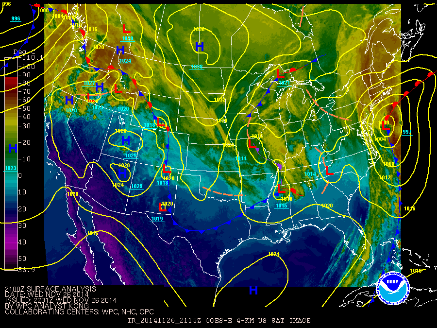
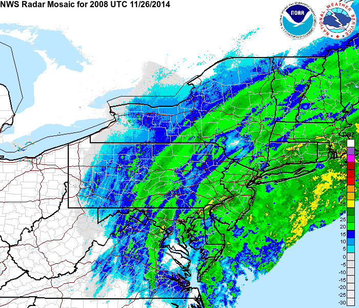
Satellite/Surface analysis and regional radar loops. Click to view a loop.
 |
 |
Additional Links
Current Hazards
Briefing
Drought
Fire Weather
Graphical Hazardous Weather Outlook
Hurricanes
Local Outlook
River Flooding
Space Weather
Thunderstorms
Winter
Current Conditions
Air Quality
Local Storm Reports
Observation (list)
Observations (Map)
More Surface Observations
Rainfall
Satellite
More Satellite
Upper Air
Radar
Local Enhanced Radar
Local Standard Radar (low bandwidth)
Regional/National Standard Radar (low bandwidth)
More Radar
Forecasts
Activity Planner
Aviation
Detailed View
Fire Weather
Forecaster's Discussion
Hourly View
Map View
Model Data
Space Weather
Text Products
User Defined Area Forecast
Rivers and Lakes
River Forecasts (Map)
River Observations (Map)
River Forecast Centers
River Forecasts (Text)
Ensemble River Guidance
Current Streamflow
Flood Inundation Maps
River Monitor
US Dept of Commerce
National Oceanic and Atmospheric Administration
National Weather Service
Binghamton, NY
32 Dawes Drive
Johnson City, NY 13790
(607) 729-1597
Comments? Questions? Please Contact Us.

