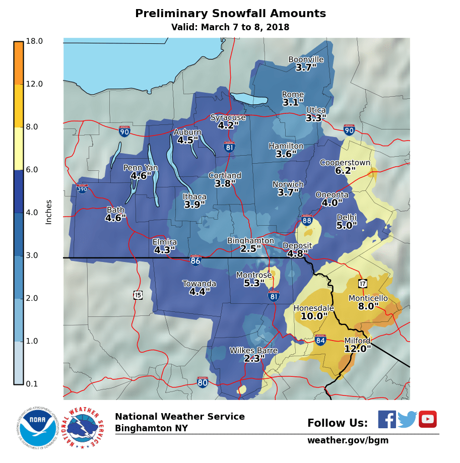
A Nor'easter formed and slowly moved up the eastern US coast late March 6 through March 9, 2018. Cold air was in place and precipitation in the form of snow spread across most of central New York and northeast Pennsylvania. Snow became heavy at times, especially across parts of the southeastern New York and eastern Pennsylvania mainly on March 7.
LOCATION          STORM TOTAL     TIME/DATE   COMMENTS
                     SNOWFALL           OF
                     /INCHES/   MEASUREMENT

NEW YORK

...Broome County...
   Vestal                 3.5   823 PM  3/07  Social Media
   Binghamton Reg arpt    2.5   500 PM  3/07  ASOS

...Delaware County...
   Trout Creek            9.0   824 PM  3/07  Social Media
   Davenport              6.0   813 PM  3/07  Amateur Radio
   7 WSW Delhi            5.0   835 PM  3/07  Law Enforcement
   Franklin               4.5   814 PM  3/07  Amateur Radio
   Walton                 3.3   810 PM  3/07  Amateur Radio
   Sidney                 3.3   818 PM  3/07  ELEVATION 1700`

...Oneida County...
   Paris                  2.5   807 PM  3/07  Trained Spotter

...Otsego County...
   Milford                5.5   813 PM  3/07  Amateur Radio
   Edmeston               5.0   817 PM  3/07  Amateur Radio
   2 N Oneonta            4.1   819 PM  3/07  ELEVATION 1490`
   Oneonta                4.0  1030 AM  3/07  Trained Spotter
   2 E Oneonta            4.0   817 PM  3/07  ELEVATION 1150`
   1 W Oneonta            2.5   814 PM  3/07  ELEVATION 1150`

...Sullivan County...
   Kiamesha              12.3   639 PM  3/07  Trained Spotter
   Woodridge             12.3   629 PM  3/07  Trained Spotter
   Glen Spey             12.0   620 PM  3/07  Trained Spotter
   Swan Lake             11.0   454 PM  3/07  Trained Spotter
   Monticello             8.0   755 PM  3/07  Social Media
   Grahamsville           7.0   857 PM  3/07  Amateur Radio
   Jeffersonville         7.0   855 PM  3/07  Amateur Radio

...Tioga County...
   2 N Candor             3.0   859 PM  3/07  Amateur Radio
   2 E Candor             2.0   859 PM  3/07  Amateur Radio

PENNSYLVANIA

...Lackawanna County...
   Clarks Summit          3.6   515 PM  3/07  Trained Spotter
   Moosic                 2.0   832 PM  3/07  Amateur Radio

...Luzerne County...
   3 N Hazleton           6.3  1130 PM  3/07  Trained Spotter
   Mountain Top           6.0   636 PM  3/07  1380 feet elevation.
   Laurel Run             5.5  1056 PM  3/07  Trained Spotter
   Drums                  5.0   836 PM  3/07  Amateur Radio
   Dallas                 4.8   831 PM  3/07  Amateur Radio
   Freeland               4.5   837 PM  3/07  Amateur Radio
   Sweet Valley           4.0   831 PM  3/07  Amateur Radio
   Shavertown             4.0   830 PM  3/07  Amateur Radio
   Nanticoke              3.8   830 PM  3/07  Amateur Radio
   Plains                 3.3   833 PM  3/07  Amateur Radio
   WB-Scranton Arpt       3.0   530 PM  3/07  REPORTED FROM WNEP
   Wilkes-Barre           2.3   832 PM  3/07  Amateur Radio
   Alden                  2.0   858 PM  3/07  Amateur Radio
   Harding                1.5   829 PM  3/07  Amateur Radio

...Pike County...
   Dingmans Ferry        14.0   902 PM  3/07  Amateur Radio
   Milford               12.0   725 PM  3/07  Trained Spotter
   Millrift              12.0   903 PM  3/07  Amateur Radio
   Lords Valley          11.0   903 PM  3/07  Amateur Radio
   Blooming Grove         9.8   901 PM  3/07  Amateur Radio
   3 SW Milford           9.0   901 PM  3/07  Amateur Radio
   6 NE Milford           6.0   405 PM  3/07  MATAMORAS
   2 WNW Milford          4.0   101 PM  3/07  Trained Spotter
   6 WNW Milford          1.5  1130 AM  3/07  Trained Spotter

...Susquehanna County...
   Lakeside               8.5   900 PM  3/07  Amateur Radio
   Forest City            5.7   900 PM  3/07  Social Media
   Thompson               3.0   424 PM  3/07  Trained Spotter
   Great Bend             1.0   857 PM  3/07  Amateur Radio

...Wayne County...
   Beach Lake            11.0   600 AM  3/08  Trained Spotter
   Waymart                9.3   900 PM  3/07  Trained Spotter
   Damascus               9.0   900 PM  3/07  Social Media
   Lakeville              8.0   623 PM  3/07  Trained Spotter
   Newfoundland           6.0   900 PM  3/07  Amateur Radio
   Greentown              6.0   901 PM  3/07  Amateur Radio
   Hawley                 4.1   230 PM  3/07  Trained Spotter

...Wyoming County...
   Falls                  3.5   455 PM  3/07  Trained Spotter


**********************24 HOUR SNOWFALL**********************

LOCATION              24 HOUR     TIME/DATE   COMMENTS
                     SNOWFALL           OF
                     /INCHES/   MEASUREMENT

NEW YORK

...Broome County...
   Binghamton Wfo         2.5  1200 AM  3/08  OTHER
   4 WNW Sherman          2.3   700 AM  3/08  CoCoRaHS
   2 SE Endwell           2.0   530 AM  3/08  CoCoRaHS

...Cayuga County...
   Aurora Research Farm   1.0   700 AM  3/08  Co-Op Observer

...Chemung County...
   1 ESE Elmira           1.0   700 AM  3/08  CoCoRaHS

...Chenango County...
   1 W Preston            2.1   700 AM  3/08  CoCoRaHS
   Sherburne              1.5   617 AM  3/08  Co-Op Observer
   Greene                 1.0  1000 AM  3/07  Co-Op Observer

...Cortland County...
   1 WSW German           1.9   700 AM  3/08  CoCoRaHS

...Delaware County...
   4 WSW Meredith         5.5   700 AM  3/08  CoCoRaHS
   Walton 2               5.2   500 AM  3/08  Co-Op Observer
   4 SE Stamford          4.5   700 AM  3/08  CoCoRaHS
   3 ENE Peabrook         4.0   800 AM  3/08  CoCoRaHS
   2 SE Delhi             2.5   800 AM  3/08  Co-Op Observer
   7 W Walton             2.0   830 AM  3/08  CoCoRaHS

...Madison County...
   2 SE Cazenovia         1.0   700 AM  3/08  CoCoRaHS

...Oneida County...
   4 SSW Boonville        2.6   700 AM  3/08  Co-Op Observer
   Point Rock             1.6   730 AM  3/08  CoCoRaHS
   1 W New York Mills     1.5   520 AM  3/08  CoCoRaHS
   3 NW Westmoreland      1.4   700 AM  3/08  CoCoRaHS
   4 N Westmoreland       1.4   700 AM  3/08  Co-Op Observer
   3 ESE Verona Beach     1.3   700 AM  3/08  CoCoRaHS

...Otsego County...
   Hartwick               4.3   525 AM  3/08  CoCoRaHS
   Emmons                 2.4   700 AM  3/08  Co-Op Observer
   1 S Unadilla Forks     1.8   645 AM  3/08  CoCoRaHS

...Schuyler County...
   4 SW Mecklenburg       1.2   700 AM  3/08  Co-Op Observer

...Steuben County...
   Addison                1.3   500 AM  3/08  Co-Op Observer
   Corning                1.2   700 AM  3/08  Co-Op Observer
   2 W North Hornell      1.0   600 AM  3/08  HADS

...Sullivan County...
   Wurtsboro              7.7   800 AM  3/08  CoCoRaHS

...Tioga County...
   3 ENE Owego            1.1   615 AM  3/08  CoCoRaHS

...Tompkins County...
   Trumansburg            1.3   700 AM  3/08  CoCoRaHS

PENNSYLVANIA

...Bradford County...
   Waverly                1.0   700 AM  3/08  Co-Op Observer

...Lackawanna County...
   1 NE Lehigh            7.0   700 AM  3/08  CoCoRaHS
   Winton                 3.0   800 AM  3/08  CoCoRaHS

...Luzerne County...
   1 SW Mountain Top      6.1   645 PM  3/07  CoCoRaHS
   Forty Fort             2.6   700 AM  3/08  CoCoRaHS
   Duryea                 2.3   600 AM  3/08  CoCoRaHS

...Susquehanna County...
   4 W Hallstead          2.5   430 AM  3/08  CoCoRaHS
   1 SE New Milford       2.5   830 AM  3/08  CoCoRaHS
   Susquehanna            1.5   700 AM  3/08  Co-Op Observer

...Wayne County...
   Headley                9.0   700 AM  3/08  CoCoRaHS
   Prompton Dam           7.0   700 AM  3/08  Co-Op Observer
   Bethany                5.0   700 AM  3/08  CoCoRaHS
   1 W Prompton           4.7   700 AM  3/08  CoCoRaHS
   NE Damascus            4.2   745 AM  3/08  CoCoRaHS

...Wyoming County...
   Russell Hill           3.0   300 PM  3/07  CoCoRaHS
   Wyoming County Eoc     2.0   805 AM  3/08  Co-Op Observer
Radar reflectivity loop from the NWS Binghamton, NY WSR88D radar. This radar loop was from 01:01 PM EST (1801 UTC) March 6 to 6:53 AM EST (1153 UTC) March 8, 2018. Note that the radar goes briefly into clear air mode near the end of the loop. There is no audio with this video.
More on radar modes, http://www.srh.noaa.gov/jetstream/doppler/vcp_max.html
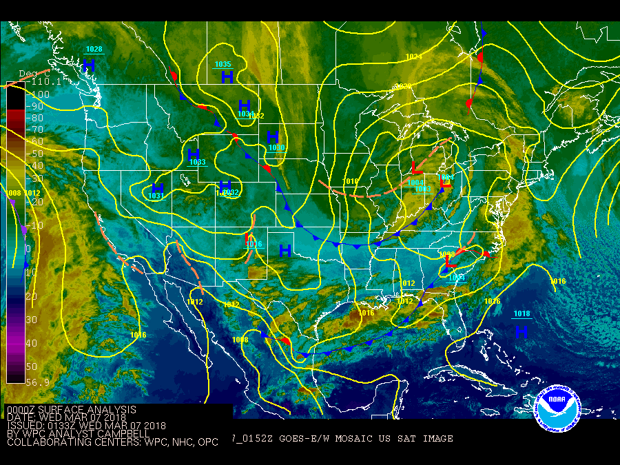
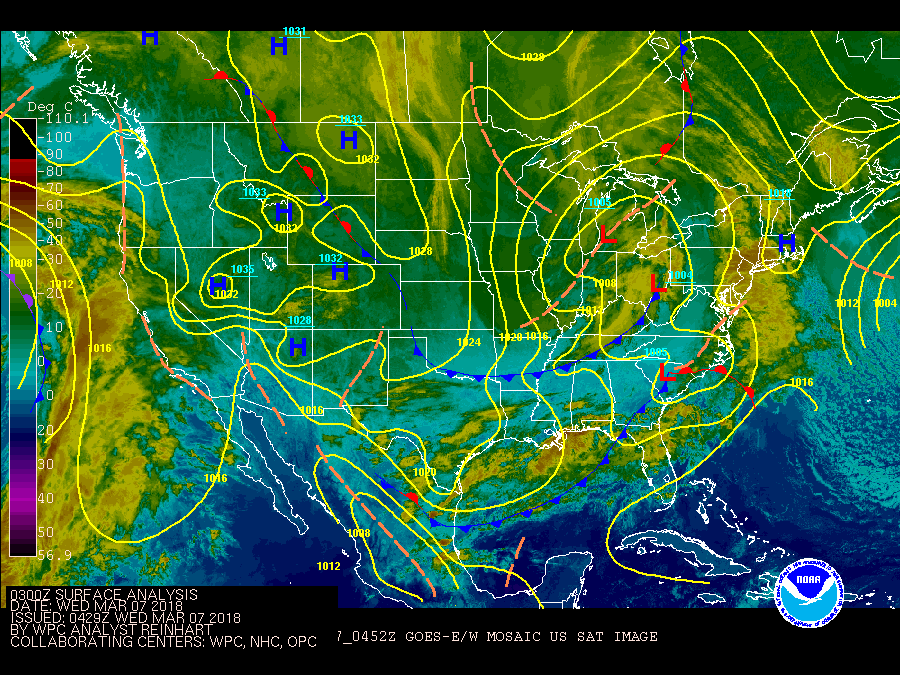
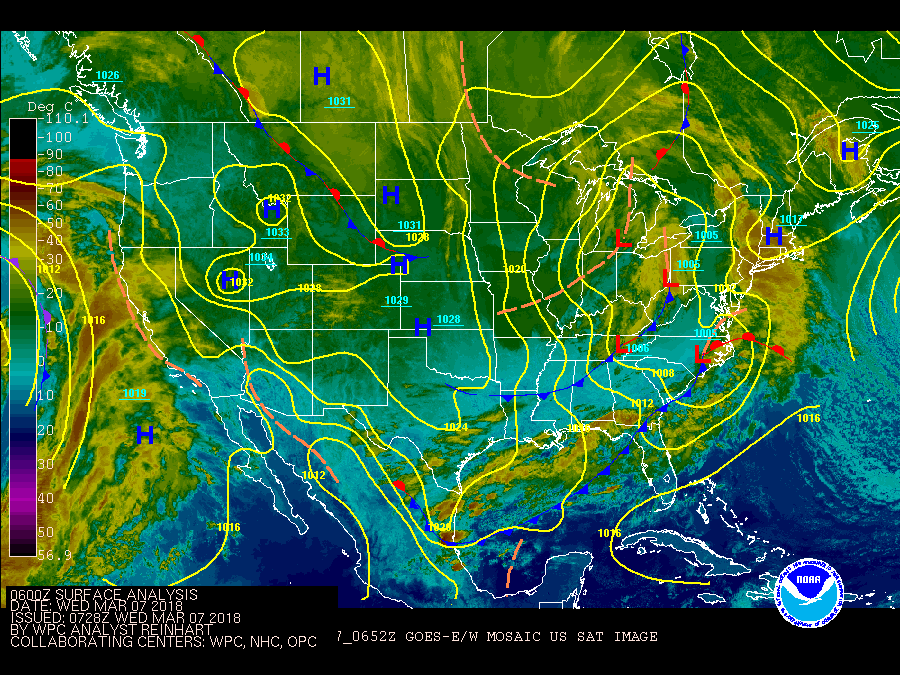
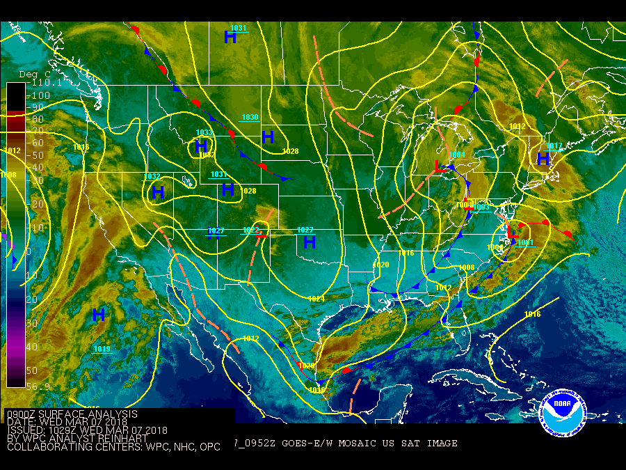
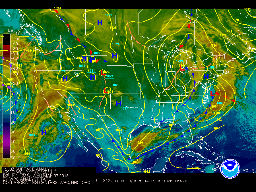
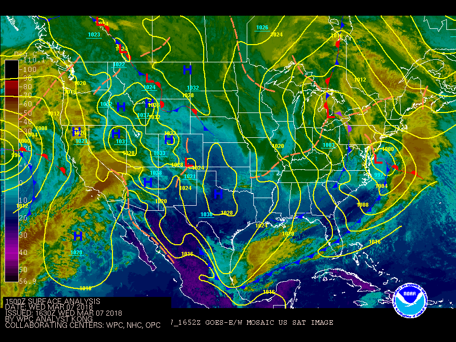
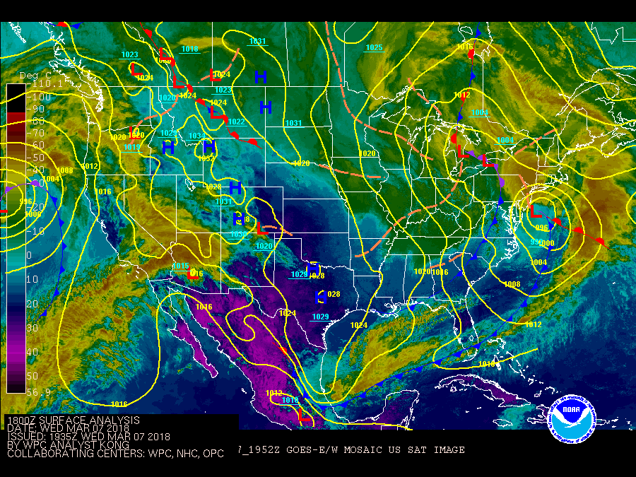
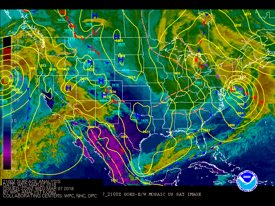
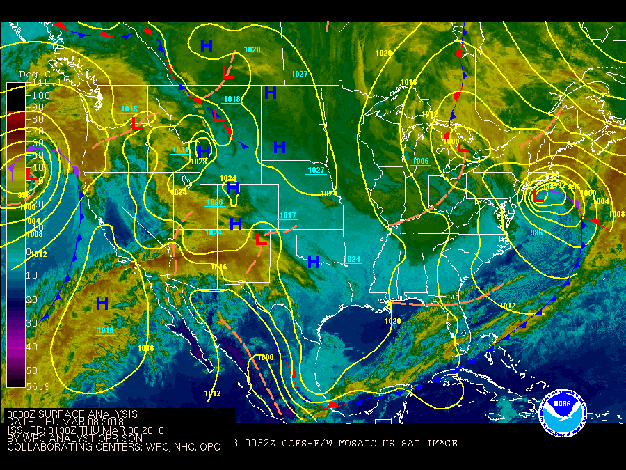
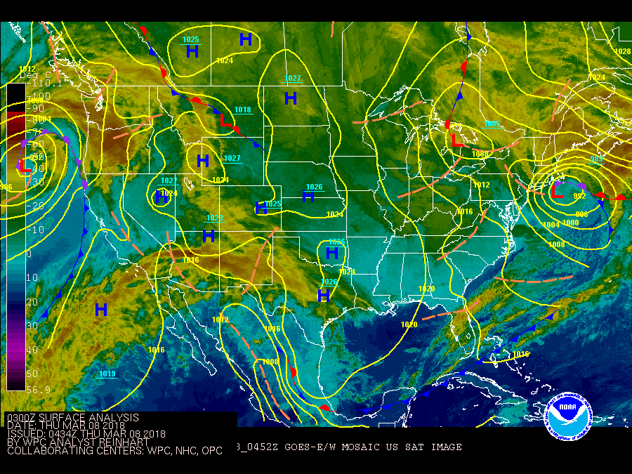
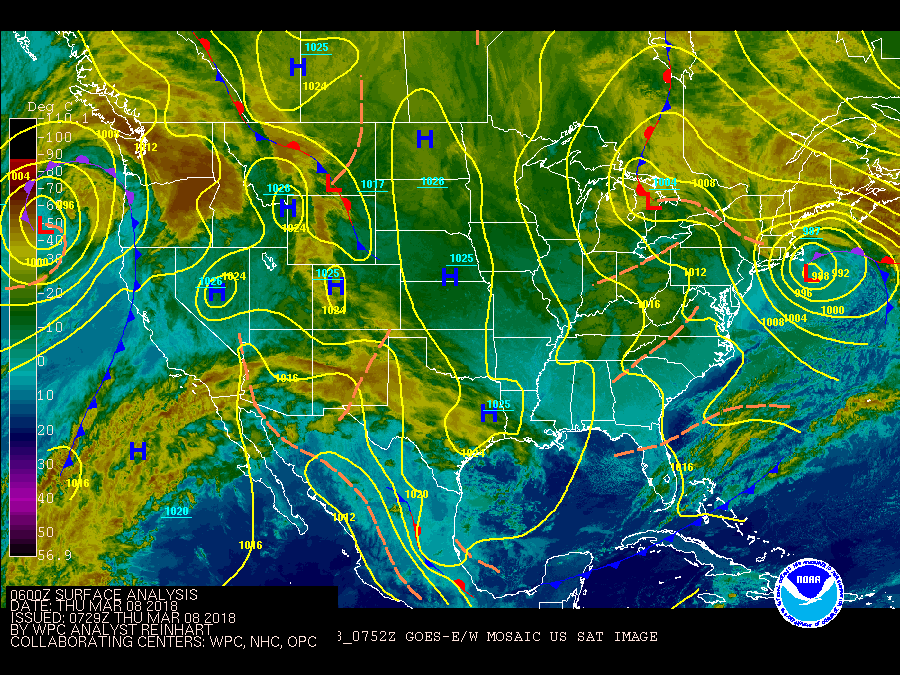
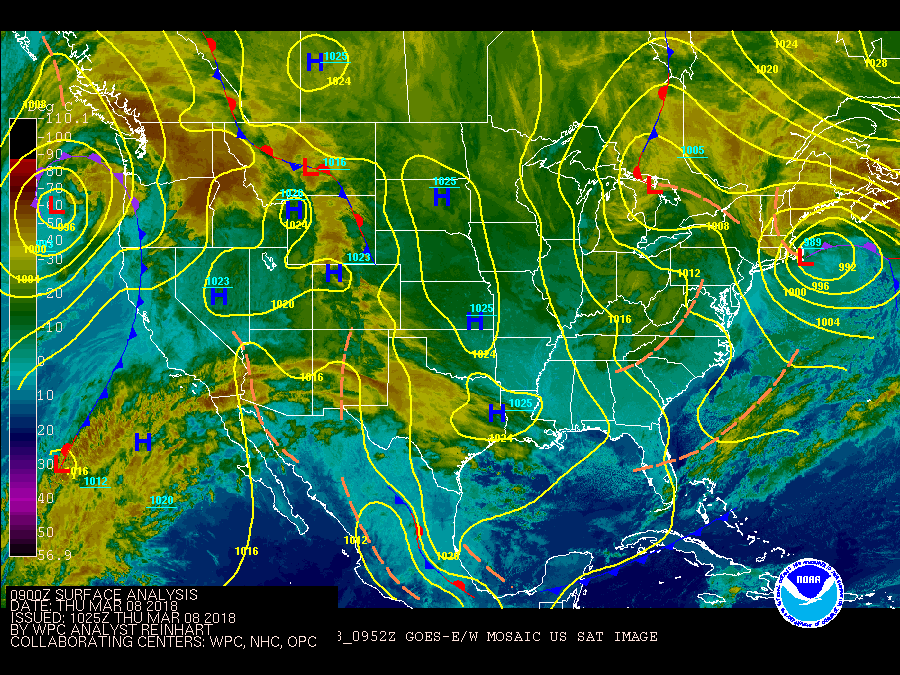
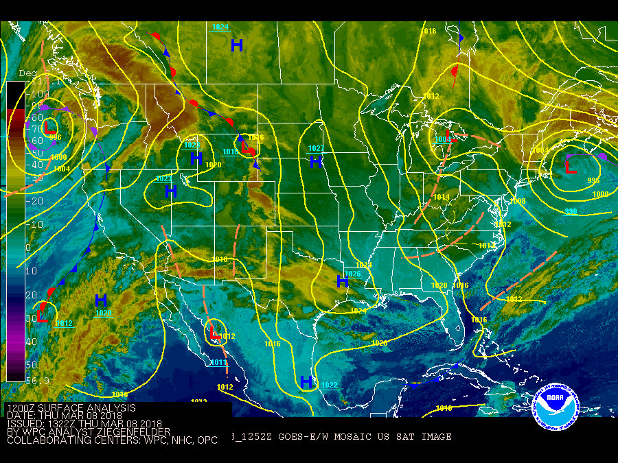
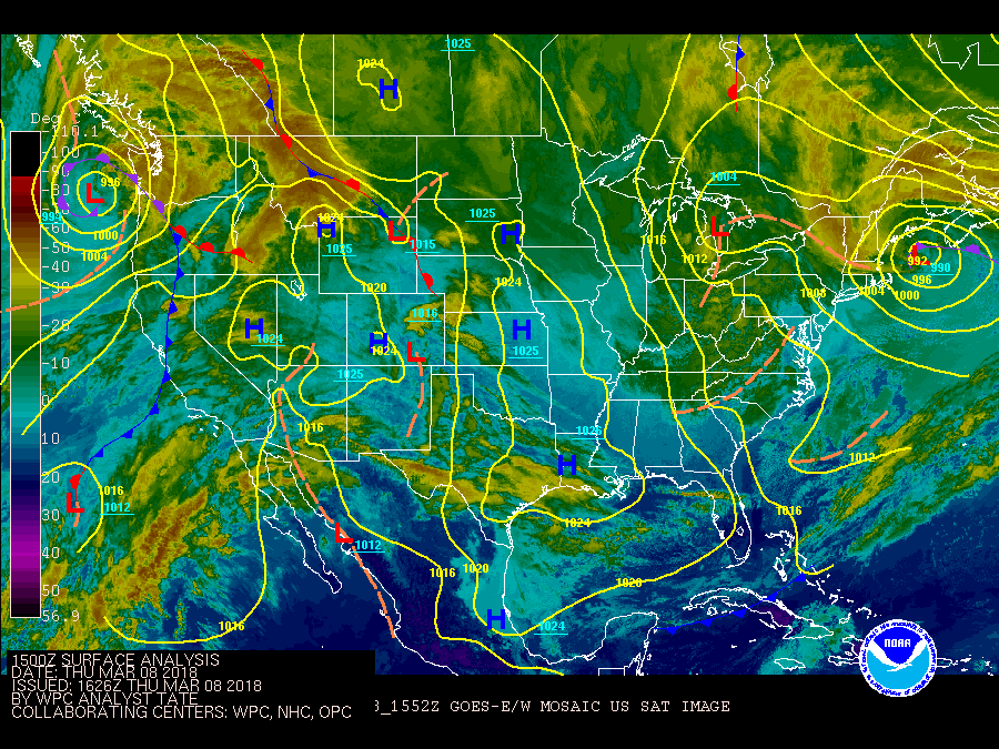
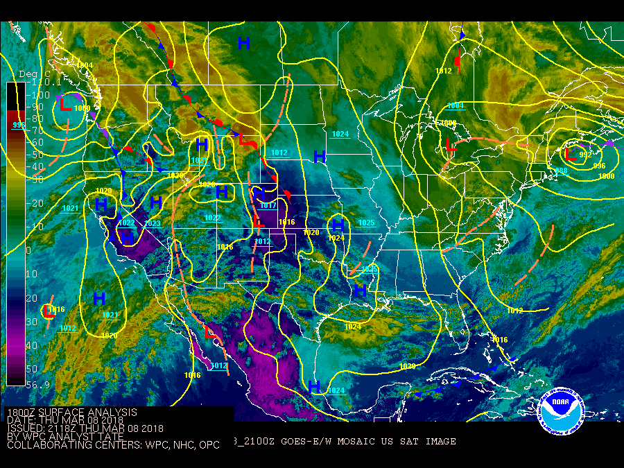
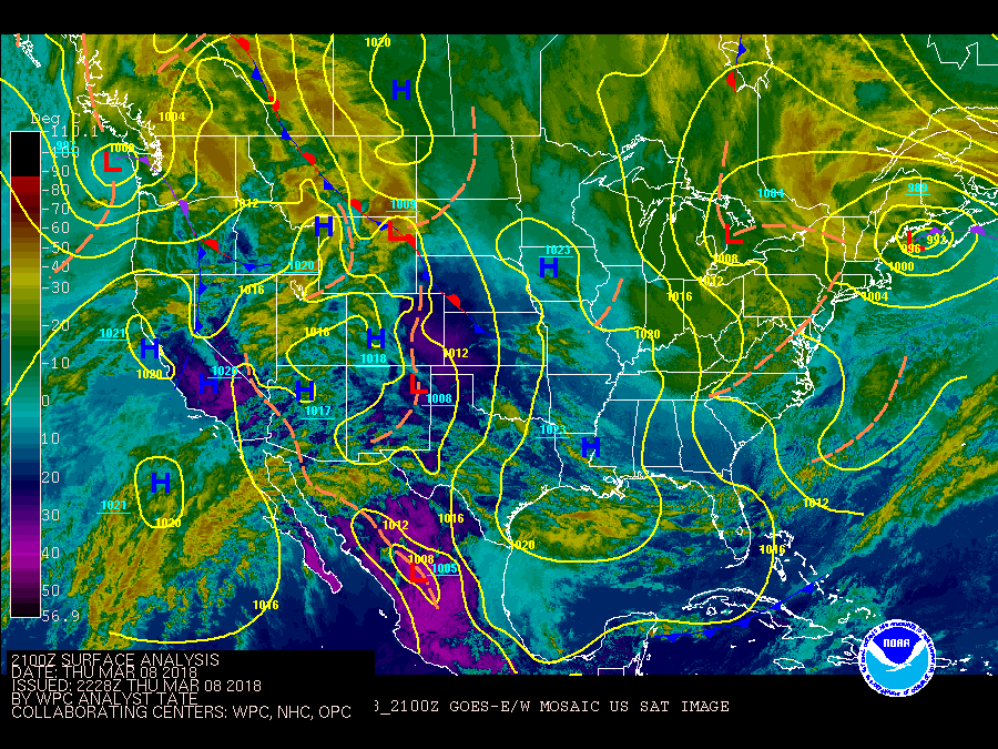
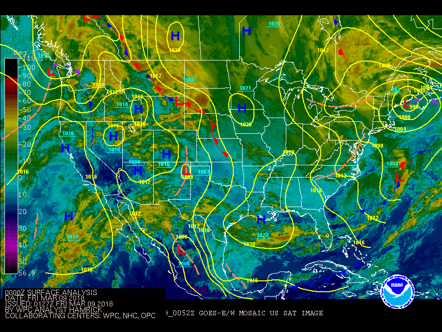
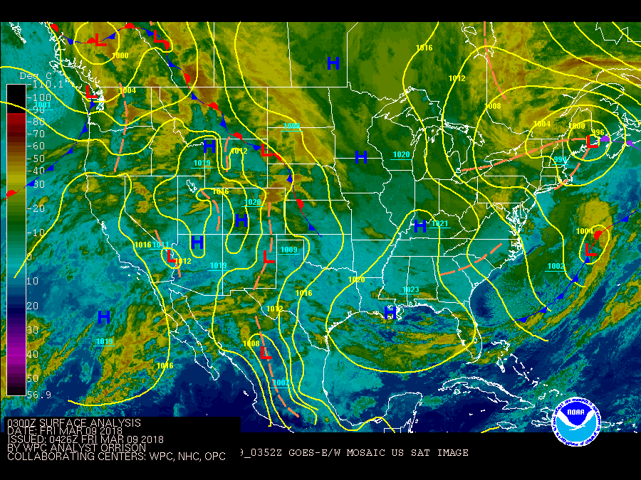
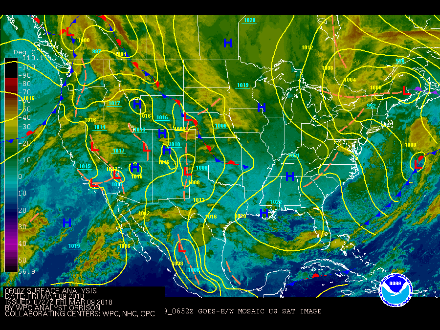
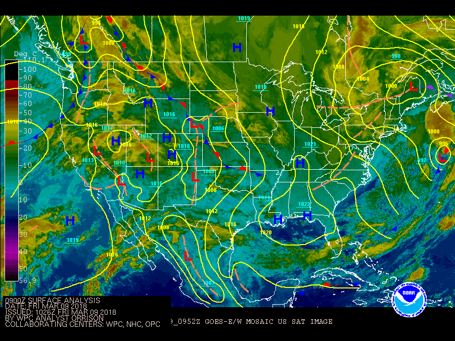
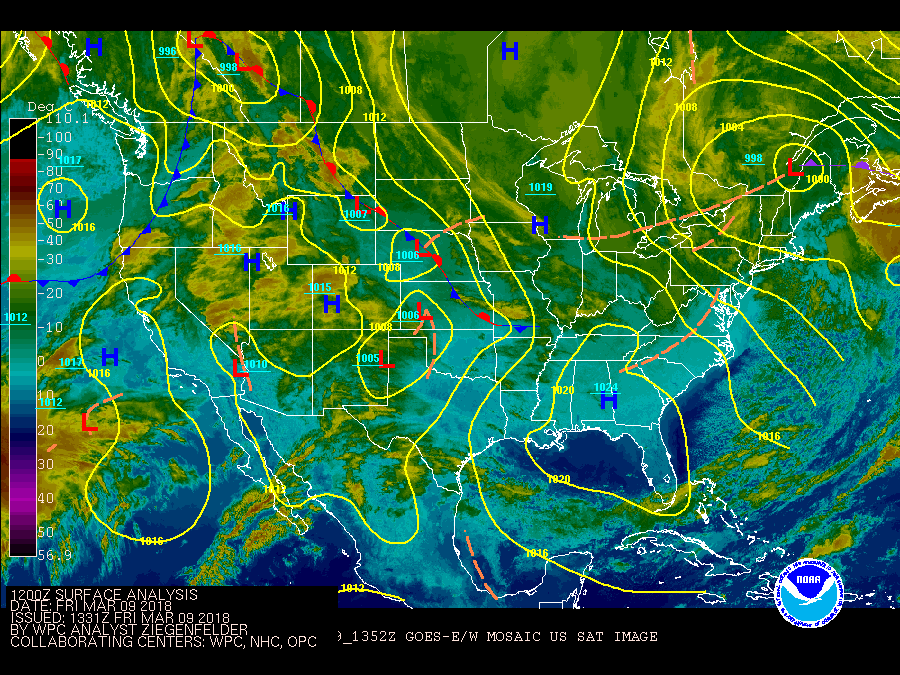
The following surface analysis and satellite images are from NOAA's Weather Prediction Center.
The loop starts at 7 PM EST March 06, 2018 and ends 7 AM EST March 9, 2018. Most notable feature is the storm, Nor'easter, that forms over parts of South Carolina and Georga and strengthens as it slowly moves up the eastern coastline into Maine.
Where to find snow/rain reports.
For snowfall analyses for the entire country, try the National Operational Hydrologic Remote Sensing Center.
Rainfall/snowfall amounts from official National Weather Service observing sites can be found on the NOWData web page.

