
Beryl is expected to restrengthen into a hurricane by Sunday as it moves closer towards the Middle Texas Coast. Beryl is expected to make landfall by early Monday morning along the Middle Texas Coast. Deteriorating conditions are expected on Sunday into early Monday morning across coastal areas of Cameron, Willacy, and Kenedy counties and the Lower Texas coastal waters. Read More >
Last Map Update: Sat, Jul 6, 2024 at 7:08:40 pm CDT


|
||||||||||||||||||||||||||||||||||||||||||||||||||||||||||||||||||||||||||||||||||||||||||||||||||||||||||||||||||||||||
|
Text Product Selector (Selected product opens in current window)
|
|
| Beach | Tropical | Marine Weather | Fire Weather | Hazards Outlook | Rivers-Flooding |
| Observations | Forecasters Discussion | Satellite | Preparedness | Weather Radio | Spanish Weather Radio |
| Outreach | Newsletter | Drought | Rip Current Safety | Flood Safety | Skywarn |
| Event Summaries | Seasonal Outlooks | Storm Data | Research | User Guides | Severe Weather Drill |


 Brownsville/RGV Radar
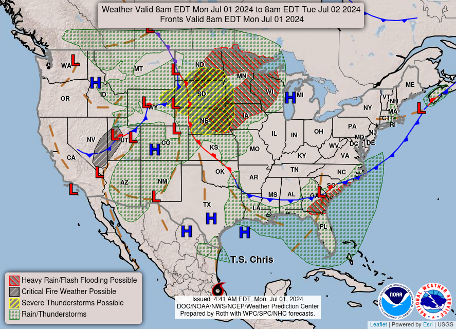 Weather Map