
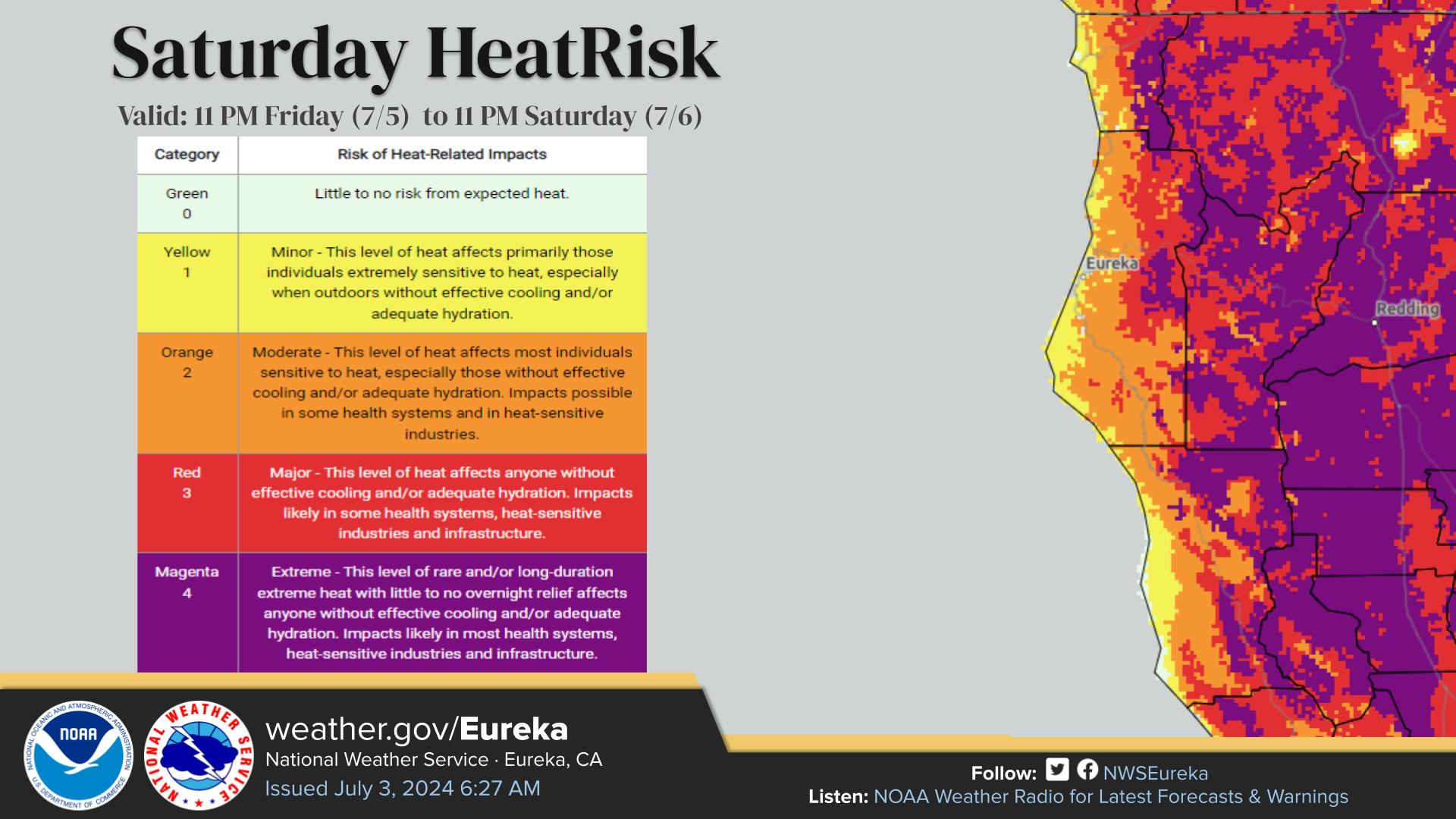
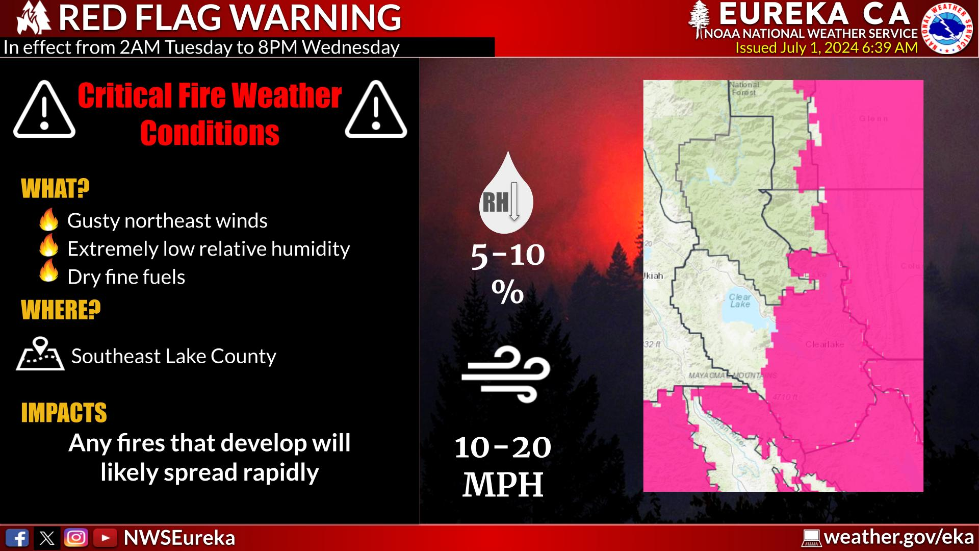
Severe thunderstorms are expected mainly from Kansas into northern Missouri and into Iowa Tuesday. Damaging winds will be the most likely threat, with large hail possible. An Enhanced Risk (level 3 of 5) of severe thunderstorms is in effect. Hot conditions will continue across the Southern Plains Tuesday, spreading into the southeast and Mid-Atlantic by Independence Day. Read More >
Last Map Update: Tue, Jul 2, 2024 at 1:48:33 am PDT
|
Text Product Selector (Selected product opens in current window)
|
|


 KBHX Radar
 Social Media
 Satellite
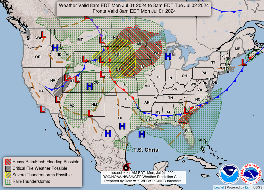 Weather Map
 Forecast Weather Tables
 Climate Graphs
 Become A Rain/Snow/Hail Observer
 TsunamiReady
 Water Temperatures for NW California
 NW CA Mtn Pass Forecasts
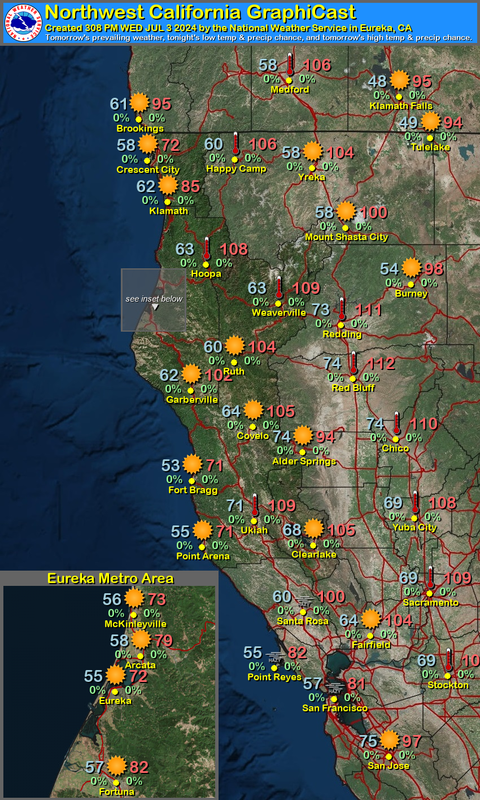 NW CA Daily Graphicast
 Subscribe to our Newsletter
 Area Smoke Forecast
 Drought Monitor
 Air Quality