
A significant and dangerous heat wave will expand from the Central U.S. into the Eastern U.S and linger through much of the work week. Numerous daily record highs and warm lows are likely. Severe thunderstorms are possible from the southern Plains through the Upper Mississippi Valley. Fire weather concerns are expected to persist across the Four Corners region. Read More >
Green Bay, WI
Weather Forecast Office
Outlooks, Watches and Warnings
| Send your Storm Report | Severe Weather Monitor Page | Go to Winter Storms |
Note: Always check the time and date of any product or map to ensure it is current.
Latest Local Hazardous Weather Outlook
Latest Watches, Warnings, and Advisories
| All Watches/Warnings | T-Storm/Tornado Watches | SPC Activity Chart |
 |
 |
 |
| Mesoscale Discussions | Mesoscale Analysis | Storm Reports |
 |
 |
 |
Thunderstorm Outlooks and Rainfall (Severe Risk Categories Explained)
| Today/Tonight | Tomorrow | Day 3 |
 |
 |
 |
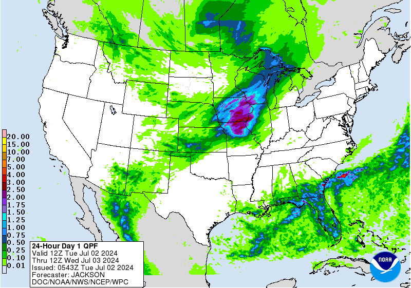
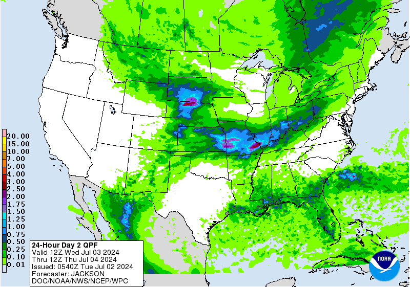
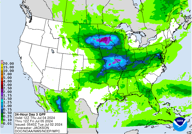
| Today/Tonight Rain | Tomorrow Rain | Day 3 Rain |
 |
 |
 |
Watch, Warning, and Advisory Text Products
Note: Always check the time and date of any product or map to ensure it is current.
US Dept of Commerce
National Oceanic and Atmospheric Administration
National Weather Service
Green Bay, WI
2485 South Point Road
Green Bay, WI 54313-5522
920-494-2363
Comments? Questions? Please Contact Us.

