
Severe thunderstorms will bring a threat of damaging winds, large hail, and a couple of tornadoes to portions of the Southeast and Mid-Atlantic on Friday, and heavy rain may lead to instances of flash flooding from eastern Kentucky to southern New York. Meanwhile, dangerous heat will develop in the West, with potentially record-breaking temperatures. Read More >
| Snow Amount Potential
Experimental - Leave feedback
|
|
| Expected Snowfall - Official NWS Forecast
What's this? |
High End Amount 1 in 10 Chance (10%) of Higher Snowfall What's this? |
| Low End Amount 9 in 10 Chance (90%) of Higher Snowfall What's this? |
|
| Percent Chance That Snow Amounts Will Be Greater Than...
Experimental - Leave feedback
What's this?
|
||||||||||||||||
|
||||||||||||||||
| Snowfall Totals by Location
Experimental - Leave feedback
What's this?
|
|
|
| Selected City Charts | |
Expected Snowfall - Box and Whisker Plot |
Expected Snowfall - Exceedance Bar Plot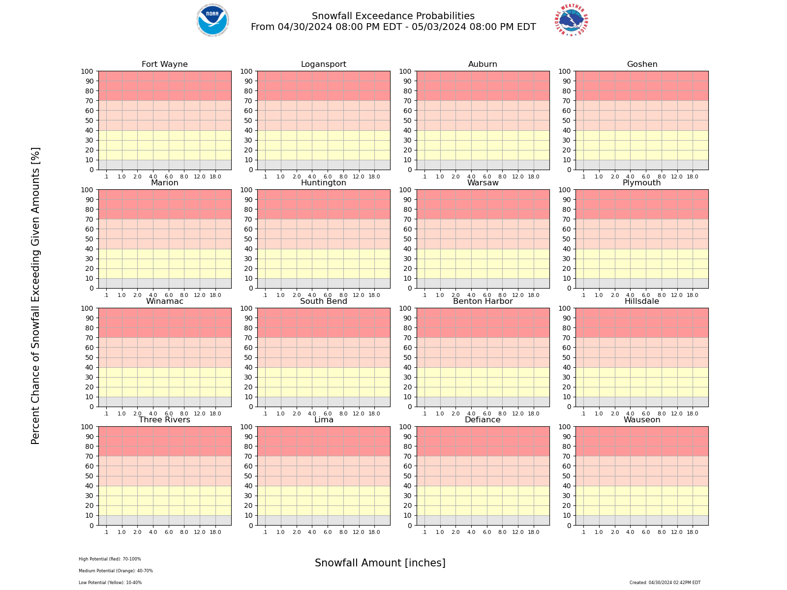 |
| Ice Accumulation Potential
|
|
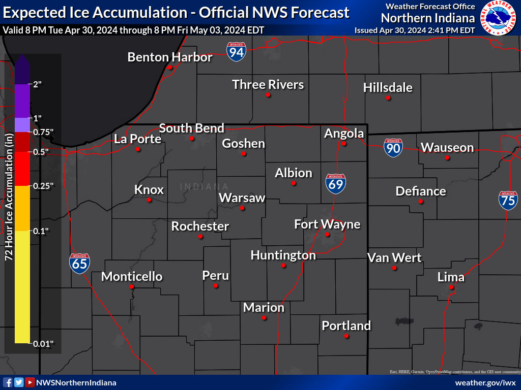
Expected Ice Accumulation - Official NWS Forecast This is the elevated flat surface ice accumulation. It is not radial/line ice. Radial/line ice is typically 39% of the elevated flat surface ice. For more information on this, see this module. |
|---|
 What's this? |
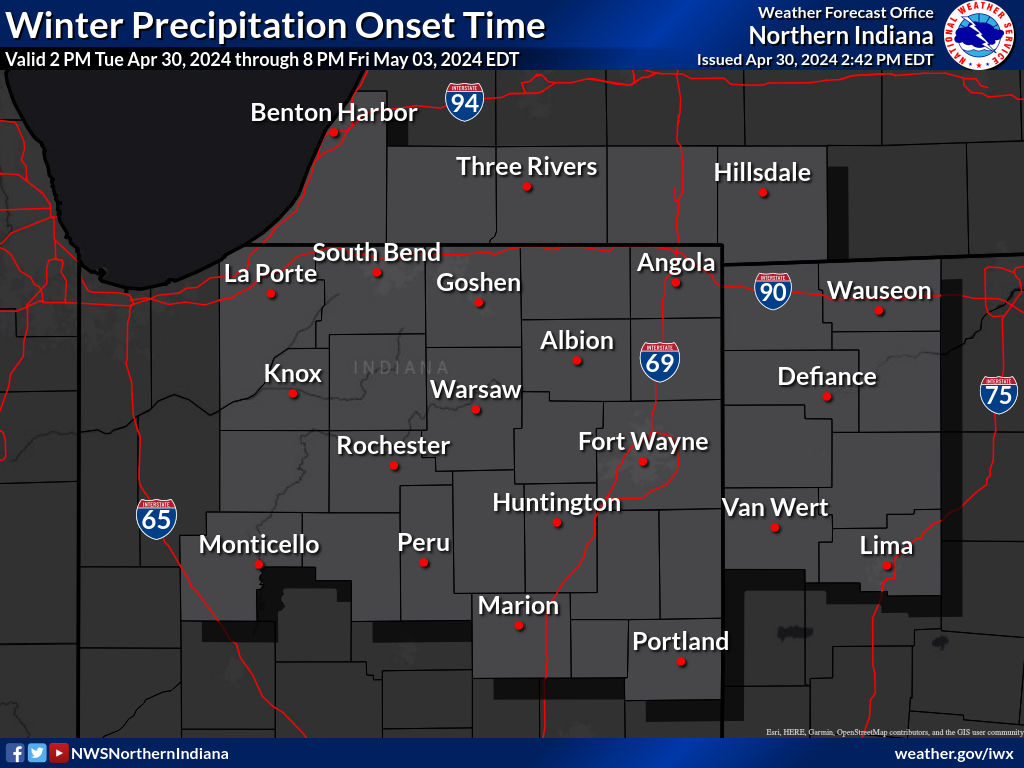
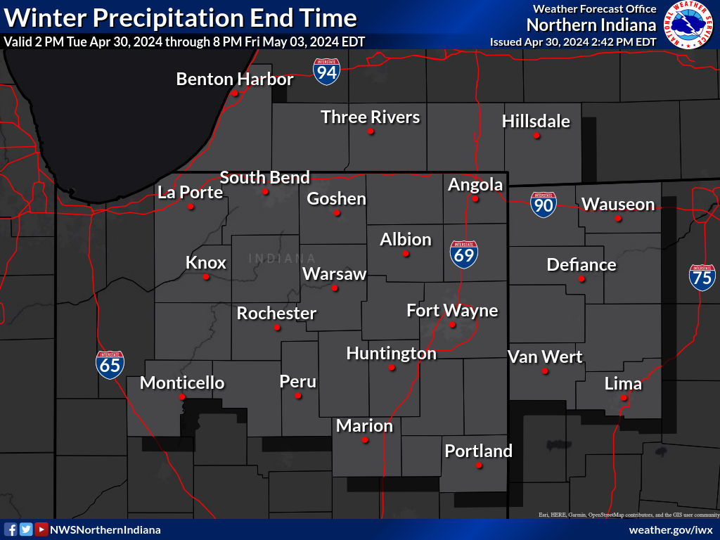
| Precipitation Onset/End Timing | ||
| Onset of Wintry Precipitation | End Timing of Wintry Precipitation | |
|---|---|---|
 |
 |
|
| What's this? | What's this? | |
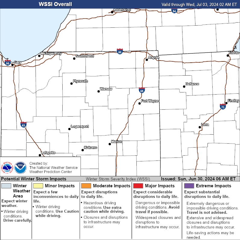
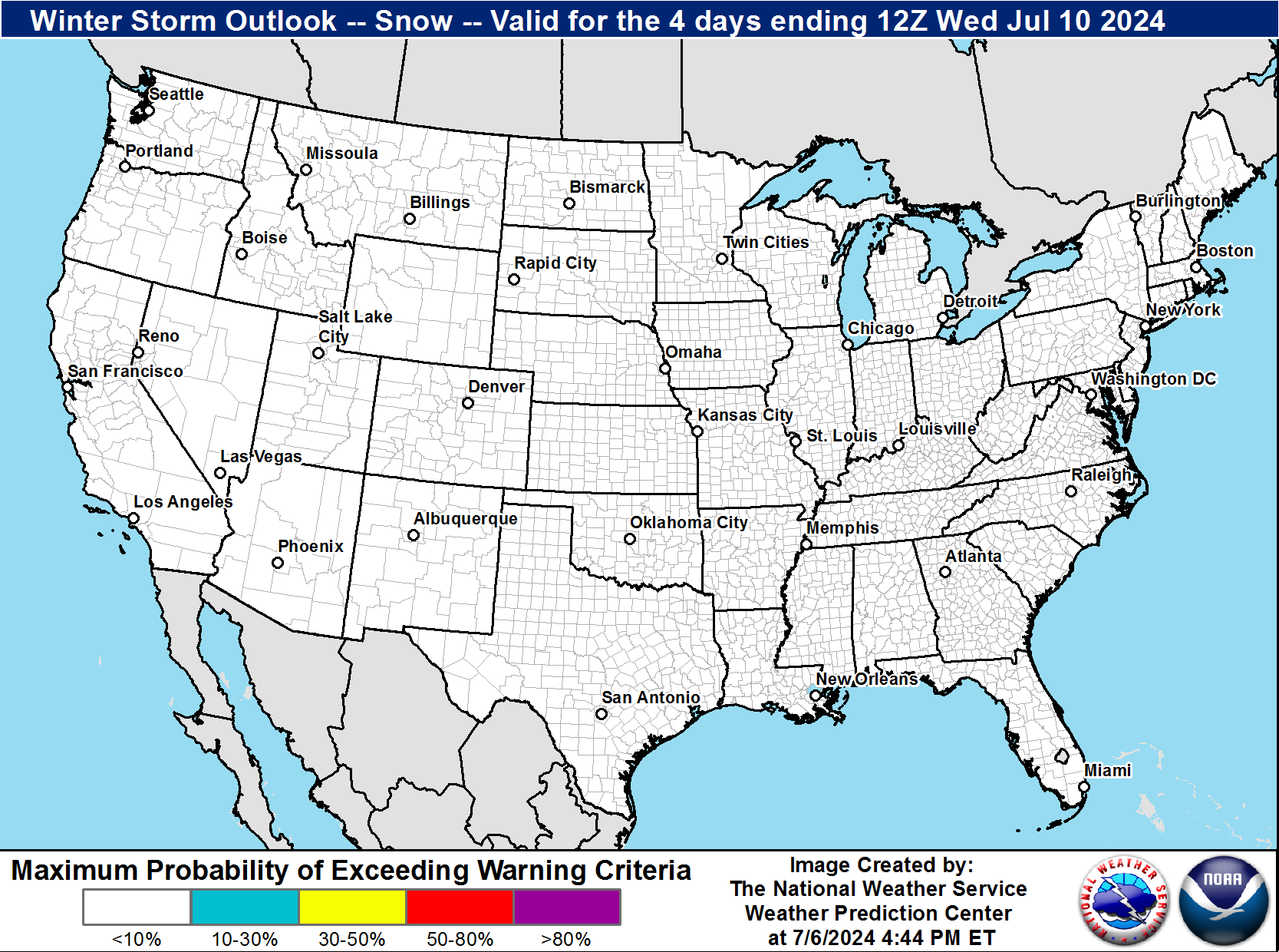
| Winter Storm Severity Index (WSSI) | Winter Storm Outlook (WSO) |
|---|---|
 |
 |
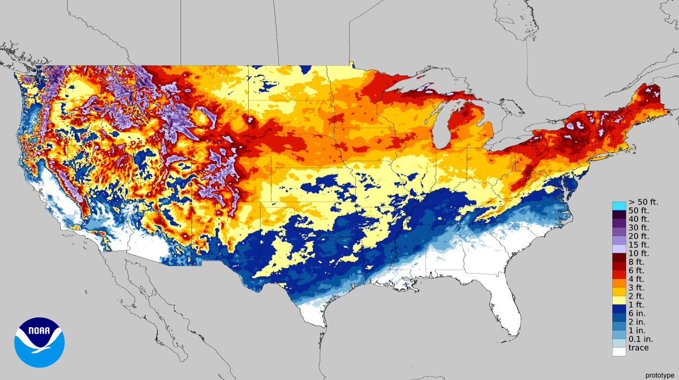
| National Snow Reports | National Snowfall Analysis |
|---|---|
 |
 |
| Local Snow Reports | |
 |
|
| Days 4-7 Winter Weather Outlook | |
| Day 4 Winter Weather Outlook | Day 5 Winter Weather Outlook |
 |
 |
| Day 6 Winter Weather Outlook | Day 7 Winter Weather Outlook |
 |
 |
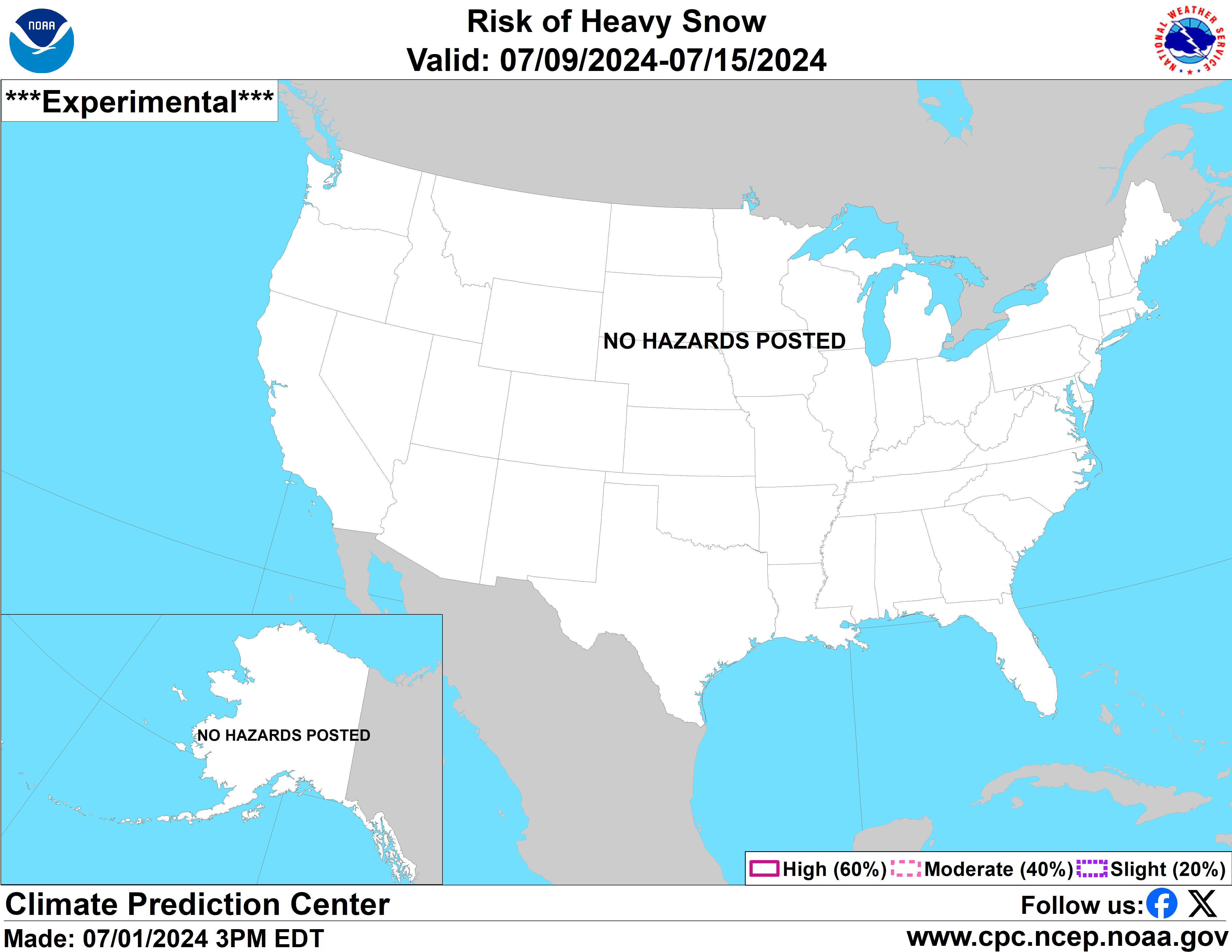
| CPC Week-2 Experimental Heavy Snow Risk | |
 |
|
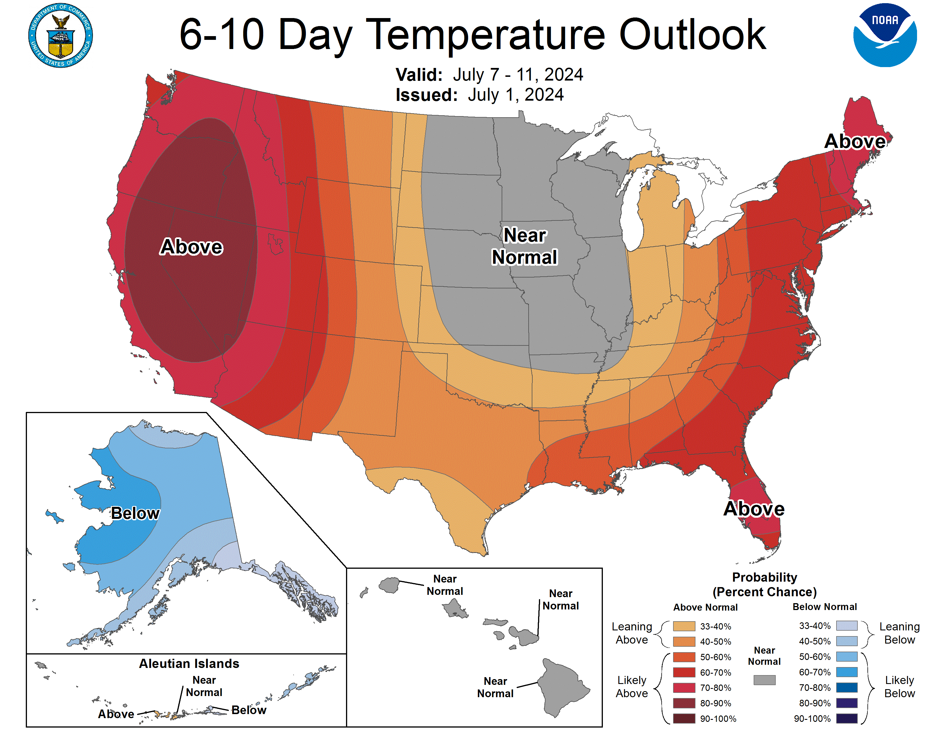
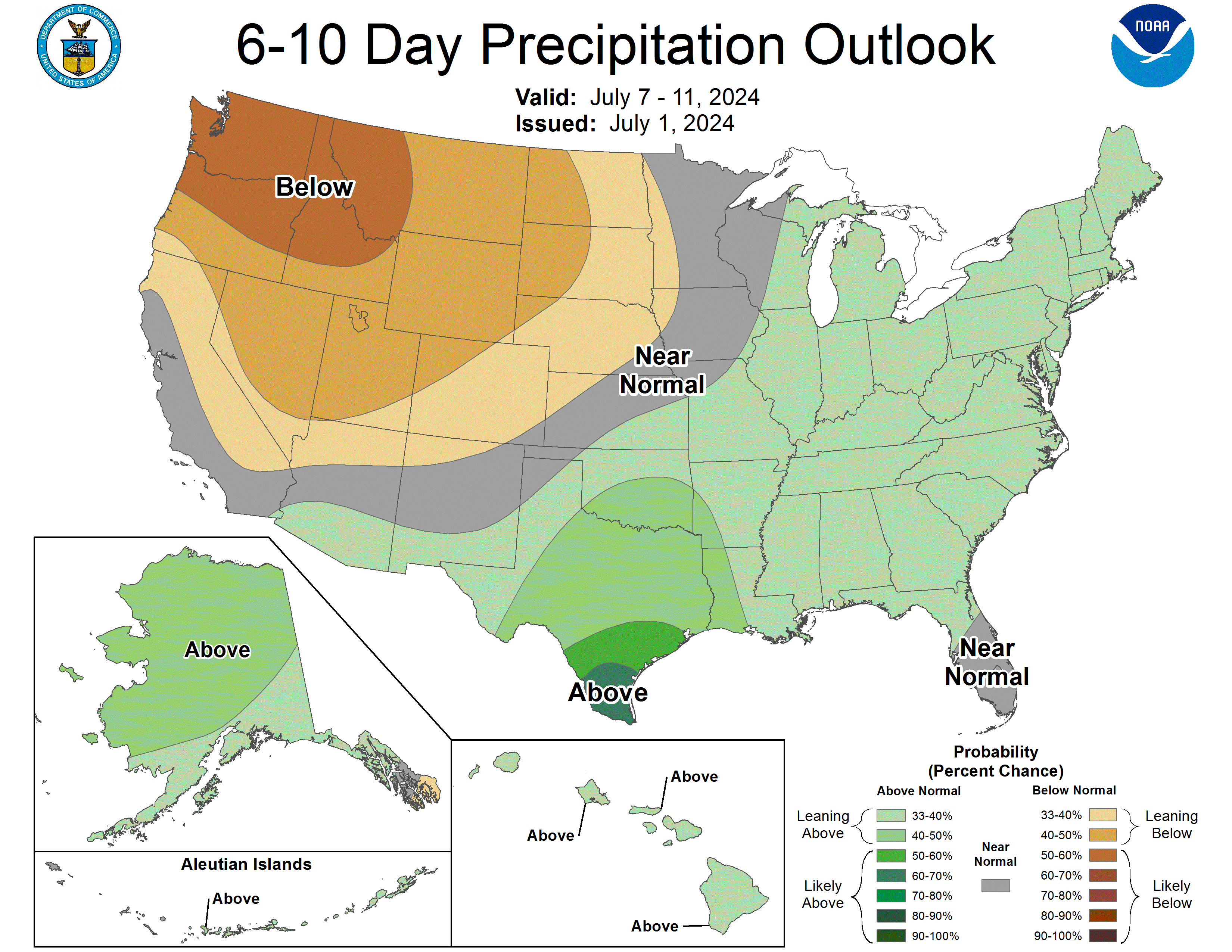
| CPC Temperature & Precipitation Maps | |
|
Days 6-10 |
|
| Temperature | Precipitation |
 |
 |
|
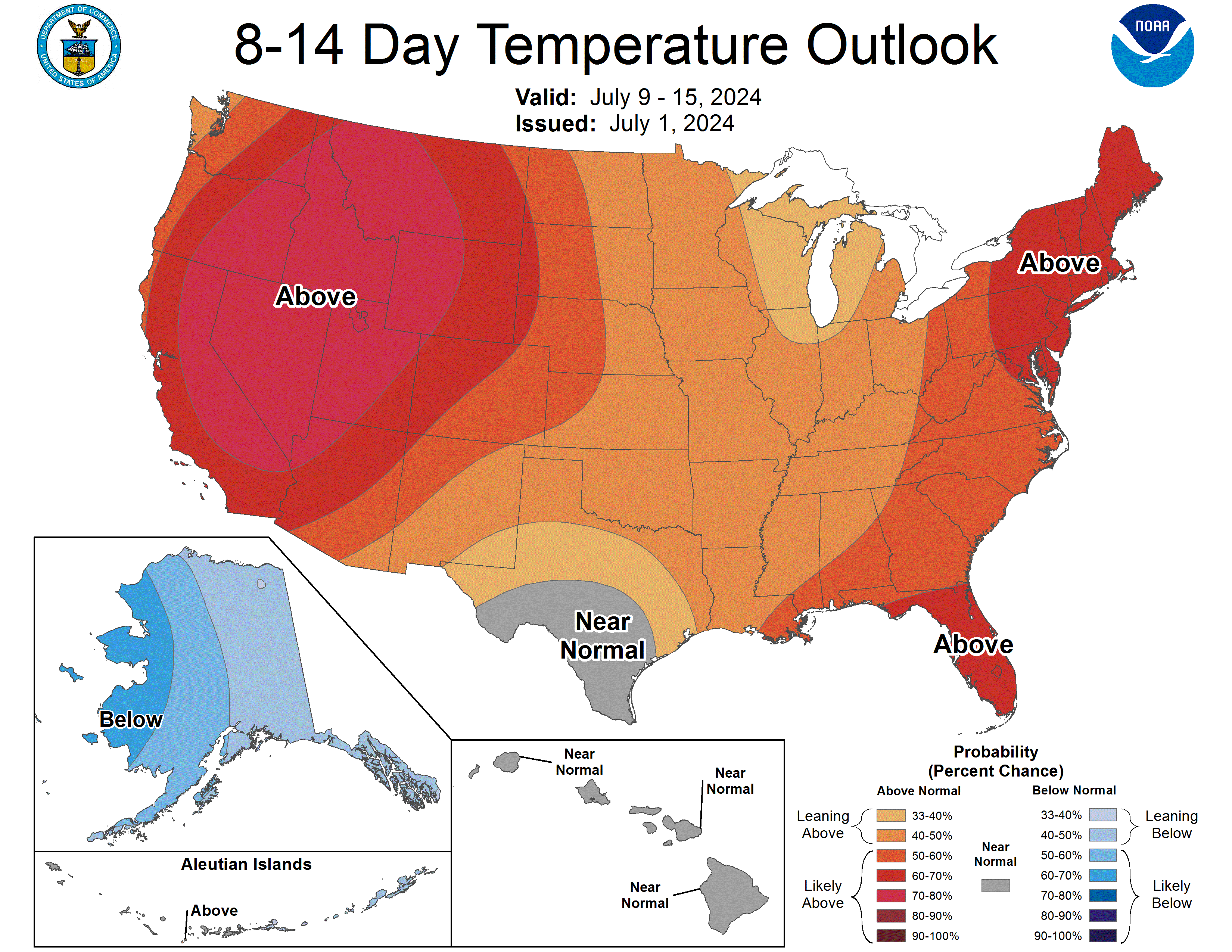
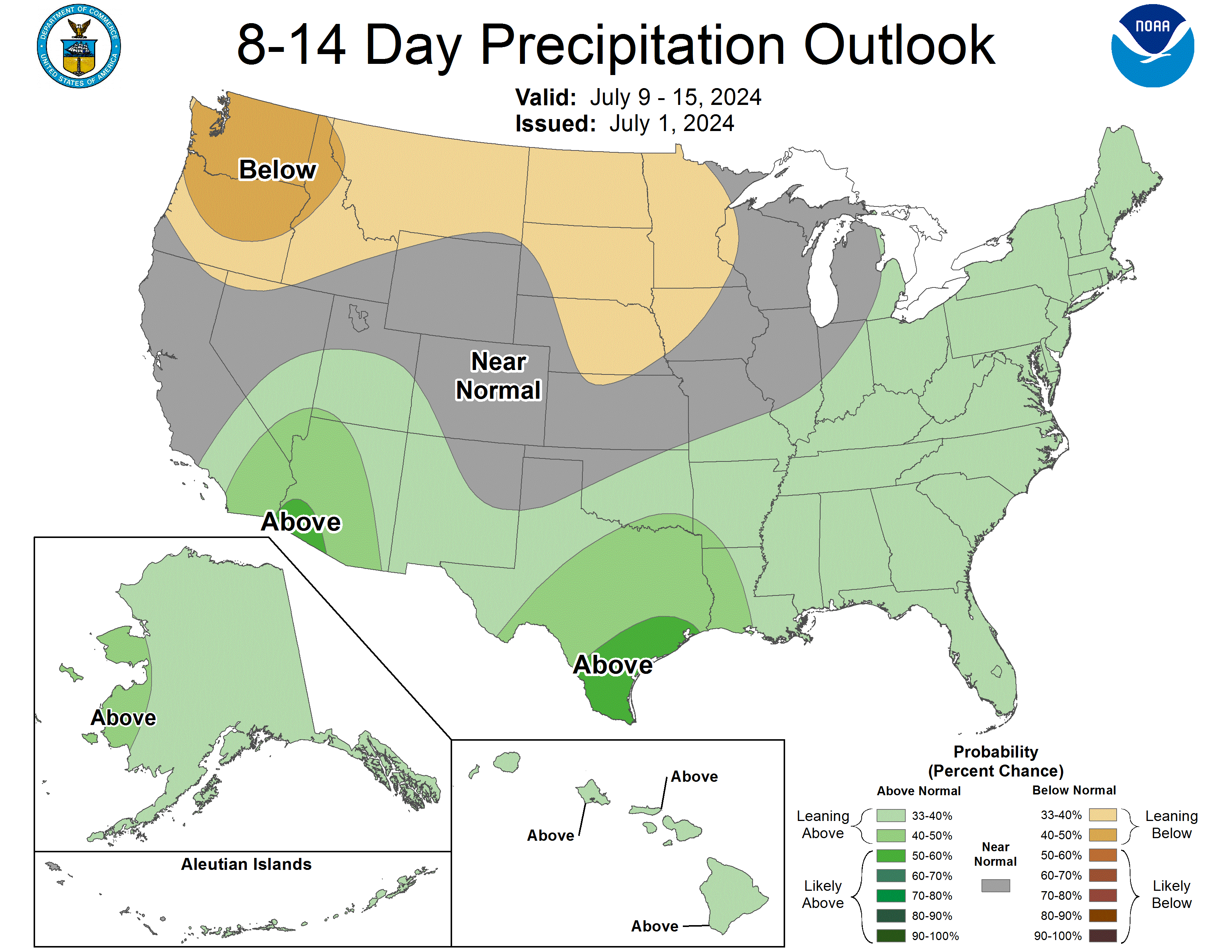
Days 8-14 |
|
| TEMPERATURE | PRECIPITATION |
 |
 |
|
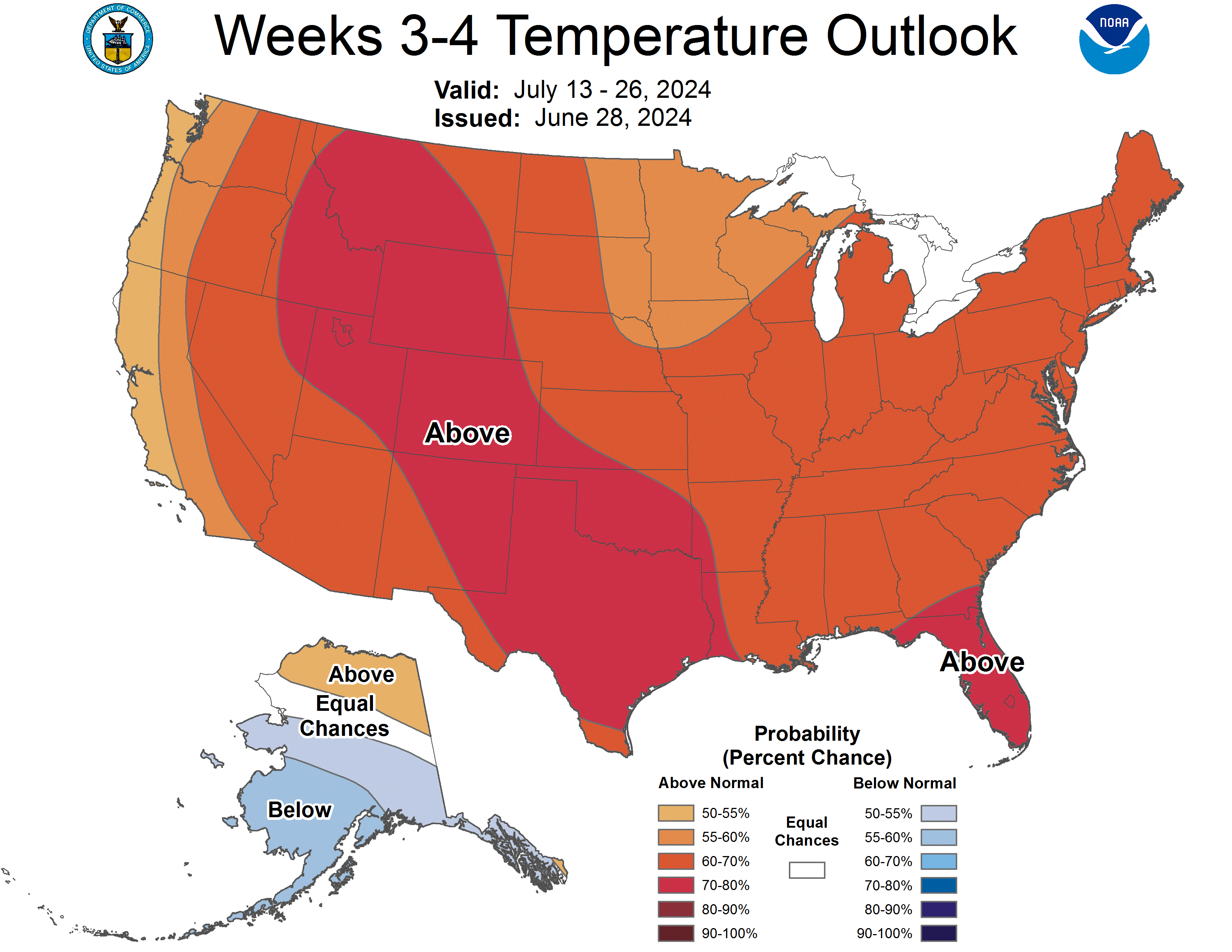
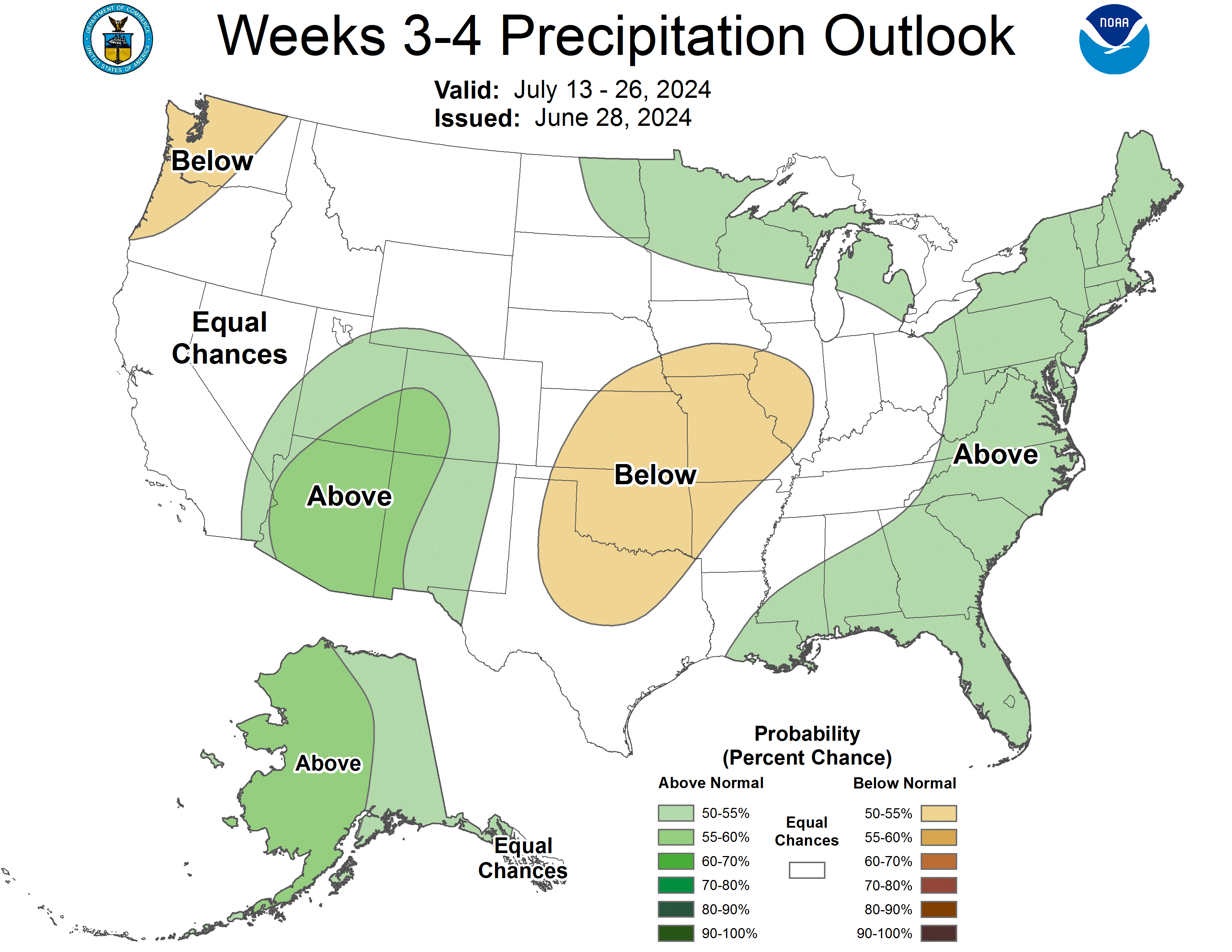
Week 3-4 |
|
|
TEMPERATURE |
PRECIPITATION |
 |
 |

