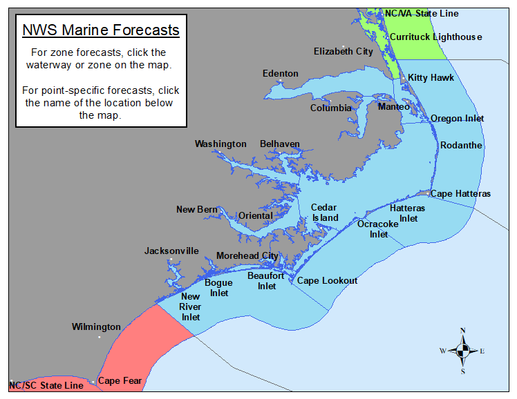
NWS Newport/Morehead City, NC is responsible for marine forecasts for the coastal waters from Duck, NC to North Topsail, NC out to 20 nautical miles, as well as the tidal inshore waters from the Albemarle Sound to New River. Forecasts are updated frequently based on the latest observations and forecast guidance.
To report unusual marine conditions, including waterspout, to the National Weather Service call toll free 800-889-6889.
Select Point Forecasts:
| 145 | 230 | 255 | 275 | 285 | 296 | 315 | 342 | 345 | 355 |
| Wimble Shoals | Diamond Shoals | Lookout Shoals | Eastern Albemarle Sound (ICW) | Mouth of Pungo River (ICW) | Mouth of Neuse River (ICW) |
Other Forecast Resources:
337
WHUS72 KMHX 200804
MWWMHX
URGENT - MARINE WEATHER MESSAGE
National Weather Service Newport/Morehead City NC
404 AM EDT Fri Jun 20 2025
AMZ135-200915-
/O.EXP.KMHX.SC.Y.0056.000000T0000Z-250620T0800Z/
Pamlico Sound-
404 AM EDT Fri Jun 20 2025
...SMALL CRAFT ADVISORY HAS EXPIRED...
Wind gusts have fallen below 25 knots and are not expected to
increase further, so the Small Craft Advisory has been allowed to
expire.
$$
AMZ156-158-201300-
/O.CON.KMHX.SC.Y.0056.000000T0000Z-250620T1300Z/
S of Ocracoke Inlet to Cape Lookout NC out 20 nm-
S of Cape Lookout to N of Surf City NC out 20 nm-
404 AM EDT Fri Jun 20 2025
...SMALL CRAFT ADVISORY REMAINS IN EFFECT UNTIL 9 AM EDT THIS
MORNING...
* WHAT...West winds 10 to 20 kt with gusts up to 30 kt and seas
4 to 6 ft.
* WHERE...The coastal waters from Ocracoke Inlet to Surf City.
* WHEN...Until 9 AM EDT this morning.
* IMPACTS...Conditions will be hazardous to small craft.
PRECAUTIONARY/PREPAREDNESS ACTIONS...
Inexperienced mariners, especially those operating smaller
vessels, should avoid navigating in hazardous conditions.
&&
$$
AMZ152-154-201300-
/O.CON.KMHX.SC.Y.0056.000000T0000Z-250620T1300Z/
S of Oregon Inlet to Cape Hatteras NC out 20 nm-
S of Cape Hatteras to Ocracoke Inlet NC out 20 nm
including the Monitor National Marine Sanctuary-
404 AM EDT Fri Jun 20 2025
...SMALL CRAFT ADVISORY REMAINS IN EFFECT UNTIL 9 AM EDT THIS
MORNING...
* WHAT...West winds 10 to 20 kt with gusts up to 30 kt and seas
4 to 6 ft.
* WHERE...The coastal waters from Oregon Inlet to Ocracoke Inlet.
* WHEN...Until 9 AM EDT this morning.
* IMPACTS...Conditions will be hazardous to small craft.
PRECAUTIONARY/PREPAREDNESS ACTIONS...
Inexperienced mariners, especially those operating smaller
vessels, should avoid navigating in hazardous conditions.
&&
$$
607
FZUS52 KMHX 221926
CWFMHX
Coastal Waters Forecast for North Carolina
National Weather Service Newport/Morehead City NC
326 PM EDT Sun Jun 22 2025
From S of Currituck Beach Light to N of Surf City NC out 20 NM,
including the Albemarle and Pamlico Sounds and the Monitor
National Marine Sanctuary
AMZ100-230815-
326 PM EDT Sun Jun 22 2025
.Synopsis for Eastern North Carolina coastal waters...
High pressure will remain over the area through early this week
with mainly dry conditions but dangerous heat and humidity.
$$
AMZ230-230815-
Albemarle Sound-
326 PM EDT Sun Jun 22 2025
.TONIGHT...E winds 10 to 15 kt, becoming S 5 to 10 kt this
evening, then becoming SW after midnight. Waves 1 ft or less.
.MON...W winds 5 to 10 kt. Waves 1 ft or less.
.MON NIGHT...SE winds around 5 kt, becoming SW after midnight.
Waves 1 ft or less.
.TUE...N winds around 5 kt, becoming E around 5 kt in the
afternoon. Waves 1 ft or less.
.TUE NIGHT...SE winds 5 to 10 kt, becoming SW after midnight.
Waves 1 ft or less.
.WED...W winds around 5 kt, becoming E in the afternoon. Waves
1 ft or less.
.WED NIGHT...S winds 5 to 10 kt. Waves 1 ft or less.
.THU...SW winds 5 to 10 kt, becoming S in the afternoon. Waves
1 ft or less.
.THU NIGHT...S winds 5 to 10 kt. Waves 1 ft or less.
.FRI...S winds 5 to 10 kt. Waves 1 ft or less.
.FRI NIGHT...SW winds 5 to 10 kt. Waves 1 ft or less.
$$
AMZ131-230815-
Alligator River-
326 PM EDT Sun Jun 22 2025
.TONIGHT...S winds 5 to 10 kt, becoming SW after midnight. Waves
light chop. Isolated showers and tstms early.
.MON...W winds 5 to 10 kt, becoming N in the afternoon. Waves
light chop, diminishing to flat in the afternoon.
.MON NIGHT...SE winds around 5 kt, becoming SW after midnight.
Waves flat.
.TUE...N winds around 5 kt, becoming NE around 5 kt in the
afternoon. Waves flat.
.TUE NIGHT...SE winds around 5 kt, becoming SW after midnight.
Waves flat.
.WED...W winds around 5 kt, becoming E in the afternoon. Waves
flat, increasing to light chop in the afternoon.
.WED NIGHT...S winds 5 to 10 kt. Waves light chop.
.THU...S winds 5 to 10 kt. Waves light chop.
.THU NIGHT...S winds around 10 kt. Waves light chop.
.FRI...S winds 5 to 10 kt. Waves light chop.
.FRI NIGHT...SW winds around 10 kt. Waves light chop.
Winds and waves higher in and near tstms.
$$
AMZ231-230815-
Croatan and Roanoke Sounds-
326 PM EDT Sun Jun 22 2025
.TONIGHT...S winds 10 to 15 kt, becoming SW late this evening and
overnight. Waves light chop.
.MON...W winds 5 to 10 kt, becoming SW in the afternoon. Waves
light chop.
.MON NIGHT...S winds around 5 kt, becoming SW after midnight.
Waves flat.
.TUE...N winds around 5 kt, becoming E around 5 kt in the
afternoon. Waves flat.
.TUE NIGHT...S winds 5 to 10 kt. Waves light chop.
.WED...W winds around 5 kt, becoming SE in the afternoon. Waves
flat, increasing to light chop in the afternoon.
.WED NIGHT...S winds 5 to 10 kt. Waves light chop.
.THU...SW winds 5 to 10 kt, becoming S 10 to 15 kt in the
afternoon. Waves light chop, increasing to a moderate chop in the
afternoon.
.THU NIGHT...S winds 10 to 15 kt. Waves a moderate chop.
.FRI...S winds 10 to 15 kt. Waves a moderate chop.
.FRI NIGHT...SW winds 10 to 15 kt. Waves a moderate chop.
$$
AMZ135-230815-
Pamlico Sound-
326 PM EDT Sun Jun 22 2025
.TONIGHT...S winds around 10 kt, becoming SW late this evening
and overnight. Waves 1 ft or less, then around 2 ft.
.MON...W winds 5 to 10 kt, becoming SW in the afternoon. Waves
1 ft or less.
.MON NIGHT...SW winds 5 to 10 kt. Waves 1 ft or less.
.TUE...N winds around 5 kt, becoming E around 5 kt in the
afternoon. Waves 1 ft or less.
.TUE NIGHT...SE winds around 5 kt, becoming SW after midnight.
Waves 1 ft or less.
.WED...SW winds around 5 kt, becoming SE in the afternoon. Waves
1 ft or less.
.WED NIGHT...S winds around 10 kt. Waves 1 ft or less.
.THU...SW winds 5 to 10 kt, becoming S 10 to 15 kt in the
afternoon. Waves 1 ft or less.
.THU NIGHT...SW winds 10 to 15 kt. Waves around 2 ft.
.FRI...SW winds 10 to 15 kt. Waves 1 ft or less, then around 2 ft
in the afternoon.
.FRI NIGHT...SW winds 10 to 15 kt. Waves around 2 ft.
$$
AMZ136-230815-
Pamlico and Pungo Rivers-
326 PM EDT Sun Jun 22 2025
.TONIGHT...SE winds 5 to 10 kt, becoming W late. Waves light
chop.
.MON...W winds 5 to 10 kt, becoming SW in the afternoon. Waves
light chop, diminishing to flat in the afternoon.
.MON NIGHT...SW winds around 5 kt. Waves flat.
.TUE...NW winds around 5 kt, becoming E in the afternoon. Waves
flat, increasing to light chop in the afternoon.
.TUE NIGHT...SE winds 5 to 10 kt, becoming SW after midnight.
Waves light chop, diminishing to flat after midnight.
.WED...NW winds around 5 kt, becoming SE in the afternoon. Waves
flat, increasing to light chop in the afternoon.
.WED NIGHT...S winds 5 to 10 kt. Waves light chop.
.THU...SW winds 5 to 10 kt, becoming S in the afternoon. Waves
light chop.
.THU NIGHT...S winds 5 to 10 kt. Waves light chop.
.FRI...S winds 5 to 10 kt. Waves light chop.
.FRI NIGHT...SW winds 5 to 10 kt. Waves light chop.
$$
AMZ137-230815-
Neuse and Bay Rivers-
326 PM EDT Sun Jun 22 2025
.TONIGHT...S winds 5 to 10 kt, becoming SW late this evening and
overnight. Waves light chop. Isolated showers and tstms early.
.MON...W winds 5 to 10 kt, becoming S in the afternoon. Waves
light chop, diminishing to flat in the afternoon.
.MON NIGHT...SW winds 5 to 10 kt. Waves light chop.
.TUE...NW winds around 5 kt, becoming E in the afternoon. Waves
flat, increasing to light chop in the afternoon.
.TUE NIGHT...S winds around 5 kt, becoming SW after midnight.
Waves flat.
.WED...W winds around 5 kt, becoming SE in the afternoon. Waves
flat, increasing to light chop in the afternoon.
.WED NIGHT...S winds 5 to 10 kt. Waves light chop.
.THU...S winds 5 to 10 kt. Waves light chop.
.THU NIGHT...S winds 5 to 10 kt. Waves light chop.
.FRI...SW winds 5 to 10 kt. Waves light chop.
.FRI NIGHT...SW winds 10 to 15 kt, diminishing to 5 to 10 kt
after midnight. Waves a moderate chop, diminishing to light chop
after midnight.
Winds and waves higher in and near tstms.
$$
AMZ150-230815-
S of Currituck Beach Light to Oregon Inlet NC out 20 nm-
326 PM EDT Sun Jun 22 2025
.TONIGHT...S winds 5 to 10 kt, becoming SW 10 to 15 kt late this
evening and overnight. Seas 2 to 3 ft. Wave Detail: S 2 ft at
4 seconds and SE 1 ft at 8 seconds.
.MON...W winds 5 to 10 kt. Seas 2 to 3 ft. Wave Detail: W 2 ft at
3 seconds and SE 1 ft at 8 seconds.
.MON NIGHT...S winds 5 to 10 kt, becoming SW after midnight. Seas
around 2 ft. Wave Detail: S 1 ft at 4 seconds and E 1 ft at
8 seconds.
.TUE...N winds around 5 kt, becoming E in the afternoon. Seas
around 2 ft. Wave Detail: S 1 ft at 4 seconds and E 1 ft at
8 seconds.
.TUE NIGHT...S winds 5 to 10 kt, becoming SW after midnight. Seas
around 2 ft. Wave Detail: SE 2 ft at 8 seconds and S 1 ft at
4 seconds.
.WED...SW winds around 5 kt, becoming S in the afternoon. Seas
around 2 ft. Wave Detail: SE 2 ft at 9 seconds and S 1 ft at
4 seconds.
.WED NIGHT...S winds around 10 kt. Seas around 2 ft.
.THU...SW winds 5 to 10 kt, becoming S 10 to 15 kt in the
afternoon. Seas 2 to 3 ft.
.THU NIGHT...S winds 10 to 15 kt. Seas 2 to 3 ft.
.FRI...S winds 10 to 15 kt. Seas 2 to 3 ft.
.FRI NIGHT...SW winds 10 to 15 kt. Seas 2 to 3 ft.
$$
AMZ152-230815-
S of Oregon Inlet to Cape Hatteras NC out 20 nm-
326 PM EDT Sun Jun 22 2025
.TONIGHT...S winds 5 to 10 kt, becoming SW 10 to 15 kt late this
evening and overnight. Seas 2 to 3 ft. Wave Detail: S 2 ft at
4 seconds and SE 1 ft at 8 seconds.
.MON...W winds 5 to 10 kt. Seas 2 to 3 ft. Wave Detail: SW 2 ft
at 4 seconds and SE 1 ft at 8 seconds.
.MON NIGHT...SW winds 5 to 10 kt. Seas around 2 ft. Wave Detail:
S 2 ft at 4 seconds and NE 1 ft at 8 seconds.
.TUE...N winds around 5 kt, becoming NE around 5 kt in the
afternoon. Seas around 2 ft. Wave Detail: S 2 ft at 4 seconds and
SE 1 ft at 8 seconds.
.TUE NIGHT...SE winds around 5 kt, becoming SW after midnight.
Seas around 2 ft. Wave Detail: S 2 ft at 4 seconds and E 2 ft at
10 seconds.
.WED...SW winds around 5 kt, becoming S in the afternoon. Seas
around 2 ft. Wave Detail: E 2 ft at 9 seconds and E 1 ft at
4 seconds.
.WED NIGHT...SW winds 5 to 10 kt. Seas around 2 ft.
.THU...SW winds 5 to 10 kt, increasing to 10 to 15 kt in the
afternoon. Seas 2 to 3 ft.
.THU NIGHT...SW winds 10 to 15 kt. Seas around 3 ft.
.FRI...SW winds 10 to 15 kt. Seas around 3 ft.
.FRI NIGHT...SW winds 10 to 15 kt. Seas around 3 ft.
$$
AMZ154-230815-
S of Cape Hatteras to Ocracoke Inlet NC out 20 nm
including the Monitor National Marine Sanctuary-
326 PM EDT Sun Jun 22 2025
.TONIGHT...S winds 5 to 10 kt, becoming SW 10 to 15 kt late this
evening and overnight. Seas 2 to 3 ft. Wave Detail: SW 2 ft at
3 seconds and SE 2 ft at 8 seconds.
.MON...W winds around 10 kt. Seas 2 to 3 ft. Wave Detail: SW 2 ft
at 4 seconds and SE 1 ft at 8 seconds.
.MON NIGHT...W winds 5 to 10 kt. Seas 2 to 3 ft. Wave Detail: SW
2 ft at 4 seconds and E 1 ft at 3 seconds.
.TUE...NW winds 5 to 10 kt, becoming NE in the afternoon. Seas
2 to 3 ft. Wave Detail: SW 2 ft at 4 seconds and E 1 ft at
3 seconds.
.TUE NIGHT...SE winds around 5 kt, becoming SW after midnight.
Seas around 2 ft. Wave Detail: SE 2 ft at 11 seconds and E 1 ft
at 4 seconds.
.WED...W winds around 5 kt, becoming S in the afternoon. Seas
around 2 ft. Wave Detail: SE 2 ft at 10 seconds and E 1 ft at
4 seconds.
.WED NIGHT...S winds 5 to 10 kt. Seas around 2 ft.
.THU...SW winds 5 to 10 kt. Seas 2 to 3 ft.
.THU NIGHT...SW winds 10 to 15 kt. Seas around 3 ft.
.FRI...SW winds 10 to 15 kt. Seas around 3 ft.
.FRI NIGHT...SW winds around 15 kt. Seas around 3 ft.
$$
AMZ156-230815-
S of Ocracoke Inlet to Cape Lookout NC out 20 nm-
326 PM EDT Sun Jun 22 2025
.TONIGHT...S winds 5 to 10 kt, becoming W 10 to 15 kt after
midnight. Seas 2 to 3 ft. Wave Detail: SW 2 ft at 3 seconds and
SE 2 ft at 8 seconds. Adjacent sounds and rivers light chop,
increasing to a moderate chop after midnight.
.MON...W winds 5 to 10 kt, becoming SW in the afternoon. Seas
2 to 3 ft. Wave Detail: SW 2 ft at 4 seconds and SE 2 ft at
8 seconds. Adjacent sounds and rivers light chop.
.MON NIGHT...SW winds around 10 kt. Seas 2 to 3 ft. Wave Detail:
SW 2 ft at 4 seconds and SE 2 ft at 8 seconds. Adjacent sounds
and rivers light chop.
.TUE...NW winds 5 to 10 kt, becoming E in the afternoon. Seas
2 to 3 ft. Wave Detail: SW 2 ft at 4 seconds and SE 2 ft at
8 seconds. Adjacent sounds and rivers light chop, diminishing to
flat in the afternoon.
.TUE NIGHT...S winds around 5 kt, becoming W after midnight. Seas
around 2 ft. Wave Detail: SE 2 ft at 9 seconds and SW 1 ft at
4 seconds. Adjacent sounds and rivers flat, increasing to light
chop after midnight.
.WED...SW winds around 5 kt, becoming S in the afternoon. Seas
around 2 ft. Wave Detail: SE 2 ft at 9 seconds and SW 1 ft at
3 seconds. Adjacent sounds and rivers flat, increasing to light
chop in the afternoon.
.WED NIGHT...S winds 5 to 10 kt. Seas around 2 ft. Adjacent
sounds and rivers light chop.
.THU...SW winds 10 to 15 kt. Seas 2 to 3 ft. Adjacent sounds and
rivers a moderate chop.
.THU NIGHT...SW winds 10 to 15 kt. Seas around 3 ft. Adjacent
sounds and rivers a moderate chop.
.FRI...SW winds 10 to 15 kt. Seas 2 to 3 ft. Adjacent sounds and
rivers a moderate chop.
.FRI NIGHT...SW winds 10 to 15 kt. Seas 3 to 4 ft. Adjacent
sounds and rivers a moderate chop.
$$
AMZ158-230815-
S of Cape Lookout to N of Surf City NC out 20 nm-
326 PM EDT Sun Jun 22 2025
.TONIGHT...S winds 5 to 10 kt, becoming W after midnight. Seas
2 to 3 ft. Wave Detail: SW 2 ft at 4 seconds and SE 2 ft at
8 seconds. Adjacent sounds and rivers light chop.
.MON...W winds 5 to 10 kt, becoming SW in the afternoon. Seas
2 to 3 ft. Wave Detail: SW 2 ft at 4 seconds and SE 2 ft at
8 seconds. Adjacent sounds and rivers light chop.
.MON NIGHT...SW winds around 10 kt. Seas 2 to 3 ft. Wave Detail:
SW 2 ft at 4 seconds and SE 2 ft at 8 seconds. Adjacent sounds
and rivers light chop.
.TUE...NW winds 5 to 10 kt, becoming SW in the afternoon. Seas
2 to 3 ft. Wave Detail: SW 2 ft at 4 seconds and SE 2 ft at
8 seconds. Adjacent sounds and rivers light chop.
.TUE NIGHT...SW winds 5 to 10 kt. Seas around 2 ft. Wave Detail:
SE 2 ft at 8 seconds and SW 1 ft at 4 seconds. Adjacent sounds
and rivers light chop.
.WED...SW winds 5 to 10 kt. Seas around 2 ft. Wave Detail: SE
2 ft at 8 seconds and SW 1 ft at 3 seconds. Adjacent sounds and
rivers light chop.
.WED NIGHT...SW winds 5 to 10 kt. Seas around 2 ft. Adjacent
sounds and rivers light chop.
.THU...SW winds 5 to 10 kt, becoming S 10 to 15 kt in the
afternoon. Seas 2 to 3 ft. Adjacent sounds and rivers light chop,
increasing to a moderate chop in the afternoon.
.THU NIGHT...SW winds 10 to 15 kt. Seas 2 to 3 ft. Adjacent
sounds and rivers a moderate chop.
.FRI...SW winds 10 to 15 kt. Seas 2 to 3 ft. Adjacent sounds and
rivers a moderate chop.
.FRI NIGHT...SW winds 10 to 15 kt. Seas 3 to 4 ft. Adjacent
sounds and rivers a moderate chop.
$$
984
FZNT22 KWBC 222102
OFFNT2
Offshore Waters Forecast
NWS Ocean Prediction Center Washington DC
502 PM EDT Sun Jun 22 2025
West central North Atlantic continental shelf and slope waters
beyond 20 nm to 250 nm offshore, including south of Georges Bank
from 1000 fm to 250 nm offshore.
Seas given as significant wave height, which is the average
height of the highest 1/3 of the waves. Individual waves may be
more than twice the significant wave height.
Locally higher winds and seas can be expected in and near tstms.
ANZ899-230815-
502 PM EDT Sun Jun 22 2025
.SYNOPSIS FOR MID ATLC WATERS...A weak trough of low pressure
over the S waters will dissipate tonight. High pressure will
continue over much of the area tonight. The high pressure over
the S waters will slip just S of the area Mon through Wed night.
A weak low center will move S into the far NE portion Mon, then
remain nearly stationary just E of the waters Mon night while
pulling a cold front into the far northern waters. The front will
continue pressing S into the region Tue before dissipating Tue
night. Another cold front will move into the N waters Wed, stall
across the area Wed night into Fri, then lift N as a warm front
by later Fri night. High pressure will remain in place SE of the
central and southern waters into Fri night.
$$
ANZ820-230815-
Hudson Canyon to Baltimore Canyon to 1000 FM-
502 PM EDT Sun Jun 22 2025
.TONIGHT...SW winds 10 to 20 kt, becoming W 5 to 15 kt. Seas
3 to 4 ft. Scattered showers and tstms.
.MON...N winds less than 10 kt, becoming variable. Seas 3 to
4 ft.
.MON NIGHT...S winds less than 10 kt, becoming SW. Seas 3 to
4 ft.
.TUE...W to SW winds less than 10 kt, becoming SW. Seas 3 to
4 ft.
.TUE NIGHT...SW winds 5 to 15 kt, becoming W 5 to 10 kt. Seas
3 to 4 ft.
.WED...Variable winds less than 10 kt, becoming S to SW. Seas
3 to 4 ft.
.WED NIGHT...SW winds 5 to 15 kt, becoming 5 to 10 kt. Seas 3 to
4 ft.
.THU...SW winds less than 10 kt, becoming S to SW. Seas 3 to
4 ft.
.THU NIGHT...S winds 5 to 15 kt, becoming E. Seas 3 to 4 ft.
.FRI...E winds 5 to 15 kt, becoming NE. Seas 3 to 4 ft.
.FRI NIGHT...E winds less than 10 kt, becoming S. Seas 3 to
4 ft.
$$
ANZ915-230815-
Between 1000FM and 38.5 N west of 69 W-
502 PM EDT Sun Jun 22 2025
.TONIGHT...SW winds 15 to 20 kt, becoming W 10 to 20 kt. Seas
3 to 5 ft. Scattered showers and tstms.
.MON...N to NW winds 5 to 10 kt, becoming N to NE. Seas 3 to
5 ft.
.MON NIGHT...Variable winds less than 5 kt. Seas 3 to 4 ft.
.TUE...SW winds less than 10 kt. Seas 3 to 4 ft.
.TUE NIGHT...SW winds 5 to 15 kt. Seas 3 to 4 ft.
.WED...W to SW winds 5 to 10 kt. Seas 3 to 4 ft.
.WED NIGHT...SW winds 5 to 10 kt. Seas 3 to 4 ft.
.THU...SW winds less than 10 kt. Seas 3 to 4 ft.
.THU NIGHT...Variable winds less than 10 kt, becoming W to SW.
Seas 3 to 4 ft.
.FRI...Variable winds less than 10 kt. Seas 3 to 4 ft.
.FRI NIGHT...SW winds less than 10 kt. Seas 3 to 4 ft.
$$
ANZ920-230815-
Baltimore Canyon to 69W east of 1000 FM and south of 38.5N to
250 NM offshore-
502 PM EDT Sun Jun 22 2025
.TONIGHT...SW winds 10 to 15 kt, becoming 10 to 20 kt, then,
becoming W 10 to 15 kt. Seas 3 to 4 ft. Scattered showers early.
Scattered tstms.
.MON...W winds 5 to 15 kt, becoming variable. Seas 3 to 4 ft.
Scattered showers and tstms.
.MON NIGHT...Variable winds less than 10 kt. Seas 3 to 4 ft.
.TUE...Variable winds less than 5 kt, becoming SW. Seas 3 to
4 ft.
.TUE NIGHT...SW winds 5 to 10 kt, increasing to 10 to 15 kt.
Seas 3 to 4 ft.
.WED...SW winds 5 to 15 kt. Seas 3 to 4 ft.
.WED NIGHT...SW winds 5 to 15 kt. Seas 3 to 4 ft.
.THU...SW winds 10 to 15 kt. Seas 3 to 4 ft.
.THU NIGHT...SW winds 5 to 15 kt. Seas 3 to 4 ft.
.FRI...W to SW winds 5 to 15 kt. Seas 3 to 4 ft.
.FRI NIGHT...SW winds 5 to 15 kt. Seas 3 to 4 ft.
$$
ANZ905-230815-
East of 69W to the Hague Line between 1000 FM and 39N-
502 PM EDT Sun Jun 22 2025
.TONIGHT...SW winds 10 to 20 kt, becoming W. Seas 3 to 6 ft.
Scattered showers early. Scattered tstms.
.MON...W winds 5 to 15 kt, becoming N 5 to 10 kt. Seas 3 to
5 ft.
.MON NIGHT...Variable winds less than 5 kt. Seas 3 to 4 ft.
.TUE...W to SW winds less than 10 kt, becoming SW. Seas 3 to
4 ft.
.TUE NIGHT...SW winds 10 to 15 kt. Seas 3 to 4 ft.
.WED...W to SW winds 5 to 15 kt. Seas 3 to 4 ft.
.WED NIGHT...W winds 5 to 15 kt, diminishing to less than 10 kt.
Seas 3 to 4 ft.
.THU...Variable winds less than 10 kt. Seas 3 to 4 ft.
.THU NIGHT...Variable winds less than 10 kt. Seas 3 to 4 ft.
.FRI...E to NE winds 5 to 15 kt. Seas 3 to 4 ft.
.FRI NIGHT...E winds 5 to 15 kt, becoming E to SE. Seas 3 to
5 ft.
$$
ANZ910-230815-
East of 69W and south of 39N to 250 NM offshore-
502 PM EDT Sun Jun 22 2025
.TONIGHT...W to SW winds 10 to 15 kt, becoming 10 to 20 kt. Seas
3 to 5 ft. Scattered showers early. Scattered tstms.
.MON...W winds 5 to 15 kt. Seas 3 to 5 ft. Scattered showers and
tstms.
.MON NIGHT...Variable winds less than 10 kt. Seas 3 to 4 ft.
.TUE...Variable winds less than 5 kt, becoming SW. Seas 3 to
4 ft.
.TUE NIGHT...SW winds 5 to 15 kt. Seas 3 to 4 ft.
.WED...W to SW winds 10 to 15 kt. Seas 3 to 4 ft.
.WED NIGHT...W to SW winds 5 to 15 kt. Seas 3 to 4 ft.
.THU...W winds 5 to 15 kt. Seas 3 to 4 ft.
.THU NIGHT...W to SW winds 5 to 15 kt. Seas 3 to 4 ft.
.FRI...W winds 5 to 15 kt. Seas 3 to 4 ft.
.FRI NIGHT...Variable winds 5 to 15 kt, becoming W to SW. Seas
3 to 4 ft.
$$
ANZ825-230815-
Baltimore Canyon to Cape Charles Light to 100 NM offshore-
502 PM EDT Sun Jun 22 2025
.TONIGHT...S to SW winds 10 to 15 kt, becoming W to SW. Seas
3 to 4 ft. Scattered showers and tstms.
.MON...W to NW winds 5 to 10 kt, becoming variable. Seas 3 to
4 ft. Scattered showers and tstms.
.MON NIGHT...Variable winds less than 5 kt. Seas 3 to 4 ft.
.TUE...Variable winds less than 5 kt, becoming S to SW. Seas
3 to 4 ft.
.TUE NIGHT...S winds 5 to 10 kt, becoming W to SW. Seas 3 to
4 ft.
.WED...SW winds less than 5 kt, becoming S. Seas 3 to 4 ft.
.WED NIGHT...S winds 5 to 10 kt, becoming SW. Seas 3 to 4 ft.
.THU...SW winds 5 to 10 kt, becoming S 5 to 15 kt. Seas 3 to
4 ft.
.THU NIGHT...S winds 10 to 15 kt, becoming SW. Seas 3 to 4 ft.
.FRI...S to SW winds 5 to 15 kt. Seas 3 to 4 ft.
.FRI NIGHT...S winds 5 to 15 kt, becoming SW 10 to 15 kt. Seas
3 to 4 ft.
$$
ANZ828-230815-
Cape Charles Light to Currituck Beach Light to 100 NM offshore-
502 PM EDT Sun Jun 22 2025
.TONIGHT...S to SW winds 5 to 15 kt, becoming W to SW 10 to
15 kt. Seas 3 to 4 ft.
.MON...W to NW winds less than 10 kt. Seas 3 to 4 ft. Scattered
showers and tstms.
.MON NIGHT...Variable winds less than 5 kt. Seas 3 to 4 ft.
.TUE...Variable winds less than 10 kt. Seas 3 to 4 ft.
.TUE NIGHT...S to SE winds 5 to 10 kt, becoming W to SW. Seas
3 to 4 ft.
.WED...Variable winds less than 5 kt, becoming S. Seas 3 to
4 ft.
.WED NIGHT...S to SW winds 5 to 15 kt. Seas 3 to 4 ft.
.THU...SW winds 5 to 10 kt, becoming S to SW 5 to 15 kt. Seas
3 to 4 ft.
.THU NIGHT...S to SW winds 10 to 15 kt. Seas 3 to 4 ft.
.FRI...S to SW winds 5 to 15 kt. Seas 3 to 4 ft.
.FRI NIGHT...S to SW winds 10 to 20 kt, becoming SW 10 to 15 kt.
Seas 3 to 4 ft.
$$
ANZ925-230815-
Baltimore Canyon to Hatteras Canyon between 100 NM and 250 NM
offshore-
502 PM EDT Sun Jun 22 2025
.TONIGHT...SW winds 5 to 15 kt, becoming W. Seas 3 to 4 ft.
Scattered showers and tstms.
.MON...W to SW winds 5 to 15 kt. Seas 3 to 4 ft. Scattered
showers and tstms.
.MON NIGHT...W to SW winds less than 10 kt. Seas 3 to 4 ft.
Scattered showers and tstms.
.TUE...Variable winds less than 10 kt. Seas 3 to 4 ft. Scattered
showers and tstms.
.TUE NIGHT...S winds less than 10 kt, becoming SW. Seas 3 to
4 ft.
.WED...SW winds less than 10 kt, increasing to 5 to 15 kt. Seas
3 to 4 ft.
.WED NIGHT...SW winds 5 to 15 kt. Seas 3 to 4 ft.
.THU...SW winds 5 to 15 kt. Seas 3 to 4 ft.
.THU NIGHT...SW winds 10 to 15 kt. Seas 3 to 4 ft.
.FRI...SW winds 5 to 15 kt. Seas 3 to 4 ft.
.FRI NIGHT...SW winds 10 to 15 kt. Seas 3 to 4 ft.
$$
ANZ830-230815-
Currituck Beach Light to Cape Hatteras to 100 NM offshore-
502 PM EDT Sun Jun 22 2025
.TONIGHT...S to SW winds 5 to 10 kt, becoming SW 5 to 15 kt,
then, becoming W 10 to 15 kt. Seas 3 to 4 ft.
.MON...W winds less than 10 kt. Seas 3 to 4 ft. Scattered tstms.
.MON NIGHT...W to NW winds less than 10 kt. Seas 3 to 4 ft.
.TUE...N to NE winds less than 10 kt, becoming E to NE. Seas
3 to 4 ft. Scattered showers and tstms.
.TUE NIGHT...E to SE winds 5 to 10 kt, becoming variable. Seas
3 to 4 ft.
.WED...Variable winds less than 5 kt, becoming S. Seas 3 to
4 ft.
.WED NIGHT...S to SW winds 5 to 15 kt. Seas 3 to 4 ft.
.THU...SW winds 5 to 15 kt. Seas 3 to 4 ft.
.THU NIGHT...SW winds 10 to 15 kt. Seas 3 to 4 ft.
.FRI...SW winds 10 to 15 kt. Seas 3 to 4 ft.
.FRI NIGHT...SW winds 10 to 15 kt. Seas 3 to 4 ft.
$$
ANZ833-230815-
Cape Hatteras to Cape Fear to 100 NM Offshore.-
502 PM EDT Sun Jun 22 2025
.TONIGHT...S to SW winds 5 to 10 kt, becoming W 5 to 15 kt. Seas
3 to 4 ft.
.MON...W winds 5 to 10 kt. Seas 3 to 4 ft.
.MON NIGHT...W to SW winds 5 to 15 kt. Seas 3 to 4 ft.
.TUE...N to NW winds 5 to 10 kt, becoming variable. Seas 3 to
4 ft. Scattered showers and tstms.
.TUE NIGHT...Variable winds less than 5 kt. Seas 3 to 4 ft.
.WED...Variable winds less than 5 kt, becoming S. Seas 3 to
4 ft.
.WED NIGHT...S to SW winds 5 to 15 kt. Seas 3 to 4 ft.
.THU...SW winds 5 to 10 kt, increasing to 10 to 15 kt. Seas 3 to
4 ft.
.THU NIGHT...SW winds 10 to 15 kt. Seas 3 to 4 ft.
.FRI...SW winds 10 to 15 kt. Seas 3 to 4 ft.
.FRI NIGHT...SW winds 10 to 15 kt. Seas 3 to 4 ft.
$$
ANZ930-230815-
Hatteras Canyon to Cape Fear between 100 NM and 250 NM offshore-
502 PM EDT Sun Jun 22 2025
.TONIGHT...Variable winds less than 5 kt, becoming W. Seas 3 to
4 ft.
.MON...W to NW winds less than 10 kt. Seas 3 to 4 ft. Scattered
tstms.
.MON NIGHT...W to SW winds less than 10 kt. Seas 3 to 4 ft.
Scattered showers and tstms.
.TUE...W to SW winds less than 10 kt, becoming S to SW. Seas
3 to 4 ft. Scattered showers and tstms.
.TUE NIGHT...S to SW winds less than 10 kt. Seas 3 to 4 ft.
.WED...S winds less than 10 kt. Seas 3 to 4 ft.
.WED NIGHT...S winds 5 to 15 kt, becoming SW. Seas 3 to 4 ft.
.THU...SW winds 5 to 15 kt. Seas 3 to 4 ft.
.THU NIGHT...SW winds 5 to 15 kt. Seas 3 to 4 ft.
.FRI...SW winds 5 to 15 kt. Seas 3 to 4 ft.
.FRI NIGHT...SW winds 10 to 15 kt. Seas 3 to 4 ft.
$$
ANZ835-230815-
Cape Fear to 31N to 1000 FM-
502 PM EDT Sun Jun 22 2025
.TONIGHT...S to SE winds 5 to 10 kt, becoming W to SW 5 to
15 kt. Seas 3 to 4 ft. Scattered showers and slight chance of
tstms early.
.MON...W to NW winds less than 10 kt, becoming variable. Seas
3 to 4 ft.
.MON NIGHT...SW winds 5 to 15 kt, becoming W. Seas 3 to 4 ft.
.TUE...W to NW winds 5 to 10 kt, becoming W to SW. Seas 3 to
4 ft. Scattered showers and tstms.
.TUE NIGHT...W to SW winds less than 10 kt. Seas 3 to 4 ft.
.WED...Variable winds less than 10 kt, becoming S to SW. Seas
3 to 4 ft.
.WED NIGHT...S winds 5 to 10 kt, becoming S to SW 5 to 15 kt.
Seas 3 to 4 ft.
.THU...SW winds 5 to 10 kt, becoming S 5 to 15 kt. Seas 3 to
4 ft.
.THU NIGHT...S to SW winds 10 to 15 kt. Seas 3 to 4 ft.
.FRI...S to SW winds 5 to 10 kt, becoming SW 5 to 15 kt. Seas
3 to 4 ft.
.FRI NIGHT...S to SW winds 10 to 15 kt. Seas 3 to 4 ft.
$$
ANZ935-230815-
Cape Fear to 31N east of 1000 FM to 250 NM offshore-
502 PM EDT Sun Jun 22 2025
.TONIGHT...Variable winds less than 10 kt. Seas 3 to 4 ft.
Scattered showers and slight chance of tstms early.
.MON...N to NW winds 5 to 10 kt, becoming variable. Seas 3 to
4 ft.
.MON NIGHT...Variable winds less than 10 kt, becoming W. Seas
3 to 4 ft. Scattered tstms.
.TUE...W to NW winds less than 10 kt, becoming W to SW. Seas
3 to 4 ft. Scattered showers and tstms.
.TUE NIGHT...S to SW winds less than 10 kt. Seas 3 to 4 ft.
.WED...S to SW winds less than 10 kt. Seas 3 to 4 ft.
.WED NIGHT...S winds 5 to 10 kt. Seas 3 to 4 ft.
.THU...S to SW winds 5 to 10 kt. Seas 3 to 4 ft.
.THU NIGHT...S winds 10 to 15 kt, becoming SW 5 to 15 kt. Seas
3 to 4 ft.
.FRI...S to SW winds 5 to 10 kt, becoming SW 10 to 15 kt. Seas
3 to 4 ft.
.FRI NIGHT...SW winds 5 to 10 kt, increasing to 10 to 15 kt.
Seas 4 to 5 ft.
$$
.Forecaster Dawson. Ocean Prediction Center.
NWS Tide Predictions:


NOAA Tides and Currents Webpage
958
SOUS42 KMHX 222210
TIDMHX
Tidal Information
National Weather Service Newport/Morehead City NC
610 PM EDT Sun Jun 22 2025
NCZ203-204-205-232200-
Northern Outer Banks-Ocracoke Island-Hatteras Island-
610 PM EDT Sun Jun 22 2025
Tides for Duck Pier:
Low tide 1213 AM Monday.
High tide 600 AM Monday.
Low tide 1155 AM Monday.
High tide 632 PM Monday.
Tides for Oregon Inlet:
Low tide 1226 AM Monday.
High tide 611 AM Monday.
Low tide 1148 AM Monday.
High tide 700 PM Monday.
Tides for the Pamlico Sound near Rodanthe:
High tide 850 PM.
Low tide 346 AM Monday.
High tide 803 AM Monday.
Low tide 251 PM Monday.
Tides for Hatteras Inlet:
Low tide 1221 AM Monday.
High tide 555 AM Monday.
Low tide 1156 AM Monday.
High tide 637 PM Monday.
Tides for Ocracoke Inlet:
Low tide 1219 AM Monday.
High tide 556 AM Monday.
Low tide 1154 AM Monday.
High tide 638 PM Monday.
Area Water Temperatures:
Duck Pier...73.
Jennettes Pier...78.
Oregon Inlet Marina...83.
Rodanthe Pier...76.
Avon Pier...79.
$$
NCZ195-196-199-232200-
West Carteret-East Carteret-Coastal Onslow-
610 PM EDT Sun Jun 22 2025
Tides for Bardens Inlet:
Low tide 1150 PM.
High tide 539 AM Monday.
Low tide 1135 AM Monday.
High tide 618 PM Monday.
Tides for the Harkers Island Bridge:
High tide 741 PM.
Low tide 239 AM Monday.
High tide 755 AM Monday.
Low tide 214 PM Monday.
Tides for Beaufort Inlet:
Low tide 1219 AM Monday.
High tide 554 AM Monday.
Low tide 1154 AM Monday.
High tide 636 PM Monday.
Tides for the Newport River:
High tide 636 PM.
Low tide 121 AM Monday.
High tide 650 AM Monday.
Low tide 1256 PM Monday.
Tides for Bogue Inlet:
Low tide 1223 AM Monday.
High tide 600 AM Monday.
Low tide 1158 AM Monday.
High tide 642 PM Monday.
Tides for Swansboro:
High tide 737 PM.
Low tide 233 AM Monday.
High tide 728 AM Monday.
Low tide 159 PM Monday.
Area Water Temperatures:
Beaufort...84.
Oceanana Pier...80.
Bogue Inlet Pier...80.
$$
Current View from Diamond Shoal Buoy:

Current Radar (click for looping options):


 Graphical Forecast
 Forecaster Discussion
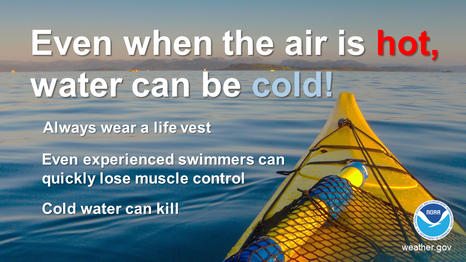
.png) Surf Forecast/Rip Currents
Surf Forecast/Rip Currents Map View
 Marine
 Text Products
.png) Skywarn
Skywarn Submit Storm Reports
 Coastal Flood