
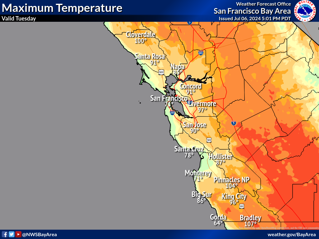
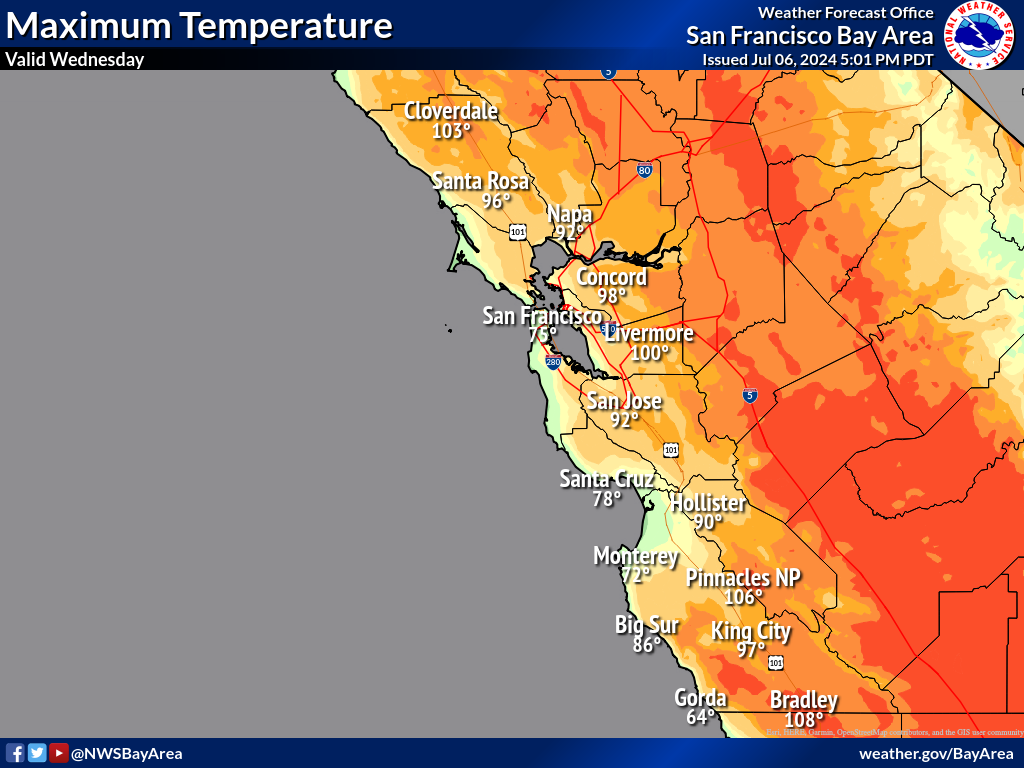
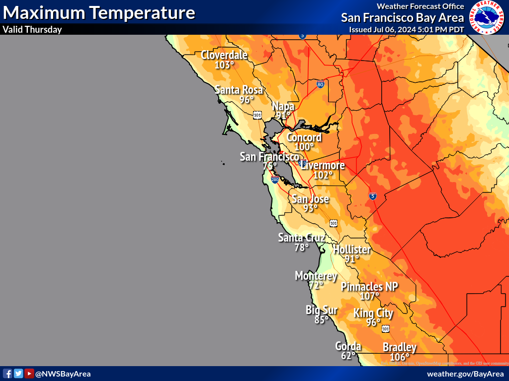
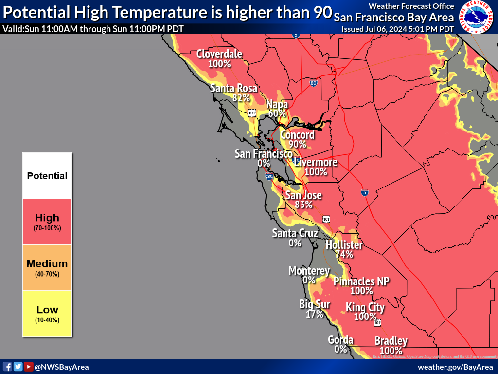
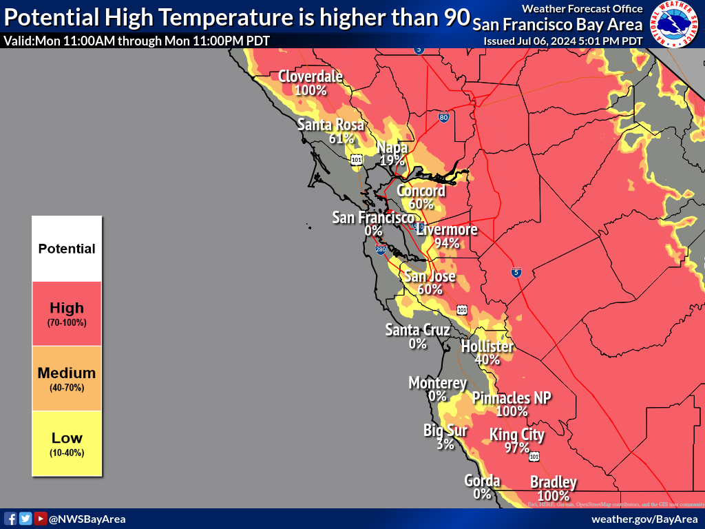
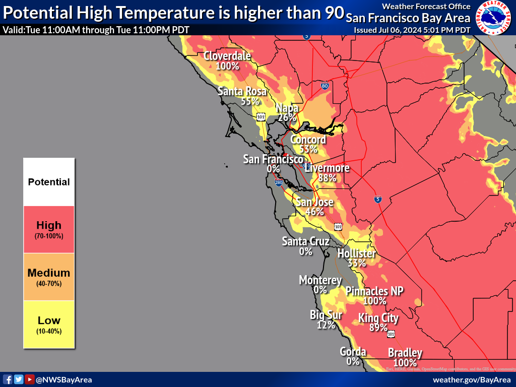
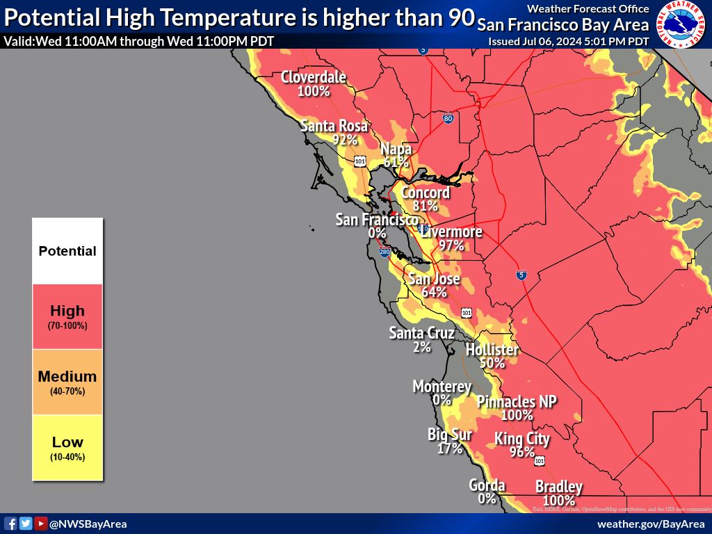
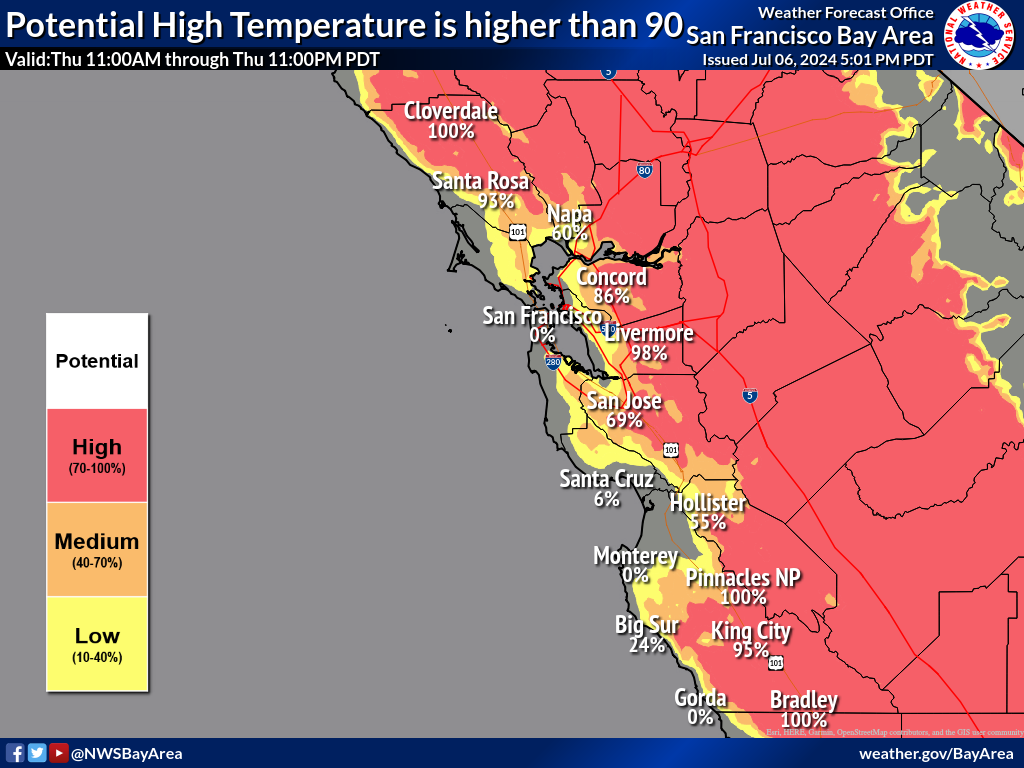
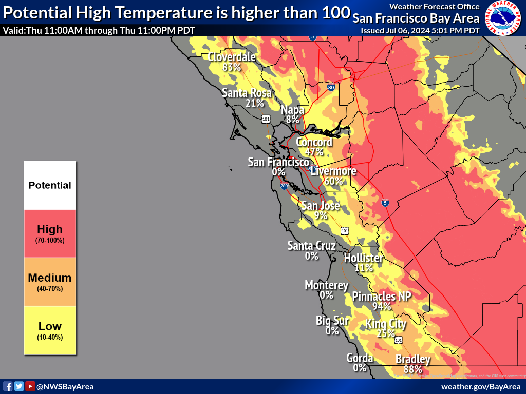
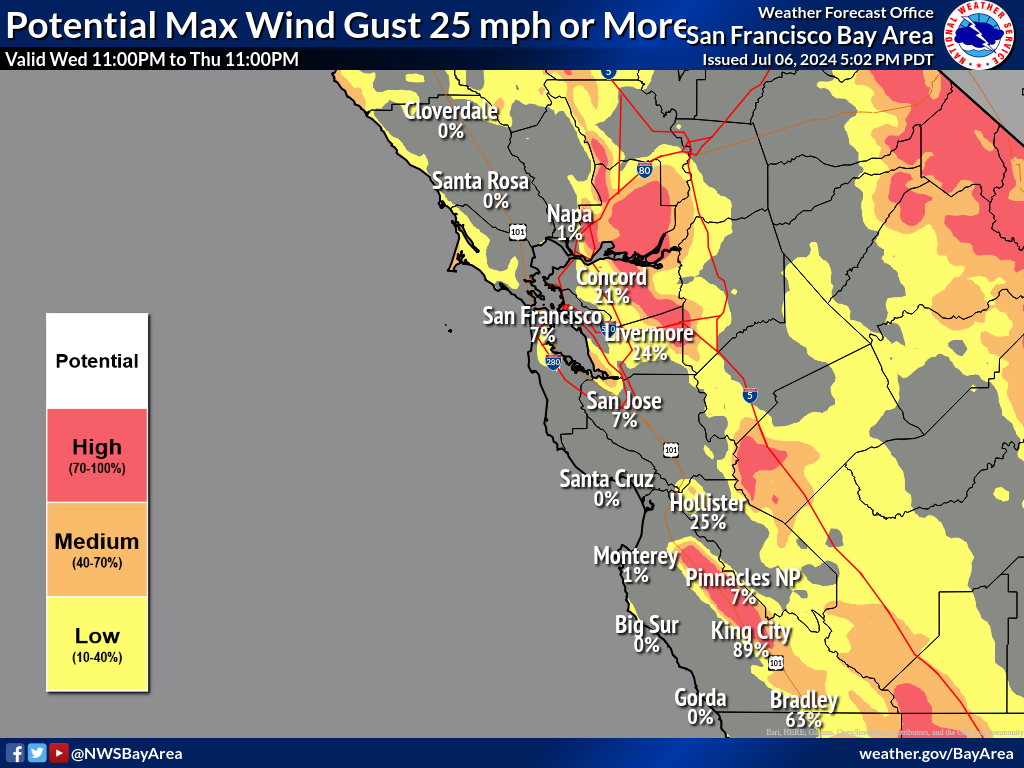
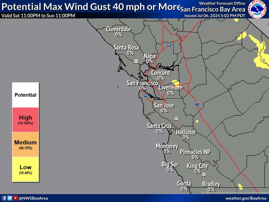
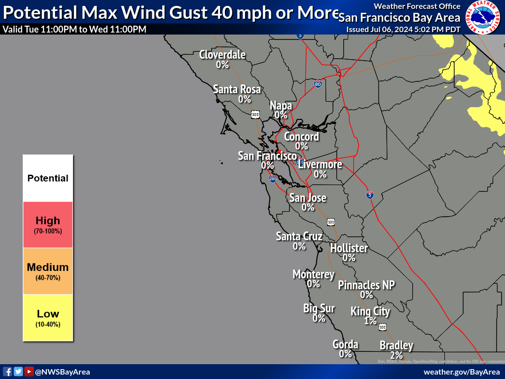
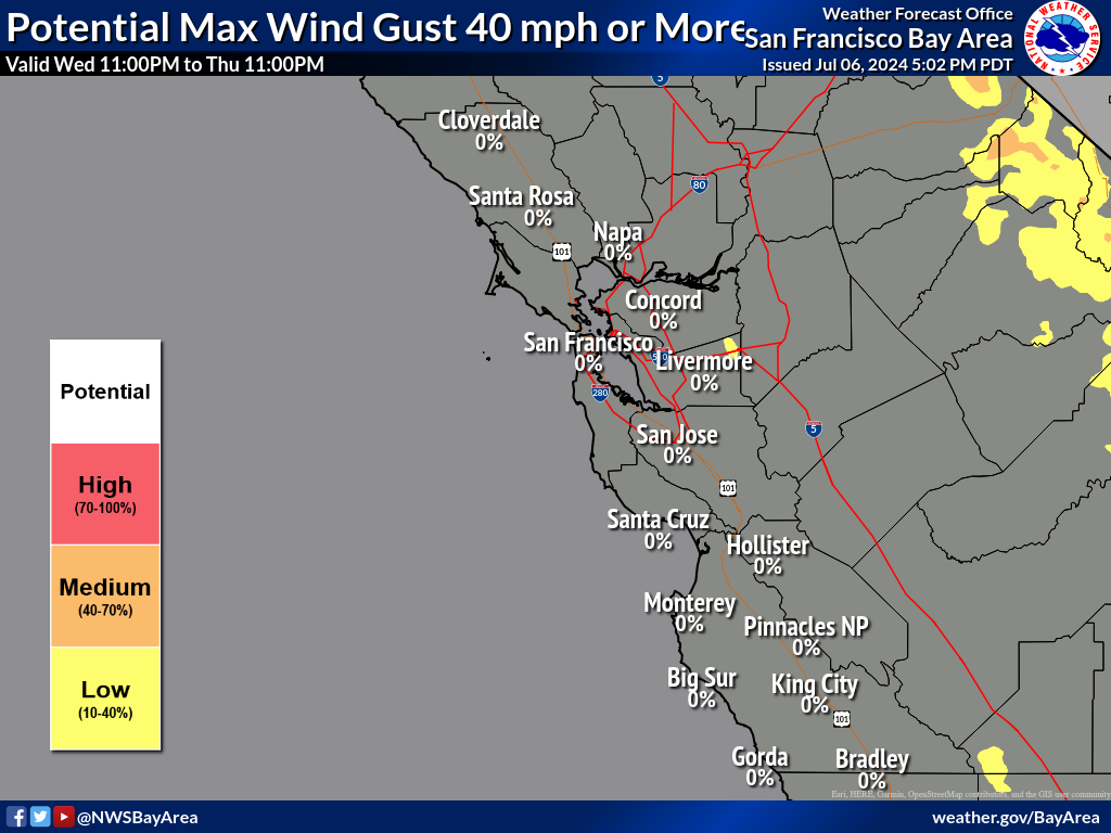
Severe thunderstorms are expected today and Friday from the upper Midwest, central Great Lakes into the Ohio and mid-Mississippi Valley's. In addition, heavy rainfall threat increases on Friday across the Ohio Valley. Meanwhile, early summer-like heat wave across portions of southern Texas with new daily records are forecast today and through the weekend; The heat spreads across the Gulf States. Read More >

