
Severe thunderstorms will be possible on Independence Day, mainly across parts of the Upper Mississippi Valley, Ozarks, and southern/central Plains. Excessive heat with possible record highs and warm overnight lows will continue to impact much of the West into next week. Dangerous heat is expected across the Southern U.S. and Mid-Atlantic into the weekend. Read More >
.AVIATION /08Z THURSDAY THROUGH MONDAY/...
The following discussion is for KPHL, KPNE, KTTN, KABE, KRDG,
KILG, KMIV, KACY and surrounding areas.

Through 12Z...VFR with no significant weather. Increasing
cirrus. Winds generally southerly around 5 kts. High confidence.

Today...VFR in the morning with increasing clouds. Scattered
showers and thunderstorms are expected to develop mainly after
18z, and these could bring restrictions if any of these storms
move over a TAF site. The best chances (50-60% chance) for this
look to be around RDG/ABE with lower chances (30-50% chance)
farther south and east toward MIV and ACY. Winds mainly south to
southwest around 5-10 kts, except 10-15 kts around ACY.
Moderate confidence overall, low confidence exactly where storms
will impact terminals.

Tonight...Initially VFR outside of any lingering showers or
thunderstorms, however some areas of fog/haze and/or stratus
development are possible with MVFR restrictions. Winds diminish
to around 5 kts or less, favoring a southerly direction. High
confidence in initially prevailing VFR conditions, but low
confidence on the occurrence and timing of any restrictions in
fog/haze/stratus overnight.

Outlook...
Friday through Saturday night...MVFR/IFR conditions possible due
to chance TSRA and potential low clouds/fog during late
night/early morning periods when precip tapers and higher clouds
break.

Sunday through Monday...Mainly VFR with NO SIG WX currently
anticipated.

&&
FTNA35 KPHL 040906
KPHL 040859Z 0409/0512 19005KT P6SM BKN250
     FM041200 21008KT P6SM FEW040 BKN250
     FM042000 22008KT P6SM VCTS SCT050CB BKN250
     FM050200 20004KT 6SM BR HZ VCSH BKN060
     FM050900 20004KT 5SM BR HZ BKN020
FTUS51 KPNE 292321 RRB
KPNE 292320Z 3000/3024 VRB04KT P6SM SKC
     FM301000 34003KT P6SM SCT030
     FM301800 17004KT P6SM FEW040 BKN200

FTUS80 KTTN 292321 RRX
KTTN 292320Z 3000/3024 VRB04KT P6SM SKC
     FM300900 VRB03KT P6SM SCT030
     FM301800 17004KT P6SM SCT200

FTUS80 KILG 292321 RRN
KILG 292320Z 3000/3024 VRB05KT P6SM SKC
     FM300900 VRB03KT P6SM SCT030
     FM301500 VRB03KT P6SM SCT035 BKN200

FTUS51 KRDG 292321 RRB
KRDG 292320Z 3000/3024 VRB02KT P6SM SKC
     FM301600 16004KT P6SM SCT200

FTUS80 KABE 292321
KABE 292320Z 3000/3024 VRB03KT P6SM SKC
     FM301800 17003KT P6SM SCT200

FTNA35 KACY 292327 RRC
KACY 292320Z 3000/3024 VRB03KT P6SM SCT025
     TEMPO 3001/3005 BKN025
     FM300500 VRB03KT P6SM BKN025
     FM301500 03005KT P6SM BKN035

FTUS80 KMIV 292321 RRR
KMIV 292320Z 3000/3024 VRB02KT P6SM FEW025
      TEMPO 3003/3006 BKN025
     FM300600 VRB02KT P6SM BKN025
     FM301500 03005KT P6SM BKN035

FTUS80 KEWR 292321 RRI
KEWR 292320Z 3000/3106 VRB03KT P6SM SKC
     FM302000 16005KT P6SM FEW250
     FM310100 VRB03KT P6SM BKN250

FTUS41 KOKX 300102 AAA
TAFLGA
TAF AMD
KLGA 300102Z 3001/3106 VRB03KT P6SM SKC
     FM301300 05005KT P6SM SKC
     FM301900 15004KT P6SM FEW250
     FM310100 VRB03KT P6SM BKN250=

FTUS80 KJFK 300103 AAA
KJFK 300102Z 3001/3106 VRB02KT P6SM SKC
     FM301600 17006KT P6SM FEW250
     FM310000 VRB03KT P6SM FEW030 BKN250

FTUS80 KMDT 292324 RRB
KMDT 292321Z 3000/3024 00000KT P6SM SKC
     FM301200 VRB03KT P6SM BKN250

FTUS80 KBWI 292321 RRD
KBWI 292320Z 3000/3106 00000KT P6SM FEW060
     FM301500 15004KT P6SM SCT250
     FM310000 00000KT P6SM BKN080

FTUS80 KIAD 292321 RRM
KIAD 292320Z 3000/3106 VRB04KT P6SM FEW250
     FM300100 00000KT P6SM SKC
     FM301500 14004KT P6SM SCT250
     FM310300 00000KT P6SM BKN080

FTUS80 KDCA 292321 RRG
KDCA 292320Z 3000/3106 12004KT P6SM SKC
     FM300300 VRB03KT P6SM SKC
     FM301500 14005KT P6SM SCT250
     FM310400 15003KT P6SM BKN070
| --TAFs-- | Time | T | Td | RH | HI | WC | Dir | Wind | G | PK | Vis | Wx | Pcp | Clouds |
|---|---|---|---|---|---|---|---|---|---|---|---|---|---|---|
| KRDG | 0915Z | 70 | 61 | 73 | calm | 10 | CLR | |||||||
| KABE | 0915Z | 70 | 57 | 64 | calm | 10 | SCT110 | |||||||
| KTTN | 0915Z | 66 | 63 | 88 | 190 | 6 | 10 | BKN090 | ||||||
| KPNE | 0920Z | 72 | 63 | 73 | 170 | 3 | 10 | CLR | ||||||
| KPHL | 0920Z | 70 | 64 | 83 | 150 | 5 | 10 | SCT085 | ||||||
| KILG | 0920Z | 70 | 66 | 88 | 170 | 10 | 10 | CLR | ||||||
| KMIV | 0920Z | 70 | 66 | 88 | calm | 10 | CLR | |||||||
| KACY | 0920Z | 70 | 64 | 83 | 180 | 6 | 10 | SCT070 | --PA-- | Time | T | Td | RH | HI | WC | Dir | Wind | G | PK | Vis | Wx | Pcp | Clouds |
| KMPO | 0920Z | 64 | 61 | 88 | 230 | 9 | 10 | BKN080 OVC110 | ||||||
| K22N | 0915Z | 61 | 59 | 94 | calm | 10 | SCT060 OVC120 | |||||||
| KXLL | 0915Z | 68 | 59 | 73 | 210 | 5 | 10 | CLR | ||||||
| KUKT | 0915Z | 66 | 61 | 83 | calm | 10 | CLR | |||||||
| KCKZ | 0915Z | 64 | 64 | 100 | calm | 10 | BKN012 BKN039 OVC046 | |||||||
| KDYL | 0920Z | 68 | 61 | 78 | 170 | 3 | 10 | CLR | ||||||
| KPTW | 0920Z | 66 | 61 | 83 | calm | 9 | FEW013 | |||||||
| KLOM | 0915Z | 68 | 63 | 82 | 180 | 3 | 10 | BKN012 OVC070 | ||||||
| KOQN | 0915Z | 70 | 63 | 78 | 170 | 3 | 10 | BKN009 | ||||||
| KMQS | 0915Z | 66 | 66 | 100 | calm | 10 | FEW009 | --NJ-- | Time | T | Td | RH | HI | WC | Dir | Wind | G | PK | Vis | Wx | Pcp | Clouds |
| KFWN | 0920Z | 66 | 55 | 68 | calm | 10 | FEW100 | |||||||
| K12N | 0854Z | 67 | 57 | 71 | calm | |||||||||
| KMMU | 0915Z | 66 | 59 | 78 | calm | 10 | OVC075 | |||||||
| KSMQ | 0920Z | 64 | 61 | 88 | calm | 10 | OVC090 | |||||||
| KBLM | 0920Z | 70 | 64 | 83 | 190 | 5 | 10 | BKN070 BKN090 | ||||||
| KMJX | 0920Z | 66 | 64 | 94 | 200 | 6 | 10 | FEW090 | ||||||
| KWRI | 0855Z | 66 | 63 | 88 | 170 | 2 | 10 | BKN065 | ||||||
| KVAY | 0920Z | 66 | 63 | 88 | calm | 10 | SCT070 | |||||||
| KWWD | 0920Z | 70 | 68 | 94 | 180 | 7 | 10 | FEW070 | --DE-- | Time | T | Td | RH | HI | WC | Dir | Wind | G | PK | Vis | Wx | Pcp | Clouds |
| KDOV | 0855Z | 70 | 66 | 86 | 170 | 7 | 10 | CLR | ||||||
| KGED | 0920Z | 70 | 68 | 94 | 180 | 9 | 10 | CLR | --MD-- | Time | T | Td | RH | HI | WC | Dir | Wind | G | PK | Vis | Wx | Pcp | Clouds |
| KW29 | 0905Z | 76 | 73 | 90 | 190 | 8 | 10 | CLR | ||||||
| KESN | 0905Z | 71 | 69 | 95 | 140 | 5 | 10 | CLR | ||||||
| KCGE | 0905Z | 73 | 70 | 89 | VRB | 3 | 10 | CLR | --OKXTAF-- | Time | T | Td | RH | HI | WC | Dir | Wind | G | PK | Vis | Wx | Pcp | Clouds |
| KTEB | 0920Z | 70 | 61 | 73 | 200 | 8 | 10 | SCT070 OVC095 | ||||||
| KEWR | 0920Z | 72 | 63 | 73 | 210 | 7 | 10 | BKN075 BKN090 OVC100 | ||||||
| KLGA | 0920Z | 72 | 57 | 61 | 200 | 9 | 10 | BKN070 | ||||||
| KJFK | 0920Z | 70 | 63 | 78 | 180 | 6 | 10 | FEW070 BKN095 | ||||||
| KISP | 0920Z | 70 | 64 | 83 | 210 | 7 | 10 | BKN065 BKN080 | ||||||
| KHPN | 0920Z | 66 | 55 | 68 | calm | 10 | SCT065 BKN090 BKN110 | |||||||
| KSWF | 0845Z | 68 | 54 | 60 | 240 | 6 | 10 | OVC060 | ||||||
| KBDR | 0920Z | 70 | 63 | 78 | 200 | 10 | 10 | BKN060 | ||||||
| KGON | 0920Z | 66 | 66 | 100 | 210 | 6 | 10 | FEW070 | --LWXTAF-- | Time | T | Td | RH | HI | WC | Dir | Wind | G | PK | Vis | Wx | Pcp | Clouds |
| KMTN | 0909Z | 73 | 70 | 89 | 150 | 5 | 10 | SCT075 | ||||||
| KBWI | 0920Z | 72 | 68 | 88 | 130 | 3 | 10 | CLR | ||||||
| KDCA | 0920Z | 75 | 66 | 74 | 190 | 10 | 10 | CLR | ||||||
| KIAD | 0920Z | 73 | 64 | 74 | 210 | 5 | 10 | CLR | ||||||
| KMRB | 0920Z | 70 | 66 | 88 | calm | 10 | CLR | |||||||
| KCHO | 0910Z | 72 | 64 | 78 | calm | 10 | CLR | -Misc- | Time | T | Td | RH | HI | WC | Dir | Wind | G | PK | Vis | Wx | Pcp | Clouds |
| KCDW | 0920Z | 70 | 57 | 64 | calm | 10 | OVC080 | |||||||
| KLNS | 0920Z | 66 | 64 | 94 | 80 | 3 | 10 | SCT055 | ||||||
| KHZL | 0915Z | 68 | 61 | 78 | calm | SCT048 SCT055 OVC110 | ||||||||
| KAVP | 0920Z | 72 | 61 | 69 | calm | 10 | FEW048 SCT080 BKN110 | |||||||
| KCXY | 0920Z | 73 | 64 | 74 | 120 | 5 | 10 | FEW120 | ||||||
| KMDT | 0920Z | 70 | 63 | 78 | 60 | 5 | 10 | FEW120 | ||||||
| KUNV | 0915Z | 72 | 67 | 85 | calm | 10 | ||||||||
| KTHV | 0920Z | 70 | 64 | 83 | calm | 10 | CLR | |||||||
| KSEG | 0920Z | 72 | 63 | 73 | calm | 10 | CLR | |||||||
| KAPG | 0855Z | 68 | 66 | 92 | calm | 10 | CLR | |||||||
| KNHK | 0852Z | 76 | 68 | 77 | 180 | 6 | 10 | CLR | ||||||
| KOXB | 0920Z | 72 | 68 | 88 | 190 | 5 | 10 | FEW080 | ||||||
| KSBY | 0920Z | 68 | 66 | 94 | 150 | 6 | 10 | CLR | ||||||
| KWAL | 0920Z | 72 | 70 | 94 | 190 | 7 | 10 | CLR | ||||||
| KBGM | 0920Z | 70 | 61 | 73 | 190 | 7 | 10 | SCT036 OVC046 | ||||||
| KNYC | 0851Z | 71 | 59 | 66 | calm | 10 | BKN070 OVC095 | |||||||
| KMGJ | 0920Z | 64 | 57 | 78 | calm | 10 | SCT055 BKN070 OVC120 | |||||||
| KPOU | 0920Z | 68 | 55 | 64 | calm | 10 | SCT060 BKN080 OVC100 |


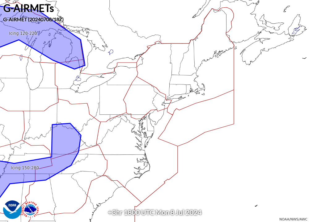
| Current | 3-hr Forecast | 6-hr Forecast |
|
|
|
|
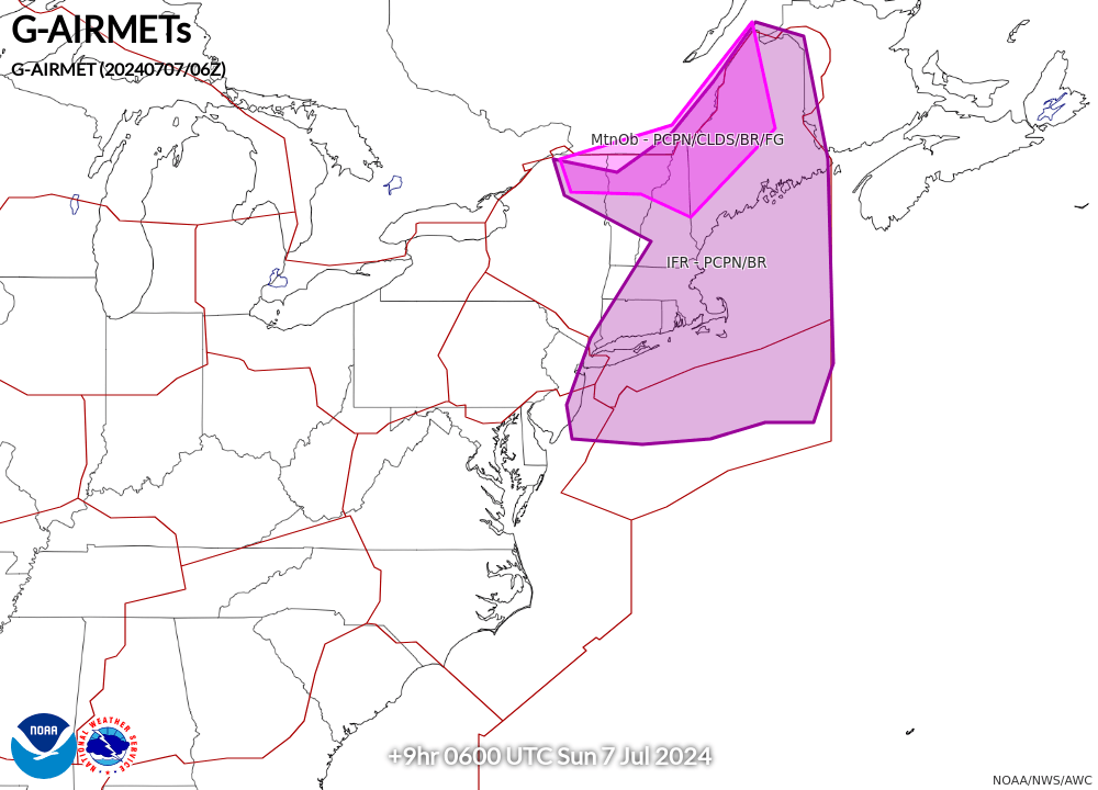
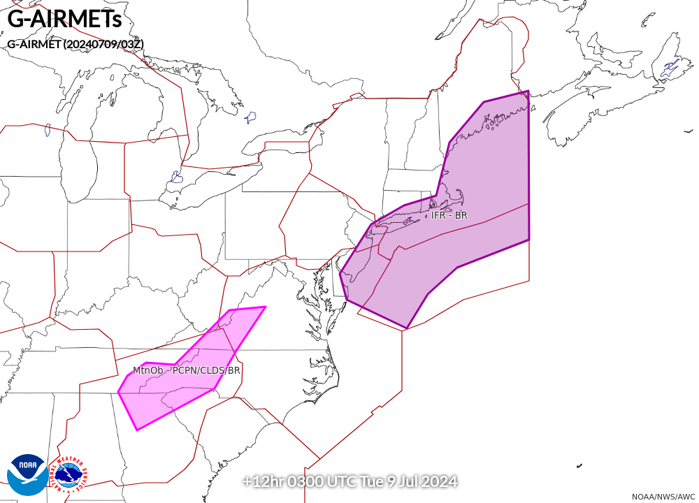
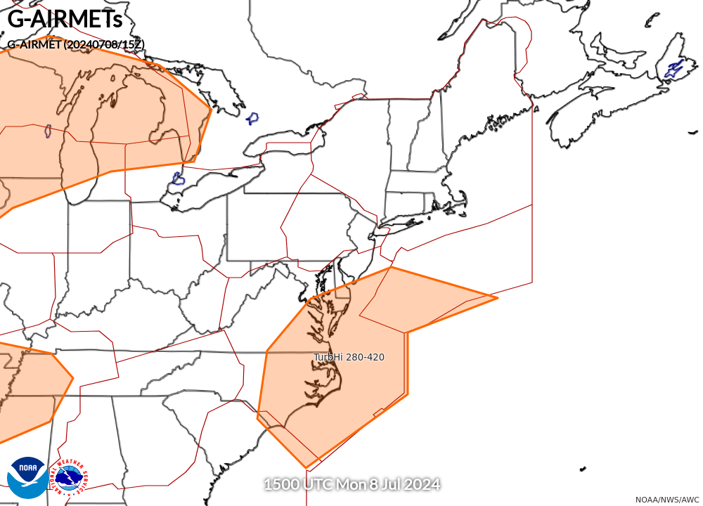
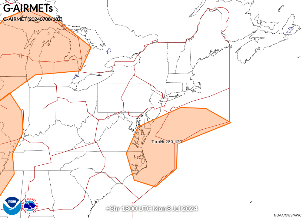
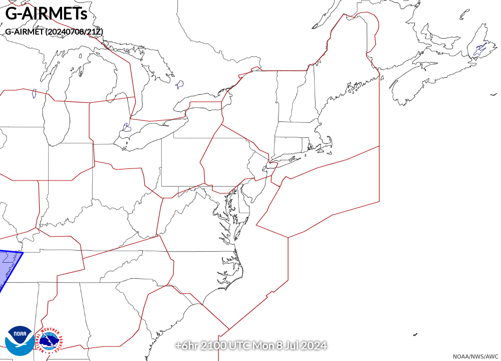
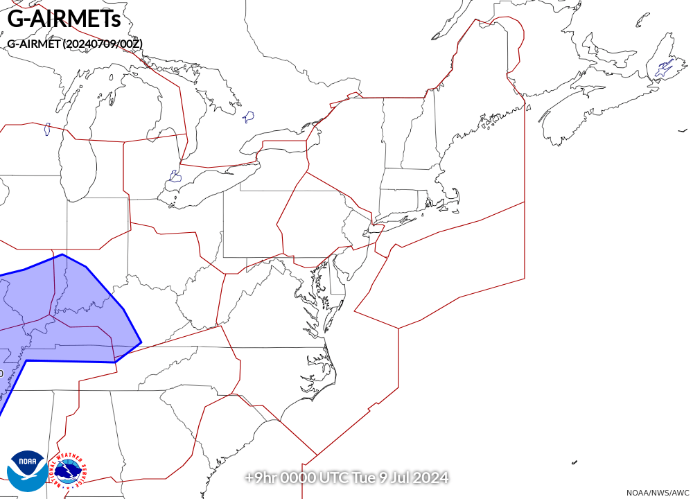
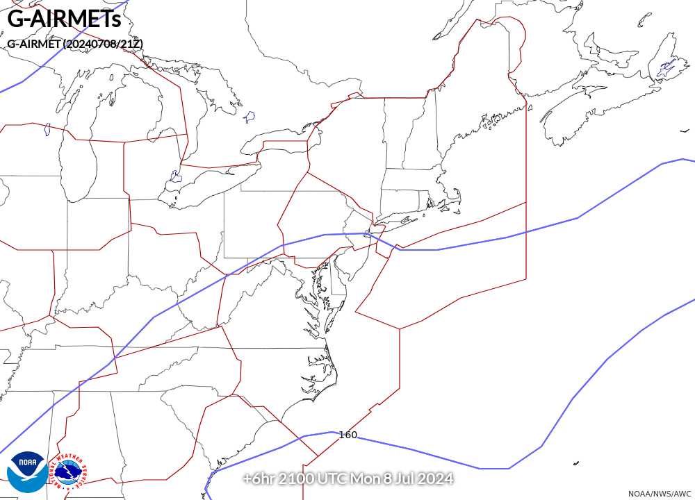
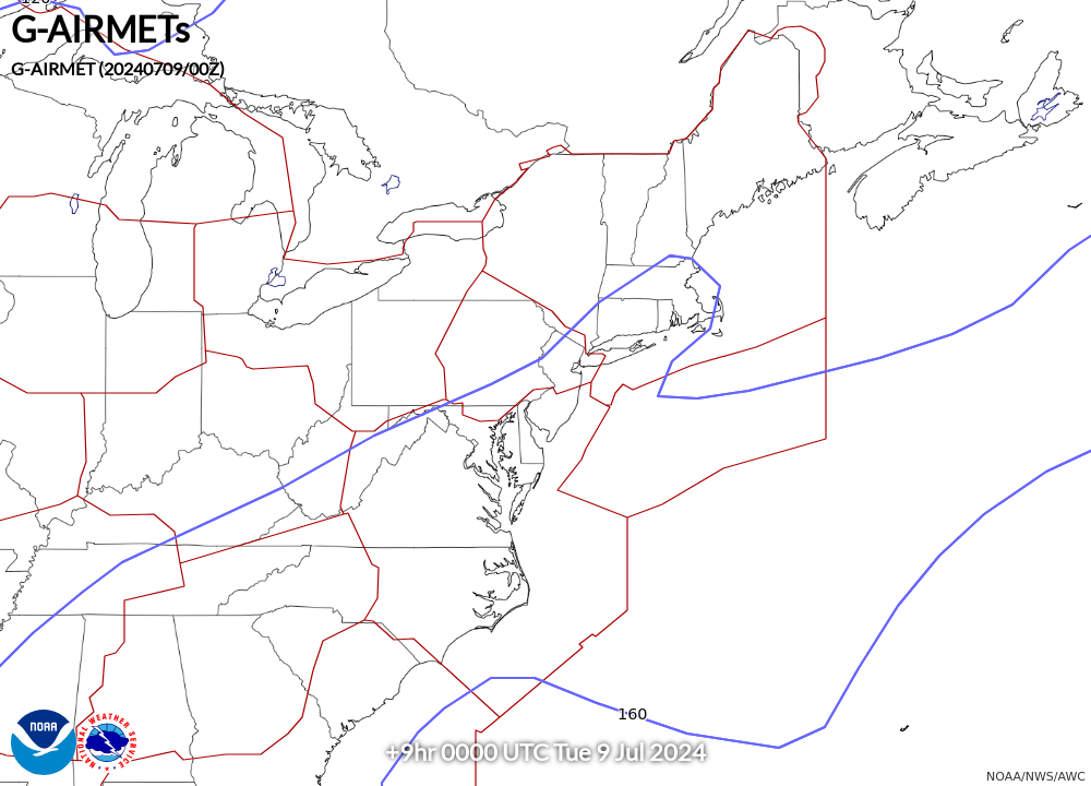
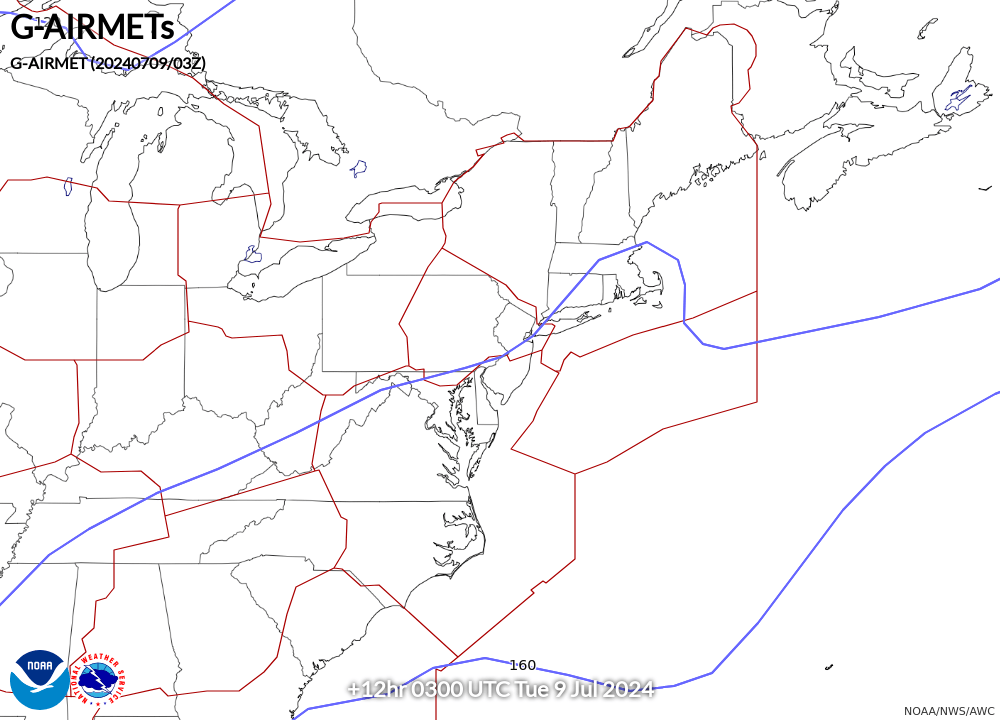
| 9-hr Forecast | 12-hr Forecast | |
|
|
|
| Current | 3-hr Forecast | 6-hr Forecast |
|
|
|
|
| 9-hr Forecast | 12-hr Forecast | |
|
|
|
| Current | 3-hr Forecast | 6-hr Forecast |
|
|
|
|
| 9-hr Forecast | 12-hr Forecast | |
|
|
|
| Current | 3-hr Forecast | 6-hr Forecast |
|
|
|
|
| 9-hr Forecast | 12-hr Forecast | |
|
|
|


 Visible Loop
 Infrared Loop


 Coastal Flood
 Marine Forecasts
 Text Products
 Climate Information
 Skywarn
 Submit Storm Report
 Weather Event Archives
 Forecast Discussion
 Emergency Managers
 Briefing Page