
Severe thunderstorms will be possible on Independence Day, mainly across parts of the Upper Mississippi Valley, Ozarks, and southern/central Plains. Excessive heat with possible record highs and warm overnight lows will continue to impact much of the West into next week. Dangerous heat is expected across the Southern U.S. and Mid-Atlantic into the weekend. Read More >
 |
NWS Mt Holly Weather Briefing PageClick HERE for the Latest Hazardous Weather Briefing Suggestions for improvement are welcome. |
 |
|
Fire Weather Outlooks and Parameters
|
|
 |
|||||||||||||||||||||||||
Updated 18 June 2020
No valid fire weather discussion is available at this time.
Fire Weather Message NWS PHI
WWUS81 KPHI 212300
RFWPHI

URGENT - FIRE WEATHER MESSAGE
National Weather Service Mount Holly NJ
700 PM EDT Thu Mar 21 2024


NJZ012>027-220000-
/O.EXP.KPHI.FW.W.0001.000000T0000Z-240321T2300Z/
Middlesex-Western Monmouth-Eastern Monmouth-Mercer-Salem-
Gloucester-Camden-Northwestern Burlington-Ocean-Cumberland-
Atlantic-Cape May-Atlantic Coastal Cape May-Coastal Atlantic-
Coastal Ocean-Southeastern Burlington-
700 PM EDT Thu Mar 21 2024

...RED FLAG WARNING WILL EXPIRE AT 7 PM EDT THIS EVENING FOR
GUSTY WINDS AND LOW RELATIVE HUMIDITY ACROSS PORTIONS OF NEW
JERSEY...

As sunset approaches and we lose daytime heating, relative
humidity values are creeping above 30 percent, and wind gusts at
almost all sites are below 20 mph. RH will continue to rise
tonight with winds quickly easing as well. Much lighter winds
along with somewhat higher humidity values are forecast on Friday,
greatly limiting the fire weather threat.

$$
Fire Weather Message NWS OKX
WWUS81 KOKX 170738
RFWOKX

URGENT - FIRE WEATHER MESSAGE
National Weather Service New York NY
338 AM EDT Wed May 17 2023

CTZ005>012-180000-
/O.CON.KOKX.FW.W.0007.230517T1200Z-230518T0000Z/
Northern Fairfield-Northern New Haven-Northern Middlesex-
Northern New London-Southern Fairfield-Southern New Haven-
Southern Middlesex-Southern New London-
338 AM EDT Wed May 17 2023

...RED FLAG WARNING REMAINS IN EFFECT FROM 8 AM THIS MORNING TO
8 PM EDT THIS EVENING FOR SOUTHERN CONNECTICUT...

* AFFECTED AREA...Northern Fairfield, Northern New Haven,
  Northern Middlesex, Northern New London, Southern Fairfield,
  Southern New Haven, Southern Middlesex and Southern New London.

* TIMING...From late morning into the early evening hours on
  Wednesday.

* WINDS...North 10 to 15 mph with gusts up to 25 mph.

* RELATIVE HUMIDITY...As low as 21 percent.

* TEMPERATURES...In the upper 50s.

* LIGHTNING...None.

* IMPACTS...Rapid fire spread if ignition occurs.

PRECAUTIONARY/PREPAREDNESS ACTIONS...

A Red Flag Warning means that critical fire weather conditions
are expected or occurring. A combination of strong winds, low
relative humidity, and dry fuels will create a significantly
elevated fire growth potential.

&&

$$

For more information from the National Weather Service visit
http://weather.gov/nyc
Fire Weather Message NWS LWX
WWUS81 KLWX 202356
RFWLWX

URGENT - FIRE WEATHER MESSAGE
National Weather Service Baltimore MD/Washington DC
756 PM EDT Wed Mar 20 2024


DCZ001-MDZ013-016-503-504-VAZ025>031-036>040-050-051-053>057-501-
502-504>508-526-527-WVZ050-055-502-504-506-210100-
/O.EXP.KLWX.FW.W.0001.000000T0000Z-240321T0000Z/
District of Columbia-Prince Georges-Charles-Northwest Montgomery-
Central and Southeast Montgomery-Augusta-Rockingham-Shenandoah-
Frederick VA-Page-Warren-Clarke-Nelson-Albemarle-Greene-Madison-
Rappahannock-Orange-Culpeper-Fairfax-
Arlington/Falls Church/Alexandria-Stafford-Spotsylvania-
King George-Northern Fauquier-Southern Fauquier-Eastern Highland-
Western Loudoun-Eastern Loudoun-Northern Virginia Blue Ridge-
Central Virginia Blue Ridge-Northwest Prince William-
Central and Southeast Prince William/Manassas/Manassas Park-
Hampshire-Hardy-Eastern Grant-Eastern Mineral-Eastern Pendleton-
756 PM EDT Wed Mar 20 2024

...RED FLAG WARNING WILL EXPIRE AT 8 PM EDT THIS EVENING FOR
PORTIONS OF CENTRAL AND NORTHERN VIRGINIA...EASTERN WEST
VIRGINIA...CENTRAL MARYLAND...AND WASHINGTON DC...

Winds are gradually diminishing and humidity rising with sunset,
ending red flag conditions. However, gusty winds will continue
this evening, and humidity will only recover to around 40 to 55
percent overnight.

$$
Fire Weather Message NWS AKQ
WWUS81 KAKQ 210002
RFWAKQ

URGENT - FIRE WEATHER MESSAGE
National Weather Service Wakefield VA
802 PM EDT Wed Mar 20 2024


NCZ012>017-030>032-VAZ048-060>062-064>069-075>090-092-093-095>098-
509>525-210115-
/O.EXP.KAKQ.FW.W.0001.000000T0000Z-240321T0000Z/
Northampton-Hertford-Gates-Pasquotank-Camden-Western Currituck-
Bertie-Chowan-Perquimans-Fluvanna-Prince Edward-Cumberland-
Goochland-Caroline-Mecklenburg-Lunenburg-Nottoway-Amelia-Powhatan-
Westmoreland-Richmond-Northumberland-Lancaster-Brunswick-
Dinwiddie-Prince George-Charles City-New Kent-Gloucester-
Middlesex-Mathews-Greensville-Sussex-Surry-James City-Southampton-
Isle of Wight-Norfolk/Portsmouth-Suffolk-Chesapeake-
Virginia Beach-Western Louisa-Eastern Louisa-Western Hanover-
Eastern Hanover-Western Chesterfield-
Eastern Chesterfield (Including Col. Heights)-
Western Henrico (Including the City of Richmond)-Eastern Henrico-
Western King William-Eastern King William-Western King and Queen-
Eastern King and Queen-Western Essex-Eastern Essex-York-
Newport News-Hampton/Poquoson-
802 PM EDT Wed Mar 20 2024

...RED FLAG WARNING HAS EXPIRED FOR ALL OF CENTRAL AND SOUTHERN
VIRGINIA...AND NORTHEAST NORTH CAROLINA...

$$
Fire Weather Message NWS CTP
WWUS81 KCTP 061226
RFWCTP

URGENT - FIRE WEATHER MESSAGE
National Weather Service State College PA
826 AM EDT Tue Jun 6 2023

PAZ006-012-018-019-027-028-037-041-042-045-046-049>053-056-057-
063>065-062030-
/O.UPG.KCTP.FW.A.0002.230606T1500Z-230607T0000Z/
/O.NEW.KCTP.FW.W.0002.230606T1500Z-230607T0000Z/
Potter-Northern Clinton-Northern Centre-Southern Centre-Mifflin-
Juniata-Tioga-Northern Lycoming-Sullivan-Southern Clinton-
Southern Lycoming-Union-Snyder-Montour-Northumberland-Columbia-
Perry-Dauphin-Cumberland-Adams-York-
826 AM EDT Tue Jun 6 2023

...RED FLAG WARNING IN EFFECT UNTIL 8 PM EDT THIS EVENING FOR
CENTRAL PENNSYLVANIA...

The National Weather Service in State College has issued a Red
Flag Warning, which is in effect until 8 PM EDT this evening. The
Fire Weather Watch is no longer in effect.

* AFFECTED AREA...Potter, Northern Clinton, Northern Centre,
  Southern Centre, Mifflin, Juniata, Tioga, Northern Lycoming,
  Sullivan, Southern Clinton, Southern Lycoming, Union, Snyder,
  Montour, Northumberland, Columbia, Perry, Dauphin, Cumberland,
  Adams and York Counties.

* TIMING...From 11 am until 8 pm on Tuesday.

* WINDS...Northwest 10 to 15 mph with gusts up to 25 mph.

* RELATIVE HUMIDITY...As low as 24 percent.

* TEMPERATURES...In the mid 70s.

* LIGHTNING...Dry lightning strikes may cause initial fire starts
  especially in the driest fuel beds.

* IMPACTS...Rapid wildfire growth and spread expected. Outdoor
  burning is not recommended.

PRECAUTIONARY/PREPAREDNESS ACTIONS...

A Red Flag Warning means that critical fire weather conditions
are either occurring or are imminent due to a combination of
strong winds, low relative humidity and dry fuels. Any fires that
develop may quickly get out of control and become difficult to
contain.

For more information about wildfire danger, burn restrictions,
and wildfire prevention and education, please visit the
Pennsylvania Department of Conservation and Natural Resources
website at http://dcnr.pa.gov/Communities/Wildfire.

&&

$$

PAZ058-059-066-062030-
/O.UPG.KCTP.FW.A.0002.230606T1500Z-230607T0000Z/
/O.NEW.KCTP.FW.W.0002.230606T1500Z-230607T0000Z/
Schuylkill-Lebanon-Lancaster-
826 AM EDT Tue Jun 6 2023

...RED FLAG WARNING IN EFFECT UNTIL 8 PM EDT THIS EVENING FOR
CENTRAL PENNSYLVANIA...

The National Weather Service in State College has issued a Red
Flag Warning, which is in effect until 8 PM EDT this evening. The
Fire Weather Watch is no longer in effect.

* AFFECTED AREA...Schuylkill, Lebanon and Lancaster Counties.

* TIMING...From 11 am until 8 pm on Tuesday.

* WINDS...Northwest 10 to 15 mph with gusts up to 25 mph.

* RELATIVE HUMIDITY...As low as 25 percent.

* TEMPERATURES...In the mid 70s.

* LIGHTNING...Dry lightning strikes may cause initial fire starts
  especially in the driest fuel beds.

* IMPACTS...Critical fire weather conditions possible. Rapid
  wildfire growth and spread expected. Outdoor burning is not
  recommended.

PRECAUTIONARY/PREPAREDNESS ACTIONS...

A Red Flag Warning means that critical fire weather conditions
are either occurring or are imminent due to a combination of
strong winds, low relative humidity and dry fuels. Any fires that
develop may quickly get out of control and become difficult to
contain.

For more information about wildfire danger, burn restrictions,
and wildfire prevention and education, please visit the
Pennsylvania Department of Conservation and Natural Resources
website at http://dcnr.pa.gov/Communities/Wildfire.

&&

$$

PAZ025-026-034>036-062030-
/O.UPG.KCTP.FW.A.0002.230606T1500Z-230607T0000Z/
/O.NEW.KCTP.FW.W.0002.230606T1500Z-230607T0000Z/
Blair-Huntingdon-Bedford-Fulton-Franklin-
826 AM EDT Tue Jun 6 2023

...RED FLAG WARNING IN EFFECT UNTIL 8 PM EDT THIS EVENING FOR
CENTRAL PENNSYLVANIA...

The National Weather Service in State College has issued a Red
Flag Warning, which is in effect until 8 PM EDT this evening. The
Fire Weather Watch is no longer in effect.

* AFFECTED AREA...Blair, Huntingdon, Bedford, Fulton and
  Franklin Counties.

* TIMING...From 11 am until 8 pm on Tuesday.

* WINDS...Northwest 10 to 15 mph with gusts up to 25 mph.

* RELATIVE HUMIDITY...As low as 25 percent.

* TEMPERATURES...In the mid 70s.

* IMPACTS...Rapid wildfire growth and spread expected. Outdoor
  burning is not recommended.

PRECAUTIONARY/PREPAREDNESS ACTIONS...

A Red Flag Warning means that critical fire weather conditions
are either occurring or are imminent due to a combination of
strong winds, low relative humidity and dry fuels. Any fires that
develop may quickly get out of control and become difficult to
contain.

For more information about wildfire danger, burn restrictions,
and wildfire prevention and education, please visit the
Pennsylvania Department of Conservation and Natural Resources
website at http://dcnr.pa.gov/Communities/Wildfire.

&&

$$

Visit https://www.weather.gov/ctp for more information from the
National Weather Service office in State College.
Fire Weather Message NWS BGM
WWUS81 KBGM 062355
RFWBGM

URGENT - FIRE WEATHER MESSAGE
National Weather Service Binghamton NY
755 PM EDT Tue Jun 6 2023

PAZ038>040-043-044-047-048-072-070100-
/O.EXP.KBGM.FW.W.0002.000000T0000Z-230607T0000Z/
Bradford-Susquehanna-Northern Wayne-Wyoming-Lackawanna-Luzerne-
Pike-Southern Wayne-
755 PM EDT Tue Jun 6 2023

...RED FLAG WARNING WILL EXPIRE AT 8 PM EDT THIS EVENING
FOR LOW HUMIDITY, GUSTY WINDS, AND ISOLATED DRY LIGHTNING IN
NORTHEAST PENNSYLVANIA...

Humidity levels have risen between 45 and 70 percent this evening
and will continue to recover between 80 to 100 percent overnight.
Winds will decrease overnight under 10 mph and any thunderstorms
look to stay away from Northeast PA overnight.

Humidity values are forecast to reach between 28 to 40 percent
Wednesday afternoon along with northwest winds between 8 to 15
mph. There will also be widespread wildfire smoke over the area
again, originating from Canada.

$$
Fire Weather Planning Forecast NWS PHI
FNUS51 KPHI 040807
FWFPHI
Fire Weather Planning Forecast
National Weather Service Mount Holly NJ
406 AM EDT Thu Jul 4 2024
.DISCUSSION...
High pressure will remainseast of the area through the weekend.
Low pressure moves well north of the area today and sends a few
weak fronts towards eastern Pennsylvania and northern New
Jersey. These fronts remain in the area through Saturday before
diminishing. Another system arrives for Tuesday of next week.
PAZ054-042000-
Carbon-
Including the city of Jim Thorpe
406 AM EDT Thu Jul 4 2024
Today Tonight Fri
Cloud Cover Mcldy Mcldy Mcldy
Precip Type Tstms Tstms Tstms
Chance Precip (%) 60 60 60
Max/Min Temp 87 66 87
Min/Max RH % 61 99 59
Wind 20ft/early(mph) S 3 W 3 Lgt/Var
Wind 20ft/late(mph) SW 5 Lgt/Var S 3
Precip Amount 0.08 0.05 0.10
Precip Duration 2 3 4
Mixing Hgt(ft-agl/msl)4540 120 4440
Transport Wnd (mph) W 9 NE 5 S 8
Vent Rate (mph-ft) 51540 0 36950
Dispersion Good Very Poor Good
Max ADI Early 49 Gen Good 2 Very Poor 35 Fair
Max ADI Late 49 Gen Good 2 Very Poor 35 Fair
Max LVORI Early 3 8 3
Max LVORI Late 3 8 3
LAL 4 4 4
Haines Index 3 3 3
Remarks...None.
.FORECAST FOR DAYS 3 THROUGH 7...
.FRIDAY NIGHT...Mostly cloudy with showers likely and a chance of
thunderstorms. Lows in the upper 60s. South winds around 5 mph.
.SATURDAY...Partly sunny with a chance of showers and
thunderstorms. Highs in the mid 80s. South winds around 5 mph.
.SATURDAY NIGHT...Partly cloudy. Lows in the lower 60s. Southwest
winds around 5 mph.
.SUNDAY...Mostly sunny. Highs in the mid 80s. Light winds.
.SUNDAY NIGHT...Partly cloudy. Lows in the lower 60s. Northwest
winds around 5 mph.
.MONDAY...Mostly sunny. Highs in the mid 80s. South winds around
5 mph.
.MONDAY NIGHT...Mostly cloudy. Lows in the mid 60s. South winds
around 5 mph.
.TUESDAY...Mostly cloudy with a chance of showers and
thunderstorms. Highs in the mid 80s. South winds around 5 mph.
.TUESDAY NIGHT...Mostly cloudy with a chance of showers and
thunderstorms. Lows in the mid 60s. South winds around 5 mph.
.WEDNESDAY...Mostly cloudy with a chance of showers and
thunderstorms. Highs in the lower 80s. Southwest winds around
5 mph.
$$
PAZ055-042000-
Monroe-
Including the city of Stroudsburg
406 AM EDT Thu Jul 4 2024
Today Tonight Fri
Cloud Cover Mcldy Mcldy Mcldy
Precip Type Tstms Tstms Tstms
Chance Precip (%) 60 50 60
Max/Min Temp 86 65 88
Min/Max RH % 62 99 58
Wind 20ft/early(mph) SW 4 W 3 Lgt/Var
Wind 20ft/late(mph) SW 5 Lgt/Var S 4
Precip Amount 0.11 0.11 0.10
Precip Duration 3 3 4
Mixing Hgt(ft-agl/msl)4420 180 3960
Transport Wnd (mph) SW 10 NE 5 S 7
Vent Rate (mph-ft) 49960 0 34620
Dispersion Good Very Poor Good
Max ADI Early 49 Gen Good 2 Very Poor 29 Fair
Max ADI Late 49 Gen Good 2 Very Poor 29 Fair
Max LVORI Early 3 8 3
Max LVORI Late 3 8 3
LAL 4 4 4
Haines Index 3 3 3
Remarks...None.
.FORECAST FOR DAYS 3 THROUGH 7...
.FRIDAY NIGHT...Mostly cloudy with showers likely and a chance of
thunderstorms. Lows in the upper 60s. South winds around 5 mph.
.SATURDAY...Partly sunny with a chance of showers and
thunderstorms. Highs in the mid 80s. South winds around 5 mph.
.SATURDAY NIGHT...Mostly cloudy. Lows in the lower 60s. Southwest
winds around 5 mph.
.SUNDAY...Mostly sunny. Highs in the mid 80s. Northwest winds
around 5 mph.
.SUNDAY NIGHT...Partly cloudy. Lows in the lower 60s. Northwest
winds around 5 mph.
.MONDAY...Mostly sunny. Highs in the mid 80s. South winds around
5 mph.
.MONDAY NIGHT...Partly cloudy. Lows in the mid 60s. South winds
around 5 mph.
.TUESDAY...Partly sunny with a chance of showers and
thunderstorms. Highs in the mid 80s. South winds around 5 mph.
.TUESDAY NIGHT...Mostly cloudy with a chance of showers and
thunderstorms. Lows in the mid 60s. South winds around 5 mph.
.WEDNESDAY...Mostly cloudy with a chance of showers and
thunderstorms. Highs in the lower 80s. Southwest winds around
5 mph.
$$
PAZ062-042000-
Northampton-
Including the cities of Bethlehem and Easton
406 AM EDT Thu Jul 4 2024
Today Tonight Fri
Cloud Cover Pcldy Mcldy Mcldy
Precip Type Tstms Tstms Tstms
Chance Precip (%) 60 50 50
Max/Min Temp 89 70 90
Min/Max RH % 59 98 57
Wind 20ft/early(mph) SW 4 SW 3 Lgt/Var
Wind 20ft/late(mph) SW 6 Lgt/Var S 3
Precip Amount 0.06 0.05 0.09
Precip Duration 2 3 2
Mixing Hgt(ft-agl/msl)5120 270 4570
Transport Wnd (mph) SW 10 NE 3 SW 7
Vent Rate (mph-ft) 57310 20 39930
Dispersion Good Very Poor Good
Max ADI Early 53 Gen Good 2 Very Poor 34 Fair
Max ADI Late 53 Gen Good 2 Very Poor 34 Fair
Max LVORI Early 3 8 3
Max LVORI Late 3 8 3
LAL 4 3 4
Haines Index 3 3 3
Remarks...None.
.FORECAST FOR DAYS 3 THROUGH 7...
.FRIDAY NIGHT...Mostly cloudy with showers likely and a chance of
thunderstorms. Lows in the lower 70s. Southeast winds around
5 mph.
.SATURDAY...Mostly cloudy with showers likely and a chance of
thunderstorms. Highs in the upper 80s. South winds around 5 mph.
.SATURDAY NIGHT...Mostly cloudy with a chance of showers and
thunderstorms. Lows in the upper 60s. Southwest winds around
5 mph.
.SUNDAY...Mostly sunny. Highs in the upper 80s. Light winds.
.SUNDAY NIGHT...Partly cloudy. Lows in the mid 60s. Northwest
winds around 5 mph.
.MONDAY...Mostly sunny. Highs around 90. South winds around
5 mph.
.MONDAY NIGHT...Partly cloudy. Lows in the upper 60s. South winds
around 5 mph.
.TUESDAY...Partly sunny with a chance of showers and
thunderstorms. Highs in the upper 80s. South winds around 5 mph.
.TUESDAY NIGHT...Mostly cloudy with a chance of showers and
thunderstorms. Lows in the upper 60s. South winds around 5 mph.
.WEDNESDAY...Mostly cloudy with a chance of showers and
thunderstorms. Highs in the mid 80s. Southwest winds around
5 mph.
$$
PAZ061-042000-
Lehigh-
Including the city of Allentown
406 AM EDT Thu Jul 4 2024
Today Tonight Fri
Cloud Cover Pcldy Mcldy Mcldy
Precip Type Tstms Tstms Tstms
Chance Precip (%) 60 60 50
Max/Min Temp 90 70 90
Min/Max RH % 57 99 57
Wind 20ft/early(mph) SW 4 SW 4 Lgt/Var
Wind 20ft/late(mph) SW 6 Lgt/Var S 3
Precip Amount 0.11 0.07 0.09
Precip Duration 2 3 2
Mixing Hgt(ft-agl/msl)5280 280 4620
Transport Wnd (mph) W 9 NE 3 SW 7
Vent Rate (mph-ft) 56490 120 39280
Dispersion Good Very Poor Good
Max ADI Early 54 Gen Good 2 Very Poor 35 Fair
Max ADI Late 54 Gen Good 2 Very Poor 35 Fair
Max LVORI Early 3 8 3
Max LVORI Late 3 8 3
LAL 4 4 4
Haines Index 4 3 4
Remarks...None.
.FORECAST FOR DAYS 3 THROUGH 7...
.FRIDAY NIGHT...Mostly cloudy with showers likely and a chance of
thunderstorms. Lows in the lower 70s. South winds around 5 mph.
.SATURDAY...Mostly cloudy with a chance of showers and
thunderstorms. Highs around 90. South winds around 5 mph.
.SATURDAY NIGHT...Mostly cloudy with a chance of showers and
thunderstorms. Lows in the upper 60s. Southwest winds around
5 mph.
.SUNDAY...Mostly sunny. Highs in the upper 80s. Light winds.
.SUNDAY NIGHT...Partly cloudy. Lows in the mid 60s. Northwest
winds around 5 mph.
.MONDAY...Mostly sunny. Highs around 90. Southeast winds around
5 mph.
.MONDAY NIGHT...Partly cloudy. Lows in the upper 60s. South winds
around 5 mph.
.TUESDAY...Partly sunny with a chance of showers and
thunderstorms. Highs in the upper 80s. South winds around 5 mph.
.TUESDAY NIGHT...Mostly cloudy with a chance of showers and
thunderstorms. Lows in the upper 60s. South winds around 5 mph.
.WEDNESDAY...Mostly cloudy with a chance of showers and
thunderstorms. Highs in the mid 80s. Southwest winds around
5 mph.
$$
PAZ060-042000-
Berks-
Including the city of Reading
406 AM EDT Thu Jul 4 2024
Today Tonight Fri
Cloud Cover Pcldy Mcldy Mcldy
Precip Type Tstms Tstms Tstms
Chance Precip (%) 60 60 50
Max/Min Temp 90 71 91
Min/Max RH % 56 99 56
Wind 20ft/early(mph) S 4 SW 3 Lgt/Var
Wind 20ft/late(mph) SW 6 Lgt/Var S 4
Precip Amount 0.38 0.20 0.08
Precip Duration 2 3 2
Mixing Hgt(ft-agl/msl)5350 240 5180
Transport Wnd (mph) SW 10 E 3 SW 7
Vent Rate (mph-ft) 60550 0 43730
Dispersion Very Good Very Poor Good
Max ADI Early 57 Gen Good 3 Very Poor 40 Fair
Max ADI Late 57 Gen Good 3 Very Poor 40 Fair
Max LVORI Early 3 8 3
Max LVORI Late 3 8 3
LAL 4 4 4
Haines Index 4 3 4
Remarks...None.
.FORECAST FOR DAYS 3 THROUGH 7...
.FRIDAY NIGHT...Mostly cloudy with a chance of showers and
thunderstorms. Lows in the lower 70s. South winds around 5 mph.
.SATURDAY...Partly sunny with a chance of showers and
thunderstorms. Highs around 90. South winds around 5 mph.
.SATURDAY NIGHT...Mostly cloudy with a chance of showers and
thunderstorms. Lows in the upper 60s. Southwest winds around
5 mph.
.SUNDAY...Mostly sunny. Highs in the upper 80s. Light winds.
.SUNDAY NIGHT...Partly cloudy. Lows in the mid 60s. Northwest
winds around 5 mph.
.MONDAY...Mostly sunny. Highs around 90. Southeast winds around
5 mph.
.MONDAY NIGHT...Mostly cloudy. Lows in the upper 60s. South winds
around 5 mph.
.TUESDAY...Partly sunny with a chance of showers and
thunderstorms. Highs in the upper 80s. South winds 5 to 10 mph.
.TUESDAY NIGHT...Mostly cloudy with a chance of showers and
thunderstorms. Lows in the upper 60s. South winds 5 to 10 mph.
.WEDNESDAY...Mostly cloudy with a chance of showers and
thunderstorms. Highs in the mid 80s. Southwest winds around
5 mph.
$$
PAZ101-042000-
Western Chester-
Including the cities of Honey Brook and Oxford
406 AM EDT Thu Jul 4 2024
Today Tonight Fri
Cloud Cover Pcldy Mcldy Pcldy
Precip Type Tstms Tstms Tstms
Chance Precip (%) 60 60 50
Max/Min Temp 89 71 90
Min/Max RH % 58 100 60
Wind 20ft/early(mph) S 5 SW 4 Lgt/Var
Wind 20ft/late(mph) SW 6 Lgt/Var S 4
Precip Amount 0.20 0.14 0.06
Precip Duration 2 3 2
Mixing Hgt(ft-agl/msl)5360 290 5020
Transport Wnd (mph) SW 10 SW 7 SW 9
Vent Rate (mph-ft) 58630 20 47320
Dispersion Very Good Very Poor Good
Max ADI Early 60 Gen Good 3 Very Poor 47 Gen Good
Max ADI Late 60 Gen Good 3 Very Poor 47 Gen Good
Max LVORI Early 3 9 3
Max LVORI Late 3 9 3
LAL 4 4 3
Haines Index 4 3 4
Remarks...None.
.FORECAST FOR DAYS 3 THROUGH 7...
.FRIDAY NIGHT...Mostly cloudy with a chance of showers and
thunderstorms. Lows in the lower 70s. South winds around 5 mph.
.SATURDAY...Partly sunny with showers likely and a chance of
thunderstorms. Highs in the upper 80s. South winds around 5 mph.
.SATURDAY NIGHT...Mostly cloudy with a chance of showers and
thunderstorms. Lows in the upper 60s. South winds around 5 mph.
.SUNDAY...Mostly sunny. Highs in the upper 80s. West winds around
5 mph.
.SUNDAY NIGHT...Partly cloudy. Lows in the mid 60s. Northwest
winds around 5 mph.
.MONDAY...Mostly sunny. Highs around 90. Southeast winds around
5 mph.
.MONDAY NIGHT...Mostly cloudy. Lows in the upper 60s. South winds
around 5 mph.
.TUESDAY...Partly sunny with a chance of showers and
thunderstorms. Highs in the upper 80s. South winds around 5 mph.
.TUESDAY NIGHT...Mostly cloudy with a chance of showers and
thunderstorms. Lows in the upper 60s. South winds around 5 mph.
.WEDNESDAY...Mostly cloudy with a chance of showers and
thunderstorms. Highs in the mid 80s. Southwest winds around
5 mph.
$$
PAZ102-042000-
Eastern Chester-
Including the cities of West Chester and Kennett Square
406 AM EDT Thu Jul 4 2024
Today Tonight Fri
Cloud Cover Pcldy Mcldy Pcldy
Precip Type Tstms Tstms Tstms
Chance Precip (%) 60 60 50
Max/Min Temp 89 71 90
Min/Max RH % 58 100 59
Wind 20ft/early(mph) S 6 SW 4 Lgt/Var
Wind 20ft/late(mph) SW 6 Lgt/Var S 5
Precip Amount 0.10 0.10 0.05
Precip Duration 2 3 1
Mixing Hgt(ft-agl/msl)5220 320 5020
Transport Wnd (mph) SW 10 SW 5 SW 9
Vent Rate (mph-ft) 56780 650 48970
Dispersion Good Very Poor Good
Max ADI Early 60 Gen Good 3 Very Poor 50 Gen Good
Max ADI Late 60 Gen Good 3 Very Poor 50 Gen Good
Max LVORI Early 3 8 3
Max LVORI Late 3 8 3
LAL 4 4 3
Haines Index 3 3 4
Remarks...None.
.FORECAST FOR DAYS 3 THROUGH 7...
.FRIDAY NIGHT...Mostly cloudy with a chance of showers and
thunderstorms. Lows in the lower 70s. South winds around 5 mph.
.SATURDAY...Partly sunny with showers likely and a chance of
thunderstorms. Highs in the upper 80s. Southwest winds around
5 mph.
.SATURDAY NIGHT...Mostly cloudy with a chance of showers and
thunderstorms. Lows in the upper 60s. Southwest winds around
5 mph.
.SUNDAY...Mostly sunny. Highs in the upper 80s. West winds around
5 mph.
.SUNDAY NIGHT...Partly cloudy. Lows in the mid 60s. Northwest
winds around 5 mph.
.MONDAY...Mostly sunny. Highs around 90. Southeast winds around
5 mph.
.MONDAY NIGHT...Mostly cloudy. Lows in the upper 60s. South winds
around 5 mph.
.TUESDAY...Partly sunny with a chance of showers and
thunderstorms. Highs in the upper 80s. South winds 5 to 10 mph.
.TUESDAY NIGHT...Mostly cloudy with a chance of showers and
thunderstorms. Lows in the upper 60s. South winds 5 to 10 mph.
.WEDNESDAY...Mostly cloudy with a chance of showers and
thunderstorms. Highs in the mid 80s. Southwest winds around
5 mph.
$$
PAZ103-042000-
Western Montgomery-
Including the cities of Collegeville and Pottstown
406 AM EDT Thu Jul 4 2024
Today Tonight Fri
Cloud Cover Pcldy Mcldy Mcldy
Precip Type Tstms Tstms Tstms
Chance Precip (%) 60 60 50
Max/Min Temp 90 70 91
Min/Max RH % 55 100 55
Wind 20ft/early(mph) S 4 SW 3 Lgt/Var
Wind 20ft/late(mph) SW 6 Lgt/Var S 3
Precip Amount 0.16 0.09 0.08
Precip Duration 2 3 1
Mixing Hgt(ft-agl/msl)5420 370 5420
Transport Wnd (mph) SW 10 SW 3 SW 7
Vent Rate (mph-ft) 58390 1010 45190
Dispersion Very Good Very Poor Good
Max ADI Early 69 Good 3 Very Poor 42 Gen Good
Max ADI Late 69 Good 3 Very Poor 42 Gen Good
Max LVORI Early 2 9 3
Max LVORI Late 2 9 3
LAL 4 4 3
Haines Index 4 3 4
Remarks...None.
.FORECAST FOR DAYS 3 THROUGH 7...
.FRIDAY NIGHT...Mostly cloudy with a chance of showers and
thunderstorms. Lows in the lower 70s. South winds around 5 mph.
.SATURDAY...Mostly cloudy with showers likely and a chance of
thunderstorms. Highs around 90. South winds around 5 mph.
.SATURDAY NIGHT...Mostly cloudy with a chance of showers and
thunderstorms. Lows in the upper 60s. Light winds.
.SUNDAY...Mostly sunny. Highs in the upper 80s. Light winds.
.SUNDAY NIGHT...Partly cloudy. Lows in the mid 60s. Northwest
winds around 5 mph.
.MONDAY...Mostly sunny. Highs in the lower 90s. Southeast winds
around 5 mph.
.MONDAY NIGHT...Partly cloudy. Lows in the upper 60s. South winds
around 5 mph.
.TUESDAY...Partly sunny with a chance of showers and
thunderstorms. Highs in the upper 80s. South winds around 5 mph.
.TUESDAY NIGHT...Mostly cloudy with a chance of showers and
thunderstorms. Lows in the upper 60s. South winds around 5 mph.
.WEDNESDAY...Mostly cloudy with a chance of showers and
thunderstorms. Highs in the mid 80s. Southwest winds around
5 mph.
$$
PAZ104-042000-
Eastern Montgomery-
Including the cities of Norristown and Lansdale
406 AM EDT Thu Jul 4 2024
Today Tonight Fri
Cloud Cover Pcldy Mcldy Mcldy
Precip Type Tstms Tstms Tstms
Chance Precip (%) 50 50 50
Max/Min Temp 91 72 92
Min/Max RH % 53 98 54
Wind 20ft/early(mph) S 6 SW 4 Lgt/Var
Wind 20ft/late(mph) SW 6 Lgt/Var S 4
Precip Amount 0.01 0.02 0.08
Precip Duration 1 3 1
Mixing Hgt(ft-agl/msl)5620 340 5650
Transport Wnd (mph) SW 12 SW 6 SW 7
Vent Rate (mph-ft) 72690 1210 45230
Dispersion Very Good Very Poor Good
Max ADI Early 72 Good 3 Very Poor 43 Gen Good
Max ADI Late 72 Good 3 Very Poor 43 Gen Good
Max LVORI Early 1 7 2
Max LVORI Late 1 7 2
LAL 4 4 3
Haines Index 3 3 4
Remarks...None.
.FORECAST FOR DAYS 3 THROUGH 7...
.FRIDAY NIGHT...Mostly cloudy with a chance of showers and
thunderstorms. Lows in the lower 70s. South winds around 5 mph.
.SATURDAY...Mostly cloudy with showers likely and a chance of
thunderstorms. Highs around 90. Southwest winds around 5 mph.
.SATURDAY NIGHT...Mostly cloudy with a chance of showers and
thunderstorms. Lows around 70. Southwest winds around 5 mph.
.SUNDAY...Mostly sunny. Highs in the upper 80s. West winds around
5 mph.
.SUNDAY NIGHT...Partly cloudy. Lows in the upper 60s. Northwest
winds around 5 mph.
.MONDAY...Mostly sunny. Highs in the lower 90s. Southeast winds
around 5 mph.
.MONDAY NIGHT...Partly cloudy. Lows around 70. South winds around
5 mph.
.TUESDAY...Partly sunny with a chance of showers and
thunderstorms. Highs in the upper 80s. South winds 5 to 10 mph.
.TUESDAY NIGHT...Mostly cloudy with a chance of showers and
thunderstorms. Lows in the lower 70s. South winds 5 to 10 mph.
.WEDNESDAY...Mostly cloudy with a chance of showers and
thunderstorms. Highs in the mid 80s. Southwest winds around
5 mph.
$$
PAZ105-042000-
Upper Bucks-
Including the cities of Chalfont and Perkasie
406 AM EDT Thu Jul 4 2024
Today Tonight Fri
Cloud Cover Pcldy Mcldy Mcldy
Precip Type Tstms Tstms Tstms
Chance Precip (%) 60 50 50
Max/Min Temp 89 70 90
Min/Max RH % 56 100 56
Wind 20ft/early(mph) SW 5 SW 3 Lgt/Var
Wind 20ft/late(mph) SW 5 Lgt/Var S 3
Precip Amount 0.25 0.14 0.09
Precip Duration 2 3 2
Mixing Hgt(ft-agl/msl)5240 290 5280
Transport Wnd (mph) SW 10 SW 3 SW 7
Vent Rate (mph-ft) 56730 200 40010
Dispersion Good Very Poor Good
Max ADI Early 64 Good 3 Very Poor 40 Fair
Max ADI Late 64 Good 3 Very Poor 40 Fair
Max LVORI Early 3 9 3
Max LVORI Late 3 9 3
LAL 4 4 3
Haines Index 4 3 4
Remarks...None.
.FORECAST FOR DAYS 3 THROUGH 7...
.FRIDAY NIGHT...Mostly cloudy with a chance of showers and
thunderstorms. Lows in the lower 70s. Southeast winds around
5 mph.
.SATURDAY...Mostly cloudy with showers likely and a chance of
thunderstorms. Highs in the upper 80s. South winds around 5 mph.
.SATURDAY NIGHT...Mostly cloudy with a chance of showers and
thunderstorms. Lows in the upper 60s. Light winds.
.SUNDAY...Mostly sunny. Highs in the upper 80s. Light winds.
.SUNDAY NIGHT...Partly cloudy. Lows in the mid 60s. Northwest
winds around 5 mph.
.MONDAY...Mostly sunny. Highs around 90. Southeast winds around
5 mph.
.MONDAY NIGHT...Partly cloudy. Lows in the upper 60s. South winds
around 5 mph.
.TUESDAY...Partly sunny with a chance of showers and
thunderstorms. Highs in the upper 80s. South winds around 5 mph.
.TUESDAY NIGHT...Mostly cloudy with a chance of showers and
thunderstorms. Lows in the upper 60s. South winds around 5 mph.
.WEDNESDAY...Mostly cloudy with a chance of showers and
thunderstorms. Highs in the mid 80s. Southwest winds around
5 mph.
$$
PAZ106-042000-
Lower Bucks-
Including the cities of Morrisville and Doylestown
406 AM EDT Thu Jul 4 2024
Today Tonight Fri
Cloud Cover Pcldy Mcldy Mcldy
Precip Type Tstms Tstms Tstms
Chance Precip (%) 50 50 50
Max/Min Temp 91 72 93
Min/Max RH % 52 98 54
Wind 20ft/early(mph) S 6 SW 4 Lgt/Var
Wind 20ft/late(mph) SW 6 Lgt/Var S 4
Precip Amount 0.04 0.04 0.09
Precip Duration 1 3 2
Mixing Hgt(ft-agl/msl)5650 420 5820
Transport Wnd (mph) SW 12 S 5 SW 7
Vent Rate (mph-ft) 81100 1090 43970
Dispersion Very Good Very Poor Good
Max ADI Early 71 Good 3 Very Poor 44 Gen Good
Max ADI Late 71 Good 3 Very Poor 44 Gen Good
Max LVORI Early 1 7 2
Max LVORI Late 1 7 2
LAL 3 3 3
Haines Index 3 3 4
Remarks...None.
.FORECAST FOR DAYS 3 THROUGH 7...
.FRIDAY NIGHT...Mostly cloudy with a chance of showers and
thunderstorms. Lows in the lower 70s. Southeast winds around
5 mph.
.SATURDAY...Mostly cloudy with showers likely and a chance of
thunderstorms. Highs around 90. South winds around 5 mph.
.SATURDAY NIGHT...Mostly cloudy with a chance of showers and
thunderstorms. Lows around 70. Southwest winds around 5 mph.
.SUNDAY...Mostly sunny. Highs around 90. Light winds.
.SUNDAY NIGHT...Partly cloudy. Lows in the upper 60s. Northwest
winds around 5 mph.
.MONDAY...Mostly sunny. Highs in the lower 90s. Southeast winds
around 5 mph.
.MONDAY NIGHT...Partly cloudy. Lows in the upper 60s. South winds
around 5 mph.
.TUESDAY...Partly sunny with a chance of showers and
thunderstorms. Highs around 90. South winds around 5 mph.
.TUESDAY NIGHT...Mostly cloudy with a chance of showers and
thunderstorms. Lows around 70. South winds around 5 mph.
.WEDNESDAY...Mostly cloudy with a chance of showers and
thunderstorms. Highs in the mid 80s. Southwest winds around
5 mph.
$$
PAZ071-042000-
Philadelphia-
Including the city of Philadelphia
406 AM EDT Thu Jul 4 2024
Today Tonight Fri
Cloud Cover Pcldy Mcldy Pcldy
Precip Type Tstms Tstms Tstms
Chance Precip (%) 40 50 50
Max/Min Temp 91 73 93
Min/Max RH % 52 94 52
Wind 20ft/early(mph) S 6 SW 5 Lgt/Var
Wind 20ft/late(mph) SW 8 S 3 S 5
Precip Amount 0.01 0.03 0.07
Precip Duration 1 3 1
Mixing Hgt(ft-agl/msl)5810 440 5540
Transport Wnd (mph) SW 13 S 5 SW 7
Vent Rate (mph-ft) 82920 1570 44150
Dispersion Very Good Very Poor Good
Max ADI Early 81 Good 3 Very Poor 44 Gen Good
Max ADI Late 81 Good 3 Very Poor 44 Gen Good
Max LVORI Early 1 6 2
Max LVORI Late 1 6 2
LAL 3 3 3
Haines Index 3 3 3
Remarks...None.
.FORECAST FOR DAYS 3 THROUGH 7...
.FRIDAY NIGHT...Mostly cloudy with a chance of showers and
thunderstorms. Lows in the mid 70s. South winds around 5 mph.
.SATURDAY...Mostly cloudy with showers likely and a chance of
thunderstorms. Highs around 90. Southwest winds around 5 mph.
.SATURDAY NIGHT...Mostly cloudy with a chance of showers and
thunderstorms. Lows in the lower 70s. South winds around 5 mph.
.SUNDAY...Mostly sunny. Highs around 90. West winds around 5 mph.
.SUNDAY NIGHT...Partly cloudy. Lows around 70. West winds around
5 mph.
.MONDAY...Mostly sunny. Highs in the lower 90s. Southeast winds
around 5 mph.
.MONDAY NIGHT...Partly cloudy. Lows in the lower 70s. South winds
around 5 mph.
.TUESDAY...Partly sunny with a chance of showers and
thunderstorms. Highs around 90. South winds 5 to 10 mph.
.TUESDAY NIGHT...Mostly cloudy with a chance of showers and
thunderstorms. Lows in the lower 70s. South winds 5 to 10 mph.
.WEDNESDAY...Mostly cloudy with a chance of showers and
thunderstorms. Highs in the mid 80s. Southwest winds around
5 mph.
$$
PAZ070-042000-
Delaware-
Including the city of Media
406 AM EDT Thu Jul 4 2024
Today Tonight Fri
Cloud Cover Pcldy Mcldy Pcldy
Precip Type Tstms Tstms Tstms
Chance Precip (%) 50 50 50
Max/Min Temp 90 72 92
Min/Max RH % 56 98 55
Wind 20ft/early(mph) S 6 SW 5 Lgt/Var
Wind 20ft/late(mph) SW 7 S 3 S 5
Precip Amount 0.01 0.10 0.05
Precip Duration 1 3 1
Mixing Hgt(ft-agl/msl)5430 290 5310
Transport Wnd (mph) SW 13 S 5 SW 8
Vent Rate (mph-ft) 73530 1260 49740
Dispersion Very Good Very Poor Good
Max ADI Early 75 Good 3 Very Poor 49 Gen Good
Max ADI Late 75 Good 3 Very Poor 49 Gen Good
Max LVORI Early 3 7 3
Max LVORI Late 3 7 3
LAL 4 3 3
Haines Index 3 3 4
Remarks...None.
.FORECAST FOR DAYS 3 THROUGH 7...
.FRIDAY NIGHT...Mostly cloudy with a chance of showers and
thunderstorms. Lows in the mid 70s. South winds around 5 mph.
.SATURDAY...Mostly cloudy with showers likely and a chance of
thunderstorms. Highs in the upper 80s. Southwest winds around
5 mph.
.SATURDAY NIGHT...Mostly cloudy with a chance of showers and
thunderstorms. Lows in the lower 70s. South winds around 5 mph.
.SUNDAY...Mostly sunny. Highs in the upper 80s. West winds around
5 mph.
.SUNDAY NIGHT...Partly cloudy. Lows in the upper 60s. West winds
around 5 mph.
.MONDAY...Mostly sunny. Highs in the lower 90s. Southeast winds
around 5 mph.
.MONDAY NIGHT...Partly cloudy. Lows around 70. South winds around
5 mph.
.TUESDAY...Partly sunny with a chance of showers and
thunderstorms. Highs in the upper 80s. South winds 5 to 10 mph.
.TUESDAY NIGHT...Mostly cloudy with a chance of showers and
thunderstorms. Lows in the lower 70s. South winds 5 to 10 mph.
.WEDNESDAY...Mostly cloudy with a chance of showers and
thunderstorms. Highs in the mid 80s. Southwest winds around
5 mph.
$$
NJZ001-042000-
Sussex-
Including the city of Newton
406 AM EDT Thu Jul 4 2024
Today Tonight Fri
Cloud Cover Mcldy Mcldy Mcldy
Precip Type Tstms Tstms Tstms
Chance Precip (%) 50 50 50
Max/Min Temp 87 68 87
Min/Max RH % 62 100 59
Wind 20ft/early(mph) SW 5 Lgt/Var Lgt/Var
Wind 20ft/late(mph) SW 5 Lgt/Var SE 3
Precip Amount 0.12 0.17 0.09
Precip Duration 2 3 2
Mixing Hgt(ft-agl/msl)4280 190 3710
Transport Wnd (mph) SW 9 NW 5 S 7
Vent Rate (mph-ft) 48010 0 32050
Dispersion Good Very Poor Good
Max ADI Early 38 Fair 2 Very Poor 28 Fair
Max ADI Late 38 Fair 2 Very Poor 28 Fair
Max LVORI Early 3 9 3
Max LVORI Late 3 9 3
LAL 4 3 3
Haines Index 3 3 3
Remarks...None.
.FORECAST FOR DAYS 3 THROUGH 7...
.FRIDAY NIGHT...Mostly cloudy with showers likely and a chance of
thunderstorms. Lows around 70. Light winds.
.SATURDAY...Mostly cloudy with showers likely and a chance of
thunderstorms. Highs in the upper 80s. South winds around 5 mph.
.SATURDAY NIGHT...Mostly cloudy with a chance of showers and
thunderstorms. Lows in the mid 60s. Light winds.
.SUNDAY...Mostly sunny. Highs in the mid 80s. Light winds.
.SUNDAY NIGHT...Partly cloudy. Lows in the lower 60s. Northwest
winds around 5 mph.
.MONDAY...Mostly sunny. Highs in the upper 80s. Southwest winds
around 5 mph.
.MONDAY NIGHT...Partly cloudy. Lows in the mid 60s. South winds
around 5 mph.
.TUESDAY...Partly sunny with a chance of showers and
thunderstorms. Highs in the mid 80s. South winds around 5 mph.
.TUESDAY NIGHT...Mostly cloudy with a chance of showers and
thunderstorms. Lows in the mid 60s. South winds around 5 mph.
.WEDNESDAY...Mostly cloudy with a chance of showers and
thunderstorms. Highs in the lower 80s. Southwest winds around
5 mph.
$$
NJZ007-042000-
Warren-
Including the city of Washington
406 AM EDT Thu Jul 4 2024
Today Tonight Fri
Cloud Cover Pcldy Mcldy Mcldy
Precip Type Tstms Tstms Tstms
Chance Precip (%) 50 50 50
Max/Min Temp 88 69 89
Min/Max RH % 60 100 58
Wind 20ft/early(mph) SW 4 Lgt/Var Lgt/Var
Wind 20ft/late(mph) SW 5 Lgt/Var SE 3
Precip Amount 0.05 0.09 0.08
Precip Duration 2 3 2
Mixing Hgt(ft-agl/msl)4930 230 4090
Transport Wnd (mph) SW 9 NE 3 SW 7
Vent Rate (mph-ft) 57680 0 32590
Dispersion Very Good Very Poor Good
Max ADI Early 53 Gen Good 2 Very Poor 30 Fair
Max ADI Late 53 Gen Good 2 Very Poor 30 Fair
Max LVORI Early 3 9 3
Max LVORI Late 3 9 3
LAL 4 3 4
Haines Index 3 3 3
Remarks...None.
.FORECAST FOR DAYS 3 THROUGH 7...
.FRIDAY NIGHT...Mostly cloudy with showers likely and a chance of
thunderstorms. Lows in the lower 70s. Light winds.
.SATURDAY...Mostly cloudy with showers likely and a chance of
thunderstorms. Highs in the upper 80s. Southwest winds around
5 mph.
.SATURDAY NIGHT...Mostly cloudy with a chance of showers and
thunderstorms. Lows in the upper 60s. Light winds.
.SUNDAY...Mostly sunny. Highs in the upper 80s. Light winds.
.SUNDAY NIGHT...Partly cloudy. Lows in the lower 60s. Northwest
winds around 5 mph.
.MONDAY...Mostly sunny. Highs in the upper 80s. Southwest winds
around 5 mph.
.MONDAY NIGHT...Partly cloudy. Lows in the upper 60s. South winds
around 5 mph.
.TUESDAY...Partly sunny with a chance of showers and
thunderstorms. Highs in the upper 80s. South winds around 5 mph.
.TUESDAY NIGHT...Mostly cloudy with a chance of showers and
thunderstorms. Lows in the upper 60s. South winds around 5 mph.
.WEDNESDAY...Mostly cloudy with a chance of showers and
thunderstorms. Highs in the mid 80s. Southwest winds around
5 mph.
$$
NJZ008-042000-
Morris-
Including the city of Morristown
406 AM EDT Thu Jul 4 2024
Today Tonight Fri
Cloud Cover Pcldy Mcldy Mcldy
Precip Type Tstms Tstms Tstms
Chance Precip (%) 50 50 50
Max/Min Temp 88 69 87
Min/Max RH % 58 100 63
Wind 20ft/early(mph) SW 5 SW 3 Lgt/Var
Wind 20ft/late(mph) SW 6 Lgt/Var SE 4
Precip Amount 0.05 0.14 0.09
Precip Duration 2 3 2
Mixing Hgt(ft-agl/msl)4840 230 3620
Transport Wnd (mph) SW 10 NE 3 S 6
Vent Rate (mph-ft) 59730 10 28410
Dispersion Very Good Very Poor Fair
Max ADI Early 51 Gen Good 2 Very Poor 23 Fair
Max ADI Late 51 Gen Good 2 Very Poor 23 Fair
Max LVORI Early 3 9 3
Max LVORI Late 3 9 3
LAL 3 3 3
Haines Index 3 3 3
Remarks...None.
.FORECAST FOR DAYS 3 THROUGH 7...
.FRIDAY NIGHT...Mostly cloudy with showers likely and a chance of
thunderstorms. Lows around 70. Southeast winds around 5 mph.
.SATURDAY...Mostly cloudy with showers likely and a chance of
thunderstorms. Highs in the upper 80s. South winds around 5 mph.
.SATURDAY NIGHT...Mostly cloudy with a chance of showers and
thunderstorms. Lows in the upper 60s. Light winds.
.SUNDAY...Mostly sunny. Highs in the upper 80s. Light winds.
.SUNDAY NIGHT...Partly cloudy. Lows in the mid 60s. Northwest
winds around 5 mph.
.MONDAY...Mostly sunny. Highs in the upper 80s. Southwest winds
around 5 mph.
.MONDAY NIGHT...Mostly cloudy. Lows in the upper 60s. South winds
around 5 mph.
.TUESDAY...Partly sunny with a chance of showers. Highs in the
upper 80s. South winds around 5 mph.
.TUESDAY NIGHT...Mostly cloudy with a chance of showers and
thunderstorms. Lows in the upper 60s. South winds around 5 mph.
.WEDNESDAY...Mostly cloudy with a chance of showers and
thunderstorms. Highs in the lower 80s. Southwest winds around
5 mph.
$$
NJZ009-042000-
Hunterdon-
Including the city of Flemington
406 AM EDT Thu Jul 4 2024
Today Tonight Fri
Cloud Cover Pcldy Mcldy Mcldy
Precip Type Tstms Tstms Tstms
Chance Precip (%) 50 50 50
Max/Min Temp 90 70 90
Min/Max RH % 57 100 57
Wind 20ft/early(mph) SW 4 SW 3 Lgt/Var
Wind 20ft/late(mph) SW 5 Lgt/Var SE 3
Precip Amount 0.10 0.07 0.08
Precip Duration 2 3 2
Mixing Hgt(ft-agl/msl)5230 250 5090
Transport Wnd (mph) SW 10 S 3 SW 7
Vent Rate (mph-ft) 62720 10 43100
Dispersion Very Good Very Poor Good
Max ADI Early 60 Gen Good 2 Very Poor 38 Fair
Max ADI Late 60 Gen Good 2 Very Poor 38 Fair
Max LVORI Early 3 9 3
Max LVORI Late 3 9 3
LAL 3 3 3
Haines Index 3 3 4
Remarks...None.
.FORECAST FOR DAYS 3 THROUGH 7...
.FRIDAY NIGHT...Mostly cloudy with a chance of showers and
thunderstorms. Lows in the lower 70s. Southeast winds around
5 mph.
.SATURDAY...Mostly cloudy with showers likely and a chance of
thunderstorms. Highs in the upper 80s. South winds around 5 mph.
.SATURDAY NIGHT...Mostly cloudy with a chance of showers and
thunderstorms. Lows in the upper 60s. Light winds.
.SUNDAY...Mostly sunny. Highs in the upper 80s. Light winds.
.SUNDAY NIGHT...Partly cloudy. Lows in the mid 60s. Northwest
winds around 5 mph.
.MONDAY...Mostly sunny. Highs around 90. South winds around
5 mph.
.MONDAY NIGHT...Mostly cloudy. Lows in the upper 60s. South winds
around 5 mph.
.TUESDAY...Partly sunny with a chance of showers and
thunderstorms. Highs in the upper 80s. South winds around 5 mph.
.TUESDAY NIGHT...Mostly cloudy with a chance of showers and
thunderstorms. Lows in the upper 60s. South winds around 5 mph.
.WEDNESDAY...Mostly cloudy with a chance of showers and
thunderstorms. Highs in the mid 80s. Southwest winds around
5 mph.
$$
NJZ010-042000-
Somerset-
Including the city of Somerville
406 AM EDT Thu Jul 4 2024
Today Tonight Fri
Cloud Cover Pcldy Mcldy Mcldy
Precip Type Tstms Tstms Tstms
Chance Precip (%) 50 50 50
Max/Min Temp 91 70 90
Min/Max RH % 54 99 57
Wind 20ft/early(mph) SW 5 SW 3 Lgt/Var
Wind 20ft/late(mph) SW 6 Lgt/Var SE 4
Precip Amount 0.05 0.08 0.08
Precip Duration 2 3 2
Mixing Hgt(ft-agl/msl)5320 360 4920
Transport Wnd (mph) SW 12 S 5 S 7
Vent Rate (mph-ft) 70400 630 35120
Dispersion Very Good Very Poor Good
Max ADI Early 64 Good 2 Very Poor 29 Fair
Max ADI Late 64 Good 2 Very Poor 29 Fair
Max LVORI Early 2 8 3
Max LVORI Late 2 8 3
LAL 3 3 3
Haines Index 3 3 3
Remarks...None.
.FORECAST FOR DAYS 3 THROUGH 7...
.FRIDAY NIGHT...Mostly cloudy with a chance of showers and
thunderstorms. Lows in the lower 70s. Southeast winds around
5 mph.
.SATURDAY...Mostly cloudy with showers likely and a chance of
thunderstorms. Highs in the upper 80s. South winds around 5 mph.
.SATURDAY NIGHT...Mostly cloudy with a chance of showers and
thunderstorms. Lows in the upper 60s. Southwest winds around
5 mph.
.SUNDAY...Mostly sunny. Highs in the upper 80s. Light winds.
.SUNDAY NIGHT...Partly cloudy. Lows in the mid 60s. Northwest
winds around 5 mph.
.MONDAY...Mostly sunny. Highs in the lower 90s. Southeast winds
around 5 mph.
.MONDAY NIGHT...Mostly cloudy. Lows in the upper 60s. South winds
around 5 mph.
.TUESDAY...Partly sunny with a chance of showers and
thunderstorms. Highs in the upper 80s. South winds around 5 mph.
.TUESDAY NIGHT...Mostly cloudy with a chance of showers and
thunderstorms. Lows in the upper 60s. South winds around 5 mph.
.WEDNESDAY...Mostly cloudy with a chance of showers and
thunderstorms. Highs in the mid 80s. Southwest winds around
5 mph.
$$
NJZ012-042000-
Middlesex-
Including the city of New Brunswick
406 AM EDT Thu Jul 4 2024
Today Tonight Fri
Cloud Cover Pcldy Mcldy Mcldy
Precip Type Tstms Tstms Tstms
Chance Precip (%) 50 50 40
Max/Min Temp 90 71 90
Min/Max RH % 53 97 58
Wind 20ft/early(mph) SW 6 SW 4 Lgt/Var
Wind 20ft/late(mph) SW 6 S 3 SE 5
Precip Amount 0.03 0.10 0.07
Precip Duration 1 3 2
Mixing Hgt(ft-agl/msl)5610 390 4410
Transport Wnd (mph) SW 13 S 5 S 7
Vent Rate (mph-ft) 77460 1270 36350
Dispersion Very Good Very Poor Good
Max ADI Early 75 Good 3 Very Poor 25 Fair
Max ADI Late 75 Good 3 Very Poor 25 Fair
Max LVORI Early 1 7 3
Max LVORI Late 1 7 3
LAL 3 3 3
Haines Index 3 3 3
Remarks...None.
.FORECAST FOR DAYS 3 THROUGH 7...
.FRIDAY NIGHT...Mostly cloudy with a chance of showers and
thunderstorms. Lows in the lower 70s. Southeast winds around
5 mph.
.SATURDAY...Mostly cloudy with showers likely and a chance of
thunderstorms. Highs in the upper 80s. South winds around 5 mph.
.SATURDAY NIGHT...Mostly cloudy with a chance of showers and
thunderstorms. Lows around 70. South winds around 5 mph.
.SUNDAY...Partly sunny. Highs around 90. West winds around 5 mph.
.SUNDAY NIGHT...Mostly cloudy. Lows in the upper 60s. West winds
around 5 mph.
.MONDAY...Mostly sunny. Highs in the lower 90s. East winds around
5 mph.
.MONDAY NIGHT...Mostly cloudy. Lows in the upper 60s. South winds
around 5 mph.
.TUESDAY...Partly sunny with a chance of showers. Highs in the
upper 80s. South winds 5 to 10 mph.
.TUESDAY NIGHT...Mostly cloudy with a chance of showers and
thunderstorms. Lows around 70. South winds 5 to 10 mph.
.WEDNESDAY...Mostly cloudy with a chance of showers and
thunderstorms. Highs in the mid 80s. Southwest winds 5 to 10 mph.
$$
NJZ015-042000-
Mercer-
Including the city of Trenton
406 AM EDT Thu Jul 4 2024
Today Tonight Fri
Cloud Cover Pcldy Mcldy Mcldy
Precip Type Tstms Tstms Tstms
Chance Precip (%) 50 50 50
Max/Min Temp 91 71 92
Min/Max RH % 52 98 53
Wind 20ft/early(mph) SW 6 SW 4 Lgt/Var
Wind 20ft/late(mph) SW 6 Lgt/Var S 4
Precip Amount 0.03 0.04 0.08
Precip Duration 1 3 2
Mixing Hgt(ft-agl/msl)5550 340 5420
Transport Wnd (mph) SW 13 S 5 SW 7
Vent Rate (mph-ft) 76090 920 45600
Dispersion Very Good Very Poor Good
Max ADI Early 78 Good 3 Very Poor 33 Fair
Max ADI Late 78 Good 3 Very Poor 33 Fair
Max LVORI Early 1 7 3
Max LVORI Late 1 7 3
LAL 3 3 3
Haines Index 3 3 4
Remarks...None.
.FORECAST FOR DAYS 3 THROUGH 7...
.FRIDAY NIGHT...Mostly cloudy with a chance of showers and
thunderstorms. Lows in the lower 70s. Southeast winds around
5 mph.
.SATURDAY...Mostly cloudy with showers likely and a chance of
thunderstorms. Highs around 90. South winds around 5 mph.
.SATURDAY NIGHT...Mostly cloudy with a chance of showers and
thunderstorms. Lows around 70. South winds around 5 mph.
.SUNDAY...Mostly sunny. Highs around 90. Light winds.
.SUNDAY NIGHT...Partly cloudy. Lows in the upper 60s. Northwest
winds around 5 mph.
.MONDAY...Mostly sunny. Highs in the lower 90s. Southeast winds
around 5 mph.
.MONDAY NIGHT...Mostly cloudy. Lows in the upper 60s. South winds
around 5 mph.
.TUESDAY...Partly sunny with a chance of showers and
thunderstorms. Highs around 90. South winds 5 to 10 mph.
.TUESDAY NIGHT...Mostly cloudy with a chance of showers and
thunderstorms. Lows in the upper 60s. South winds 5 to 10 mph.
.WEDNESDAY...Mostly cloudy with a chance of showers and
thunderstorms. Highs in the mid 80s. Southwest winds around
5 mph.
$$
NJZ013-042000-
Western Monmouth-
Including the city of Freehold
406 AM EDT Thu Jul 4 2024
Today Tonight Fri
Cloud Cover Pcldy Mcldy Mcldy
Precip Type Tstms Tstms Tstms
Chance Precip (%) 40 50 40
Max/Min Temp 90 71 89
Min/Max RH % 54 97 59
Wind 20ft/early(mph) SW 6 S 6 Lgt/Var
Wind 20ft/late(mph) S 9 S 3 SE 6
Precip Amount 0.01 0.04 0.05
Precip Duration 1 3 2
Mixing Hgt(ft-agl/msl)5410 360 4600
Transport Wnd (mph) SW 13 SW 6 S 8
Vent Rate (mph-ft) 72460 1330 42030
Dispersion Very Good Very Poor Good
Max ADI Early 57 Gen Good 5 Very Poor 30 Fair
Max ADI Late 57 Gen Good 5 Very Poor 30 Fair
Max LVORI Early 1 7 3
Max LVORI Late 1 7 3
LAL 3 3 3
Haines Index 3 3 3
Remarks...None.
.FORECAST FOR DAYS 3 THROUGH 7...
.FRIDAY NIGHT...Mostly cloudy with a chance of showers and
thunderstorms. Lows in the lower 70s. Southeast winds around
5 mph.
.SATURDAY...Mostly cloudy with a chance of showers and
thunderstorms. Highs in the upper 80s. South winds around 10 mph.
.SATURDAY NIGHT...Mostly cloudy with a chance of showers and
thunderstorms. Lows around 70. South winds around 5 mph.
.SUNDAY...Partly sunny. Highs in the upper 80s. Southwest winds
around 5 mph.
.SUNDAY NIGHT...Mostly cloudy. Lows in the upper 60s. West winds
around 5 mph.
.MONDAY...Mostly sunny. Highs in the upper 80s. East winds 5 to
10 mph.
.MONDAY NIGHT...Mostly cloudy. Lows in the upper 60s. South winds
5 to 10 mph.
.TUESDAY...Partly sunny with a chance of showers. Highs in the
upper 80s. South winds 5 to 10 mph.
.TUESDAY NIGHT...Mostly cloudy with a chance of showers and
thunderstorms. Lows around 70. South winds 5 to 10 mph.
.WEDNESDAY...Mostly cloudy with a chance of showers and
thunderstorms. Highs in the mid 80s. Southwest winds 5 to 10 mph.
$$
NJZ014-042000-
Eastern Monmouth-
Including the city of Sandy Hook
406 AM EDT Thu Jul 4 2024
Today Tonight Fri
Cloud Cover Pcldy Mcldy Mcldy
Precip Type Tstms Tstms Tstms
Chance Precip (%) 20 50 30
Max/Min Temp 85 70 85
Min/Max RH % 62 96 67
Wind 20ft/early(mph) S 8 S 9 G17 S 4
Wind 20ft/late(mph) S 12 S 5 SE 8
Precip Amount 0.01 0.04 0.03
Precip Duration 1 3 2
Mixing Hgt(ft-agl/msl)1770 400 1660
Transport Wnd (mph) S 14 S 16 SE 7
Vent Rate (mph-ft) 35470 5140 15210
Dispersion Good Very Poor Poor
Max ADI Early 20 Gen Poor 8 Poor 11 Poor
Max ADI Late 20 Gen Poor 8 Poor 11 Poor
Max LVORI Early 3 6 4
Max LVORI Late 3 6 4
LAL 3 3 3
Haines Index 3 3 3
Remarks...None.
.FORECAST FOR DAYS 3 THROUGH 7...
.FRIDAY NIGHT...Mostly cloudy with showers likely and a chance of
thunderstorms. Lows in the lower 70s. Southeast winds around
10 mph.
.SATURDAY...Mostly cloudy with a chance of showers and
thunderstorms. Highs in the lower 80s. South winds around 10 mph.
.SATURDAY NIGHT...Mostly cloudy with a chance of showers and
thunderstorms. Lows in the lower 70s. South winds around 10 mph.
.SUNDAY...Partly sunny. Highs in the lower 80s. Southwest winds
around 5 mph.
.SUNDAY NIGHT...Mostly cloudy. Lows in the upper 60s. Southwest
winds 5 to 10 mph.
.MONDAY...Mostly sunny. Highs in the lower 80s. East winds 5 to
10 mph.
.MONDAY NIGHT...Mostly cloudy. Lows in the upper 60s. South winds
5 to 10 mph.
.TUESDAY...Partly sunny with a chance of showers. Highs in the
lower 80s. South winds 10 to 15 mph.
.TUESDAY NIGHT...Mostly cloudy with a chance of showers and
thunderstorms. Lows around 70. South winds 10 to 15 mph.
.WEDNESDAY...Mostly cloudy with a chance of showers and
thunderstorms. Highs in the lower 80s. South winds 5 to 10 mph.
$$
NJZ026-042000-
Coastal Ocean-
Including the city of Long Beach Island
406 AM EDT Thu Jul 4 2024
Today Tonight Fri
Cloud Cover Pcldy Mcldy Pcldy
Precip Type None Tstms Tstms
Chance Precip (%) 0 30 30
Max/Min Temp 80 69 79
Min/Max RH % 75 97 78
Wind 20ft/early(mph) S 11 G18 S 13 G20 SW 6
Wind 20ft/late(mph) S 15 SW 9 S 10
Precip Amount 0.00 0.02 0.03
Precip Duration 3 1
Mixing Hgt(ft-agl/msl)1030 430 780
Transport Wnd (mph) S 17 SW 10 S 9
Vent Rate (mph-ft) 31420 3600 10000
Dispersion Good Very Poor Poor
Max ADI Early 15 Gen Poor 16 Gen Poor 16 Gen Poor
Max ADI Late 15 Gen Poor 16 Gen Poor 16 Gen Poor
Max LVORI Early 4 5 5
Max LVORI Late 4 5 5
LAL 2 3 3
Haines Index 3 3 3
Remarks...None.
.FORECAST FOR DAYS 3 THROUGH 7...
.FRIDAY NIGHT...Mostly cloudy with a chance of showers and
thunderstorms. Lows in the lower 70s. South winds around 10 mph.
.SATURDAY...Partly sunny with a chance of showers and
thunderstorms. Highs in the upper 70s. South winds around 15 mph.
.SATURDAY NIGHT...Mostly cloudy with a chance of showers and
thunderstorms. Lows in the lower 70s. South winds around 10 mph.
.SUNDAY...Partly sunny. Highs in the upper 70s. Southwest winds
around 5 mph.
.SUNDAY NIGHT...Mostly cloudy. Lows in the upper 60s. Southwest
winds 5 to 10 mph.
.MONDAY...Partly sunny. Highs in the upper 70s. South winds 5 to
10 mph.
.MONDAY NIGHT...Mostly cloudy. Lows around 70. South winds 5 to
10 mph.
.TUESDAY...Partly sunny with a chance of showers. Highs in the
upper 70s. South winds 10 to 15 mph.
.TUESDAY NIGHT...Mostly cloudy with a chance of showers and
thunderstorms. Lows in the lower 70s. South winds 10 to 15 mph.
.WEDNESDAY...Mostly cloudy with a chance of showers and
thunderstorms. Highs in the upper 70s. South winds 10 to 15 mph.
$$
NJZ020-042000-
Ocean-
Including the city of Jackson
406 AM EDT Thu Jul 4 2024
Today Tonight Fri
Cloud Cover Pcldy Mcldy Pcldy
Precip Type None Tstms Tstms
Chance Precip (%) 0 40 30
Max/Min Temp 90 70 90
Min/Max RH % 53 97 58
Wind 20ft/early(mph) SW 7 S 7 G17 SW 3
Wind 20ft/late(mph) S 11 G19 S 4 S 7
Precip Amount 0.00 0.02 0.04
Precip Duration 3 2
Mixing Hgt(ft-agl/msl)4690 400 4650
Transport Wnd (mph) S 15 SW 7 S 9
Vent Rate (mph-ft) 69550 1930 42460
Dispersion Very Good Very Poor Good
Max ADI Early 48 Gen Good 7 Poor 27 Fair
Max ADI Late 48 Gen Good 7 Poor 27 Fair
Max LVORI Early 2 6 3
Max LVORI Late 2 6 3
LAL 3 3 3
Haines Index 3 3 3
Remarks...None.
.FORECAST FOR DAYS 3 THROUGH 7...
.FRIDAY NIGHT...Mostly cloudy with a chance of showers and
thunderstorms. Lows in the lower 70s. South winds around 5 mph.
.SATURDAY...Partly sunny with a chance of showers and
thunderstorms. Highs in the upper 80s. South winds around 10 mph.
.SATURDAY NIGHT...Mostly cloudy with a chance of showers and
thunderstorms. Lows around 70. South winds around 5 mph.
.SUNDAY...Partly sunny. Highs in the upper 80s. Southwest winds
around 5 mph.
.SUNDAY NIGHT...Mostly cloudy. Lows in the upper 60s. Southwest
winds around 5 mph.
.MONDAY...Mostly sunny. Highs in the upper 80s. Southeast winds
5 to 10 mph.
.MONDAY NIGHT...Mostly cloudy. Lows in the upper 60s. South winds
5 to 10 mph.
.TUESDAY...Partly sunny with a chance of showers. Highs in the
upper 80s. South winds 5 to 10 mph.
.TUESDAY NIGHT...Mostly cloudy with a chance of showers and
thunderstorms. Lows in the upper 60s. South winds 5 to 10 mph.
.WEDNESDAY...Mostly cloudy with a chance of showers and
thunderstorms. Highs in the mid 80s. South winds 5 to 10 mph.
$$
NJZ027-042000-
Southeastern Burlington-
Including the city of Wharton State Forest
406 AM EDT Thu Jul 4 2024
Today Tonight Fri
Cloud Cover Pcldy Mcldy Pcldy
Precip Type None Tstms Tstms
Chance Precip (%) 0 40 30
Max/Min Temp 91 70 91
Min/Max RH % 53 96 60
Wind 20ft/early(mph) S 6 S 6 Lgt/Var
Wind 20ft/late(mph) S 9 G17 S 3 S 5
Precip Amount 0.00 0.02 0.04
Precip Duration 3 2
Mixing Hgt(ft-agl/msl)4830 400 4990
Transport Wnd (mph) S 14 SW 7 SW 8
Vent Rate (mph-ft) 67740 2420 49960
Dispersion Very Good Very Poor Good
Max ADI Early 70 Good 5 Very Poor 32 Fair
Max ADI Late 70 Good 5 Very Poor 32 Fair
Max LVORI Early 1 6 3
Max LVORI Late 1 6 3
LAL 2 3 3
Haines Index 3 3 3
Remarks...None.
.FORECAST FOR DAYS 3 THROUGH 7...
.FRIDAY NIGHT...Mostly cloudy with a chance of showers and
thunderstorms. Lows in the lower 70s. South winds around 5 mph.
.SATURDAY...Partly sunny with a chance of showers and
thunderstorms. Highs in the upper 80s. South winds around 10 mph.
.SATURDAY NIGHT...Mostly cloudy with a chance of showers and
thunderstorms. Lows around 70. South winds around 5 mph.
.SUNDAY...Partly sunny. Highs around 90. Light winds.
.SUNDAY NIGHT...Mostly cloudy. Lows in the mid 60s. Southwest
winds around 5 mph.
.MONDAY...Mostly sunny. Highs around 90. South winds around
5 mph.
.MONDAY NIGHT...Mostly cloudy. Lows in the upper 60s. South winds
around 5 mph.
.TUESDAY...Partly sunny with a chance of showers. Highs in the
upper 80s. South winds 5 to 10 mph.
.TUESDAY NIGHT...Mostly cloudy with a chance of showers and
thunderstorms. Lows in the upper 60s. South winds 5 to 10 mph.
.WEDNESDAY...Mostly cloudy with a chance of showers and
thunderstorms. Highs in the mid 80s. Southwest winds 5 to 10 mph.
$$
NJZ019-042000-
Northwestern Burlington-
Including the cities of Moorestown and Mount Holly
406 AM EDT Thu Jul 4 2024
Today Tonight Fri
Cloud Cover Pcldy Mcldy Pcldy
Precip Type Tstms Tstms Tstms
Chance Precip (%) 30 50 40
Max/Min Temp 91 71 92
Min/Max RH % 52 96 54
Wind 20ft/early(mph) S 6 S 5 Lgt/Var
Wind 20ft/late(mph) SW 8 S 3 S 5
Precip Amount 0.01 0.02 0.06
Precip Duration 1 3 2
Mixing Hgt(ft-agl/msl)5530 370 5470
Transport Wnd (mph) SW 14 S 6 SW 7
Vent Rate (mph-ft) 82570 1690 45160
Dispersion Very Good Very Poor Good
Max ADI Early 79 Good 4 Very Poor 34 Fair
Max ADI Late 79 Good 4 Very Poor 34 Fair
Max LVORI Early 1 6 3
Max LVORI Late 1 6 3
LAL 3 3 3
Haines Index 3 3 4
Remarks...None.
.FORECAST FOR DAYS 3 THROUGH 7...
.FRIDAY NIGHT...Mostly cloudy with a chance of showers and
thunderstorms. Lows in the lower 70s. South winds around 5 mph.
.SATURDAY...Mostly cloudy with showers likely and a chance of
thunderstorms. Highs around 90. South winds around 5 mph.
.SATURDAY NIGHT...Mostly cloudy with a chance of showers and
thunderstorms. Lows in the lower 70s. South winds around 5 mph.
.SUNDAY...Partly sunny. Highs around 90. West winds around 5 mph.
.SUNDAY NIGHT...Mostly cloudy. Lows in the upper 60s. West winds
around 5 mph.
.MONDAY...Mostly sunny. Highs in the lower 90s. Southeast winds
around 5 mph.
.MONDAY NIGHT...Mostly cloudy. Lows in the upper 60s. South winds
around 5 mph.
.TUESDAY...Partly sunny with a chance of showers and
thunderstorms. Highs around 90. South winds 5 to 10 mph.
.TUESDAY NIGHT...Mostly cloudy with a chance of showers and
thunderstorms. Lows around 70. South winds 5 to 10 mph.
.WEDNESDAY...Mostly cloudy with a chance of showers and
thunderstorms. Highs in the mid 80s. Southwest winds around
5 mph.
$$
NJZ018-042000-
Camden-
Including the cities of Camden and Cherry Hill
406 AM EDT Thu Jul 4 2024
Today Tonight Fri
Cloud Cover Pcldy Mcldy Pcldy
Precip Type Tstms Tstms Tstms
Chance Precip (%) 30 50 40
Max/Min Temp 91 71 92
Min/Max RH % 53 95 55
Wind 20ft/early(mph) S 6 S 5 Lgt/Var
Wind 20ft/late(mph) SW 8 S 3 S 5
Precip Amount 0.01 0.03 0.06
Precip Duration 1 3 2
Mixing Hgt(ft-agl/msl)5470 370 5330
Transport Wnd (mph) SW 13 S 7 SW 8
Vent Rate (mph-ft) 80430 2540 48530
Dispersion Very Good Very Poor Good
Max ADI Early 73 Good 4 Very Poor 44 Gen Good
Max ADI Late 73 Good 4 Very Poor 44 Gen Good
Max LVORI Early 1 6 3
Max LVORI Late 1 6 3
LAL 3 3 3
Haines Index 3 3 3
Remarks...None.
.FORECAST FOR DAYS 3 THROUGH 7...
.FRIDAY NIGHT...Mostly cloudy with a chance of showers and
thunderstorms. Lows in the lower 70s. South winds around 5 mph.
.SATURDAY...Mostly cloudy with a chance of showers and
thunderstorms. Highs around 90. South winds around 10 mph.
.SATURDAY NIGHT...Mostly cloudy with a chance of showers and
thunderstorms. Lows in the lower 70s. South winds around 5 mph.
.SUNDAY...Partly sunny. Highs around 90. West winds around 5 mph.
.SUNDAY NIGHT...Mostly cloudy. Lows in the upper 60s. Southwest
winds around 5 mph.
.MONDAY...Mostly sunny. Highs in the lower 90s. South winds
around 5 mph.
.MONDAY NIGHT...Mostly cloudy. Lows in the upper 60s. South winds
around 5 mph.
.TUESDAY...Partly sunny with a chance of showers and
thunderstorms. Highs in the upper 80s. South winds 5 to 10 mph.
.TUESDAY NIGHT...Mostly cloudy with a chance of showers and
thunderstorms. Lows in the lower 70s. South winds 5 to 10 mph.
.WEDNESDAY...Mostly cloudy with a chance of showers and
thunderstorms. Highs in the mid 80s. Southwest winds around
5 mph.
$$
NJZ017-042000-
Gloucester-
Including the city of Glassboro
406 AM EDT Thu Jul 4 2024
Today Tonight Fri
Cloud Cover Pcldy Mcldy Pcldy
Precip Type Tstms Tstms Tstms
Chance Precip (%) 30 50 40
Max/Min Temp 91 72 92
Min/Max RH % 54 95 56
Wind 20ft/early(mph) S 7 S 5 Lgt/Var
Wind 20ft/late(mph) SW 9 S 3 S 5
Precip Amount 0.01 0.08 0.05
Precip Duration 1 3 1
Mixing Hgt(ft-agl/msl)4910 370 4870
Transport Wnd (mph) S 13 S 7 SW 8
Vent Rate (mph-ft) 72120 2060 43300
Dispersion Very Good Very Poor Good
Max ADI Early 66 Good 4 Very Poor 44 Gen Good
Max ADI Late 66 Good 4 Very Poor 44 Gen Good
Max LVORI Early 2 6 3
Max LVORI Late 2 6 3
LAL 3 3 3
Haines Index 3 3 3
Remarks...None.
.FORECAST FOR DAYS 3 THROUGH 7...
.FRIDAY NIGHT...Mostly cloudy with a chance of showers and
thunderstorms. Lows in the lower 70s. South winds around 5 mph.
.SATURDAY...Mostly cloudy with showers likely and a chance of
thunderstorms. Highs around 90. South winds around 10 mph.
.SATURDAY NIGHT...Mostly cloudy with a chance of showers and
thunderstorms. Lows in the lower 70s. South winds around 5 mph.
.SUNDAY...Partly sunny. Highs around 90. West winds around 5 mph.
.SUNDAY NIGHT...Partly cloudy. Lows in the upper 60s. Southwest
winds around 5 mph.
.MONDAY...Mostly sunny. Highs in the lower 90s. South winds
around 5 mph.
.MONDAY NIGHT...Mostly cloudy. Lows in the upper 60s. South winds
around 5 mph.
.TUESDAY...Partly sunny with a chance of showers and
thunderstorms. Highs in the upper 80s. South winds 5 to 10 mph.
.TUESDAY NIGHT...Mostly cloudy with a chance of showers and
thunderstorms. Lows in the lower 70s. South winds 5 to 10 mph.
.WEDNESDAY...Mostly cloudy with a chance of showers and
thunderstorms. Highs in the mid 80s. Southwest winds around
5 mph.
$$
NJZ016-042000-
Salem-
Including the city of Pennsville
406 AM EDT Thu Jul 4 2024
Today Tonight Fri
Cloud Cover Pcldy Mcldy Pcldy
Precip Type Tstms Tstms Tstms
Chance Precip (%) 30 50 40
Max/Min Temp 92 72 93
Min/Max RH % 52 94 56
Wind 20ft/early(mph) S 7 S 5 Lgt/Var
Wind 20ft/late(mph) S 9 S 4 S 5
Precip Amount 0.01 0.10 0.04
Precip Duration 1 3 1
Mixing Hgt(ft-agl/msl)4620 390 4760
Transport Wnd (mph) S 12 S 6 SW 8
Vent Rate (mph-ft) 57110 1970 41550
Dispersion Good Very Poor Good
Max ADI Early 56 Gen Good 4 Very Poor 41 Gen Good
Max ADI Late 56 Gen Good 4 Very Poor 41 Gen Good
Max LVORI Early 2 6 3
Max LVORI Late 2 6 3
LAL 3 3 3
Haines Index 3 3 3
Remarks...None.
.FORECAST FOR DAYS 3 THROUGH 7...
.FRIDAY NIGHT...Mostly cloudy with a chance of showers and
thunderstorms. Lows in the mid 70s. Southeast winds around 5 mph.
.SATURDAY...Partly sunny with showers likely and a chance of
thunderstorms. Highs around 90. South winds around 10 mph.
.SATURDAY NIGHT...Mostly cloudy with a chance of showers and
thunderstorms. Lows in the lower 70s. South winds around 5 mph.
.SUNDAY...Partly sunny. Highs in the upper 80s. West winds around
5 mph.
.SUNDAY NIGHT...Partly cloudy. Lows in the upper 60s. Southwest
winds around 5 mph.
.MONDAY...Mostly sunny. Highs around 90. Southeast winds around
5 mph.
.MONDAY NIGHT...Mostly cloudy. Lows around 70. South winds 5 to
10 mph.
.TUESDAY...Partly sunny with a chance of showers and
thunderstorms. Highs in the upper 80s. South winds 5 to 10 mph.
.TUESDAY NIGHT...Mostly cloudy with a chance of showers and
thunderstorms. Lows in the lower 70s. South winds 5 to 10 mph.
.WEDNESDAY...Mostly cloudy with a chance of showers and
thunderstorms. Highs in the mid 80s. Southwest winds 5 to 10 mph.
$$
NJZ021-042000-
Cumberland-
Including the city of Millville
406 AM EDT Thu Jul 4 2024
Today Tonight Fri
Cloud Cover Pcldy Mcldy Pcldy
Precip Type Tstms Tstms Tstms
Chance Precip (%) 20 30 30
Max/Min Temp 91 71 92
Min/Max RH % 52 94 57
Wind 20ft/early(mph) S 7 S 6 Lgt/Var
Wind 20ft/late(mph) S 9 S 4 S 6
Precip Amount 0.01 0.03 0.03
Precip Duration 0 3 1
Mixing Hgt(ft-agl/msl)3740 400 3850
Transport Wnd (mph) S 12 S 6 S 9
Vent Rate (mph-ft) 48180 2110 41830
Dispersion Good Very Poor Good
Max ADI Early 43 Gen Good 6 Very Poor 33 Fair
Max ADI Late 43 Gen Good 6 Very Poor 33 Fair
Max LVORI Early 2 6 3
Max LVORI Late 2 6 3
LAL 3 3 3
Haines Index 3 3 3
Remarks...None.
.FORECAST FOR DAYS 3 THROUGH 7...
.FRIDAY NIGHT...Mostly cloudy with a chance of showers and
thunderstorms. Lows in the lower 70s. Southeast winds around
5 mph.
.SATURDAY...Partly sunny with showers likely and a chance of
thunderstorms. Highs in the upper 80s. South winds around 10 mph.
.SATURDAY NIGHT...Mostly cloudy with a chance of showers and
thunderstorms. Lows around 70. South winds around 5 mph.
.SUNDAY...Partly sunny. Highs in the upper 80s. West winds around
5 mph.
.SUNDAY NIGHT...Mostly cloudy. Lows in the upper 60s. Southwest
winds around 5 mph.
.MONDAY...Mostly sunny. Highs in the upper 80s. South winds 5 to
10 mph.
.MONDAY NIGHT...Mostly cloudy. Lows in the upper 60s. South winds
5 to 10 mph.
.TUESDAY...Partly sunny with a chance of showers and
thunderstorms. Highs in the upper 80s. South winds 5 to 10 mph.
.TUESDAY NIGHT...Mostly cloudy with a chance of showers and
thunderstorms. Lows in the lower 70s. South winds 5 to 10 mph.
.WEDNESDAY...Mostly cloudy with a chance of showers and
thunderstorms. Highs in the mid 80s. South winds 5 to 10 mph.
$$
NJZ022-042000-
Atlantic-
Including the city of Hammonton
406 AM EDT Thu Jul 4 2024
Today Tonight Fri
Cloud Cover Pcldy Mcldy Pcldy
Precip Type None Tstms Tstms
Chance Precip (%) 0 30 30
Max/Min Temp 89 70 91
Min/Max RH % 54 96 60
Wind 20ft/early(mph) S 6 S 6 G17 SW 3
Wind 20ft/late(mph) S 10 G18 S 4 S 6
Precip Amount 0.00 0.02 0.03
Precip Duration 3 2
Mixing Hgt(ft-agl/msl)4240 400 4570
Transport Wnd (mph) S 14 SW 7 SW 9
Vent Rate (mph-ft) 61580 2270 43190
Dispersion Very Good Very Poor Good
Max ADI Early 54 Gen Good 6 Very Poor 37 Fair
Max ADI Late 54 Gen Good 6 Very Poor 37 Fair
Max LVORI Early 2 6 3
Max LVORI Late 2 6 3
LAL 2 3 3
Haines Index 3 3 3
Remarks...None.
.FORECAST FOR DAYS 3 THROUGH 7...
.FRIDAY NIGHT...Mostly cloudy with a chance of showers and
thunderstorms. Lows in the lower 70s. South winds around 5 mph.
.SATURDAY...Partly sunny with a chance of showers and
thunderstorms. Highs in the upper 80s. South winds around 10 mph.
.SATURDAY NIGHT...Mostly cloudy with a chance of showers and
thunderstorms. Lows around 70. South winds around 5 mph.
.SUNDAY...Partly sunny. Highs in the upper 80s. Light winds.
.SUNDAY NIGHT...Mostly cloudy. Lows in the upper 60s. Southwest
winds around 5 mph.
.MONDAY...Mostly sunny. Highs in the upper 80s. South winds 5 to
10 mph.
.MONDAY NIGHT...Mostly cloudy. Lows in the upper 60s. South winds
around 5 mph.
.TUESDAY...Partly sunny with a chance of showers. Highs in the
upper 80s. South winds 5 to 10 mph.
.TUESDAY NIGHT...Mostly cloudy with a chance of showers and
thunderstorms. Lows around 70. South winds 5 to 10 mph.
.WEDNESDAY...Mostly cloudy with a chance of showers and
thunderstorms. Highs in the mid 80s. South winds 5 to 10 mph.
$$
NJZ025-042000-
Coastal Atlantic-
Including the city of Atlantic City
406 AM EDT Thu Jul 4 2024
Today Tonight Fri
Cloud Cover Pcldy Mcldy Pcldy
Precip Type None Tstms Tstms
Chance Precip (%) 0 30 30
Max/Min Temp 81 69 81
Min/Max RH % 71 97 78
Wind 20ft/early(mph) S 10 G17 S 12 G20 SW 6
Wind 20ft/late(mph) S 13 G21 S 8 S 10
Precip Amount 0.00 0.02 0.02
Precip Duration 2 1
Mixing Hgt(ft-agl/msl)1040 440 930
Transport Wnd (mph) S 17 SW 10 S 10
Vent Rate (mph-ft) 21260 3080 11160
Dispersion Fair Very Poor Poor
Max ADI Early 14 Gen Poor 15 Gen Poor 14 Gen Poor
Max ADI Late 14 Gen Poor 15 Gen Poor 14 Gen Poor
Max LVORI Early 4 6 5
Max LVORI Late 4 6 5
LAL 1 3 3
Haines Index 3 3 3
Remarks...None.
.FORECAST FOR DAYS 3 THROUGH 7...
.FRIDAY NIGHT...Mostly cloudy with a chance of showers and
thunderstorms. Lows around 70. South winds around 10 mph.
.SATURDAY...Partly sunny with a chance of showers and
thunderstorms. Highs in the upper 70s. South winds around 15 mph.
.SATURDAY NIGHT...Mostly cloudy with a chance of showers and
thunderstorms. Lows around 70. South winds around 10 mph.
.SUNDAY...Partly sunny. Highs in the lower 80s. Southwest winds
around 5 mph.
.SUNDAY NIGHT...Mostly cloudy. Lows in the upper 60s. Southwest
winds 5 to 10 mph.
.MONDAY...Partly sunny. Highs around 80. South winds 5 to 10 mph.
.MONDAY NIGHT...Mostly cloudy. Lows around 70. South winds 5 to
10 mph.
.TUESDAY...Partly sunny with a chance of showers. Highs in the
upper 70s. South winds 10 to 15 mph.
.TUESDAY NIGHT...Mostly cloudy with a chance of showers and
thunderstorms. Lows in the lower 70s. South winds 5 to 10 mph.
.WEDNESDAY...Mostly cloudy with a chance of showers. Highs in the
upper 70s. South winds 10 to 15 mph.
$$
NJZ023-042000-
Cape May-
Including the city of Cape May Court House
406 AM EDT Thu Jul 4 2024
Today Tonight Fri
Cloud Cover Pcldy Mcldy Pcldy
Precip Type None Tstms Tstms
Chance Precip (%) 0 30 30
Max/Min Temp 87 70 88
Min/Max RH % 58 94 66
Wind 20ft/early(mph) S 7 S 8 G17 SW 4
Wind 20ft/late(mph) S 11 S 5 S 8
Precip Amount 0.00 0.02 0.03
Precip Duration 3 2
Mixing Hgt(ft-agl/msl)2410 400 2510
Transport Wnd (mph) S 14 SW 8 S 10
Vent Rate (mph-ft) 43840 2420 30210
Dispersion Good Very Poor Good
Max ADI Early 30 Fair 9 Poor 20 Gen Poor
Max ADI Late 30 Fair 9 Poor 20 Gen Poor
Max LVORI Early 3 6 3
Max LVORI Late 3 6 3
LAL 1 3 3
Haines Index 3 3 3
Remarks...None.
.FORECAST FOR DAYS 3 THROUGH 7...
.FRIDAY NIGHT...Mostly cloudy with a chance of showers and
thunderstorms. Lows in the lower 70s. South winds around 10 mph.
.SATURDAY...Partly sunny with a chance of showers and
thunderstorms. Highs in the mid 80s. South winds around 10 mph.
.SATURDAY NIGHT...Mostly cloudy with a chance of showers and
thunderstorms. Lows around 70. South winds around 5 mph.
.SUNDAY...Partly sunny. Highs in the mid 80s. Southwest winds
around 5 mph.
.SUNDAY NIGHT...Mostly cloudy. Lows in the upper 60s. Southwest
winds around 5 mph.
.MONDAY...Partly sunny. Highs in the mid 80s. South winds 5 to
10 mph.
.MONDAY NIGHT...Mostly cloudy. Lows in the upper 60s. South winds
5 to 10 mph.
.TUESDAY...Partly sunny with a chance of showers. Highs in the
mid 80s. South winds 5 to 10 mph.
.TUESDAY NIGHT...Mostly cloudy with a chance of showers and
thunderstorms. Lows around 70. South winds 5 to 10 mph.
.WEDNESDAY...Mostly cloudy with a chance of showers and
thunderstorms. Highs in the mid 80s. South winds 5 to 10 mph.
$$
NJZ024-042000-
Atlantic Coastal Cape May-
Including the city of Ocean City
406 AM EDT Thu Jul 4 2024
Today Tonight Fri
Cloud Cover Pcldy Mcldy Pcldy
Precip Type None Tstms Tstms
Chance Precip (%) 0 30 20
Max/Min Temp 84 69 82
Min/Max RH % 68 98 75
Wind 20ft/early(mph) S 9 S 11 G19 S 5
Wind 20ft/late(mph) S 13 G20 S 8 S 10
Precip Amount 0.00 0.02 0.03
Precip Duration 2 1
Mixing Hgt(ft-agl/msl)860 370 950
Transport Wnd (mph) S 15 SW 9 S 9
Vent Rate (mph-ft) 24010 2750 14070
Dispersion Fair Very Poor Poor
Max ADI Early 15 Gen Poor 14 Gen Poor 13 Gen Poor
Max ADI Late 15 Gen Poor 14 Gen Poor 13 Gen Poor
Max LVORI Early 4 6 5
Max LVORI Late 4 6 5
LAL 1 3 2
Haines Index 3 3 3
Remarks...None.
.FORECAST FOR DAYS 3 THROUGH 7...
.FRIDAY NIGHT...Mostly cloudy with a chance of showers and
thunderstorms. Lows around 70. South winds around 10 mph.
.SATURDAY...Partly sunny with a chance of showers and
thunderstorms. Highs around 80. South winds around 15 mph.
.SATURDAY NIGHT...Mostly cloudy with a chance of showers and
thunderstorms. Lows around 70. South winds around 10 mph.
.SUNDAY...Partly sunny. Highs in the lower 80s. Southwest winds
around 5 mph.
.SUNDAY NIGHT...Mostly cloudy. Lows in the upper 60s. Southwest
winds 5 to 10 mph.
.MONDAY...Partly sunny. Highs around 80. South winds 5 to 10 mph.
.MONDAY NIGHT...Mostly cloudy. Lows in the upper 60s. South winds
5 to 10 mph.
.TUESDAY...Partly sunny with a chance of showers. Highs around
80. South winds 5 to 10 mph.
.TUESDAY NIGHT...Mostly cloudy with a chance of showers and
thunderstorms. Lows around 70. South winds 5 to 10 mph.
.WEDNESDAY...Mostly cloudy with a chance of showers and
thunderstorms. Highs around 80. South winds 5 to 10 mph.
$$
DEZ001-042000-
New Castle-
Including the city of Wilmington
406 AM EDT Thu Jul 4 2024
Today Tonight Fri
Cloud Cover Pcldy Mcldy Pcldy
Precip Type Tstms Tstms Tstms
Chance Precip (%) 40 50 40
Max/Min Temp 92 73 93
Min/Max RH % 53 96 57
Wind 20ft/early(mph) S 6 SW 4 Lgt/Var
Wind 20ft/late(mph) SW 6 S 3 S 5
Precip Amount 0.02 0.11 0.04
Precip Duration 1 3 1
Mixing Hgt(ft-agl/msl)5210 380 5050
Transport Wnd (mph) SW 10 S 7 SW 9
Vent Rate (mph-ft) 60060 1360 46350
Dispersion Very Good Very Poor Good
Max ADI Early 58 Gen Good 3 Very Poor 47 Gen Good
Max ADI Late 58 Gen Good 3 Very Poor 47 Gen Good
Max LVORI Early 2 6 3
Max LVORI Late 2 6 3
LAL 3 3 3
Haines Index 3 3 4
Remarks...None.
.FORECAST FOR DAYS 3 THROUGH 7...
.FRIDAY NIGHT...Mostly cloudy with a chance of showers and
thunderstorms. Lows in the mid 70s. Southeast winds around 5 mph.
.SATURDAY...Partly sunny with showers likely and a chance of
thunderstorms. Highs around 90. South winds around 5 mph.
.SATURDAY NIGHT...Mostly cloudy with a chance of showers and
thunderstorms. Lows in the lower 70s. South winds around 5 mph.
.SUNDAY...Mostly sunny. Highs in the upper 80s. West winds around
5 mph.
.SUNDAY NIGHT...Partly cloudy. Lows in the upper 60s. West winds
around 5 mph.
.MONDAY...Mostly sunny. Highs in the lower 90s. Southeast winds
around 5 mph.
.MONDAY NIGHT...Mostly cloudy. Lows around 70. South winds around
5 mph.
.TUESDAY...Partly sunny with a chance of showers and
thunderstorms. Highs in the upper 80s. South winds 5 to 10 mph.
.TUESDAY NIGHT...Mostly cloudy with a chance of showers and
thunderstorms. Lows in the lower 70s. South winds 5 to 10 mph.
.WEDNESDAY...Mostly cloudy with a chance of showers and
thunderstorms. Highs in the mid 80s. Southwest winds around
5 mph.
$$
DEZ002-042000-
Kent-
Including the city of Dover
406 AM EDT Thu Jul 4 2024
Today Tonight Fri
Cloud Cover Pcldy Mcldy Pcldy
Precip Type Tstms Tstms Tstms
Chance Precip (%) 20 40 40
Max/Min Temp 93 73 94
Min/Max RH % 47 95 54
Wind 20ft/early(mph) S 7 SW 6 SW 3
Wind 20ft/late(mph) S 8 S 4 S 5
Precip Amount 0.01 0.04 0.05
Precip Duration 0 3 1
Mixing Hgt(ft-agl/msl)6170 420 5410
Transport Wnd (mph) S 12 SW 8 SW 9
Vent Rate (mph-ft) 77700 2900 55950
Dispersion Very Good Very Poor Good
Max ADI Early 68 Good 7 Poor 53 Gen Good
Max ADI Late 68 Good 7 Poor 53 Gen Good
Max LVORI Early 1 6 2
Max LVORI Late 1 6 2
LAL 3 3 3
Haines Index 4 3 4
Remarks...None.
.FORECAST FOR DAYS 3 THROUGH 7...
.FRIDAY NIGHT...Mostly cloudy with a chance of showers and
thunderstorms. Lows in the mid 70s. Southeast winds around 5 mph.
.SATURDAY...Partly sunny with showers likely and a chance of
thunderstorms. Highs in the lower 90s. South winds around 10 mph.
.SATURDAY NIGHT...Mostly cloudy with a chance of showers and
thunderstorms. Lows in the lower 70s. South winds around 5 mph.
.SUNDAY...Partly sunny. Highs in the upper 80s. West winds around
5 mph.
.SUNDAY NIGHT...Mostly cloudy. Lows in the upper 60s. Southwest
winds around 5 mph.
.MONDAY...Partly sunny. Highs in the upper 80s. Southeast winds
5 to 10 mph.
.MONDAY NIGHT...Mostly cloudy. Lows in the lower 70s. South winds
5 to 10 mph.
.TUESDAY...Partly sunny with a chance of showers and
thunderstorms. Highs in the upper 80s. South winds 5 to 10 mph.
.TUESDAY NIGHT...Mostly cloudy with a chance of showers and
thunderstorms. Lows in the lower 70s. South winds 5 to 10 mph.
.WEDNESDAY...Mostly cloudy with a chance of showers and
thunderstorms. Highs in the mid 80s. Southwest winds 5 to 10 mph.
$$
DEZ003-042000-
Inland Sussex-
Including the city of Georgetown
406 AM EDT Thu Jul 4 2024
Today Tonight Fri
Cloud Cover Pcldy Mcldy Pcldy
Precip Type None Tstms Tstms
Chance Precip (%) 0 30 30
Max/Min Temp 93 72 94
Min/Max RH % 48 94 53
Wind 20ft/early(mph) S 7 S 7 SW 4
Wind 20ft/late(mph) SW 9 S 5 S 6
Precip Amount 0.00 0.01 0.03
Precip Duration 3 1
Mixing Hgt(ft-agl/msl)5650 430 5210
Transport Wnd (mph) SW 14 SW 8 SW 10
Vent Rate (mph-ft) 79310 3380 54880
Dispersion Very Good Very Poor Good
Max ADI Early 60 Gen Good 7 Poor 55 Gen Good
Max ADI Late 60 Gen Good 7 Poor 55 Gen Good
Max LVORI Early 1 6 1
Max LVORI Late 1 6 1
LAL 2 3 3
Haines Index 3 3 4
Remarks...None.
.FORECAST FOR DAYS 3 THROUGH 7...
.FRIDAY NIGHT...Mostly cloudy with a chance of showers and
thunderstorms. Lows in the mid 70s. South winds around 5 mph.
.SATURDAY...Partly sunny with a chance of showers and
thunderstorms. Highs in the lower 90s. South winds around 10 mph.
.SATURDAY NIGHT...Mostly cloudy with a chance of showers and
thunderstorms. Lows in the lower 70s. South winds around 5 mph.
.SUNDAY...Partly sunny. Highs in the upper 80s. Southwest winds
around 5 mph.
.SUNDAY NIGHT...Mostly cloudy. Lows in the upper 60s. South winds
around 5 mph.
.MONDAY...Partly sunny. Highs around 90. South winds 5 to 10 mph.
.MONDAY NIGHT...Mostly cloudy. Lows around 70. South winds 5 to
10 mph.
.TUESDAY...Partly sunny with a chance of showers and
thunderstorms. Highs in the upper 80s. South winds 5 to 10 mph.
.TUESDAY NIGHT...Mostly cloudy with a chance of showers and
thunderstorms. Lows in the lower 70s. South winds 5 to 10 mph.
.WEDNESDAY...Mostly cloudy with a chance of showers and
thunderstorms. Highs in the upper 80s. Southwest winds 5 to
10 mph.
$$
DEZ004-042000-
Delaware Beaches-
Including the city of Rehoboth Beach
406 AM EDT Thu Jul 4 2024
Today Tonight Fri
Cloud Cover Pcldy Mcldy Pcldy
Precip Type None Tstms Tstms
Chance Precip (%) 0 30 20
Max/Min Temp 88 71 87
Min/Max RH % 60 95 67
Wind 20ft/early(mph) S 8 S 10 S 6
Wind 20ft/late(mph) S 12 S 7 S 10
Precip Amount 0.00 0.01 0.03
Precip Duration 2 1
Mixing Hgt(ft-agl/msl)1210 420 1690
Transport Wnd (mph) S 14 SW 10 S 9
Vent Rate (mph-ft) 29540 3860 20540
Dispersion Good Very Poor Fair
Max ADI Early 13 Gen Poor 12 Poor 14 Gen Poor
Max ADI Late 13 Gen Poor 12 Poor 14 Gen Poor
Max LVORI Early 3 5 4
Max LVORI Late 3 5 4
LAL 1 3 3
Haines Index 3 3 3
Remarks...None.
.FORECAST FOR DAYS 3 THROUGH 7...
.FRIDAY NIGHT...Mostly cloudy with a chance of showers and
thunderstorms. Lows in the lower 70s. South winds around 10 mph.
.SATURDAY...Partly sunny with a chance of showers and
thunderstorms. Highs in the mid 80s. South winds around 15 mph.
.SATURDAY NIGHT...Mostly cloudy with a chance of showers and
thunderstorms. Lows in the lower 70s. South winds around 10 mph.
.SUNDAY...Mostly cloudy. Highs in the lower 80s. Southwest winds
around 5 mph.
.SUNDAY NIGHT...Mostly cloudy. Lows around 70. South winds around
5 mph.
.MONDAY...Partly sunny. Highs in the lower 80s. South winds 5 to
10 mph.
.MONDAY NIGHT...Mostly cloudy. Lows around 70. South winds 5 to
10 mph.
.TUESDAY...Partly sunny with a chance of showers. Highs in the
lower 80s. South winds 5 to 10 mph.
.TUESDAY NIGHT...Mostly cloudy with a chance of showers and
thunderstorms. Lows in the lower 70s. South winds 5 to 10 mph.
.WEDNESDAY...Mostly cloudy with a chance of showers and
thunderstorms. Highs in the lower 80s. South winds 5 to 10 mph.
$$
MDZ012-042000-
Kent MD-
Including the city of Chestertown
406 AM EDT Thu Jul 4 2024
Today Tonight Fri
Cloud Cover Pcldy Mcldy Pcldy
Precip Type Tstms Tstms Tstms
Chance Precip (%) 40 50 40
Max/Min Temp 92 73 94
Min/Max RH % 53 97 59
Wind 20ft/early(mph) S 7 SW 5 Lgt/Var
Wind 20ft/late(mph) SW 7 SW 3 S 4
Precip Amount 0.01 0.36 0.03
Precip Duration 1 3 1
Mixing Hgt(ft-agl/msl)5210 390 4370
Transport Wnd (mph) SW 10 SW 7 SW 8
Vent Rate (mph-ft) 57860 2720 45380
Dispersion Very Good Very Poor Good
Max ADI Early 48 Gen Good 6 Very Poor 33 Fair
Max ADI Late 48 Gen Good 6 Very Poor 33 Fair
Max LVORI Early 2 7 3
Max LVORI Late 2 7 3
LAL 3 3 3
Haines Index 3 3 4
Remarks...None.
.FORECAST FOR DAYS 3 THROUGH 7...
.FRIDAY NIGHT...Mostly cloudy with a chance of showers and
thunderstorms. Lows in the mid 70s. South winds around 5 mph.
.SATURDAY...Partly sunny with showers likely and a chance of
thunderstorms. Highs in the lower 90s. South winds around 5 mph.
.SATURDAY NIGHT...Mostly cloudy with a chance of showers and
thunderstorms. Lows in the lower 70s. South winds around 5 mph.
.SUNDAY...Partly sunny. Highs around 90. Northwest winds around
5 mph.
.SUNDAY NIGHT...Partly cloudy. Lows in the lower 70s. Southwest
winds around 5 mph.
.MONDAY...Mostly sunny. Highs in the lower 90s. Southeast winds
around 5 mph.
.MONDAY NIGHT...Mostly cloudy. Lows in the lower 70s. South winds
around 5 mph.
.TUESDAY...Partly sunny with a chance of showers and
thunderstorms. Highs in the lower 90s. South winds 5 to 10 mph.
.TUESDAY NIGHT...Mostly cloudy with a chance of showers and
thunderstorms. Lows in the lower 70s. South winds 5 to 10 mph.
.WEDNESDAY...Mostly cloudy with a chance of showers and
thunderstorms. Highs in the upper 80s. Southwest winds around
5 mph.
$$
MDZ015-042000-
Queen Annes-
Including the city of Centreville
406 AM EDT Thu Jul 4 2024
Today Tonight Fri
Cloud Cover Pcldy Mcldy Pcldy
Precip Type Tstms Tstms Tstms
Chance Precip (%) 40 40 40
Max/Min Temp 93 73 94
Min/Max RH % 50 96 55
Wind 20ft/early(mph) S 7 SW 6 SW 3
Wind 20ft/late(mph) SW 8 S 4 S 5
Precip Amount 0.01 0.25 0.02
Precip Duration 1 3 1
Mixing Hgt(ft-agl/msl)5830 390 4850
Transport Wnd (mph) SW 10 SW 8 SW 9
Vent Rate (mph-ft) 66990 2900 51060
Dispersion Very Good Very Poor Good
Max ADI Early 58 Gen Good 6 Very Poor 47 Gen Good
Max ADI Late 58 Gen Good 6 Very Poor 47 Gen Good
Max LVORI Early 2 6 3
Max LVORI Late 2 6 3
LAL 3 3 3
Haines Index 3 3 4
Remarks...None.
.FORECAST FOR DAYS 3 THROUGH 7...
.FRIDAY NIGHT...Mostly cloudy with a chance of showers and
thunderstorms. Lows in the mid 70s. South winds around 5 mph.
.SATURDAY...Partly sunny with showers likely and a chance of
thunderstorms. Highs in the lower 90s. South winds around 5 mph.
.SATURDAY NIGHT...Mostly cloudy with a chance of showers and
thunderstorms. Lows in the lower 70s. South winds around 5 mph.
.SUNDAY...Partly sunny. Highs around 90. Northwest winds around
5 mph.
.SUNDAY NIGHT...Partly cloudy. Lows in the lower 70s. South winds
around 5 mph.
.MONDAY...Partly sunny. Highs in the lower 90s. Southeast winds
around 5 mph.
.MONDAY NIGHT...Mostly cloudy. Lows in the lower 70s. South winds
5 to 10 mph.
.TUESDAY...Partly sunny with a chance of showers and
thunderstorms. Highs around 90. South winds 5 to 10 mph.
.TUESDAY NIGHT...Mostly cloudy with a chance of showers and
thunderstorms. Lows in the lower 70s. South winds 5 to 10 mph.
.WEDNESDAY...Mostly cloudy with a chance of showers and
thunderstorms. Highs in the upper 80s. Southwest winds around
5 mph.
$$
MDZ020-042000-
Caroline-
Including the city of Denton
406 AM EDT Thu Jul 4 2024
Today Tonight Fri
Cloud Cover Pcldy Mcldy Pcldy
Precip Type Tstms Tstms Tstms
Chance Precip (%) 20 40 30
Max/Min Temp 93 73 94
Min/Max RH % 49 94 54
Wind 20ft/early(mph) S 7 S 5 SW 3
Wind 20ft/late(mph) SW 7 S 4 SW 5
Precip Amount 0.01 0.08 0.03
Precip Duration 0 3 1
Mixing Hgt(ft-agl/msl)5860 430 4970
Transport Wnd (mph) SW 12 S 9 SW 10
Vent Rate (mph-ft) 68510 3380 53250
Dispersion Very Good Very Poor Good
Max ADI Early 71 Good 6 Very Poor 56 Gen Good
Max ADI Late 71 Good 6 Very Poor 56 Gen Good
Max LVORI Early 1 6 2
Max LVORI Late 1 6 2
LAL 3 3 3
Haines Index 3 3 4
Remarks...None.
.FORECAST FOR DAYS 3 THROUGH 7...
.FRIDAY NIGHT...Mostly cloudy with a chance of showers and
thunderstorms. Lows in the mid 70s. South winds around 5 mph.
.SATURDAY...Partly sunny with showers likely and a chance of
thunderstorms. Highs in the lower 90s. South winds around 5 mph.
.SATURDAY NIGHT...Mostly cloudy with a chance of showers and
thunderstorms. Lows in the lower 70s. South winds around 5 mph.
.SUNDAY...Partly sunny. Highs around 90. West winds around 5 mph.
.SUNDAY NIGHT...Mostly cloudy. Lows around 70. Southwest winds
around 5 mph.
.MONDAY...Partly sunny. Highs around 90. South winds around
5 mph.
.MONDAY NIGHT...Mostly cloudy. Lows in the lower 70s. South winds
around 5 mph.
.TUESDAY...Partly sunny with a chance of showers and
thunderstorms. Highs around 90. South winds 5 to 10 mph.
.TUESDAY NIGHT...Mostly cloudy with a chance of showers and
thunderstorms. Lows in the lower 70s. South winds 5 to 10 mph.
.WEDNESDAY...Mostly cloudy with a chance of showers and
thunderstorms. Highs in the upper 80s. Southwest winds around
5 mph.
$$
MDZ019-042000-
Talbot-
Including the city of Easton
406 AM EDT Thu Jul 4 2024
Today Tonight Fri
Cloud Cover Pcldy Mcldy Pcldy
Precip Type Tstms Tstms Tstms
Chance Precip (%) 30 40 40
Max/Min Temp 92 74 94
Min/Max RH % 52 95 56
Wind 20ft/early(mph) S 8 S 7 SW 4
Wind 20ft/late(mph) S 9 S 4 S 5
Precip Amount 0.01 0.02 0.01
Precip Duration 1 3 1
Mixing Hgt(ft-agl/msl)5210 420 4200
Transport Wnd (mph) S 10 SW 9 SW 9
Vent Rate (mph-ft) 57590 3380 44010
Dispersion Very Good Very Poor Good
Max ADI Early 51 Gen Good 6 Very Poor 41 Gen Good
Max ADI Late 51 Gen Good 6 Very Poor 41 Gen Good
Max LVORI Early 2 6 3
Max LVORI Late 2 6 3
LAL 3 3 3
Haines Index 3 3 4
Remarks...None.
.FORECAST FOR DAYS 3 THROUGH 7...
.FRIDAY NIGHT...Mostly cloudy with a chance of showers and
thunderstorms. Lows in the upper 70s. South winds around 5 mph.
.SATURDAY...Partly sunny with showers likely and a chance of
thunderstorms. Highs in the lower 90s. South winds around 5 mph.
.SATURDAY NIGHT...Mostly cloudy with a chance of showers and
thunderstorms. Lows in the mid 70s. South winds around 5 mph.
.SUNDAY...Partly sunny. Highs in the upper 80s. Northwest winds
around 5 mph.
.SUNDAY NIGHT...Mostly cloudy. Lows in the lower 70s. South winds
around 5 mph.
.MONDAY...Partly sunny. Highs around 90. South winds around
5 mph.
.MONDAY NIGHT...Mostly cloudy. Lows in the mid 70s. South winds
5 to 10 mph.
.TUESDAY...Partly sunny with a chance of showers and
thunderstorms. Highs around 90. South winds 5 to 10 mph.
.TUESDAY NIGHT...Mostly cloudy with a chance of showers and
thunderstorms. Lows in the mid 70s. South winds 5 to 10 mph.
.WEDNESDAY...Mostly cloudy with a chance of showers and
thunderstorms. Highs in the upper 80s. Southwest winds 5 to
10 mph.
$$
.OUTLOOK 8 TO 14 DAYS...
Temperatures above normal. Precipitation above normal.
$$
Fire Weather Planning Forecast NWS OKX
FNUS51 KOKX 040811
FWFOKX
Fire Weather Planning Forecast for Southeastern New York
Northern New Jersey and Southern CT
National Weather Service New York NY
411 AM EDT Thu Jul 4 2024
.DISCUSSION...
A weak cold front moves towards the area today and stalls near
the area tonight into Friday morning. This front lifts back north
of the area late Friday.
Southerly wind gusts strengthen to 20 to 25 mph this afternoon,
with min RH values in the 60 percent range. Southerly winds gust
of 20 mph likely Friday afternoon with min RH values in the 60 to
70 percent range.
NYZ212-050815-
New York City-
411 AM EDT Thu Jul 4 2024
Today Tonight Fri
Cloud Cover Pcldy Mcldy Mcldy
Precip Type Tstms Tstms Tstms
Chance Precip (%) 10 50 30
Temp (24h trend) 88 (+6) 71 (+2) 88
RH % (24h trend) 56 (+12) 95 (+17) 62
Wind 20ft/early(mph) SW 5-9 S 6-10 G21 Lgt/Var
Wind 20ft/late(mph) S 9-13 G23 Lgt/Var SE 7-11 G22
Precip Amount 0.02 0.28 0.01
Precip Duration 0 2 2
Precip Begin 2 PM Continuing Continuing
Precip End Continuing Continuing Continuing
Mixing Hgt(ft-agl/msl)4490 200 4610
Transport Wnd (mph) S 17 S 21 SE 9
Vent Rate (kt-ft) 67350 3600 36880
LAL No Tstms 9-15 Strikes 9-15 Strikes
Haines Index 2 3 3
Remarks...None.
$$
NYZ213-050815-
Long Island-
411 AM EDT Thu Jul 4 2024
Today Tonight Fri
Cloud Cover Pcldy Mcldy Mcldy
Precip Type None Tstms Tstms
Chance Precip (%) 0 40 30
Temp (24h trend) 82 (+2) 68 (+3) 84
RH % (24h trend) 62 (+12) 100 (+12) 70
Wind 20ft/early(mph) SW 5-9 S 6-10 G21 Lgt/Var
Wind 20ft/late(mph) S 8-12 G22 Lgt/Var S 6-10 G20
Precip Amount 0.00 0.11 0.02
Precip Duration 2 2
Precip Begin 6 PM Continuing
Precip End Continuing Continuing
Mixing Hgt(ft-agl/msl)3220 110 3230
Transport Wnd (mph) SW 22 S 14 S 12
Vent Rate (kt-ft) 61180 1320 32300
LAL No Tstms 9-15 Strikes 1-8 Strikes
Haines Index 3 3 3
Remarks...None.
$$
NYZ211-050815-
Lower Hudson Valley-
411 AM EDT Thu Jul 4 2024
Today Tonight Fri
Cloud Cover Pcldy Mcldy Pcldy
Precip Type Tstms Tstms Tstms
Chance Precip (%) 30 40 30
Temp (24h trend) 87 (+3) 67 (+3) 88
RH % (24h trend) 58 (+20) 100 (+20) 61
Wind 20ft/early(mph) Lgt/Var Lgt/Var Lgt/Var
Wind 20ft/late(mph) SW 4-8 Lgt/Var SE 4-8 G18
Precip Amount 0.14 0.41 0.03
Precip Duration 1 2 1
Precip Begin 6 AM Continuing Continuing
Precip End Continuing Continuing Continuing
Mixing Hgt(ft-agl/msl)5360 260 6420
Transport Wnd (mph) SW 10 N 5 S 8
Vent Rate (kt-ft) 48240 1040 44940
LAL 9-15 Strikes 9-15 Strikes 9-15 Strikes
Haines Index 2 3 3
Remarks...None.
$$
NJZ002-050815-
Western Passaic-
411 AM EDT Thu Jul 4 2024
Today Tonight Fri
Cloud Cover Pcldy Mcldy Mcldy
Precip Type Tstms Tstms Tstms
Chance Precip (%) 30 40 30
Temp (24h trend) 87 (+3) 69 (+5) 88
RH % (24h trend) 59 (+19) 100 (+21) 62
Wind 20ft/early(mph) Lgt/Var Lgt/Var Lgt/Var
Wind 20ft/late(mph) SW 3-7 Lgt/Var Lgt/Var
Precip Amount 0.15 0.43 0.03
Precip Duration 1 2 2
Precip Begin 6 AM Continuing Continuing
Precip End Continuing Continuing Continuing
Mixing Hgt(ft-agl/msl)6090 290 6450
Transport Wnd (mph) SW 10 NW 5 S 7
Vent Rate (kt-ft) 54810 1160 38700
LAL 9-15 Strikes 9-15 Strikes 9-15 Strikes
Haines Index 2 3 3
Remarks...None.
$$
NJZ004-050815-
Eastern Passaic-
411 AM EDT Thu Jul 4 2024
Today Tonight Fri
Cloud Cover Pcldy Mcldy Mcldy
Precip Type Tstms Tstms Tstms
Chance Precip (%) 20 40 30
Temp (24h trend) 89 (+4) 71 (+4) 89
RH % (24h trend) 54 (+16) 98 (+19) 59
Wind 20ft/early(mph) Lgt/Var Lgt/Var Lgt/Var
Wind 20ft/late(mph) S 4-8 Lgt/Var SE 4-8 G17
Precip Amount 0.06 0.46 0.01
Precip Duration 1 2 2
Precip Begin 2 PM Continuing Continuing
Precip End Continuing Continuing Continuing
Mixing Hgt(ft-agl/msl)6270 840 6540
Transport Wnd (mph) SW 10 N 5 S 7
Vent Rate (kt-ft) 56430 3360 39240
LAL 1-8 Strikes 9-15 Strikes 9-15 Strikes
Haines Index 2 3 3
Remarks...None.
$$
NJZ103-050815-
Western Bergen-
411 AM EDT Thu Jul 4 2024
Today Tonight Fri
Cloud Cover Pcldy Mcldy Mcldy
Precip Type Tstms Tstms Tstms
Chance Precip (%) 20 40 30
Temp (24h trend) 89 (+4) 69 (+3) 89
RH % (24h trend) 54 (+17) 100 (+20) 59
Wind 20ft/early(mph) Lgt/Var Lgt/Var Lgt/Var
Wind 20ft/late(mph) S 4-8 Lgt/Var SE 4-8 G18
Precip Amount 0.08 0.50 0.02
Precip Duration 1 2 2
Precip Begin 6 AM Continuing Continuing
Precip End Continuing Continuing Continuing
Mixing Hgt(ft-agl/msl)6220 620 6510
Transport Wnd (mph) SW 10 N 6 S 7
Vent Rate (kt-ft) 55980 3100 39060
LAL 9-15 Strikes 9-15 Strikes 9-15 Strikes
Haines Index 2 3 3
Remarks...None.
$$
NJZ104-050815-
Eastern Bergen-
411 AM EDT Thu Jul 4 2024
Today Tonight Fri
Cloud Cover Pcldy Mcldy Mcldy
Precip Type Tstms Tstms Tstms
Chance Precip (%) 20 50 20
Temp (24h trend) 89 (+4) 72 (+5) 89
RH % (24h trend) 53 (+16) 96 (+18) 60
Wind 20ft/early(mph) S 3-7 S 3-7 Lgt/Var
Wind 20ft/late(mph) S 5-9 G17 Lgt/Var SE 5-9 G18
Precip Amount 0.03 0.49 0.01
Precip Duration 1 2 1
Precip Begin 2 PM Continuing Continuing
Precip End Continuing Continuing Continuing
Mixing Hgt(ft-agl/msl)6050 960 6070
Transport Wnd (mph) SW 10 N 6 S 8
Vent Rate (kt-ft) 54450 4800 42490
LAL 1-8 Strikes 9-15 Strikes 9-15 Strikes
Haines Index 2 3 3
Remarks...None.
$$
NJZ105-050815-
Western Essex-
411 AM EDT Thu Jul 4 2024
Today Tonight Fri
Cloud Cover Pcldy Mcldy Mcldy
Precip Type Tstms Tstms Tstms
Chance Precip (%) 20 40 30
Temp (24h trend) 89 (+4) 72 (+6) 90
RH % (24h trend) 53 (+15) 99 (+21) 57
Wind 20ft/early(mph) SW 3-7 Lgt/Var Lgt/Var
Wind 20ft/late(mph) SW 5-9 Lgt/Var SE 4-8 G18
Precip Amount 0.05 0.43 0.01
Precip Duration 1 2 2
Precip Begin 2 PM Continuing Continuing
Precip End Continuing Continuing Continuing
Mixing Hgt(ft-agl/msl)6540 170 6290
Transport Wnd (mph) SW 12 S 7 S 8
Vent Rate (kt-ft) 65400 1020 44030
LAL 1-8 Strikes 9-15 Strikes 9-15 Strikes
Haines Index 2 4 3
Remarks...None.
$$
NJZ106-050815-
Eastern Essex-
411 AM EDT Thu Jul 4 2024
Today Tonight Fri
Cloud Cover Pcldy Mcldy Mcldy
Precip Type Tstms Tstms Tstms
Chance Precip (%) 20 40 30
Temp (24h trend) 89 (+4) 73 (+4) 89
RH % (24h trend) 52 (+14) 92 (+19) 59
Wind 20ft/early(mph) SW 4-8 S 4-8 Lgt/Var
Wind 20ft/late(mph) S 6-10 G18 Lgt/Var SE 5-9 G19
Precip Amount 0.03 0.46 0.01
Precip Duration 1 2 2
Precip Begin 2 PM Continuing Continuing
Precip End Continuing Continuing Continuing
Mixing Hgt(ft-agl/msl)6140 1080 5520
Transport Wnd (mph) SW 12 N 5 S 8
Vent Rate (kt-ft) 61400 4320 38640
LAL 1-8 Strikes 9-15 Strikes 9-15 Strikes
Haines Index 2 3 3
Remarks...None.
$$
NJZ107-050815-
Western Union-
411 AM EDT Thu Jul 4 2024
Today Tonight Fri
Cloud Cover Pcldy Mcldy Mcldy
Precip Type Tstms Tstms Tstms
Chance Precip (%) 20 40 30
Temp (24h trend) 91 (+4) 71 (+6) 91
RH % (24h trend) 52 (+15) 99 (+19) 56
Wind 20ft/early(mph) SW 3-7 S 3-7 Lgt/Var
Wind 20ft/late(mph) SW 5-9 G17 Lgt/Var S 4-8 G17
Precip Amount 0.03 0.36 0.02
Precip Duration 1 2 2
Precip Begin 2 PM Continuing Continuing
Precip End Continuing Continuing Continuing
Mixing Hgt(ft-agl/msl)6790 240 6420
Transport Wnd (mph) SW 13 W 3 S 9
Vent Rate (kt-ft) 74690 720 51360
LAL 1-8 Strikes 9-15 Strikes 9-15 Strikes
Haines Index 2 3 3
Remarks...None.
$$
NJZ108-050815-
Eastern Union-
411 AM EDT Thu Jul 4 2024
Today Tonight Fri
Cloud Cover Pcldy Mcldy Mcldy
Precip Type Tstms Tstms Tstms
Chance Precip (%) 20 40 30
Temp (24h trend) 91 (+5) 73 (+4) 91
RH % (24h trend) 50 (+15) 95 (+19) 56
Wind 20ft/early(mph) SW 4-8 S 3-7 Lgt/Var
Wind 20ft/late(mph) S 6-10 G18 Lgt/Var SE 5-9 G20
Precip Amount 0.02 0.39 0.02
Precip Duration 1 2 2
Precip Begin 2 PM Continuing Continuing
Precip End Continuing Continuing Continuing
Mixing Hgt(ft-agl/msl)6840 540 6290
Transport Wnd (mph) SW 13 NW 3 S 9
Vent Rate (kt-ft) 75240 1620 50320
LAL 1-8 Strikes 9-15 Strikes 9-15 Strikes
Haines Index 2 3 3
Remarks...None.
$$
NJZ006-050815-
Hudson-
411 AM EDT Thu Jul 4 2024
Today Tonight Fri
Cloud Cover Pcldy Mcldy Mcldy
Precip Type Tstms Tstms Tstms
Chance Precip (%) 20 50 30
Temp (24h trend) 88 (+5) 73 (+3) 89
RH % (24h trend) 53 (+12) 91 (+18) 59
Wind 20ft/early(mph) SW 4-8 S 4-8 G17 Lgt/Var
Wind 20ft/late(mph) S 7-11 G19 Lgt/Var SE 6-10 G20
Precip Amount 0.02 0.39 0.01
Precip Duration 1 2 2
Precip Begin 2 PM Continuing Continuing
Precip End Continuing Continuing Continuing
Mixing Hgt(ft-agl/msl)4970 480 5090
Transport Wnd (mph) S 12 S 15 S 7
Vent Rate (kt-ft) 49700 6240 30540
LAL 1-8 Strikes 9-15 Strikes 9-15 Strikes
Haines Index 2 3 3
Remarks...None.
$$
CTZ005-050815-
Northern Fairfield-
411 AM EDT Thu Jul 4 2024
Today Tonight Fri
Cloud Cover Pcldy Mcldy Pcldy
Precip Type Tstms Tstms Tstms
Chance Precip (%) 20 40 20
Temp (24h trend) 84 (+2) 67 (+3) 86
RH % (24h trend) 59 (+23) 100 (+16) 68
Wind 20ft/early(mph) SW 3-7 Lgt/Var Lgt/Var
Wind 20ft/late(mph) SW 6-10 G17 Lgt/Var S 5-9 G18
Precip Amount 0.02 0.19 0.01
Precip Duration 1 2 1
Precip Begin 2 PM Continuing Continuing
Precip End Continuing Continuing Continuing
Mixing Hgt(ft-agl/msl)4730 250 5610
Transport Wnd (mph) SW 13 NE 5 S 7
Vent Rate (kt-ft) 52030 1000 33660
LAL 1-8 Strikes 9-15 Strikes 1-8 Strikes
Haines Index 2 3 4
Remarks...None.
$$
CTZ009-050815-
Southern Fairfield-
411 AM EDT Thu Jul 4 2024
Today Tonight Fri
Cloud Cover Pcldy Mcldy Pcldy
Precip Type Tstms Tstms Tstms
Chance Precip (%) 10 40 20
Temp (24h trend) 86 (+4) 68 (+2) 86
RH % (24h trend) 58 (+18) 100 (+13) 69
Wind 20ft/early(mph) SW 3-7 S 3-7 Lgt/Var
Wind 20ft/late(mph) S 6-10 G17 Lgt/Var SE 5-9 G18
Precip Amount 0.01 0.28 0.01
Precip Duration 0 2 2
Precip Begin 2 PM Continuing Continuing
Precip End Continuing Continuing Continuing
Mixing Hgt(ft-agl/msl)4660 210 4860
Transport Wnd (mph) SW 15 E 7 SE 8
Vent Rate (kt-ft) 60580 1260 34020
LAL No Tstms 9-15 Strikes 1-8 Strikes
Haines Index 2 3 3
Remarks...None.
$$
CTZ006-050815-
Northern New Haven-
411 AM EDT Thu Jul 4 2024
Today Tonight Fri
Cloud Cover Pcldy Mcldy Pcldy
Precip Type Tstms Tstms Tstms
Chance Precip (%) 10 30 20
Temp (24h trend) 84 (+2) 67 (+4) 86
RH % (24h trend) 61 (+23) 100 (+12) 68
Wind 20ft/early(mph) Lgt/Var Lgt/Var Lgt/Var
Wind 20ft/late(mph) S 6-10 G18 Lgt/Var S 5-9 G18
Precip Amount 0.00 0.12 0.01
Precip Duration 1 2 1
Precip Begin 2 PM Continuing Continuing
Precip End Continuing Continuing Continuing
Mixing Hgt(ft-agl/msl)4670 250 5120
Transport Wnd (mph) SW 15 S 3 S 7
Vent Rate (kt-ft) 60710 750 30720
LAL 1-8 Strikes 9-15 Strikes 1-8 Strikes
Haines Index 2 3 4
Remarks...None.
$$
CTZ010-050815-
Southern New Haven-
411 AM EDT Thu Jul 4 2024
Today Tonight Fri
Cloud Cover Pcldy Mcldy Mcldy
Precip Type None Tstms Showers
Chance Precip (%) 0 30 20
Temp (24h trend) 83 (+1) 68 (+2) 84
RH % (24h trend) 61 (+18) 100 (+12) 72
Wind 20ft/early(mph) S 3-7 S 3-7 Lgt/Var
Wind 20ft/late(mph) S 6-10 G18 Lgt/Var S 5-9 G18
Precip Amount 0.00 0.09 0.02
Precip Duration 2 1
Precip Begin 6 PM Continuing
Precip End Continuing Continuing
Mixing Hgt(ft-agl/msl)3860 190 3310
Transport Wnd (mph) SW 18 SE 5 S 10
Vent Rate (kt-ft) 61760 760 29790
LAL No Tstms 1-8 Strikes No Tstms
Haines Index 2 3 3
Remarks...None.
$$
CTZ007-050815-
Northern Middlesex-
411 AM EDT Thu Jul 4 2024
Today Tonight Fri
Cloud Cover Pcldy Mcldy Mcldy
Precip Type Tstms Tstms Tstms
Chance Precip (%) 10 30 20
Temp (24h trend) 84 (+2) 67 (+4) 85
RH % (24h trend) 62 (+24) 100 (+10) 69
Wind 20ft/early(mph) S 3-7 S 3-7 Lgt/Var
Wind 20ft/late(mph) S 6-10 G18 Lgt/Var S 5-9 G18
Precip Amount 0.00 0.04 0.02
Precip Duration 0 2 1
Precip Begin 2 PM Continuing Continuing
Precip End Continuing Continuing Continuing
Mixing Hgt(ft-agl/msl)4120 250 4060
Transport Wnd (mph) SW 18 S 7 S 8
Vent Rate (kt-ft) 65920 1500 28420
LAL No Tstms 1-8 Strikes No Tstms
Haines Index 2 3 4
Remarks...None.
$$
CTZ011-050815-
Southern Middlesex-
411 AM EDT Thu Jul 4 2024
Today Tonight Fri
Cloud Cover Pcldy Mcldy Mcldy
Precip Type None Tstms Showers
Chance Precip (%) 0 30 30
Temp (24h trend) 82 (+1) 68 (+4) 83
RH % (24h trend) 63 (+15) 100 (+8) 73
Wind 20ft/early(mph) SW 3-7 S 3-7 Lgt/Var
Wind 20ft/late(mph) S 6-10 G19 Lgt/Var S 5-9 G17
Precip Amount 0.00 0.05 0.02
Precip Duration 2 1
Precip Begin 6 PM Continuing
Precip End Continuing Continuing
Mixing Hgt(ft-agl/msl)3520 230 2810
Transport Wnd (mph) SW 20 SW 10 S 8
Vent Rate (kt-ft) 59840 2070 19670
LAL No Tstms 1-8 Strikes No Tstms
Haines Index 2 3 3
Remarks...None.
$$
CTZ008-050815-
Northern New London-
411 AM EDT Thu Jul 4 2024
Today Tonight Fri
Cloud Cover Pcldy Mcldy Mcldy
Precip Type None Tstms Showers
Chance Precip (%) 0 30 20
Temp (24h trend) 82 (0) 67 (+6) 84
RH % (24h trend) 64 (+22) 100 (+5) 73
Wind 20ft/early(mph) SW 3-7 S 4-8 Lgt/Var
Wind 20ft/late(mph) SW 7-11 G19 Lgt/Var S 5-9 G18
Precip Amount 0.00 0.03 0.02
Precip Duration 2 1
Precip Begin 6 PM Continuing
Precip End Continuing Continuing
Mixing Hgt(ft-agl/msl)4020 250 3510
Transport Wnd (mph) SW 21 S 7 S 8
Vent Rate (kt-ft) 72360 1500 24570
LAL No Tstms 1-8 Strikes No Tstms
Haines Index 2 3 3
Remarks...None.
$$
CTZ012-050815-
Southern New London-
411 AM EDT Thu Jul 4 2024
Today Tonight Fri
Cloud Cover Pcldy Mcldy Mcldy
Precip Type None Tstms Showers
Chance Precip (%) 0 30 30
Temp (24h trend) 81 (+1) 67 (+4) 81
RH % (24h trend) 64 (+11) 100 (+8) 76
Wind 20ft/early(mph) SW 4-8 S 4-8 Lgt/Var
Wind 20ft/late(mph) SW 7-11 G19 Lgt/Var S 6-10 G18
Precip Amount 0.00 0.05 0.03
Precip Duration 2 1
Precip Begin 8 PM Continuing
Precip End Continuing Continuing
Mixing Hgt(ft-agl/msl)3340 150 2630
Transport Wnd (mph) SW 22 S 10 S 9
Vent Rate (kt-ft) 63460 1350 21040
LAL No Tstms 1-8 Strikes No Tstms
Haines Index 2 3 3
Remarks...None.
$$
.FORECAST FOR DAYS 3 THROUGH 7...
.FRIDAY NIGHT AND SATURDAY...Mostly cloudy with showers likely
and a chance of thunderstorms. Lows around 70. Highs in the mid
80s. South winds 15 to 20 mph.
.SATURDAY NIGHT AND SUNDAY...Partly cloudy. A chance of showers
and thunderstorms. Lows in the upper 60s. Highs in the upper 80s.
West winds 15 to 20 mph.
.SUNDAY NIGHT AND MONDAY...Partly cloudy. Lows in the upper 60s.
Highs in the upper 80s. West winds 5 to 10 mph.
.MONDAY NIGHT AND TUESDAY...Partly cloudy. A chance of showers.
Lows in the upper 60s. Highs in the mid 80s. South winds 10 to
15 mph.
.TUESDAY NIGHT AND WEDNESDAY...Mostly cloudy. A chance of showers
and thunderstorms. Lows in the upper 60s. Highs in the lower 80s.
Southwest winds 10 to 15 mph.
.OUTLOOK 8 TO 14 DAYS...
Temperatures above normal. Precipitation above normal.
$$
Fire Weather Planning Forecast NWS LWX
FNUS51 KLWX 040838
FWFLWX
Fire Weather Planning Forecast for W and CTL MD...E WV...N VA and DC
National Weather Service Baltimore MD/Washington DC
437 AM EDT Thu Jul 4 2024
.DISCUSSION...
An approaching cold front will bring daily shower and
thunderstorm chances today into Friday. Hot temperatures, high
humidity and increased thunderstorm chances are expected through
the weekend.
DCZ001-042000-
District of Columbia-
Including the city of Washington
437 AM EDT Thu Jul 4 2024
Today Tonight Fri
CLOUD COVER Pcldy Mcldy Pcldy
PRECIP TYPE Tstms Tstms Tstms
CHANCE PRECIP (%) 60 50 50
MX/MN TEMP(24H TREND) 94 (+6) 74 (+2) 95
MX/MN RH% (24H TREND) 44 (+4) 98 (+20) 49
AM WIND (MPH) SW 5 Lgt/Var
PM WIND (MPH) SW 5 Lgt/Var S 5
PRECIP AMOUNT 0.06 0.04 0.06
PRECIP DURATION 2 2 1
PRECIP BEGIN 1 PM Continuing 7 AM
PRECIP END Continuing 1 AM Continuing
MIXING HGT(FT-AGL) 7780 8770
TRANSPORT WND (MPH) W 7 SW 8
VENT RATE (KT-FT) 46680 61390
LAL 4 3 4
HAINES INDEX 3 4 3
ADI early 29 FAIR 37 FAIR 36 FAIR
ADI late 34 FAIR 2 VERY POOR 54 GEN GOOD
MAX LVORI EARLY 4 6 9
MAX LVORI LATE 2 8 1
Remarks...None.
.FORECAST FOR DAYS 3 THROUGH 7...
.SATURDAY...Mostly cloudy. A chance of showers and thunderstorms.
Lows in the upper 70s. Highs in the lower 90s. Southwest winds
around 5 mph.
.SUNDAY...Partly cloudy. Lows in the lower 70s. Highs in the
lower 90s. Northwest winds around 5 mph.
.MONDAY...Partly cloudy. Lows in the lower 70s. Highs in the
lower 90s. Southeast winds around 5 mph.
.TUESDAY...Partly cloudy. A chance of showers and thunderstorms.
Lows in the mid 70s. Highs in the lower 90s. South winds around
5 mph.
.WEDNESDAY...Mostly cloudy. A chance of showers and
thunderstorms. Lows in the mid 70s. Highs around 90. Southwest
winds around 5 mph.
$$
VAZ054-042000-
Arlington/Falls Church/Alexandria-
Including the cities of Arlington, Alexandria, and Falls Church
437 AM EDT Thu Jul 4 2024
Today Tonight Fri
CLOUD COVER Pcldy Mcldy Pcldy
PRECIP TYPE Tstms Tstms Tstms
CHANCE PRECIP (%) 60 50 50
MX/MN TEMP(24H TREND) 94 (+6) 75 (+3) 95
MX/MN RH% (24H TREND) 45 (+4) 97 (+21) 49
AM WIND (MPH) SW 5 Lgt/Var
PM WIND (MPH) SW 5 Lgt/Var S 5
PRECIP AMOUNT 0.06 0.03 0.05
PRECIP DURATION 2 2 1
PRECIP BEGIN 1 PM Continuing 7 AM
PRECIP END Continuing 1 AM Continuing
MIXING HGT(FT-AGL) 7770 8630
TRANSPORT WND (MPH) W 7 SW 8
VENT RATE (KT-FT) 46620 60410
LAL 4 3 4
HAINES INDEX 3 4 3
ADI early 20 GEN POOR 37 FAIR 36 FAIR
ADI late 34 FAIR 1 VERY POOR 53 GEN GOOD
MAX LVORI EARLY 4 6 8
MAX LVORI LATE 2 8 1
Remarks...None.
.FORECAST FOR DAYS 3 THROUGH 7...
.SATURDAY...Mostly cloudy. A chance of showers and thunderstorms.
Lows in the upper 70s. Highs in the lower 90s. Southwest winds
around 5 mph.
.SUNDAY...Partly cloudy. Lows in the lower 70s. Highs around 90.
Northwest winds around 5 mph.
.MONDAY...Partly cloudy. Lows in the lower 70s. Highs in the
lower 90s. Southeast winds around 5 mph.
.TUESDAY...Partly cloudy. A chance of showers and thunderstorms.
Lows in the mid 70s. Highs in the lower 90s. South winds around
5 mph.
.WEDNESDAY...Mostly cloudy. A chance of showers and
thunderstorms. Lows in the mid 70s. Highs in the upper 80s.
Southwest winds around 5 mph.
$$
MDZ011-042000-
Southern Baltimore-
Including the city of Baltimore
437 AM EDT Thu Jul 4 2024
Today Tonight Fri
CLOUD COVER Pcldy Mcldy Pcldy
PRECIP TYPE Tstms Tstms Tstms
CHANCE PRECIP (%) 50 50 50
MX/MN TEMP(24H TREND) 92 (+7) 73 (+2) 93
MX/MN RH% (24H TREND) 47 (+4) 100 (+19) 52
AM WIND (MPH) S 5 Lgt/Var
PM WIND (MPH) S 6 Lgt/Var S 6
PRECIP AMOUNT 0.09 0.09 0.05
PRECIP DURATION 2 3 1
PRECIP BEGIN 1 PM Continuing 7 AM
PRECIP END Continuing 3 AM Continuing
MIXING HGT(FT-AGL) 7350 8510
TRANSPORT WND (MPH) W 6 SW 10
VENT RATE (KT-FT) 36750 76590
LAL 4 3 4
HAINES INDEX 3 3 3
ADI early 31 FAIR 28 FAIR 28 FAIR
ADI late 28 FAIR 3 VERY POOR 58 GEN GOOD
MAX LVORI EARLY 4 6 9
MAX LVORI LATE 2 8 2
Remarks...None.
.FORECAST FOR DAYS 3 THROUGH 7...
.SATURDAY...Mostly cloudy. A chance of showers and thunderstorms.
Lows in the mid 70s. Highs in the lower 90s. Southwest winds 5 to
10 mph.
.SUNDAY...Partly cloudy. A chance of showers and thunderstorms.
Lows in the lower 70s. Highs around 90. Northwest winds 5 to
10 mph.
.MONDAY...Partly cloudy. Lows in the lower 70s. Highs in the
lower 90s. East winds around 5 mph.
.TUESDAY THROUGH WEDNESDAY...Mostly cloudy with a chance of
showers and thunderstorms. Lows in the mid 70s. Highs in the
upper 80s. South winds 5 to 10 mph.
$$
MDZ004-042000-
Frederick MD-
Including the cities of Frederick and Ballenger Creek
437 AM EDT Thu Jul 4 2024
Today Tonight Fri
CLOUD COVER Pcldy Mcldy Pcldy
PRECIP TYPE Tstms Tstms Tstms
CHANCE PRECIP (%) 60 60 60
MX/MN TEMP(24H TREND) 92 (+6) 71 (+1) 94
MX/MN RH% (24H TREND) 49 (-1) 100 (+18) 51
AM WIND (MPH) Lgt/Var Lgt/Var
PM WIND (MPH) Lgt/Var Lgt/Var Lgt/Var
PRECIP AMOUNT 0.20 0.11 0.04
PRECIP DURATION 3 3 4
PRECIP BEGIN 12 PM Continuing 7 AM
PRECIP END Continuing 1 AM Continuing
MIXING HGT(FT-AGL) 5750 8320
TRANSPORT WND (MPH) W 6 SW 10
VENT RATE (KT-FT) 28750 74880
LAL 5 3 4
HAINES INDEX 3 3 3
ADI early 36 FAIR 16 GEN POOR 47 GEN GOOD
ADI late 35 FAIR 2 VERY POOR 68 GOOD
MAX LVORI EARLY 5 7 9
MAX LVORI LATE 2 9 1
Remarks...None.
.FORECAST FOR DAYS 3 THROUGH 7...
.SATURDAY...Mostly cloudy. A chance of showers and thunderstorms.
Lows in the mid 70s. Highs in the lower 90s. Southwest winds 5 to
10 mph.
.SUNDAY...Partly cloudy. Lows in the upper 60s. Highs in the
upper 80s. Northwest winds 5 to 10 mph.
.MONDAY...Partly cloudy. Lows in the upper 60s. Highs in the
lower 90s. Southeast winds around 5 mph.
.TUESDAY...Mostly cloudy. Showers likely and a chance of
thunderstorms. Lows in the lower 70s. Highs in the lower 90s.
South winds 5 to 10 mph.
.WEDNESDAY...Mostly cloudy. A chance of showers and
thunderstorms. Lows in the lower 70s. Highs in the upper 80s.
Southwest winds 5 to 10 mph.
$$
MDZ005-042000-
Carroll-
Including the cities of Eldersburg and Westminster
437 AM EDT Thu Jul 4 2024
Today Tonight Fri
CLOUD COVER Pcldy Mcldy Pcldy
PRECIP TYPE Tstms Tstms Tstms
CHANCE PRECIP (%) 60 60 60
MX/MN TEMP(24H TREND) 91 (+6) 71 (+1) 92
MX/MN RH% (24H TREND) 49 (+2) 100 (+16) 52
AM WIND (MPH) Lgt/Var Lgt/Var
PM WIND (MPH) Lgt/Var Lgt/Var SW 5
PRECIP AMOUNT 0.15 0.08 0.05
PRECIP DURATION 3 3 4
PRECIP BEGIN 1 PM Continuing 7 AM
PRECIP END Continuing 2 AM Continuing
MIXING HGT(FT-AGL) 5950 8570
TRANSPORT WND (MPH) W 6 SW 12
VENT RATE (KT-FT) 29750 85700
LAL 4 3 4
HAINES INDEX 3 3 3
ADI early 37 FAIR 16 GEN POOR 48 GEN GOOD
ADI late 34 FAIR 2 VERY POOR 64 GOOD
MAX LVORI EARLY 5 8 10
MAX LVORI LATE 2 9 1
Remarks...None.
.FORECAST FOR DAYS 3 THROUGH 7...
.SATURDAY...Mostly cloudy. A chance of showers and thunderstorms.
Lows in the lower 70s. Highs in the lower 90s. Southwest winds
5 to 10 mph.
.SUNDAY...Partly cloudy. Lows in the upper 60s. Highs in the
upper 80s. Northwest winds around 5 mph.
.MONDAY...Partly cloudy. Lows in the upper 60s. Highs in the
lower 90s. Southeast winds around 5 mph.
.TUESDAY...Mostly cloudy. Showers likely and a chance of
thunderstorms. Lows in the lower 70s. Highs around 90. South
winds 5 to 10 mph.
.WEDNESDAY...Mostly cloudy. A chance of showers and
thunderstorms. Lows around 70. Highs in the upper 80s. Southwest
winds 5 to 10 mph.
$$
MDZ006-042000-
Northern Baltimore-
Including the cities of Reisterstown and Cockeysville
437 AM EDT Thu Jul 4 2024
Today Tonight Fri
CLOUD COVER Pcldy Mcldy Pcldy
PRECIP TYPE Tstms Tstms Tstms
CHANCE PRECIP (%) 60 60 60
MX/MN TEMP(24H TREND) 91 (+6) 71 (+2) 91
MX/MN RH% (24H TREND) 50 (+4) 100 (+14) 55
AM WIND (MPH) Lgt/Var Lgt/Var
PM WIND (MPH) Lgt/Var Lgt/Var S 5
PRECIP AMOUNT 0.23 0.12 0.06
PRECIP DURATION 2 3 4
PRECIP BEGIN 1 PM Continuing 7 AM
PRECIP END Continuing 3 AM Continuing
MIXING HGT(FT-AGL) 6700 7990
TRANSPORT WND (MPH) W 6 SW 10
VENT RATE (KT-FT) 33500 71910
LAL 4 3 4
HAINES INDEX 3 3 3
ADI early 37 FAIR 17 GEN POOR 41 GEN GOOD
ADI late 37 FAIR 1 VERY POOR 57 GEN GOOD
MAX LVORI EARLY 5 8 10
MAX LVORI LATE 3 10 2
Remarks...None.
.FORECAST FOR DAYS 3 THROUGH 7...
.SATURDAY...Mostly cloudy. A chance of showers and thunderstorms.
Lows in the mid 70s. Highs in the lower 90s. Southwest winds 5 to
10 mph.
.SUNDAY...Partly cloudy. Lows in the upper 60s. Highs in the
upper 80s. Northwest winds around 5 mph.
.MONDAY...Partly cloudy. Lows in the upper 60s. Highs in the
lower 90s. Southeast winds around 5 mph.
.TUESDAY...Mostly cloudy. Showers likely and a chance of
thunderstorms. Lows in the lower 70s. Highs around 90. South
winds 5 to 10 mph.
.WEDNESDAY...Mostly cloudy. A chance of showers and
thunderstorms. Lows in the lower 70s. Highs in the upper 80s.
Southwest winds 5 to 10 mph.
$$
MDZ507-042000-
Northwest Harford-
Including the city of Jarrettsville
437 AM EDT Thu Jul 4 2024
Today Tonight Fri
CLOUD COVER Pcldy Mcldy Pcldy
PRECIP TYPE Tstms Tstms Tstms
CHANCE PRECIP (%) 60 60 50
MX/MN TEMP(24H TREND) 90 (+7) 71 (+2) 90
MX/MN RH% (24H TREND) 54 (+9) 100 (+10) 58
AM WIND (MPH) S 5 Lgt/Var
PM WIND (MPH) S 5 Lgt/Var S 5
PRECIP AMOUNT 0.37 0.20 0.06
PRECIP DURATION 2 3 2
PRECIP BEGIN 1 PM Continuing 6 AM
PRECIP END Continuing 4 AM Continuing
MIXING HGT(FT-AGL) 6230 7430
TRANSPORT WND (MPH) W 6 SW 9
VENT RATE (KT-FT) 31150 59440
LAL 4 4 4
HAINES INDEX 3 3 3
ADI early 24 FAIR 16 GEN POOR 30 FAIR
ADI late 27 FAIR 2 VERY POOR 58 GEN GOOD
MAX LVORI EARLY 6 8 10
MAX LVORI LATE 3 10 2
Remarks...None.
.FORECAST FOR DAYS 3 THROUGH 7...
.SATURDAY...Mostly cloudy. Showers likely and a chance of
thunderstorms. Lows in the mid 70s. Highs around 90. Southwest
winds 5 to 10 mph.
.SUNDAY...Partly cloudy. Lows in the upper 60s. Highs in the
upper 80s. Northwest winds around 5 mph.
.MONDAY...Partly cloudy. Lows in the upper 60s. Highs in the
lower 90s. Southeast winds around 5 mph.
.TUESDAY...Partly cloudy. A chance of showers and thunderstorms.
Lows in the lower 70s. Highs in the upper 80s. South winds 5 to
10 mph.
.WEDNESDAY...Mostly cloudy. A chance of showers and
thunderstorms. Lows around 70. Highs in the upper 80s. Southwest
winds 5 to 10 mph.
$$
MDZ508-042000-
Southeast Harford-
Including the city of Aberdeen
437 AM EDT Thu Jul 4 2024
Today Tonight Fri
CLOUD COVER Pcldy Mcldy Pcldy
PRECIP TYPE Tstms Tstms Tstms
CHANCE PRECIP (%) 50 50 50
MX/MN TEMP(24H TREND) 89 (+4) 72 (+2) 90
MX/MN RH% (24H TREND) 56 (+16) 100 (+13) 60
AM WIND (MPH) S 6 G17 Lgt/Var
PM WIND (MPH) S 6 Lgt/Var S 5
PRECIP AMOUNT 0.14 0.24 0.04
PRECIP DURATION 1 3 2
PRECIP BEGIN 2 PM Continuing 6 AM
PRECIP END Continuing 4 AM Continuing
MIXING HGT(FT-AGL) 6230 6920
TRANSPORT WND (MPH) W 6 SW 9
VENT RATE (KT-FT) 31150 55360
LAL 4 4 4
HAINES INDEX 3 3 3
ADI early 16 GEN POOR 21 FAIR 25 FAIR
ADI late 26 FAIR 2 VERY POOR 81 GOOD
MAX LVORI EARLY 5 6 10
MAX LVORI LATE 2 10 3
Remarks...None.
.FORECAST FOR DAYS 3 THROUGH 7...
.SATURDAY...Mostly cloudy. Showers likely and a chance of
thunderstorms. Lows in the mid 70s. Highs around 90. Southwest
winds 5 to 10 mph.
.SUNDAY...Partly cloudy. A chance of showers and thunderstorms.
Lows around 70. Highs in the upper 80s. Northwest winds 5 to
10 mph.
.MONDAY...Partly cloudy. Lows around 70. Highs in the lower 90s.
Southeast winds around 5 mph.
.TUESDAY...Partly cloudy. A chance of showers and thunderstorms.
Lows in the lower 70s. Highs in the upper 80s. South winds 5 to
10 mph.
.WEDNESDAY...Mostly cloudy. A chance of showers and
thunderstorms. Lows in the lower 70s. Highs in the upper 80s.
Southwest winds 5 to 10 mph.
$$
MDZ008-042000-
Cecil-
Including the city of Elkton
437 AM EDT Thu Jul 4 2024
Today Tonight Fri
CLOUD COVER Pcldy Mcldy Pcldy
PRECIP TYPE Tstms Tstms Tstms
CHANCE PRECIP (%) 50 50 50
MX/MN TEMP(24H TREND) 91 (+6) 71 (+3) 91
MX/MN RH% (24H TREND) 53 (+10) 100 (+10) 57
AM WIND (MPH) S 6 Lgt/Var
PM WIND (MPH) SW 5 Lgt/Var S 5
PRECIP AMOUNT 0.11 0.17 0.03
PRECIP DURATION 1 3 2
PRECIP BEGIN 2 PM Continuing 6 AM
PRECIP END Continuing 4 AM Continuing
MIXING HGT(FT-AGL) 5660 7360
TRANSPORT WND (MPH) SW 7 SW 10
VENT RATE (KT-FT) 33960 66240
LAL 4 4 4
HAINES INDEX 3 3 3
ADI early 15 GEN POOR 20 GEN POOR 22 FAIR
ADI late 28 FAIR 2 VERY POOR 88 GOOD
MAX LVORI EARLY 6 6 10
MAX LVORI LATE 2 10 3
Remarks...None.
.FORECAST FOR DAYS 3 THROUGH 7...
.SATURDAY...Mostly cloudy. Showers likely and a chance of
thunderstorms. Lows in the mid 70s. Highs around 90. Southwest
winds 5 to 10 mph.
.SUNDAY...Partly cloudy. A chance of showers and thunderstorms.
Lows around 70. Highs in the upper 80s. Northwest winds 5 to
10 mph.
.MONDAY...Partly cloudy. Lows around 70. Highs in the lower 90s.
Southeast winds around 5 mph.
.TUESDAY...Partly cloudy. A chance of showers and thunderstorms.
Lows in the lower 70s. Highs around 90. South winds 5 to 10 mph.
.WEDNESDAY...Mostly cloudy. A chance of showers and
thunderstorms. Lows in the lower 70s. Highs in the upper 80s.
Southwest winds 5 to 10 mph.
$$
MDZ503-042000-
Northwest Montgomery-
Including the cities of Germantown and Damascus
437 AM EDT Thu Jul 4 2024
Today Tonight Fri
CLOUD COVER Pcldy Mcldy Pcldy
PRECIP TYPE Tstms Tstms Tstms
CHANCE PRECIP (%) 60 50 60
MX/MN TEMP(24H TREND) 92 (+5) 72 (+2) 92
MX/MN RH% (24H TREND) 49 (+2) 100 (+19) 52
AM WIND (MPH) Lgt/Var Lgt/Var
PM WIND (MPH) SW 5 Lgt/Var SW 5
PRECIP AMOUNT 0.14 0.06 0.03
PRECIP DURATION 3 2 4
PRECIP BEGIN 1 PM Continuing 7 AM
PRECIP END Continuing 1 AM Continuing
MIXING HGT(FT-AGL) 6500 9030
TRANSPORT WND (MPH) W 6 SW 10
VENT RATE (KT-FT) 32500 81270
LAL 4 3 4
HAINES INDEX 3 4 3
ADI early 48 GEN GOOD 17 GEN POOR 46 GEN GOOD
ADI late 41 GEN GOOD 1 VERY POOR 63 GOOD
MAX LVORI EARLY 4 7 10
MAX LVORI LATE 3 10 1
Remarks...None.
.FORECAST FOR DAYS 3 THROUGH 7...
.SATURDAY...Mostly cloudy. A chance of showers and thunderstorms.
Lows in the mid 70s. Highs in the lower 90s. Southwest winds
around 5 mph.
.SUNDAY...Partly cloudy. Lows in the upper 60s. Highs in the
upper 80s. Northwest winds around 5 mph.
.MONDAY...Partly cloudy. Lows in the upper 60s. Highs in the
lower 90s. Southeast winds around 5 mph.
.TUESDAY...Partly cloudy. Showers likely and a chance of
thunderstorms. Lows in the lower 70s. Highs in the lower 90s.
South winds 5 to 10 mph.
.WEDNESDAY...Mostly cloudy. A chance of showers and
thunderstorms. Lows in the lower 70s. Highs in the upper 80s.
Southwest winds 5 to 10 mph.
$$
MDZ504-042000-
Central and Southeast Montgomery-
Including the cities of Bethesda, Rockville, Gaithersburg,
and Silver Spring
437 AM EDT Thu Jul 4 2024
Today Tonight Fri
CLOUD COVER Pcldy Mcldy Pcldy
PRECIP TYPE Tstms Tstms Tstms
CHANCE PRECIP (%) 60 50 60
MX/MN TEMP(24H TREND) 93 (+6) 73 (+2) 93
MX/MN RH% (24H TREND) 45 (+1) 100 (+22) 50
AM WIND (MPH) Lgt/Var Lgt/Var
PM WIND (MPH) Lgt/Var Lgt/Var SW 5
PRECIP AMOUNT 0.09 0.05 0.05
PRECIP DURATION 2 2 4
PRECIP BEGIN 1 PM Continuing 7 AM
PRECIP END Continuing 1 AM Continuing
MIXING HGT(FT-AGL) 7460 8970
TRANSPORT WND (MPH) W 6 SW 9
VENT RATE (KT-FT) 37300 71760
LAL 4 3 4
HAINES INDEX 3 4 3
ADI early 59 GEN GOOD 26 FAIR 45 GEN GOOD
ADI late 45 GEN GOOD 1 VERY POOR 61 GOOD
MAX LVORI EARLY 4 6 10
MAX LVORI LATE 2 9 1
Remarks...None.
.FORECAST FOR DAYS 3 THROUGH 7...
.SATURDAY...Mostly cloudy. A chance of showers and thunderstorms.
Lows in the mid 70s. Highs in the lower 90s. Southwest winds
around 5 mph.
.SUNDAY...Partly cloudy. Lows around 70. Highs in the upper 80s.
Northwest winds around 5 mph.
.MONDAY...Partly cloudy. Lows around 70. Highs in the lower 90s.
Southeast winds around 5 mph.
.TUESDAY...Partly cloudy. A chance of showers and thunderstorms.
Lows in the lower 70s. Highs in the lower 90s. South winds 5 to
10 mph.
.WEDNESDAY...Mostly cloudy. A chance of showers and
thunderstorms. Lows in the lower 70s. Highs in the upper 80s.
Southwest winds 5 to 10 mph.
$$
MDZ506-042000-
Central and Southeast Howard-
Including the cities of Columbia and Ellicott City
437 AM EDT Thu Jul 4 2024
Today Tonight Fri
CLOUD COVER Pcldy Mcldy Pcldy
PRECIP TYPE Tstms Tstms Tstms
CHANCE PRECIP (%) 60 50 60
MX/MN TEMP(24H TREND) 92 (+5) 72 (+3) 92
MX/MN RH% (24H TREND) 47 (+3) 100 (+17) 52
AM WIND (MPH) Lgt/Var Lgt/Var
PM WIND (MPH) SW 5 Lgt/Var S 5
PRECIP AMOUNT 0.04 0.03 0.06
PRECIP DURATION 2 2 4
PRECIP BEGIN 1 PM Continuing 7 AM
PRECIP END Continuing 2 AM Continuing
MIXING HGT(FT-AGL) 7200 8700
TRANSPORT WND (MPH) W 7 SW 9
VENT RATE (KT-FT) 43200 69600
LAL 4 3 4
HAINES INDEX 3 4 3
ADI early 47 GEN GOOD 21 FAIR 39 FAIR
ADI late 53 GEN GOOD 1 VERY POOR 56 GEN GOOD
MAX LVORI EARLY 5 7 9
MAX LVORI LATE 2 9 1
Remarks...None.
.FORECAST FOR DAYS 3 THROUGH 7...
.SATURDAY...Mostly cloudy. A chance of showers and thunderstorms.
Lows in the mid 70s. Highs in the lower 90s. Southwest winds
around 5 mph.
.SUNDAY...Partly cloudy. Lows in the upper 60s. Highs around 90.
Northwest winds around 5 mph.
.MONDAY...Partly cloudy. Lows around 70. Highs in the lower 90s.
Southeast winds around 5 mph.
.TUESDAY THROUGH WEDNESDAY...Mostly cloudy with a chance of
showers and thunderstorms. Lows in the lower 70s. Highs around
90. Southwest winds 5 to 10 mph.
$$
MDZ505-042000-
Northwest Howard-
Including the city of Lisbon
437 AM EDT Thu Jul 4 2024
Today Tonight Fri
CLOUD COVER Pcldy Mcldy Pcldy
PRECIP TYPE Tstms Tstms Tstms
CHANCE PRECIP (%) 60 50 60
MX/MN TEMP(24H TREND) 91 (+5) 71 (+2) 91
MX/MN RH% (24H TREND) 51 (+5) 100 (+16) 54
AM WIND (MPH) Lgt/Var Lgt/Var
PM WIND (MPH) Lgt/Var Lgt/Var SW 5
PRECIP AMOUNT 0.10 0.05 0.04
PRECIP DURATION 2 2 4
PRECIP BEGIN 1 PM Continuing 7 AM
PRECIP END Continuing 2 AM Continuing
MIXING HGT(FT-AGL) 6370 8740
TRANSPORT WND (MPH) W 6 SW 10
VENT RATE (KT-FT) 31850 78660
LAL 4 3 4
HAINES INDEX 3 4 3
ADI early 40 FAIR 17 GEN POOR 45 GEN GOOD
ADI late 36 FAIR 2 VERY POOR 63 GOOD
MAX LVORI EARLY 5 9 10
MAX LVORI LATE 2 10 1
Remarks...None.
.FORECAST FOR DAYS 3 THROUGH 7...
.SATURDAY...Mostly cloudy. A chance of showers and thunderstorms.
Lows in the mid 70s. Highs around 90. Southwest winds 5 to
10 mph.
.SUNDAY...Partly cloudy. Lows in the upper 60s. Highs in the
upper 80s. Northwest winds around 5 mph.
.MONDAY...Partly cloudy. Lows in the upper 60s. Highs in the
lower 90s. Southeast winds around 5 mph.
.TUESDAY...Mostly cloudy. Showers likely and a chance of
thunderstorms. Lows in the lower 70s. Highs around 90. South
winds 5 to 10 mph.
.WEDNESDAY...Mostly cloudy. A chance of showers and
thunderstorms. Lows around 70. Highs in the upper 80s. Southwest
winds 5 to 10 mph.
$$
VAZ506-042000-
Eastern Loudoun-
Including the cities of Leesburg, Ashburn, and Sterling
437 AM EDT Thu Jul 4 2024
Today Tonight Fri
CLOUD COVER Pcldy Mcldy Pcldy
PRECIP TYPE Tstms Tstms Tstms
CHANCE PRECIP (%) 70 50 60
MX/MN TEMP(24H TREND) 93 (+5) 72 (+1) 94
MX/MN RH% (24H TREND) 47 (0) 100 (+20) 51
AM WIND (MPH) Lgt/Var Lgt/Var
PM WIND (MPH) Lgt/Var Lgt/Var Lgt/Var
PRECIP AMOUNT 0.24 0.08 0.05
PRECIP DURATION 3 2 4
PRECIP BEGIN 12 PM Continuing 7 AM
PRECIP END Continuing 1 AM Continuing
MIXING HGT(FT-AGL) 6810 9000
TRANSPORT WND (MPH) W 6 SW 10
VENT RATE (KT-FT) 34050 81000
LAL 4 3 4
HAINES INDEX 3 3 4
ADI early 64 GOOD 24 FAIR 39 FAIR
ADI late 55 GEN GOOD 1 VERY POOR 56 GEN GOOD
MAX LVORI EARLY 4 7 10
MAX LVORI LATE 3 9 1
Remarks...None.
.FORECAST FOR DAYS 3 THROUGH 7...
.SATURDAY...Mostly cloudy. A chance of showers and thunderstorms.
Lows in the mid 70s. Highs in the lower 90s. Southwest winds
around 5 mph.
.SUNDAY...Partly cloudy. Lows in the upper 60s. Highs around 90.
Northwest winds around 5 mph.
.MONDAY...Partly cloudy. Lows in the upper 60s. Highs in the
lower 90s. East winds around 5 mph.
.TUESDAY...Partly cloudy. Showers likely and a chance of
thunderstorms. Lows in the lower 70s. Highs in the lower 90s.
South winds 5 to 10 mph.
.WEDNESDAY...Mostly cloudy. A chance of showers and
thunderstorms. Lows in the lower 70s. Highs around 90. Southwest
winds 5 to 10 mph.
$$
VAZ505-042000-
Western Loudoun-
Including the city of Purcellville
437 AM EDT Thu Jul 4 2024
Today Tonight Fri
CLOUD COVER Pcldy Mcldy Pcldy
PRECIP TYPE Tstms Tstms Tstms
CHANCE PRECIP (%) 70 50 60
MX/MN TEMP(24H TREND) 93 (+5) 71 (+1) 94
MX/MN RH% (24H TREND) 50 (+2) 100 (+18) 52
AM WIND (MPH) Lgt/Var Lgt/Var
PM WIND (MPH) Lgt/Var Lgt/Var Lgt/Var
PRECIP AMOUNT 0.25 0.12 0.04
PRECIP DURATION 3 2 4
PRECIP BEGIN 12 PM Continuing 7 AM
PRECIP END Continuing 1 AM Continuing
MIXING HGT(FT-AGL) 6020 8870
TRANSPORT WND (MPH) W 6 SW 13
VENT RATE (KT-FT) 30100 97570
LAL 4 3 4
HAINES INDEX 3 3 3
ADI early 59 GEN GOOD 19 GEN POOR 36 FAIR
ADI late 56 GEN GOOD 1 VERY POOR 65 GOOD
MAX LVORI EARLY 5 8 10
MAX LVORI LATE 3 9 1
Remarks...None.
.FORECAST FOR DAYS 3 THROUGH 7...
.SATURDAY...Mostly cloudy. A chance of showers and thunderstorms.
Lows in the lower 70s. Highs in the lower 90s. Southwest winds
around 5 mph.
.SUNDAY...Partly cloudy. Lows in the upper 60s. Highs in the
upper 80s. Northwest winds around 5 mph.
.MONDAY...Partly cloudy. Lows in the upper 60s. Highs in the
lower 90s. East winds around 5 mph.
.TUESDAY...Partly cloudy. Showers likely and a chance of
thunderstorms. Lows in the lower 70s. Highs in the lower 90s.
South winds 5 to 10 mph.
.WEDNESDAY...Mostly cloudy. A chance of showers and
thunderstorms. Lows in the lower 70s. Highs in the upper 80s.
Southwest winds 5 to 10 mph.
$$
VAZ501-042000-
Northern Fauquier-
Including the city of Warrenton
437 AM EDT Thu Jul 4 2024
Today Tonight Fri
CLOUD COVER Pcldy Mcldy Pcldy
PRECIP TYPE Tstms Tstms Tstms
CHANCE PRECIP (%) 70 50 60
MX/MN TEMP(24H TREND) 93 (+6) 71 (+2) 94
MX/MN RH% (24H TREND) 49 (+2) 100 (+17) 52
AM WIND (MPH) Lgt/Var Lgt/Var
PM WIND (MPH) Lgt/Var Lgt/Var Lgt/Var
PRECIP AMOUNT 0.25 0.11 0.05
PRECIP DURATION 3 2 4
PRECIP BEGIN 12 PM Continuing 7 AM
PRECIP END Continuing 2 AM Continuing
MIXING HGT(FT-AGL) 6280 7790
TRANSPORT WND (MPH) W 6 SW 10
VENT RATE (KT-FT) 31400 70110
LAL 5 3 4
HAINES INDEX 3 3 3
ADI early 52 GEN GOOD 14 GEN POOR 30 FAIR
ADI late 54 GEN GOOD 1 VERY POOR 69 GOOD
MAX LVORI EARLY 5 8 10
MAX LVORI LATE 3 10 1
Remarks...None.
.FORECAST FOR DAYS 3 THROUGH 7...
.SATURDAY...Mostly cloudy. A chance of showers and thunderstorms.
Lows in the lower 70s. Highs in the lower 90s. Southwest winds
around 5 mph.
.SUNDAY...Partly cloudy. Lows in the mid 60s. Highs around 90.
Northwest winds around 5 mph.
.MONDAY...Partly cloudy. A chance of showers and thunderstorms.
Lows in the upper 60s. Highs in the lower 90s. Southeast winds
around 5 mph.
.TUESDAY...Mostly cloudy. Showers likely and a chance of
thunderstorms. Lows in the lower 70s. Highs in the lower 90s.
South winds around 5 mph.
.WEDNESDAY...Mostly cloudy. A chance of showers and
thunderstorms. Lows around 70. Highs in the upper 80s. Southwest
winds around 5 mph.
$$
VAZ502-042000-
Southern Fauquier-
Including the city of Turnbull
437 AM EDT Thu Jul 4 2024
Today Tonight Fri
CLOUD COVER Pcldy Mcldy Pcldy
PRECIP TYPE Tstms Tstms Tstms
CHANCE PRECIP (%) 60 50 60
MX/MN TEMP(24H TREND) 94 (+5) 72 (+3) 95
MX/MN RH% (24H TREND) 46 (-1) 100 (+19) 49
AM WIND (MPH) Lgt/Var Lgt/Var
PM WIND (MPH) Lgt/Var Lgt/Var Lgt/Var
PRECIP AMOUNT 0.12 0.04 0.05
PRECIP DURATION 2 2 4
PRECIP BEGIN 1 PM Continuing 8 AM
PRECIP END Continuing 1 AM Continuing
MIXING HGT(FT-AGL) 6840 8240
TRANSPORT WND (MPH) SW 5 S 10
VENT RATE (KT-FT) 27360 74160
LAL 4 3 4
HAINES INDEX 3 4 4
ADI early 19 GEN POOR 22 FAIR 23 FAIR
ADI late 31 FAIR 1 VERY POOR 54 GEN GOOD
MAX LVORI EARLY 4 9 10
MAX LVORI LATE 3 9 1
Remarks...None.
.FORECAST FOR DAYS 3 THROUGH 7...
.SATURDAY...Mostly cloudy. A chance of showers and thunderstorms.
Lows in the mid 70s. Highs in the lower 90s. Southwest winds
around 5 mph.
.SUNDAY...Partly cloudy. Lows in the upper 60s. Highs in the
lower 90s. North winds around 5 mph.
.MONDAY...Partly cloudy. A chance of showers and thunderstorms.
Lows in the upper 60s. Highs in the mid 90s. East winds around
5 mph.
.TUESDAY...Partly cloudy. Showers likely and a chance of
thunderstorms. Lows in the lower 70s. Highs in the mid 90s. South
winds around 5 mph.
.WEDNESDAY...Mostly cloudy. A chance of showers and
thunderstorms. Lows around 70. Highs around 90. Southwest winds
around 5 mph.
$$
VAZ526-042000-
Northwest Prince William-
Including the city of Haymarket
437 AM EDT Thu Jul 4 2024
Today Tonight Fri
CLOUD COVER Pcldy Mcldy Pcldy
PRECIP TYPE Tstms Tstms Tstms
CHANCE PRECIP (%) 70 50 60
MX/MN TEMP(24H TREND) 93 (+5) 72 (+2) 94
MX/MN RH% (24H TREND) 47 (-1) 100 (+21) 53
AM WIND (MPH) Lgt/Var Lgt/Var
PM WIND (MPH) Lgt/Var Lgt/Var Lgt/Var
PRECIP AMOUNT 0.29 0.08 0.05
PRECIP DURATION 3 2 4
PRECIP BEGIN 1 PM Continuing 7 AM
PRECIP END Continuing 1 AM Continuing
MIXING HGT(FT-AGL) 6580 8360
TRANSPORT WND (MPH) W 5 SW 9
VENT RATE (KT-FT) 26320 66880
LAL 4 3 4
HAINES INDEX 3 3 3
ADI early 53 GEN GOOD 30 FAIR 33 FAIR
ADI late 53 GEN GOOD 1 VERY POOR 55 GEN GOOD
MAX LVORI EARLY 4 8 10
MAX LVORI LATE 3 10 1
Remarks...None.
.FORECAST FOR DAYS 3 THROUGH 7...
.SATURDAY...Mostly cloudy. A chance of showers and thunderstorms.
Lows in the mid 70s. Highs in the lower 90s. Southwest winds
around 5 mph.
.SUNDAY...Partly cloudy. Lows in the upper 60s. Highs around 90.
Northwest winds around 5 mph.
.MONDAY...Partly cloudy. Lows in the upper 60s. Highs in the
lower 90s. East winds around 5 mph.
.TUESDAY...Partly cloudy. Showers likely and a chance of
thunderstorms. Lows in the lower 70s. Highs in the lower 90s.
South winds around 5 mph.
.WEDNESDAY...Mostly cloudy. A chance of showers and
thunderstorms. Lows in the lower 70s. Highs in the upper 80s.
Southwest winds around 5 mph.
$$
VAZ527-042000-
Central and Southeast Prince William/Manassas/Manassas Park-
Including the cities of Dale City, Manassas, Woodbridge,
Lake Ridge, and Montclair
437 AM EDT Thu Jul 4 2024
Today Tonight Fri
CLOUD COVER Pcldy Mcldy Pcldy
PRECIP TYPE Tstms Tstms Tstms
CHANCE PRECIP (%) 60 50 50
MX/MN TEMP(24H TREND) 94 (+6) 72 (+2) 95
MX/MN RH% (24H TREND) 46 (-2) 100 (+20) 50
AM WIND (MPH) Lgt/Var Lgt/Var
PM WIND (MPH) Lgt/Var Lgt/Var Lgt/Var
PRECIP AMOUNT 0.17 0.05 0.05
PRECIP DURATION 2 2 1
PRECIP BEGIN 1 PM Continuing 7 AM
PRECIP END Continuing 1 AM Continuing
MIXING HGT(FT-AGL) 6960 8030
TRANSPORT WND (MPH) SW 6 SW 8
VENT RATE (KT-FT) 34800 56210
LAL 4 3 4
HAINES INDEX 3 3 3
ADI early 15 GEN POOR 26 FAIR 26 FAIR
ADI late 36 FAIR 1 VERY POOR 49 GEN GOOD
MAX LVORI EARLY 4 8 10
MAX LVORI LATE 3 10 1
Remarks...None.
.FORECAST FOR DAYS 3 THROUGH 7...
.SATURDAY...Mostly cloudy. A chance of showers and thunderstorms.
Lows in the mid 70s. Highs in the lower 90s. Southwest winds
around 5 mph.
.SUNDAY...Partly cloudy. Lows around 70. Highs in the lower 90s.
North winds around 5 mph.
.MONDAY...Partly cloudy. A chance of showers and thunderstorms.
Lows around 70. Highs in the lower 90s. East winds around 5 mph.
.TUESDAY...Partly cloudy. Showers likely and a chance of
thunderstorms. Lows in the lower 70s. Highs in the lower 90s.
South winds 5 to 10 mph.
.WEDNESDAY...Mostly cloudy. A chance of showers and
thunderstorms. Lows in the lower 70s. Highs around 90. Southwest
winds 5 to 10 mph.
$$
VAZ053-042000-
Fairfax-
Including the cities of Reston, Herndon, Annandale, Centreville,
Chantilly, McLean, and Franconia
437 AM EDT Thu Jul 4 2024
Today Tonight Fri
CLOUD COVER Pcldy Mcldy Pcldy
PRECIP TYPE Tstms Tstms Tstms
CHANCE PRECIP (%) 60 50 60
MX/MN TEMP(24H TREND) 94 (+6) 73 (+1) 94
MX/MN RH% (24H TREND) 45 (0) 100 (+23) 50
AM WIND (MPH) SW 5 Lgt/Var
PM WIND (MPH) SW 5 Lgt/Var SW 5
PRECIP AMOUNT 0.13 0.05 0.05
PRECIP DURATION 2 2 4
PRECIP BEGIN 1 PM Continuing 7 AM
PRECIP END Continuing 1 AM Continuing
MIXING HGT(FT-AGL) 7500 8820
TRANSPORT WND (MPH) W 6 SW 8
VENT RATE (KT-FT) 37500 61740
LAL 4 3 4
HAINES INDEX 3 3 3
ADI early 34 FAIR 35 FAIR 36 FAIR
ADI late 39 FAIR 1 VERY POOR 55 GEN GOOD
MAX LVORI EARLY 4 6 9
MAX LVORI LATE 3 9 1
Remarks...None.
.FORECAST FOR DAYS 3 THROUGH 7...
.SATURDAY...Mostly cloudy. A chance of showers and thunderstorms.
Lows in the mid 70s. Highs in the lower 90s. Southwest winds
around 5 mph.
.SUNDAY...Partly cloudy. Lows in the lower 70s. Highs around 90.
Northwest winds around 5 mph.
.MONDAY...Partly cloudy. Lows in the lower 70s. Highs in the
lower 90s. Southeast winds around 5 mph.
.TUESDAY...Partly cloudy. Showers likely and a chance of
thunderstorms. Lows in the mid 70s. Highs in the lower 90s. South
winds around 5 mph.
.WEDNESDAY...Mostly cloudy. A chance of showers and
thunderstorms. Lows in the lower 70s. Highs in the upper 80s.
Southwest winds around 5 mph.
$$
MDZ013-042000-
Prince Georges-
Including the cities of Bowie, Suitland-Silver Hill, Clinton,
College Park, Greenbelt, Laurel, and Camp Springs
437 AM EDT Thu Jul 4 2024
Today Tonight Fri
CLOUD COVER Pcldy Mcldy Pcldy
PRECIP TYPE Tstms Tstms Tstms
CHANCE PRECIP (%) 60 50 50
MX/MN TEMP(24H TREND) 93 (+6) 74 (+4) 94
MX/MN RH% (24H TREND) 45 (+4) 99 (+18) 50
AM WIND (MPH) SW 5 Lgt/Var
PM WIND (MPH) SW 5 Lgt/Var S 5
PRECIP AMOUNT 0.05 0.05 0.07
PRECIP DURATION 2 2 1
PRECIP BEGIN 1 PM Continuing 7 AM
PRECIP END Continuing 1 AM Continuing
MIXING HGT(FT-AGL) 7420 8530
TRANSPORT WND (MPH) W 7 S 9
VENT RATE (KT-FT) 44520 68240
LAL 4 3 4
HAINES INDEX 3 4 3
ADI early 19 GEN POOR 30 FAIR 24 FAIR
ADI late 35 FAIR 2 VERY POOR 50 GEN GOOD
MAX LVORI EARLY 4 6 9
MAX LVORI LATE 2 8 1
Remarks...None.
.FORECAST FOR DAYS 3 THROUGH 7...
.SATURDAY...Mostly cloudy. A chance of showers and thunderstorms.
Lows in the mid 70s. Highs in the lower 90s. Southwest winds
around 5 mph.
.SUNDAY...Partly cloudy. A chance of showers and thunderstorms.
Lows in the lower 70s. Highs around 90. Northwest winds around
5 mph.
.MONDAY...Partly cloudy. Lows in the lower 70s. Highs in the
lower 90s. Southeast winds around 5 mph.
.TUESDAY...Partly cloudy. A chance of showers and thunderstorms.
Lows in the mid 70s. Highs in the lower 90s. South winds 5 to
10 mph.
.WEDNESDAY...Mostly cloudy. A chance of showers and
thunderstorms. Lows in the lower 70s. Highs in the upper 80s.
Southwest winds 5 to 10 mph.
$$
MDZ014-042000-
Anne Arundel-
Including the cities of Glen Burnie, Annapolis, Severn,
South Gate, Severna Park, Arnold, and Odenton
437 AM EDT Thu Jul 4 2024
Today Tonight Fri
CLOUD COVER Pcldy Mcldy Pcldy
PRECIP TYPE Tstms Tstms Tstms
CHANCE PRECIP (%) 50 50 50
MX/MN TEMP(24H TREND) 93 (+8) 74 (+3) 93
MX/MN RH% (24H TREND) 47 (0) 98 (+16) 53
AM WIND (MPH) S 6 G17 Lgt/Var
PM WIND (MPH) S 6 Lgt/Var S 6
PRECIP AMOUNT 0.03 0.10 0.06
PRECIP DURATION 1 2 1
PRECIP BEGIN 1 PM Continuing 7 AM
PRECIP END Continuing 2 AM Continuing
MIXING HGT(FT-AGL) 7200 8020
TRANSPORT WND (MPH) SW 6 S 10
VENT RATE (KT-FT) 36000 72180
LAL 4 3 4
HAINES INDEX 3 4 4
ADI early 18 GEN POOR 26 FAIR 19 GEN POOR
ADI late 29 FAIR 3 VERY POOR 54 GEN GOOD
MAX LVORI EARLY 4 6 8
MAX LVORI LATE 2 8 2
Remarks...None.
.FORECAST FOR DAYS 3 THROUGH 7...
.SATURDAY...Mostly cloudy. A chance of showers and thunderstorms.
Lows in the mid 70s. Highs in the lower 90s. Southwest winds 5 to
10 mph.
.SUNDAY...Partly cloudy. A chance of showers and thunderstorms.
Lows in the lower 70s. Highs around 90. Northwest winds 5 to
10 mph.
.MONDAY...Partly cloudy. Lows in the lower 70s. Highs in the
lower 90s. Southeast winds 5 to 10 mph.
.TUESDAY...Partly cloudy. A chance of showers and thunderstorms.
Lows in the mid 70s. Highs around 90. South winds 5 to 10 mph.
.WEDNESDAY...Mostly cloudy. A chance of showers and
thunderstorms. Lows in the lower 70s. Highs in the upper 80s.
South winds 5 to 10 mph.
$$
VAZ040-042000-
Rappahannock-
Including the city of Washington
437 AM EDT Thu Jul 4 2024
Today Tonight Fri
CLOUD COVER Pcldy Mcldy Pcldy
PRECIP TYPE Tstms Tstms Tstms
CHANCE PRECIP (%) 70 50 60
MX/MN TEMP(24H TREND) 92 (+4) 70 (+1) 94
MX/MN RH% (24H TREND) 50 (+3) 100 (+17) 53
AM WIND (MPH) Lgt/Var Lgt/Var
PM WIND (MPH) Lgt/Var Lgt/Var Lgt/Var
PRECIP AMOUNT 0.25 0.08 0.06
PRECIP DURATION 3 2 4
PRECIP BEGIN 12 PM Continuing 8 AM
PRECIP END Continuing 2 AM Continuing
MIXING HGT(FT-AGL) 6460 7650
TRANSPORT WND (MPH) SW 6 SW 9
VENT RATE (KT-FT) 32300 61200
LAL 4 3 4
HAINES INDEX 3 3 4
ADI early 47 GEN GOOD 6 VERY POOR 32 FAIR
ADI late 50 GEN GOOD 2 VERY POOR 85 GOOD
MAX LVORI EARLY 5 9 10
MAX LVORI LATE 3 10 1
Remarks...None.
.FORECAST FOR DAYS 3 THROUGH 7...
.SATURDAY...Mostly cloudy. A chance of showers and thunderstorms.
Lows in the lower 70s. Highs in the lower 90s. Southwest winds
around 5 mph.
.SUNDAY...Partly cloudy. Lows in the mid 60s. Highs around 90.
North winds around 5 mph.
.MONDAY...Partly cloudy. A chance of showers and thunderstorms.
Lows in the upper 60s. Highs in the lower 90s. Southeast winds
around 5 mph.
.TUESDAY...Mostly cloudy. Showers likely and a chance of
thunderstorms. Lows in the lower 70s. Highs in the lower 90s.
South winds around 5 mph.
.WEDNESDAY...Mostly cloudy. A chance of showers and
thunderstorms. Lows in the upper 60s. Highs in the upper 80s.
Southwest winds around 5 mph.
$$
VAZ051-042000-
Culpeper-
Including the city of Culpeper
437 AM EDT Thu Jul 4 2024
Today Tonight Fri
CLOUD COVER Pcldy Mcldy Pcldy
PRECIP TYPE Tstms Tstms Tstms
CHANCE PRECIP (%) 60 50 60
MX/MN TEMP(24H TREND) 94 (+6) 71 (+3) 95
MX/MN RH% (24H TREND) 46 (-2) 100 (+17) 50
AM WIND (MPH) Lgt/Var Lgt/Var
PM WIND (MPH) Lgt/Var Lgt/Var Lgt/Var
PRECIP AMOUNT 0.12 0.05 0.05
PRECIP DURATION 3 2 4
PRECIP BEGIN 1 PM Continuing 8 AM
PRECIP END Continuing 1 AM Continuing
MIXING HGT(FT-AGL) 6880 8470
TRANSPORT WND (MPH) SW 5 SW 12
VENT RATE (KT-FT) 27520 84700
LAL 4 3 4
HAINES INDEX 3 3 3
ADI early 31 FAIR 23 FAIR 23 FAIR
ADI late 32 FAIR 2 VERY POOR 89 GOOD
MAX LVORI EARLY 5 8 10
MAX LVORI LATE 3 9 1
Remarks...None.
.FORECAST FOR DAYS 3 THROUGH 7...
.SATURDAY...Mostly cloudy. A chance of showers and thunderstorms.
Lows in the mid 70s. Highs in the lower 90s. Southwest winds
around 5 mph.
.SUNDAY...Partly cloudy. Lows in the upper 60s. Highs in the
lower 90s. North winds around 5 mph.
.MONDAY...Partly cloudy. A chance of showers and thunderstorms.
Lows in the upper 60s. Highs in the lower 90s. Southeast winds
around 5 mph.
.TUESDAY...Mostly cloudy. Showers likely and a chance of
thunderstorms. Lows in the lower 70s. Highs in the lower 90s.
South winds around 5 mph.
.WEDNESDAY...Mostly cloudy. A chance of showers and
thunderstorms. Lows around 70. Highs around 90. Southwest winds
around 5 mph.
$$
VAZ039-042000-
Madison-
Including the city of Madison
437 AM EDT Thu Jul 4 2024
Today Tonight Fri
CLOUD COVER Pcldy Mcldy Pcldy
PRECIP TYPE Tstms Tstms Tstms
CHANCE PRECIP (%) 70 50 60
MX/MN TEMP(24H TREND) 93 (+5) 70 (+2) 93
MX/MN RH% (24H TREND) 48 (0) 100 (+16) 53
AM WIND (MPH) Lgt/Var Lgt/Var
PM WIND (MPH) Lgt/Var Lgt/Var Lgt/Var
PRECIP AMOUNT 0.22 0.09 0.06
PRECIP DURATION 3 2 4
PRECIP BEGIN 12 PM Continuing 8 AM
PRECIP END Continuing 1 AM Continuing
MIXING HGT(FT-AGL) 7070 8280
TRANSPORT WND (MPH) SW 6 SW 12
VENT RATE (KT-FT) 35350 82800
LAL 4 3 4
HAINES INDEX 3 3 3
ADI early 40 FAIR 7 POOR 22 FAIR
ADI late 47 GEN GOOD 2 VERY POOR 61 GOOD
MAX LVORI EARLY 5 8 10
MAX LVORI LATE 3 9 1
Remarks...None.
.FORECAST FOR DAYS 3 THROUGH 7...
.SATURDAY...Mostly cloudy. A chance of showers and thunderstorms.
Lows in the lower 70s. Highs in the lower 90s. Southwest winds
around 5 mph.
.SUNDAY...Partly cloudy. Lows in the mid 60s. Highs around 90.
Northeast winds around 5 mph.
.MONDAY...Partly cloudy. A chance of showers and thunderstorms.
Lows in the upper 60s. Highs in the lower 90s. East winds around
5 mph.
.TUESDAY...Mostly cloudy. Showers likely and a chance of
thunderstorms. Lows in the lower 70s. Highs in the lower 90s.
South winds around 5 mph.
.WEDNESDAY...Mostly cloudy. A chance of showers and
thunderstorms. Lows in the upper 60s. Highs in the upper 80s.
Southwest winds around 5 mph.
$$
VAZ038-042000-
Greene-
Including the city of Stanardsville
437 AM EDT Thu Jul 4 2024
Today Tonight Fri
CLOUD COVER Pcldy Pcldy Pcldy
PRECIP TYPE Tstms Tstms Tstms
CHANCE PRECIP (%) 70 50 60
MX/MN TEMP(24H TREND) 93 (+4) 71 (+2) 94
MX/MN RH% (24H TREND) 48 (+1) 100 (+18) 51
AM WIND (MPH) Lgt/Var Lgt/Var
PM WIND (MPH) Lgt/Var Lgt/Var Lgt/Var
PRECIP AMOUNT 0.26 0.07 0.06
PRECIP DURATION 3 2 4
PRECIP BEGIN 12 PM Continuing 8 AM
PRECIP END Continuing 1 AM Continuing
MIXING HGT(FT-AGL) 6960 8100
TRANSPORT WND (MPH) SW 7 SW 13
VENT RATE (KT-FT) 41760 89100
LAL 4 3 4
HAINES INDEX 4 3 3
ADI early 44 GEN GOOD 15 GEN POOR 21 FAIR
ADI late 53 GEN GOOD 2 VERY POOR 63 GOOD
MAX LVORI EARLY 5 7 9
MAX LVORI LATE 3 8 1
Remarks...None.
.FORECAST FOR DAYS 3 THROUGH 7...
.SATURDAY...Mostly cloudy. A chance of showers and thunderstorms.
Lows in the lower 70s. Highs in the lower 90s. Southwest winds
around 5 mph.
.SUNDAY...Partly cloudy. Lows in the upper 60s. Highs in the
lower 90s. Northeast winds around 5 mph.
.MONDAY...Partly cloudy. A chance of showers and thunderstorms.
Lows in the upper 60s. Highs in the lower 90s. Southeast winds
around 5 mph.
.TUESDAY...Mostly cloudy. Showers likely and a chance of
thunderstorms. Lows in the lower 70s. Highs in the lower 90s.
South winds around 5 mph.
.WEDNESDAY...Mostly cloudy. A chance of showers and
thunderstorms. Lows around 70. Highs in the upper 80s. Southwest
winds around 5 mph.
$$
VAZ050-042000-
Orange-
Including the cities of Orange and Gordonsville
437 AM EDT Thu Jul 4 2024
Today Tonight Fri
CLOUD COVER Pcldy Mcldy Pcldy
PRECIP TYPE Tstms Tstms Tstms
CHANCE PRECIP (%) 60 60 60
MX/MN TEMP(24H TREND) 94 (+6) 71 (+3) 94
MX/MN RH% (24H TREND) 45 (-4) 100 (+16) 50
AM WIND (MPH) Lgt/Var Lgt/Var
PM WIND (MPH) Lgt/Var Lgt/Var Lgt/Var
PRECIP AMOUNT 0.18 0.09 0.08
PRECIP DURATION 2 2 3
PRECIP BEGIN 1 PM Continuing 2 PM
PRECIP END Continuing 1 AM Continuing
MIXING HGT(FT-AGL) 7370 8420
TRANSPORT WND (MPH) SW 7 SW 10
VENT RATE (KT-FT) 44220 75780
LAL 4 3 4
HAINES INDEX 3 3 3
ADI early 23 FAIR 49 GEN GOOD 14 GEN POOR
ADI late 56 GEN GOOD 2 VERY POOR 54 GEN GOOD
MAX LVORI EARLY 5 9 10
MAX LVORI LATE 2 10 2
Remarks...None.
.FORECAST FOR DAYS 3 THROUGH 7...
.SATURDAY...Mostly cloudy. A chance of showers and thunderstorms.
Lows in the mid 70s. Highs in the lower 90s. Southwest winds
around 5 mph.
.SUNDAY...Partly cloudy. Lows in the upper 60s. Highs in the
lower 90s. Northeast winds around 5 mph.
.MONDAY...Partly cloudy. A chance of showers and thunderstorms.
Lows in the upper 60s. Highs in the lower 90s. East winds around
5 mph.
.TUESDAY...Mostly cloudy. Showers likely and a chance of
thunderstorms. Lows in the lower 70s. Highs in the lower 90s.
South winds around 5 mph.
.WEDNESDAY...Mostly cloudy. A chance of showers and
thunderstorms. Lows around 70. Highs in the upper 80s. Southwest
winds around 5 mph.
$$
VAZ056-042000-
Spotsylvania-
Including the city of Fredericksburg
437 AM EDT Thu Jul 4 2024
Today Tonight Fri
CLOUD COVER Pcldy Mcldy Pcldy
PRECIP TYPE Tstms Tstms Tstms
CHANCE PRECIP (%) 60 60 50
MX/MN TEMP(24H TREND) 95 (+7) 71 (+2) 96
MX/MN RH% (24H TREND) 44 (-4) 100 (+18) 48
AM WIND (MPH) SW 5 Lgt/Var
PM WIND (MPH) Lgt/Var Lgt/Var Lgt/Var
PRECIP AMOUNT 0.08 0.05 0.08
PRECIP DURATION 2 2 1
PRECIP BEGIN 2 PM Continuing 7 AM
PRECIP END Continuing 1 AM Continuing
MIXING HGT(FT-AGL) 7380 8160
TRANSPORT WND (MPH) SW 5 SW 8
VENT RATE (KT-FT) 29520 57120
LAL 4 3 4
HAINES INDEX 3 3 3
ADI early 17 GEN POOR 57 GEN GOOD 10 POOR
ADI late 44 GEN GOOD 2 VERY POOR 47 GEN GOOD
MAX LVORI EARLY 4 10 9
MAX LVORI LATE 2 10 2
Remarks...None.
.FORECAST FOR DAYS 3 THROUGH 7...
.SATURDAY...Mostly cloudy. A chance of showers and thunderstorms.
Lows in the mid 70s. Highs in the lower 90s. Southwest winds
around 5 mph.
.SUNDAY...Partly cloudy. Lows in the upper 60s. Highs in the
lower 90s. Northeast winds around 5 mph.
.MONDAY...Partly cloudy. A chance of showers and thunderstorms.
Lows around 70. Highs in the lower 90s. Southeast winds around
5 mph.
.TUESDAY...Partly cloudy. Showers likely and a chance of
thunderstorms. Lows in the lower 70s. Highs in the lower 90s.
South winds around 5 mph.
.WEDNESDAY...Mostly cloudy. A chance of showers and
thunderstorms. Lows in the lower 70s. Highs in the upper 80s.
Southwest winds around 5 mph.
$$
VAZ055-042000-
Stafford-
Including the city of Falmouth
437 AM EDT Thu Jul 4 2024
Today Tonight Fri
CLOUD COVER Pcldy Mcldy Pcldy
PRECIP TYPE Tstms Tstms Tstms
CHANCE PRECIP (%) 60 60 50
MX/MN TEMP(24H TREND) 95 (+6) 73 (+3) 96
MX/MN RH% (24H TREND) 44 (-3) 100 (+20) 49
AM WIND (MPH) Lgt/Var Lgt/Var
PM WIND (MPH) Lgt/Var Lgt/Var Lgt/Var
PRECIP AMOUNT 0.03 0.02 0.05
PRECIP DURATION 2 2 1
PRECIP BEGIN 1 PM Continuing 2 PM
PRECIP END Continuing 1 AM Continuing
MIXING HGT(FT-AGL) 7120 7920
TRANSPORT WND (MPH) SW 6 S 8
VENT RATE (KT-FT) 35600 55440
LAL 4 3 4
HAINES INDEX 3 3 3
ADI early 11 POOR 26 FAIR 14 GEN POOR
ADI late 36 FAIR 2 VERY POOR 44 GEN GOOD
MAX LVORI EARLY 4 8 10
MAX LVORI LATE 3 10 2
Remarks...None.
.FORECAST FOR DAYS 3 THROUGH 7...
.SATURDAY...Mostly cloudy. A chance of showers and thunderstorms.
Lows in the mid 70s. Highs in the mid 90s. Southwest winds around
5 mph.
.SUNDAY...Partly cloudy. Lows around 70. Highs in the lower 90s.
North winds around 5 mph.
.MONDAY...Partly cloudy. A chance of showers and thunderstorms.
Lows in the lower 70s. Highs in the lower 90s. Southeast winds
around 5 mph.
.TUESDAY...Partly cloudy. A chance of showers and thunderstorms.
Lows in the lower 70s. Highs in the mid 90s. South winds around
5 mph.
.WEDNESDAY...Mostly cloudy. A chance of showers and
thunderstorms. Lows in the lower 70s. Highs around 90. Southwest
winds around 5 mph.
$$
VAZ057-042000-
King George-
Including the city of Dahlgren
437 AM EDT Thu Jul 4 2024
Today Tonight Fri
CLOUD COVER Pcldy Mcldy Pcldy
PRECIP TYPE Tstms Tstms Tstms
CHANCE PRECIP (%) 50 50 40
MX/MN TEMP(24H TREND) 94 (+6) 73 (+3) 95
MX/MN RH% (24H TREND) 45 (+1) 100 (+17) 48
AM WIND (MPH) SW 5 Lgt/Var
PM WIND (MPH) Lgt/Var Lgt/Var Lgt/Var
PRECIP AMOUNT 0.01 0.01 0.04
PRECIP DURATION 1 2 1
PRECIP BEGIN 2 PM Continuing 2 PM
PRECIP END Continuing 1 AM Continuing
MIXING HGT(FT-AGL) 7320 7380
TRANSPORT WND (MPH) SW 5 S 7
VENT RATE (KT-FT) 29280 44280
LAL 4 3 4
HAINES INDEX 3 3 4
ADI early 19 GEN POOR 33 FAIR 12 POOR
ADI late 42 GEN GOOD 3 VERY POOR 38 FAIR
MAX LVORI EARLY 4 6 9
MAX LVORI LATE 2 8 2
Remarks...None.
.FORECAST FOR DAYS 3 THROUGH 7...
.SATURDAY...Mostly cloudy. A chance of showers and thunderstorms.
Lows in the upper 70s. Highs in the lower 90s. Southwest winds
around 5 mph.
.SUNDAY...Partly cloudy. A chance of showers and thunderstorms.
Lows in the lower 70s. Highs around 90. North winds around 5 mph.
.MONDAY...Partly cloudy. A chance of showers and thunderstorms.
Lows in the lower 70s. Highs in the lower 90s. Southeast winds
around 5 mph.
.TUESDAY...Partly cloudy. A chance of showers and thunderstorms.
Lows in the lower 70s. Highs in the lower 90s. South winds around
5 mph.
.WEDNESDAY...Mostly cloudy. A chance of showers and
thunderstorms. Lows in the lower 70s. Highs in the upper 80s.
Southwest winds around 5 mph.
$$
MDZ016-042000-
Charles-
Including the cities of St. Charles and Waldorf
437 AM EDT Thu Jul 4 2024
Today Tonight Fri
CLOUD COVER Pcldy Mcldy Pcldy
PRECIP TYPE Tstms Tstms Tstms
CHANCE PRECIP (%) 50 50 40
MX/MN TEMP(24H TREND) 94 (+7) 73 (+3) 95
MX/MN RH% (24H TREND) 45 (0) 100 (+17) 51
AM WIND (MPH) S 5 Lgt/Var
PM WIND (MPH) SW 5 Lgt/Var Lgt/Var
PRECIP AMOUNT 0.03 0.02 0.06
PRECIP DURATION 1 2 1
PRECIP BEGIN 2 PM Continuing 7 AM
PRECIP END Continuing 1 AM Continuing
MIXING HGT(FT-AGL) 7100 7550
TRANSPORT WND (MPH) SW 6 S 8
VENT RATE (KT-FT) 35500 52850
LAL 4 3 4
HAINES INDEX 3 3 3
ADI early 16 GEN POOR 31 FAIR 15 GEN POOR
ADI late 41 GEN GOOD 2 VERY POOR 44 GEN GOOD
MAX LVORI EARLY 4 7 10
MAX LVORI LATE 2 9 2
Remarks...None.
.FORECAST FOR DAYS 3 THROUGH 7...
.SATURDAY...Mostly cloudy. A chance of showers and thunderstorms.
Lows in the upper 70s. Highs in the lower 90s. Southwest winds
around 5 mph.
.SUNDAY...Partly cloudy. A chance of showers and thunderstorms.
Lows in the lower 70s. Highs in the upper 80s. North winds around
5 mph.
.MONDAY THROUGH TUESDAY...Partly cloudy with a chance of showers
and thunderstorms. Lows in the lower 70s. Highs in the lower 90s.
South winds 5 to 10 mph.
.WEDNESDAY...Mostly cloudy. A chance of showers and
thunderstorms. Lows in the lower 70s. Highs in the upper 80s.
Southwest winds 5 to 10 mph.
$$
MDZ017-042000-
St. Marys-
Including the cities of Lexington Park and California
437 AM EDT Thu Jul 4 2024
Today Tonight Fri
CLOUD COVER Pcldy Mcldy Pcldy
PRECIP TYPE Tstms Tstms Tstms
CHANCE PRECIP (%) 40 50 40
MX/MN TEMP(24H TREND) 93 (+8) 73 (+2) 94
MX/MN RH% (24H TREND) 47 (-1) 99 (+16) 53
AM WIND (MPH) SW 7 G19 Lgt/Var
PM WIND (MPH) S 6 Lgt/Var S 6
PRECIP AMOUNT 0.00 0.01 0.07
PRECIP DURATION 1 2 1
PRECIP BEGIN 3 PM Continuing 7 AM
PRECIP END Continuing 4 AM Continuing
MIXING HGT(FT-AGL) 7240 7660
TRANSPORT WND (MPH) SW 6 S 10
VENT RATE (KT-FT) 36200 68940
LAL 3 3 4
HAINES INDEX 3 4 3
ADI early 21 FAIR 33 FAIR 16 GEN POOR
ADI late 40 FAIR 4 VERY POOR 61 GOOD
MAX LVORI EARLY 4 6 8
MAX LVORI LATE 2 7 2
Remarks...None.
.FORECAST FOR DAYS 3 THROUGH 7...
.SATURDAY...Mostly cloudy. A chance of showers and thunderstorms.
Lows in the upper 70s. Highs in the lower 90s. Southwest winds
10 to 15 mph.
.SUNDAY...Mostly cloudy. A chance of showers and thunderstorms.
Lows in the lower 70s. Highs in the upper 80s. North winds 5 to
10 mph.
.MONDAY THROUGH TUESDAY...Partly cloudy with a chance of showers
and thunderstorms. Lows in the mid 70s. Highs around 90. South
winds 10 to 15 mph.
.WEDNESDAY...Mostly cloudy. A chance of showers and
thunderstorms. Lows in the lower 70s. Highs in the upper 80s.
South winds 10 to 15 mph.
$$
MDZ018-042000-
Calvert-
Including the cities of Chesapeake Beach, Huntingtown, Dunkirk,
North Beach, Lusby, and Prince Frederick
437 AM EDT Thu Jul 4 2024
Today Tonight Fri
CLOUD COVER Pcldy Mcldy Pcldy
PRECIP TYPE Tstms Tstms Tstms
CHANCE PRECIP (%) 40 50 40
MX/MN TEMP(24H TREND) 93 (+9) 74 (+3) 93
MX/MN RH% (24H TREND) 49 (0) 100 (+16) 54
AM WIND (MPH) SW 7 Lgt/Var
PM WIND (MPH) S 6 Lgt/Var S 6
PRECIP AMOUNT 0.04 0.02 0.07
PRECIP DURATION 1 2 1
PRECIP BEGIN 3 PM Continuing 7 AM
PRECIP END Continuing 4 AM Continuing
MIXING HGT(FT-AGL) 5680 5740
TRANSPORT WND (MPH) SW 6 S 10
VENT RATE (KT-FT) 28400 51660
LAL 3 3 4
HAINES INDEX 3 4 3
ADI early 16 GEN POOR 23 FAIR 13 GEN POOR
ADI late 31 FAIR 5 VERY POOR 42 GEN GOOD
MAX LVORI EARLY 4 5 8
MAX LVORI LATE 2 7 2
Remarks...None.
.FORECAST FOR DAYS 3 THROUGH 7...
.SATURDAY...Mostly cloudy. A chance of showers and thunderstorms.
Lows in the mid 70s. Highs in the lower 90s. South winds 5 to
10 mph.
.SUNDAY...Mostly cloudy. A chance of showers and thunderstorms.
Lows in the lower 70s. Highs in the upper 80s. North winds 5 to
10 mph.
.MONDAY...Partly cloudy. Lows in the lower 70s. Highs around 90.
Southeast winds 5 to 10 mph.
.TUESDAY...Partly cloudy. A chance of showers and thunderstorms.
Lows in the mid 70s. Highs around 90. South winds 5 to 10 mph.
.WEDNESDAY...Mostly cloudy. A chance of showers and
thunderstorms. Lows in the lower 70s. Highs in the upper 80s.
South winds 5 to 10 mph.
$$
MDZ001-042000-
Garrett-
Including the cities of Mountain Lake Park, Oakland,
and Grantsville
437 AM EDT Thu Jul 4 2024
Today Tonight Fri
CLOUD COVER Mcldy Mcldy Pcldy
PRECIP TYPE Tstms Tstms Tstms
CHANCE PRECIP (%) 70 70 60
MX/MN TEMP(24H TREND) 81 (-4) 65 (-4) 84
MX/MN RH% (24H TREND) 66 (+12) 100 (+7) 58
AM WIND (MPH) W 5 Lgt/Var
PM WIND (MPH) W 5 Lgt/Var SW 6
PRECIP AMOUNT 0.24 0.11 0.22
PRECIP DURATION 5 4 5
PRECIP BEGIN 6 AM Continuing Continuing
PRECIP END Continuing Continuing Continuing
MIXING HGT(FT-AGL) 4540 6730
TRANSPORT WND (MPH) W 9 SW 15
VENT RATE (KT-FT) 36320 87490
LAL 5 4 5
HAINES INDEX 3 3 4
ADI early 25 FAIR 31 FAIR 67 GOOD
ADI late 31 FAIR 3 VERY POOR 73 GOOD
MAX LVORI EARLY 6 8 9
MAX LVORI LATE 3 9 2
Remarks...None.
.FORECAST FOR DAYS 3 THROUGH 7...
.SATURDAY...Showers with thunderstorms likely. Lows in the mid
60s. Highs around 80. West winds 10 to 15 mph.
.SUNDAY...Mostly clear. Lows in the upper 50s. Highs around 80.
West winds 5 to 10 mph.
.MONDAY...Partly cloudy. Lows around 60. Highs in the mid 80s.
Southeast winds around 5 mph.
.TUESDAY...Mostly cloudy. Showers likely and a chance of
thunderstorms. Lows in the mid 60s. Highs in the lower 80s.
Southwest winds 5 to 10 mph.
.WEDNESDAY...Mostly cloudy. A chance of showers and
thunderstorms. Lows in the mid 60s. Highs in the upper 70s. West
winds 5 to 10 mph.
$$
MDZ501-042000-
Extreme Western Allegany-
Including the city of Frostburg
437 AM EDT Thu Jul 4 2024
Today Tonight Fri
CLOUD COVER Mcldy Mcldy Pcldy
PRECIP TYPE Tstms Tstms Tstms
CHANCE PRECIP (%) 70 70 60
MX/MN TEMP(24H TREND) 87 (-2) 67 (-2) 90
MX/MN RH% (24H TREND) 58 (+12) 100 (+7) 51
AM WIND (MPH) W 5 Lgt/Var
PM WIND (MPH) W 5 Lgt/Var SW 6
PRECIP AMOUNT 0.21 0.17 0.13
PRECIP DURATION 4 4 5
PRECIP BEGIN 6 AM Continuing Continuing
PRECIP END Continuing Continuing Continuing
MIXING HGT(FT-AGL) 4920 6390
TRANSPORT WND (MPH) W 7 SW 12
VENT RATE (KT-FT) 29520 63900
LAL 5 4 5
HAINES INDEX 3 3 3
ADI early 48 GEN GOOD 22 FAIR 57 GEN GOOD
ADI late 46 GEN GOOD 1 VERY POOR 76 GOOD
MAX LVORI EARLY 6 7 10
MAX LVORI LATE 2 9 1
Remarks...None.
.FORECAST FOR DAYS 3 THROUGH 7...
.SATURDAY...Partly cloudy. Showers likely and a chance of
thunderstorms. Lows in the upper 60s. Highs in the mid 80s. West
winds 5 to 10 mph.
.SUNDAY...Mostly clear. Lows in the lower 60s. Highs in the mid
80s. Northwest winds 5 to 10 mph.
.MONDAY...Partly cloudy. Lows in the lower 60s. Highs in the
upper 80s. Southeast winds around 5 mph.
.TUESDAY...Mostly cloudy. Showers likely and a chance of
thunderstorms. Lows in the upper 60s. Highs in the upper 80s.
Southwest winds 5 to 10 mph.
.WEDNESDAY...Mostly cloudy. A chance of showers and
thunderstorms. Lows in the upper 60s. Highs in the mid 80s. West
winds 5 to 10 mph.
$$
WVZ503-042000-
Western Mineral-
Including the city of Elk Garden
437 AM EDT Thu Jul 4 2024
Today Tonight Fri
CLOUD COVER Mcldy Pcldy Pcldy
PRECIP TYPE Tstms Tstms Tstms
CHANCE PRECIP (%) 70 70 60
MX/MN TEMP(24H TREND) 86 (-3) 65 (-4) 89
MX/MN RH% (24H TREND) 58 (+13) 100 (+11) 51
AM WIND (MPH) W 5 Lgt/Var
PM WIND (MPH) W 6 Lgt/Var SW 6
PRECIP AMOUNT 0.15 0.04 0.14
PRECIP DURATION 4 4 5
PRECIP BEGIN 6 AM Continuing Continuing
PRECIP END Continuing Continuing Continuing
MIXING HGT(FT-AGL) 5370 6980
TRANSPORT WND (MPH) W 9 SW 14
VENT RATE (KT-FT) 42960 83760
LAL 5 3 5
HAINES INDEX 3 3 4
ADI early 50 GEN GOOD 35 FAIR 109 VERY GOOD
ADI late 45 GEN GOOD 2 VERY POOR 99 GOOD
MAX LVORI EARLY 5 7 9
MAX LVORI LATE 3 9 1
Remarks...None.
.FORECAST FOR DAYS 3 THROUGH 7...
.SATURDAY...Partly cloudy. Showers and thunderstorms likely. Lows
in the upper 60s. Highs in the mid 80s. West winds 5 to 10 mph.
.SUNDAY...Mostly clear. Lows around 60. Highs in the mid 80s.
West winds 5 to 10 mph.
.MONDAY...Partly cloudy. Lows in the lower 60s. Highs in the
upper 80s. Southeast winds around 5 mph.
.TUESDAY...Mostly cloudy. Showers likely and a chance of
thunderstorms. Lows in the upper 60s. Highs in the mid 80s.
Southwest winds 5 to 10 mph.
.WEDNESDAY...Mostly cloudy. A chance of showers and
thunderstorms. Lows in the mid 60s. Highs in the lower 80s. West
winds 5 to 10 mph.
$$
WVZ501-042000-
Western Grant-
Including the cities of Bayard and Mount Storm
437 AM EDT Thu Jul 4 2024
Today Tonight Fri
CLOUD COVER Mcldy Pcldy Pcldy
PRECIP TYPE Tstms Tstms Tstms
CHANCE PRECIP (%) 70 70 70
MX/MN TEMP(24H TREND) 84 (-2) 65 (-3) 87
MX/MN RH% (24H TREND) 63 (+13) 100 (+12) 53
AM WIND (MPH) W 5 G17 Lgt/Var
PM WIND (MPH) W 5 Lgt/Var SW 6
PRECIP AMOUNT 0.20 0.06 0.14
PRECIP DURATION 5 4 5
PRECIP BEGIN 6 AM Continuing Continuing
PRECIP END Continuing Continuing Continuing
MIXING HGT(FT-AGL) 5870 7260
TRANSPORT WND (MPH) W 10 SW 13
VENT RATE (KT-FT) 52830 79860
LAL 5 4 5
HAINES INDEX 3 3 4
ADI early 53 GEN GOOD 43 GEN GOOD 104 VERY GOOD
ADI late 46 GEN GOOD 3 VERY POOR 75 GOOD
MAX LVORI EARLY 5 7 8
MAX LVORI LATE 3 8 1
Remarks...None.
.FORECAST FOR DAYS 3 THROUGH 7...
.SATURDAY...Partly cloudy. Showers and thunderstorms likely. Lows
in the upper 60s. Highs in the lower 80s. West winds 5 to 10 mph.
.SUNDAY...Mostly clear. Lows in the upper 50s. Highs in the lower
80s. Northwest winds 5 to 10 mph.
.MONDAY...Partly cloudy. Lows in the lower 60s. Highs in the mid
80s. Southeast winds around 5 mph.
.TUESDAY...Mostly cloudy. Showers likely and a chance of
thunderstorms. Lows in the mid 60s. Highs in the lower 80s.
Southwest winds 5 to 10 mph.
.WEDNESDAY...Mostly cloudy. A chance of showers and
thunderstorms. Lows in the mid 60s. Highs around 80. West winds
5 to 10 mph.
$$
MDZ502-042000-
Central and Eastern Allegany-
Including the city of Cumberland
437 AM EDT Thu Jul 4 2024
Today Tonight Fri
CLOUD COVER Pcldy Mcldy Pcldy
PRECIP TYPE Tstms Tstms Tstms
CHANCE PRECIP (%) 70 70 60
MX/MN TEMP(24H TREND) 89 (-2) 69 (-1) 91
MX/MN RH% (24H TREND) 56 (+14) 100 (+10) 50
AM WIND (MPH) Lgt/Var Lgt/Var
PM WIND (MPH) Lgt/Var Lgt/Var Lgt/Var
PRECIP AMOUNT 0.27 0.12 0.09
PRECIP DURATION 4 3 5
PRECIP BEGIN 6 AM Continuing Continuing
PRECIP END Continuing Continuing Continuing
MIXING HGT(FT-AGL) 5560 7200
TRANSPORT WND (MPH) W 6 SW 12
VENT RATE (KT-FT) 27800 72000
LAL 5 3 5
HAINES INDEX 3 3 3
ADI early 49 GEN GOOD 18 GEN POOR 53 GEN GOOD
ADI late 53 GEN GOOD 1 VERY POOR 75 GOOD
MAX LVORI EARLY 7 6 10
MAX LVORI LATE 2 9 1
Remarks...None.
.FORECAST FOR DAYS 3 THROUGH 7...
.SATURDAY...Partly cloudy. Showers likely and a chance of
thunderstorms. Lows around 70. Highs in the upper 80s. West winds
5 to 10 mph.
.SUNDAY...Mostly clear. Lows in the lower 60s. Highs in the upper
80s. Northwest winds 5 to 10 mph.
.MONDAY...Partly cloudy. Lows in the lower 60s. Highs in the
lower 90s. Southeast winds around 5 mph.
.TUESDAY...Mostly cloudy. Showers likely and a chance of
thunderstorms. Lows in the upper 60s. Highs in the upper 80s.
South winds around 5 mph.
.WEDNESDAY...Mostly cloudy. A chance of showers and
thunderstorms. Lows in the upper 60s. Highs in the upper 80s.
West winds around 5 mph.
$$
WVZ504-042000-
Eastern Mineral-
Including the cities of Antioch, Keyser, New Creek, Ridgeville,
Russelldale, Headsville, and Fort Ashby
437 AM EDT Thu Jul 4 2024
Today Tonight Fri
CLOUD COVER Mcldy Pcldy Pcldy
PRECIP TYPE Tstms Tstms Tstms
CHANCE PRECIP (%) 70 70 60
MX/MN TEMP(24H TREND) 89 (-4) 69 (0) 92
MX/MN RH% (24H TREND) 56 (+16) 100 (+11) 49
AM WIND (MPH) Lgt/Var Lgt/Var
PM WIND (MPH) Lgt/Var Lgt/Var SW 5
PRECIP AMOUNT 0.12 0.04 0.09
PRECIP DURATION 4 4 5
PRECIP BEGIN 6 AM Continuing Continuing
PRECIP END Continuing Continuing Continuing
MIXING HGT(FT-AGL) 5530 6980
TRANSPORT WND (MPH) W 7 SW 10
VENT RATE (KT-FT) 33180 62820
LAL 5 3 5
HAINES INDEX 3 3 4
ADI early 53 GEN GOOD 22 FAIR 65 GOOD
ADI late 47 GEN GOOD 1 VERY POOR 82 GOOD
MAX LVORI EARLY 6 6 10
MAX LVORI LATE 2 9 1
Remarks...None.
.FORECAST FOR DAYS 3 THROUGH 7...
.SATURDAY...Partly cloudy. Showers and thunderstorms likely. Lows
around 70. Highs in the upper 80s. West winds 5 to 10 mph.
.SUNDAY...Mostly clear. Lows in the lower 60s. Highs in the upper
80s. Northwest winds 5 to 10 mph.
.MONDAY...Partly cloudy. Lows in the lower 60s. Highs in the
lower 90s. Southeast winds around 5 mph.
.TUESDAY...Mostly cloudy. Showers likely and a chance of
thunderstorms. Lows in the upper 60s. Highs around 90. Southwest
winds 5 to 10 mph.
.WEDNESDAY...Mostly cloudy. A chance of showers and
thunderstorms. Lows in the upper 60s. Highs in the upper 80s.
West winds 5 to 10 mph.
$$
WVZ502-042000-
Eastern Grant-
Including the city of Petersburg
437 AM EDT Thu Jul 4 2024
Today Tonight Fri
CLOUD COVER Mcldy Pcldy Pcldy
PRECIP TYPE Tstms Tstms Tstms
CHANCE PRECIP (%) 70 70 70
MX/MN TEMP(24H TREND) 89 (-3) 68 (-1) 91
MX/MN RH% (24H TREND) 55 (+16) 100 (+13) 48
AM WIND (MPH) Lgt/Var Lgt/Var
PM WIND (MPH) Lgt/Var Lgt/Var SW 5
PRECIP AMOUNT 0.19 0.04 0.08
PRECIP DURATION 4 3 5
PRECIP BEGIN 6 AM Continuing Continuing
PRECIP END Continuing Continuing Continuing
MIXING HGT(FT-AGL) 5810 7310
TRANSPORT WND (MPH) W 8 SW 12
VENT RATE (KT-FT) 40670 73100
LAL 5 3 5
HAINES INDEX 3 4 4
ADI early 62 GOOD 43 GEN GOOD 83 GOOD
ADI late 49 GEN GOOD 2 VERY POOR 63 GOOD
MAX LVORI EARLY 6 6 9
MAX LVORI LATE 2 8 1
Remarks...None.
.FORECAST FOR DAYS 3 THROUGH 7...
.SATURDAY...Partly cloudy. Showers and thunderstorms likely. Lows
around 70. Highs in the upper 80s. West winds 5 to 10 mph.
.SUNDAY...Mostly clear. Lows in the lower 60s. Highs in the upper
80s. Northwest winds 5 to 10 mph.
.MONDAY...Partly cloudy. Lows in the lower 60s. Highs in the
lower 90s. South winds around 5 mph.
.TUESDAY...Mostly cloudy. Showers likely and a chance of
thunderstorms. Lows in the upper 60s. Highs in the upper 80s.
Southwest winds around 5 mph.
.WEDNESDAY...Mostly cloudy. A chance of showers and
thunderstorms. Lows in the upper 60s. Highs in the mid 80s. West
winds 5 to 10 mph.
$$
MDZ003-042000-
Washington-
Including the city of Hagerstown
437 AM EDT Thu Jul 4 2024
Today Tonight Fri
CLOUD COVER Pcldy Mcldy Pcldy
PRECIP TYPE Tstms Tstms Tstms
CHANCE PRECIP (%) 70 60 60
MX/MN TEMP(24H TREND) 92 (+4) 70 (-1) 93
MX/MN RH% (24H TREND) 51 (+2) 99 (+17) 48
AM WIND (MPH) Lgt/Var Lgt/Var
PM WIND (MPH) W 5 Lgt/Var SW 5
PRECIP AMOUNT 0.26 0.14 0.04
PRECIP DURATION 3 3 4
PRECIP BEGIN 12 PM Continuing 7 AM
PRECIP END Continuing 4 AM Continuing
MIXING HGT(FT-AGL) 5480 7140
TRANSPORT WND (MPH) W 6 SW 13
VENT RATE (KT-FT) 27400 78540
LAL 5 3 4
HAINES INDEX 3 3 3
ADI early 46 GEN GOOD 12 POOR 40 FAIR
ADI late 36 FAIR 2 VERY POOR 61 GOOD
MAX LVORI EARLY 4 6 9
MAX LVORI LATE 2 8 2
Remarks...None.
.FORECAST FOR DAYS 3 THROUGH 7...
.SATURDAY...Mostly cloudy. A chance of showers and thunderstorms.
Lows in the lower 70s. Highs in the lower 90s. Southwest winds
5 to 10 mph.
.SUNDAY...Mostly clear. Lows in the mid 60s. Highs in the upper
80s. Northwest winds 5 to 10 mph.
.MONDAY...Partly cloudy. Lows in the upper 60s. Highs in the
lower 90s. Southeast winds around 5 mph.
.TUESDAY...Mostly cloudy. Showers likely and a chance of
thunderstorms. Lows in the lower 70s. Highs in the lower 90s.
South winds 5 to 10 mph.
.WEDNESDAY...Mostly cloudy. A chance of showers and
thunderstorms. Lows around 70. Highs in the upper 80s. West winds
5 to 10 mph.
$$
WVZ051-042000-
Morgan-
Including the city of Paw Paw
437 AM EDT Thu Jul 4 2024
Today Tonight Fri
CLOUD COVER Pcldy Mcldy Pcldy
PRECIP TYPE Tstms Tstms Tstms
CHANCE PRECIP (%) 70 60 60
MX/MN TEMP(24H TREND) 90 (+1) 70 (0) 91
MX/MN RH% (24H TREND) 53 (+9) 100 (+14) 50
AM WIND (MPH) Lgt/Var Lgt/Var
PM WIND (MPH) Lgt/Var Lgt/Var Lgt/Var
PRECIP AMOUNT 0.30 0.19 0.06
PRECIP DURATION 4 3 4
PRECIP BEGIN 11 AM Continuing Continuing
PRECIP END Continuing Continuing Continuing
MIXING HGT(FT-AGL) 5810 7700
TRANSPORT WND (MPH) W 5 SW 13
VENT RATE (KT-FT) 23240 84700
LAL 5 3 4
HAINES INDEX 3 3 3
ADI early 49 GEN GOOD 14 GEN POOR 50 GEN GOOD
ADI late 43 GEN GOOD 1 VERY POOR 78 GOOD
MAX LVORI EARLY 6 7 10
MAX LVORI LATE 2 9 2
Remarks...None.
.FORECAST FOR DAYS 3 THROUGH 7...
.SATURDAY...Mostly cloudy. A chance of showers and thunderstorms.
Lows in the lower 70s. Highs around 90. West winds 5 to 10 mph.
.SUNDAY...Mostly clear. Lows in the mid 60s. Highs in the upper
80s. Northwest winds 5 to 10 mph.
.MONDAY...Partly cloudy. Lows in the mid 60s. Highs in the lower
90s. Southeast winds around 5 mph.
.TUESDAY...Mostly cloudy. Showers likely and a chance of
thunderstorms. Lows around 70. Highs in the upper 80s. South
winds 5 to 10 mph.
.WEDNESDAY...Mostly cloudy. A chance of showers and
thunderstorms. Lows in the upper 60s. Highs in the upper 80s.
West winds 5 to 10 mph.
$$
WVZ052-042000-
Berkeley-
Including the city of Martinsburg
437 AM EDT Thu Jul 4 2024
Today Tonight Fri
CLOUD COVER Pcldy Mcldy Pcldy
PRECIP TYPE Tstms Tstms Tstms
CHANCE PRECIP (%) 70 70 60
MX/MN TEMP(24H TREND) 92 (+4) 71 (0) 93
MX/MN RH% (24H TREND) 51 (+3) 99 (+17) 49
AM WIND (MPH) Lgt/Var Lgt/Var
PM WIND (MPH) W 5 Lgt/Var SW 5
PRECIP AMOUNT 0.30 0.20 0.04
PRECIP DURATION 3 3 4
PRECIP BEGIN 12 PM Continuing 6 AM
PRECIP END Continuing 5 AM Continuing
MIXING HGT(FT-AGL) 5690 7390
TRANSPORT WND (MPH) W 5 SW 13
VENT RATE (KT-FT) 22760 81290
LAL 5 3 4
HAINES INDEX 3 3 3
ADI early 44 GEN GOOD 12 POOR 40 FAIR
ADI late 41 GEN GOOD 2 VERY POOR 73 GOOD
MAX LVORI EARLY 5 6 9
MAX LVORI LATE 2 9 2
Remarks...None.
.FORECAST FOR DAYS 3 THROUGH 7...
.SATURDAY...Mostly cloudy. A chance of showers and thunderstorms.
Lows in the lower 70s. Highs in the lower 90s. West winds 5 to
10 mph.
.SUNDAY...Mostly clear. Lows in the mid 60s. Highs in the upper
80s. Northwest winds 5 to 10 mph.
.MONDAY...Partly cloudy. Lows in the mid 60s. Highs in the lower
90s. Southeast winds around 5 mph.
.TUESDAY...Mostly cloudy. Showers likely and a chance of
thunderstorms. Lows in the lower 70s. Highs in the lower 90s.
South winds 5 to 10 mph.
.WEDNESDAY...Mostly cloudy. A chance of showers and
thunderstorms. Lows in the upper 60s. Highs in the upper 80s.
West winds 5 to 10 mph.
$$
WVZ053-042000-
Jefferson-
Including the cities of Charles Town and Shepherdstown
437 AM EDT Thu Jul 4 2024
Today Tonight Fri
CLOUD COVER Pcldy Mcldy Pcldy
PRECIP TYPE Tstms Tstms Tstms
CHANCE PRECIP (%) 70 60 60
MX/MN TEMP(24H TREND) 91 (+3) 71 (0) 93
MX/MN RH% (24H TREND) 51 (+2) 100 (+20) 51
AM WIND (MPH) Lgt/Var Lgt/Var
PM WIND (MPH) Lgt/Var Lgt/Var Lgt/Var
PRECIP AMOUNT 0.35 0.19 0.03
PRECIP DURATION 3 3 4
PRECIP BEGIN 12 PM Continuing 7 AM
PRECIP END Continuing 2 AM Continuing
MIXING HGT(FT-AGL) 5580 7660
TRANSPORT WND (MPH) W 5 SW 13
VENT RATE (KT-FT) 22320 84260
LAL 5 3 4
HAINES INDEX 3 3 3
ADI early 52 GEN GOOD 13 GEN POOR 37 FAIR
ADI late 41 GEN GOOD 1 VERY POOR 60 GEN GOOD
MAX LVORI EARLY 5 7 9
MAX LVORI LATE 2 9 2
Remarks...None.
.FORECAST FOR DAYS 3 THROUGH 7...
.SATURDAY...Mostly cloudy. A chance of showers and thunderstorms.
Lows in the lower 70s. Highs in the lower 90s. Southwest winds
around 5 mph.
.SUNDAY...Partly cloudy. Lows in the mid 60s. Highs in the upper
80s. Northwest winds 5 to 10 mph.
.MONDAY...Partly cloudy. Lows in the upper 60s. Highs in the
lower 90s. Southeast winds around 5 mph.
.TUESDAY...Mostly cloudy. Showers likely and a chance of
thunderstorms. Lows in the lower 70s. Highs in the lower 90s.
South winds 5 to 10 mph.
.WEDNESDAY...Mostly cloudy. A chance of showers and
thunderstorms. Lows around 70. Highs in the upper 80s. West winds
5 to 10 mph.
$$
WVZ050-042000-
Hampshire-
Including the city of Romney
437 AM EDT Thu Jul 4 2024
Today Tonight Fri
CLOUD COVER Pcldy Mcldy Pcldy
PRECIP TYPE Tstms Tstms Tstms
CHANCE PRECIP (%) 70 70 60
MX/MN TEMP(24H TREND) 88 (-2) 69 (-1) 91
MX/MN RH% (24H TREND) 57 (+15) 100 (+16) 50
AM WIND (MPH) Lgt/Var Lgt/Var
PM WIND (MPH) Lgt/Var Lgt/Var SW 5
PRECIP AMOUNT 0.16 0.08 0.06
PRECIP DURATION 4 3 4
PRECIP BEGIN 10 AM Continuing Continuing
PRECIP END Continuing Continuing Continuing
MIXING HGT(FT-AGL) 5740 8400
TRANSPORT WND (MPH) W 6 SW 12
VENT RATE (KT-FT) 28700 84000
LAL 5 3 5
HAINES INDEX 3 3 3
ADI early 42 GEN GOOD 17 GEN POOR 52 GEN GOOD
ADI late 41 GEN GOOD 1 VERY POOR 88 GOOD
MAX LVORI EARLY 6 7 10
MAX LVORI LATE 2 9 1
Remarks...None.
.FORECAST FOR DAYS 3 THROUGH 7...
.SATURDAY...Mostly cloudy. A chance of showers and thunderstorms.
Lows around 70. Highs in the upper 80s. West winds 5 to 10 mph.
.SUNDAY...Mostly clear. Lows in the lower 60s. Highs in the upper
80s. Northwest winds 5 to 10 mph.
.MONDAY...Partly cloudy. Lows in the lower 60s. Highs around 90.
South winds around 5 mph.
.TUESDAY...Mostly cloudy. Showers likely and a chance of
thunderstorms. Lows in the upper 60s. Highs in the upper 80s.
South winds 5 to 10 mph.
.WEDNESDAY...Mostly cloudy. A chance of showers and
thunderstorms. Lows in the upper 60s. Highs in the mid 80s. West
winds 5 to 10 mph.
$$
VAZ028-042000-
Frederick VA-
Including the city of Winchester
437 AM EDT Thu Jul 4 2024
Today Tonight Fri
CLOUD COVER Pcldy Pcldy Pcldy
PRECIP TYPE Tstms Tstms Tstms
CHANCE PRECIP (%) 70 60 60
MX/MN TEMP(24H TREND) 90 (+1) 70 (-1) 92
MX/MN RH% (24H TREND) 51 (+6) 100 (+20) 51
AM WIND (MPH) Lgt/Var Lgt/Var
PM WIND (MPH) Lgt/Var Lgt/Var Lgt/Var
PRECIP AMOUNT 0.32 0.15 0.03
PRECIP DURATION 3 3 4
PRECIP BEGIN 11 AM Continuing 6 AM
PRECIP END Continuing 4 AM Continuing
MIXING HGT(FT-AGL) 5760 7910
TRANSPORT WND (MPH) W 5 SW 12
VENT RATE (KT-FT) 23040 79100
LAL 5 3 4
HAINES INDEX 3 3 3
ADI early 32 FAIR 16 GEN POOR 29 FAIR
ADI late 34 FAIR 1 VERY POOR 61 GOOD
MAX LVORI EARLY 4 7 9
MAX LVORI LATE 2 9 1
Remarks...None.
.FORECAST FOR DAYS 3 THROUGH 7...
.SATURDAY...Mostly cloudy. A chance of showers and thunderstorms.
Lows in the lower 70s. Highs in the lower 90s. West winds 5 to
10 mph.
.SUNDAY...Mostly clear. Lows in the mid 60s. Highs in the upper
80s. Northwest winds 5 to 10 mph.
.MONDAY...Partly cloudy. Lows in the mid 60s. Highs in the lower
90s. Southeast winds around 5 mph.
.TUESDAY...Partly cloudy. Showers likely and a chance of
thunderstorms. Lows in the lower 70s. Highs around 90. South
winds 5 to 10 mph.
.WEDNESDAY...Mostly cloudy. A chance of showers and
thunderstorms. Lows in the upper 60s. Highs in the upper 80s.
West winds 5 to 10 mph.
$$
VAZ031-042000-
Clarke-
Including the city of Berryville
437 AM EDT Thu Jul 4 2024
Today Tonight Fri
CLOUD COVER Pcldy Pcldy Pcldy
PRECIP TYPE Tstms Tstms Tstms
CHANCE PRECIP (%) 70 60 60
MX/MN TEMP(24H TREND) 92 (+4) 71 (0) 94
MX/MN RH% (24H TREND) 50 (+3) 100 (+21) 51
AM WIND (MPH) Lgt/Var Lgt/Var
PM WIND (MPH) Lgt/Var Lgt/Var Lgt/Var
PRECIP AMOUNT 0.48 0.21 0.04
PRECIP DURATION 3 2 4
PRECIP BEGIN 12 PM Continuing 7 AM
PRECIP END Continuing 2 AM Continuing
MIXING HGT(FT-AGL) 5850 8260
TRANSPORT WND (MPH) W 5 SW 13
VENT RATE (KT-FT) 23400 90860
LAL 5 3 4
HAINES INDEX 3 3 3
ADI early 47 GEN GOOD 18 GEN POOR 31 FAIR
ADI late 42 GEN GOOD 1 VERY POOR 68 GOOD
MAX LVORI EARLY 4 7 9
MAX LVORI LATE 2 9 1
Remarks...None.
.FORECAST FOR DAYS 3 THROUGH 7...
.SATURDAY...Mostly cloudy. A chance of showers and thunderstorms.
Lows in the lower 70s. Highs in the lower 90s. Southwest winds
around 5 mph.
.SUNDAY...Partly cloudy. Lows in the upper 60s. Highs in the
upper 80s. Northwest winds around 5 mph.
.MONDAY...Partly cloudy. Lows in the upper 60s. Highs in the
lower 90s. Southeast winds around 5 mph.
.TUESDAY...Mostly cloudy. Showers likely and a chance of
thunderstorms. Lows in the lower 70s. Highs in the lower 90s.
South winds around 5 mph.
.WEDNESDAY...Mostly cloudy. A chance of showers and
thunderstorms. Lows around 70. Highs in the upper 80s. West winds
around 5 mph.
$$
WVZ055-042000-
Hardy-
Including the city of Moorefield
437 AM EDT Thu Jul 4 2024
Today Tonight Fri
CLOUD COVER Mcldy Pcldy Pcldy
PRECIP TYPE Tstms Tstms Tstms
CHANCE PRECIP (%) 70 60 60
MX/MN TEMP(24H TREND) 88 (-1) 69 (-1) 90
MX/MN RH% (24H TREND) 56 (+13) 98 (+15) 50
AM WIND (MPH) Lgt/Var Lgt/Var
PM WIND (MPH) Lgt/Var Lgt/Var SW 5
PRECIP AMOUNT 0.15 0.03 0.04
PRECIP DURATION 4 3 4
PRECIP BEGIN 9 AM Continuing Continuing
PRECIP END Continuing Continuing Continuing
MIXING HGT(FT-AGL) 5280 7930
TRANSPORT WND (MPH) W 6 SW 13
VENT RATE (KT-FT) 26400 87230
LAL 5 3 5
HAINES INDEX 3 4 4
ADI early 50 GEN GOOD 18 GEN POOR 66 GOOD
ADI late 41 GEN GOOD 1 VERY POOR 65 GOOD
MAX LVORI EARLY 5 6 8
MAX LVORI LATE 3 8 1
Remarks...None.
.FORECAST FOR DAYS 3 THROUGH 7...
.SATURDAY...Mostly cloudy. A chance of showers and thunderstorms.
Lows around 70. Highs in the upper 80s. West winds 5 to 10 mph.
.SUNDAY...Mostly clear. Lows in the lower 60s. Highs in the mid
80s. Northwest winds 5 to 10 mph.
.MONDAY...Partly cloudy. A chance of showers. Lows in the mid
60s. Highs in the upper 80s. South winds around 5 mph.
.TUESDAY...Mostly cloudy. Showers likely and a chance of
thunderstorms. Lows in the upper 60s. Highs in the upper 80s.
South winds 5 to 10 mph.
.WEDNESDAY...Mostly cloudy. A chance of showers and
thunderstorms. Lows in the upper 60s. Highs in the mid 80s. West
winds 5 to 10 mph.
$$
VAZ027-042000-
Shenandoah-
Including the cities of Strasburg, Woodstock, Mount Jackson,
and New Market
437 AM EDT Thu Jul 4 2024
Today Tonight Fri
CLOUD COVER Mcldy Pcldy Pcldy
PRECIP TYPE Tstms Tstms Tstms
CHANCE PRECIP (%) 70 50 60
MX/MN TEMP(24H TREND) 91 (+1) 69 (-1) 94
MX/MN RH% (24H TREND) 49 (+7) 100 (+19) 48
AM WIND (MPH) Lgt/Var Lgt/Var
PM WIND (MPH) Lgt/Var Lgt/Var Lgt/Var
PRECIP AMOUNT 0.40 0.08 0.03
PRECIP DURATION 4 2 4
PRECIP BEGIN 11 AM Continuing 6 AM
PRECIP END Continuing 2 AM Continuing
MIXING HGT(FT-AGL) 5550 7660
TRANSPORT WND (MPH) SW 5 SW 12
VENT RATE (KT-FT) 22200 76600
LAL 5 3 5
HAINES INDEX 3 3 4
ADI early 38 FAIR 18 GEN POOR 53 GEN GOOD
ADI late 40 FAIR 1 VERY POOR 82 GOOD
MAX LVORI EARLY 5 7 9
MAX LVORI LATE 3 9 1
Remarks...None.
.FORECAST FOR DAYS 3 THROUGH 7...
.SATURDAY...Mostly cloudy. A chance of showers and thunderstorms.
Lows in the lower 70s. Highs in the lower 90s. Southwest winds
5 to 10 mph.
.SUNDAY...Partly cloudy. Lows in the lower 60s. Highs in the
upper 80s. Northwest winds 5 to 10 mph.
.MONDAY...Partly cloudy. A chance of showers and thunderstorms.
Lows in the mid 60s. Highs in the lower 90s. South winds around
5 mph.
.TUESDAY...Mostly cloudy. Showers likely and a chance of
thunderstorms. Lows around 70. Highs around 90. South winds 5 to
10 mph.
.WEDNESDAY...Mostly cloudy. A chance of showers and
thunderstorms. Lows in the upper 60s. Highs in the upper 80s.
West winds 5 to 10 mph.
$$
VAZ030-042000-
Warren-
Including the city of Front Royal
437 AM EDT Thu Jul 4 2024
Today Tonight Fri
CLOUD COVER Pcldy Pcldy Pcldy
PRECIP TYPE Tstms Tstms Tstms
CHANCE PRECIP (%) 70 50 60
MX/MN TEMP(24H TREND) 92 (+2) 71 (0) 94
MX/MN RH% (24H TREND) 49 (+5) 100 (+22) 49
AM WIND (MPH) Lgt/Var Lgt/Var
PM WIND (MPH) Lgt/Var Lgt/Var Lgt/Var
PRECIP AMOUNT 0.33 0.09 0.04
PRECIP DURATION 3 2 4
PRECIP BEGIN 11 AM Continuing 7 AM
PRECIP END Continuing 2 AM Continuing
MIXING HGT(FT-AGL) 5870 7800
TRANSPORT WND (MPH) W 3 SW 10
VENT RATE (KT-FT) 17610 70200
LAL 5 3 4
HAINES INDEX 3 3 4
ADI early 38 FAIR 15 GEN POOR 29 FAIR
ADI late 43 GEN GOOD 2 VERY POOR 83 GOOD
MAX LVORI EARLY 4 6 9
MAX LVORI LATE 3 9 1
Remarks...None.
.FORECAST FOR DAYS 3 THROUGH 7...
.SATURDAY...Mostly cloudy. A chance of showers and thunderstorms.
Lows in the lower 70s. Highs in the lower 90s. Southwest winds
around 5 mph.
.SUNDAY...Partly cloudy. Lows in the mid 60s. Highs around 90.
Northwest winds around 5 mph.
.MONDAY...Partly cloudy. A chance of showers and thunderstorms.
Lows in the upper 60s. Highs in the lower 90s. Southeast winds
around 5 mph.
.TUESDAY...Mostly cloudy. Showers likely and a chance of
thunderstorms. Lows in the lower 70s. Highs in the lower 90s.
South winds 5 to 10 mph.
.WEDNESDAY...Mostly cloudy. A chance of showers and
thunderstorms. Lows around 70. Highs in the upper 80s. Southwest
winds 5 to 10 mph.
$$
VAZ029-042000-
Page-
Including the cities of Luray, Shenandoah, and Stanley
437 AM EDT Thu Jul 4 2024
Today Tonight Fri
CLOUD COVER Pcldy Pcldy Pcldy
PRECIP TYPE Tstms Tstms Tstms
CHANCE PRECIP (%) 70 50 60
MX/MN TEMP(24H TREND) 93 (+4) 69 (-1) 95
MX/MN RH% (24H TREND) 48 (+3) 100 (+19) 47
AM WIND (MPH) Lgt/Var Lgt/Var
PM WIND (MPH) Lgt/Var Lgt/Var Lgt/Var
PRECIP AMOUNT 0.22 0.07 0.04
PRECIP DURATION 3 2 4
PRECIP BEGIN 11 AM Continuing 8 AM
PRECIP END Continuing 2 AM Continuing
MIXING HGT(FT-AGL) 6080 7750
TRANSPORT WND (MPH) SW 6 SW 13
VENT RATE (KT-FT) 30400 85250
LAL 5 3 5
HAINES INDEX 3 3 4
ADI early 42 GEN GOOD 16 GEN POOR 51 GEN GOOD
ADI late 46 GEN GOOD 2 VERY POOR 92 GOOD
MAX LVORI EARLY 4 7 9
MAX LVORI LATE 3 9 1
Remarks...None.
.FORECAST FOR DAYS 3 THROUGH 7...
.SATURDAY...Mostly cloudy. A chance of showers and thunderstorms.
Lows in the lower 70s. Highs in the lower 90s. Southwest winds
around 5 mph.
.SUNDAY...Partly cloudy. Lows in the mid 60s. Highs around 90.
North winds around 5 mph.
.MONDAY...Partly cloudy. A chance of showers and thunderstorms.
Lows in the mid 60s. Highs in the lower 90s. Southeast winds
around 5 mph.
.TUESDAY...Partly cloudy. Showers likely and a chance of
thunderstorms. Lows around 70. Highs in the lower 90s. South
winds around 5 mph.
.WEDNESDAY...Mostly cloudy. A chance of showers and
thunderstorms. Lows in the upper 60s. Highs in the upper 80s.
Southwest winds around 5 mph.
$$
VAZ026-042000-
Rockingham-
Including the city of Harrisonburg
437 AM EDT Thu Jul 4 2024
Today Tonight Fri
CLOUD COVER Mcldy Pcldy Pcldy
PRECIP TYPE Tstms Tstms Tstms
CHANCE PRECIP (%) 70 50 60
MX/MN TEMP(24H TREND) 91 (+3) 68 (-1) 93
MX/MN RH% (24H TREND) 49 (+5) 98 (+15) 47
AM WIND (MPH) Lgt/Var Lgt/Var
PM WIND (MPH) Lgt/Var Lgt/Var SW 5
PRECIP AMOUNT 0.54 0.09 0.04
PRECIP DURATION 3 2 4
PRECIP BEGIN 10 AM Continuing 6 AM
PRECIP END Continuing 2 AM Continuing
MIXING HGT(FT-AGL) 6530 8660
TRANSPORT WND (MPH) W 7 SW 13
VENT RATE (KT-FT) 39180 95260
LAL 5 3 5
HAINES INDEX 4 4 4
ADI early 43 GEN GOOD 31 FAIR 62 GOOD
ADI late 45 GEN GOOD 2 VERY POOR 71 GOOD
MAX LVORI EARLY 5 6 8
MAX LVORI LATE 2 7 1
Remarks...None.
.FORECAST FOR DAYS 3 THROUGH 7...
.SATURDAY...Mostly cloudy. A chance of showers and thunderstorms.
Lows around 70. Highs in the upper 80s. Southwest winds 5 to
10 mph.
.SUNDAY...Partly cloudy. Lows in the lower 60s. Highs in the
upper 80s. North winds 5 to 10 mph.
.MONDAY...Partly cloudy. A chance of showers and thunderstorms.
Lows in the mid 60s. Highs in the upper 80s. Southeast winds
around 5 mph.
.TUESDAY...Mostly cloudy. Showers likely and a chance of
thunderstorms. Lows around 70. Highs in the upper 80s. South
winds 5 to 10 mph.
.WEDNESDAY...Mostly cloudy. A chance of showers and
thunderstorms. Lows in the upper 60s. Highs in the mid 80s.
Southwest winds 5 to 10 mph.
$$
VAZ025-042000-
Augusta-
Including the cities of Staunton, Waynesboro, and Stuarts Draft
437 AM EDT Thu Jul 4 2024
Today Tonight Fri
CLOUD COVER Pcldy Pcldy Pcldy
PRECIP TYPE Tstms Tstms Tstms
CHANCE PRECIP (%) 70 50 60
MX/MN TEMP(24H TREND) 90 (+2) 67 (-1) 92
MX/MN RH% (24H TREND) 48 (+3) 99 (+17) 48
AM WIND (MPH) Lgt/Var Lgt/Var
PM WIND (MPH) W 5 Lgt/Var SW 6
PRECIP AMOUNT 0.43 0.16 0.05
PRECIP DURATION 3 2 4
PRECIP BEGIN 10 AM Continuing 6 AM
PRECIP END Continuing 2 AM Continuing
MIXING HGT(FT-AGL) 5970 8480
TRANSPORT WND (MPH) W 9 SW 13
VENT RATE (KT-FT) 47760 93280
LAL 5 3 5
HAINES INDEX 3 4 4
ADI early 60 GEN GOOD 31 FAIR 57 GEN GOOD
ADI late 59 GEN GOOD 3 VERY POOR 74 GOOD
MAX LVORI EARLY 5 6 8
MAX LVORI LATE 2 7 1
Remarks...None.
.FORECAST FOR DAYS 3 THROUGH 7...
.SATURDAY...Mostly cloudy. A chance of showers and thunderstorms.
Lows around 70. Highs in the upper 80s. West winds 5 to 10 mph.
.SUNDAY...Partly cloudy. Lows in the lower 60s. Highs in the
upper 80s. North winds 5 to 10 mph.
.MONDAY...Partly cloudy. A chance of showers and thunderstorms.
Lows in the mid 60s. Highs in the upper 80s. Southeast winds 5 to
10 mph.
.TUESDAY...Mostly cloudy. Showers likely and a chance of
thunderstorms. Lows in the upper 60s. Highs in the upper 80s.
Southwest winds 5 to 10 mph.
.WEDNESDAY...Mostly cloudy. A chance of showers and
thunderstorms. Lows in the upper 60s. Highs in the mid 80s.
Southwest winds 10 to 15 mph.
$$
VAZ037-042000-
Albemarle-
Including the city of Charlottesville
437 AM EDT Thu Jul 4 2024
Today Tonight Fri
CLOUD COVER Pcldy Pcldy Pcldy
PRECIP TYPE Tstms Tstms Tstms
CHANCE PRECIP (%) 60 60 60
MX/MN TEMP(24H TREND) 94 (+5) 71 (+2) 95
MX/MN RH% (24H TREND) 46 (-1) 99 (+16) 50
AM WIND (MPH) Lgt/Var Lgt/Var
PM WIND (MPH) Lgt/Var Lgt/Var Lgt/Var
PRECIP AMOUNT 0.34 0.15 0.04
PRECIP DURATION 2 2 4
PRECIP BEGIN 1 PM Continuing 8 AM
PRECIP END Continuing 1 AM Continuing
MIXING HGT(FT-AGL) 7050 8490
TRANSPORT WND (MPH) SW 7 SW 10
VENT RATE (KT-FT) 42300 76410
LAL 4 2 4
HAINES INDEX 4 3 4
ADI early 41 GEN GOOD 29 FAIR 27 FAIR
ADI late 51 GEN GOOD 2 VERY POOR 57 GEN GOOD
MAX LVORI EARLY 5 7 8
MAX LVORI LATE 2 8 1
Remarks...None.
.FORECAST FOR DAYS 3 THROUGH 7...
.SATURDAY...Mostly cloudy. A chance of showers and thunderstorms.
Lows in the mid 70s. Highs in the lower 90s. Southwest winds
around 5 mph.
.SUNDAY...Partly cloudy. Lows in the upper 60s. Highs in the
lower 90s. Northeast winds around 5 mph.
.MONDAY...Partly cloudy. A chance of showers and thunderstorms.
Lows around 70. Highs in the lower 90s. East winds around 5 mph.
.TUESDAY...Mostly cloudy. Showers likely and a chance of
thunderstorms. Lows in the lower 70s. Highs in the lower 90s.
South winds around 5 mph.
.WEDNESDAY...Mostly cloudy. A chance of showers and
thunderstorms. Lows in the lower 70s. Highs in the upper 80s.
Southwest winds around 5 mph.
$$
VAZ036-042000-
Nelson-
Including the city of Lovingston
437 AM EDT Thu Jul 4 2024
Today Tonight Fri
CLOUD COVER Pcldy Pcldy Pcldy
PRECIP TYPE Tstms Tstms Tstms
CHANCE PRECIP (%) 60 60 60
MX/MN TEMP(24H TREND) 93 (+4) 70 (+1) 96
MX/MN RH% (24H TREND) 47 (0) 100 (+17) 47
AM WIND (MPH) Lgt/Var Lgt/Var
PM WIND (MPH) Lgt/Var Lgt/Var Lgt/Var
PRECIP AMOUNT 0.22 0.11 0.04
PRECIP DURATION 2 2 4
PRECIP BEGIN 1 PM Continuing 8 AM
PRECIP END Continuing 1 AM Continuing
MIXING HGT(FT-AGL) 6030 8490
TRANSPORT WND (MPH) W 9 SW 10
VENT RATE (KT-FT) 48240 76410
LAL 4 2 4
HAINES INDEX 3 4 4
ADI early 35 FAIR 24 FAIR 41 GEN GOOD
ADI late 49 GEN GOOD 2 VERY POOR 67 GOOD
MAX LVORI EARLY 5 7 8
MAX LVORI LATE 2 8 1
Remarks...None.
.FORECAST FOR DAYS 3 THROUGH 7...
.SATURDAY...Mostly cloudy. A chance of showers and thunderstorms.
Lows in the lower 70s. Highs in the lower 90s. Southwest winds
5 to 10 mph.
.SUNDAY...Partly cloudy. Lows in the upper 60s. Highs around 90.
Northeast winds 5 to 10 mph.
.MONDAY...Partly cloudy. A chance of showers and thunderstorms.
Lows in the upper 60s. Highs in the lower 90s. East winds around
5 mph.
.TUESDAY...Mostly cloudy. Showers likely and a chance of
thunderstorms. Lows in the lower 70s. Highs in the lower 90s.
Southwest winds around 5 mph.
.WEDNESDAY...Mostly cloudy. A chance of showers and
thunderstorms. Lows in the lower 70s. Highs in the upper 80s.
Southwest winds 5 to 10 mph.
$$
VAZ503-042000-
Western Highland-
Including the city of Hightown
437 AM EDT Thu Jul 4 2024
Today Tonight Fri
CLOUD COVER Pcldy Pcldy Pcldy
PRECIP TYPE Tstms Tstms Tstms
CHANCE PRECIP (%) 70 60 70
MX/MN TEMP(24H TREND) 82 (0) 62 (-2) 84
MX/MN RH% (24H TREND) 64 (+9) 100 (+8) 58
AM WIND (MPH) Lgt/Var Lgt/Var
PM WIND (MPH) W 5 Lgt/Var SW 6
PRECIP AMOUNT 0.42 0.11 0.15
PRECIP DURATION 4 3 5
PRECIP BEGIN 8 AM Continuing Continuing
PRECIP END Continuing Continuing Continuing
MIXING HGT(FT-AGL) 4240 5650
TRANSPORT WND (MPH) W 10 SW 13
VENT RATE (KT-FT) 38160 62150
LAL 5 3 5
HAINES INDEX 3 3 3
ADI early 57 GEN GOOD 33 FAIR 68 GOOD
ADI late 58 GEN GOOD 2 VERY POOR 55 GEN GOOD
MAX LVORI EARLY 6 8 10
MAX LVORI LATE 3 10 2
Remarks...None.
.FORECAST FOR DAYS 3 THROUGH 7...
.SATURDAY...Mostly cloudy. A chance of showers and thunderstorms.
Lows in the mid 60s. Highs around 80. West winds 5 to 10 mph.
.SUNDAY...Mostly clear. Lows in the upper 50s. Highs in the lower
80s. West winds 5 to 10 mph.
.MONDAY...Partly cloudy. A chance of showers and thunderstorms.
Lows around 60. Highs in the lower 80s. Southeast winds around
5 mph.
.TUESDAY...Mostly cloudy. Showers likely and a chance of
thunderstorms. Lows in the mid 60s. Highs in the lower 80s.
Southwest winds 5 to 10 mph.
.WEDNESDAY...Mostly cloudy. A chance of showers and
thunderstorms. Lows in the lower 60s. Highs in the upper 70s.
West winds 5 to 10 mph.
$$
VAZ504-042000-
Eastern Highland-
Including the city of Monterey
437 AM EDT Thu Jul 4 2024
Today Tonight Fri
CLOUD COVER Pcldy Pcldy Pcldy
PRECIP TYPE Tstms Tstms Tstms
CHANCE PRECIP (%) 70 50 70
MX/MN TEMP(24H TREND) 86 (0) 65 (0) 88
MX/MN RH% (24H TREND) 56 (+6) 100 (+12) 53
AM WIND (MPH) Lgt/Var Lgt/Var
PM WIND (MPH) W 5 Lgt/Var SW 5
PRECIP AMOUNT 0.59 0.15 0.11
PRECIP DURATION 4 3 4
PRECIP BEGIN 9 AM Continuing Continuing
PRECIP END Continuing Continuing Continuing
MIXING HGT(FT-AGL) 4400 7720
TRANSPORT WND (MPH) W 10 SW 14
VENT RATE (KT-FT) 39600 92640
LAL 5 3 5
HAINES INDEX 3 3 3
ADI early 51 GEN GOOD 32 FAIR 37 FAIR
ADI late 53 GEN GOOD 2 VERY POOR 64 GOOD
MAX LVORI EARLY 6 7 10
MAX LVORI LATE 2 9 1
Remarks...None.
.FORECAST FOR DAYS 3 THROUGH 7...
.SATURDAY...Mostly cloudy. A chance of showers and thunderstorms.
Lows in the mid 60s. Highs in the mid 80s. West winds 5 to
10 mph.
.SUNDAY...Mostly clear. Lows in the upper 50s. Highs in the mid
80s. West winds 5 to 10 mph.
.MONDAY...Partly cloudy. A chance of showers and thunderstorms.
Lows in the lower 60s. Highs in the mid 80s. Southeast winds
around 5 mph.
.TUESDAY...Mostly cloudy. Showers likely and a chance of
thunderstorms. Lows in the upper 60s. Highs in the mid 80s.
Southwest winds 5 to 10 mph.
.WEDNESDAY...Mostly cloudy. A chance of showers and
thunderstorms. Lows in the mid 60s. Highs in the lower 80s. West
winds 5 to 10 mph.
$$
WVZ505-042000-
Western Pendleton-
Including the city of Riverton
437 AM EDT Thu Jul 4 2024
Today Tonight Fri
CLOUD COVER Mcldy Pcldy Pcldy
PRECIP TYPE Tstms Tstms Tstms
CHANCE PRECIP (%) 70 60 70
MX/MN TEMP(24H TREND) 83 (-1) 63 (-3) 86
MX/MN RH% (24H TREND) 63 (+11) 100 (+11) 54
AM WIND (MPH) W 5 G17 Lgt/Var
PM WIND (MPH) W 5 Lgt/Var W 6
PRECIP AMOUNT 0.34 0.08 0.14
PRECIP DURATION 5 3 5
PRECIP BEGIN 7 AM Continuing Continuing
PRECIP END Continuing Continuing Continuing
MIXING HGT(FT-AGL) 5820 6570
TRANSPORT WND (MPH) W 12 W 13
VENT RATE (KT-FT) 58200 72270
LAL 5 3 5
HAINES INDEX 3 3 4
ADI early 52 GEN GOOD 49 GEN GOOD 76 GOOD
ADI late 53 GEN GOOD 3 VERY POOR 64 GOOD
MAX LVORI EARLY 5 7 9
MAX LVORI LATE 3 9 2
Remarks...None.
.FORECAST FOR DAYS 3 THROUGH 7...
.SATURDAY...Mostly cloudy. Showers and thunderstorms likely. Lows
in the mid 60s. Highs around 80. West winds 5 to 10 mph.
.SUNDAY...Mostly clear. Lows in the upper 50s. Highs in the lower
80s. Northwest winds 5 to 10 mph.
.MONDAY...Partly cloudy. A chance of showers and thunderstorms.
Lows around 60. Highs in the mid 80s. South winds around 5 mph.
.TUESDAY THROUGH WEDNESDAY...Mostly cloudy with showers likely
and a chance of thunderstorms. Lows in the mid 60s. Highs around
80. West winds 10 to 15 mph.
$$
WVZ506-042000-
Eastern Pendleton-
Including the cities of Brandywine, Franklin, Oak Flat, Ruddle,
and Sugar Grove
437 AM EDT Thu Jul 4 2024
Today Tonight Fri
CLOUD COVER Mcldy Pcldy Pcldy
PRECIP TYPE Tstms Tstms Tstms
CHANCE PRECIP (%) 70 50 70
MX/MN TEMP(24H TREND) 86 (-2) 65 (-3) 89
MX/MN RH% (24H TREND) 57 (+13) 100 (+15) 50
AM WIND (MPH) Lgt/Var Lgt/Var
PM WIND (MPH) Lgt/Var Lgt/Var SW 5
PRECIP AMOUNT 0.37 0.07 0.08
PRECIP DURATION 4 3 4
PRECIP BEGIN 9 AM Continuing Continuing
PRECIP END Continuing Continuing Continuing
MIXING HGT(FT-AGL) 5740 7500
TRANSPORT WND (MPH) W 10 SW 10
VENT RATE (KT-FT) 51660 67500
LAL 5 3 5
HAINES INDEX 4 3 4
ADI early 51 GEN GOOD 41 GEN GOOD 73 GOOD
ADI late 49 GEN GOOD 2 VERY POOR 53 GEN GOOD
MAX LVORI EARLY 5 6 9
MAX LVORI LATE 2 8 1
Remarks...None.
.FORECAST FOR DAYS 3 THROUGH 7...
.SATURDAY...Mostly cloudy. A chance of showers and thunderstorms.
Lows in the upper 60s. Highs in the mid 80s. West winds 5 to
10 mph.
.SUNDAY...Mostly clear. Lows around 60. Highs in the mid 80s.
Northwest winds 5 to 10 mph.
.MONDAY...Partly cloudy. A chance of showers and thunderstorms.
Lows in the lower 60s. Highs in the upper 80s. South winds around
5 mph.
.TUESDAY...Mostly cloudy. Showers likely and a chance of
thunderstorms. Lows in the upper 60s. Highs in the mid 80s.
Southwest winds 5 to 10 mph.
.WEDNESDAY...Mostly cloudy. A chance of showers and
thunderstorms. Lows in the mid 60s. Highs in the lower 80s. West
winds 5 to 10 mph.
$$
VAZ507-042000-
Northern Virginia Blue Ridge-
Including the city of Big Meadows
437 AM EDT Thu Jul 4 2024
Today Tonight Fri
CLOUD COVER Pcldy Pcldy Pcldy
PRECIP TYPE Tstms Tstms Tstms
CHANCE PRECIP (%) 70 50 60
MX/MN TEMP(24H TREND) 88 (+5) 68 (0) 89
MX/MN RH% (24H TREND) 52 (+3) 99 (+19) 54
AM WIND (MPH) Lgt/Var Lgt/Var
PM WIND (MPH) Lgt/Var Lgt/Var SW 5
PRECIP AMOUNT 0.24 0.08 0.05
PRECIP DURATION 3 2 4
PRECIP BEGIN 12 PM Continuing 8 AM
PRECIP END Continuing 2 AM Continuing
MIXING HGT(FT-AGL) 6510 7850
TRANSPORT WND (MPH) SW 6 SW 13
VENT RATE (KT-FT) 32550 86350
LAL 5 3 4
HAINES INDEX 3 3 4
ADI early 44 GEN GOOD 11 POOR 43 GEN GOOD
ADI late 50 GEN GOOD 2 VERY POOR 65 GOOD
MAX LVORI EARLY 4 7 7
MAX LVORI LATE 3 7 1
Remarks...None.
.FORECAST FOR DAYS 3 THROUGH 7...
.SATURDAY...Mostly cloudy. A chance of showers and thunderstorms.
Lows around 70. Highs in the mid 80s. Southwest winds 5 to
10 mph.
.SUNDAY...Partly cloudy. Lows in the mid 60s. Highs in the mid
80s. North winds 5 to 10 mph.
.MONDAY...Partly cloudy. A chance of showers and thunderstorms.
Lows in the mid 60s. Highs in the mid 80s. Southeast winds around
5 mph.
.TUESDAY...Mostly cloudy. Showers likely and a chance of
thunderstorms. Lows in the upper 60s. Highs in the mid 80s. South
winds 5 to 10 mph.
.WEDNESDAY...Mostly cloudy. A chance of showers and
thunderstorms. Lows in the upper 60s. Highs in the lower 80s.
Southwest winds 5 to 10 mph.
$$
VAZ508-042000-
Central Virginia Blue Ridge-
Including the city of Wintergreen
437 AM EDT Thu Jul 4 2024
Today Tonight Fri
CLOUD COVER Pcldy Pcldy Pcldy
PRECIP TYPE Tstms Tstms Tstms
CHANCE PRECIP (%) 60 50 60
MX/MN TEMP(24H TREND) 89 (+6) 68 (-1) 90
MX/MN RH% (24H TREND) 48 (0) 94 (+17) 49
AM WIND (MPH) Lgt/Var Lgt/Var
PM WIND (MPH) W 5 Lgt/Var SW 5
PRECIP AMOUNT 0.26 0.11 0.03
PRECIP DURATION 3 2 4
PRECIP BEGIN 12 PM Continuing 8 AM
PRECIP END Continuing 1 AM Continuing
MIXING HGT(FT-AGL) 6610 8270
TRANSPORT WND (MPH) W 9 SW 12
VENT RATE (KT-FT) 52880 82700
LAL 4 3 4
HAINES INDEX 3 4 4
ADI early 60 GEN GOOD 23 FAIR 59 GEN GOOD
ADI late 55 GEN GOOD 3 VERY POOR 81 GOOD
MAX LVORI EARLY 4 6 6
MAX LVORI LATE 3 6 1
Remarks...None.
.FORECAST FOR DAYS 3 THROUGH 7...
.SATURDAY...Mostly cloudy. A chance of showers and thunderstorms.
Lows in the lower 70s. Highs in the mid 80s. Southwest winds 5 to
10 mph.
.SUNDAY...Partly cloudy. Lows in the mid 60s. Highs in the mid
80s. Northeast winds 5 to 10 mph.
.MONDAY...Partly cloudy. A chance of showers and thunderstorms.
Lows in the mid 60s. Highs in the mid 80s. Southeast winds around
5 mph.
.TUESDAY...Mostly cloudy. Showers likely and a chance of
thunderstorms. Lows around 70. Highs in the mid 80s. South winds
5 to 10 mph.
.WEDNESDAY...Mostly cloudy. A chance of showers and
thunderstorms. Lows in the upper 60s. Highs in the lower 80s.
Southwest winds 5 to 10 mph.
$$
.OUTLOOK 8 TO 14 DAYS...
Temperatures above normal. Precipitation above normal.
$$
Fire Weather Planning Forecast NWS AKQ
FNUS51 KAKQ 040926
FWFAKQ
Fire Weather Planning Forecast For CEN/ERN VA...NE NC...MD ERN SHORE
National Weather Service WAKEFIELD VA
526 AM EDT Thu Jul 4 2024
.DISCUSSION...
High pressure off the coast gradually settles south into the
western Atlantic through late this week. Heat and humidity build
over the region today through early next week. Daily chances of
mainly afternoon and evening showers and thunderstorms also
return today into the upcoming weekend.
MDZ021>023-042015-
Dorchester-Wicomico-Somerset-
Including the cities of Cambridge, Salisbury, Crisfield,
and Princess Anne
526 AM EDT Thu Jul 4 2024
Today Tonight Fri
Cloud Cover PCldy PCldy PCldy
Chance Precip (%) 0 40 20
Precip Type None Tstms Tstms
Max/Min Temp 92 73 93
Min/Max RH (%) 47 97 56
Wnd20ft/Early(MPH) S 6-10 G17 SW 3-7
Wnd20ft/Late(MPH) S 7-11 G19 S 5-9 G17 S 7-11 G18
Precip Duration 0 0 0
Precip Amount 0.00 0.01 0.02
Precip Begin 6 PM Continuing
Precip End Continuing Continuing
LAL 2 3 3
Inversion(Temp/Time) 74/0700 None None
Dispersion (Evening) Poor
Haines Index 3 4 4
Max Mixing Hgt(FT-AGL)3620 4560
Transport Wind (MPH) SW 11 SW 10
Vent Rate (FT-MPH) 39820 45600
ADI Early 30 Fair 27 Fair 24 Fair
ADI Late 28 Fair 6 Very Poor 51 Gen Good
Max LVORI Early 5 4 6
Max LVORI Late 2 6 2
Turner Stability B E B
Remarks...None.
.FORECAST FOR DAYS 3 THROUGH 7...
.FRIDAY NIGHT...Mostly cloudy with a chance of showers and
thunderstorms. Lows in the upper 70s. South winds around 10 mph.
.SATURDAY...Partly sunny with a chance of showers and
thunderstorms. Highs in the lower 90s. Minimum RH 59 percent in
the late morning and afternoon. South winds around 10 mph.
.SATURDAY NIGHT...Mostly cloudy with a chance of showers and
thunderstorms. Lows in the mid 70s. South winds around 5 mph.
.SUNDAY...Mostly sunny. Highs in the lower 90s. Minimum RH
46 percent in the late morning and afternoon. West winds around
5 mph.
.MONDAY...Partly cloudy. Lows in the lower 70s. Highs in the
lower 90s. Minimum RH 51 percent. South winds around 5 mph.
.TUESDAY...Partly cloudy. A chance of showers and thunderstorms.
Lows in the mid 70s. Highs around 90. Minimum RH 57 percent.
South winds 5 to 10 mph.
.WEDNESDAY...Mostly cloudy with a chance of showers and
thunderstorms. Lows in the mid 70s. Highs in the upper 80s.
Minimum RH 60 percent. South winds around 5 mph.
$$
MDZ024-042015-
Inland Worcester-
Including the city of Snow Hill
526 AM EDT Thu Jul 4 2024
Today Tonight Fri
Cloud Cover PCldy PCldy PCldy
Chance Precip (%) 0 30 0
Precip Type None Tstms None
Max/Min Temp 89 72 91
Min/Max RH (%) 53 96 60
Wnd20ft/Early(MPH) S 4-8 SW 4-8
Wnd20ft/Late(MPH) S 7-11 G18 S 6-10 G17 S 7-11 G19
Precip Duration 0 0 0
Precip Amount 0.00 0.00 0.00
Precip Begin 8 PM
Precip End 6 AM
LAL 1 3 2
Inversion(Temp/Time) 74/0800 2300 77/0800
Dispersion (Evening) Poor
Haines Index 3 4 4
Max Mixing Hgt(FT-AGL)3760 3940
Transport Wind (MPH) SW 12 SW 12
Vent Rate (FT-MPH) 45120 47280
ADI Early 34 Fair 32 Fair 31 Fair
ADI Late 38 Fair 11 Poor 49 Gen Good
Max LVORI Early 6 4 6
Max LVORI Late 1 6 2
Turner Stability B D B
Remarks...None.
.FORECAST FOR DAYS 3 THROUGH 7...
.FRIDAY NIGHT...Mostly cloudy with a chance of showers and
thunderstorms. Lows in the upper 70s. South winds around 10 mph.
.SATURDAY...Partly sunny with a chance of showers and
thunderstorms. Highs around 90. Minimum RH 61 percent in the late
morning and afternoon. South winds around 10 mph.
.SATURDAY NIGHT...Mostly cloudy with a chance of showers and
thunderstorms. Lows in the lower 70s. South winds around 5 mph.
.SUNDAY...Partly sunny. Highs around 90. Minimum RH 50 percent in
the late morning and afternoon. Southwest winds around 5 mph.
.MONDAY THROUGH TUESDAY...Partly cloudy. Lows in the lower 70s.
Highs around 90. Minimum RH 54 percent. South winds 5 to 10 mph.
.WEDNESDAY...Mostly cloudy with a chance of showers and
thunderstorms. Lows in the lower 70s. Highs in the upper 80s.
Minimum RH 60 percent. South winds around 5 mph.
$$
MDZ025-042015-
Maryland Beaches-
Including the city of Ocean City
526 AM EDT Thu Jul 4 2024
Today Tonight Fri
Cloud Cover PCldy PCldy PCldy
Chance Precip (%) 0 30 0
Precip Type None Tstms None
Max/Min Temp 82 70 86
Min/Max RH (%) 65 100 68
Wnd20ft/Early(MPH) S 7-11 S 7-11 G17
Wnd20ft/Late(MPH) S 10-14 G19 S 9-13 G19 S 10-14 G20
Precip Duration 0 0 0
Precip Amount 0.00 0.00 0.00
Precip Begin 8 PM
Precip End 6 AM
LAL 1 3 2
Inversion(Temp/Time) 78/1100 None None
Dispersion (Evening) Fair
Haines Index 3 4 4
Max Mixing Hgt(FT-AGL)1120 1380
Transport Wind (MPH) S 14 S 15
Vent Rate (FT-MPH) 15680 20700
ADI Early 13 Gen Poor 15 Gen Poor 17 Gen Poor
ADI Late 14 Gen Poor 14 Gen Poor 18 Gen Poor
Max LVORI Early 5 5 6
Max LVORI Late 3 6 3
Turner Stability C D C
Remarks...None.
.FORECAST FOR DAYS 3 THROUGH 7...
.FRIDAY NIGHT...Mostly cloudy with a chance of showers and
thunderstorms. Lows in the mid 70s. South winds around 15 mph.
.SATURDAY...Partly sunny with a chance of showers and
thunderstorms. Highs in the lower 80s. Minimum RH 71 percent in
the late morning and afternoon. South winds around 15 mph.
.SATURDAY NIGHT...Mostly cloudy with a chance of showers and
thunderstorms. Lows in the lower 70s. South winds around 10 mph.
.SUNDAY...Partly sunny. Highs in the mid 80s. Minimum RH
58 percent in the late morning and afternoon. Southwest winds
around 5 mph.
.MONDAY...Mostly cloudy. Lows around 70. Highs in the mid 80s.
Minimum RH 61 percent. South winds around 5 mph.
.TUESDAY...Partly cloudy. Lows in the lower 70s. Highs in the mid
80s. Minimum RH 65 percent. South winds 5 to 10 mph.
.WEDNESDAY...Mostly cloudy with a chance of showers and
thunderstorms. Lows in the lower 70s. Highs in the mid 80s.
Minimum RH 66 percent. South winds around 10 mph.
$$
NCZ012>014-030-042015-
Northampton-Hertford-Gates-Bertie-
Including the cities of Margarettsville, Ahoskie, Corapeake,
Quitsna, Edenhouse, Merry Hill, Midway, and Windsor
526 AM EDT Thu Jul 4 2024
Today Tonight Fri
Cloud Cover MClear PCldy PCldy
Chance Precip (%) 0 20 20
Precip Type None Tstms Tstms
Max/Min Temp 94 71 95
Min/Max RH (%) 44 96 47
Wnd20ft/Early(MPH) SW 2-6 SW 3-7
Wnd20ft/Late(MPH) SW 3-7 S 4-8 S 5-9
Precip Duration 0 0 0
Precip Amount 0.00 0.00 0.00
Precip Begin 6 PM 2 PM
Precip End 2 AM Continuing
LAL 1 2 2
Inversion(Temp/Time) 74/0800 2200 77/0800
Dispersion (Evening) Poor
Haines Index 4 4 4
Max Mixing Hgt(FT-AGL)6040 6400
Transport Wind (MPH) SW 10 SW 11
Vent Rate (FT-MPH) 60400 70400
ADI Early 41 Gen Good 52 Gen Good 35 Fair
ADI Late 68 Good 9 Poor 63 Good
Max LVORI Early 6 4 6
Max LVORI Late 1 6 1
Turner Stability B E B
Remarks...None.
.FORECAST FOR DAYS 3 THROUGH 7...
.FRIDAY NIGHT...Partly cloudy. Lows in the mid 70s. South winds
around 5 mph.
.SATURDAY...Mostly sunny with a chance of showers and
thunderstorms. Highs in the mid 90s. Minimum RH 50 percent in the
late morning and afternoon. South winds around 5 mph.
.SATURDAY NIGHT...Mostly cloudy with a chance of showers and
thunderstorms. Lows in the lower 70s. Southwest winds around
5 mph.
.SUNDAY...Mostly cloudy with a chance of showers and
thunderstorms. Highs in the lower 90s. Minimum RH 55 percent in
the late morning and afternoon. South winds around 5 mph.
.MONDAY THROUGH WEDNESDAY...Mostly cloudy with a chance of
showers and thunderstorms. Lows in the lower 70s. Highs in the
lower 90s. Minimum RH 49 percent. South winds around 5 mph.
$$
NCZ015-016-031-032-042015-
Pasquotank-Camden-Chowan-Perquimans-
Including the cities of Elizabeth City, Horseshoe, Lilly, Sharon,
Cape Colony, Edenton, Hancock, Macedonia, Mavaton, Saint Johns,
Valhalla, Jacocks, and Woodville
526 AM EDT Thu Jul 4 2024
Today Tonight Fri
Cloud Cover MClear PCldy PCldy
Chance Precip (%) 0 0 20
Precip Type None None Tstms
Max/Min Temp 92 72 95
Min/Max RH (%) 48 91 49
Wnd20ft/Early(MPH) SW 3-7 SW 5-9
Wnd20ft/Late(MPH) S 4-8 S 6-10 G16 S 7-11 G17
Precip Duration 0 0 0
Precip Amount 0.00 0.00 0.00
Precip Begin 2 PM
Precip End Continuing
LAL 1 2 2
Inversion(Temp/Time) 74/0800 None None
Dispersion (Evening) Fair
Haines Index 4 4 4
Max Mixing Hgt(FT-AGL)5280 5810
Transport Wind (MPH) SW 10 SW 13
Vent Rate (FT-MPH) 52800 75530
ADI Early 38 Fair 48 Gen Good 39 Fair
ADI Late 52 Gen Good 13 Gen Poor 59 Gen Good
Max LVORI Early 6 3 5
Max LVORI Late 1 5 1
Turner Stability B D B
Remarks...None.
.FORECAST FOR DAYS 3 THROUGH 7...
.FRIDAY NIGHT...Partly cloudy. Lows in the upper 70s. South winds
around 10 mph.
.SATURDAY...Mostly sunny with a chance of showers and
thunderstorms. Highs in the mid 90s. Minimum RH 54 percent in the
late morning and afternoon. South winds around 10 mph.
.SATURDAY NIGHT...Partly cloudy in the evening, then becoming
mostly cloudy. A chance of showers and thunderstorms. Lows in the
mid 70s. South winds around 5 mph.
.SUNDAY...Mostly cloudy with a chance of showers and
thunderstorms. Highs in the lower 90s. Minimum RH 57 percent in
the late morning and afternoon. South winds around 5 mph.
.MONDAY...Mostly cloudy. A chance of showers and thunderstorms.
Lows in the lower 70s. Highs in the lower 90s. Minimum RH
55 percent. South winds around 5 mph.
.TUESDAY...Partly cloudy. A chance of showers and thunderstorms.
Lows in the mid 70s. Highs in the lower 90s. Minimum RH
53 percent. South winds around 5 mph.
.WEDNESDAY...Mostly cloudy. A chance of showers and
thunderstorms. Lows in the mid 70s. Highs in the lower 90s.
Minimum RH 58 percent. Southwest winds around 5 mph.
$$
NCZ017-042015-
Western Currituck-
Including the city of Knotts Island
526 AM EDT Thu Jul 4 2024
Today Tonight Fri
Cloud Cover MClear PCldy PCldy
Chance Precip (%) 0 20 20
Precip Type None Tstms Tstms
Max/Min Temp 90 72 94
Min/Max RH (%) 51 90 52
Wnd20ft/Early(MPH) SW 2-6 SW 6-10
Wnd20ft/Late(MPH) S 5-9 G15 S 7-11 G17 S 7-11 G19
Precip Duration 0 0 0
Precip Amount 0.00 0.00 0.00
Precip Begin 11 PM Continuing
Precip End Continuing Continuing
LAL 1 2 2
Inversion(Temp/Time) 74/0800 None None
Dispersion (Evening) Poor
Haines Index 3 3 3
Max Mixing Hgt(FT-AGL)4340 4330
Transport Wind (MPH) SW 12 SW 14
Vent Rate (FT-MPH) 52080 60620
ADI Early 35 Fair 31 Fair 38 Fair
ADI Late 36 Fair 13 Gen Poor 53 Gen Good
Max LVORI Early 6 4 5
Max LVORI Late 2 5 1
Turner Stability B D B
Remarks...None.
.FORECAST FOR DAYS 3 THROUGH 7...
.FRIDAY NIGHT...Partly cloudy. Lows in the upper 70s. South winds
around 10 mph.
.SATURDAY...Mostly sunny with a chance of showers and
thunderstorms. Highs in the lower 90s. Minimum RH 55 percent in
the late morning and afternoon. South winds around 10 mph.
.SATURDAY NIGHT...Partly cloudy in the evening, then becoming
mostly cloudy. A chance of showers and thunderstorms. Lows in the
mid 70s. South winds around 10 mph.
.SUNDAY...Mostly cloudy with a chance of showers and
thunderstorms. Highs in the lower 90s. Minimum RH 57 percent in
the late morning and afternoon. Southwest winds around 5 mph.
.MONDAY...Mostly cloudy. A chance of showers and thunderstorms.
Lows in the mid 70s. Highs in the lower 90s. Minimum RH
57 percent. South winds around 5 mph.
.TUESDAY...Partly cloudy. Lows in the mid 70s. Highs in the lower
90s. Minimum RH 55 percent. South winds around 5 mph.
.WEDNESDAY...Mostly cloudy. A chance of showers and
thunderstorms. Lows in the mid 70s. Highs around 90. Minimum RH
59 percent. Southwest winds around 5 mph.
$$
NCZ102-042015-
Eastern Currituck-
Including the city of Corolla
526 AM EDT Thu Jul 4 2024
Today Tonight Fri
Cloud Cover MClear PCldy PCldy
Chance Precip (%) 0 20 0
Precip Type None Tstms None
Max/Min Temp 84 75 89
Min/Max RH (%) 63 90 60
Wnd20ft/Early(MPH) SW 3-7 SW 8-12
Wnd20ft/Late(MPH) S 8-12 G18 S 10-14 G19 S 9-13 G20
Precip Duration 0 0 0
Precip Amount 0.00 0.00 0.00
Precip Begin 2 AM
Precip End 6 AM
LAL 1 2 2
Inversion(Temp/Time) Continued None None
Dispersion (Evening) Fair
Haines Index 3 3 3
Max Mixing Hgt(FT-AGL)830 900
Transport Wind (MPH) S 13 S 15
Vent Rate (FT-MPH) 10790 13500
ADI Early 12 Poor 15 Gen Poor 15 Gen Poor
ADI Late 13 Gen Poor 13 Gen Poor 13 Gen Poor
Max LVORI Early 6 4 5
Max LVORI Late 3 4 3
Turner Stability B D C
Remarks...None.
.FORECAST FOR DAYS 3 THROUGH 7...
.FRIDAY NIGHT...Partly cloudy. Lows in the upper 70s. South winds
around 15 mph.
.SATURDAY...Mostly sunny with a chance of showers and
thunderstorms. Highs in the upper 80s. Minimum RH 65 percent in
the late morning and afternoon. South winds around 10 mph.
.SATURDAY NIGHT...Partly cloudy in the evening, then becoming
mostly cloudy. A chance of showers and thunderstorms. Lows in the
mid 70s. South winds around 10 mph.
.SUNDAY...Mostly cloudy with a chance of showers and
thunderstorms. Highs in the upper 80s. Minimum RH 64 percent in
the late morning and afternoon. Southwest winds around 5 mph.
.MONDAY...Mostly cloudy. A chance of showers and thunderstorms.
Lows in the mid 70s. Highs in the upper 80s. Minimum RH
64 percent. South winds around 5 mph.
.TUESDAY...Partly cloudy. Lows in the mid 70s. Highs in the upper
80s. Minimum RH 66 percent. South winds 5 to 10 mph.
.WEDNESDAY...Mostly cloudy. A chance of showers and
thunderstorms. Lows in the mid 70s. Highs in the upper 80s.
Minimum RH 66 percent. Southwest winds around 10 mph.
$$
VAZ048-061-062-068-069-509-510-042015-
Fluvanna-Cumberland-Goochland-Amelia-Powhatan-Western Louisa-
Eastern Louisa-
Including the cities of Bybee, Central Plains, Cunningham,
Lake Monticello, Nahor, Palmyra, Troy, Angola, Guinea Mills,
Hawk, Raines Tavern, Reeds, Stoddert, Goochland, Earls, Mannboro,
Scotts Fork, Amelia Courthouse, Chula, Denaro, Jetersville,
Fine Creek Mills, Flat Rock, Goodwins Store, Subletts, Worshams,
Clayville, Genito, Louisa, and Mineral
526 AM EDT Thu Jul 4 2024
Today Tonight Fri
Cloud Cover PCldy PCldy PCldy
Chance Precip (%) 50 50 40
Precip Type Tstms Tstms Tstms
Max/Min Temp 95 71 95
Min/Max RH (%) 43 100 48
Wnd20ft/Early(MPH) SW 2-6 SW 1-5
Wnd20ft/Late(MPH) SW 2-6 SW 1-5 G15 SW 3-7
Precip Duration 2 2
Precip Amount 0.19 0.10 0.03
Precip Begin 2 PM Continuing 2 PM
Precip End Continuing 2 AM Continuing
LAL 3 3 3
Inversion(Temp/Time) 75/0800 2200 80/0900
Dispersion (Evening) Very Poor
Haines Index 4 4 4
Max Mixing Hgt(FT-AGL)7280 6460
Transport Wind (MPH) SW 8 SW 6
Vent Rate (FT-MPH) 58240 38760
ADI Early 27 Fair 28 Fair 18 Gen Poor
ADI Late 45 Gen Good 2 Very Poor 53 Gen Good
Max LVORI Early 5 5 9
Max LVORI Late 2 9 2
Turner Stability B F A
Remarks...None.
.FORECAST FOR DAYS 3 THROUGH 7...
.FRIDAY NIGHT...Mostly cloudy with a chance of showers and
thunderstorms. Lows in the mid 70s. South winds around 5 mph.
.SATURDAY...Partly sunny with a chance of showers and
thunderstorms. Highs in the mid 90s. Minimum RH 50 percent in the
late morning and afternoon. South winds around 5 mph.
.SATURDAY NIGHT...Partly cloudy. Lows in the upper 60s. Light
winds.
.SUNDAY...Mostly sunny. Highs in the lower 90s. Minimum RH
41 percent in the late morning and afternoon. Light winds.
.MONDAY...Partly cloudy. A chance of showers and thunderstorms.
Lows in the upper 60s. Highs in the lower 90s. Minimum RH
47 percent. Light winds.
.TUESDAY THROUGH WEDNESDAY...Mostly cloudy with a chance of
showers and thunderstorms. Lows in the lower 70s. Highs in the
lower 90s. Minimum RH 51 percent. Southwest winds around 5 mph.
$$
VAZ060-065>067-042015-
Prince Edward-Mecklenburg-Lunenburg-Nottoway-
Including the cities of Farmville, South Hill, Fort Mitchell,
Kells Corner, Arvins Store, Loves Mill, Lunenburg, Nutbush,
Rehoboth, and Crewe
526 AM EDT Thu Jul 4 2024
Today Tonight Fri
Cloud Cover MClear PCldy PCldy
Chance Precip (%) 30 40 40
Precip Type Tstms Tstms Tstms
Max/Min Temp 96 72 95
Min/Max RH (%) 41 100 46
Wnd20ft/Early(MPH) SW 2-6 SW 1-5
Wnd20ft/Late(MPH) SW 3-7 W 2-6 SW 4-8
Precip Duration 0 0 0
Precip Amount 0.04 0.04 0.02
Precip Begin 2 PM Continuing 2 PM
Precip End Continuing 2 AM Continuing
LAL 3 3 3
Inversion(Temp/Time) 75/0800 2100 78/0800
Dispersion (Evening) Stagnant
Haines Index 4 4 5
Max Mixing Hgt(FT-AGL)7260 6910
Transport Wind (MPH) SW 8 SW 8
Vent Rate (FT-MPH) 58080 55280
ADI Early 36 Fair 38 Fair 28 Fair
ADI Late 57 Gen Good 3 Very Poor 57 Gen Good
Max LVORI Early 6 4 8
Max LVORI Late 1 9 1
Turner Stability A F A
Remarks...None.
.FORECAST FOR DAYS 3 THROUGH 7...
.FRIDAY NIGHT...Mostly cloudy in the evening, then becoming
partly cloudy. A chance of showers and thunderstorms. Lows in the
mid 70s. South winds around 5 mph.
.SATURDAY...Partly sunny with a chance of showers and
thunderstorms. Highs in the mid 90s. Minimum RH 52 percent in the
late morning and afternoon. South winds around 5 mph.
.SATURDAY NIGHT...Mostly cloudy with a chance of showers and
thunderstorms. Lows in the lower 70s. Light winds.
.SUNDAY...Partly sunny with a chance of showers and
thunderstorms. Highs in the lower 90s. Minimum RH 45 percent in
the late morning and afternoon. Light winds.
.MONDAY...Mostly cloudy. A chance of showers and thunderstorms.
Lows in the lower 70s. Highs in the lower 90s. Minimum RH
47 percent. Light winds.
.TUESDAY THROUGH WEDNESDAY...Mostly cloudy with a chance of
showers and thunderstorms. Lows in the lower 70s. Highs in the
lower 90s. Minimum RH 49 percent. Southwest winds around 5 mph.
$$
VAZ064-075-076-082-083-090-511>522-042015-
Caroline-Westmoreland-Richmond-Charles City-New Kent-James City-
Western Hanover-Eastern Hanover-Western Chesterfield-
Eastern Chesterfield (Including Col. Heights)-
Western Henrico (Including the City of Richmond)-Eastern Henrico-
Western King William-Eastern King William-Western King and Queen-
Eastern King and Queen-Western Essex-Eastern Essex-
Including the cities of Corbin, Burruss Corner, Cedar Fork, Dawn,
Sandy Point, Westmoreland, Colonial Beach, Leedstown, Oak Grove,
Potomac Beach, Potomac Mills, Naylors Beach, Downing, Emmerton,
Ethel, Farnham, Haynesville, Kennard, Barnetts, Wayside, Roxbury,
Bottoms Bridge, Browns Corner, Mountcastle, New Kent Airport,
Orapax Farms, Quinton, Talleysville, Williamsburg, Ashland,
Mechanicsville, Bon Air, Midlothian, Chesterfield, Chester,
Colonial Heights, Richmond, Sandston, Aylett, King William,
West Point, Beazley, Biscoe, Henley Fork, Indian Neck, Newtown,
Owenton, Saint Stephens Church, King And Queen Court House,
Tappahannock, and Dunnsville
526 AM EDT Thu Jul 4 2024
Today Tonight Fri
Cloud Cover PCldy PCldy PCldy
Chance Precip (%) 30 50 40
Precip Type Tstms Tstms Tstms
Max/Min Temp 97 72 95
Min/Max RH (%) 43 99 46
Wnd20ft/Early(MPH) SW 3-7 SW 1-5
Wnd20ft/Late(MPH) SW 3-7 SW 2-6 G15 S 3-7
Precip Duration 0 2 0
Precip Amount 0.01 0.02 0.03
Precip Begin 4 PM Continuing 2 PM
Precip End Continuing 2 AM Continuing
LAL 3 3 3
Inversion(Temp/Time) 76/0800 2200 79/0800
Dispersion (Evening) Very Poor
Haines Index 4 4 5
Max Mixing Hgt(FT-AGL)6740 6450
Transport Wind (MPH) SW 9 SW 7
Vent Rate (FT-MPH) 60660 45150
ADI Early 31 Fair 36 Fair 24 Fair
ADI Late 43 Gen Good 4 Very Poor 53 Gen Good
Max LVORI Early 5 4 7
Max LVORI Late 1 7 2
Turner Stability B F A
Remarks...None.
.FORECAST FOR DAYS 3 THROUGH 7...
.FRIDAY NIGHT...Mostly cloudy in the evening, then becoming
partly cloudy. A chance of showers and thunderstorms. Lows in the
mid 70s. South winds around 5 mph.
.SATURDAY...Partly sunny with a chance of showers and
thunderstorms. Highs in the mid 90s. Minimum RH 50 percent in the
late morning and afternoon. South winds around 5 mph.
.SATURDAY NIGHT...Mostly cloudy with a chance of showers and
thunderstorms. Lows in the lower 70s. Light winds.
.SUNDAY...Mostly sunny. Highs in the lower 90s. Minimum RH
44 percent in the late morning and afternoon. Light winds.
.MONDAY...Partly cloudy. A chance of showers and thunderstorms.
Lows in the lower 70s. Highs in the lower 90s. Minimum RH
48 percent. South winds around 5 mph.
.TUESDAY THROUGH WEDNESDAY...Mostly cloudy with a chance of
showers and thunderstorms. Lows in the lower 70s. Highs in the
lower 90s. Minimum RH 51 percent. South winds around 5 mph.
$$
VAZ077-078-084>086-042015-
Northumberland-Lancaster-Gloucester-Middlesex-Mathews-
Including the cities of Lewisetta, Alfonso, Beanes Corner,
Brook Vale, Kilmarnock, Lancaster, Lively, Regina, Achilles,
Glass, Gloucester Point, Maryus, Naxera, Ordinary, Severn,
Grafton, Harmony Village, Church View, Cooper, Healys, Jamaica,
Nesting, Bavon, New Point, New Point Comfort, and Peary
526 AM EDT Thu Jul 4 2024
Today Tonight Fri
Cloud Cover MClear PCldy PCldy
Chance Precip (%) 0 40 30
Precip Type None Tstms Tstms
Max/Min Temp 94 75 94
Min/Max RH (%) 47 96 51
Wnd20ft/Early(MPH) SW 4-8 SW 3-7
Wnd20ft/Late(MPH) S 5-9 G19 S 4-8 G17 S 5-9 G17
Precip Duration 0 0 0
Precip Amount 0.00 0.01 0.03
Precip Begin 6 PM Continuing
Precip End Continuing Continuing
LAL 2 3 3
Inversion(Temp/Time) 76/0800 None None
Dispersion (Evening) Very Poor
Haines Index 4 4 4
Max Mixing Hgt(FT-AGL)5520 5510
Transport Wind (MPH) SW 11 SW 10
Vent Rate (FT-MPH) 60720 55100
ADI Early 34 Fair 35 Fair 24 Fair
ADI Late 49 Gen Good 8 Poor 50 Gen Good
Max LVORI Early 5 4 6
Max LVORI Late 1 6 2
Turner Stability B E A
Remarks...None.
.FORECAST FOR DAYS 3 THROUGH 7...
.FRIDAY NIGHT...Partly cloudy with a chance of showers and
thunderstorms. Lows in the upper 70s. Southeast winds around
10 mph.
.SATURDAY...Partly sunny with a chance of showers and
thunderstorms. Highs in the mid 90s. Minimum RH 55 percent in the
late morning and afternoon. South winds around 5 mph.
.SATURDAY NIGHT...Mostly cloudy with a chance of showers and
thunderstorms. Lows in the mid 70s. South winds around 5 mph.
.SUNDAY...Partly sunny. Highs in the lower 90s. Minimum RH
51 percent in the late morning and afternoon. Southwest winds
around 5 mph.
.MONDAY...Mostly cloudy. A chance of showers and thunderstorms.
Lows in the lower 70s. Highs in the lower 90s. Minimum RH
56 percent. South winds around 5 mph.
.TUESDAY...Partly cloudy. A chance of showers and thunderstorms.
Lows in the mid 70s. Highs in the lower 90s. Minimum RH
56 percent. South winds around 5 mph.
.WEDNESDAY...Mostly cloudy with a chance of showers and
thunderstorms. Lows in the mid 70s. Highs in the upper 80s.
Minimum RH 59 percent. Southwest winds around 5 mph.
$$
VAZ079>081-087>089-092-042015-
Brunswick-Dinwiddie-Prince George-Greensville-Sussex-Surry-
Southampton-
Including the cities of Lawrenceville, Reams, Petersburg,
Hopewell, Emporia, Wakefield, Barham, Gwaltney Corner,
Bacons Castle, Chippokes State Park, Hog Island Game Reserve,
Poolesville, Booth Fork, and Franklin
526 AM EDT Thu Jul 4 2024
Today Tonight Fri
Cloud Cover MClear PCldy PCldy
Chance Precip (%) 0 20 30
Precip Type None Tstms Tstms
Max/Min Temp 95 72 96
Min/Max RH (%) 44 97 46
Wnd20ft/Early(MPH) SW 2-6 SW 2-6
Wnd20ft/Late(MPH) SW 3-7 SW 2-6 G15 S 4-8
Precip Duration 0 0 0
Precip Amount 0.00 0.01 0.01
Precip Begin 6 PM 2 PM
Precip End 2 AM Continuing
LAL 2 3 3
Inversion(Temp/Time) 74/0800 2000 78/0800
Dispersion (Evening) Very Poor
Haines Index 4 4 5
Max Mixing Hgt(FT-AGL)6060 6410
Transport Wind (MPH) SW 9 SW 9
Vent Rate (FT-MPH) 54540 57690
ADI Early 36 Fair 42 Gen Good 31 Fair
ADI Late 66 Good 5 Very Poor 52 Gen Good
Max LVORI Early 6 4 6
Max LVORI Late 1 6 1
Turner Stability B F A
Remarks...None.
.FORECAST FOR DAYS 3 THROUGH 7...
.FRIDAY NIGHT...Partly cloudy with a chance of showers and
thunderstorms. Lows in the mid 70s. South winds around 5 mph.
.SATURDAY...Partly sunny with a chance of showers and
thunderstorms. Highs in the mid 90s. Minimum RH 50 percent in the
late morning and afternoon. South winds around 5 mph.
.SATURDAY NIGHT...Mostly cloudy with a chance of showers and
thunderstorms. Lows in the lower 70s. Light winds.
.SUNDAY...Partly sunny with a chance of showers and
thunderstorms. Highs in the lower 90s. Minimum RH 49 percent in
the late morning and afternoon. Light winds.
.MONDAY THROUGH WEDNESDAY...Mostly cloudy with a chance of
showers and thunderstorms. Lows in the lower 70s. Highs in the
lower 90s. Minimum RH 50 percent. South winds around 5 mph.
$$
VAZ523>525-042015-
York-Newport News-Hampton/Poquoson-
Including the cities of Grafton, Tabb, Beaconsdale, Denbigh,
Fort Eustis, Hilton Village, Lee Hall, Menchville, Newport News,
Buckroe Beach, Fort Monroe, Fox Hill, Grand View, Hallwood,
Hampton, and Langley AFB
526 AM EDT Thu Jul 4 2024
Today Tonight Fri
Cloud Cover MClear PCldy PCldy
Chance Precip (%) 0 20 30
Precip Type None Tstms Tstms
Max/Min Temp 93 75 95
Min/Max RH (%) 48 87 49
Wnd20ft/Early(MPH) SW 5-9 SW 5-9 G16
Wnd20ft/Late(MPH) S 5-9 S 5-9 G17 S 5-9
Precip Duration 0 0 0
Precip Amount 0.00 0.00 0.01
Precip Begin 6 PM 2 PM
Precip End 2 AM Continuing
LAL 1 3 3
Inversion(Temp/Time) 76/0800 None None
Dispersion (Evening) Poor
Haines Index 4 4 4
Max Mixing Hgt(FT-AGL)5230 5320
Transport Wind (MPH) SW 11 SW 11
Vent Rate (FT-MPH) 57530 58520
ADI Early 36 Fair 39 Fair 32 Fair
ADI Late 61 Good 16 Gen Poor 55 Gen Good
Max LVORI Early 4 4 4
Max LVORI Late 1 4 1
Turner Stability B D B
Remarks...None.
.FORECAST FOR DAYS 3 THROUGH 7...
.FRIDAY NIGHT...Partly cloudy with a chance of showers and
thunderstorms. Lows in the upper 70s. Southeast winds around
10 mph.
.SATURDAY...Partly sunny with a chance of showers and
thunderstorms. Highs in the mid 90s. Minimum RH 53 percent in the
late morning and afternoon. South winds around 10 mph.
.SATURDAY NIGHT...Mostly cloudy with a chance of showers and
thunderstorms. Lows in the mid 70s. South winds around 5 mph.
.SUNDAY...Partly sunny with a chance of showers and
thunderstorms. Highs around 90. Minimum RH 51 percent in the late
morning and afternoon. Southwest winds around 5 mph.
.MONDAY...Mostly cloudy. A chance of showers and thunderstorms.
Lows in the mid 70s. Highs in the lower 90s. Minimum RH
56 percent. South winds around 5 mph.
.TUESDAY...Partly cloudy. A chance of showers and thunderstorms.
Lows in the mid 70s. Highs in the lower 90s. Minimum RH
54 percent. South winds around 5 mph.
.WEDNESDAY...Mostly cloudy with a chance of showers and
thunderstorms. Lows in the mid 70s. Highs around 90. Minimum RH
59 percent. Southwest winds around 5 mph.
$$
VAZ093-096-097-042015-
Isle of Wight-Suffolk-Chesapeake-
Including the cities of Carrsville, Lees Mill, Benns Church,
Bethel Church, Carrollton, Lawson, Longview, Chuckatuck, Cleopus,
Crittenden, Deanes, Downtown Suffolk, Driver, Elwood,
Mount Pleasant, Bowers Hill, Chesapeake Airport, Deep Creek,
Fentress, Great Bridge, and Greenbrier
526 AM EDT Thu Jul 4 2024
Today Tonight Fri
Cloud Cover MClear PCldy MClear
Chance Precip (%) 0 20 20
Precip Type None Tstms Tstms
Max/Min Temp 93 72 95
Min/Max RH (%) 46 95 49
Wnd20ft/Early(MPH) SW 3-7 SW 4-8
Wnd20ft/Late(MPH) S 5-9 S 5-9 G15 S 5-9 G15
Precip Duration 0 0 0
Precip Amount 0.00 0.00 0.00
Precip Begin 6 PM 2 PM
Precip End 2 AM Continuing
LAL 1 2 3
Inversion(Temp/Time) 74/0800 None None
Dispersion (Evening) Poor
Haines Index 4 4 4
Max Mixing Hgt(FT-AGL)5740 6330
Transport Wind (MPH) SW 10 SW 11
Vent Rate (FT-MPH) 57400 69630
ADI Early 38 Fair 50 Gen Good 35 Fair
ADI Late 71 Good 8 Poor 70 Good
Max LVORI Early 6 4 6
Max LVORI Late 1 5 1
Turner Stability B E B
Remarks...None.
.FORECAST FOR DAYS 3 THROUGH 7...
.FRIDAY NIGHT...Partly cloudy with a chance of showers and
thunderstorms. Lows in the upper 70s. South winds around 10 mph.
.SATURDAY...Mostly sunny with a chance of showers and
thunderstorms. Highs in the mid 90s. Minimum RH 53 percent in the
late morning and afternoon. South winds around 10 mph.
.SATURDAY NIGHT...Mostly cloudy with a chance of showers and
thunderstorms. Lows in the mid 70s. South winds around 5 mph.
.SUNDAY...Mostly cloudy with a chance of showers and
thunderstorms. Highs in the lower 90s. Minimum RH 55 percent in
the late morning and afternoon. Southwest winds around 5 mph.
.MONDAY...Mostly cloudy. A chance of showers and thunderstorms.
Lows in the lower 70s. Highs in the lower 90s. Minimum RH
55 percent. South winds around 5 mph.
.TUESDAY...Partly cloudy. A chance of showers and thunderstorms.
Lows in the lower 70s. Highs in the lower 90s. Minimum RH
53 percent. South winds around 5 mph.
.WEDNESDAY...Mostly cloudy with a chance of showers and
thunderstorms. Lows in the lower 70s. Highs around 90. Minimum RH
59 percent. South winds around 5 mph.
$$
VAZ095-098-042015-
Norfolk/Portsmouth-Virginia Beach-
Including the cities of Downtown Norfolk, Ghent,
Norfolk International Arpt, Norfolk NAS, Norview, Ocean View,
Wards Corner, Back Bay, Bayside, Cape Henry, Dam Neck,
Gallups Corner, Kempsville, and London Bridge
526 AM EDT Thu Jul 4 2024
Today Tonight Fri
Cloud Cover MClear PCldy PCldy
Chance Precip (%) 0 20 20
Precip Type None Tstms Tstms
Max/Min Temp 92 73 95
Min/Max RH (%) 46 87 49
Wnd20ft/Early(MPH) SW 4-8 SW 6-10
Wnd20ft/Late(MPH) S 6-10 G19 S 7-11 G19 S 7-11 G20
Precip Duration 0 0 0
Precip Amount 0.00 0.00 0.01
Precip Begin 8 PM Continuing
Precip End Continuing Continuing
LAL 1 2 2
Inversion(Temp/Time) 75/0800 None None
Dispersion (Evening) Fair
Haines Index 4 4 4
Max Mixing Hgt(FT-AGL)4910 4730
Transport Wind (MPH) SW 12 SW 13
Vent Rate (FT-MPH) 58920 61490
ADI Early 35 Fair 37 Fair 32 Fair
ADI Late 47 Gen Good 14 Gen Poor 49 Gen Good
Max LVORI Early 5 3 4
Max LVORI Late 1 4 2
Turner Stability B D B
Remarks...None.
.FORECAST FOR DAYS 3 THROUGH 7...
.FRIDAY NIGHT...Partly cloudy with a chance of showers and
thunderstorms. Lows in the upper 70s. South winds around 10 mph.
.SATURDAY...Mostly sunny with a chance of showers and
thunderstorms. Highs in the lower 90s. Minimum RH 55 percent in
the late morning and afternoon. South winds around 10 mph.
.SATURDAY NIGHT...Mostly cloudy with a chance of showers and
thunderstorms. Lows in the mid 70s. South winds around 10 mph.
.SUNDAY...Mostly cloudy with a chance of showers and
thunderstorms. Highs around 90. Minimum RH 56 percent in the late
morning and afternoon. Southwest winds around 5 mph.
.MONDAY...Mostly cloudy. A chance of showers and thunderstorms.
Lows in the mid 70s. Highs around 90. Minimum RH 58 percent.
South winds around 5 mph.
.TUESDAY...Partly cloudy. Lows in the mid 70s. Highs in the lower
90s. Minimum RH 56 percent. South winds around 5 mph.
.WEDNESDAY...Mostly cloudy with a chance of showers and
thunderstorms. Lows in the mid 70s. Highs around 90. Minimum RH
60 percent. Southwest winds around 10 mph.
$$
VAZ099-100-042015-
Accomack-Northampton-
Including the cities of Chincoteague, Wallops Island, Melfa,
Exmore, Cape Charles, Cheapside, Fishermans Island, Kiptopeke,
Kiptopeke State Park, and Plantation
526 AM EDT Thu Jul 4 2024
Today Tonight Fri
Cloud Cover MClear PCldy PCldy
Chance Precip (%) 0 30 20
Precip Type None Tstms Tstms
Max/Min Temp 87 73 90
Min/Max RH (%) 57 97 61
Wnd20ft/Early(MPH) SW 6-10 SW 7-11 G16
Wnd20ft/Late(MPH) S 8-12 G19 S 9-13 G21 S 8-12 G21
Precip Duration 0 0 0
Precip Amount 0.00 0.00 0.00
Precip Begin 8 PM Continuing
Precip End Continuing Continuing
LAL 1 3 2
Inversion(Temp/Time) 73/0700 0000 76/0700
Dispersion (Evening) Fair
Haines Index 3 4 4
Max Mixing Hgt(FT-AGL)2400 2170
Transport Wind (MPH) SW 14 S 14
Vent Rate (FT-MPH) 33600 30380
ADI Early 26 Fair 17 Gen Poor 23 Fair
ADI Late 28 Fair 14 Gen Poor 28 Fair
Max LVORI Early 5 4 5
Max LVORI Late 2 5 3
Turner Stability B D B
Remarks...None.
.FORECAST FOR DAYS 3 THROUGH 7...
.FRIDAY NIGHT...Partly cloudy with a chance of showers and
thunderstorms. Lows in the upper 70s. South winds around 15 mph.
.SATURDAY...Partly sunny with a chance of showers and
thunderstorms. Highs in the upper 80s. Minimum RH 66 percent in
the late morning and afternoon. South winds around 10 mph.
.SATURDAY NIGHT...Mostly cloudy with a chance of showers and
thunderstorms. Lows in the mid 70s. South winds around 10 mph.
.SUNDAY...Partly sunny. Highs in the upper 80s. Minimum RH
55 percent in the late morning and afternoon. Southwest winds
around 5 mph.
.MONDAY...Mostly cloudy. Lows in the lower 70s. Highs in the
upper 80s. Minimum RH 57 percent. South winds around 5 mph.
.TUESDAY...Partly cloudy. Lows in the mid 70s. Highs in the upper
80s. Minimum RH 60 percent. South winds 5 to 10 mph.
.WEDNESDAY...Mostly cloudy with a chance of showers and
thunderstorms. Lows in the lower 70s. Highs in the upper 80s.
Minimum RH 61 percent. South winds around 10 mph.
$$
.OUTLOOK 8 TO 14 DAYS...
Temperatures above normal. Precipitation above normal.
$$
Fire Weather Planning Forecast NWS CTP
FNUS51 KCTP 040754
FWFCTP
Fire Weather Planning Forecast for Central Pennsylvania
National Weather Service State College, PA
354 AM EDT Thu Jul 4 2024
.DISCUSSION...
A cold front will spread scattered showers and thunderstorms
across Pennsylvania today. Humidity will increase dramatically
today with Min RH values in the 50s and 60s this afternoon. Very
warm and humid conditions continue on Friday with scattered
afternoon and evening showers and thunderstorms expected once
again.
Rain free conditions will build in by Sunday and continue into
early next week as heat and humidity stick around for the
foreseeable future.
PAZ064-042015-
Adams-
Including the city of Gettysburg
354 AM EDT Thu Jul 4 2024
Today Tonight Fri
Cloud Cover Pcldy Pcldy Pcldy
Precip Type Tstms Tstms Tstms
Chance Precip (%) 60 60 60
Temp (24h trend) 91 (+7) 70 (+2) 92
RH % (24h trend) 57 (+2) 100 (+15) 55
20ftWnd-Val/AM(mph) Lgt/Var Lgt/Var
20ftWnd-Rdg/PM(mph) Lgt/Var Lgt/Var Lgt/Var
Precip Amount 0.11 0.07 0.06
Precip Duration 3 2 4
Precip Begin 12 PM Continuing 9 AM
Precip End Continuing 1 AM Continuing
Mixing Hgt(ft-agl) 5620 250 5360
Transport Wnd (mph) W 9 SW 7 SW 12
Vent Rate (kt-ft) 44960 1500 53600
Dispersion 5 1 5
DSI 2 2
Sunshine Hours 4 4
LAL >25 Strikes >25 Strikes >25 Strikes
Haines Index 4 3 4
Max ADI Early 29 Fair 5 Very Poor 19 Gen Poor
Max ADI Late 41 Gen Good 3 Very Poor 47 Gen Good
Max LVORI Early 4 6 9
Max LVORI Late 2 9 3
Remarks: ADI is Atmospheric Dispersion Index by Lavdas.
LVORI is Low Visibility Occurrence Risk Index.
.FORECAST FOR DAYS 3 THROUGH 7...
.SATURDAY...Mostly cloudy. Showers likely and a chance of
thunderstorms. Lows in the lower 70s. Highs in the lower 90s.
Minimum RH 49 percent. Southwest winds around 5 mph.
.SUNDAY...Partly cloudy. Lows in the mid 60s. Highs in the upper
80s. Minimum RH 43 percent. Northwest winds around 5 mph.
.MONDAY...Partly cloudy. Lows in the mid 60s. Highs in the lower
90s. Minimum RH 44 percent. Southeast winds around 5 mph.
.TUESDAY...Partly cloudy. Showers likely and a chance of
thunderstorms. Lows around 70. Highs around 90. Minimum RH
56 percent. South winds around 5 mph.
.WEDNESDAY...Mostly cloudy. A chance of showers and
thunderstorms. Lows in the upper 60s. Highs in the upper 80s.
Minimum RH 55 percent. Southwest winds around 5 mph.
$$
PAZ034-042015-
Bedford-
Including the city of Bedford
354 AM EDT Thu Jul 4 2024
Today Tonight Fri
Cloud Cover Pcldy Pcldy Pcldy
Precip Type Tstms Tstms Tstms
Chance Precip (%) 70 60 70
Temp (24h trend) 87 (0) 67 (0) 89
RH % (24h trend) 60 (+12) 100 (+12) 57
20ftWnd-Val/AM(mph) Lgt/Var Lgt/Var
20ftWnd-Rdg/PM(mph) Lgt/Var Lgt/Var Lgt/Var
Precip Amount 0.14 0.05 0.14
Precip Duration 3 3 4
Precip Begin 11 AM Continuing Continuing
Precip End Continuing Continuing Continuing
Mixing Hgt(ft-agl) 4440 330 5660
Transport Wnd (mph) W 13 W 7 SW 13
Vent Rate (kt-ft) 48840 1980 62260
Dispersion 5 1 5
DSI 2 2
Sunshine Hours 4 4
LAL >25 Strikes >25 Strikes >25 Strikes
Haines Index 3 4 3
Max ADI Early 38 Fair 8 Poor 31 Fair
Max ADI Late 34 Fair 3 Very Poor 41 Gen Good
Max LVORI Early 5 6 8
Max LVORI Late 3 8 2
Remarks: ADI is Atmospheric Dispersion Index by Lavdas.
LVORI is Low Visibility Occurrence Risk Index.
.FORECAST FOR DAYS 3 THROUGH 7...
.SATURDAY...Partly cloudy. Showers likely and a chance of
thunderstorms. Lows in the upper 60s. Highs in the mid 80s.
Minimum RH 45 percent. West winds 5 to 10 mph.
.SUNDAY...Mostly clear. Lows in the lower 60s. Highs in the mid
80s. Minimum RH 43 percent. Northwest winds 5 to 10 mph.
.MONDAY...Partly cloudy. Lows in the lower 60s. Highs in the
upper 80s. Minimum RH 43 percent. Southeast winds around 5 mph.
.TUESDAY...Mostly cloudy. Showers likely and a chance of
thunderstorms. Lows in the upper 60s. Highs in the mid 80s.
Minimum RH 53 percent. South winds around 5 mph.
.WEDNESDAY...Mostly cloudy. A chance of showers and
thunderstorms. Lows in the mid 60s. Highs in the mid 80s. Minimum
RH 56 percent. West winds around 5 mph.
$$
PAZ025-042015-
Blair-
Including the city of Altoona
354 AM EDT Thu Jul 4 2024
Today Tonight Fri
Cloud Cover Pcldy Pcldy Pcldy
Precip Type Tstms Tstms Tstms
Chance Precip (%) 60 50 70
Temp (24h trend) 87 (+2) 67 (0) 89
RH % (24h trend) 61 (+7) 100 (+8) 60
20ftWnd-Val/AM(mph) Lgt/Var Lgt/Var
20ftWnd-Rdg/PM(mph) Lgt/Var Lgt/Var Lgt/Var
Precip Amount 0.09 0.04 0.13
Precip Duration 3 3 5
Precip Begin 6 AM Continuing Continuing
Precip End Continuing Continuing Continuing
Mixing Hgt(ft-agl) 4760 280 4900
Transport Wnd (mph) W 13 W 7 SW 12
Vent Rate (kt-ft) 52360 1680 49000
Dispersion 5 1 5
DSI 2 2
Sunshine Hours 5 5
LAL >25 Strikes 16-25 Strikes>25 Strikes
Haines Index 3 3 3
Max ADI Early 31 Fair 8 Poor 24 Fair
Max ADI Late 36 Fair 3 Very Poor 32 Fair
Max LVORI Early 6 6 8
Max LVORI Late 3 8 3
Remarks: ADI is Atmospheric Dispersion Index by Lavdas.
LVORI is Low Visibility Occurrence Risk Index.
.FORECAST FOR DAYS 3 THROUGH 7...
.SATURDAY...Partly cloudy. Showers and thunderstorms likely. Lows
in the upper 60s. Highs in the mid 80s. Minimum RH 47 percent.
West winds 5 to 10 mph.
.SUNDAY...Mostly clear. Lows in the lower 60s. Highs in the mid
80s. Minimum RH 45 percent. West winds 5 to 10 mph.
.MONDAY...Mostly clear. Lows in the lower 60s. Highs in the upper
80s. Minimum RH 43 percent. Southeast winds around 5 mph.
.TUESDAY...Mostly cloudy. Showers likely and a chance of
thunderstorms. Lows in the upper 60s. Highs in the mid 80s.
Minimum RH 57 percent. South winds around 5 mph.
.WEDNESDAY...Mostly cloudy. A chance of showers and
thunderstorms. Lows in the mid 60s. Highs in the lower 80s.
Minimum RH 58 percent. West winds around 5 mph.
$$
PAZ024-042015-
Cambria-
Including the city of Johnstown
354 AM EDT Thu Jul 4 2024
Today Tonight Fri
Cloud Cover Pcldy Pcldy Pcldy
Precip Type Tstms Tstms Tstms
Chance Precip (%) 60 50 70
Temp (24h trend) 83 (-2) 67 (0) 85
RH % (24h trend) 69 (+13) 100 (+3) 64
20ftWnd-Val/AM(mph) Lgt/Var Lgt/Var
20ftWnd-Rdg/PM(mph) Lgt/Var Lgt/Var SW 5
Precip Amount 0.09 0.08 0.16
Precip Duration 3 4 5
Precip Begin 6 AM Continuing Continuing
Precip End Continuing Continuing Continuing
Mixing Hgt(ft-agl) 4440 260 4610
Transport Wnd (mph) W 13 W 6 SW 14
Vent Rate (kt-ft) 48840 1300 55320
Dispersion 5 1 5
DSI 1 1
Sunshine Hours 5 5
LAL >25 Strikes >25 Strikes >25 Strikes
Haines Index 3 3 3
Max ADI Early 24 Fair 7 Poor 22 Fair
Max ADI Late 37 Fair 3 Very Poor 39 Fair
Max LVORI Early 6 6 8
Max LVORI Late 3 8 3
Remarks: ADI is Atmospheric Dispersion Index by Lavdas.
LVORI is Low Visibility Occurrence Risk Index.
.FORECAST FOR DAYS 3 THROUGH 7...
.SATURDAY...Showers with thunderstorms likely. Lows in the upper
60s. Highs in the lower 80s. Minimum RH 49 percent. West winds
5 to 10 mph.
.SUNDAY...Mostly clear. Lows around 60. Highs in the lower 80s.
Minimum RH 48 percent. West winds 5 to 10 mph.
.MONDAY...Mostly clear. Lows in the lower 60s. Highs in the upper
80s. Minimum RH 44 percent. Southeast winds around 5 mph.
.TUESDAY...Mostly cloudy. Showers likely and a chance of
thunderstorms. Lows in the upper 60s. Highs in the lower 80s.
Minimum RH 60 percent. Southwest winds around 5 mph.
.WEDNESDAY...Mostly cloudy. A chance of showers and
thunderstorms. Lows in the mid 60s. Highs around 80. Minimum RH
63 percent. West winds 5 to 10 mph.
$$
PAZ011-042015-
Cameron-
Including the city of Emporium
354 AM EDT Thu Jul 4 2024
Today Tonight Fri
Cloud Cover Pcldy Pcldy Pcldy
Precip Type Tstms Showers Tstms
Chance Precip (%) 40 20 60
Temp (24h trend) 86 (+2) 64 (-3) 85
RH % (24h trend) 56 (+1) 100 (+3) 63
20ftWnd-Val/AM(mph) Lgt/Var Lgt/Var
20ftWnd-Rdg/PM(mph) Lgt/Var Lgt/Var Lgt/Var
Precip Amount 0.08 0.04 0.24
Precip Duration 3 1 4
Precip Begin 6 AM Continuing Continuing
Precip End Continuing Continuing Continuing
Mixing Hgt(ft-agl) 5310 340 3990
Transport Wnd (mph) W 10 NE 5 S 14
Vent Rate (kt-ft) 47790 1360 47880
Dispersion 5 1 5
DSI 2 2
Sunshine Hours 5 5
LAL 16-25 Strikes16-25 Strikes>25 Strikes
Haines Index 3 4 3
Max ADI Early 26 Fair 4 Very Poor 26 Fair
Max ADI Late 37 Fair 2 Very Poor 37 Fair
Max LVORI Early 6 5 8
Max LVORI Late 3 9 3
Remarks: ADI is Atmospheric Dispersion Index by Lavdas.
LVORI is Low Visibility Occurrence Risk Index.
.FORECAST FOR DAYS 3 THROUGH 7...
.SATURDAY...Showers with thunderstorms likely. Lows in the upper
60s. Highs in the mid 80s. Minimum RH 48 percent. Southwest winds
5 to 10 mph.
.SUNDAY...Partly cloudy. Lows in the lower 60s. Highs in the
lower 80s. Minimum RH 49 percent. West winds 5 to 10 mph.
.MONDAY...Partly cloudy. Lows in the upper 50s. Highs in the
upper 80s. Minimum RH 44 percent. South winds around 5 mph.
.TUESDAY...Mostly cloudy. Showers likely and a chance of
thunderstorms. Lows in the mid 60s. Highs in the lower 80s.
Minimum RH 61 percent. South winds around 5 mph.
.WEDNESDAY...Mostly cloudy. A chance of showers and
thunderstorms. Lows in the mid 60s. Highs in the lower 80s.
Minimum RH 62 percent. West winds around 5 mph.
$$
PAZ017-042015-
Clearfield-
Including the cities of DuBois and Clearfield
354 AM EDT Thu Jul 4 2024
Today Tonight Fri
Cloud Cover Pcldy Pcldy Pcldy
Precip Type Tstms Tstms Tstms
Chance Precip (%) 40 30 70
Temp (24h trend) 85 (+1) 66 (-1) 86
RH % (24h trend) 62 (+7) 100 (+2) 63
20ftWnd-Val/AM(mph) Lgt/Var Lgt/Var
20ftWnd-Rdg/PM(mph) Lgt/Var Lgt/Var Lgt/Var
Precip Amount 0.12 0.10 0.18
Precip Duration 3 3 4
Precip Begin 6 AM Continuing Continuing
Precip End Continuing Continuing Continuing
Mixing Hgt(ft-agl) 4330 290 4090
Transport Wnd (mph) W 12 NW 5 SW 13
Vent Rate (kt-ft) 43300 1160 44990
Dispersion 5 1 5
DSI 2 2
Sunshine Hours 5 5
LAL 16-25 Strikes16-25 Strikes>25 Strikes
Haines Index 3 4 3
Max ADI Early 23 Fair 6 Very Poor 20 Gen Poor
Max ADI Late 31 Fair 2 Very Poor 32 Fair
Max LVORI Early 7 6 9
Max LVORI Late 3 9 3
Remarks: ADI is Atmospheric Dispersion Index by Lavdas.
LVORI is Low Visibility Occurrence Risk Index.
.FORECAST FOR DAYS 3 THROUGH 7...
.SATURDAY...Showers with thunderstorms likely. Lows in the upper
60s. Highs in the mid 80s. Minimum RH 47 percent. Southwest winds
5 to 10 mph.
.SUNDAY...Partly cloudy. Lows around 60. Highs in the lower 80s.
Minimum RH 47 percent. West winds 5 to 10 mph.
.MONDAY...Mostly clear. Lows in the upper 50s. Highs in the upper
80s. Minimum RH 43 percent. Southeast winds around 5 mph.
.TUESDAY...Mostly cloudy. Showers likely and a chance of
thunderstorms. Lows in the mid 60s. Highs in the lower 80s.
Minimum RH 60 percent. South winds around 5 mph.
.WEDNESDAY...Mostly cloudy. A chance of showers and
thunderstorms. Lows in the mid 60s. Highs in the lower 80s.
Minimum RH 62 percent. West winds around 5 mph.
$$
PAZ053-042015-
Columbia-
Including the cities of Bloomsburg and Berwick
354 AM EDT Thu Jul 4 2024
Today Tonight Fri
Cloud Cover Pcldy Mcldy Pcldy
Precip Type Tstms Tstms Tstms
Chance Precip (%) 60 50 50
Temp (24h trend) 88 (+5) 68 (+3) 88
RH % (24h trend) 63 (+11) 100 (+11) 60
20ftWnd-Val/AM(mph) Lgt/Var Lgt/Var
20ftWnd-Rdg/PM(mph) Lgt/Var Lgt/Var Lgt/Var
Precip Amount 0.07 0.16 0.11
Precip Duration 2 3 2
Precip Begin 6 AM Continuing Continuing
Precip End Continuing Continuing Continuing
Mixing Hgt(ft-agl) 4580 290 4420
Transport Wnd (mph) W 8 E 5 SW 8
Vent Rate (kt-ft) 32060 1160 30940
Dispersion 5 1 5
DSI 2 2
Sunshine Hours 5 5
LAL >25 Strikes 16-25 Strikes16-25 Strikes
Haines Index 3 3 4
Max ADI Early 19 Gen Poor 3 Very Poor 16 Gen Poor
Max ADI Late 33 Fair 2 Very Poor 29 Fair
Max LVORI Early 5 7 9
Max LVORI Late 3 9 3
Remarks: ADI is Atmospheric Dispersion Index by Lavdas.
LVORI is Low Visibility Occurrence Risk Index.
.FORECAST FOR DAYS 3 THROUGH 7...
.SATURDAY...Showers and a chance of thunderstorms. Lows in the
lower 70s. Highs in the upper 80s. Minimum RH 52 percent.
Southwest winds around 5 mph.
.SUNDAY...Mostly clear. Lows in the mid 60s. Highs in the mid
80s. Minimum RH 49 percent. West winds around 5 mph.
.MONDAY...Partly cloudy. Lows in the lower 60s. Highs in the
upper 80s. Minimum RH 48 percent. South winds around 5 mph.
.TUESDAY...Mostly cloudy. Showers likely and a chance of
thunderstorms. Lows in the upper 60s. Highs in the upper 80s.
Minimum RH 60 percent. South winds around 5 mph.
.WEDNESDAY...Mostly cloudy. A chance of showers and
thunderstorms. Lows in the upper 60s. Highs in the mid 80s.
Minimum RH 64 percent. Southwest winds around 5 mph.
$$
PAZ063-042015-
Cumberland-
Including the city of Carlisle
354 AM EDT Thu Jul 4 2024
Today Tonight Fri
Cloud Cover Pcldy Pcldy Pcldy
Precip Type Tstms Tstms Tstms
Chance Precip (%) 60 60 60
Temp (24h trend) 90 (+5) 70 (+2) 91
RH % (24h trend) 56 (+2) 100 (+18) 56
20ftWnd-Val/AM(mph) Lgt/Var Lgt/Var
20ftWnd-Rdg/PM(mph) Lgt/Var Lgt/Var Lgt/Var
Precip Amount 0.24 0.12 0.08
Precip Duration 2 2 4
Precip Begin 12 PM Continuing 9 AM
Precip End Continuing 1 AM Continuing
Mixing Hgt(ft-agl) 5260 290 5330
Transport Wnd (mph) W 10 W 5 SW 12
Vent Rate (kt-ft) 47340 1160 53300
Dispersion 5 1 5
DSI 2 2
Sunshine Hours 5 4
LAL >25 Strikes >25 Strikes >25 Strikes
Haines Index 4 3 4
Max ADI Early 31 Fair 5 Very Poor 19 Gen Poor
Max ADI Late 42 Gen Good 3 Very Poor 43 Gen Good
Max LVORI Early 4 6 8
Max LVORI Late 2 8 3
Remarks: ADI is Atmospheric Dispersion Index by Lavdas.
LVORI is Low Visibility Occurrence Risk Index.
.FORECAST FOR DAYS 3 THROUGH 7...
.SATURDAY...Mostly cloudy. Showers likely and a chance of
thunderstorms. Lows in the lower 70s. Highs in the lower 90s.
Minimum RH 45 percent. Southwest winds around 5 mph.
.SUNDAY...Mostly clear. Lows in the mid 60s. Highs in the upper
80s. Minimum RH 42 percent. Northwest winds around 5 mph.
.MONDAY...Partly cloudy. Lows in the mid 60s. Highs in the lower
90s. Minimum RH 43 percent. Southeast winds around 5 mph.
.TUESDAY...Partly cloudy. Showers likely and a chance of
thunderstorms. Lows around 70. Highs in the upper 80s. Minimum RH
54 percent. South winds around 5 mph.
.WEDNESDAY...Mostly cloudy. A chance of showers and
thunderstorms. Lows in the upper 60s. Highs in the upper 80s.
Minimum RH 54 percent. West winds around 5 mph.
$$
PAZ057-042015-
Dauphin-
Including the cities of Harrisburg and Hershey
354 AM EDT Thu Jul 4 2024
Today Tonight Fri
Cloud Cover Pcldy Pcldy Pcldy
Precip Type Tstms Tstms Tstms
Chance Precip (%) 60 60 60
Temp (24h trend) 90 (+6) 69 (+2) 91
RH % (24h trend) 56 (+6) 100 (+15) 56
20ftWnd-Val/AM(mph) Lgt/Var Lgt/Var
20ftWnd-Rdg/PM(mph) Lgt/Var Lgt/Var Lgt/Var
Precip Amount 0.47 0.25 0.13
Precip Duration 2 3 4
Precip Begin 12 PM Continuing 9 AM
Precip End Continuing 2 AM Continuing
Mixing Hgt(ft-agl) 5310 280 4770
Transport Wnd (mph) W 10 SW 5 SW 10
Vent Rate (kt-ft) 47790 1120 42930
Dispersion 5 1 5
DSI 2 2
Sunshine Hours 5 5
LAL >25 Strikes >25 Strikes >25 Strikes
Haines Index 4 3 4
Max ADI Early 24 Fair 4 Very Poor 18 Gen Poor
Max ADI Late 34 Fair 2 Very Poor 31 Fair
Max LVORI Early 5 6 9
Max LVORI Late 3 9 3
Remarks: ADI is Atmospheric Dispersion Index by Lavdas.
LVORI is Low Visibility Occurrence Risk Index.
.FORECAST FOR DAYS 3 THROUGH 7...
.SATURDAY...Mostly cloudy. Showers and thunderstorms likely. Lows
in the lower 70s. Highs in the lower 90s. Minimum RH 47 percent.
Southwest winds 5 to 10 mph.
.SUNDAY...Mostly clear. Lows in the mid 60s. Highs in the upper
80s. Minimum RH 42 percent. Northwest winds around 5 mph.
.MONDAY...Partly cloudy. Lows in the mid 60s. Highs in the lower
90s. Minimum RH 43 percent. Southeast winds around 5 mph.
.TUESDAY...Partly cloudy. Showers likely and a chance of
thunderstorms. Lows around 70. Highs in the upper 80s. Minimum RH
53 percent. South winds around 5 mph.
.WEDNESDAY...Mostly cloudy. A chance of showers and
thunderstorms. Lows in the upper 60s. Highs in the upper 80s.
Minimum RH 56 percent. Southwest winds around 5 mph.
$$
PAZ010-042015-
Elk-
Including the cities of St. Marys and Ridgway
354 AM EDT Thu Jul 4 2024
Today Tonight Fri
Cloud Cover Pcldy Pcldy Pcldy
Precip Type Tstms Showers Tstms
Chance Precip (%) 40 20 70
Temp (24h trend) 84 (0) 63 (-3) 84
RH % (24h trend) 57 (-2) 100 (+1) 67
20ftWnd-Val/AM(mph) Lgt/Var Lgt/Var
20ftWnd-Rdg/PM(mph) Lgt/Var Lgt/Var Lgt/Var
Precip Amount 0.10 0.04 0.27
Precip Duration 2 1 4
Precip Begin 6 AM Continuing Continuing
Precip End Continuing Continuing Continuing
Mixing Hgt(ft-agl) 4880 320 3140
Transport Wnd (mph) W 9 NE 5 SW 14
Vent Rate (kt-ft) 39040 1280 37680
Dispersion 5 1 5
DSI 2 1
Sunshine Hours 5 5
LAL 16-25 Strikes9-15 Strikes >25 Strikes
Haines Index 3 4 3
Max ADI Early 23 Fair 4 Very Poor 21 Fair
Max ADI Late 31 Fair 2 Very Poor 32 Fair
Max LVORI Early 8 5 8
Max LVORI Late 3 10 3
Remarks: ADI is Atmospheric Dispersion Index by Lavdas.
LVORI is Low Visibility Occurrence Risk Index.
.FORECAST FOR DAYS 3 THROUGH 7...
.SATURDAY...Showers with thunderstorms likely. Lows in the upper
60s. Highs in the lower 80s. Minimum RH 52 percent. Southwest
winds 5 to 10 mph.
.SUNDAY...Partly cloudy. Lows in the upper 50s. Highs around 80.
Minimum RH 52 percent. West winds 5 to 10 mph.
.MONDAY...Mostly clear. Lows in the upper 50s. Highs in the mid
80s. Minimum RH 45 percent. South winds around 5 mph.
.TUESDAY...Mostly cloudy with showers likely and a chance of
thunderstorms. Lows in the mid 60s. Highs in the lower 80s.
Minimum RH 66 percent. South winds around 5 mph.
.WEDNESDAY...Mostly cloudy. A chance of showers and
thunderstorms. Lows in the mid 60s. Highs in the upper 70s.
Minimum RH 66 percent. West winds around 5 mph.
$$
PAZ036-042015-
Franklin-
Including the city of Chambersburg
354 AM EDT Thu Jul 4 2024
Today Tonight Fri
Cloud Cover Pcldy Pcldy Pcldy
Precip Type Tstms Tstms Tstms
Chance Precip (%) 60 60 60
Temp (24h trend) 90 (+4) 69 (+1) 91
RH % (24h trend) 58 (+5) 100 (+17) 55
20ftWnd-Val/AM(mph) Lgt/Var Lgt/Var
20ftWnd-Rdg/PM(mph) Lgt/Var Lgt/Var Lgt/Var
Precip Amount 0.16 0.08 0.06
Precip Duration 3 2 4
Precip Begin 12 PM Continuing 9 AM
Precip End Continuing 12 AM Continuing
Mixing Hgt(ft-agl) 4820 280 4750
Transport Wnd (mph) W 10 W 6 SW 12
Vent Rate (kt-ft) 43380 1400 47500
Dispersion 5 1 5
DSI 2 2
Sunshine Hours 4 4
LAL >25 Strikes >25 Strikes >25 Strikes
Haines Index 4 3 4
Max ADI Early 32 Fair 5 Very Poor 22 Fair
Max ADI Late 37 Fair 3 Very Poor 36 Fair
Max LVORI Early 4 6 9
Max LVORI Late 2 8 2
Remarks: ADI is Atmospheric Dispersion Index by Lavdas.
LVORI is Low Visibility Occurrence Risk Index.
.FORECAST FOR DAYS 3 THROUGH 7...
.SATURDAY...Mostly cloudy. Showers likely and a chance of
thunderstorms. Lows in the lower 70s. Highs in the lower 90s.
Minimum RH 43 percent. Southwest winds around 5 mph.
.SUNDAY...Mostly clear. Lows in the mid 60s. Highs in the upper
80s. Minimum RH 40 percent. Northwest winds around 5 mph.
.MONDAY...Partly cloudy. Lows in the mid 60s. Highs in the lower
90s. Minimum RH 41 percent. Southeast winds around 5 mph.
.TUESDAY...Mostly cloudy. Showers likely and a chance of
thunderstorms. Lows around 70. Highs around 90. Minimum RH
53 percent. South winds around 5 mph.
.WEDNESDAY...Mostly cloudy. A chance of showers and
thunderstorms. Lows in the upper 60s. Highs in the upper 80s.
Minimum RH 53 percent. West winds around 5 mph.
$$
PAZ035-042015-
Fulton-
Including the city of McConnellsburg
354 AM EDT Thu Jul 4 2024
Today Tonight Fri
Cloud Cover Pcldy Pcldy Pcldy
Precip Type Tstms Tstms Tstms
Chance Precip (%) 60 60 60
Temp (24h trend) 88 (+2) 68 (+1) 91
RH % (24h trend) 61 (+11) 100 (+12) 55
20ftWnd-Val/AM(mph) Lgt/Var Lgt/Var
20ftWnd-Rdg/PM(mph) Lgt/Var Lgt/Var Lgt/Var
Precip Amount 0.26 0.11 0.08
Precip Duration 3 2 4
Precip Begin 12 PM Continuing 8 AM
Precip End Continuing 4 AM Continuing
Mixing Hgt(ft-agl) 4620 270 5230
Transport Wnd (mph) W 10 W 6 SW 13
Vent Rate (kt-ft) 41580 1350 57530
Dispersion 5 1 5
DSI 2 2
Sunshine Hours 4 4
LAL >25 Strikes >25 Strikes >25 Strikes
Haines Index 3 3 3
Max ADI Early 36 Fair 5 Very Poor 27 Fair
Max ADI Late 40 Fair 3 Very Poor 41 Gen Good
Max LVORI Early 5 6 9
Max LVORI Late 3 8 2
Remarks: ADI is Atmospheric Dispersion Index by Lavdas.
LVORI is Low Visibility Occurrence Risk Index.
.FORECAST FOR DAYS 3 THROUGH 7...
.SATURDAY...Partly cloudy. Showers likely and a chance of
thunderstorms. Lows around 70. Highs in the upper 80s. Minimum RH
43 percent. West winds around 5 mph.
.SUNDAY...Mostly clear. Lows in the lower 60s. Highs in the upper
80s. Minimum RH 41 percent. Northwest winds around 5 mph.
.MONDAY...Partly cloudy. Lows in the lower 60s. Highs around 90.
Minimum RH 42 percent. Southeast winds around 5 mph.
.TUESDAY...Mostly cloudy. Showers likely and a chance of
thunderstorms. Lows in the upper 60s. Highs in the upper 80s.
Minimum RH 54 percent. South winds around 5 mph.
.WEDNESDAY...Mostly cloudy. A chance of showers and
thunderstorms. Lows in the upper 60s. Highs in the mid 80s.
Minimum RH 54 percent. West winds around 5 mph.
$$
PAZ026-042015-
Huntingdon-
Including the cities of Huntingdon and Mount Union
354 AM EDT Thu Jul 4 2024
Today Tonight Fri
Cloud Cover Pcldy Pcldy Pcldy
Precip Type Tstms Tstms Tstms
Chance Precip (%) 60 50 60
Temp (24h trend) 88 (+3) 68 (0) 89
RH % (24h trend) 61 (+7) 100 (+12) 58
20ftWnd-Val/AM(mph) Lgt/Var Lgt/Var
20ftWnd-Rdg/PM(mph) Lgt/Var Lgt/Var Lgt/Var
Precip Amount 0.09 0.03 0.12
Precip Duration 3 2 4
Precip Begin 6 AM Continuing Continuing
Precip End Continuing Continuing Continuing
Mixing Hgt(ft-agl) 4860 300 5090
Transport Wnd (mph) W 10 W 5 SW 12
Vent Rate (kt-ft) 43740 1200 50900
Dispersion 5 1 5
DSI 2 2
Sunshine Hours 5 5
LAL >25 Strikes >25 Strikes >25 Strikes
Haines Index 3 3 3
Max ADI Early 36 Fair 5 Very Poor 25 Fair
Max ADI Late 44 Gen Good 3 Very Poor 37 Fair
Max LVORI Early 5 6 9
Max LVORI Late 3 8 3
Remarks: ADI is Atmospheric Dispersion Index by Lavdas.
LVORI is Low Visibility Occurrence Risk Index.
.FORECAST FOR DAYS 3 THROUGH 7...
.SATURDAY...Partly cloudy. Showers and thunderstorms likely. Lows
around 70. Highs in the upper 80s. Minimum RH 46 percent. West
winds 5 to 10 mph.
.SUNDAY...Mostly clear. Lows in the lower 60s. Highs in the mid
80s. Minimum RH 44 percent. Northwest winds 5 to 10 mph.
.MONDAY...Partly cloudy. Lows in the lower 60s. Highs around 90.
Minimum RH 43 percent. Southeast winds around 5 mph.
.TUESDAY...Partly cloudy. Showers likely and a chance of
thunderstorms. Lows in the upper 60s. Highs in the upper 80s.
Minimum RH 57 percent. South winds around 5 mph.
.WEDNESDAY...Mostly cloudy. A chance of showers and
thunderstorms. Lows in the upper 60s. Highs in the mid 80s.
Minimum RH 57 percent. West winds around 5 mph.
$$
PAZ028-042015-
Juniata-
Including the city of Mifflintown
354 AM EDT Thu Jul 4 2024
Today Tonight Fri
Cloud Cover Pcldy Pcldy Pcldy
Precip Type Tstms Tstms Tstms
Chance Precip (%) 60 60 60
Temp (24h trend) 89 (+4) 69 (+2) 89
RH % (24h trend) 59 (+4) 100 (+13) 58
20ftWnd-Val/AM(mph) Lgt/Var Lgt/Var
20ftWnd-Rdg/PM(mph) Lgt/Var Lgt/Var Lgt/Var
Precip Amount 0.19 0.10 0.15
Precip Duration 3 3 4
Precip Begin 6 AM Continuing Continuing
Precip End Continuing Continuing Continuing
Mixing Hgt(ft-agl) 5070 330 4520
Transport Wnd (mph) W 10 W 5 SW 10
Vent Rate (kt-ft) 45630 1320 40680
Dispersion 5 1 5
DSI 2 2
Sunshine Hours 5 5
LAL >25 Strikes >25 Strikes >25 Strikes
Haines Index 4 3 4
Max ADI Early 29 Fair 4 Very Poor 19 Gen Poor
Max ADI Late 42 Gen Good 2 Very Poor 37 Fair
Max LVORI Early 5 6 9
Max LVORI Late 3 9 3
Remarks: ADI is Atmospheric Dispersion Index by Lavdas.
LVORI is Low Visibility Occurrence Risk Index.
.FORECAST FOR DAYS 3 THROUGH 7...
.SATURDAY...Mostly cloudy. Showers and thunderstorms likely. Lows
in the lower 70s. Highs in the upper 80s. Minimum RH 47 percent.
Southwest winds around 5 mph.
.SUNDAY...Mostly clear. Lows in the mid 60s. Highs in the upper
80s. Minimum RH 44 percent. Northwest winds around 5 mph.
.MONDAY...Partly cloudy. Lows in the mid 60s. Highs around 90.
Minimum RH 44 percent. Southeast winds around 5 mph.
.TUESDAY...Partly cloudy. Showers likely and a chance of
thunderstorms. Lows in the upper 60s. Highs in the upper 80s.
Minimum RH 57 percent. South winds around 5 mph.
.WEDNESDAY...Mostly cloudy. A chance of showers and
thunderstorms. Lows in the upper 60s. Highs in the mid 80s.
Minimum RH 58 percent. West winds around 5 mph.
$$
PAZ066-042015-
Lancaster-
Including the city of Lancaster
354 AM EDT Thu Jul 4 2024
Today Tonight Fri
Cloud Cover Pcldy Mcldy Pcldy
Precip Type Tstms Tstms Tstms
Chance Precip (%) 50 50 50
Temp (24h trend) 91 (+8) 71 (+6) 90
RH % (24h trend) 57 (+9) 100 (+10) 58
20ftWnd-Val/AM(mph) Lgt/Var Lgt/Var
20ftWnd-Rdg/PM(mph) Lgt/Var Lgt/Var Lgt/Var
Precip Amount 0.53 0.34 0.08
Precip Duration 2 3 1
Precip Begin 1 PM Continuing 9 AM
Precip End Continuing 6 AM Continuing
Mixing Hgt(ft-agl) 5440 360 4960
Transport Wnd (mph) SW 9 SW 6 SW 9
Vent Rate (kt-ft) 43520 1800 39680
Dispersion 5 1 5
DSI 2 2
Sunshine Hours 5 4
LAL 16-25 Strikes>25 Strikes 16-25 Strikes
Haines Index 4 3 4
Max ADI Early 19 Gen Poor 4 Very Poor 19 Gen Poor
Max ADI Late 32 Fair 3 Very Poor 28 Fair
Max LVORI Early 5 6 9
Max LVORI Late 3 8 3
Remarks: ADI is Atmospheric Dispersion Index by Lavdas.
LVORI is Low Visibility Occurrence Risk Index.
.FORECAST FOR DAYS 3 THROUGH 7...
.SATURDAY...Mostly cloudy. Showers likely and a chance of
thunderstorms. Lows in the mid 70s. Highs in the lower 90s.
Minimum RH 58 percent. Southwest winds 5 to 10 mph.
.SUNDAY...Partly cloudy. Lows in the upper 60s. Highs in the
upper 80s. Minimum RH 48 percent. Northwest winds around 5 mph.
.MONDAY...Partly cloudy. Lows in the upper 60s. Highs in the
lower 90s. Minimum RH 47 percent. Southeast winds around 5 mph.
.TUESDAY...Partly cloudy. A chance of showers and thunderstorms.
Lows in the lower 70s. Highs around 90. Minimum RH 58 percent.
South winds around 5 mph.
.WEDNESDAY...Mostly cloudy. A chance of showers and
thunderstorms. Lows around 70. Highs in the upper 80s. Minimum RH
62 percent. Southwest winds around 5 mph.
$$
PAZ059-042015-
Lebanon-
Including the city of Lebanon
354 AM EDT Thu Jul 4 2024
Today Tonight Fri
Cloud Cover Pcldy Pcldy Pcldy
Precip Type Tstms Tstms Tstms
Chance Precip (%) 60 60 50
Temp (24h trend) 91 (+6) 71 (+5) 91
RH % (24h trend) 56 (+10) 100 (+11) 57
20ftWnd-Val/AM(mph) Lgt/Var Lgt/Var
20ftWnd-Rdg/PM(mph) Lgt/Var Lgt/Var Lgt/Var
Precip Amount 0.41 0.22 0.13
Precip Duration 2 3 1
Precip Begin 1 PM Continuing 9 AM
Precip End Continuing 4 AM Continuing
Mixing Hgt(ft-agl) 5160 310 4930
Transport Wnd (mph) W 10 SW 5 SW 9
Vent Rate (kt-ft) 46440 1240 39440
Dispersion 5 1 5
DSI 2 2
Sunshine Hours 5 5
LAL >25 Strikes >25 Strikes 16-25 Strikes
Haines Index 4 3 4
Max ADI Early 21 Fair 4 Very Poor 18 Gen Poor
Max ADI Late 31 Fair 2 Very Poor 30 Fair
Max LVORI Early 5 6 9
Max LVORI Late 3 9 3
Remarks: ADI is Atmospheric Dispersion Index by Lavdas.
LVORI is Low Visibility Occurrence Risk Index.
.FORECAST FOR DAYS 3 THROUGH 7...
.SATURDAY...Mostly cloudy. Showers and thunderstorms likely. Lows
in the lower 70s. Highs in the lower 90s. Minimum RH 50 percent.
Southwest winds 5 to 10 mph.
.SUNDAY...Partly cloudy. Lows in the upper 60s. Highs in the
upper 80s. Minimum RH 44 percent. Northwest winds around 5 mph.
.MONDAY...Partly cloudy. Lows in the mid 60s. Highs in the lower
90s. Minimum RH 44 percent. Southeast winds around 5 mph.
.TUESDAY...Partly cloudy. Showers likely and a chance of
thunderstorms. Lows around 70. Highs around 90. Minimum RH
54 percent. South winds around 5 mph.
.WEDNESDAY...Mostly cloudy. A chance of showers and
thunderstorms. Lows in the upper 60s. Highs in the upper 80s.
Minimum RH 58 percent. Southwest winds around 5 mph.
$$
PAZ005-042015-
McKean-
Including the city of Bradford
354 AM EDT Thu Jul 4 2024
Today Tonight Fri
Cloud Cover Pcldy Pcldy Pcldy
Precip Type Tstms None Tstms
Chance Precip (%) 50 0 60
Temp (24h trend) 84 (+1) 62 (-4) 81
RH % (24h trend) 54 (-7) 100 (0) 68
20ftWnd-Val/AM(mph) Lgt/Var Lgt/Var
20ftWnd-Rdg/PM(mph) Lgt/Var Lgt/Var Lgt/Var
Precip Amount 0.03 0.00 0.19
Precip Duration 1 4
Precip Begin 6 AM 6 AM
Precip End 9 AM Continuing
Mixing Hgt(ft-agl) 5120 310 2840
Transport Wnd (mph) W 9 NE 3 S 15
Vent Rate (kt-ft) 40960 930 36920
Dispersion 5 1 5
DSI 2 1
Sunshine Hours 5 5
LAL 16-25 StrikesNo Tstms >25 Strikes
Haines Index 4 4 3
Max ADI Early 28 Fair 4 Very Poor 23 Fair
Max ADI Late 29 Fair 2 Very Poor 32 Fair
Max LVORI Early 8 6 9
Max LVORI Late 3 9 3
Remarks: ADI is Atmospheric Dispersion Index by Lavdas.
LVORI is Low Visibility Occurrence Risk Index.
.FORECAST FOR DAYS 3 THROUGH 7...
.SATURDAY...Showers with thunderstorms likely. Lows in the mid
60s. Highs in the lower 80s. Minimum RH 54 percent. Southwest
winds 5 to 10 mph.
.SUNDAY...Partly cloudy. Lows in the upper 50s. Highs in the
upper 70s. Minimum RH 55 percent. West winds 5 to 10 mph.
.MONDAY...Mostly clear. Lows in the upper 50s. Highs in the mid
80s. Minimum RH 46 percent. South winds around 5 mph.
.TUESDAY...Mostly cloudy with showers likely and a chance of
thunderstorms. Lows in the lower 60s. Highs around 80. Minimum RH
67 percent. South winds around 5 mph.
.WEDNESDAY...Mostly cloudy. A chance of showers and
thunderstorms. Lows in the lower 60s. Highs in the upper 70s.
Minimum RH 67 percent. West winds around 5 mph.
$$
PAZ027-042015-
Mifflin-
Including the city of Lewistown
354 AM EDT Thu Jul 4 2024
Today Tonight Fri
Cloud Cover Pcldy Pcldy Pcldy
Precip Type Tstms Tstms Tstms
Chance Precip (%) 60 60 60
Temp (24h trend) 89 (+5) 68 (+1) 89
RH % (24h trend) 62 (+6) 100 (+12) 61
20ftWnd-Val/AM(mph) Lgt/Var Lgt/Var
20ftWnd-Rdg/PM(mph) Lgt/Var Lgt/Var Lgt/Var
Precip Amount 0.16 0.10 0.14
Precip Duration 2 3 4
Precip Begin 6 AM Continuing Continuing
Precip End Continuing Continuing Continuing
Mixing Hgt(ft-agl) 5090 300 4470
Transport Wnd (mph) W 10 NW 5 SW 9
Vent Rate (kt-ft) 45810 1200 35760
Dispersion 5 1 5
DSI 2 2
Sunshine Hours 5 5
LAL >25 Strikes >25 Strikes >25 Strikes
Haines Index 3 3 3
Max ADI Early 30 Fair 4 Very Poor 22 Fair
Max ADI Late 42 Gen Good 3 Very Poor 34 Fair
Max LVORI Early 6 6 9
Max LVORI Late 3 9 3
Remarks: ADI is Atmospheric Dispersion Index by Lavdas.
LVORI is Low Visibility Occurrence Risk Index.
.FORECAST FOR DAYS 3 THROUGH 7...
.SATURDAY...Partly cloudy. Showers and thunderstorms likely. Lows
around 70. Highs in the upper 80s. Minimum RH 46 percent.
Southwest winds around 5 mph.
.SUNDAY...Mostly clear. Lows in the lower 60s. Highs in the mid
80s. Minimum RH 45 percent. West winds around 5 mph.
.MONDAY...Mostly clear. Lows in the lower 60s. Highs in the upper
80s. Minimum RH 45 percent. Southeast winds around 5 mph.
.TUESDAY...Partly cloudy. Showers likely and a chance of
thunderstorms. Lows in the upper 60s. Highs in the mid 80s.
Minimum RH 59 percent. South winds around 5 mph.
.WEDNESDAY...Mostly cloudy. A chance of showers and
thunderstorms. Lows in the upper 60s. Highs in the mid 80s.
Minimum RH 59 percent. West winds around 5 mph.
$$
PAZ051-042015-
Montour-
Including the city of Danville
354 AM EDT Thu Jul 4 2024
Today Tonight Fri
Cloud Cover Pcldy Mcldy Pcldy
Precip Type Tstms Tstms Tstms
Chance Precip (%) 50 50 50
Temp (24h trend) 88 (+4) 69 (+3) 88
RH % (24h trend) 62 (+10) 100 (+14) 59
20ftWnd-Val/AM(mph) Lgt/Var Lgt/Var
20ftWnd-Rdg/PM(mph) Lgt/Var Lgt/Var Lgt/Var
Precip Amount 0.10 0.17 0.12
Precip Duration 2 3 2
Precip Begin 6 AM Continuing Continuing
Precip End Continuing Continuing Continuing
Mixing Hgt(ft-agl) 4400 350 4750
Transport Wnd (mph) W 7 NE 3 SW 8
Vent Rate (kt-ft) 26400 1050 33250
Dispersion 5 1 5
DSI 2 2
Sunshine Hours 4 5
LAL >25 Strikes 16-25 Strikes>25 Strikes
Haines Index 3 3 4
Max ADI Early 17 Gen Poor 3 Very Poor 15 Gen Poor
Max ADI Late 30 Fair 2 Very Poor 26 Fair
Max LVORI Early 5 6 9
Max LVORI Late 3 10 3
Remarks: ADI is Atmospheric Dispersion Index by Lavdas.
LVORI is Low Visibility Occurrence Risk Index.
.FORECAST FOR DAYS 3 THROUGH 7...
.SATURDAY...Showers and a chance of thunderstorms. Lows in the
lower 70s. Highs around 90. Minimum RH 47 percent. Southwest
winds around 5 mph.
.SUNDAY...Mostly clear. Lows in the mid 60s. Highs in the upper
80s. Minimum RH 45 percent. Northwest winds around 5 mph.
.MONDAY...Partly cloudy. Lows in the mid 60s. Highs around 90.
Minimum RH 45 percent. Southeast winds around 5 mph.
.TUESDAY...Mostly cloudy. Showers likely and a chance of
thunderstorms. Lows in the upper 60s. Highs in the upper 80s.
Minimum RH 56 percent. South winds around 5 mph.
.WEDNESDAY...Mostly cloudy. A chance of showers and
thunderstorms. Lows in the upper 60s. Highs in the mid 80s.
Minimum RH 59 percent. Southwest winds around 5 mph.
$$
PAZ018-042015-
Northern Centre-
Including the city of Philipsburg
354 AM EDT Thu Jul 4 2024
Today Tonight Fri
Cloud Cover Pcldy Pcldy Pcldy
Precip Type Tstms Tstms Tstms
Chance Precip (%) 50 40 60
Temp (24h trend) 84 (+2) 66 (-1) 85
RH % (24h trend) 61 (+3) 100 (+4) 63
20ftWnd-Val/AM(mph) Lgt/Var Lgt/Var
20ftWnd-Rdg/PM(mph) Lgt/Var Lgt/Var Lgt/Var
Precip Amount 0.15 0.16 0.24
Precip Duration 3 2 4
Precip Begin 6 AM Continuing Continuing
Precip End Continuing Continuing Continuing
Mixing Hgt(ft-agl) 4420 150 4050
Transport Wnd (mph) W 10 NW 5 SW 12
Vent Rate (kt-ft) 39780 600 40500
Dispersion 5 1 5
DSI 2 1
Sunshine Hours 5 5
LAL 16-25 Strikes16-25 Strikes>25 Strikes
Haines Index 3 4 3
Max ADI Early 26 Fair 4 Very Poor 22 Fair
Max ADI Late 30 Fair 3 Very Poor 31 Fair
Max LVORI Early 6 6 9
Max LVORI Late 3 9 3
Remarks: ADI is Atmospheric Dispersion Index by Lavdas.
LVORI is Low Visibility Occurrence Risk Index.
.FORECAST FOR DAYS 3 THROUGH 7...
.SATURDAY...Showers with thunderstorms likely. Lows in the upper
60s. Highs in the mid 80s. Minimum RH 46 percent. Southwest winds
5 to 10 mph.
.SUNDAY...Mostly clear. Lows in the lower 60s. Highs in the lower
80s. Minimum RH 47 percent. West winds 5 to 10 mph.
.MONDAY...Mostly clear. Lows around 60. Highs in the upper 80s.
Minimum RH 44 percent. Southeast winds around 5 mph.
.TUESDAY...Mostly cloudy. Showers likely and a chance of
thunderstorms. Lows in the mid 60s. Highs in the lower 80s.
Minimum RH 60 percent. South winds around 5 mph.
.WEDNESDAY...Mostly cloudy. A chance of showers and
thunderstorms. Lows in the mid 60s. Highs around 80. Minimum RH
62 percent. West winds around 5 mph.
$$
PAZ012-042015-
Northern Clinton-
Including the city of Renovo
354 AM EDT Thu Jul 4 2024
Today Tonight Fri
Cloud Cover Pcldy Pcldy Pcldy
Precip Type Tstms Tstms Tstms
Chance Precip (%) 40 30 60
Temp (24h trend) 86 (+3) 66 (-1) 85
RH % (24h trend) 58 (+2) 100 (+6) 63
20ftWnd-Val/AM(mph) Lgt/Var Lgt/Var
20ftWnd-Rdg/PM(mph) Lgt/Var Lgt/Var Lgt/Var
Precip Amount 0.13 0.11 0.36
Precip Duration 4 2 4
Precip Begin 6 AM Continuing Continuing
Precip End Continuing Continuing Continuing
Mixing Hgt(ft-agl) 4650 240 4360
Transport Wnd (mph) W 8 NW 6 S 13
Vent Rate (kt-ft) 32550 1200 47960
Dispersion 5 1 5
DSI 2 1
Sunshine Hours 4 5
LAL 16-25 Strikes16-25 Strikes>25 Strikes
Haines Index 3 4 3
Max ADI Early 23 Fair 4 Very Poor 22 Fair
Max ADI Late 31 Fair 3 Very Poor 38 Fair
Max LVORI Early 6 5 8
Max LVORI Late 3 8 3
Remarks: ADI is Atmospheric Dispersion Index by Lavdas.
LVORI is Low Visibility Occurrence Risk Index.
.FORECAST FOR DAYS 3 THROUGH 7...
.SATURDAY...Showers with thunderstorms likely. Lows in the upper
60s. Highs in the mid 80s. Minimum RH 46 percent. Southwest winds
5 to 10 mph.
.SUNDAY...Mostly clear. Lows in the lower 60s. Highs in the lower
80s. Minimum RH 46 percent. West winds around 5 mph.
.MONDAY...Partly cloudy. Lows in the lower 60s. Highs in the
upper 80s. Minimum RH 44 percent. South winds around 5 mph.
.TUESDAY...Mostly cloudy. Showers likely and a chance of
thunderstorms. Lows in the mid 60s. Highs in the lower 80s.
Minimum RH 61 percent. South winds around 5 mph.
.WEDNESDAY...Mostly cloudy. A chance of showers and
thunderstorms. Lows in the mid 60s. Highs in the lower 80s.
Minimum RH 61 percent. West winds around 5 mph.
$$
PAZ041-042015-
Northern Lycoming-
Including the city of Trout Run
354 AM EDT Thu Jul 4 2024
Today Tonight Fri
Cloud Cover Pcldy Pcldy Pcldy
Precip Type Tstms Tstms Tstms
Chance Precip (%) 40 30 60
Temp (24h trend) 84 (+3) 65 (+1) 83
RH % (24h trend) 63 (+4) 100 (+8) 66
20ftWnd-Val/AM(mph) Lgt/Var Lgt/Var
20ftWnd-Rdg/PM(mph) Lgt/Var Lgt/Var Lgt/Var
Precip Amount 0.12 0.13 0.42
Precip Duration 4 2 4
Precip Begin 6 AM Continuing Continuing
Precip End Continuing Continuing Continuing
Mixing Hgt(ft-agl) 4520 240 3990
Transport Wnd (mph) W 8 NW 5 S 13
Vent Rate (kt-ft) 31640 960 43890
Dispersion 5 1 5
DSI 2 1
Sunshine Hours 4 5
LAL 16-25 Strikes16-25 Strikes>25 Strikes
Haines Index 3 4 3
Max ADI Early 20 Gen Poor 3 Very Poor 17 Gen Poor
Max ADI Late 28 Fair 3 Very Poor 33 Fair
Max LVORI Early 6 6 8
Max LVORI Late 3 9 3
Remarks: ADI is Atmospheric Dispersion Index by Lavdas.
LVORI is Low Visibility Occurrence Risk Index.
.FORECAST FOR DAYS 3 THROUGH 7...
.SATURDAY...Showers and a chance of thunderstorms. Lows in the
upper 60s. Highs in the mid 80s. Minimum RH 51 percent. Southwest
winds 5 to 10 mph.
.SUNDAY...Mostly clear. Lows in the lower 60s. Highs in the lower
80s. Minimum RH 51 percent. West winds 5 to 10 mph.
.MONDAY...Partly cloudy. Lows in the lower 60s. Highs in the mid
80s. Minimum RH 50 percent. South winds around 5 mph.
.TUESDAY...Mostly cloudy. Showers likely and a chance of
thunderstorms. Lows in the mid 60s. Highs in the lower 80s.
Minimum RH 66 percent. South winds around 5 mph.
.WEDNESDAY...Mostly cloudy. A chance of showers and
thunderstorms. Lows in the mid 60s. Highs in the lower 80s.
Minimum RH 66 percent. West winds around 5 mph.
$$
PAZ052-042015-
Northumberland-
Including the cities of Sunbury and Shamokin
354 AM EDT Thu Jul 4 2024
Today Tonight Fri
Cloud Cover Pcldy Pcldy Pcldy
Precip Type Tstms Tstms Tstms
Chance Precip (%) 60 50 60
Temp (24h trend) 89 (+6) 69 (+3) 89
RH % (24h trend) 60 (+10) 100 (+14) 57
20ftWnd-Val/AM(mph) Lgt/Var Lgt/Var
20ftWnd-Rdg/PM(mph) Lgt/Var Lgt/Var Lgt/Var
Precip Amount 0.27 0.25 0.20
Precip Duration 2 3 4
Precip Begin 6 AM Continuing Continuing
Precip End Continuing Continuing Continuing
Mixing Hgt(ft-agl) 4990 310 4630
Transport Wnd (mph) SW 9 NE 3 SW 9
Vent Rate (kt-ft) 39920 930 37040
Dispersion 5 1 5
DSI 2 2
Sunshine Hours 5 5
LAL >25 Strikes 16-25 Strikes>25 Strikes
Haines Index 4 3 4
Max ADI Early 20 Gen Poor 3 Very Poor 16 Gen Poor
Max ADI Late 35 Fair 2 Very Poor 28 Fair
Max LVORI Early 5 6 9
Max LVORI Late 3 10 3
Remarks: ADI is Atmospheric Dispersion Index by Lavdas.
LVORI is Low Visibility Occurrence Risk Index.
.FORECAST FOR DAYS 3 THROUGH 7...
.SATURDAY...Showers and a chance of thunderstorms. Lows in the
lower 70s. Highs around 90. Minimum RH 46 percent. Southwest
winds around 5 mph.
.SUNDAY...Mostly clear. Lows in the mid 60s. Highs in the upper
80s. Minimum RH 43 percent. Northwest winds around 5 mph.
.MONDAY...Partly cloudy. Lows in the mid 60s. Highs around 90.
Minimum RH 43 percent. Southeast winds around 5 mph.
.TUESDAY...Mostly cloudy. Showers likely and a chance of
thunderstorms. Lows in the upper 60s. Highs in the upper 80s.
Minimum RH 54 percent. South winds around 5 mph.
.WEDNESDAY...Mostly cloudy. A chance of showers and
thunderstorms. Lows in the upper 60s. Highs in the mid 80s.
Minimum RH 57 percent. Southwest winds around 5 mph.
$$
PAZ056-042015-
Perry-
Including the city of Newport
354 AM EDT Thu Jul 4 2024
Today Tonight Fri
Cloud Cover Pcldy Pcldy Pcldy
Precip Type Tstms Tstms Tstms
Chance Precip (%) 60 60 60
Temp (24h trend) 89 (+4) 69 (+2) 90
RH % (24h trend) 59 (+6) 100 (+15) 57
20ftWnd-Val/AM(mph) Lgt/Var Lgt/Var
20ftWnd-Rdg/PM(mph) Lgt/Var Lgt/Var Lgt/Var
Precip Amount 0.29 0.14 0.11
Precip Duration 2 2 4
Precip Begin 12 PM Continuing 8 AM
Precip End Continuing 2 AM Continuing
Mixing Hgt(ft-agl) 5080 270 4940
Transport Wnd (mph) W 10 NW 5 SW 10
Vent Rate (kt-ft) 45720 1080 44460
Dispersion 5 1 5
DSI 2 2
Sunshine Hours 5 5
LAL >25 Strikes >25 Strikes >25 Strikes
Haines Index 4 3 4
Max ADI Early 32 Fair 4 Very Poor 19 Gen Poor
Max ADI Late 42 Gen Good 2 Very Poor 40 Fair
Max LVORI Early 5 6 9
Max LVORI Late 2 9 3
Remarks: ADI is Atmospheric Dispersion Index by Lavdas.
LVORI is Low Visibility Occurrence Risk Index.
.FORECAST FOR DAYS 3 THROUGH 7...
.SATURDAY...Mostly cloudy. Showers and thunderstorms likely. Lows
in the lower 70s. Highs around 90. Minimum RH 47 percent.
Southwest winds around 5 mph.
.SUNDAY...Mostly clear. Lows in the mid 60s. Highs in the upper
80s. Minimum RH 44 percent. Northwest winds around 5 mph.
.MONDAY...Partly cloudy. Lows in the mid 60s. Highs around 90.
Minimum RH 44 percent. Southeast winds around 5 mph.
.TUESDAY...Partly cloudy. Showers likely and a chance of
thunderstorms. Lows in the upper 60s. Highs in the upper 80s.
Minimum RH 56 percent. South winds around 5 mph.
.WEDNESDAY...Mostly cloudy. A chance of showers and
thunderstorms. Lows in the upper 60s. Highs in the upper 80s.
Minimum RH 57 percent. West winds around 5 mph.
$$
PAZ006-042015-
Potter-
Including the city of Coudersport
354 AM EDT Thu Jul 4 2024
Today Tonight Fri
Cloud Cover Pcldy Pcldy Pcldy
Precip Type Tstms None Tstms
Chance Precip (%) 50 0 60
Temp (24h trend) 83 (+2) 62 (-3) 82
RH % (24h trend) 57 (-5) 99 (0) 67
20ftWnd-Val/AM(mph) Lgt/Var Lgt/Var
20ftWnd-Rdg/PM(mph) Lgt/Var Lgt/Var Lgt/Var
Precip Amount 0.06 0.00 0.22
Precip Duration 2 4
Precip Begin 6 AM 7 AM
Precip End 6 PM Continuing
Mixing Hgt(ft-agl) 5290 310 3640
Transport Wnd (mph) NW 9 NE 5 S 15
Vent Rate (kt-ft) 42320 1240 47320
Dispersion 5 1 5
DSI 1 1
Sunshine Hours 4 5
LAL 16-25 Strikes9-15 Strikes >25 Strikes
Haines Index 3 4 3
Max ADI Early 24 Fair 5 Very Poor 21 Fair
Max ADI Late 32 Fair 3 Very Poor 35 Fair
Max LVORI Early 8 5 8
Max LVORI Late 3 8 3
Remarks: ADI is Atmospheric Dispersion Index by Lavdas.
LVORI is Low Visibility Occurrence Risk Index.
.FORECAST FOR DAYS 3 THROUGH 7...
.SATURDAY...Showers and a chance of thunderstorms. Lows in the
upper 60s. Highs in the lower 80s. Minimum RH 54 percent.
Southwest winds 5 to 10 mph.
.SUNDAY...Partly cloudy. Lows in the upper 50s. Highs in the
upper 70s. Minimum RH 55 percent. West winds 5 to 10 mph.
.MONDAY...Mostly clear. Lows in the upper 50s. Highs in the mid
80s. Minimum RH 49 percent. South winds around 5 mph.
.TUESDAY...Mostly cloudy with showers likely and a chance of
thunderstorms. Lows in the mid 60s. Highs in the upper 70s.
Minimum RH 68 percent. South winds 5 to 10 mph.
.WEDNESDAY...Mostly cloudy. A chance of showers and
thunderstorms. Lows in the lower 60s. Highs in the upper 70s.
Minimum RH 68 percent. West winds around 5 mph.
$$
PAZ058-042015-
Schuylkill-
Including the city of Pottsville
354 AM EDT Thu Jul 4 2024
Today Tonight Fri
Cloud Cover Pcldy Mcldy Pcldy
Precip Type Tstms Tstms Tstms
Chance Precip (%) 60 50 50
Temp (24h trend) 88 (+6) 68 (+5) 88
RH % (24h trend) 60 (+11) 100 (+7) 60
20ftWnd-Val/AM(mph) Lgt/Var Lgt/Var
20ftWnd-Rdg/PM(mph) Lgt/Var Lgt/Var Lgt/Var
Precip Amount 0.12 0.08 0.14
Precip Duration 2 4 2
Precip Begin 6 AM Continuing 8 AM
Precip End Continuing 5 AM Continuing
Mixing Hgt(ft-agl) 5000 260 4580
Transport Wnd (mph) W 10 NE 3 SW 8
Vent Rate (kt-ft) 45000 780 32060
Dispersion 5 1 5
DSI 2 2
Sunshine Hours 5 5
LAL >25 Strikes >25 Strikes 16-25 Strikes
Haines Index 3 3 3
Max ADI Early 20 Gen Poor 4 Very Poor 13 Gen Poor
Max ADI Late 40 Fair 2 Very Poor 29 Fair
Max LVORI Early 6 6 9
Max LVORI Late 3 10 3
Remarks: ADI is Atmospheric Dispersion Index by Lavdas.
LVORI is Low Visibility Occurrence Risk Index.
.FORECAST FOR DAYS 3 THROUGH 7...
.SATURDAY...Mostly cloudy. Showers and thunderstorms likely. Lows
in the lower 70s. Highs in the upper 80s. Minimum RH 53 percent.
Southwest winds around 5 mph.
.SUNDAY...Mostly clear. Lows in the mid 60s. Highs in the mid
80s. Minimum RH 47 percent. Northwest winds around 5 mph.
.MONDAY...Partly cloudy. Lows in the mid 60s. Highs in the upper
80s. Minimum RH 46 percent. Southeast winds around 5 mph.
.TUESDAY...Mostly cloudy. Showers likely and a chance of
thunderstorms. Lows in the upper 60s. Highs in the upper 80s.
Minimum RH 58 percent. South winds around 5 mph.
.WEDNESDAY...Mostly cloudy. A chance of showers and
thunderstorms. Lows in the upper 60s. Highs in the mid 80s.
Minimum RH 62 percent. Southwest winds around 5 mph.
$$
PAZ050-042015-
Snyder-
Including the city of Selinsgrove
354 AM EDT Thu Jul 4 2024
Today Tonight Fri
Cloud Cover Pcldy Pcldy Pcldy
Precip Type Tstms Tstms Tstms
Chance Precip (%) 60 50 60
Temp (24h trend) 88 (+5) 69 (+2) 89
RH % (24h trend) 61 (+6) 100 (+15) 59
20ftWnd-Val/AM(mph) Lgt/Var Lgt/Var
20ftWnd-Rdg/PM(mph) Lgt/Var Lgt/Var Lgt/Var
Precip Amount 0.30 0.24 0.23
Precip Duration 2 3 4
Precip Begin 6 AM Continuing Continuing
Precip End Continuing Continuing Continuing
Mixing Hgt(ft-agl) 4880 310 4570
Transport Wnd (mph) W 9 NW 5 SW 9
Vent Rate (kt-ft) 39040 1240 36560
Dispersion 5 1 5
DSI 2 2
Sunshine Hours 5 5
LAL >25 Strikes 16-25 Strikes>25 Strikes
Haines Index 4 3 4
Max ADI Early 22 Fair 3 Very Poor 17 Gen Poor
Max ADI Late 36 Fair 2 Very Poor 30 Fair
Max LVORI Early 5 6 9
Max LVORI Late 3 9 3
Remarks: ADI is Atmospheric Dispersion Index by Lavdas.
LVORI is Low Visibility Occurrence Risk Index.
.FORECAST FOR DAYS 3 THROUGH 7...
.SATURDAY...Showers with thunderstorms likely. Lows in the lower
70s. Highs in the upper 80s. Minimum RH 47 percent. Southwest
winds around 5 mph.
.SUNDAY...Mostly clear. Lows in the mid 60s. Highs in the mid
80s. Minimum RH 45 percent. Northwest winds around 5 mph.
.MONDAY...Partly cloudy. Lows in the mid 60s. Highs in the upper
80s. Minimum RH 45 percent. Southeast winds around 5 mph.
.TUESDAY...Mostly cloudy. Showers likely and a chance of
thunderstorms. Lows in the upper 60s. Highs in the upper 80s.
Minimum RH 58 percent. South winds around 5 mph.
.WEDNESDAY...Mostly cloudy. A chance of showers and
thunderstorms. Lows in the upper 60s. Highs in the mid 80s.
Minimum RH 59 percent. West winds around 5 mph.
$$
PAZ033-042015-
Somerset-
Including the city of Somerset
354 AM EDT Thu Jul 4 2024
Today Tonight Fri
Cloud Cover Pcldy Pcldy Pcldy
Precip Type Tstms Tstms Tstms
Chance Precip (%) 70 70 70
Temp (24h trend) 82 (-3) 66 (0) 85
RH % (24h trend) 69 (+14) 100 (+4) 62
20ftWnd-Val/AM(mph) Lgt/Var Lgt/Var
20ftWnd-Rdg/PM(mph) Lgt/Var Lgt/Var SW 5 G13
Precip Amount 0.16 0.07 0.25
Precip Duration 4 5 5
Precip Begin 10 AM Continuing Continuing
Precip End Continuing Continuing Continuing
Mixing Hgt(ft-agl) 4140 240 5140
Transport Wnd (mph) W 12 W 8 W 15
Vent Rate (kt-ft) 41400 1680 66820
Dispersion 5 1 5
DSI 1 1
Sunshine Hours 5 5
LAL >25 Strikes >25 Strikes >25 Strikes
Haines Index 3 4 3
Max ADI Early 24 Fair 8 Poor 28 Fair
Max ADI Late 35 Fair 4 Very Poor 46 Gen Good
Max LVORI Early 6 7 9
Max LVORI Late 3 9 3
Remarks: ADI is Atmospheric Dispersion Index by Lavdas.
LVORI is Low Visibility Occurrence Risk Index.
.FORECAST FOR DAYS 3 THROUGH 7...
.SATURDAY...Partly cloudy. Showers and thunderstorms likely. Lows
in the upper 60s. Highs in the lower 80s. Minimum RH 52 percent.
West winds 5 to 10 mph.
.SUNDAY...Mostly clear. Lows in the upper 50s. Highs around 80.
Minimum RH 49 percent. West winds 5 to 10 mph.
.MONDAY...Mostly clear. Lows around 60. Highs in the mid 80s.
Minimum RH 47 percent. Southeast winds around 5 mph.
.TUESDAY...Mostly cloudy. Showers likely and a chance of
thunderstorms. Lows in the mid 60s. Highs in the lower 80s.
Minimum RH 59 percent. Southwest winds around 5 mph.
.WEDNESDAY...Mostly cloudy. A chance of showers and
thunderstorms. Lows in the mid 60s. Highs in the upper 70s.
Minimum RH 65 percent. West winds around 5 mph.
$$
PAZ019-042015-
Southern Centre-
Including the city of State College
354 AM EDT Thu Jul 4 2024
Today Tonight Fri
Cloud Cover Pcldy Pcldy Pcldy
Precip Type Tstms Tstms Tstms
Chance Precip (%) 50 50 60
Temp (24h trend) 86 (+3) 67 (0) 87
RH % (24h trend) 64 (+7) 100 (+9) 64
20ftWnd-Val/AM(mph) Lgt/Var Lgt/Var
20ftWnd-Rdg/PM(mph) Lgt/Var Lgt/Var Lgt/Var
Precip Amount 0.12 0.15 0.16
Precip Duration 2 3 4
Precip Begin 6 AM Continuing Continuing
Precip End Continuing Continuing Continuing
Mixing Hgt(ft-agl) 4440 270 4780
Transport Wnd (mph) W 10 NW 5 SW 12
Vent Rate (kt-ft) 39960 1080 47800
Dispersion 5 1 5
DSI 2 2
Sunshine Hours 5 5
LAL 16-25 Strikes16-25 Strikes>25 Strikes
Haines Index 3 3 3
Max ADI Early 28 Fair 4 Very Poor 23 Fair
Max ADI Late 34 Fair 2 Very Poor 33 Fair
Max LVORI Early 6 6 9
Max LVORI Late 3 9 3
Remarks: ADI is Atmospheric Dispersion Index by Lavdas.
LVORI is Low Visibility Occurrence Risk Index.
.FORECAST FOR DAYS 3 THROUGH 7...
.SATURDAY...Showers with thunderstorms likely. Lows in the upper
60s. Highs in the upper 80s. Minimum RH 47 percent. Southwest
winds 5 to 10 mph.
.SUNDAY...Mostly clear. Lows in the lower 60s. Highs in the mid
80s. Minimum RH 46 percent. West winds 5 to 10 mph.
.MONDAY...Partly cloudy. Lows in the lower 60s. Highs in the
upper 80s. Minimum RH 45 percent. Southeast winds around 5 mph.
.TUESDAY...Partly cloudy. Showers likely and a chance of
thunderstorms. Lows in the upper 60s. Highs in the mid 80s.
Minimum RH 61 percent. South winds around 5 mph.
.WEDNESDAY...Mostly cloudy. A chance of showers and
thunderstorms. Lows in the mid 60s. Highs in the lower 80s.
Minimum RH 61 percent. West winds around 5 mph.
$$
PAZ045-042015-
Southern Clinton-
Including the city of Lock Haven
354 AM EDT Thu Jul 4 2024
Today Tonight Fri
Cloud Cover Pcldy Pcldy Pcldy
Precip Type Tstms Tstms Tstms
Chance Precip (%) 50 50 60
Temp (24h trend) 87 (+4) 66 (0) 87
RH % (24h trend) 61 (+7) 100 (+8) 62
20ftWnd-Val/AM(mph) Lgt/Var Lgt/Var
20ftWnd-Rdg/PM(mph) Lgt/Var Lgt/Var Lgt/Var
Precip Amount 0.15 0.18 0.21
Precip Duration 3 2 4
Precip Begin 6 AM Continuing Continuing
Precip End Continuing Continuing Continuing
Mixing Hgt(ft-agl) 4370 230 4890
Transport Wnd (mph) W 9 W 6 SW 10
Vent Rate (kt-ft) 34960 1150 44010
Dispersion 5 1 5
DSI 2 1
Sunshine Hours 4 5
LAL 16-25 Strikes16-25 Strikes>25 Strikes
Haines Index 3 3 3
Max ADI Early 22 Fair 4 Very Poor 18 Gen Poor
Max ADI Late 32 Fair 2 Very Poor 31 Fair
Max LVORI Early 6 6 9
Max LVORI Late 3 10 3
Remarks: ADI is Atmospheric Dispersion Index by Lavdas.
LVORI is Low Visibility Occurrence Risk Index.
.FORECAST FOR DAYS 3 THROUGH 7...
.SATURDAY...Showers and a chance of thunderstorms. Lows in the
upper 60s. Highs in the upper 80s. Minimum RH 44 percent.
Southwest winds 5 to 10 mph.
.SUNDAY...Mostly clear. Lows in the lower 60s. Highs in the mid
80s. Minimum RH 44 percent. West winds 5 to 10 mph.
.MONDAY...Partly cloudy. Lows in the lower 60s. Highs in the
upper 80s. Minimum RH 43 percent. Southeast winds around 5 mph.
.TUESDAY...Mostly cloudy. Showers likely and a chance of
thunderstorms. Lows in the upper 60s. Highs in the mid 80s.
Minimum RH 57 percent. South winds around 5 mph.
.WEDNESDAY...Mostly cloudy. A chance of showers and
thunderstorms. Lows in the mid 60s. Highs in the mid 80s. Minimum
RH 58 percent. West winds around 5 mph.
$$
PAZ046-042015-
Southern Lycoming-
Including the city of Williamsport
354 AM EDT Thu Jul 4 2024
Today Tonight Fri
Cloud Cover Pcldy Pcldy Pcldy
Precip Type Tstms Tstms Tstms
Chance Precip (%) 50 40 60
Temp (24h trend) 87 (+4) 68 (+2) 87
RH % (24h trend) 58 (+4) 100 (+12) 60
20ftWnd-Val/AM(mph) Lgt/Var Lgt/Var
20ftWnd-Rdg/PM(mph) Lgt/Var Lgt/Var Lgt/Var
Precip Amount 0.12 0.14 0.17
Precip Duration 3 3 4
Precip Begin 6 AM Continuing Continuing
Precip End Continuing Continuing Continuing
Mixing Hgt(ft-agl) 4800 310 4140
Transport Wnd (mph) W 8 NE 5 S 10
Vent Rate (kt-ft) 33600 1240 37260
Dispersion 5 1 5
DSI 2 2
Sunshine Hours 4 5
LAL 16-25 Strikes16-25 Strikes>25 Strikes
Haines Index 3 4 3
Max ADI Early 15 Gen Poor 3 Very Poor 15 Gen Poor
Max ADI Late 29 Fair 2 Very Poor 29 Fair
Max LVORI Early 6 6 9
Max LVORI Late 3 9 3
Remarks: ADI is Atmospheric Dispersion Index by Lavdas.
LVORI is Low Visibility Occurrence Risk Index.
.FORECAST FOR DAYS 3 THROUGH 7...
.SATURDAY...Showers and a chance of thunderstorms. Lows in the
lower 70s. Highs in the upper 80s. Minimum RH 46 percent.
Southwest winds 5 to 10 mph.
.SUNDAY...Mostly clear. Lows in the mid 60s. Highs in the mid
80s. Minimum RH 44 percent. West winds 5 to 10 mph.
.MONDAY...Partly cloudy. Lows in the lower 60s. Highs in the
upper 80s. Minimum RH 44 percent. South winds around 5 mph.
.TUESDAY...Mostly cloudy. Showers likely and a chance of
thunderstorms. Lows in the upper 60s. Highs in the mid 80s.
Minimum RH 58 percent. South winds around 5 mph.
.WEDNESDAY...Mostly cloudy. A chance of showers and
thunderstorms. Lows in the upper 60s. Highs in the mid 80s.
Minimum RH 58 percent. Southwest winds around 5 mph.
$$
PAZ042-042015-
Sullivan-
Including the city of Laporte
354 AM EDT Thu Jul 4 2024
Today Tonight Fri
Cloud Cover Pcldy Pcldy Pcldy
Precip Type Tstms Tstms Tstms
Chance Precip (%) 40 30 50
Temp (24h trend) 83 (+4) 65 (+2) 83
RH % (24h trend) 69 (+9) 100 (+8) 66
20ftWnd-Val/AM(mph) Lgt/Var Lgt/Var
20ftWnd-Rdg/PM(mph) Lgt/Var Lgt/Var Lgt/Var
Precip Amount 0.17 0.13 0.19
Precip Duration 3 2 2
Precip Begin 6 AM Continuing Continuing
Precip End Continuing Continuing Continuing
Mixing Hgt(ft-agl) 3590 150 3560
Transport Wnd (mph) W 8 NE 5 S 12
Vent Rate (kt-ft) 25130 600 35600
Dispersion 5 1 5
DSI 1 1
Sunshine Hours 4 5
LAL 16-25 Strikes16-25 Strikes16-25 Strikes
Haines Index 3 4 3
Max ADI Early 17 Gen Poor 3 Very Poor 18 Gen Poor
Max ADI Late 30 Fair 3 Very Poor 28 Fair
Max LVORI Early 6 7 9
Max LVORI Late 3 9 3
Remarks: ADI is Atmospheric Dispersion Index by Lavdas.
LVORI is Low Visibility Occurrence Risk Index.
.FORECAST FOR DAYS 3 THROUGH 7...
.SATURDAY...Showers and a chance of thunderstorms. Lows in the
upper 60s. Highs in the mid 80s. Minimum RH 55 percent. Southwest
winds 5 to 10 mph.
.SUNDAY...Mostly clear. Lows in the lower 60s. Highs around 80.
Minimum RH 53 percent. Northwest winds 5 to 10 mph.
.MONDAY...Partly cloudy. Lows in the lower 60s. Highs in the mid
80s. Minimum RH 52 percent. South winds around 5 mph.
.TUESDAY...Mostly cloudy. Showers likely and a chance of
thunderstorms. Lows in the mid 60s. Highs in the lower 80s.
Minimum RH 69 percent. South winds around 5 mph.
.WEDNESDAY...Mostly cloudy. Showers likely and a chance of
thunderstorms. Lows in the mid 60s. Highs around 80. Minimum RH
69 percent. Southwest winds around 5 mph.
$$
PAZ037-042015-
Tioga-
Including the cities of Mansfield and Wellsboro
354 AM EDT Thu Jul 4 2024
Today Tonight Fri
Cloud Cover Pcldy Pcldy Pcldy
Precip Type Tstms None Tstms
Chance Precip (%) 40 0 50
Temp (24h trend) 84 (+4) 64 (-1) 82
RH % (24h trend) 58 (-2) 100 (+5) 67
20ftWnd-Val/AM(mph) Lgt/Var Lgt/Var
20ftWnd-Rdg/PM(mph) Lgt/Var Lgt/Var S 5
Precip Amount 0.12 0.00 0.28
Precip Duration 3 2
Precip Begin 6 AM 7 AM
Precip End 6 PM Continuing
Mixing Hgt(ft-agl) 5450 280 3610
Transport Wnd (mph) NW 9 N 5 S 14
Vent Rate (kt-ft) 43600 1120 43320
Dispersion 5 1 5
DSI 2 1
Sunshine Hours 4 5
LAL 16-25 Strikes9-15 Strikes 16-25 Strikes
Haines Index 3 4 3
Max ADI Early 21 Fair 4 Very Poor 20 Gen Poor
Max ADI Late 28 Fair 3 Very Poor 34 Fair
Max LVORI Early 6 5 8
Max LVORI Late 3 9 3
Remarks: ADI is Atmospheric Dispersion Index by Lavdas.
LVORI is Low Visibility Occurrence Risk Index.
.FORECAST FOR DAYS 3 THROUGH 7...
.SATURDAY...Mostly cloudy. Showers likely and a chance of
thunderstorms. Lows in the upper 60s. Highs in the lower 80s.
Minimum RH 53 percent. Southwest winds 5 to 10 mph.
.SUNDAY...Partly cloudy. Lows around 60. Highs in the upper 70s.
Minimum RH 53 percent. West winds 5 to 10 mph.
.MONDAY...Partly cloudy. Lows in the upper 50s. Highs in the mid
80s. Minimum RH 50 percent. South winds around 5 mph.
.TUESDAY...Mostly cloudy. Showers likely and a chance of
thunderstorms. Lows in the mid 60s. Highs around 80. Minimum RH
66 percent. South winds 5 to 10 mph.
.WEDNESDAY...Mostly cloudy. A chance of showers and
thunderstorms. Lows in the mid 60s. Highs around 80. Minimum RH
66 percent. West winds around 5 mph.
$$
PAZ049-042015-
Union-
Including the city of Lewisburg
354 AM EDT Thu Jul 4 2024
Today Tonight Fri
Cloud Cover Pcldy Pcldy Pcldy
Precip Type Tstms Tstms Tstms
Chance Precip (%) 50 50 60
Temp (24h trend) 88 (+5) 67 (+2) 88
RH % (24h trend) 62 (+7) 100 (+13) 60
20ftWnd-Val/AM(mph) Lgt/Var Lgt/Var
20ftWnd-Rdg/PM(mph) Lgt/Var Lgt/Var Lgt/Var
Precip Amount 0.17 0.18 0.17
Precip Duration 2 3 4
Precip Begin 6 AM Continuing Continuing
Precip End Continuing Continuing Continuing
Mixing Hgt(ft-agl) 4450 260 4750
Transport Wnd (mph) W 9 N 5 SW 10
Vent Rate (kt-ft) 35600 1040 42750
Dispersion 5 1 5
DSI 2 2
Sunshine Hours 4 5
LAL >25 Strikes 16-25 Strikes>25 Strikes
Haines Index 3 3 4
Max ADI Early 20 Gen Poor 4 Very Poor 16 Gen Poor
Max ADI Late 37 Fair 2 Very Poor 30 Fair
Max LVORI Early 5 6 9
Max LVORI Late 3 9 3
Remarks: ADI is Atmospheric Dispersion Index by Lavdas.
LVORI is Low Visibility Occurrence Risk Index.
.FORECAST FOR DAYS 3 THROUGH 7...
.SATURDAY...Showers and a chance of thunderstorms. Lows in the
lower 70s. Highs in the upper 80s. Minimum RH 46 percent.
Southwest winds 5 to 10 mph.
.SUNDAY...Mostly clear. Lows in the mid 60s. Highs in the mid
80s. Minimum RH 45 percent. West winds 5 to 10 mph.
.MONDAY...Partly cloudy. Lows in the lower 60s. Highs in the
upper 80s. Minimum RH 44 percent. Southeast winds around 5 mph.
.TUESDAY...Mostly cloudy. Showers likely and a chance of
thunderstorms. Lows in the upper 60s. Highs in the mid 80s.
Minimum RH 58 percent. South winds around 5 mph.
.WEDNESDAY...Mostly cloudy. A chance of showers and
thunderstorms. Lows in the upper 60s. Highs in the mid 80s.
Minimum RH 58 percent. West winds around 5 mph.
$$
PAZ004-042015-
Warren-
Including the city of Warren
354 AM EDT Thu Jul 4 2024
Today Tonight Fri
Cloud Cover Pcldy Pcldy Pcldy
Precip Type Tstms None Tstms
Chance Precip (%) 30 0 70
Temp (24h trend) 85 (-1) 62 (-4) 82
RH % (24h trend) 53 (-5) 100 (0) 68
20ftWnd-Val/AM(mph) Lgt/Var Lgt/Var
20ftWnd-Rdg/PM(mph) Lgt/Var Lgt/Var S 5
Precip Amount 0.00 0.00 0.22
Precip Duration 1 4
Precip Begin 6 AM 6 AM
Precip End 8 AM Continuing
Mixing Hgt(ft-agl) 5050 320 3120
Transport Wnd (mph) NW 8 NE 5 S 15
Vent Rate (kt-ft) 35350 1280 40560
Dispersion 5 1 5
DSI 2 1
Sunshine Hours 5 5
LAL 16-25 StrikesNo Tstms >25 Strikes
Haines Index 4 4 3
Max ADI Early 25 Fair 4 Very Poor 24 Fair
Max ADI Late 30 Fair 2 Very Poor 36 Fair
Max LVORI Early 9 5 9
Max LVORI Late 3 9 3
Remarks: ADI is Atmospheric Dispersion Index by Lavdas.
LVORI is Low Visibility Occurrence Risk Index.
.FORECAST FOR DAYS 3 THROUGH 7...
.SATURDAY...Mostly cloudy. Showers and thunderstorms likely. Lows
in the mid 60s. Highs around 80. Minimum RH 57 percent. Southwest
winds 5 to 10 mph.
.SUNDAY...Partly cloudy. Lows in the upper 50s. Highs in the
upper 70s. Minimum RH 54 percent. West winds 5 to 10 mph.
.MONDAY...Mostly clear. Lows in the upper 50s. Highs in the mid
80s. Minimum RH 45 percent. South winds around 5 mph.
.TUESDAY...Mostly cloudy with showers likely and a chance of
thunderstorms. Lows in the mid 60s. Highs in the lower 80s.
Minimum RH 67 percent. South winds around 5 mph.
.WEDNESDAY...Mostly cloudy. A chance of showers and
thunderstorms. Lows in the mid 60s. Highs in the upper 70s.
Minimum RH 65 percent. West winds around 5 mph.
$$
PAZ065-042015-
York-
Including the city of York
354 AM EDT Thu Jul 4 2024
Today Tonight Fri
Cloud Cover Pcldy Mcldy Pcldy
Precip Type Tstms Tstms Tstms
Chance Precip (%) 60 60 50
Temp (24h trend) 91 (+7) 71 (+3) 92
RH % (24h trend) 57 (+6) 100 (+15) 57
20ftWnd-Val/AM(mph) Lgt/Var Lgt/Var
20ftWnd-Rdg/PM(mph) Lgt/Var Lgt/Var Lgt/Var
Precip Amount 0.37 0.21 0.07
Precip Duration 2 3 1
Precip Begin 1 PM Continuing 9 AM
Precip End Continuing 3 AM Continuing
Mixing Hgt(ft-agl) 5570 330 5180
Transport Wnd (mph) W 9 SW 6 SW 10
Vent Rate (kt-ft) 44560 1650 46620
Dispersion 5 1 5
DSI 2 2
Sunshine Hours 5 4
LAL >25 Strikes >25 Strikes >25 Strikes
Haines Index 4 3 4
Max ADI Early 24 Fair 5 Very Poor 20 Gen Poor
Max ADI Late 35 Fair 3 Very Poor 32 Fair
Max LVORI Early 4 6 9
Max LVORI Late 3 8 3
Remarks: ADI is Atmospheric Dispersion Index by Lavdas.
LVORI is Low Visibility Occurrence Risk Index.
.FORECAST FOR DAYS 3 THROUGH 7...
.SATURDAY...Mostly cloudy. Showers likely and a chance of
thunderstorms. Lows in the mid 70s. Highs in the lower 90s.
Minimum RH 53 percent. Southwest winds around 5 mph.
.SUNDAY...Partly cloudy. Lows in the upper 60s. Highs in the
upper 80s. Minimum RH 46 percent. Northwest winds around 5 mph.
.MONDAY...Partly cloudy. Lows in the upper 60s. Highs in the
lower 90s. Minimum RH 47 percent. Southeast winds around 5 mph.
.TUESDAY...Partly cloudy. Showers likely and a chance of
thunderstorms. Lows in the lower 70s. Highs around 90. Minimum RH
57 percent. South winds around 5 mph.
.WEDNESDAY...Mostly cloudy. A chance of showers and
thunderstorms. Lows around 70. Highs in the upper 80s. Minimum RH
59 percent. Southwest winds around 5 mph.
$$
.OUTLOOK 8 TO 14 DAYS...
Temperatures above normal. Precipitation above normal.
$$
Fire Weather Planning Forecast NWS BGM
FNUS51 KBGM 040901
FWFBGM

Fire Weather Planning Forecast for Central NY/Northeast PA
National Weather Service Binghamton NY
500 AM EDT Thu Jul 4 2024

.SYNOPSIS...
Humidity will be increasing today with a hot and muggy
afternoon expected for Independence day. A few scattered showers
and thunderstorms develop in the Southern Tier into NE PA this
afternoon and overnight that could impact some firework
displays. Muggy conditions last into Friday with continued risk
of thunderstorms into the weekend.


NYZ210-042000-
Leatherstocking-
500 AM EDT Thu Jul 4 2024

                      Today        Tonight      Fri

Cloud Cover           Pcldy        Pcldy        Pcldy
Precip Type           Tstms        None         Tstms
Chance Precip (%)     30           0            30
Temp (24h trend)      85 (+4)      62 (-1)      87
RH % (24h trend)      52 (+14)     100 (0)      42
20ft Wnd-Val/AM(mph)  Lgt/Var                   Lgt/Var
20ft Wnd-Rdg/PM(mph)  W 3-7        Lgt/Var      Lgt/Var
Precip Amount         0.10         0.00         0.01
Precip Duration       3                         1
Precip Begin          6 AM                      8 AM
Precip End            6 PM                      Continuing
Mixing Hgt(ft-agl/msl)5430                      3670
Transport Wnd (mph)   NW  9                     SE 10
Vent Rate (kt-ft)     56250                     47840
DSI                   2            2            2
Sunshine Hours        6                         7
LAL                   9-15 strikes 1-8 strikes  9-15 strikes
Haines Index          3            4            4
ADI early             20 Gen Poor  36 Fair      19 Gen Poor
ADI late              50 Gen Good  2 Very Poor  42 Gen Good
Max LVORI early       5            6            8
Max LVORI late        3            8            2

Remarks: ADI is Atmospheric Dispersion Index by Lavdas.
         LVORI is Low Visibility Occurrence Risk Index.

.FORECAST FOR DAYS 3 THROUGH 7...

.SATURDAY...Mostly cloudy. Showers and thunderstorms likely. Lows
in the upper 60s. Highs in the mid 80s. Chance of precipitation
70 percent. South winds 5 to 10 mph.
.SUNDAY...Partly cloudy. Lows in the lower 60s. Highs around 80.
West winds around 5 mph.
.MONDAY...Partly cloudy. Lows in the upper 50s. Highs in the mid
80s. North winds around 5 mph.
.TUESDAY...Mostly cloudy. A 50 percent chance of showers and
thunderstorms. Lows in the mid 60s. Highs in the mid 80s.
Southeast winds around 5 mph.
.WEDNESDAY...Mostly cloudy. A 50 percent chance of showers and
thunderstorms. Lows in the mid 60s. Highs in the upper 70s.
Southwest winds around 5 mph.

$$

PAZ038-039-043-042000-
Bradford-Susquehanna-Wyoming-
Including the cities of Sayre, Towanda, Hallstead, Montrose,
and Tunkhannock
500 AM EDT Thu Jul 4 2024

                      Today        Tonight      Fri

Cloud Cover           Pcldy        Pcldy        Pcldy
Precip Type           Tstms        Tstms        Tstms
Chance Precip (%)     40           30           50
Temp (24h trend)      85 (+4)      64 (+1)      86
RH % (24h trend)      55 (+6)      100 (0)      55
20ft Wnd-Val/AM(mph)  Lgt/Var                   Lgt/Var
20ft Wnd-Rdg/PM(mph)  Lgt/Var      Lgt/Var      S 3-7
Precip Amount         0.17         0.07         0.03
Precip Duration       3            1            2
Precip Begin          6 AM         Continuing   Continuing
Precip End            Continuing   Continuing   Continuing
Mixing Hgt(ft-agl/msl)5150                      3790
Transport Wnd (mph)   W  7                      S 13
Vent Rate (kt-ft)     46910                     59020
DSI                   2            2            2
Sunshine Hours        6                         6
LAL                   9-15 strikes 9-15 strikes 9-15 strikes
Haines Index          3            3            3
ADI early             21 Fair      25 Fair      26 Fair
ADI late              33 Fair      2 Very Poor  45 Gen Good
Max LVORI early       5            7            9
Max LVORI late        3            9            3

Remarks: ADI is Atmospheric Dispersion Index by Lavdas.
         LVORI is Low Visibility Occurrence Risk Index.

.FORECAST FOR DAYS 3 THROUGH 7...

.SATURDAY...Mostly cloudy. Showers and thunderstorms likely. Lows
in the upper 60s. Highs in the mid 80s. Chance of precipitation
60 percent. South winds 5 to 10 mph.
.SUNDAY...Mostly clear. Lows in the lower 60s. Highs in the lower
80s. West winds around 5 mph.
.MONDAY...Partly cloudy. Lows in the lower 60s. Highs in the mid
80s. Northeast winds around 5 mph.
.TUESDAY...Mostly cloudy. A 50 percent chance of showers and
thunderstorms. Lows in the mid 60s. Highs in the mid 80s. South
winds around 5 mph.
.WEDNESDAY...Mostly cloudy. A 50 percent chance of showers and
thunderstorms. Lows in the mid 60s. Highs in the lower 80s.
Southwest winds around 5 mph.

$$

PAZ044-047-042000-
Lackawanna-Luzerne-
Including the cities of Scranton, Hazleton, and Wilkes-Barre
500 AM EDT Thu Jul 4 2024

                      Today        Tonight      Fri

Cloud Cover           Pcldy        Pcldy        Pcldy
Precip Type           Tstms        Tstms        Tstms
Chance Precip (%)     60           50           50
Temp (24h trend)      87 (+5)      66 (+3)      88
RH % (24h trend)      55 (+15)     100 (0)      54
20ft Wnd-Val/AM(mph)  Lgt/Var                   Lgt/Var
20ft Wnd-Rdg/PM(mph)  Lgt/Var      Lgt/Var      Lgt/Var
Precip Amount         0.16         0.12         0.04
Precip Duration       3            2            2
Precip Begin          6 AM         Continuing   Continuing
Precip End            Continuing   Continuing   Continuing
Mixing Hgt(ft-agl/msl)4190                      3960
Transport Wnd (mph)   W  7                      SW 12
Vent Rate (kt-ft)     33130                     52560
DSI                   2            2            2
Sunshine Hours        6                         6
LAL                   9-15 strikes 9-15 strikes 9-15 strikes
Haines Index          3            3            3
ADI early             21 Fair      18 Gen Poor  30 Fair
ADI late              27 Fair      2 Very Poor  47 Gen Good
Max LVORI early       5            7            9
Max LVORI late        3            9            2

Remarks: ADI is Atmospheric Dispersion Index by Lavdas.
         LVORI is Low Visibility Occurrence Risk Index.

.FORECAST FOR DAYS 3 THROUGH 7...

.SATURDAY...Mostly cloudy. Showers and thunderstorms likely. Lows
around 70. Highs in the upper 80s. Chance of precipitation
60 percent. South winds around 5 mph.
.SUNDAY...Mostly clear. Lows in the lower 60s. Highs in the mid
80s. West winds around 5 mph.
.MONDAY...Partly cloudy. Lows in the lower 60s. Highs in the mid
80s. Light winds.
.TUESDAY...Mostly cloudy. A 50 percent chance of showers and
thunderstorms. Lows in the upper 60s. Highs in the upper 80s.
South winds around 5 mph.
.WEDNESDAY...Mostly cloudy. A 50 percent chance of showers and
thunderstorms. Lows in the upper 60s. Highs in the lower 80s.
Southwest winds around 5 mph.

$$

PAZ040-048-072-042000-
Northern Wayne-Pike-Southern Wayne-
Including the cities of Damascus, Equinunk, Milford,
and Honesdale
500 AM EDT Thu Jul 4 2024

                      Today        Tonight      Fri

Cloud Cover           Pcldy        Mcldy        Pcldy
Precip Type           Tstms        Tstms        Tstms
Chance Precip (%)     60           50           50
Temp (24h trend)      84 (+4)      65 (+4)      85
RH % (24h trend)      59 (+18)     100 (0)      55
20ft Wnd-Val/AM(mph)  Lgt/Var                   Lgt/Var
20ft Wnd-Rdg/PM(mph)  Lgt/Var      Lgt/Var      Lgt/Var
Precip Amount         0.18         0.15         0.03
Precip Duration       3            2            2
Precip Begin          6 AM         Continuing   Continuing
Precip End            Continuing   Continuing   Continuing
Mixing Hgt(ft-agl/msl)4110                      3460
Transport Wnd (mph)   W  7                      S 12
Vent Rate (kt-ft)     32040                     44210
DSI                   2            2            2
Sunshine Hours        6                         6
LAL                   9-15 strikes 9-15 strikes 9-15 strikes
Haines Index          3            3            3
ADI early             19 Gen Poor  18 Gen Poor  26 Fair
ADI late              27 Fair      2 Very Poor  42 Gen Good
Max LVORI early       5            8            9
Max LVORI late        3            10           3

Remarks: ADI is Atmospheric Dispersion Index by Lavdas.
         LVORI is Low Visibility Occurrence Risk Index.

.FORECAST FOR DAYS 3 THROUGH 7...

.SATURDAY...Mostly cloudy. Showers and thunderstorms likely. Lows
in the upper 60s. Highs in the mid 80s. Chance of precipitation
70 percent. South winds around 5 mph.
.SUNDAY...Mostly clear. Lows in the lower 60s. Highs in the lower
80s. West winds around 5 mph.
.MONDAY...Partly cloudy. Lows in the lower 60s. Highs in the mid
80s. North winds around 5 mph.
.TUESDAY...Mostly cloudy. A 50 percent chance of showers and
thunderstorms. Lows in the mid 60s. Highs in the mid 80s. South
winds around 5 mph.
.WEDNESDAY...Mostly cloudy. A 50 percent chance of showers and
thunderstorms. Lows in the mid 60s. Highs in the lower 80s.
Southwest winds around 5 mph.

$$
Fire Weather Matrix NWS PHI
FNUS81 KPHI 040806
FWMPHI

FCST,360112,240704,13,2,89,57,1,4,SW,05,,89,66,87,46,0,0,N
FCST,360112,240705,13,2,89,61,4,3,S,03,,89,73,97,57,0,0,N
FCST,360112,240706,13,2,89,59,3,4,SW,05,,89,75,97,59,0,0,N
FCST,360112,240707,13,1,87,48,4,3,WNW,03,,90,70,93,48,0,0,N
FCST,360112,240708,13,1,90,47,1,1,S,02,,90,68,87,45,0,0,N
FCST,360112,240709,13,2,88,59,1,1,S,05,,90,70,93,45,0,0,N
FCST,360112,240710,13,2,85,67,1,1,SW,04,,88,71,100,59,0,0,N
FCST,070031,240704,13,1,92,49,1,3,SSW,05,,92,67,93,39,0,0,N
FCST,070031,240705,13,2,93,58,3,3,S,04,,93,74,97,47,0,0,N
FCST,070031,240706,13,2,91,58,3,4,SW,05,,94,76,100,53,0,0,N
FCST,070031,240707,13,2,89,45,4,3,WNW,02,,92,72,100,45,0,0,N
FCST,070031,240708,13,2,90,47,1,1,SSE,03,,90,69,97,42,0,0,N
FCST,070031,240709,13,2,90,56,1,1,S,05,,91,71,97,45,0,0,N
FCST,070031,240710,13,2,87,61,1,1,SSW,05,,90,72,100,54,0,0,N
FCST,070052,240704,13,1,92,47,1,3,SSW,06,,92,66,97,35,0,0,N
FCST,070052,240705,13,2,94,54,3,3,SSW,05,,94,74,97,46,0,0,N
FCST,070052,240706,13,2,93,54,3,4,SSW,08,,95,75,100,53,0,0,N
FCST,070052,240707,13,2,89,50,4,3,NW,03,,93,73,100,50,0,0,N
FCST,070052,240708,13,2,90,52,1,1,SE,04,,90,69,100,47,0,0,N
FCST,070052,240709,13,2,90,56,1,1,S,06,,91,70,100,49,0,0,N
FCST,070052,240710,13,2,87,61,1,1,SSW,05,,90,72,100,54,0,0,N
FCST,182101,240704,13,1,90,54,1,3,SSW,06,,90,69,90,38,0,0,N
FCST,182101,240705,13,2,92,60,3,3,SSW,05,,92,75,94,52,0,0,N
FCST,182101,240706,13,2,90,64,3,4,SW,06,,93,78,94,56,0,0,N
FCST,182101,240707,13,2,88,50,4,3,WNW,03,,91,74,100,50,0,0,N
FCST,182101,240708,13,2,89,56,1,1,S,03,,89,72,93,48,0,0,N
FCST,182101,240709,13,2,89,61,1,1,S,05,,90,73,97,54,0,0,N
FCST,182101,240710,13,2,86,68,1,1,SW,05,,90,74,97,58,0,0,N
FCST,280051,240704,13,1,89,52,1,3,S,08,,89,62,100,40,0,0,N
FCST,280051,240705,13,2,90,58,3,3,S,05,,90,71,97,52,0,0,N
FCST,280051,240706,13,2,89,57,3,3,SSW,09,,90,71,100,57,0,0,N
FCST,280051,240707,13,2,89,45,3,3,WSW,04,,89,70,100,45,0,0,N
FCST,280051,240708,13,1,89,45,1,1,SSE,04,,90,68,93,42,0,0,N
FCST,280051,240709,13,2,88,54,1,1,S,07,,89,68,100,45,0,0,N
FCST,280051,240710,13,2,86,59,1,1,SSW,06,,88,70,100,54,0,0,N
FCST,280071,240704,13,2,89,54,1,3,SSW,06,,89,65,93,39,0,0,N
FCST,280071,240705,13,2,91,58,3,3,S,05,,91,72,97,52,0,0,N
FCST,280071,240706,13,2,90,60,3,3,SSW,08,,92,73,100,56,0,0,N
FCST,280071,240707,13,2,88,47,3,3,W,03,,90,72,100,47,0,0,N
FCST,280071,240708,13,1,90,45,1,1,S,03,,90,68,100,44,0,0,N
FCST,280071,240709,13,2,89,54,1,1,S,06,,90,70,100,45,0,0,N
FCST,280071,240710,13,2,85,65,1,1,SSW,05,,89,71,100,54,0,0,N
FCST,280091,240704,13,1,85,61,1,3,S,08,,85,64,97,45,0,0,N
FCST,280091,240705,13,2,87,68,3,3,S,08,,87,72,94,57,0,0,N
FCST,280091,240706,13,2,86,65,3,3,S,10,,87,73,100,65,0,0,N
FCST,280091,240707,13,2,87,53,3,3,SW,04,,87,72,100,53,0,0,N
FCST,280091,240708,13,2,86,57,1,1,SSE,05,,88,70,97,50,0,0,N
FCST,280091,240709,13,2,86,61,1,1,S,08,,87,71,97,52,0,0,N
FCST,280091,240710,13,2,85,65,1,1,S,07,,86,72,100,59,0,0,N
FCST,280101,240704,13,2,82,65,1,4,SW,05,,82,64,87,46,0,0,N
FCST,280101,240705,13,2,84,63,4,4,SSE,03,,84,70,100,63,0,0,N
FCST,280101,240706,13,2,85,65,4,4,SW,05,,85,72,100,61,0,0,N
FCST,280101,240707,13,1,83,49,3,2,W,02,,87,67,97,49,0,0,N
FCST,280101,240708,13,1,86,45,1,1,SSW,01,,86,65,90,45,0,0,N
FCST,280101,240709,13,2,84,57,1,1,SSW,04,,87,68,90,43,0,0,N
FCST,280101,240710,13,2,81,67,1,1,SSW,03,,85,69,97,55,0,0,N
FCST,280191,240704,13,2,83,63,1,3,SW,05,,83,64,87,41,0,0,N
FCST,280191,240705,13,2,84,70,3,4,SSE,03,,84,71,100,63,0,0,N
FCST,280191,240706,13,2,83,74,4,4,SW,05,,84,73,100,67,0,0,N
FCST,280191,240707,13,1,83,51,4,3,W,03,,85,70,97,51,0,0,N
FCST,280191,240708,13,1,85,50,1,1,SSW,01,,85,67,84,48,0,0,N
FCST,280191,240709,13,2,84,59,1,1,S,04,,86,70,90,46,0,0,N
FCST,280191,240710,13,2,80,72,1,1,SW,04,,84,70,97,59,0,0,N
FCST,280231,240704,13,2,90,50,1,3,SW,05,,90,64,90,35,0,0,N
FCST,280231,240705,13,2,90,58,3,3,SE,04,,91,73,97,50,0,0,N
FCST,280231,240706,13,2,89,59,3,4,SW,06,,90,73,100,58,0,0,N
FCST,280231,240707,13,2,89,45,4,3,W,03,,90,72,100,45,0,0,N
FCST,280231,240708,13,1,91,42,1,1,S,02,,91,68,93,42,0,0,N
FCST,280231,240709,13,2,89,54,1,1,S,05,,93,69,100,40,0,0,N
FCST,280231,240710,13,2,86,61,1,1,SW,05,,89,70,100,54,0,0,N
FCST,280291,240704,13,2,89,52,1,3,SSW,05,,89,62,97,41,0,0,N
FCST,280291,240705,13,2,89,59,3,3,SSE,05,,90,72,94,52,0,0,N
FCST,280291,240706,13,2,88,61,3,3,SSW,09,,90,71,100,57,0,0,N
FCST,280291,240707,13,2,88,48,3,3,WSW,03,,88,71,100,48,0,0,N
FCST,280291,240708,13,1,89,47,1,1,SSE,03,,90,67,93,42,0,0,N
FCST,280291,240709,13,2,89,54,1,1,S,07,,90,68,100,45,0,0,N
FCST,280291,240710,13,2,85,63,1,1,SSW,06,,89,70,100,54,0,0,N
FCST,305803,240704,13,2,85,61,1,3,SW,05,,85,64,84,43,0,0,N
FCST,305803,240705,13,2,86,65,3,4,SE,03,,86,70,100,61,0,0,N
FCST,305803,240706,13,2,87,65,4,4,SSW,05,,87,72,100,61,0,0,N
FCST,305803,240707,13,1,85,48,4,2,W,04,,88,67,100,48,0,0,N
FCST,305803,240708,13,1,88,43,1,1,SSW,02,,88,64,97,43,0,0,N
FCST,305803,240709,13,2,87,55,1,1,SSW,05,,90,67,97,41,0,0,N
FCST,305803,240710,13,2,83,65,1,1,SSW,04,,87,68,100,55,0,0,N
FCST,281501,240704,13,1,82,65,1,3,S,12,,82,67,90,49,0,0,N
FCST,281501,240705,13,2,83,74,3,3,S,09,,83,72,93,65,0,0,N
FCST,281501,240706,13,2,83,70,3,3,S,12,,83,73,100,70,0,0,N
FCST,281501,240707,13,2,85,59,3,3,SSW,05,,85,72,100,59,0,0,N
FCST,281501,240708,13,2,84,61,1,1,SSE,06,,85,70,90,59,0,0,N
FCST,281501,240709,13,2,83,70,1,1,S,09,,84,71,97,61,0,0,N
FCST,281501,240710,13,2,82,72,1,1,S,09,,83,72,97,70,0,0,N
FCST,360771,240704,13,2,86,59,1,4,WSW,05,,86,64,87,48,0,0,N
FCST,360771,240705,13,2,86,65,4,4,S,04,,87,72,97,57,0,0,N
FCST,360771,240706,13,2,87,63,4,4,SW,08,,87,73,100,59,0,0,N
FCST,360771,240707,13,1,85,48,3,1,W,04,,88,69,90,48,0,0,N
FCST,360771,240708,13,1,87,48,1,1,SSW,02,,87,66,87,46,0,0,N
FCST,360771,240709,13,2,86,59,1,1,S,05,,88,69,93,45,0,0,N
FCST,360771,240710,13,2,83,67,1,1,SW,05,,87,69,97,55,0,0,N
Fire Weather Matrix NWS OKX
FNUS81 KOKX 041001
FWMOKX

FCST,305702,240704,13,1,79,69,1,2,SSW,11,,79,65,90,47,0,0,N
FCST,300711,240704,13,2,84,64,1,3,SSW,06,,84,66,78,36,0,0,Y
FCST,300712,240704,13,2,80,68,1,3,SSW,06,,82,66,75,37,0,0,Y
FCST,280311,240704,13,2,84,62,1,3,SSW,05,,85,66,81,37,0,0,Y
FCST,305702,240705,13,2,80,78,2,2,S,09,,80,69,100,67,0,0,Y
FCST,300711,240705,13,2,86,67,3,3,S,06,,86,69,100,63,0,0,Y
FCST,300712,240705,13,2,84,70,3,3,S,06,,84,70,97,67,0,0,Y
FCST,280311,240705,13,2,86,65,3,3,SSE,05,,87,69,100,61,0,0,Y
FCST,305702,240706,13,2,80,77,2,3,SSW,13,,80,71,97,77,0,0,N
FCST,300711,240706,13,2,85,76,3,3,SSW,09,,87,71,100,63,5,6,N
FCST,300712,240706,13,2,82,79,3,3,SSW,09,,84,71,100,67,5,6,N
FCST,280311,240706,13,2,84,78,3,3,SSW,08,,87,71,100,63,9,3,N
FCST,305702,240707,13,1,84,64,3,2,SW,08,,84,71,97,63,0,0,N
FCST,300711,240707,13,1,86,51,3,2,W,05,,87,69,93,51,0,0,N
FCST,300712,240707,13,1,84,52,3,2,W,05,,85,70,90,50,0,0,N
FCST,280311,240707,13,1,85,51,3,2,W,04,,87,69,97,50,0,0,N
FCST,305702,240708,13,1,84,59,1,1,S,05,,84,69,93,59,0,0,N
FCST,300711,240708,13,1,87,50,1,1,SW,03,,87,67,87,48,0,0,N
FCST,300712,240708,13,1,85,50,1,1,SW,04,,86,67,87,48,0,0,N
FCST,280311,240708,13,1,87,49,1,1,SSW,03,,88,67,87,48,0,0,N
FCST,305702,240709,13,1,83,70,1,1,S,10,,84,70,93,59,0,0,N
FCST,300711,240709,13,2,86,59,1,3,S,06,,88,69,87,48,0,0,N
FCST,300712,240709,13,2,84,60,1,3,S,06,,87,69,87,46,0,0,N
FCST,280311,240709,13,2,86,60,1,3,S,06,,88,69,90,48,0,0,N
FCST,305702,240710,13,2,81,73,1,2,SSW,10,,83,70,97,67,0,0,N
FCST,300711,240710,13,2,83,70,3,3,SSW,06,,86,70,97,59,0,0,N
FCST,300712,240710,13,2,80,73,3,3,SSW,06,,84,70,93,59,0,0,N
FCST,280311,240710,13,2,82,73,3,3,SSW,05,,87,69,100,59,0,0,N
Fire Weather Matrix NWS LWX
FNUS81 KLWX 040839
FWMLWX

FCST,180201,240704,13,2,87,59,1,5,WSW,02,,89,70,90,44,0,0,Y
FCST,180201,240705,13,2,90,52,5,4,SSW,02,,90,69,100,52,0,0,Y
FCST,180201,240706,13,1,88,43,4,4,WSW,04,,90,70,100,43,0,0,Y
FCST,180201,240707,13,1,86,43,3,1,WNW,02,,89,63,93,41,0,0,N
FCST,180201,240708,13,1,89,45,1,1,SSE,02,,89,63,93,42,0,0,N
FCST,180201,240709,13,2,88,54,1,1,S,03,,91,68,97,42,0,0,N
FCST,180201,240710,13,2,84,57,1,1,WSW,02,,89,67,100,52,0,0,N
FCST,440402,240704,13,8,91,52,1,5,WSW,02,,92,69,87,42,0,0,Y
FCST,440402,240705,13,2,94,47,5,4,SSW,02,,94,69,100,47,5,0,Y
FCST,440402,240706,13,1,90,50,4,4,WSW,02,,94,70,100,47,0,0,Y
FCST,440402,240707,13,1,88,39,3,1,NNW,01,,94,62,100,39,0,0,N
FCST,440402,240708,13,1,91,41,1,1,SSE,01,,91,64,93,34,0,0,N
FCST,440402,240709,13,2,92,49,1,1,S,02,,93,69,97,37,0,0,N
FCST,440402,240710,13,1,88,50,1,1,W,02,,92,67,100,49,0,0,N
FCST,440901,240704,13,8,88,55,1,5,W,02,,90,70,81,45,0,0,N
FCST,440901,240705,13,2,92,51,5,4,SSW,01,,92,69,100,51,4,0,Y
FCST,440901,240706,13,2,88,55,4,4,SW,02,,92,70,100,51,0,0,Y
FCST,440901,240707,13,1,86,43,4,1,NNW,00,,91,64,93,43,0,0,N
FCST,440901,240708,13,1,88,48,1,1,SSE,01,,88,66,87,40,0,0,N
FCST,440901,240709,13,2,89,56,1,1,S,02,,90,69,97,45,0,0,N
FCST,440901,240710,13,2,85,57,1,1,SW,02,,89,67,100,56,0,0,N
FCST,461102,240704,13,2,87,63,1,5,W,02,,91,70,84,42,0,0,N
FCST,461102,240705,13,2,89,54,5,4,SW,03,,89,68,100,54,0,0,Y
FCST,461102,240706,13,1,86,48,4,4,W,05,,89,69,100,48,0,0,Y
FCST,461102,240707,13,1,85,46,3,1,NW,02,,87,63,93,43,0,0,N
FCST,461102,240708,13,1,88,48,1,1,SSE,03,,88,63,90,43,0,0,N
FCST,461102,240709,13,2,88,55,1,1,S,04,,90,68,93,44,0,0,N
FCST,461102,240710,13,1,84,59,1,1,WSW,04,,88,67,100,54,0,0,N
FCST,463501,240704,13,8,87,57,1,5,W,02,,93,68,87,40,0,0,Y
FCST,463501,240705,13,2,90,50,5,5,WSW,03,,90,67,100,50,5,0,N
FCST,463501,240706,13,1,88,42,5,4,W,04,,91,68,100,42,0,0,Y
FCST,463501,240707,13,1,87,39,3,1,NW,02,,90,59,100,37,0,0,N
FCST,463501,240708,13,1,90,42,1,1,SSE,02,,90,62,93,37,0,0,N
FCST,463501,240709,13,2,89,50,1,1,SW,03,,91,67,93,41,0,0,N
FCST,463501,240710,13,1,86,51,1,1,W,03,,90,66,100,49,0,0,N
FCST,462901,240704,13,2,89,57,1,5,WSW,03,,91,71,81,50,0,0,Y
FCST,462901,240705,13,2,92,54,5,4,SSW,03,,92,72,100,54,0,0,Y
FCST,462901,240706,13,1,90,52,4,4,WSW,03,,93,72,97,52,0,0,Y
FCST,462901,240707,13,1,87,45,4,1,NW,02,,92,66,90,44,0,0,N
FCST,462901,240708,13,1,91,45,1,1,SSE,02,,91,66,90,39,0,0,N
FCST,462901,240709,13,2,91,54,1,1,S,04,,93,71,93,41,0,0,N
FCST,462901,240710,13,1,88,54,1,1,WSW,02,,91,69,100,54,0,0,N
FCST,181510,240704,13,2,92,51,1,4,S,03,,92,70,84,43,0,0,N
FCST,181510,240705,13,2,93,54,4,4,SSW,03,,93,74,100,49,0,0,Y
FCST,181510,240706,13,2,91,62,4,4,SW,03,,93,76,97,54,0,0,Y
FCST,181510,240707,13,2,87,48,4,1,NW,01,,92,71,97,48,0,0,N
FCST,181510,240708,13,1,89,54,1,1,SE,02,,89,71,93,45,0,0,N
FCST,181510,240709,13,2,90,58,1,1,S,04,,90,72,100,52,0,0,N
FCST,181510,240710,13,2,86,63,1,1,S,02,,90,72,100,58,0,0,N
FCST,441906,240704,13,2,90,50,1,4,WSW,02,,91,71,79,43,0,0,Y
FCST,441906,240705,13,2,92,49,4,4,SW,02,,92,71,90,49,0,0,Y
FCST,441906,240706,13,1,89,48,4,4,SW,03,,92,73,87,48,0,0,Y
FCST,441906,240707,13,1,88,40,4,1,SE,01,,91,66,78,40,0,0,N
FCST,441906,240708,13,1,89,47,1,1,SSE,02,,90,68,81,38,0,0,N
FCST,441906,240709,13,2,89,54,1,1,S,02,,91,71,84,44,0,0,N
FCST,441906,240710,13,1,86,53,1,1,SW,02,,89,69,90,53,0,0,N
FCST,180701,240704,13,2,88,61,1,4,S,03,,88,69,90,40,0,0,Y
FCST,180701,240705,13,2,90,62,4,4,SSW,03,,90,73,100,59,0,0,Y
FCST,180701,240706,13,2,89,66,4,4,SW,04,,90,74,100,62,0,0,Y
FCST,180701,240707,13,1,87,52,4,1,WNW,02,,90,69,100,52,0,0,N
FCST,180701,240708,13,1,89,50,1,1,SSE,02,,89,69,90,48,0,0,N
FCST,180701,240709,13,2,88,61,1,1,S,04,,91,71,100,47,0,0,N
FCST,180701,240710,13,2,85,70,1,1,SSW,02,,88,72,100,61,0,0,N
FCST,180303,240704,13,2,89,57,1,5,WSW,02,,91,70,84,50,0,0,Y
FCST,180303,240705,13,2,93,52,5,4,SSW,02,,93,72,100,52,0,0,Y
FCST,180303,240706,13,1,92,47,4,4,WSW,02,,93,73,100,47,0,0,Y
FCST,180303,240707,13,1,88,43,4,1,NW,01,,92,66,90,43,0,0,N
FCST,180303,240708,13,1,92,44,1,1,SSE,01,,92,66,97,40,0,0,N
FCST,180303,240709,13,2,91,54,1,1,S,02,,92,71,97,42,0,0,N
FCST,180303,240710,13,1,88,54,1,1,W,02,,91,69,100,54,0,0,N
FCST,180302,240704,13,2,87,55,1,5,W,02,,87,69,81,54,0,0,N
FCST,180302,240705,13,2,86,61,5,4,SW,02,,87,69,100,55,0,0,Y
FCST,180302,240706,13,1,87,52,4,4,WSW,03,,87,70,100,52,0,0,Y
FCST,180302,240707,13,1,82,47,4,1,WNW,01,,87,64,90,47,0,0,N
FCST,180302,240708,13,1,87,45,1,1,S,01,,87,66,84,43,0,0,N
FCST,180302,240709,13,2,86,57,1,1,S,02,,87,69,93,43,0,0,N
FCST,180302,240710,13,2,84,57,1,1,W,02,,86,68,100,57,0,0,N
FCST,441531,240704,13,2,95,46,1,4,S,02,,95,72,79,46,0,0,N
FCST,441531,240705,13,2,95,53,4,4,SSW,02,,95,74,97,46,0,0,N
FCST,441531,240706,13,2,93,58,4,4,SW,03,,95,76,94,53,0,0,Y
FCST,441531,240707,13,1,89,47,4,1,N,01,,94,71,90,47,0,0,N
FCST,441531,240708,13,1,92,52,1,1,SE,02,,92,71,87,45,0,0,N
FCST,441531,240709,13,2,92,58,1,1,S,03,,92,74,93,52,0,0,N
FCST,441531,240710,13,2,89,61,1,1,SW,02,,92,73,94,58,0,0,N
FCST,181501,240704,13,2,93,47,1,4,SW,03,,93,70,81,42,0,0,N
FCST,181501,240705,13,2,92,56,4,4,SSW,03,,93,74,100,47,0,0,Y
FCST,181501,240706,13,2,91,60,4,4,SW,03,,93,76,94,54,0,0,Y
FCST,181501,240707,13,1,88,47,4,1,WNW,02,,92,70,93,47,0,0,N
FCST,181501,240708,13,1,90,50,1,1,SSE,03,,90,71,87,42,0,0,N
FCST,181501,240709,13,2,91,54,1,1,S,04,,92,73,94,47,0,0,N
FCST,181501,240710,13,2,87,61,1,1,SSW,03,,91,72,100,54,0,0,N
Fire Weather Matrix NWS AKQ
FNUS81 KAKQ 031931
FWMAKQ
FNUS81 KAKQ 031930
FWMAKQ

FCST,182002,240704,13,1,89,56,1,3,S,10,,89,74,84,41,0,0,N
FCST,182002,240705,13,2,90,60,3,3,SSW,08,,91,77,97,50,0,0,N
FCST,182002,240706,13,2,91,60,3,3,S,10,,91,79,91,58,0,0,N
FCST,182002,240707,13,1,89,47,3,3,W,04,,92,76,91,47,0,0,N
FCST,182002,240708,13,1,89,54,2,2,S,08,,91,75,97,44,0,0,N
FCST,182002,240709,13,1,89,59,2,2,S,08,,91,76,94,50,0,0,N
FCST,182002,240710,13,2,87,63,1,1,SW,04,,90,76,97,58,0,0,N
FCST,182201,240704,13,1,89,51,1,3,SSW,09,,90,67,100,44,0,0,N
FCST,182201,240705,13,2,90,60,3,3,SSW,08,,92,74,97,47,0,0,N
FCST,182201,240706,13,2,92,56,3,3,SSW,10,,92,78,88,54,0,0,N
FCST,182201,240707,13,1,90,47,3,3,SW,04,,94,73,97,47,0,0,N
FCST,182201,240708,13,1,89,53,2,2,SSE,06,,92,70,100,44,0,0,N
FCST,182201,240709,13,1,88,58,2,2,S,08,,91,73,97,50,0,0,N
FCST,182201,240710,13,2,87,62,1,1,SSW,04,,90,73,100,54,0,0,N
FCST,311440,240704,13,1,90,51,1,2,SSW,04,,91,68,97,45,0,0,N
FCST,311440,240705,13,2,94,54,2,2,SSW,06,,94,75,90,47,0,0,N
FCST,311440,240706,13,2,93,56,2,3,SSW,06,,96,78,82,49,0,0,N
FCST,311440,240707,13,2,90,58,3,3,SSW,03,,95,74,100,51,0,0,N
FCST,311440,240708,13,1,90,56,3,3,S,03,,92,73,100,54,0,0,N
FCST,311440,240709,13,1,91,54,3,2,SSW,04,,92,73,100,52,0,0,N
FCST,311440,240710,13,2,89,59,1,1,SSW,03,,93,74,100,49,0,0,N
FCST,311503,240704,13,1,90,50,1,2,SSW,05,,90,68,97,45,0,0,N
FCST,311503,240705,13,2,93,54,2,2,SSW,06,,93,75,87,47,0,0,N
FCST,311503,240706,13,2,93,55,2,3,SSW,08,,95,78,82,49,0,0,N
FCST,311503,240707,13,2,89,59,3,3,SSW,03,,95,75,97,53,0,0,N
FCST,311503,240708,13,1,90,58,3,3,S,03,,92,73,100,56,0,0,N
FCST,311503,240709,13,1,90,56,3,2,S,04,,92,73,100,54,0,0,N
FCST,311503,240710,13,2,89,60,1,1,SSW,04,,93,74,100,51,0,0,N
FCST,313040,240704,13,1,91,51,1,2,SSW,04,,91,68,93,45,0,0,N
FCST,313040,240705,13,2,93,53,2,2,SSW,05,,94,74,90,46,0,0,N
FCST,313040,240706,13,2,93,53,2,3,SSW,06,,96,76,90,48,0,0,N
FCST,313040,240707,13,2,89,59,3,3,SSW,03,,95,74,100,49,0,0,N
FCST,313040,240708,13,1,91,52,3,3,SSW,03,,91,73,100,52,0,0,N
FCST,313040,240709,13,1,91,53,3,2,SW,04,,93,73,100,49,0,0,N
FCST,313040,240710,13,2,89,58,1,1,SSW,03,,93,74,100,49,0,0,N
FCST,313001,240704,13,1,90,50,1,1,SSW,03,,90,69,93,45,0,0,N
FCST,313001,240705,13,2,93,54,1,2,SSW,05,,93,74,90,47,0,0,N
FCST,313001,240706,13,2,94,53,2,3,SSW,06,,95,77,85,49,0,0,N
FCST,313001,240707,13,2,90,60,3,3,SSW,04,,96,75,97,49,0,0,N
FCST,313001,240708,13,1,91,53,3,3,SSW,03,,92,74,100,52,0,0,N
FCST,313001,240709,13,1,92,51,3,2,SSW,04,,93,74,100,49,0,0,N
FCST,313001,240710,13,2,90,58,1,1,SSW,03,,94,74,100,47,0,0,N
FCST,443301,240704,13,2,92,48,1,3,SSW,04,,92,70,84,40,0,0,N
FCST,443301,240705,13,2,93,54,3,3,SW,04,,94,73,100,47,0,0,N
FCST,443301,240706,13,2,93,54,3,3,SW,05,,95,77,94,51,0,0,N
FCST,443301,240707,13,1,90,41,3,3,ENE,02,,95,72,87,41,0,0,N
FCST,443301,240708,13,1,91,45,2,3,S,04,,92,71,100,38,0,0,N
FCST,443301,240709,13,1,90,55,3,2,S,04,,93,73,100,44,0,0,N
FCST,443301,240710,13,2,88,57,1,1,WSW,02,,93,72,100,51,0,0,N
FCST,443302,240704,13,2,92,49,1,3,SSW,04,,92,70,87,40,0,0,N
FCST,443302,240705,13,2,93,54,3,3,SW,04,,95,74,100,46,0,0,N
FCST,443302,240706,13,2,93,54,3,3,SW,05,,95,78,91,51,0,0,N
FCST,443302,240707,13,1,90,41,3,3,ENE,02,,96,72,87,41,0,0,N
FCST,443302,240708,13,1,91,47,2,3,S,04,,92,72,97,40,0,0,N
FCST,443302,240709,13,1,91,55,3,2,S,04,,93,74,97,44,0,0,N
FCST,443302,240710,13,2,89,56,1,1,WSW,02,,93,72,100,51,0,0,N
FCST,443303,240704,13,2,92,49,1,3,S,04,,93,71,81,42,0,0,N
FCST,443303,240705,13,2,93,54,3,3,SW,04,,95,74,100,46,0,0,N
FCST,443303,240706,13,2,93,54,3,3,SW,05,,95,77,94,51,0,0,N
FCST,443303,240707,13,1,90,41,3,3,E,02,,96,72,87,41,0,0,N
FCST,443303,240708,13,1,91,45,2,3,S,04,,92,72,97,38,0,0,N
FCST,443303,240709,13,1,91,55,3,2,S,04,,93,74,97,43,0,0,N
FCST,443303,240710,13,2,88,57,1,1,WSW,02,,94,72,100,49,0,0,N
FCST,443304,240704,13,2,92,49,1,3,SSW,04,,92,69,87,42,0,0,N
FCST,443304,240705,13,2,93,54,3,3,SW,04,,95,73,100,46,0,0,N
FCST,443304,240706,13,2,93,54,3,3,SW,05,,95,77,94,51,0,0,N
FCST,443304,240707,13,1,90,41,3,3,ENE,02,,96,72,87,41,0,0,N
FCST,443304,240708,13,1,91,45,2,3,S,04,,92,71,100,40,0,0,N
FCST,443304,240709,13,1,91,54,3,2,S,04,,93,73,100,44,0,0,N
FCST,443304,240710,13,2,89,56,1,1,WSW,02,,93,72,100,51,0,0,N
FCST,446801,240704,13,1,93,47,1,3,SSW,05,,93,70,87,39,0,0,N
FCST,446801,240705,13,2,95,49,3,3,SW,04,,96,75,94,43,0,0,N
FCST,446801,240706,13,2,95,53,3,3,SSW,06,,97,77,91,46,0,0,N
FCST,446801,240707,13,2,91,48,3,3,E,03,,96,74,97,47,0,0,N
FCST,446801,240708,13,1,91,52,3,3,S,04,,93,73,100,46,0,0,N
FCST,446801,240709,13,1,92,53,3,2,SSW,04,,93,74,100,49,0,0,N
FCST,446801,240710,13,2,90,59,1,1,SW,02,,95,74,100,48,0,0,N
FCST,449801,240704,13,1,90,51,1,2,SSW,05,,91,68,97,45,0,0,N
FCST,449801,240705,13,2,93,54,2,3,SSW,05,,94,75,90,46,0,0,N
FCST,449801,240706,13,2,93,56,3,3,SSW,08,,95,77,85,51,0,0,N
FCST,449801,240707,13,2,89,59,3,3,S,04,,95,74,100,53,0,0,N
FCST,449801,240708,13,1,90,58,3,3,SSE,03,,91,73,100,54,0,0,N
FCST,449801,240709,13,1,90,56,3,2,SSW,04,,92,73,100,54,0,0,N
FCST,449801,240710,13,2,88,61,1,1,SSW,04,,93,74,100,51,0,0,N
FCST,449905,240704,13,1,82,65,1,2,SSE,12,,85,71,90,57,0,0,N
FCST,449905,240705,13,2,85,69,2,2,S,10,,87,75,87,55,0,0,N
FCST,449905,240706,13,2,86,69,2,3,S,12,,89,78,88,61,0,0,N
FCST,449905,240707,13,2,84,72,3,3,SSE,08,,90,75,100,62,0,0,N
FCST,449905,240708,13,1,84,74,3,3,SE,06,,88,74,100,63,0,0,N
FCST,449905,240709,13,1,84,72,3,2,SSE,09,,88,75,100,63,0,0,N
FCST,449905,240710,13,2,84,74,1,1,S,06,,88,75,100,63,0,0,N
Fire Weather Matrix NWS CTP
FNUS81 KCTP 040956
FWMCTP

FCST,360131,240704,13,2,86,63,4,5,W,04,,88,70,97,51,0,0,N
FCST,360131,240705,13,2,86,61,5,5,SSW,04,,86,69,100,61,0,0,N
FCST,360131,240706,13,1,87,50,5,5,WSW,08,,88,70,97,50,10,0,N
FCST,360131,240707,13,1,85,46,1,1,WNW,04,,88,63,93,45,0,0,N
FCST,360131,240708,13,1,90,44,1,1,S,03,,90,62,93,43,0,0,N
FCST,360131,240709,13,2,88,54,1,5,SSW,05,,91,68,90,41,0,0,N
FCST,360131,240710,13,1,84,61,5,4,W,05,,88,67,100,54,0,0,N

FCST,360231,240704,13,2,82,61,5,5,W,03,,84,71,93,59,0,0,N
FCST,360231,240705,13,2,80,69,3,5,S,04,,83,65,100,58,0,0,N
FCST,360231,240706,13,1,80,54,5,5,WSW,07,,80,68,97,54,11,0,N
FCST,360231,240707,13,1,78,54,3,1,WNW,03,,81,60,100,53,0,0,N
FCST,360231,240708,13,1,84,46,1,1,S,03,,84,58,100,46,0,0,N
FCST,360231,240709,13,2,81,63,1,5,SSW,05,,85,64,93,46,0,0,N
FCST,360231,240710,13,2,79,64,5,4,WSW,04,,81,64,100,63,0,0,N

FCST,360271,240704,13,2,82,67,3,4,W,01,,83,67,90,56,0,0,N
FCST,360271,240705,13,2,81,69,4,5,SSE,02,,83,66,100,63,0,0,N
FCST,360271,240706,13,1,84,49,5,5,WSW,03,,84,68,100,49,11,0,N
FCST,360271,240707,13,1,81,47,4,1,WNW,02,,85,62,93,45,0,0,N
FCST,360271,240708,13,1,85,45,1,1,S,02,,85,60,97,44,0,0,N
FCST,360271,240709,13,2,83,59,1,5,S,02,,86,65,93,43,0,0,N
FCST,360271,240710,13,2,80,65,5,4,W,02,,83,64,100,58,0,0,N

FCST,360272,240704,13,2,78,71,4,4,W,04,,79,70,90,62,0,0,N
FCST,360272,240705,13,2,78,71,4,5,S,04,,79,67,100,69,0,0,N
FCST,360272,240706,13,1,79,54,5,5,WSW,08,,80,68,100,54,11,0,N
FCST,360272,240707,13,1,77,52,1,1,WNW,04,,81,61,93,47,0,0,N
FCST,360272,240708,13,1,82,47,1,1,S,04,,82,60,93,47,0,0,N
FCST,360272,240709,13,2,80,62,1,5,SSW,05,,83,66,87,46,0,0,N
FCST,360272,240710,13,1,76,69,5,4,W,05,,80,65,100,62,0,0,N

FCST,360331,240704,13,2,80,69,4,4,W,02,,82,70,100,58,0,0,N
FCST,360331,240705,13,2,79,72,4,5,S,03,,81,66,100,65,0,0,N
FCST,360331,240706,13,1,80,52,5,5,WSW,05,,81,68,100,52,11,0,N
FCST,360331,240707,13,1,78,50,1,1,WNW,03,,81,61,97,47,0,0,N
FCST,360331,240708,13,1,84,44,1,1,S,02,,84,59,100,44,0,0,N
FCST,360331,240709,13,2,81,60,1,5,SSW,03,,85,66,90,43,0,0,N
FCST,360331,240710,13,2,76,71,5,4,W,03,,81,64,100,60,0,0,N

FCST,360351,240704,13,2,81,65,4,4,W,03,,81,69,93,58,0,0,N
FCST,360351,240705,13,2,80,69,4,5,S,04,,82,66,100,63,0,0,N
FCST,360351,240706,13,1,81,53,5,5,WSW,06,,81,69,97,53,11,0,N
FCST,360351,240707,13,1,78,52,3,1,W,04,,82,62,90,49,0,0,N
FCST,360351,240708,13,1,84,46,1,1,S,04,,84,61,93,46,0,0,N
FCST,360351,240709,13,2,79,67,1,5,S,05,,85,66,90,45,0,0,N
FCST,360351,240710,13,1,78,69,5,4,WSW,04,,80,66,97,65,0,0,N

FCST,360411,240704,13,2,85,67,1,5,WSW,02,,86,69,90,58,0,0,N
FCST,360411,240705,13,2,87,61,5,5,S,02,,87,70,100,61,0,0,N
FCST,360411,240706,13,1,88,54,5,5,WSW,04,,88,72,100,54,0,0,N
FCST,360411,240707,13,1,84,49,4,1,WNW,02,,89,66,87,48,0,0,N
FCST,360411,240708,13,1,87,48,1,3,S,02,,87,65,87,45,0,0,N
FCST,360411,240709,13,2,87,59,3,5,S,04,,89,69,93,47,0,0,N
FCST,360411,240710,13,2,84,61,5,4,WSW,03,,87,69,97,59,0,0,N

FCST,360431,240704,13,2,86,61,1,5,WSW,02,,86,70,81,47,0,0,N
FCST,360431,240705,13,2,87,59,5,5,S,03,,87,70,100,59,0,0,N
FCST,360431,240706,13,1,88,52,5,5,WSW,05,,88,72,100,52,8,0,N
FCST,360431,240707,13,1,84,48,4,1,WNW,03,,89,66,93,48,0,0,N
FCST,360431,240708,13,1,88,45,1,3,S,02,,88,65,90,43,0,0,N
FCST,360431,240709,13,2,87,55,3,5,S,04,,89,69,90,44,0,0,N
FCST,360431,240710,13,2,85,59,5,4,WSW,03,,87,69,100,55,0,0,N

FCST,360432,240704,13,2,88,57,1,5,WSW,03,,88,67,90,49,0,0,N
FCST,360432,240705,13,2,88,59,5,5,S,03,,88,71,100,57,0,0,N
FCST,360432,240706,13,1,89,54,5,5,WSW,05,,89,73,97,54,10,0,N
FCST,360432,240707,13,1,86,46,4,1,WNW,03,,91,67,87,45,0,0,N
FCST,360432,240708,13,1,89,45,1,3,S,03,,89,66,87,42,0,0,N
FCST,360432,240709,13,2,88,54,3,5,S,05,,90,70,87,42,0,0,N
FCST,360432,240710,13,2,87,55,5,4,SW,04,,88,69,97,54,0,0,N

FCST,360571,240704,13,2,85,63,1,5,W,03,,86,70,87,51,0,0,N
FCST,360571,240705,13,2,88,59,5,5,SSW,03,,88,69,100,59,0,0,N
FCST,360571,240706,13,1,88,45,5,5,WSW,05,,88,71,100,45,0,0,N
FCST,360571,240707,13,1,86,42,4,1,WNW,02,,89,64,90,42,0,0,N
FCST,360571,240708,13,1,89,42,1,3,S,03,,89,64,87,40,0,0,N
FCST,360571,240709,13,2,88,54,3,5,S,04,,90,69,90,42,0,0,N
FCST,360571,240710,13,2,86,53,5,4,WSW,04,,88,68,100,53,0,0,N

FCST,360751,240704,13,2,87,59,1,5,SW,04,,87,67,90,46,0,0,N
FCST,360751,240705,13,2,88,59,5,5,S,03,,88,71,100,57,0,0,N
FCST,360751,240706,13,1,89,52,5,5,WSW,06,,89,73,97,52,7,0,N
FCST,360751,240707,13,1,86,46,4,1,WNW,04,,91,67,87,45,0,0,N
FCST,360751,240708,13,1,89,44,1,3,S,03,,89,66,87,43,0,0,N
FCST,360751,240709,13,2,88,54,3,5,S,05,,90,69,90,42,0,0,N
FCST,360751,240710,13,2,86,57,5,4,SW,04,,88,69,97,54,0,0,N

FCST,360871,240704,13,2,81,72,3,5,W,03,,82,71,82,58,0,0,N
FCST,360871,240705,13,2,81,69,5,5,S,03,,81,68,100,69,0,0,N
FCST,360871,240706,13,1,83,51,5,5,WSW,06,,83,70,97,51,10,0,N
FCST,360871,240707,13,1,80,51,3,1,WNW,03,,84,63,90,48,0,0,N
FCST,360871,240708,13,1,84,49,1,1,S,03,,84,62,90,49,0,0,N
FCST,360871,240709,13,2,83,61,1,5,S,04,,85,67,87,48,0,0,N
FCST,360871,240710,13,1,80,65,5,4,W,04,,83,67,97,61,0,0,N

FCST,360991,240704,13,2,87,59,3,5,W,02,,87,70,87,53,0,0,N
FCST,360991,240705,13,2,88,57,5,5,S,02,,88,69,100,57,0,0,N
FCST,360991,240706,13,1,90,44,5,5,WSW,04,,90,70,100,44,0,0,N
FCST,360991,240707,13,1,86,43,4,1,WNW,02,,90,64,90,43,0,0,N
FCST,360991,240708,13,1,89,42,1,3,S,02,,89,63,93,42,0,0,N
FCST,360991,240709,13,2,89,52,3,5,S,03,,90,68,90,42,0,0,N
FCST,360991,240710,13,2,87,52,5,4,WSW,02,,89,67,100,52,0,0,N

FCST,361071,240704,13,2,84,63,1,5,WSW,02,,84,64,93,49,0,0,N
FCST,361071,240705,13,2,85,63,5,5,S,02,,85,68,100,63,0,0,N
FCST,361071,240706,13,1,85,61,5,5,SW,04,,85,70,100,61,10,0,N
FCST,361071,240707,13,1,83,49,4,1,WNW,02,,87,64,97,49,0,0,N
FCST,361071,240708,13,1,86,46,1,1,S,01,,86,63,93,46,0,0,N
FCST,361071,240709,13,2,85,59,1,4,S,03,,87,67,93,45,0,0,N
FCST,361071,240710,13,2,83,65,4,4,WSW,03,,85,67,100,57,0,0,N

FCST,361171,240704,13,2,80,69,4,4,W,03,,80,67,97,62,0,0,N
FCST,361171,240705,13,2,80,69,4,5,S,04,,82,65,100,63,0,0,N
FCST,361171,240706,13,1,81,54,5,5,SW,08,,81,68,100,54,8,0,N
FCST,361171,240707,13,1,78,54,3,1,W,04,,83,61,93,49,0,0,N
FCST,361171,240708,13,1,83,49,1,1,S,04,,83,59,96,49,0,0,N
FCST,361171,240709,13,2,80,65,1,5,S,05,,84,65,90,48,0,0,N
FCST,361171,240710,13,1,79,67,5,4,WSW,05,,80,64,100,65,0,0,N

FCST,361231,240704,13,2,83,55,5,5,NW,01,,87,70,100,55,0,0,N
FCST,361231,240705,13,2,80,69,1,5,S,03,,84,63,100,53,0,0,N
FCST,361231,240706,13,1,81,54,5,5,WSW,05,,81,66,100,54,11,0,N
FCST,361231,240707,13,1,78,54,3,1,WNW,02,,81,59,100,54,0,0,N
FCST,361231,240708,13,1,86,43,1,1,SSW,02,,86,58,100,43,0,0,N
FCST,361231,240709,13,2,78,71,1,5,SW,02,,87,65,90,43,0,0,N
FCST,361231,240710,13,2,78,67,5,4,W,02,,80,64,100,65,0,0,N

&&

...STATION LOCATIONS...
360131 - Blair Helibase in Blair County
360231 - Doll Hill in Cameron County
360271 - Garden Hollow in Centre County
360272 - Bear Knob in Centre County
360331 - Kennedy Preserve in Clearfield County
360351 - Coffin Rock in Clinton County
360411 - Tumbling Run in Cumberland County
360431 - Bear Gap in Northumberland County
360432 - Manada Gap in Dauphin County
360571 - Forney Trail in Fulton County
360751 - Indiantown Run in Lebanon County
360871 - Chestnut Springs in Mifflin County
360991 - Big Knob in Perry County
361071 - Bears Head in Schuylkill County
361171 - Old Mountain in Tioga County
361231 - Kinzua in Warren County
Fire Weather Matrix NWS BGM
FNUS81 KBGM 040902
FWMBGM

FCST,301011,240704,13,2,85,55,2,3,WNW,04,,88,68,100,50,0,0,N
FCST,301011,240705,13,2,86,54,1,4,SSE,05,,89,66,100,47,0,0,N
FCST,301011,240706,13,2,87,43,4,4,SW,10,,89,69,100,41,0,0,N
FCST,301011,240707,13,1,83,43,2,1,WNW,05,,89,61,100,40,0,0,N
FCST,301011,240708,13,1,87,41,1,1,SSW,05,,90,59,100,38,0,0,N
FCST,301011,240709,13,2,87,50,1,3,SSW,06,,90,65,97,38,0,0,N
FCST,301011,240710,13,2,83,55,3,3,W,06,,89,64,100,48,0,0,N
FCST,300171,240704,13,2,81,60,1,3,WNW,04,,83,64,93,49,0,0,N
FCST,300171,240705,13,1,83,51,1,3,SSE,03,,85,63,100,49,0,0,N
FCST,300171,240706,13,2,83,52,3,4,SW,09,,86,68,100,49,0,0,N
FCST,300171,240707,13,1,77,52,3,1,WNW,05,,86,60,100,48,0,0,N
FCST,300171,240708,13,1,82,48,1,1,SSW,05,,84,58,100,46,0,0,N
FCST,300171,240709,13,2,83,55,1,3,SSW,06,,85,64,97,46,0,0,N
FCST,300171,240710,13,2,78,63,3,3,WSW,05,,85,63,100,53,0,0,N
FCST,361802,240704,13,2,84,63,1,3,SSW,03,,85,63,87,40,0,0,N
FCST,361802,240705,13,2,85,63,3,4,SSE,03,,87,67,100,59,0,0,N
FCST,361802,240706,13,2,86,64,4,4,SW,05,,88,70,100,59,0,0,N
FCST,361802,240707,13,1,86,44,4,1,WNW,03,,90,64,100,42,0,0,N
FCST,361802,240708,13,1,87,47,1,1,SSW,02,,90,63,100,41,0,0,N
FCST,361802,240709,13,2,89,53,1,3,SSW,04,,91,67,100,42,0,0,N
FCST,361802,240710,13,2,84,65,3,3,SW,03,,91,67,100,49,0,0,N
FCST,360791,240704,13,2,79,71,1,3,WSW,05,,81,62,93,50,0,0,N
FCST,360791,240705,13,2,81,67,3,4,S,05,,83,65,100,65,4,0,N
FCST,360791,240706,13,2,83,58,4,4,SW,09,,85,68,100,55,0,0,N
FCST,360791,240707,13,1,80,49,3,1,WNW,05,,85,61,100,49,0,0,N
FCST,360791,240708,13,1,82,50,1,1,SSW,05,,84,61,97,46,0,0,N
FCST,360791,240709,13,2,84,58,1,3,SSW,06,,86,65,97,47,0,0,N
FCST,360791,240710,13,2,80,68,3,3,WSW,05,,86,65,100,55,0,0,N
FCST,360792,240704,13,2,84,65,1,3,WSW,03,,87,64,93,43,0,0,N
FCST,360792,240705,13,2,85,61,3,4,S,03,,89,67,100,55,0,0,N
FCST,360792,240706,13,2,86,55,4,4,SW,08,,90,70,100,52,0,0,N
FCST,360792,240707,13,1,84,46,3,1,WNW,04,,92,62,100,43,0,0,N
FCST,360792,240708,13,1,86,47,1,1,SSW,04,,90,61,97,39,0,0,N
FCST,360792,240709,13,2,88,55,1,3,SSW,05,,91,66,97,41,0,0,N
FCST,360792,240710,13,2,83,63,3,3,WSW,04,,92,66,100,47,0,0,N
FCST,360151,240704,13,2,82,71,1,3,WNW,03,,83,67,93,53,0,0,N
FCST,360151,240705,13,2,85,65,3,4,SSE,04,,86,67,100,63,0,0,N
FCST,360151,240706,13,2,86,53,4,4,SW,08,,87,70,100,51,0,0,N
FCST,360151,240707,13,1,82,52,3,1,WNW,04,,88,63,100,48,0,0,N
FCST,360151,240708,13,1,85,50,1,1,SSW,04,,85,61,100,46,0,0,N
FCST,360151,240709,13,2,87,57,1,3,SSW,06,,88,67,97,46,0,0,N
FCST,360151,240710,13,2,82,66,3,3,WSW,04,,88,66,100,55,0,0,N
FCST,361031,240704,13,2,82,68,1,3,SSW,04,,83,61,93,46,0,0,N
FCST,361031,240705,13,2,84,69,3,4,SSE,03,,84,66,100,65,0,0,N
FCST,361031,240706,13,2,85,65,4,4,SSW,05,,86,68,100,63,0,0,N
FCST,361031,240707,13,1,85,47,4,1,WNW,04,,87,63,100,46,0,0,N
FCST,361031,240708,13,1,85,49,1,1,SSW,04,,86,61,100,45,0,0,N
FCST,361031,240709,13,2,87,57,1,3,SSW,05,,88,65,100,46,0,0,N
FCST,361031,240710,13,2,83,68,3,3,SW,04,,88,65,100,55,0,0,N
FCST,300971,240704,13,1,81,61,3,3,NW,05,,83,68,100,58,0,0,N
FCST,300971,240705,13,2,83,56,1,4,SSE,06,,84,65,97,55,0,0,N
FCST,300971,240706,13,2,82,51,4,4,SW,12,,84,69,100,49,0,0,N
FCST,300971,240707,13,1,77,55,2,1,WNW,06,,83,62,97,47,0,0,N
FCST,300971,240708,13,1,82,50,1,1,SSW,06,,83,61,97,49,0,0,N
FCST,300971,240709,13,2,83,57,1,3,SSW,09,,84,67,90,47,0,0,N
FCST,300971,240710,13,2,78,67,3,3,W,06,,84,65,100,56,0,0,N


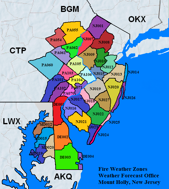


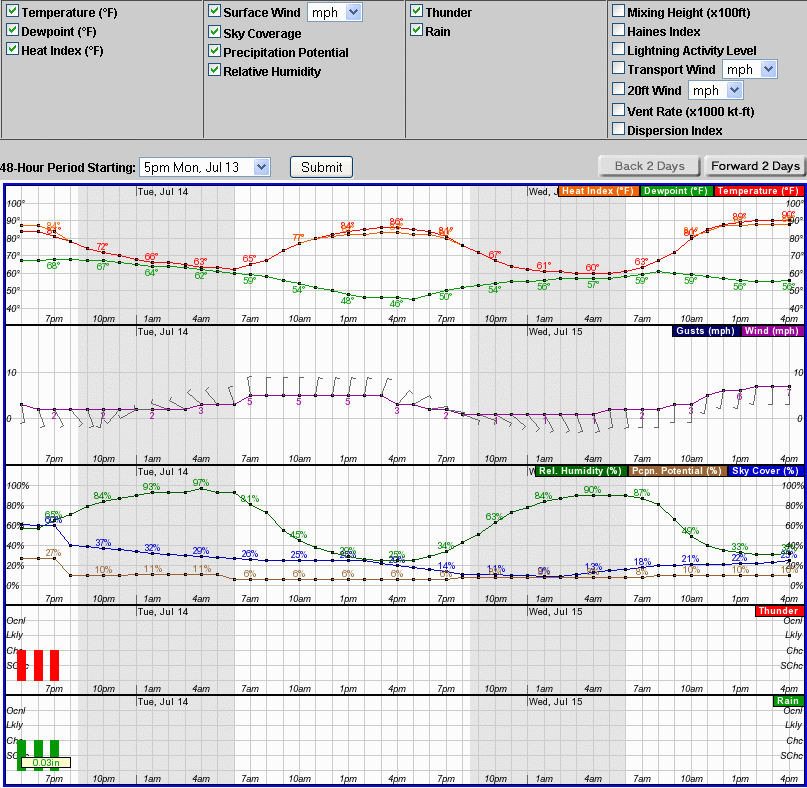
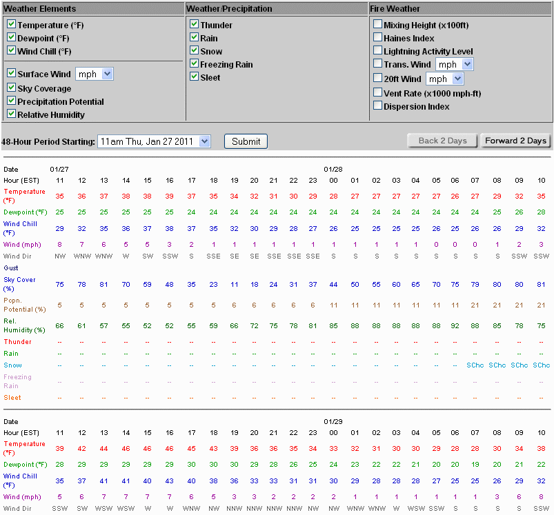


 Coastal Flood
 Marine Forecasts
 Text Products
 Climate Information
 Skywarn
 Submit Storm Report
 Weather Event Archives
 Forecast Discussion
 Emergency Managers
 Briefing Page