
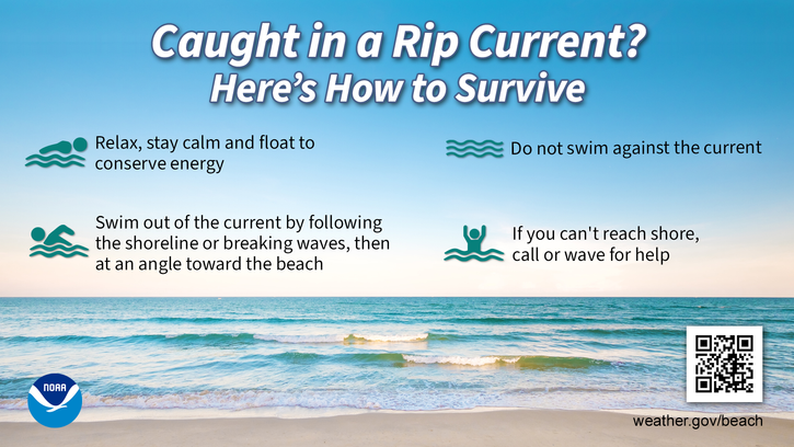
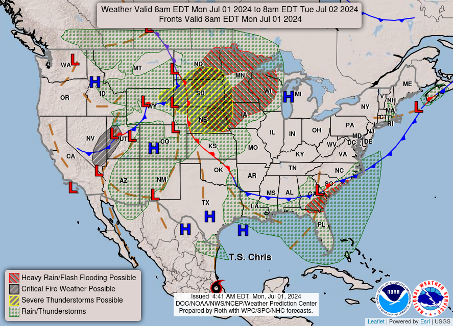
Severe thunderstorms will be possible on Independence Day, mainly across parts of the Upper Mississippi Valley, Ozarks, and southern/central Plains. Excessive heat with possible record highs and warm overnight lows will continue to impact much of the West into next week. Dangerous heat is expected across the Southern U.S. and Mid-Atlantic into the weekend. Read More >
Last Map Update: Thu, Jul 4, 2024 at 5:03:18 am CDT

| Latest Text Product Selector (Selected product opens in a new window) | |
 |
 |
 |
 |
 |
 |
| Decision Support | Hazards | Models | Observations | Climate | Hydrology |
 |
 |
 |
 |
 |
 |
| Social Media | Satellite | Fire Weather | Weather Radio | Spotter Training | Text Products |


 Weather Map
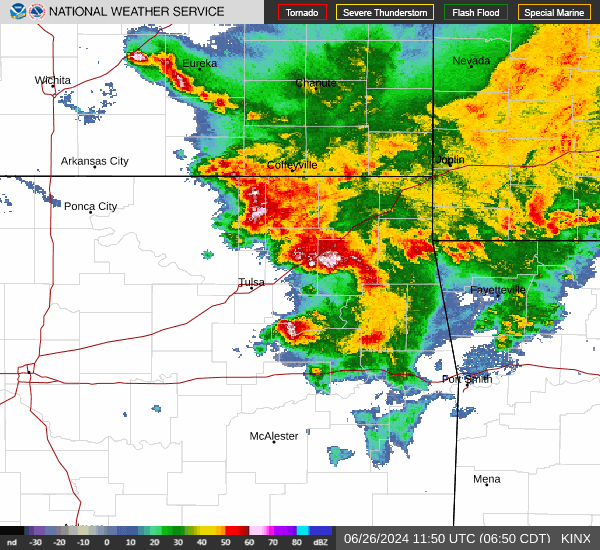
 Fort Smith Radar