Latest Aviation Discussion:
.AVIATION /07Z THURSDAY THROUGH MONDAY/...
Prevailing VFR conditions are expected for all terminals through
Saturday with winds expected to remain light out of the
south/southeast. Daily shower and thunderstorm chances peak each
afternoon with primary hazards being heavy rainfall, gusty
winds, and frequent lightning. Sub-VFR conditions are possible
during precipitation.
VFR conditions are expected Sunday as high pressure builds into the
region. A warm front lifts north across the area Monday, bringing a
return to daily showers and thunderstorms. Still, most activity
Monday looks to be around CHO, with much lower chances for storms at
the other terminals. Any storm that moves over a terminal will be
capable of producing brief periods of sub-VFR conditions, in
addition to gusty winds.
AVIATION...AVS/KRR
Update as of: 355 AM EDT Thu Jul 4 2024
This discussion and more can be found in the Area Forecast Discussion.
Aviation Forecasts
The National Weather Service (NWS) Weather Forecast Office (WFO-LWX), in Sterling, VA has responsibility for six Terminal Aerodrome Forecasts or TAFs in Virginia, Maryland and the eastern West Virginia panhandle. Click on each map below to view the latest decoded TAF Note: maps are not for official aviation use. FAA VFR charts are available here.
REAGAN NATIONAL (DCA)
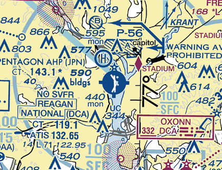
TERMINAL FORECAST (DCA)
24 HRS OF OBSERVATIONS
FAA DETAILS
TABULAR FORECAST
DCA TAF BOARD
DULLES (IAD)
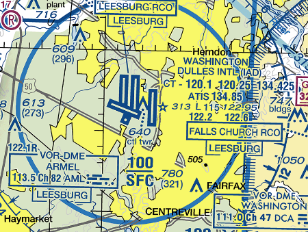
TERMINAL FORECAST (IAD)
24 HRS OF OBSERVATIONS
FAA DETAILS
TABULAR FORECAST
IAD TAF BOARD
BALTIMORE (BWI)
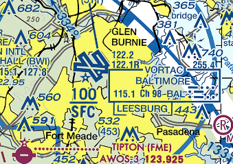
TERMINAL FORECAST (BWI)
24 HRS OF OBSERVATIONS
FAA DETAILS
TABULAR FORECAST
BWI TAF BOARD
CHARLOTTESVILLE (CHO)
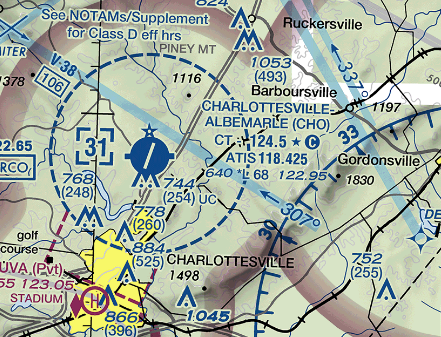
TERMINAL FORECAST (CHO)
24 HRS OF OBSERVATIONS
FAA DETAILS
TABULAR FORECAST
CHO TAF BOARD
MARTIN STATE (MTN)
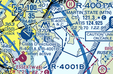
TERMINAL FORECAST (MTN)
24 HRS OF OBSERVATIONS
FAA DETAILS
TABULAR FORECAST
MTN TAF BOARD
MARTINSBURG (MRB)
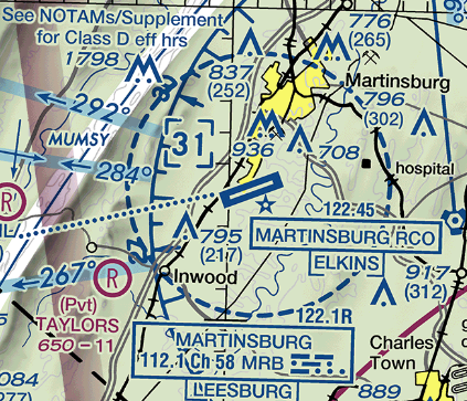
TERMINAL FORECAST (MRB)
24 HRS OF OBSERVATIONS
FAA DETAILS
TABULAR FORECAST
MRB TAF BOARD
Center Weather Service Unit Products
The Leesburg VA Center Weather Service Unit (CWSU/ZDC) covers the NWS Sterling, VA County Warning Area. Use the buttons on the map or....CLICK HERE to view ZDC's web site. For complete AVIATION WEATHER CENTER products click here.
Interactive Aviation Map (mouse over & CLICK for Observations)
See Complete MESONET MAP & OBS
Decoded/Raw Text
- 24 hour decoded observations for Virginia Portion of our CWA...
- 24 hour decoded observations for Maryland Portion of our CWA...
- 24 hour decoded observations for West Virginia Portion of our CWA...
Surface Weather Maps
Wind Rose Data
- Washington Reagan-National (DCA) wind rose data...
- Dulles International (IAD) wind rose data...
- Baltimore-Washington International (BWI) wind rose data...
Miscellaneous


 Coastal Flood
 FAQ
FAQ