
Severe thunderstorms will be possible on Independence Day, mainly across parts of the Upper Mississippi Valley, Ozarks, and southern/central Plains. Excessive heat with possible record highs and warm overnight lows will continue to impact much of the West into next week. Dangerous heat is expected across the Southern U.S. and Mid-Atlantic into the weekend. Read More >
Baltimore/Washington Area Hydrology Page
What's NEW?
View our timeline of historic flood events in the region!
Check out the DC-area Potomac Inundation Maps!
Latest drought information
Click on a tab below to view associated information!
River Observations
Hover over a location to see its name. Click on any point to see information for that site.
River Forecasts
Hover over a location to see its name. Click on any point to see information for that site.
Scroll below the map to see major rivers at a glance.
Temperature/Precipitation Observations
|
Local Precipitation Forecasts
(Hover over or click/tap on the timeframes to change the image.) |
|
|
|
National Precipitation Forecasts, Days 1 through 3 (click to enlarge)
Please note: The below forecasts represent a basin average and may not represent local maxima. Images from the NWS Weather Prediction Center (WPC) |
||
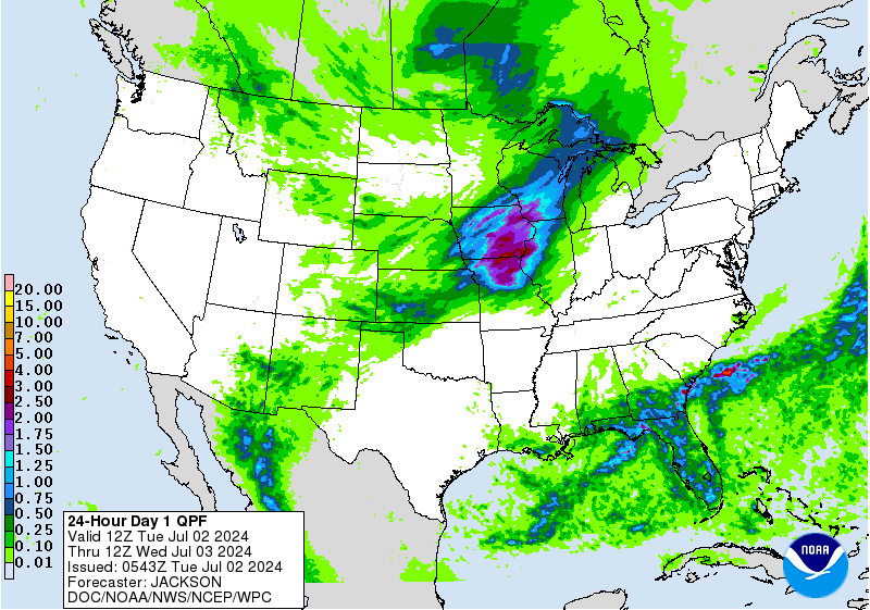 Day 1 Rainfall |
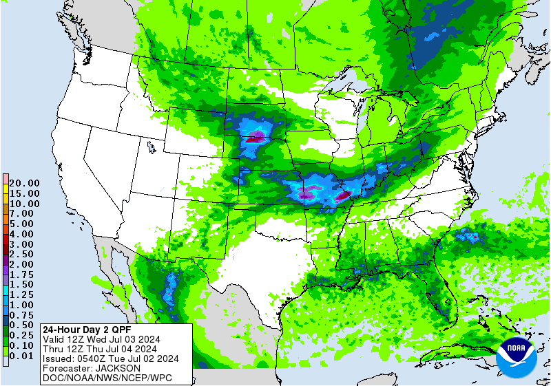 Day 2 Rainfall |
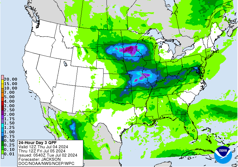 Day 3 Rainfall |
|
||


 Coastal Flood
 FAQ
FAQ