


|
Mon/Fri Morning EM Weather Briefing
For latest Mon/Fri West Virginia state briefings |

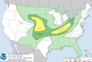
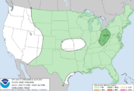
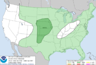
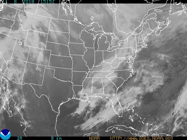
Widespread showers and thunderstorms across much of the central and eastern U.S. will produce areas of excessive rainfall, especially in the southern Mid-Atlantic states. Scattered severe thunderstorms are expected from Montana into portions of the central/southern Plains this weekend. A heatwave will build in the Desert Southwest, in parts of Arizona, southeastern California, and southern Nevada. Read More >
|
||||||
|
|
Mon/Fri Morning EM Weather Briefing
For latest Mon/Fri West Virginia state briefings |
| Baltimore-Washington KLWX Radar | |
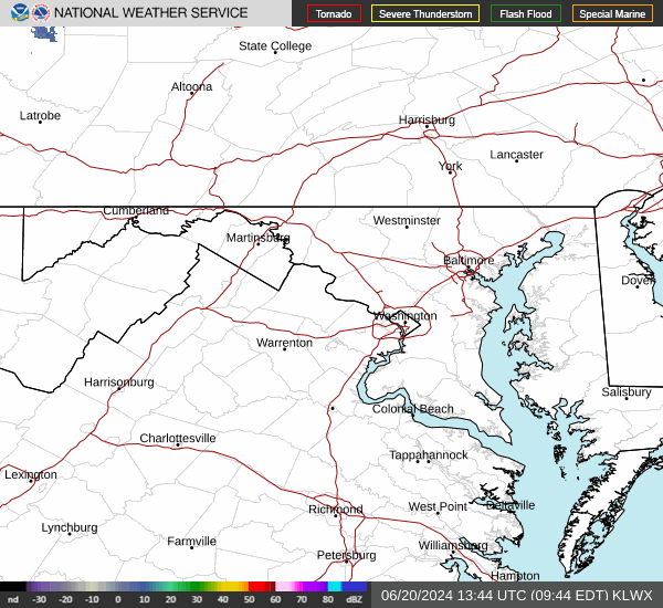 (loop) |
 (loop) |
| Storm Prediction Center (SPC) Severe Weather Outlook Graphics | ||
|
Thumbnails may not be representative of the latest forecast since each picture is derived from
the 12 UTC issuance and each 'day' has its own update times throughout the day, so click on the picture to view the latest graphic. |
||
|
Day 1 Outlook
 |
Day 2 Outlook
 |
Day 3 Outlook
 |
|
Day 1 Outlook
 |
Day 2 Outlook
 |
Day 3 Outlook
 |
|
||||||||||||||||||
| _____________________________________________________________ | ||||||||||||||||||
|
||||||||||||||||||
| _____________________________________________________________ | ||||||||||||||||||
|
||||||||||||||||||
| _____________________________________________________________ | ||||||||||||||||||
|
||||||||||||||||||
| _____________________________________________________________ | ||||||||||||||||||
|
||||||||||||||||||
| _____________________________________________________________ | ||||||||||||||||||
|
||||||||||||||||||
| _____________________________________________________________ | ||||||||||||||||||
|
||||||||||||||||||
|
||
| _____________________________________________________________ | ||
| Hurricane Local Statement Issued by NWS Baltimore-Washington (if available) |
||
| - | ||
| Training - Community Hurricane Preparedness | ||
| - | ||
| NWS Hurricane Resources | ||
|
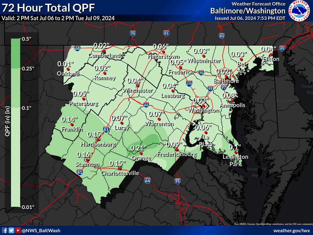
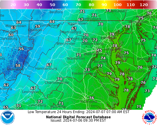
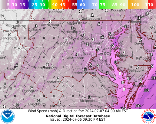
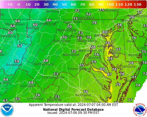
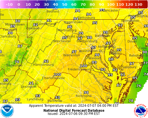
Local Forecast Graphics
|
| Drought Monitor | ||||
 |
||||
|
||||
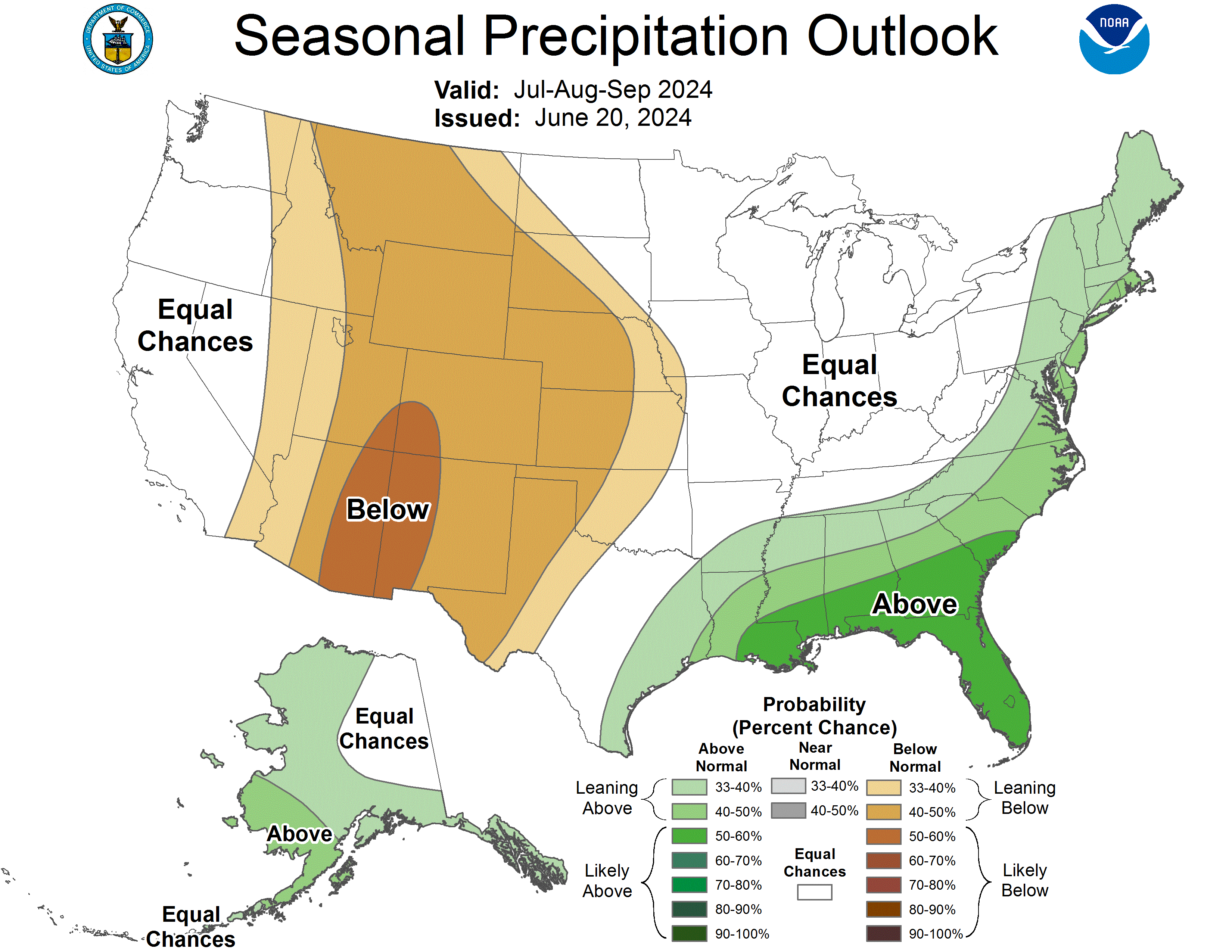
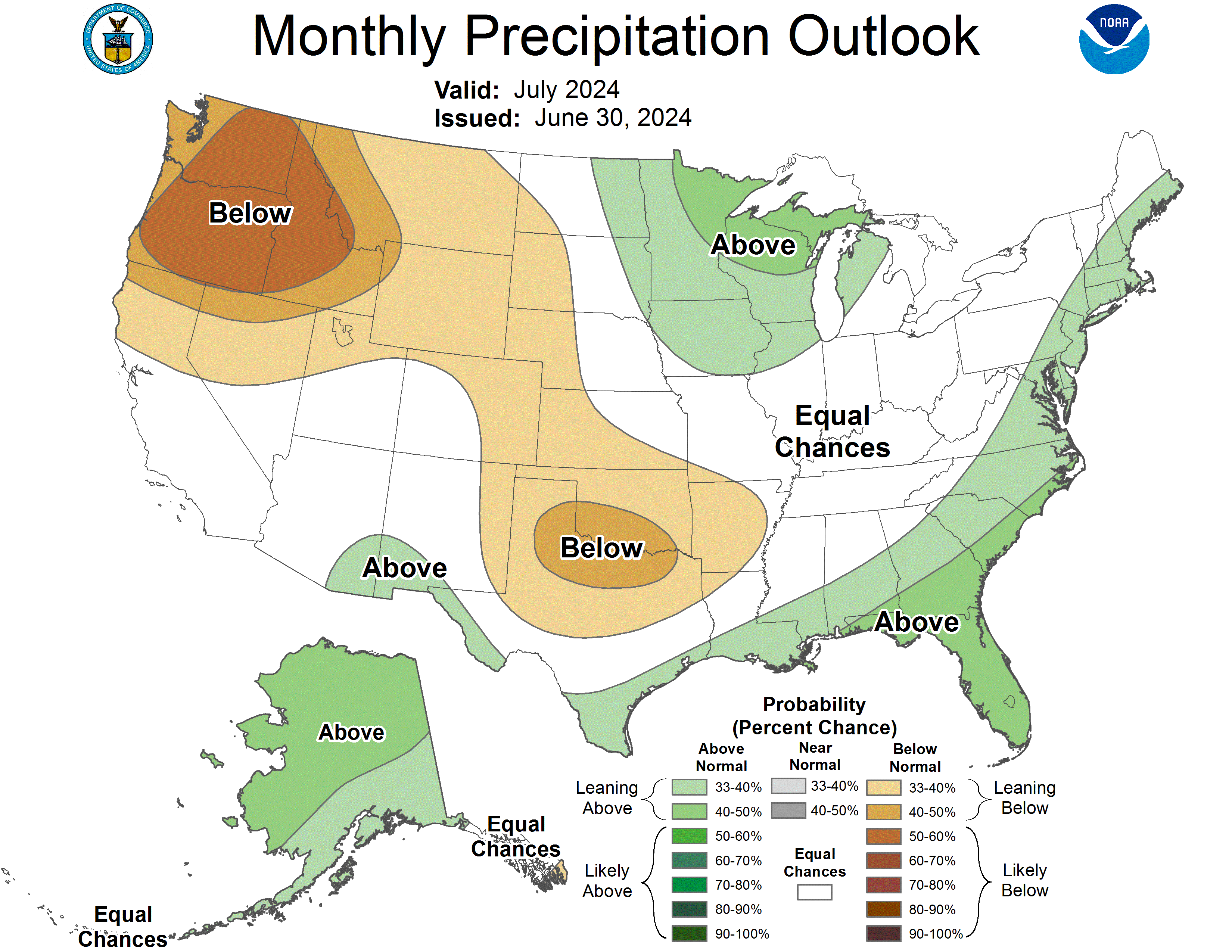
Monthly & Seasonal Drought Outlook From the Climate Prediction Center |
||||
|
||||
|
|||||||||||||||||||||||||||||||


 Coastal Flood
 FAQ
FAQ