| Heat Safety and Forecast Information for Central Pennsylvania |
||
The National Weather Service has multiple tools to assess the potential for heat stress due to extreme temperatures. Within the following tabs is information that can help understand the issuance of NWS heat watches, warnings, and advisories. Each of these tools integrate other weather parameters to provide a deeper level of information beyond what the actual air temperature can tell us. Across Central Pennsylvania we experience the conditions most favorable for heat indices reaching dangerously high levels when the winds are out of the west and thunderstorms are unable to form. If this pattern persists over several days or more, this can compound the risk for heat-related illnesses. Please visit https://www.weather.gov/safety/heat for more information. |
||
| Most images on this page can be magnified by clicking, and resized back to original size with a second click. |
||
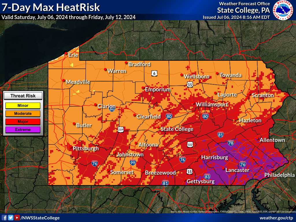
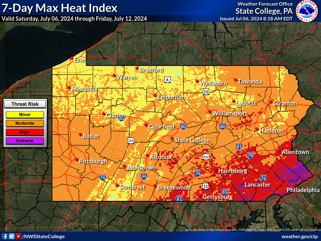
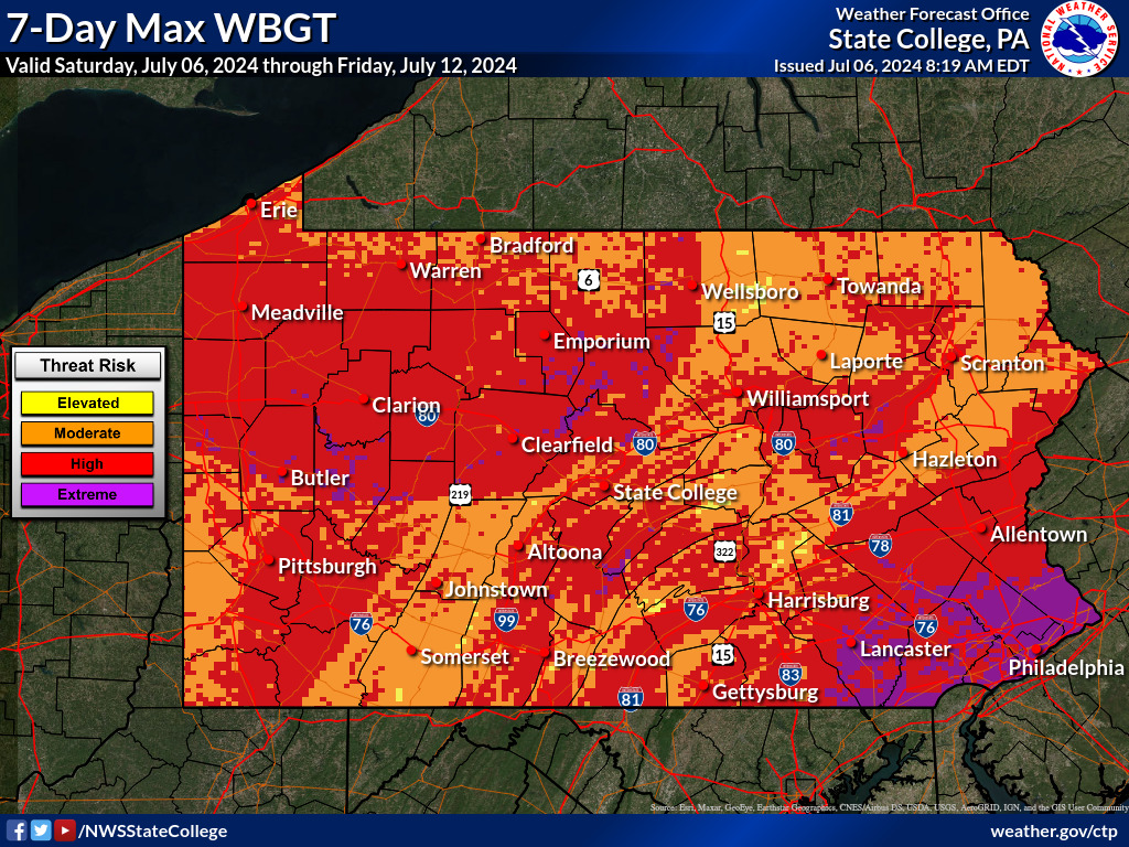
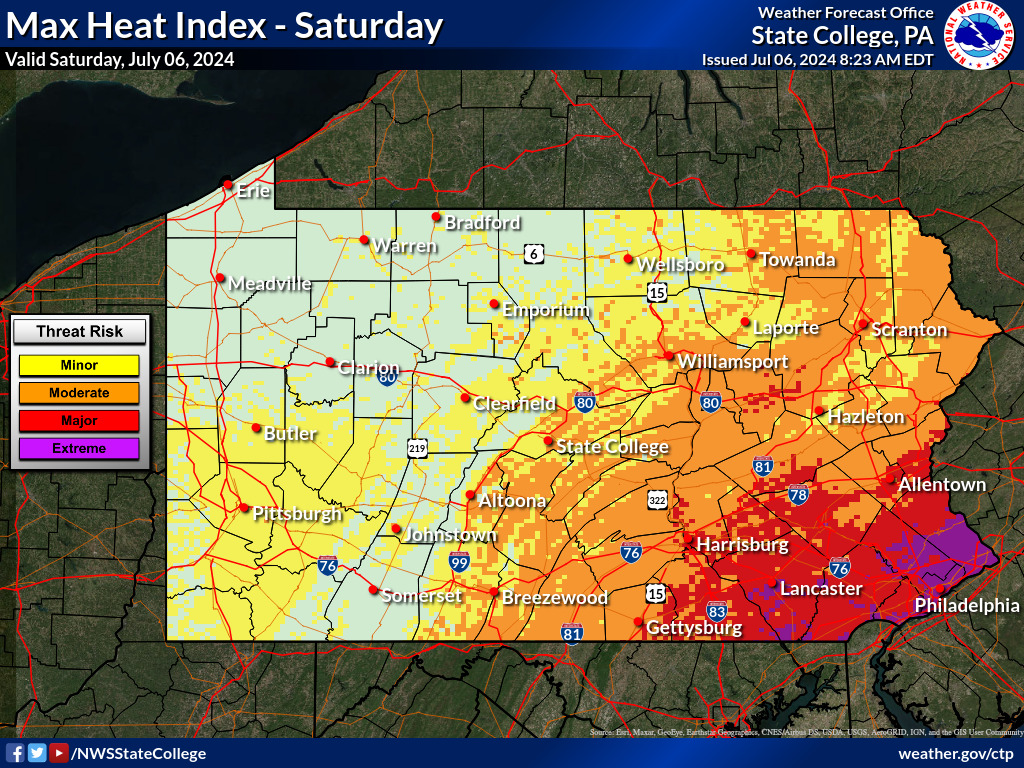
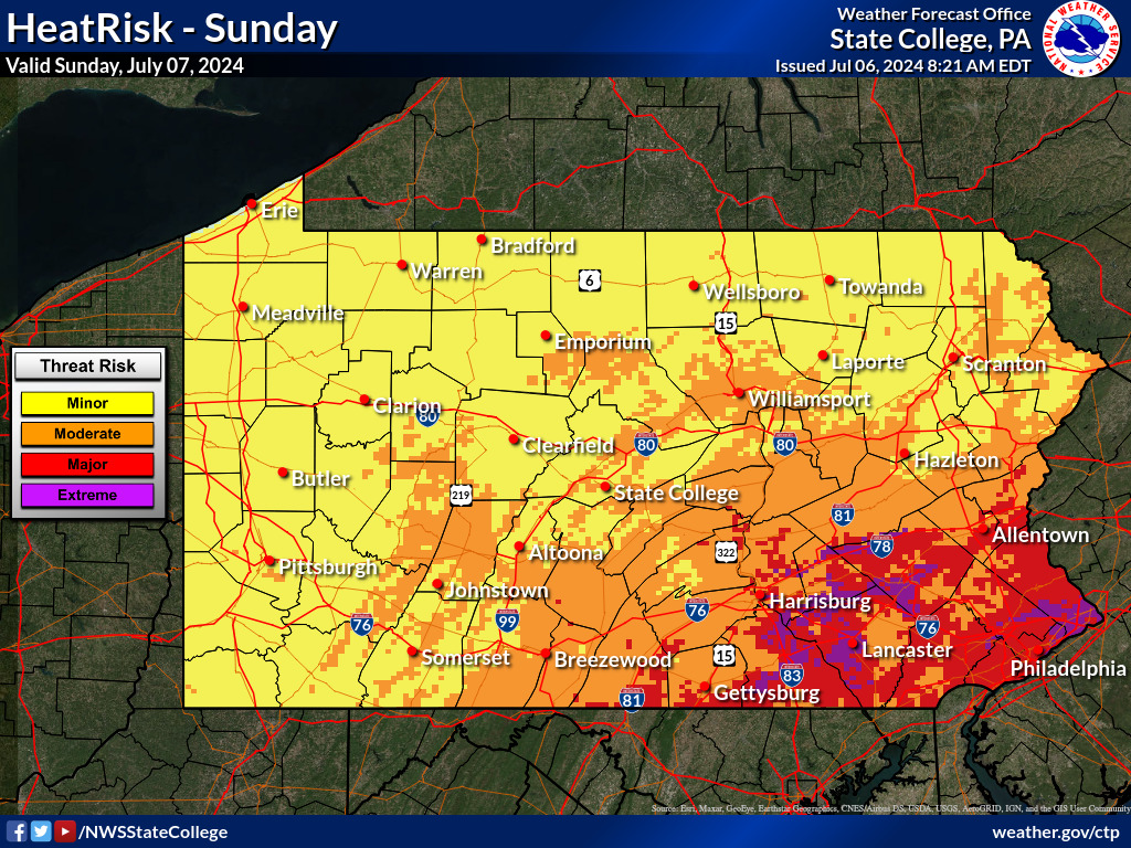
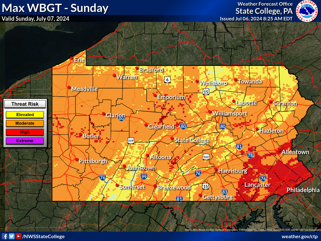
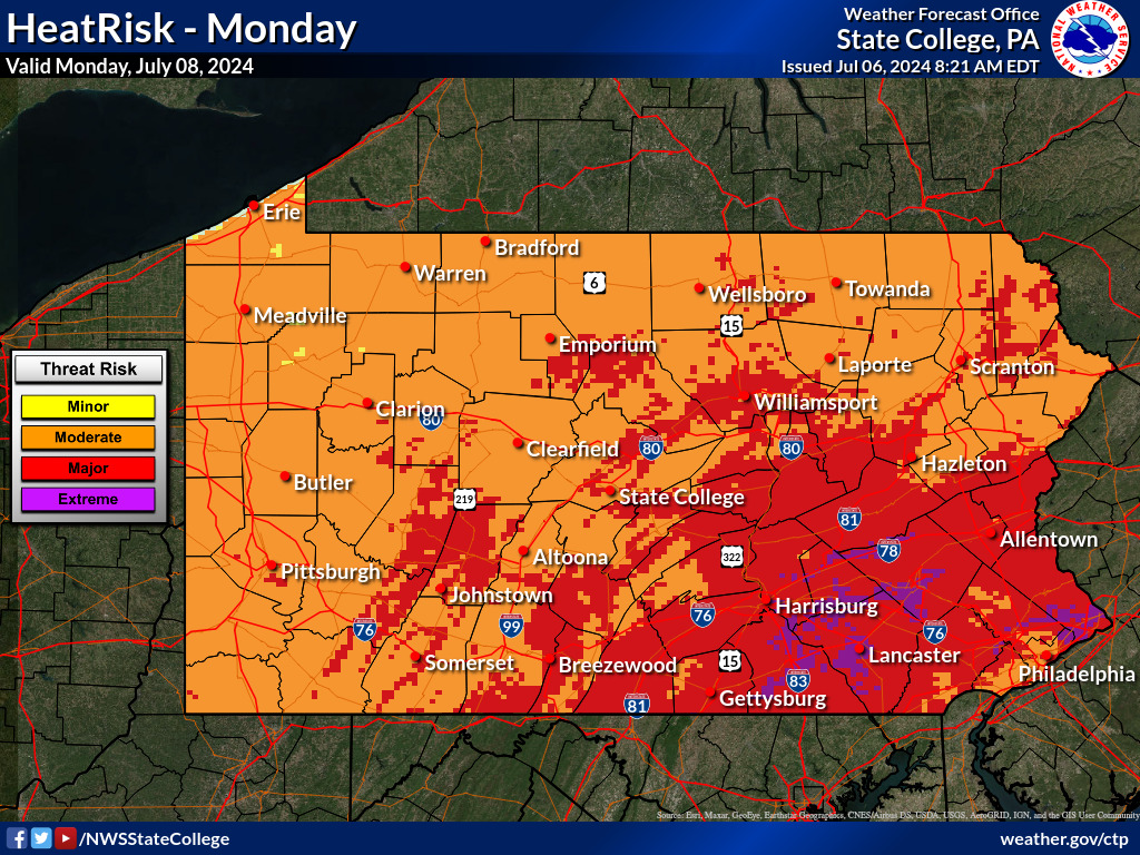
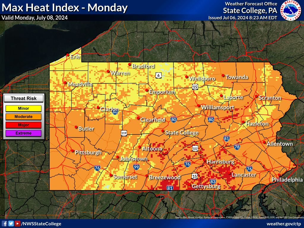
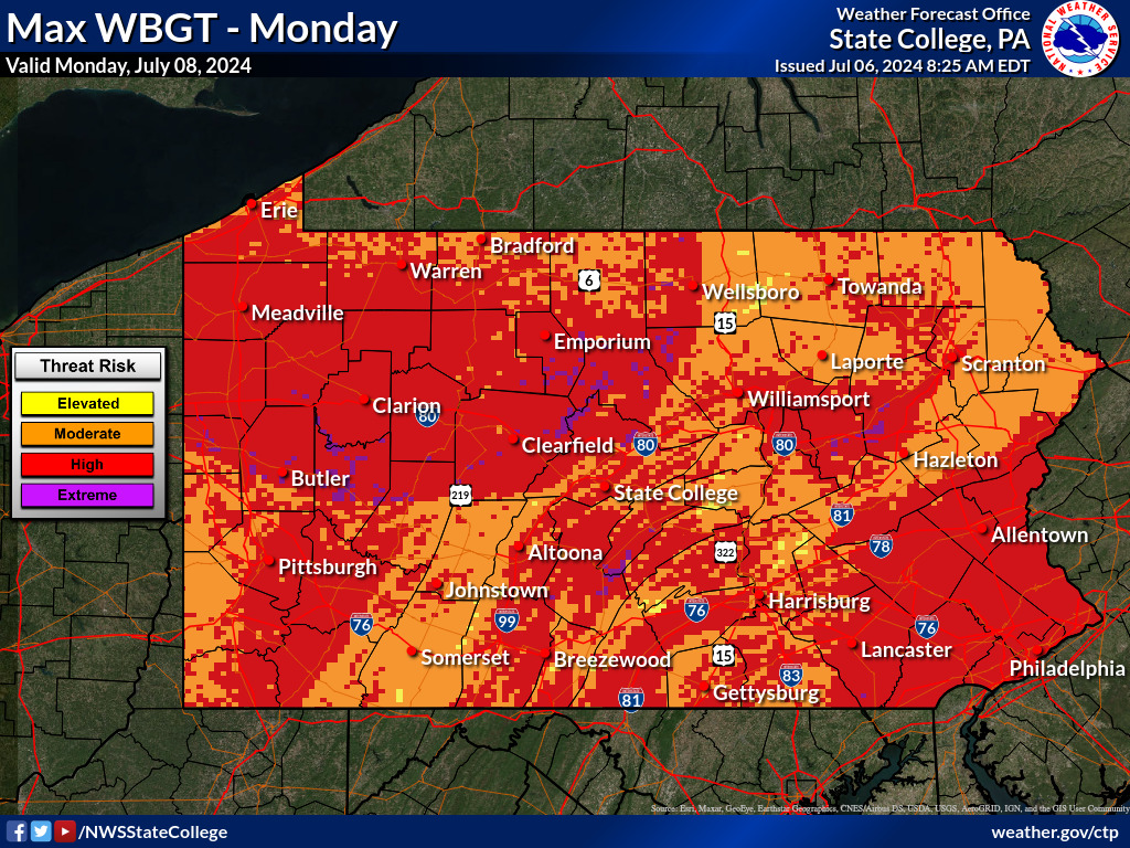
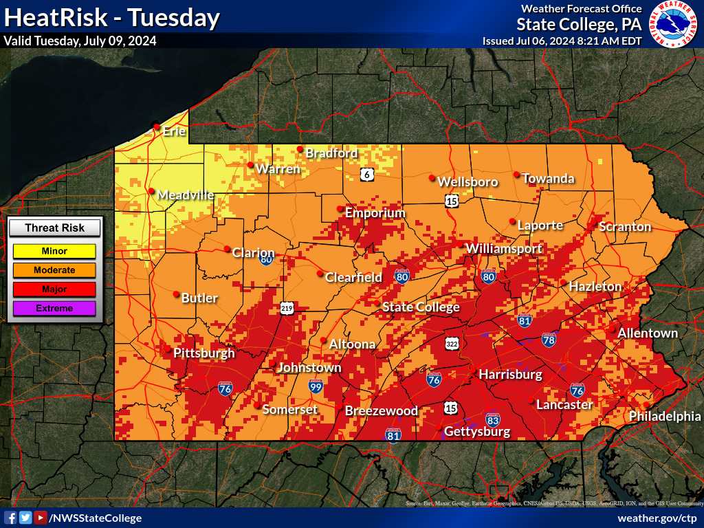
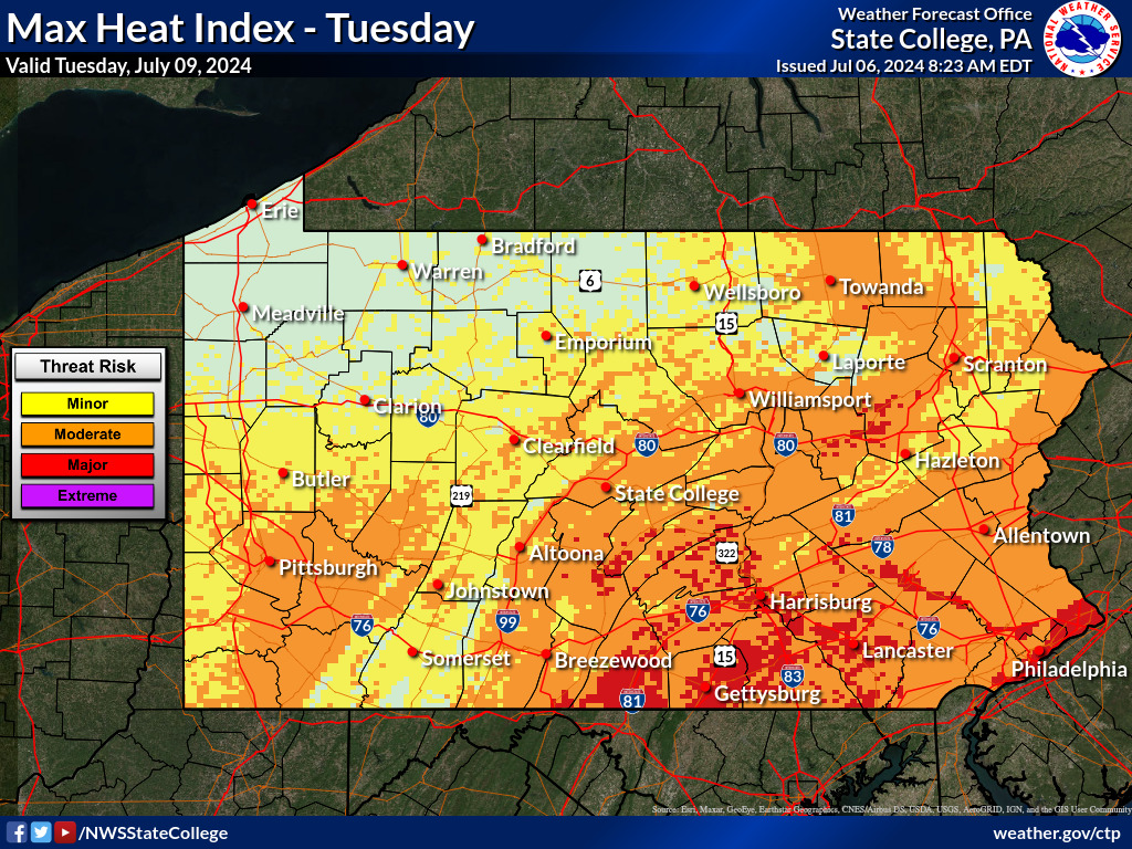
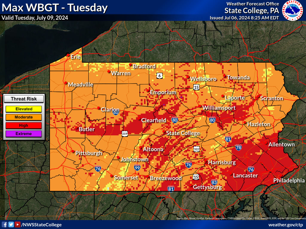
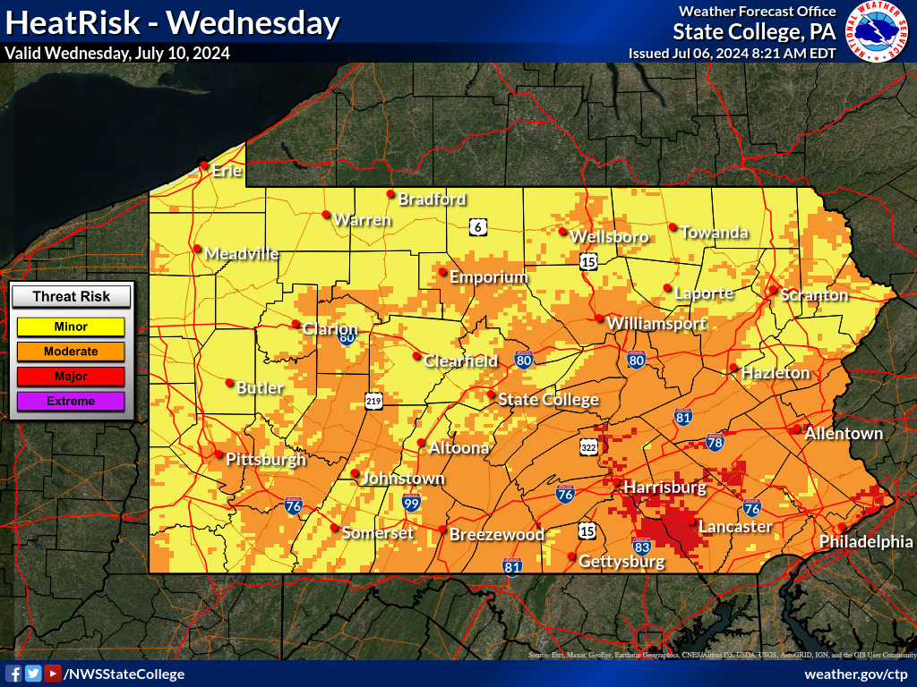
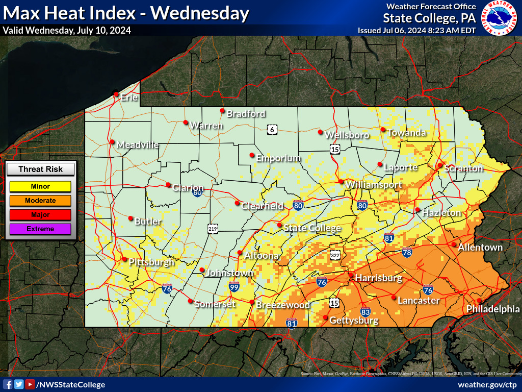
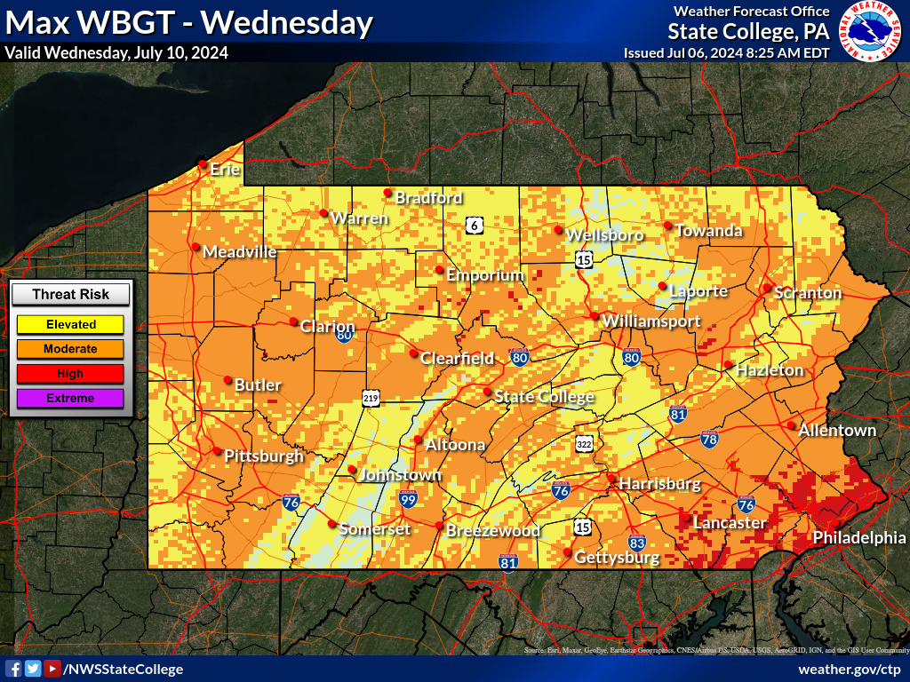
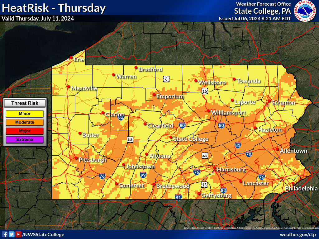
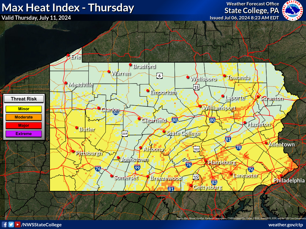
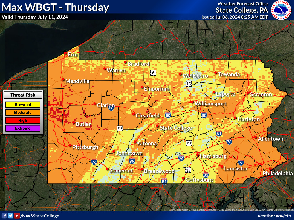
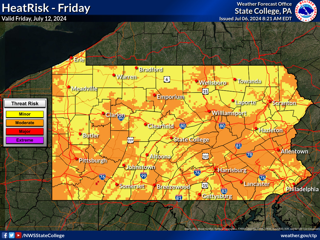
| Heat Threat Forecast Comparison: |
|||
 |
|||
| Real-time comparison of the three primary Heat Forecast Tools
used by the National Weather Service. |
|||
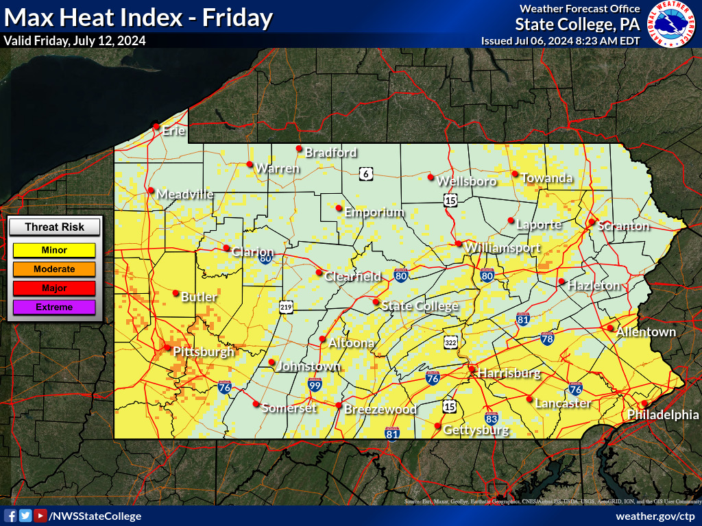
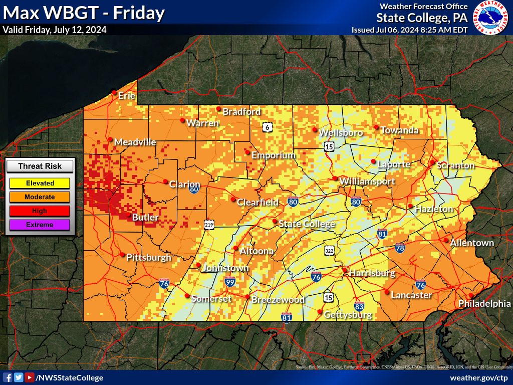
| Quick Look: Maximum During the Next 7 Days |
|||
| Heat Risk | Heat Index | Wet Bulb Globe Temp (WBGT) | |
| 7 Day Max |
 |
 |
 |
| |
* DISCLAIMER: * These three graphics will not be the same as they are customized for slightly different groups. |
||
| |
(Experimental) HeatRisk Designed to provide a spectrum of heat-health impacts for ALL populations. |
Heat Index Designed for the general public, primarily people taking part in light physical activity in the shade. |
Wet Bulb Globe Temperature Designed for people engaging in high levels of outdoor physical activity |
| |
|||
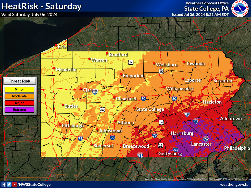
|
Daily Forecast for Next 7 Days |
|||
| Heat Risk | Heat Index | Wet Bulb Globe Temp (WBGT) | |
| Day 1 |
 |
 |
 |
| Day 2 |
 |
 |
 |
| Day 3 |
 |
 |
 |
| Day 4 |
 |
 |
 |
| Day 5 |
 |
 |
 |
| Day 6 |
 |
 |
 |
| Day 7 |
 |
 |
 |
| Heat Risk | Heat Index | Wet Bulb Globe Temp (WBGT) | |
Temperature Probability of Exceedance Forecasts: |
What is HeatRisk? |
||
HeatRisk combines weather, climate, and CDC data to identify potentially dangerous heat that may lead to increased risk from health impacts. Designed to help you understand what forecasted heat means for you and what actions you may need to take. FB: From coast to coast, HeatRisk can help people in the U.S. understand what forecasted heat means for them, their families, and their community. Visit the interactive HeatRisk viewer: wpc.ncep.noaa.gov/heatrisk/ The NWS HeatRisk is an experimental color-numeric-based index that provides a forecast risk of heat-related impacts to occur over a 24-hour period. HeatRisk takes into consideration:
|
||
 |
||
What is the Heat Index? |
||
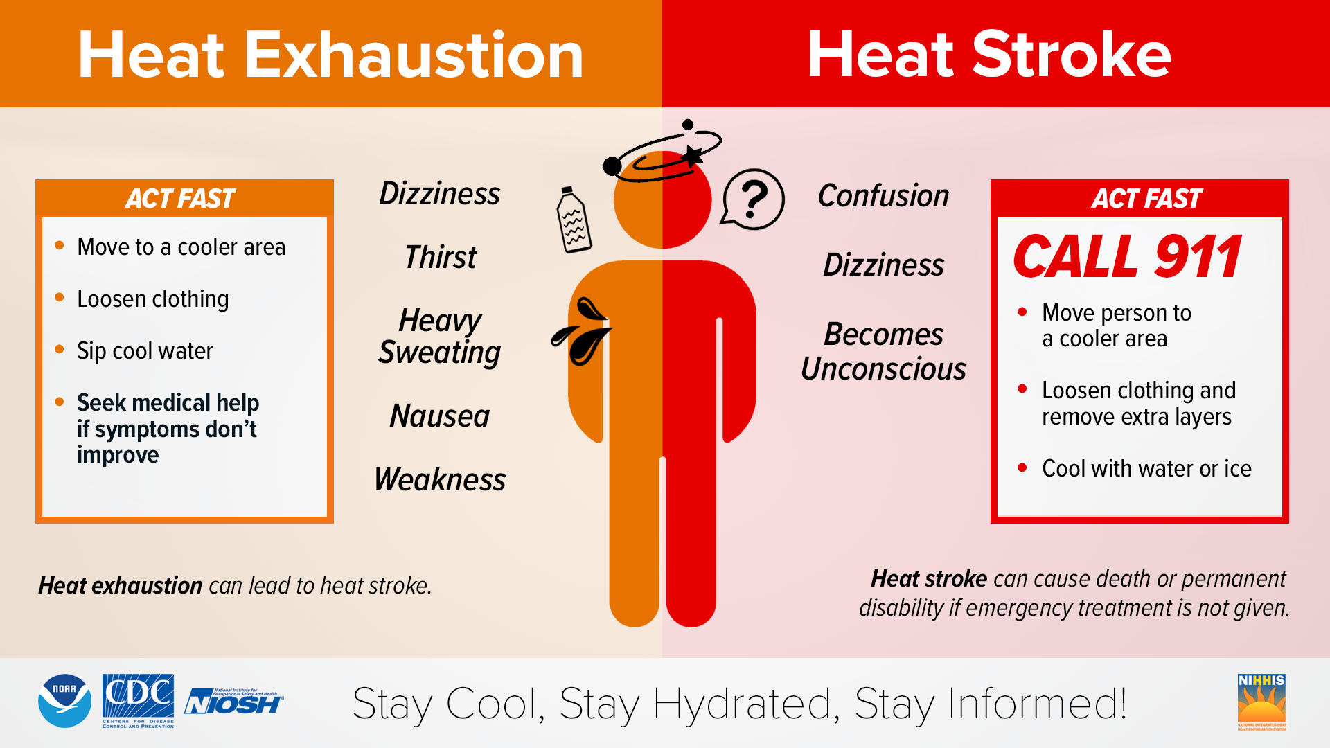
| The heat index, also known as the apparent temperature, is what the temperature feels like to the human body when relative humidity is combined with the air temperature. In other words, the “feels-like” temperature. This has important considerations for the human body's comfort. When the body gets too hot, it begins to perspire or sweat to cool itself off. If the perspiration is not able to evaporate, the body cannot regulate its temperature. Evaporation is a cooling process. When perspiration is evaporated off the body, it effectively reduces the body's temperature. When the atmospheric moisture content (i.e. relative humidity) is high, the rate of evaporation from the body decreases. In other words, the human body feels warmer in humid conditions. The opposite is true when the relative humidity decreases because the rate of perspiration increases. The body actually feels cooler in arid conditions. There is a direct relationship between the air temperature and relative humidity and the heat index. This means that as the air temperature and relative humidity increase (decrease), the heat index increases (decreases). |
||
 |
||
It surprises many people to learn that the heat index values forecasted and measured are for shady locations. If you are exposed to direct sunlight, the heat index value can be increased by up to 15°F. As shown in the table below, heat indices meeting or exceeding 103°F can lead to dangerous heat disorders with prolonged exposure and/or physical activity in the heat. |
||
 |
||
How is the Heat Index calculated? |
||
The computation of the heat index is a refinement of a result obtained by multiple regression analysis carried out by Lans P. Rothfusz and described in a 1990 National Weather Service (NWS) Technical Attachment (SR 90-23). The regression equation of Rothfusz is HI = -42.379 + 2.04901523*T + 10.14333127*RH - .22475541*T*RH - .00683783*T*T - .05481717*RH*RH + .00122874*T*T*RH + .00085282*T*RH*RH - .00000199*T*T*RH*RH
If the RH is less than 13% and the temperature is between 80 and 112 degrees F, then the following adjustment is subtracted from HI: ADJUSTMENT = [(13-RH)/4]*SQRT{[17-ABS(T-95.)]/17} where ABS and SQRT are the absolute value and square root functions, respectively. On the other hand, if the RH is greater than 85% and the temperature is between 80 and 87 degrees F, then the following adjustment is added to HI: ADJUSTMENT = [(RH-85)/10] * [(87-T)/5] The Rothfusz regression is not appropriate when conditions of temperature and humidity warrant a heat index value below about 80 degrees F. In those cases, a simpler formula is applied to calculate values consistent with Steadman's results: HI = 0.5 * {T + 61.0 + [(T-68.0)*1.2] + (RH*0.094)} In practice, the simple formula is computed first and the result averaged with the temperature. If this heat index value is 80 degrees F or higher, the full regression equation along with any adjustment as described above is applied. The Rothfusz regression is not valid for extreme temperature and relative humidity conditions beyond the range of data considered by Steadman. If this seems like a lot then use this Heat Index Calculator. |
||
What is the Wet Bulb Globe Temperature (WBGT)? |
Heat stress is commonly measured by the heat index or the “feels like temperature” which is representative of the temperature and moisture in the atmosphere. An alternative method is the Wet Bulb Globe Temperature (WBGT), which uses temperature, humidity, and other weather parameters. WBGT has been shown to be an effective indicator of heat stress for active populations. |
 |
The WBGT has been used for decades in many military agencies, by the Occupational Safety and Health Administration (OSHA), and organizations that facilitate marathons. The American College of Sports Medicine bases its guidelines for the intensity of sport practices on WBGT as well, and it is therefore utilized by athletic programs in many school districts. |
WBGT versus Heat Index: |
 |
Who is WBGT Most Helpful for? |
This parameter is best suited for active people such as outdoor workers, athletes, marching band, and others performing strenuous outdoor activities. WBGT can be used to establish guidelines for activity modifications during exercise or outdoor work. Guidelines vary geographically since temperatures fluctuate by region, and people’s response to exercising or working in heat may also vary by the geographic region. |
The Occupational Safety and Health Administration (OSHA) recommends protective measures for outdoor work:
|
Heat Safety Resources: |
 |
 |
 |
| Please visit https://www.weather.gov/safety/heat for more information. |


 Send Us a Report