Regional Warning, Watch, and Advisory Criteria
The State College NWS Office will issue Advisories and Warnings for situations where the following is expected:
Winter PrecipitationStatements for these hazards will be issued under the header "PHLWSWCTP (WWUS41 KCTP)."
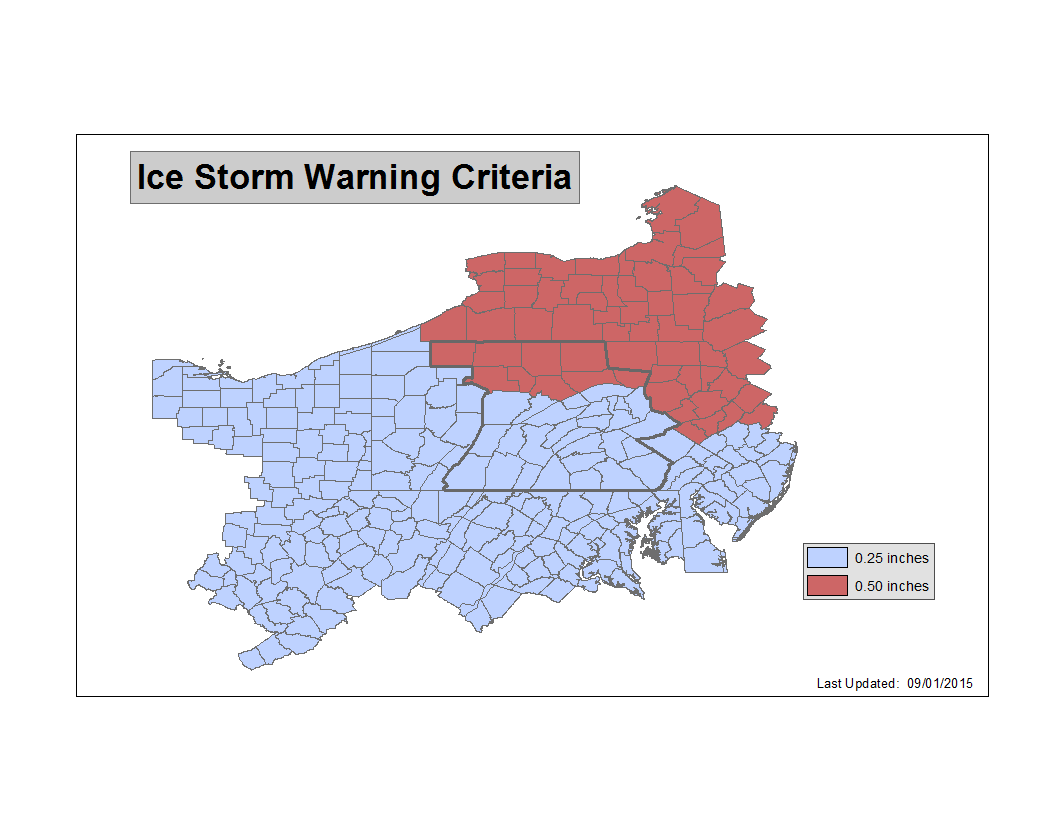
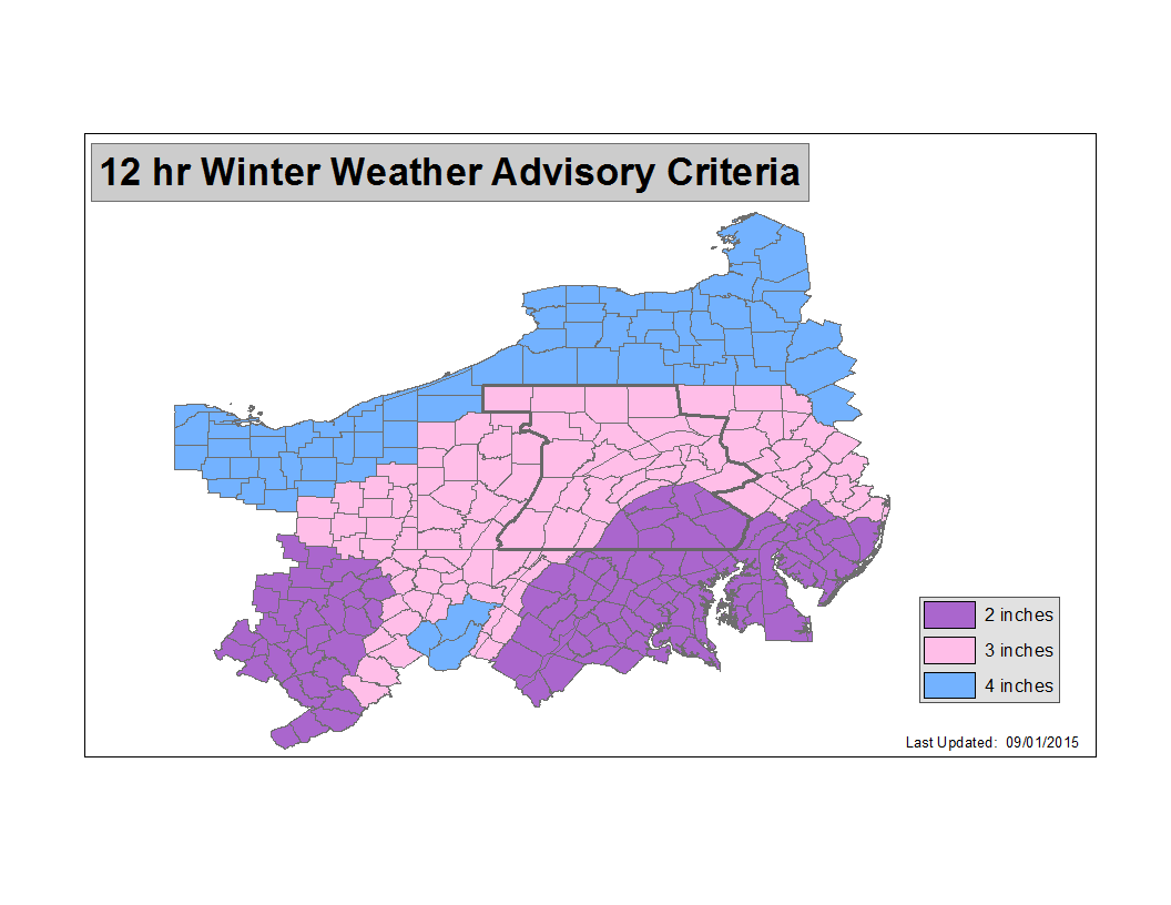
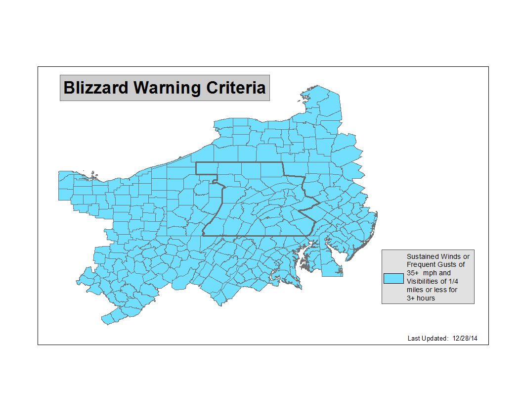
For Snow & Ice Threats:
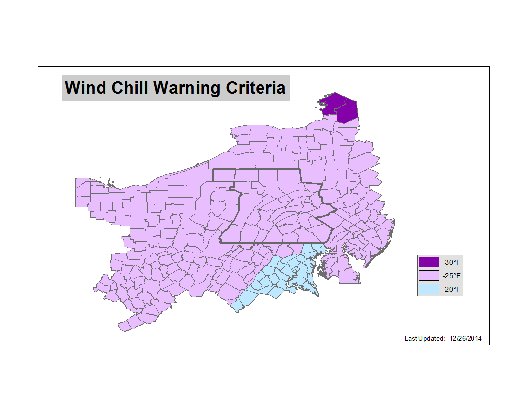
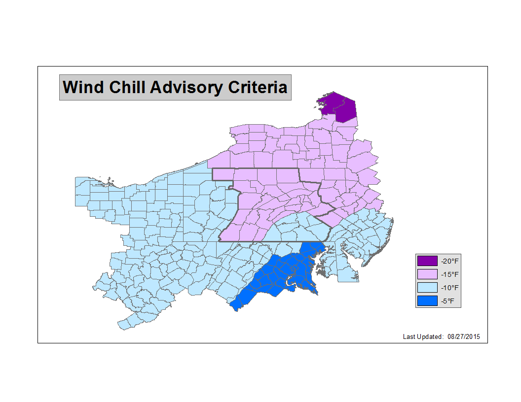
Low Wind Chills:
|
Thunderstorm ThreatsSevere Thunderstorm RISK Terminology SEVERE THUNDERSTORM or TORNADO WATCH Severe thunderstorms with large hail, damaging winds, and/or tornadoes are possible, but the exact time and location of storm development is still uncertain. A watch means be prepared for storms. SEVERE THUNDERSTORM WARNING A severe thunderstorm is imminent or occurring; it is either detected by weather radar or reported by storm spotters. A severe thunderstorm is one that produces winds 58 mph or stronger and/or hail 1 inch in diameter or larger. A warning means to take shelter. TORNADO WARNING A tornado is imminent or occurring; it is either detected by weather radar or reported by storm spotters. A warning means to take shelter. FLOOD WATCH Conditions are favorable for flash flooding. A watch means to get prepared for possible flooding. FLASH FLOOD WARNING Life-threatening flooding is imminent or occurring; it is either detected by weather radar, indicated by stream gauges, or reported by storm spotters. A flash flood is a flood that occurs very quickly; it is caused by heavy rainfall over a short period of time or from a dam break. A warning means to leave low-lying or flood prone areas. |
Non Precipitation Phenomena Warning TerminologyThe State College NWS Office will issue Advisories and Warnings under the header "PHLNPWCTP (WWUS71 KCTP)" for situations where the following non-precipitation phenomena are expected : Winds NOT associated with a specific Thunderstorm:
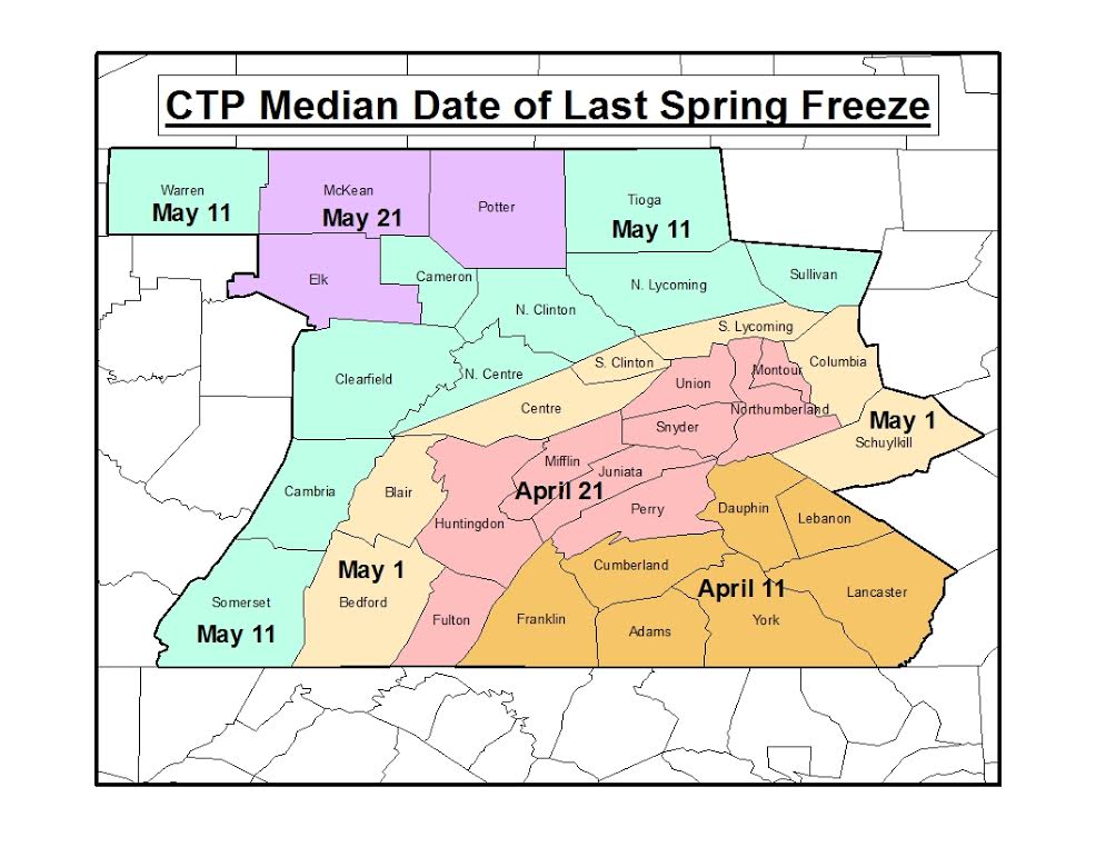
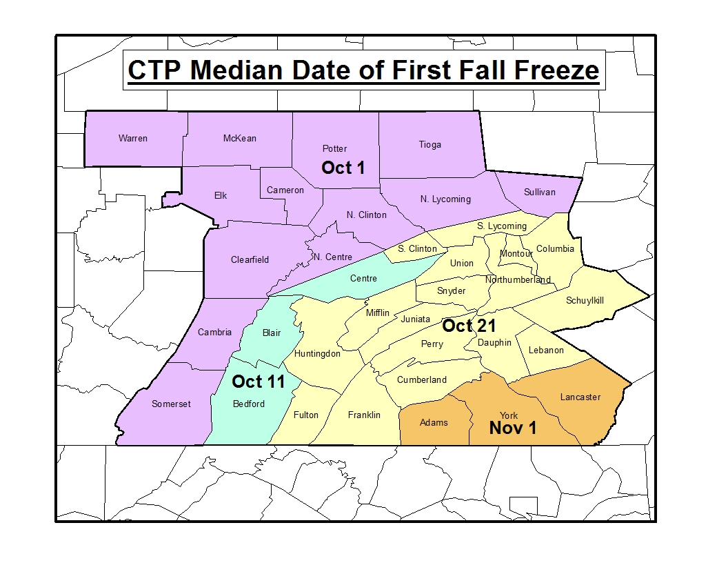
Widespread Frosts/Freezes, after the beginning (and before the end) of the "growing season":
For High Heat Indicies:
For Widespread Dense Fog:
|
Fire Weather ProductsThe State College NWS Office will issue these two Fire Weather related products under the header "PHLRFWCTP (WWUS81 KCTP)" for situations when the following criteria are met:
|


 Send Us a Report
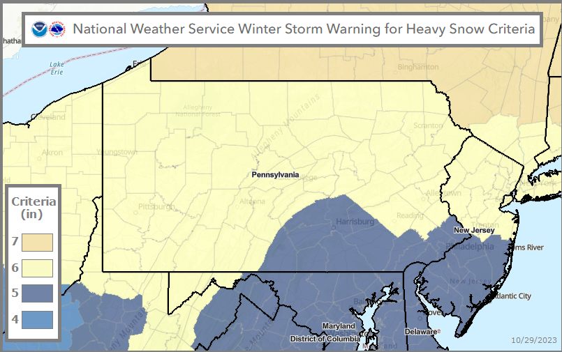
.png)
.png)