
Severe thunderstorms will be possible on Independence Day, mainly across parts of the Upper Mississippi Valley, Ozarks, and southern/central Plains. Excessive heat with possible record highs and warm overnight lows will continue to impact much of the West into next week. Dangerous heat is expected across the Southern U.S. and Mid-Atlantic into the weekend. Read More >
Wakefield, VA
Weather Forecast Office
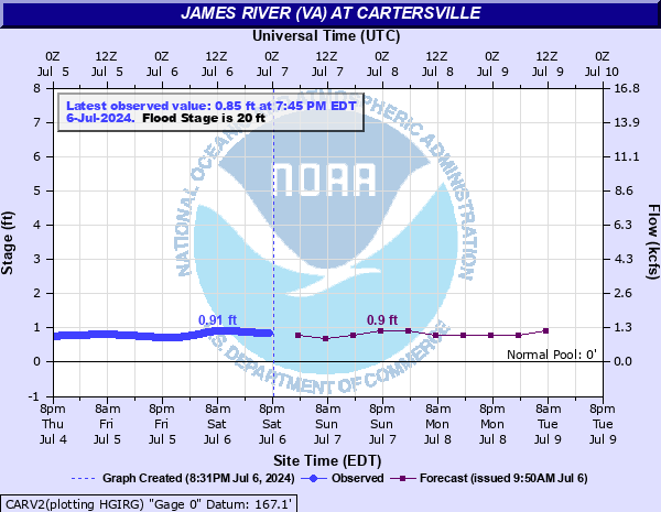
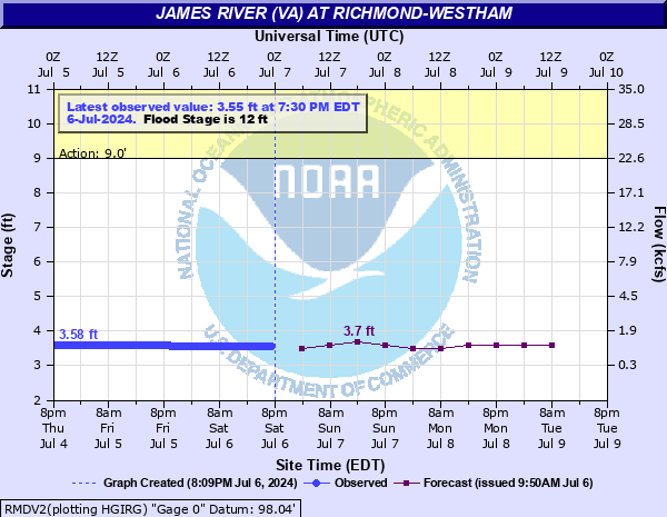
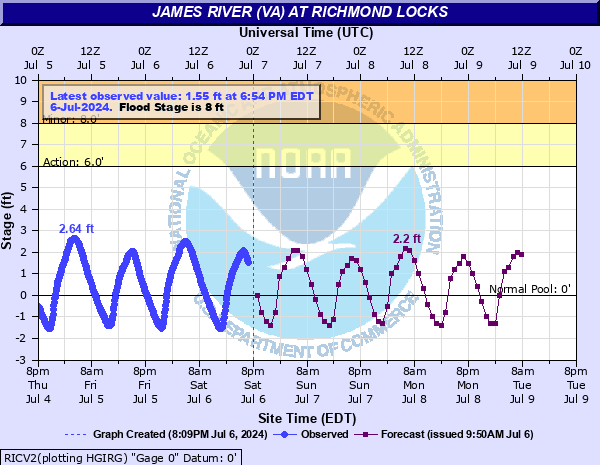
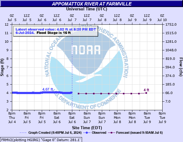
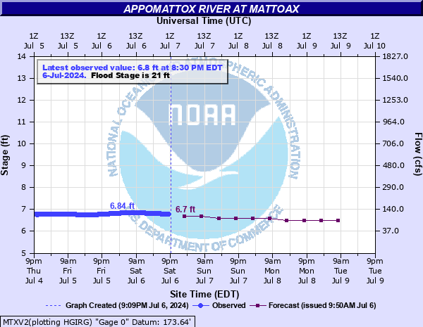
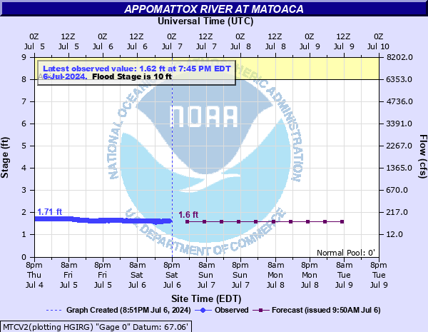
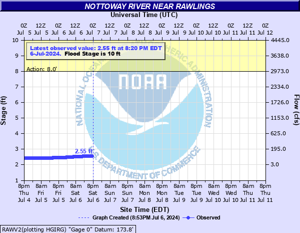
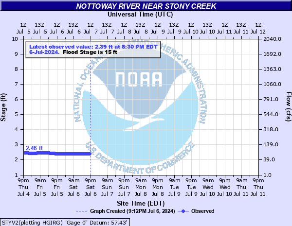
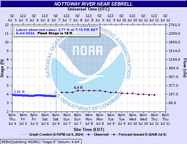
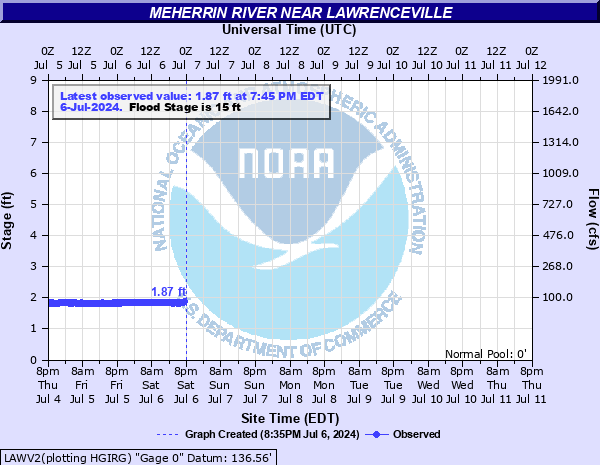
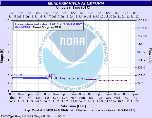
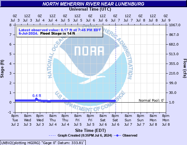
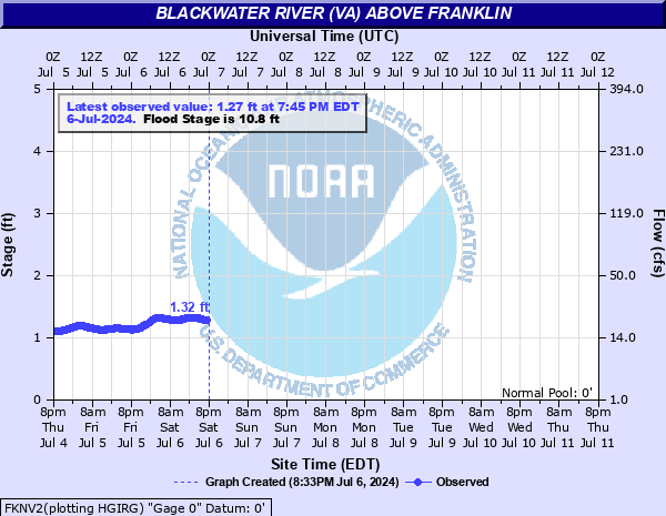
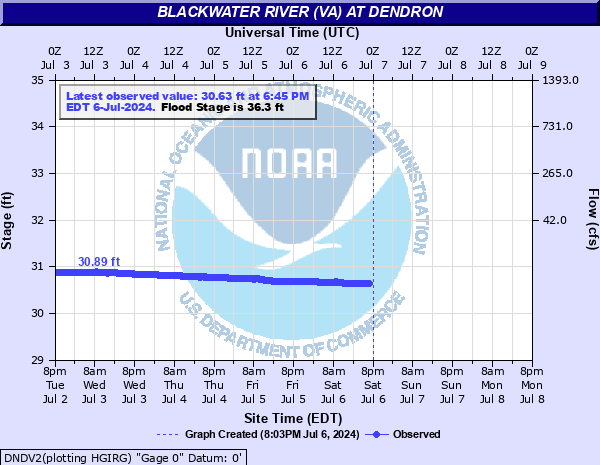
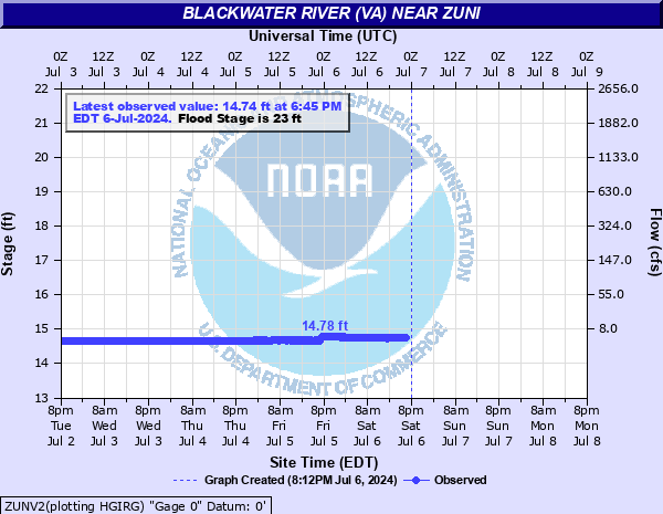
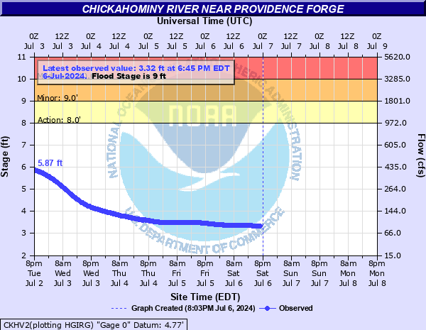
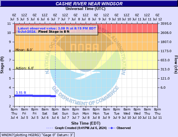
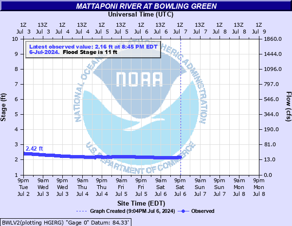
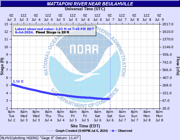
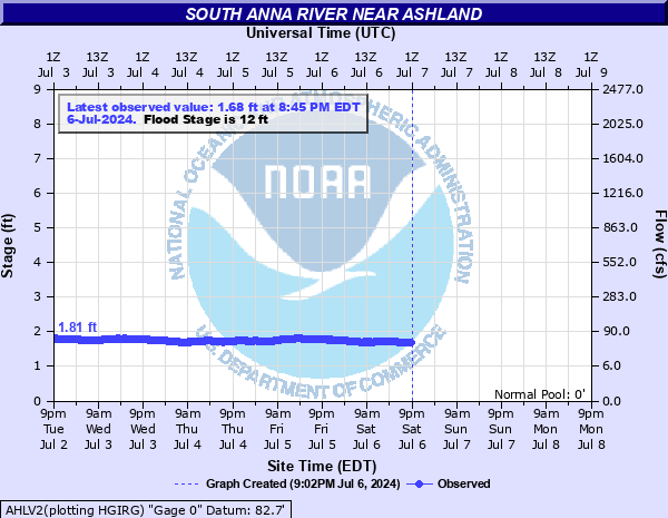
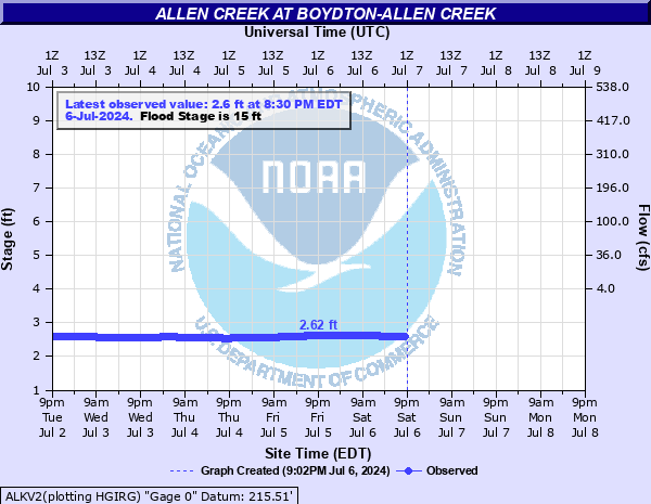
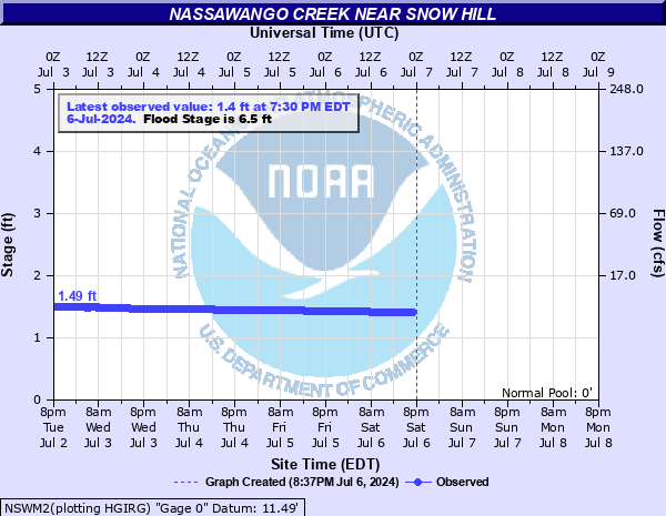
Mouse over each site to display hydrograph.
Hydrographs (showing stages and flows over time) are available through AHPS (Advanced Hydrologic Prediction Service) by clicking site names.
|
|||||||||||||||||||||||||||||||||||||||||||||||||||||||||||||||||||||||||||||||||||||||||||||||||||||||||||||||||||||||||||||||||||||||||||||||||||||||||||||||||||||||||||||||||||||||||||||||||||||||||||||||||||||||||||||||||||||||||||||||||||||||||||||||||||||||||||||||||||||||||||||||||||||||||||||||||||||||||||||||||||||||||||||||||||||||||||
CURRENT CONDITIONS
GIS MARINE REPORTS
MARINE OBSERVATIONS
EARTHQUAKE MONITOR
TIDES NEXT FEW DAYS
LAND OBSERVATIONS HOURLY
RIVER LEVEL SUMMARY
FORECASTS
Zone Forecast
Marine Forecast
Fire Weather Forecast
Air Quality Forecast
River Level Forecast
Summer Rip Current Forecast
Graphical Rain Totals
Core TEXT Products
RSS/XML
MODEL-DATA
Meso Analysis
Local WRF Model
Statistical Models
NCEP Models
ENSO
Nearshore Wave Prediction System (NWPS)
SAFETY/EDUCATION
Awareness Weeks Messages
CoCoRAHS
SkyWarn
Storm Ready
Weather Ready Nation
Brochures
Safety
WindChill Chart
Heat Index
US Dept of Commerce
National Oceanic and Atmospheric Administration
National Weather Service
Wakefield, VA
10009 General Mahone Highway
Wakefield, VA 23888
757-899-4200
Comments? Questions? Please Contact Us.


 Coastal Flood
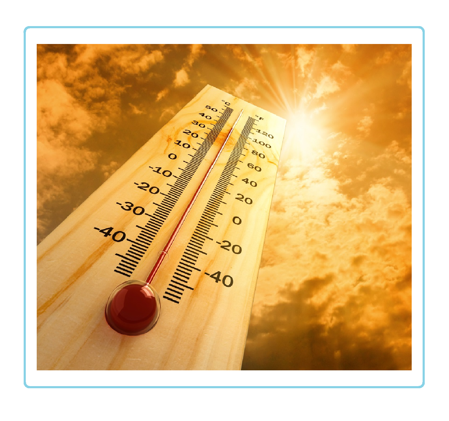 Heat
Heat