
Severe thunderstorms will be possible on Independence Day, mainly across parts of the Upper Mississippi Valley, Ozarks, and southern/central Plains. Excessive heat with possible record highs and warm overnight lows will continue to impact much of the West into next week. Dangerous heat is expected across the Southern U.S. and Mid-Atlantic into the weekend. Read More >
| Snow Amount Potential
Experimental - Leave feedback
|
|
| Expected Snowfall - Official NWS Forecast
Point Range
What's this?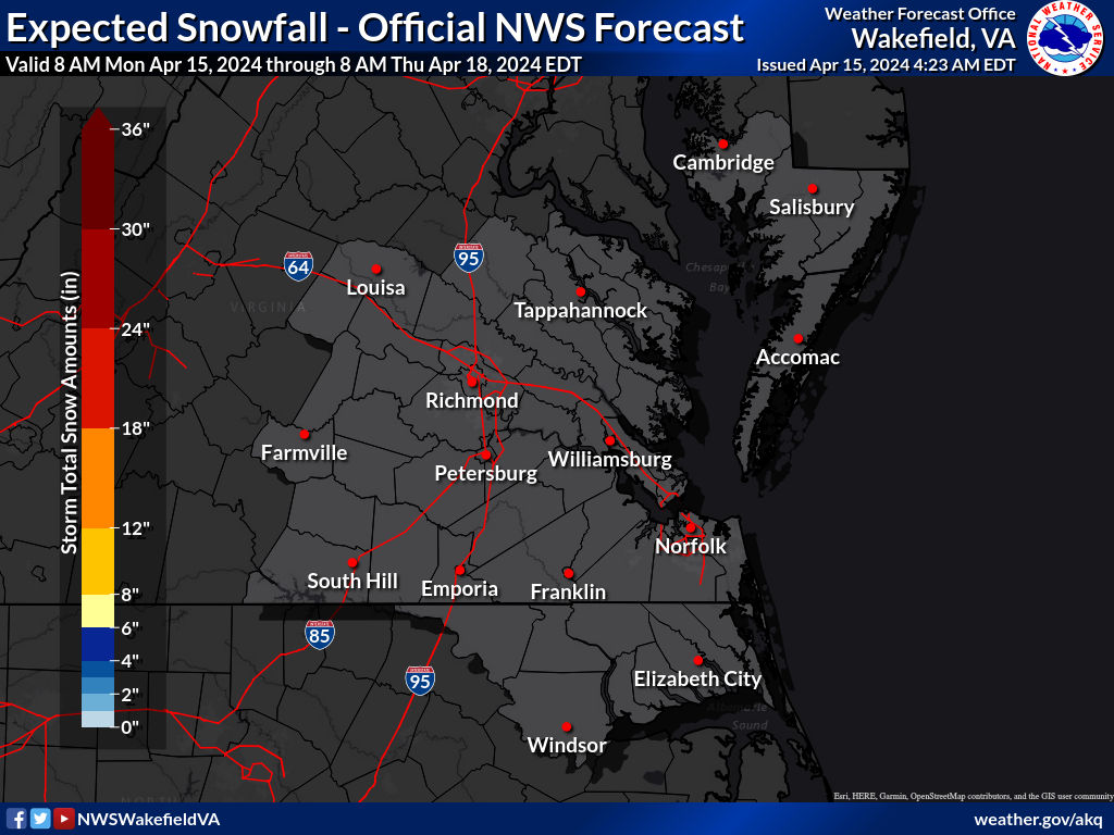 |
High End Amount 1 in 10 Chance (10%) of Higher Snowfall 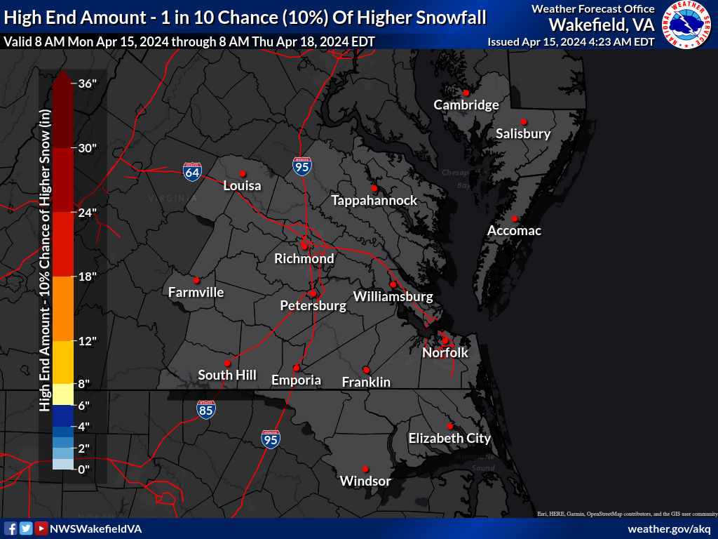 What's this? |
| Low End Amount 9 in 10 Chance (90%) of Higher Snowfall 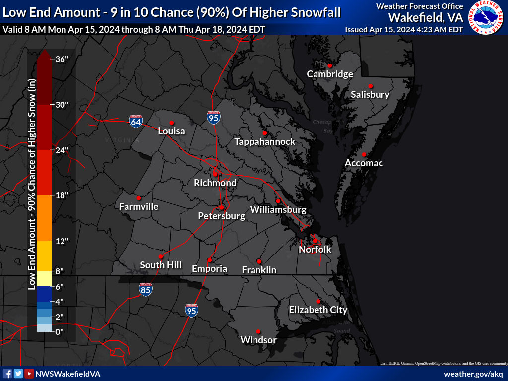 What's this? |
|
| Percent Chance That Snow Amounts Will Be Greater Than...
Experimental - Leave feedback
What's this?
|
||||||||||||||||
|
||||||||||||||||
| Snowfall Totals by Location
Experimental - Leave feedback
What's this?
|
|
|
| Snow Amount Potential
Experimental - Leave feedback
|
|
| Expected Snowfall - Official NWS Forecast
Point Range
What's this?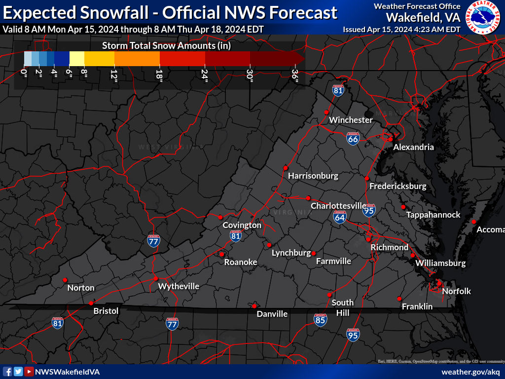 |
High End Amount 1 in 10 Chance (10%) of Higher Snowfall 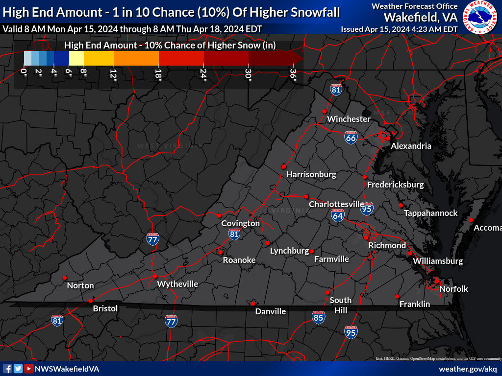 What's this? |
| Low End Amount 9 in 10 Chance (90%) of Higher Snowfall  What's this? |
|
| Percent Chance That Snow Amounts Will Be Greater Than...
Experimental - Leave feedback
What's this?
|
||||||||||||||||
|
||||||||||||||||
| Ice Accumulation Potential |
|
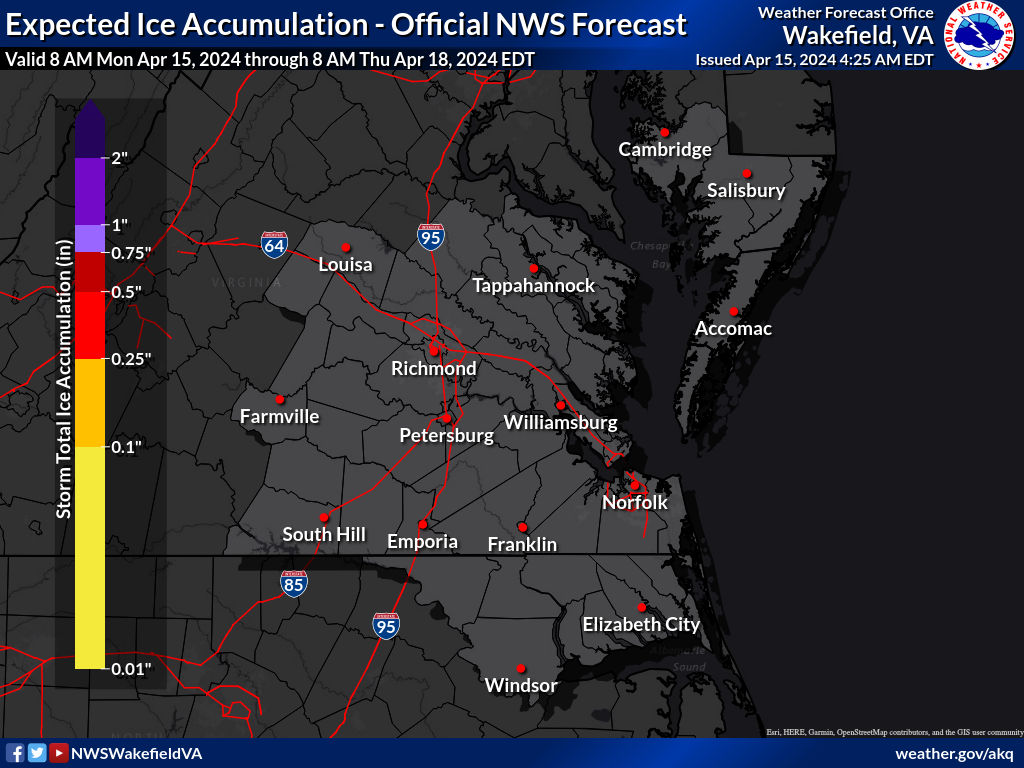
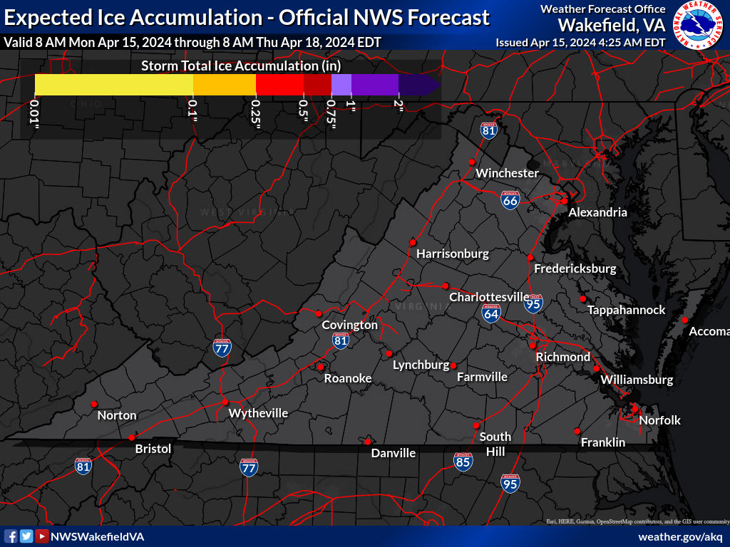
Expected Ice Accumulation - Official NWS Forecast This is the elevated flat surface ice accumulation. It is not radial/line ice. Radial/line ice is typically 39% of the elevated flat surface ice. For more information on this, see this module. |
|---|
 What's this? |
| Ice Accumulation Potential |
|
Expected Ice Accumulation - Official NWS Forecast This is the elevated flat surface ice accumulation. It is not radial/line ice. Radial/line ice is typically 39% of the elevated flat surface ice. For more information on this, see this module. |
|---|
 What's this? |
 |
 |
| Precipitation Onset/End Timimg | ||
| Onset of Wintry Precipitation | End Timing of Wintry Precipitation | |
|---|---|---|
 |
 |
|
| What's this? | What's this? | |
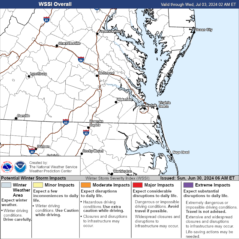
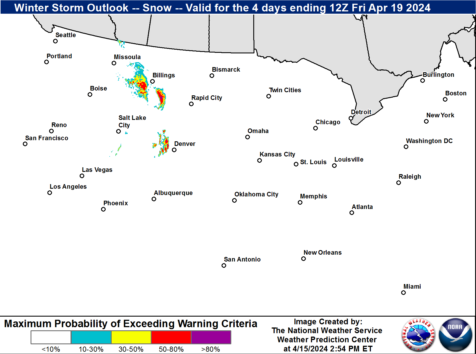
| Winter Storm Severity Index (WSSI) | Winter Storm Outlook (WSO) |
|---|---|
 |
 |
| National Snow Reports | National Snowfall Analysis |
|---|---|
 |
 |
| Local Snow Reports | |
 |
|
| Snow and Ice Threat: 3-7 Days From Now |
|
Hover over (or click) Days 3-7 thumbnails to see full-size maps showing Snow or Ice Threats. |
| Day 3 | Day 4 | Day 5 | Day 6 | Day 7 | ||
|---|---|---|---|---|---|---|
| Snow |  |
 |
 |
 |
 |
|
| Ice |  |
 |
 |
 |
 |
|
|
||||||
| High | High threat of high impact winter storm. Potential impacts include significant travel delays, closures, and threats to life and property. Plan ahead to minimize impact on you and your family. |
|---|---|
| Moderate | Moderate winter storm threat. Potential impacts include significant travel delays and closures. Plan ahead to minimize impact on you and your family. |
| Enhanced | Enhanced winter storm threat. Primary threat is disruption to travel. |
| Slight | Slight winter storm threat. If threat materializes, may cause travel disruptions. |
| None | No significant winter storm threat is currently expected. However, light wintry precipitation may still be possible. |
| Days 4-7 Winter Weather Outlook | |
| Day 4 Winter Weather Outlook | Day 5 Winter Weather Outlook |
 |
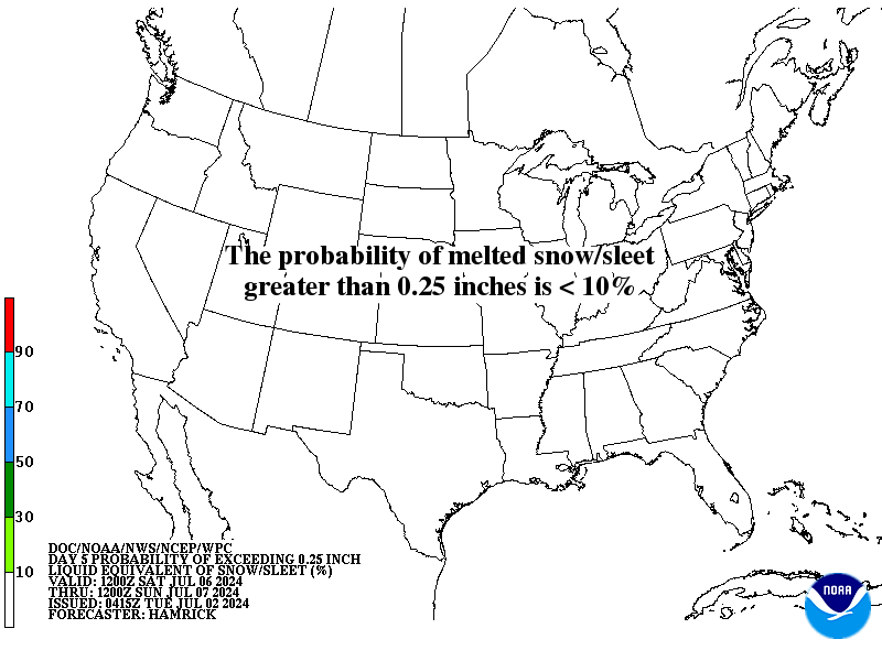 |
| Day 6 Winter Weather Outlook | Day 7 Winter Weather Outlook |
 |
 |
|
|
|
| CPC Week-2 Experimental Heavy Snow Risk | |
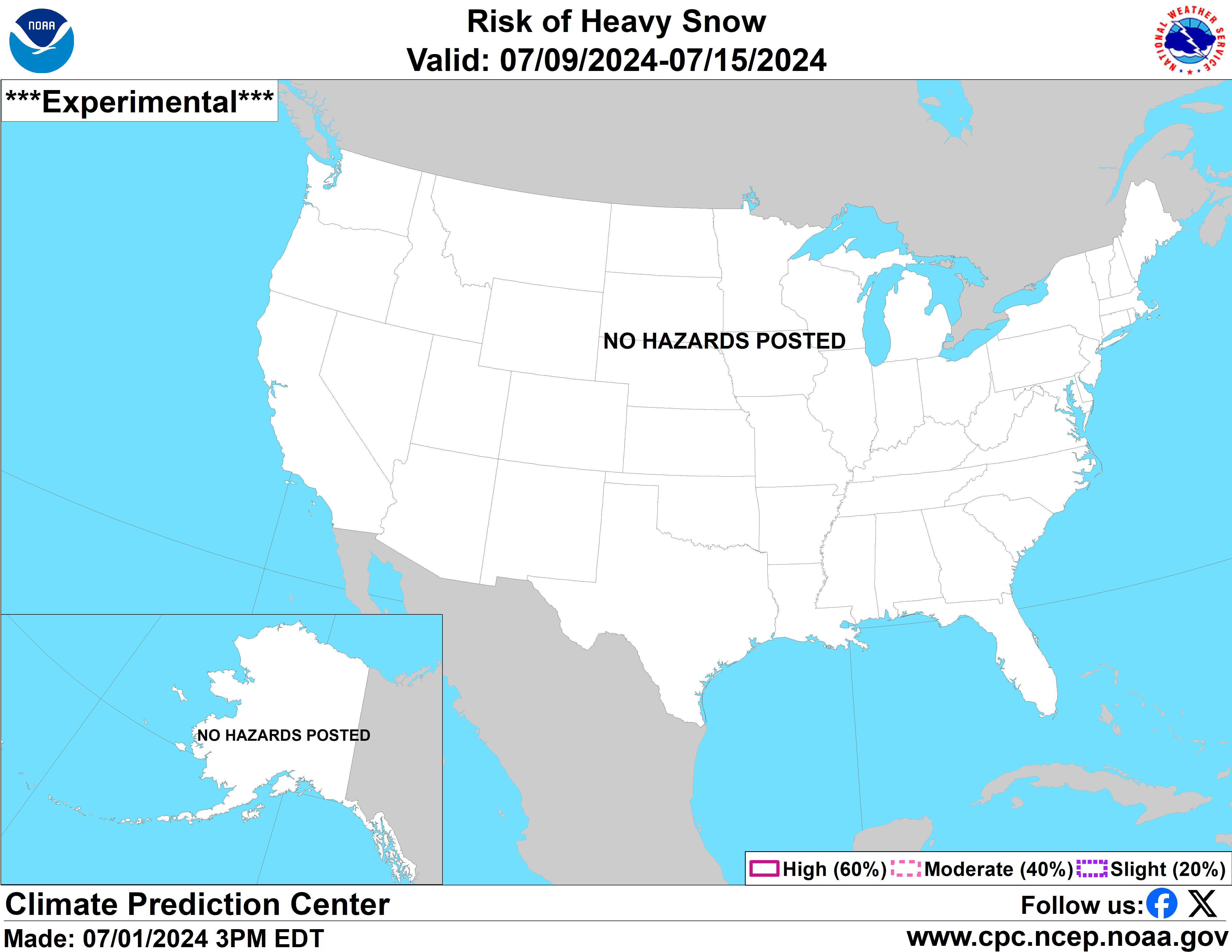 |
|
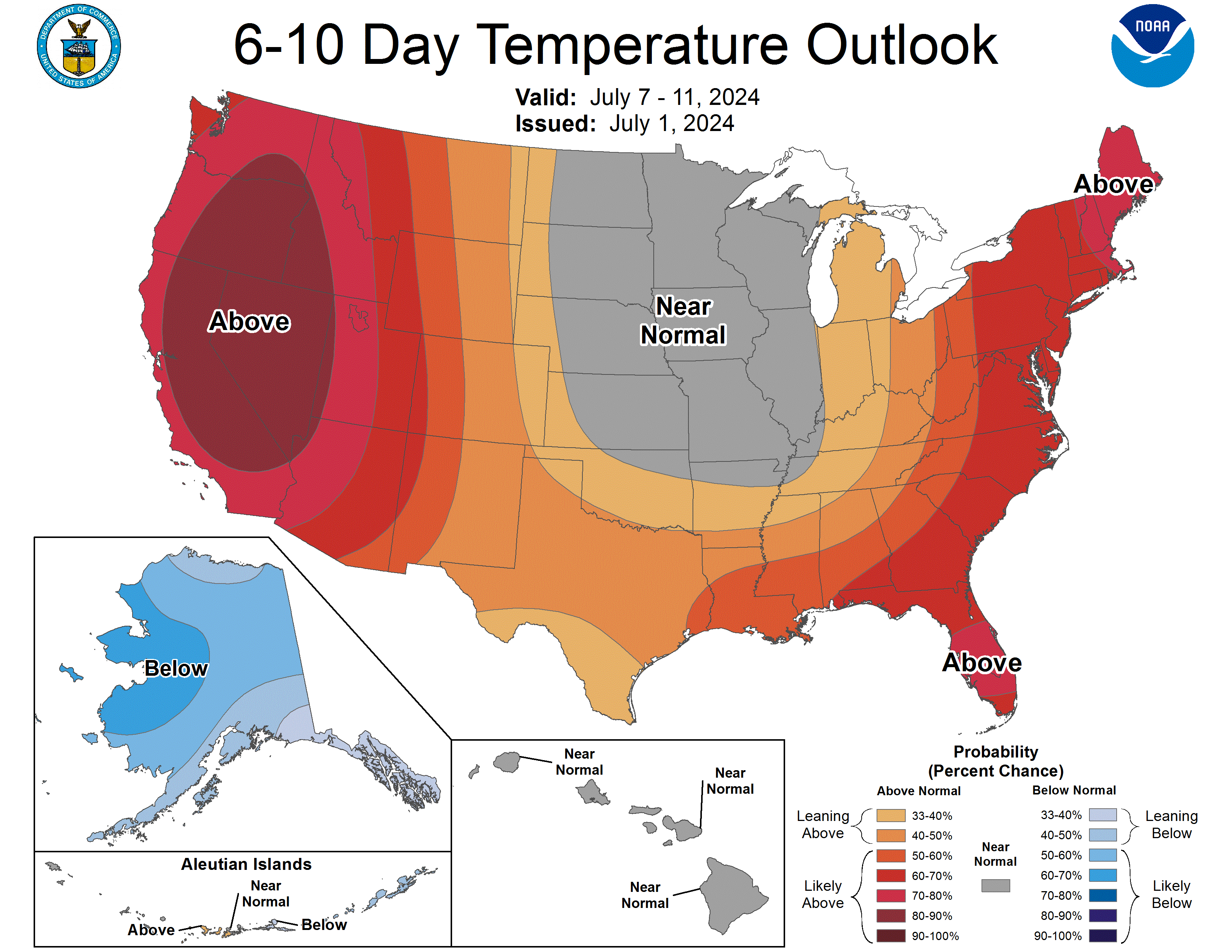
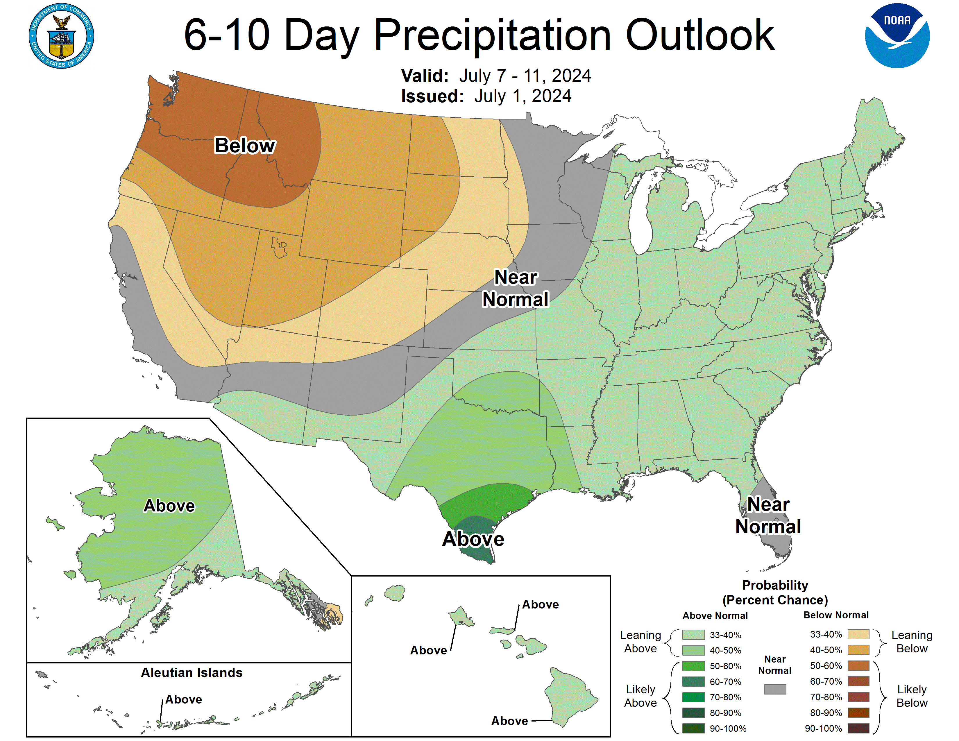
| CPC Temperature & Precipitation Maps | |
|
Days 6-10 |
|
| Temperature | Precipitation |
 |
 |
|
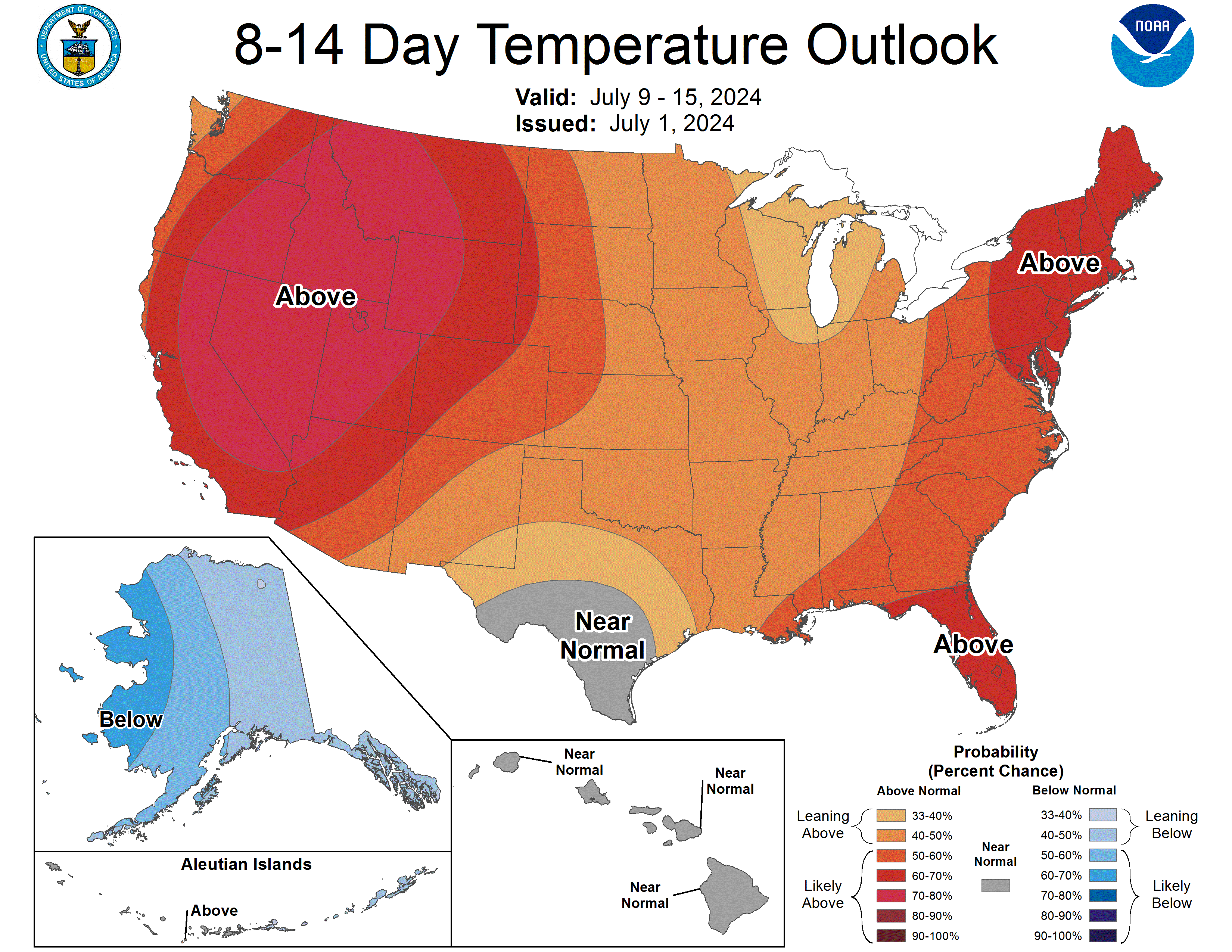
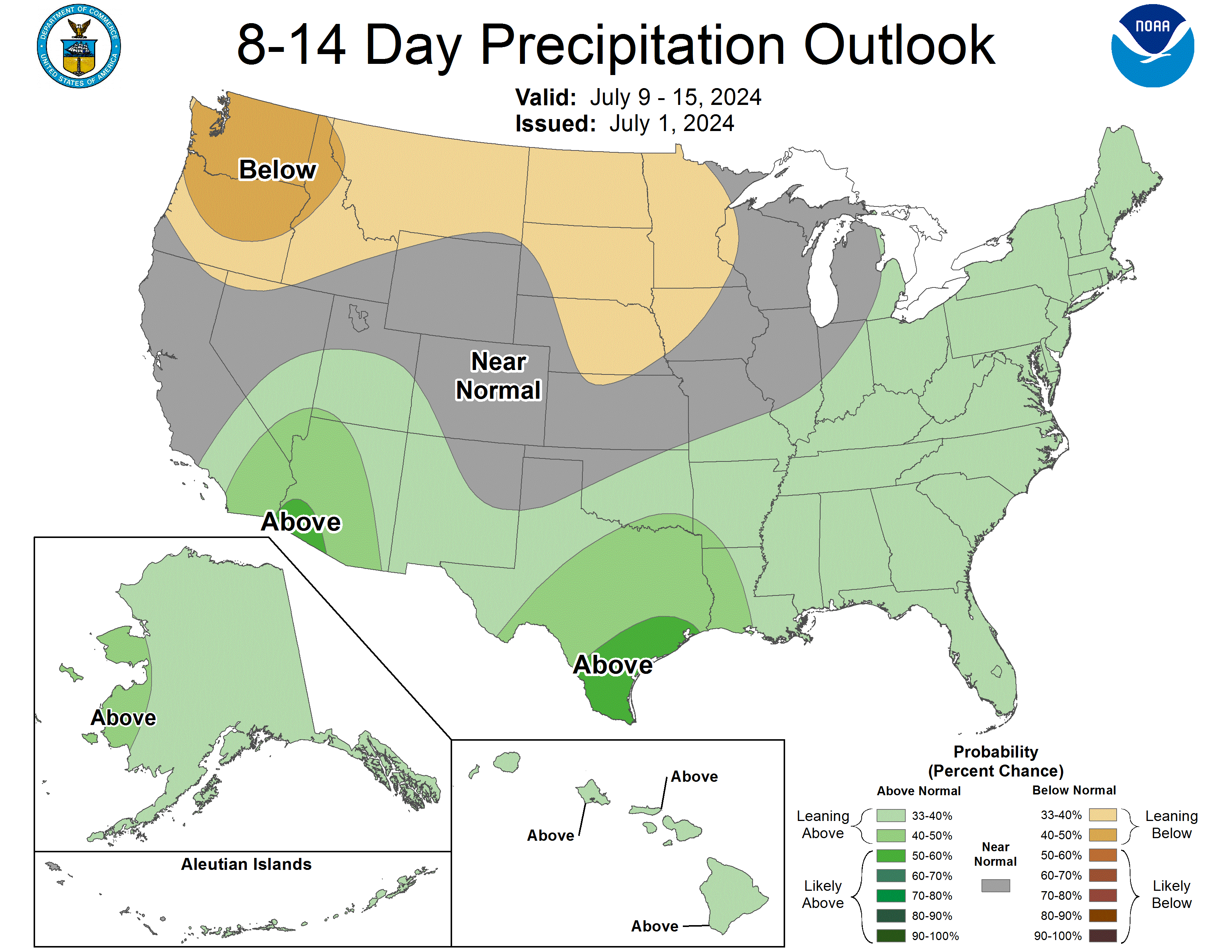
Days 8-14 |
|
| TEMPERATURE | PRECIPITATION |
 |
 |
|
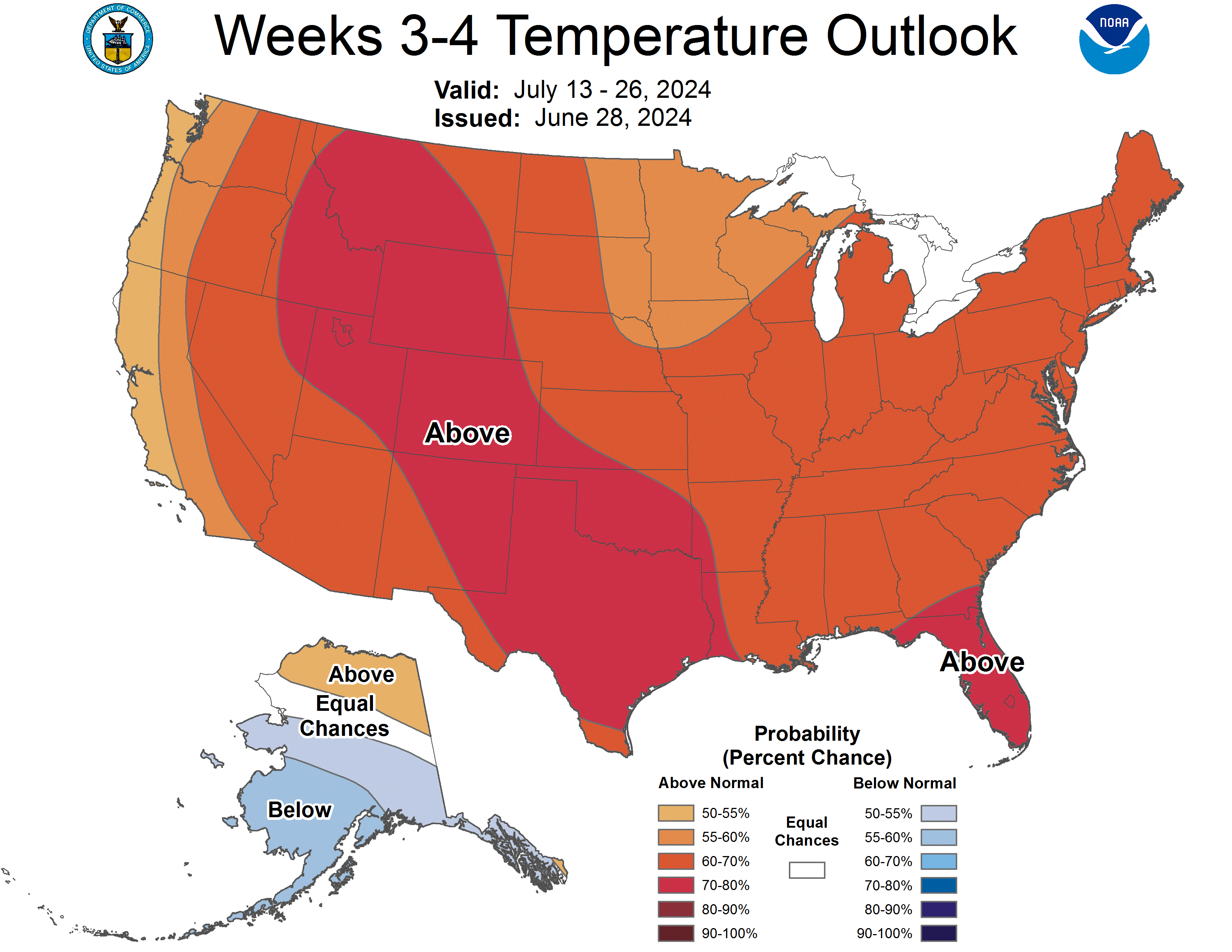
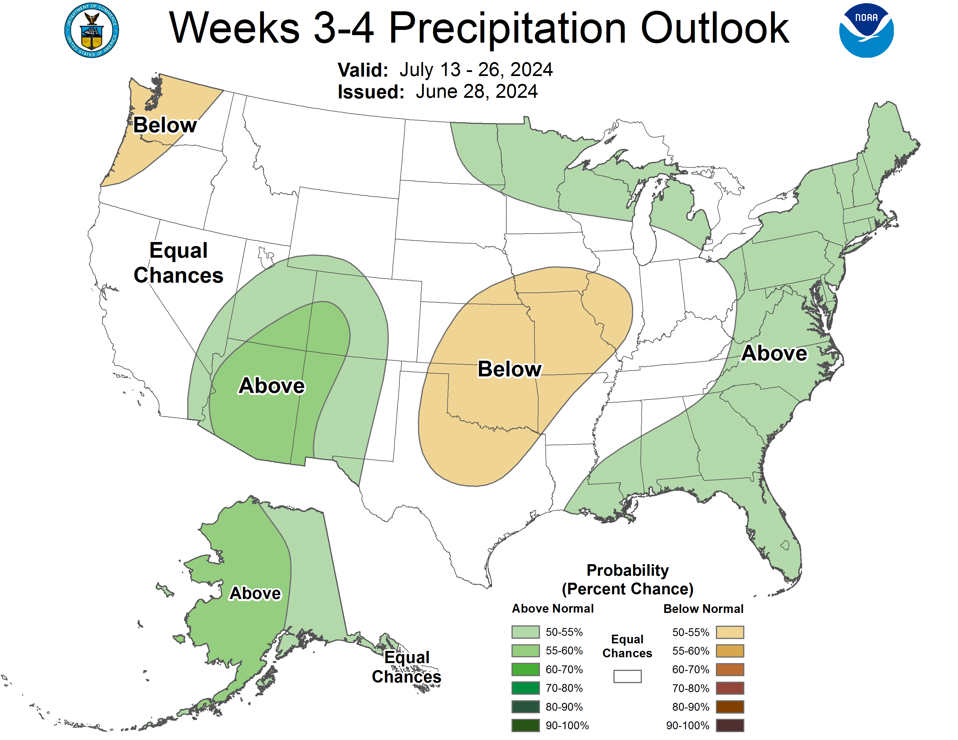
Week 3-4 |
|
|
TEMPERATURE |
PRECIPITATION |
 |
 |


 Coastal Flood
 Heat
Heat